BBlogFlow

Categories

Weather

2371 articles

Weather

Hurricane Trudy will intensify as Mexico coast braces for flooding rains, winds

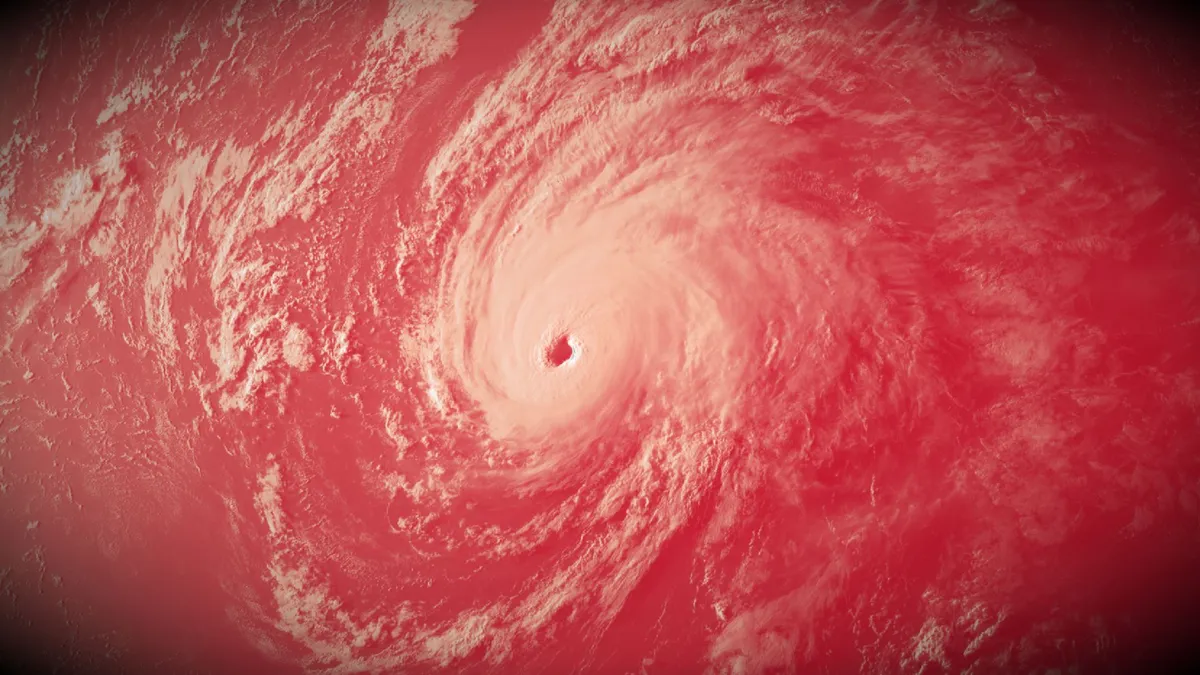
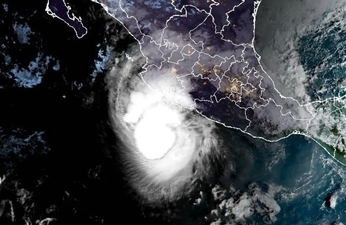
Although it's now a Category 1 hurricane off Mexico's Pacific coast, Trudy is expected to climb back to a Category 2 soon as communities prepare for its extreme rainfall and threats of flooding and mudslides. Trudy is the 10th hurricane to form in the Eastern Pacific this year--the first time since 2018 the basin has seen that feat, indicating an unusually active season. Hurricane and tropical storm warnings are in effect for parts of the Mexican coast. residents should monitor local forecasts and follow emergency officials' instructions. Trudy could strengthen before weakening near shoreTrudy is currently offshore, situated a few hundred kilometres south-southeast of Manzanillo, Mexico. On the forecast track, the centre of Trudy will approach the coast of southwestern and west-central Mexico on Saturday, and pass near the coast tonight into Sunday. Maximum, sustained winds are near 150 km/h with higher gusts. Some strengthening remains possible today, putting the hurricane back to a Category 2 storm, followed by weakening beginning by Sunday.

The Weather Network·
Weather

Bryan Norcross: Impactful nor'easter possible next week from North Carolina to New Jersey

Next fall nor'easter brewing, could Jersey Shore to Carolina Coast A nor’easter is increasingly likely to form off the Carolina coast late Sunday, bringing gusty winds and coastal flooding to millions from the Jersey Shore to the Outer Banks early next week. This brewing storm comes as many beaches along this part of the country's coastline are still dealing with significant erosion and other impacts from last month's early-season nor'easter. While there is increased confidence that a nor'easter will develop later this weekend, the storm's exact track and impacts are still uncertain. Updated at 9:40AM E. T. on Saturday, October 17A note: Billy Wagner passed away this week. Every longtime Florida Keys resident knew Billy. For 25 years until 2006, he served as Monroe County emergency manager. But he was much more. Billy was an emergency manager's emergency manager – sharing his expertise with decision-makers across the hurricane zone when life-changing storms were threatening. If I ever wanted to know what was really going on "out there," Billy was my first call. The reality of the situation on the ground always seemed to funnel through Billy.

Fox Weather·
Weather

How winter weather can make these rashes worse

Red, itchy and scaliness. Does that describe your skin during a cold Canadian winter? "Rashes that can get worse in the cold weather are eczema, psoriasis and viral-type rashes shingles, cold sores, and hand-foot-and-mouth disease," said Dr. Marisa Ponzo, a dermatologist. The weather can make these rashes feel worse, and it strips your skin of its natural moisture, further irritating the problem areas. You can ease some discomfort by doing this. "Short, lukewarm showers...the hot water makes it worse. Use a gentle, unscented cleanser only on the dirty areas of the body, so underarms, privates and feet. We don't have to scrub our elbows and make the eczema worse. And then you pat-dry after and lock in the moisture with a good, thick moisturizing cream. [It should] also [be] unscented," said Ponzo. One million Canadians suffer from psoriasis and one in six have eczema. They are non-contagious, chronic, inflammatory skin conditions. Content continues below"Sunlight actually helps with psoriasis. It's because the UV (ultraviolet rays penetrate the top layers of the skin, and they tell the immune system where the psoriasis is to sort of back off.

The Weather Network·
Weather

Ask a met: Why am I not seeing 'heat lightning' anymore?

"When I was growing up, on occasion we would see 'heat lightning” (lightning with just flashes, no thunder, no rain, no bolts). I have not seen nor heard about this event in probably 50+ years. Does it still occur anywhere? If not, why not? We live on the east coast. " — JoeThe reason you haven’t heard of heat lightning in recent years is because it’s a myth. Well, kind of. More like a meteorological misnomer. Let’s back up a few steps. What is commonly referred to as heat lightning is actually just regular old lightning that is far enough in the distance that the thunder doesn’t reach your location. The “heat” part of the moniker comes from the fact that we most commonly observe distant thunderstorms during the summer months when temperatures are hotter. This is because we’re often outside enjoying all the warm weather activities and the ingredients for pop-up storms are plentiful. So, long story short, there isn’t anything special about heat lightning. It’s not a distinct type of warm-weather lightning, but it is a fun fact you can now use to outsmart your friends.

The Weather Channel·
Weather

Wet slab avalanche risk: Rain falls on snowpack in the West

Warm rain on snowpack can trigger wet slab avalanches this winterMost people think avalanche danger comes from fresh snow, but avalanches need a weak layer in the snowpack plus a trigger. When rain falls on snow, or temperatures spike, meltwater loosens the bond between snow layers. That can release wet slab avalanches, which can break wide with little warning and run into terrain that normally feels safe.(MORE: Widespread snow blankets resorts from California to Montana)Rain triggers a wet slab avalancheA wet slab avalanche happens when water works its way down through the snowpack and weakens a layer buried below the surface. The snow above that layer, the slab, can then release all at once. Rain makes this more likely in two ways:First, it adds weight to the slab. Second, the meltwater it creates can loosen the bonds that hold snow layers together. The result is a heavy slab sitting on a weaker layer, with nothing holding it in place. Get More of Our News on GoogleSet The Weather Company as a 'Preferred Source' to get quicker access to the news you value. Wet slabs are harder to predict than many other avalanche types.

The Weather Channel·
Weather

The ‘World Series earthquake’ that caused highways to collapse

“I’ll tell you what, we’re having an earthquake!”Veteran sports broadcaster Al Michaels was the first person to break that news to the world out of San Francisco’s Candlestick Park on Oct. 17, 1989. Before he could finish the sentence, the powerful magnitude 6.9 earthquake severed power and communications throughout California’s Bay Area. Loma Prieta, also known as the World Series earthquake, remains one of the most significant disasters to strike the region in modern history. RELATED: The Great Quake of 1906 nearly wiped San Francisco off the mapA rupture within the San Andreas Fault network occurred at 5:04 p.m. local time near the Loma Prieta Peak, unleashing a powerful earthquake centred about 90 km southeast of downtown San Francisco. Strong to severe shaking rattled the Bay Area for nearly 30 seconds. Numerous buildings collapsed, especially near the epicentre and on the soft ground of San Francisco’s Marina District. Content continues belowA pancake-style collapse occurred along a section of a double-decker highway in Oakland called the Cypress Street Viaduct, a tragedy which was responsible for most of the disaster’s 63 fatalities.

The Weather Network·
Weather

Hurricane Trudy churns in the Pacific as a Cat 1 storm near Mexico, while Champi eyes rare Guam landfall

THE TAKEAWAYHurricane Trudy formed Thursday in the Pacific and is set to become a powerful Category 4 hurricane. Tropical Storm Champi, in the Western Pacific, is expected to explode into a Super Typhoon and could tie Super Typhoon Sinlaku as the strongest storm in any basin this year. The parade of intense systems has made the 2026 Eastern Pacific hurricane season the most energetic on record. Hurricane Trudy rapidly intensified into a Category 3 storm early Friday before being downgraded to a Category 1 storm. Landfall remains possible, but there is increased uncertainty around Trudy's track beyond this weekend. Meanwhile, Tropical Storm Champi still has Guam and the Northern Mariana Islands in its sights and is expected to move through the U. S. territories as the equivalent of a category 2 hurricane. Incredibly, the Google Deepmind model gives Champi a 99% chance of becoming a Super Typhoon. MAPPING HURRICANE ISAIAS' DEADLY PATH: HOW THE VIOLENT CATEGORY 2 STORM UNFOLDED ACROSS FLORIDA AND GULF COASTTrudy's forecast cone.(FOX Weather) Trudy is currently a Category 1 storm with maximum sustained winds of 85 mph and is located about 225 miles southwest of Acapulco, Mexico.

Fox Weather·
Weather

Will this fall chill stick around across southern Ontario?

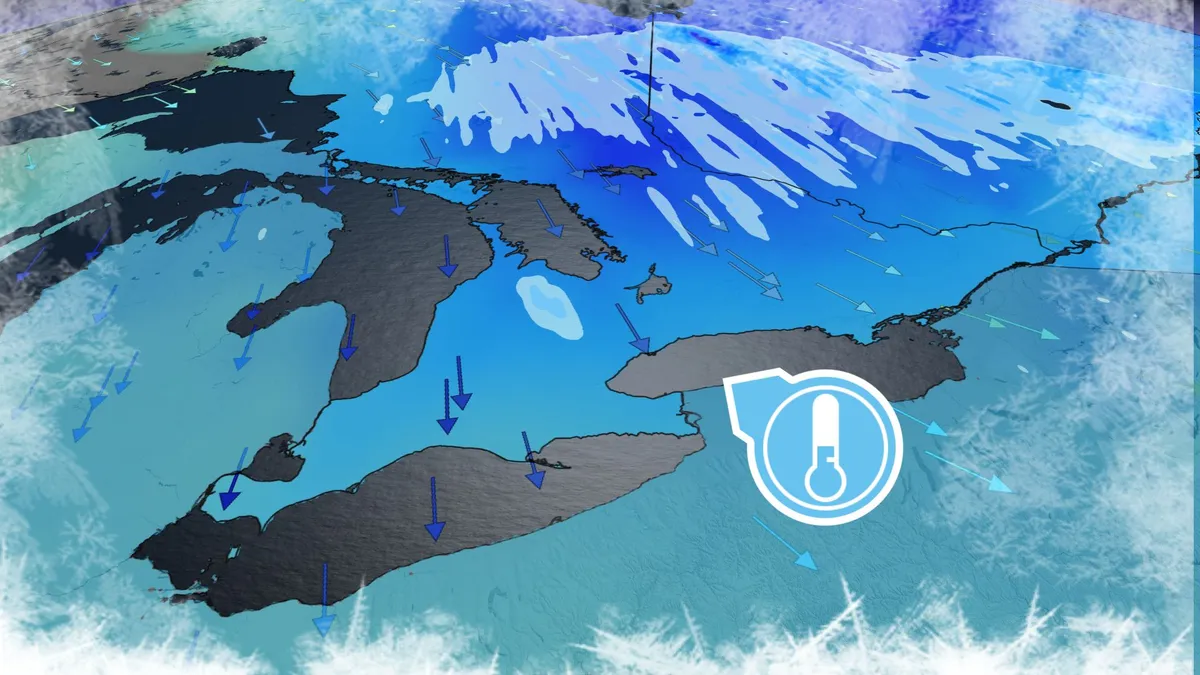
Fall-lovers are in luck this weekend as a brisk airmass swoops across southern Ontario. Temperatures will dip close to the freezing mark in some areas, prompting localized frost advisories in the Greater Toronto Area (GTA). But enjoy it while you can. This taste of autumn won’t linger for long. DON'T MISS: Winter snowfall across Canada may fall victim to El NiñoNortherly winds filtering into southern Ontario behind our departing low-pressure system will allow the fall chill to take hold of the region to kick off the weekend. Early morning temperatures will fall close to or below freezing. A frost advisory is in effect for parts of the GTA, including Toronto proper, as well as Mississauga, Brampton, and Scarborough. We could even see the first snowflakes of the season in some snowbelt communities as lake-effect showers develop amid the contrast between the cold air and the warm lakes. Additional flurries are possible in parts of Algonquin during the early-morning hours. Content continues belowThis snow is expected to remain at higher elevations as freezing levels here drop to around 800 metres.

The Weather Network·
Weather

Intense El Niño helps churn out 10 major hurricanes. How does it compare?

The northeastern Pacific Ocean is a hotbed of major hurricanes this year. Ten out of the twelve hurricanes to form in the region this year have grown to Category 3 status or stronger, including a record-tying three Category 5 storms. An intense El Niño is responsible for kicking the season into turbo mode. But how does this year compare to previous years that experienced very strong El Niño conditions? DON’T MISS: Northeast Pacific breaks record for its most active hurricane seasonA historic hurricane season continuesThe northeastern Pacific covers storms that form off the western shores of North America, as well as those that develop and track around Hawaii. As of Oct. 16, the region has seen 22 named storms, including 12 hurricanes. An impressive 10 of those hurricanes have made it to major Category 3 status or higher. Compare that to an average northeastern Pacific hurricane season, which produces 15 named storms, 8 hurricanes, and 4 major hurricanes. Content continues belowThe basin recently set the record for its highest Accumulated Cyclone Energy (ACE) on record, a metric which measures the total strength and longevity of a season’s storms.

The Weather Network·
Weather

Frost flowers: how to find ice ribbons on plants at dawn

Look down this weekend: frost flowers could bloom at your feetIf you love a garden, or just the wild corners of one, here's a reason to set an alarm this weekend and look down. On the first hard freezes of fall, a few native plants push out thin, curling ribbons of ice from their stems. They're called frost flowers. They look like spun sugar, or a curl of lace, and they're usually gone by midmorning. The recipe is short: warm ground, then a sudden hard freeze. The roots are still active, so they keep pulling water up the stem. When the freeze cracks the stem's surface, that water slips out and freezes the moment it meets the cold air. More water behind it pushes the ice outward into ribbons. The Missouri Department of Conservation says scientists still can't explain why only a few species do it. People have been puzzling over it for nearly 200 years. A naturalist wrote about it in an 1828 journal, and University of Texas at Austin researcher Bob Harms calls the ice "crystallofolia," or "ice leaf. "(MORE: Should you water your garden before a freeze?

The Weather Channel·
Weather

Fall storm to blast 40M across major Northeast cities with severe weather ahead of the season's first freeze

THE TAKEAWAYA massive cold front is setting the stage for severe storms across major Northeast cities. More than 40 million people in Washington, D. C., Baltimore, Philadelphia, New York City and Boston will see storms into tonight. Behind the storm, the chilliest temperatures of the season will arrive by Saturday morning, with parts of northern New England waking up to low temperatures in the low 30s. Storms are rumbling across the Northeast Friday as severe weather threatens more than 40 million people in Washington, D. C., Baltimore, Philadelphia, New York City and Boston. Damaging wind gusts will be the main threat with the potential for gusts up to 70 mph, particularly across eastern Pennsylvania and Northern New Jersey as thunderstorms rumble through the region. WHAT IS A COLD FRONT? Behind the storm, conditions will remain breezy as the chilliest temperatures of the season arrive by Saturday morning, with parts of northern New England waking up to low temperatures in the low 30s. SEVERE STORMS THREATEN NORTHEAST THIS WEEKEND — WHERE WILL THE HEAVIEST RAIN FALL? Delays and cancellations began to mount across the major Northeast airport hubs through the day Friday.

Fox Weather·
Weather

Magnitude 4.3 earthquake strikes near Banff, Alberta

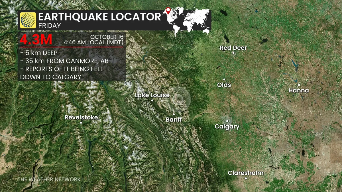
Earthquakes Canada reported a magnitude 4.3 earthquake about 34 kilometers north of Canmore, Alta., at 4:46 a.m. MDT on Friday, Oct. 16. The earthquake occurred at a depth of 5 km, with reports being felt down to Calgary. There were no immediate reports of property damage or injuries. For earthquake safety tips, click here. Stay with The Weather Network for the latest updates

The Weather Network·
Weather

Lake turnover: Why lakes smell like rotten eggs in fall

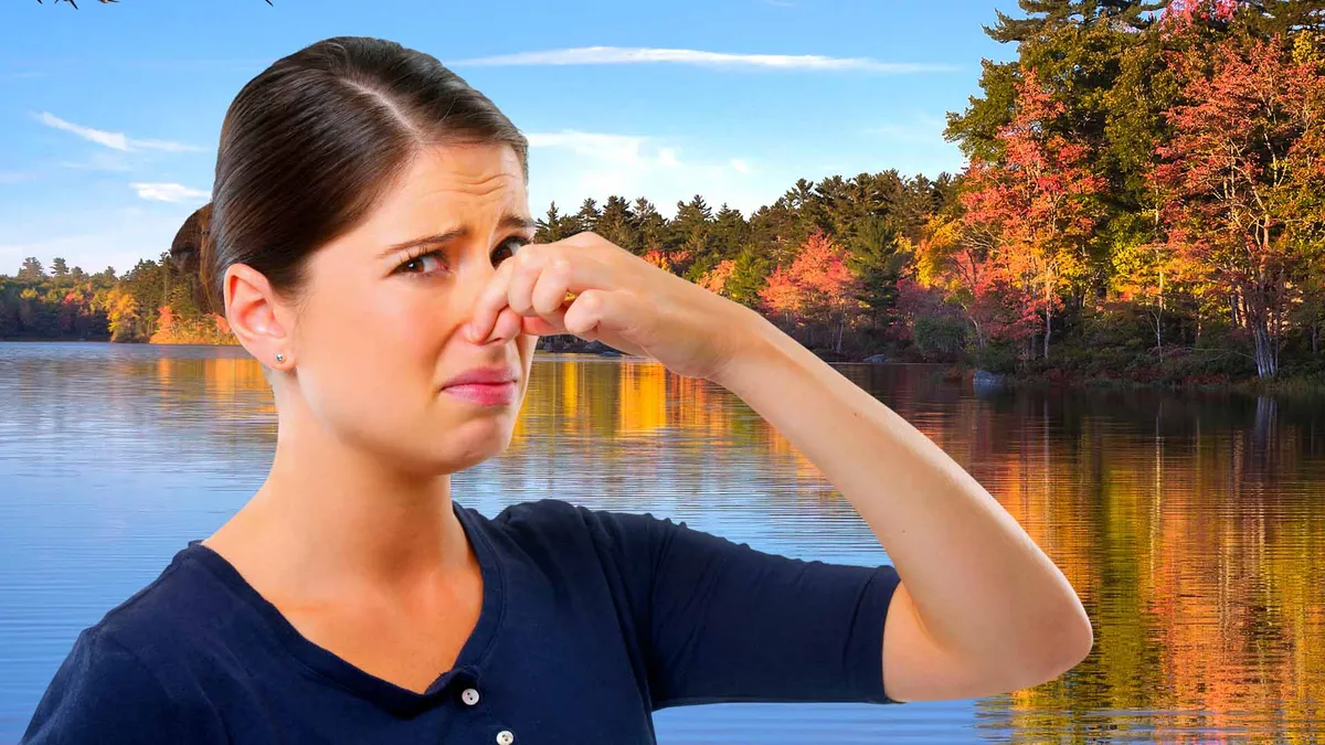
Here’s why some lakes smell like rotten eggs in fallAs the brisk temperatures of fall start to settle in, you might notice your favorite fishing spot or neighborhood lake smells a little funky, almost like rotten eggs. It's usually not pollution; it's fall turnover — a natural, seasonal mixing of the lake that brings oxygen-deprived bottom water to the surface. This week's cold front could set it off where you live. How a lake 'flips'While you're enjoying the lake all summer, warm water stays on top, while cold, dense water stays on the bottom. They're separated by something called the thermocline, which prevents those warm and cold layers from mixing. Deep underwater where the sunshine doesn't reach, bacteria breaks down dead plants and other organic materials, and because there isn't much oxygen, hydrogen sulfide is released, which is responsible for that awful smell.(MORE: What the Super El Niño means for your fall and winter)Get More of Our News on GoogleSet The Weather Company as a 'Preferred Source' to get quicker access to the news you value.

The Weather Channel·
Weather

Wildfire smoke is reaching farther than ever — stay protected

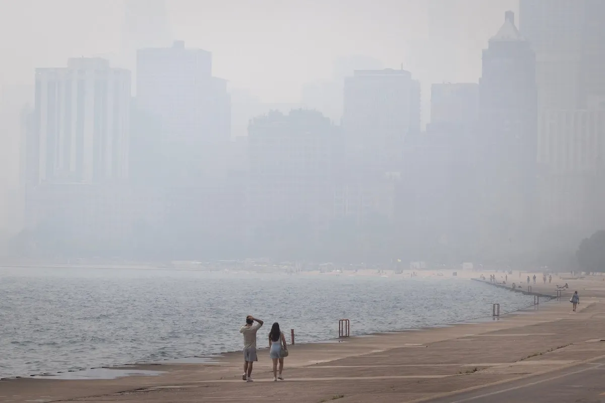
Wildfire smoke exposure quadrupled in US over past two decadesAmericans are breathing in a lot more wildfire smoke than they used to, and it's not just confined to the West. A new analysis from Climate Central found that the average American inhaled roughly four times more wildfire smoke from 2020 to 2025, compared to the previous 13 years.2026 is on pace to rank as the third-smokiest year in the last 20, driven in large part by a historic wildfire season in Canada; smoke has repeatedly drifted down into the upper Midwest, Northeast, and Pacific Northwest this year.(Climate Central)The four-fold jump in wildfire smoke exposure is mainly about geography and fire behavior. We are seeing longer fire seasons, more acreage burning in a given year and smoke that can easily travel hundreds or even thousands of miles from the flames. Because wildfire smoke can travel such long distances, researchers estimate that roughly three-quarters of smoke-related health impacts in the U. S. happen outside the West, in places that never see a flame.

The Weather Channel·
Weather

Cleveland weather a wet, windy mess for ALCS Game 4

A general view of signage prior to game three of the American League Championship Series between the Tampa Bay Rays and the Cleveland Guardians at Progressive Field on October 15, 2026 in Cleveland, Ohio.(Jamie Squire/Getty Images)The American League Championship Series (ALCS) Game 4 Friday night could have challenging weather in Cleveland, including showers and strong winds, as the Tampa Bay Rays take on the Cleveland Guardians for a chance to move on to the World Series. Major League Baseball moved up the start time for Thursday's Game 3 to avoid a threat for rain later in the day. The result was picture-perfect weather as the Guardians took a 2-1 series lead against the Rays. Don't expect a repeat of perfect weather for Game 4. Game 4 forecast: Wind dominatesFriday evening, the wind will be the biggest weather headache, both for fans and players. North winds could gust as high as 35 mph, blowing in from the outfield at Progressive Field could make it exceedingly difficult to hit home runs or simply to track any fly balls. Showers are possible, at times, though probably will not be heavy enough to suspend play, particularly given this is the ALCS, not just a mid-summer game.

The Weather Channel·
Weather

Bryan Norcross: Watching for a nasty coastal storm to develop and stall near the Carolinas

Hurricane Trudy strengthens into a monster Category 3 storm, while Champi eyes rare Guam landfall Trudy rapidly intensified into a Category 3 hurricane early Friday and is forecast to continue to strengthen as moves toward the Mexican coast. Landfall remains possible, but there is increased uncertainty around Trudy's track beyond this weekend. Meanwhile, Tropical Storm Champi still has Guam and the Northern Mariana Islands in its sights and is expected to move through the U. S. territories as the equivalent of a category 2 hurricane. A direct landfall on Guam would be rare due to the island's small size. From there the typhoon will continue to intensify. Incredibly, the Google Deepmind model is giving it a 99% chance of becoming a Super Typhoon. Last updated at 9:30 a.m. on Oct. 16, 2026A strong cold front is going to push off the East Coast by early tomorrow. The coldest air of the year on a brisk north wind will move in behind it. There is a strong consensus in the various computer forecasts that a low-pressure system will form along the front similar to the one that developed into the nor'easter last month. This system will play out very differently, however.

Fox Weather·
Weather

Weekend washout to drench Southern Florida with relentless heavy rain and flooding

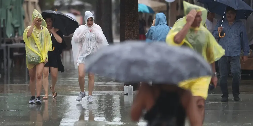
A level 1 out of 4 flash flood threat is in effect for Saturday and Sunday, with Fort Lauderdale and Miami included. Florida faces wet weekend ahead of peak King TIdes Showers and gusty winds are powering up for the Sunshine State, where a level 1 out of 4 flash flood threat is in effect for South Florida. A widespread 2 to 3 inches of rain is forecast for the region. THE TAKEAWAYDays of nasty weather full of heavy rain and gusty winds will hit South Florida this weekend. A widespread 2 to 3 inches of rain is expected across the Southeast through Monday. Temperatures in the mid-to-upper 80s will make conditions uncomfortable amid thunderstorms and heavy rain. FLORIDA – Wet weather returns to parts of the Sunshine State this weekend, after brief relief, as persistent rain and strong wind gusts create a messy scene for thousands. A stalled frontal boundary is hanging over Florida, bringing soggy, gusty conditions through the weekend for southern portions of the state.

Fox Weather·
Weather

What historic super El Niño ahead means for your fall, winter

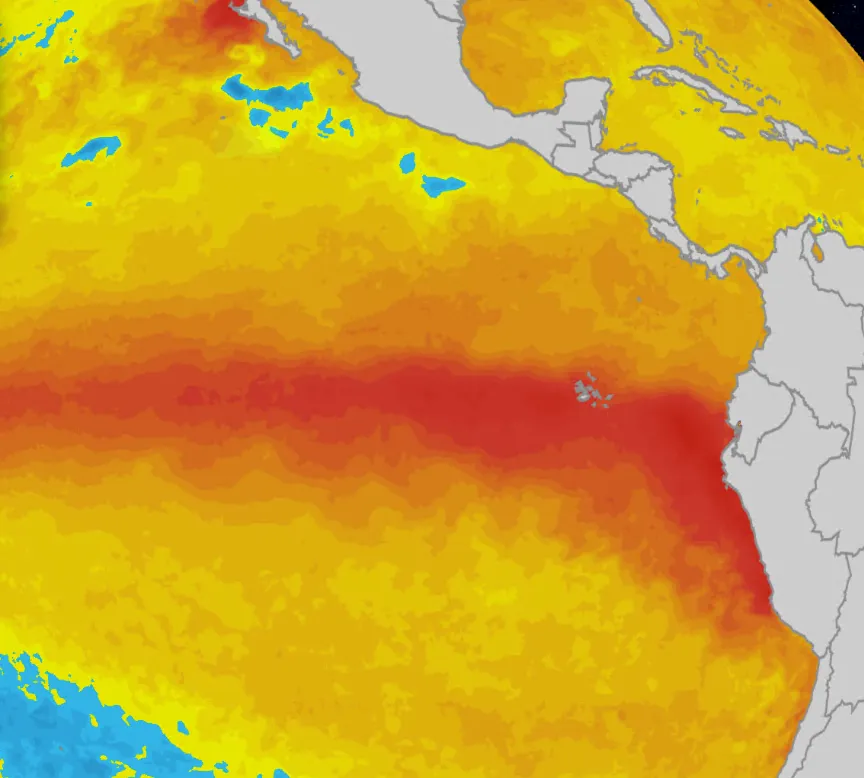
The current super El Niño is likely to become the strongest on record in over 75 years, with impacts on hurricane season, rainfall and temperatures as we move through fall and winter, according to the latest update from NOAA. What’s new in NOAA's El Niño prediction? El Niño continues to intensify, with water temperatures now 2.3 degrees Celsius above average in the equatorial eastern Pacific over the last week. Pockets of surface water are as warm as 4 degrees Celsius warmer than average. Based on daily data using an old "oceanic Niño index" (ONI), this would be a new all-time record. However, NOAA's Climate Prediction Center officially uses data averaged over three-month periods and a new index that filters out the surrounding warming ocean from climate change called the "relative oceanic Niño index" (RONI). These values are also rising, but are still not at record levels through August, according to NOAA. Regardless, the Prediction Center says chances "remain high for a historic event that would exceed the strength of previous El Niño events dating back to 1950," with an 83% chance for October-December.

The Weather Channel·