Hurricane Trudy will intensify as Mexico coast braces for flooding rains, winds
This story deserves to be shared
Send it to someone who'd care, or post it on your networks.
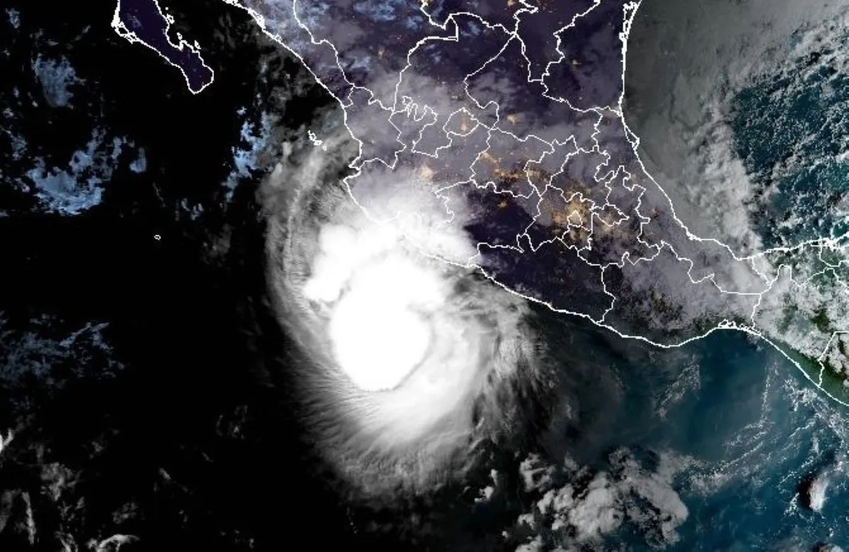
Although it's now a Category 1 hurricane off Mexico's Pacific coast, Trudy is expected to climb back to a Category 2 soon as communities prepare for its extreme rainfall and threats of flooding and mudslides. Trudy is the 10th hurricane to form in the Eastern Pacific this year--the first time since 2018 the basin has seen that feat, indicating an unusually active season. Hurricane and tropical storm warnings are in effect for parts of the Mexican coast. residents should monitor local forecasts and follow emergency officials' instructions. Trudy could strengthen before weakening near shoreTrudy is currently offshore, situated a few hundred kilometres south-southeast of Manzanillo, Mexico. On the forecast track, the centre of Trudy will approach the coast of southwestern and west-central Mexico on Saturday, and pass near the coast tonight into Sunday. Maximum, sustained winds are near 150 km/h with higher gusts. Some strengthening remains possible today, putting the hurricane back to a Category 2 storm, followed by weakening beginning by Sunday.
This article is an excerpt. To read the full content, visit the original source. The Weather Network
Related articles
Hurricane Trudy makes its way toward Mexico as Typhoon Champi threatens Guam
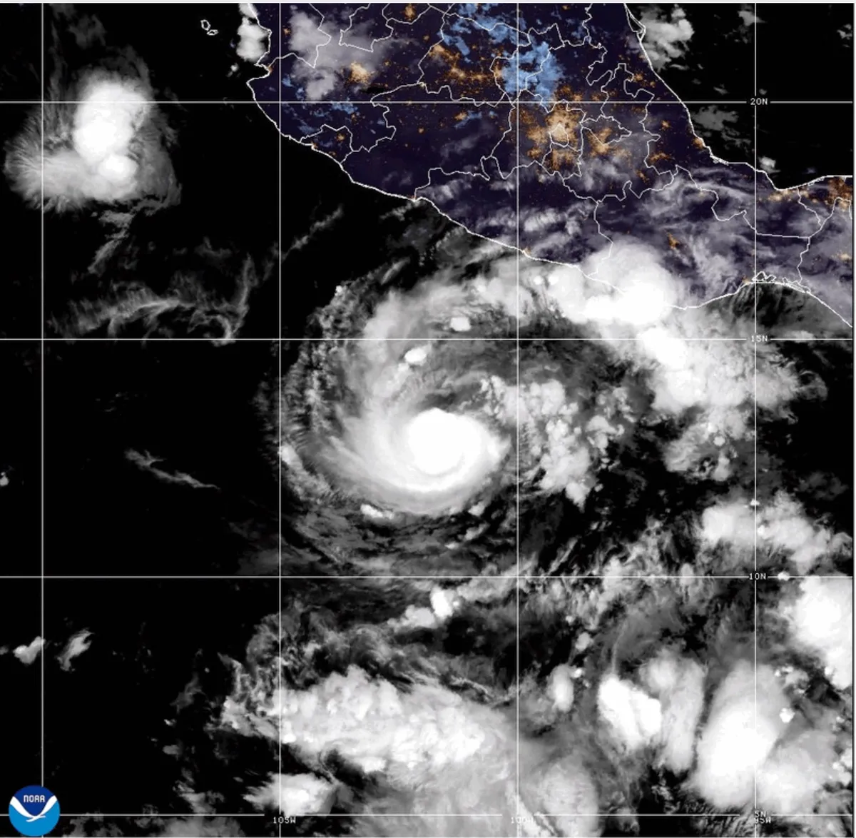
This GOES-19 GeoColor satellite image provided by the National Oceanic and Atmospheric Administration (NOAA) and taken on Thursday, Oct. 15 2026, shows Hurricane Trudy in the Pacific.(NOAA via AP)Hurricane Trudy moved toward southwestern and west-central areas of Mexico's Pacific coast and could keep growing through Saturday, forecasters said. The center of Trudy will approach the coast on Saturday, making its closest pass Sunday. A hurricane warning was in effect from Manzanillo in Colima state to Cabo Corrientes in Jalisco. The storm was a Category 1 hurricane with maximum sustained winds of 90 mph on Saturday morning.(MORE: Nor'easter to bring flooding, winds, rain to parts of East Coast)Trudy was about 250 miles west of Acapulco, in the Mexican state of Guerrero, and under 200 miles south-southeast of Manzanillo, Colima state, while moving northwest at 8 mph, the U. S. National Hurricane Center said. The Mexican navy urged the maritime community and coastal residents to exercise extreme caution due to high waves, heavy rains and the risk of rising river levels, flooding and landslides in vulnerable areas.
Hurricane Trudy churns in the Pacific as a Cat 1 storm near Mexico, while Champi eyes rare Guam landfall
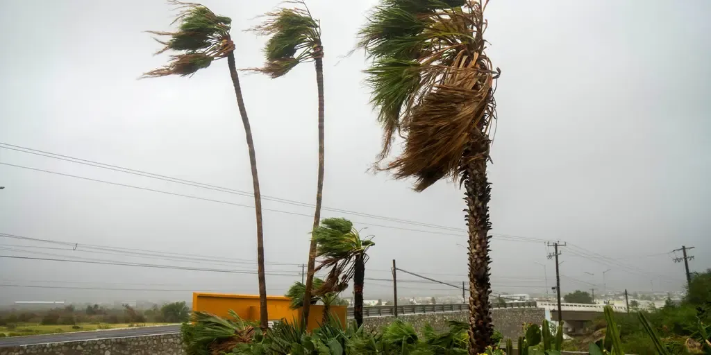
THE TAKEAWAYHurricane Trudy formed Thursday in the Pacific and is set to become a powerful Category 4 hurricane. Tropical Storm Champi, in the Western Pacific, is expected to explode into a Super Typhoon and could tie Super Typhoon Sinlaku as the strongest storm in any basin this year. The parade of intense systems has made the 2026 Eastern Pacific hurricane season the most energetic on record. Hurricane Trudy rapidly intensified into a Category 3 storm early Friday before being downgraded to a Category 1 storm. Landfall remains possible, but there is increased uncertainty around Trudy's track beyond this weekend. Meanwhile, Tropical Storm Champi still has Guam and the Northern Mariana Islands in its sights and is expected to move through the U. S. territories as the equivalent of a category 2 hurricane. Incredibly, the Google Deepmind model gives Champi a 99% chance of becoming a Super Typhoon. MAPPING HURRICANE ISAIAS' DEADLY PATH: HOW THE VIOLENT CATEGORY 2 STORM UNFOLDED ACROSS FLORIDA AND GULF COASTTrudy's forecast cone.(FOX Weather) Trudy is currently a Category 1 storm with maximum sustained winds of 85 mph and is located about 225 miles southwest of Acapulco, Mexico.
Nor' easter to bring coastal flooding, winds to East Coast
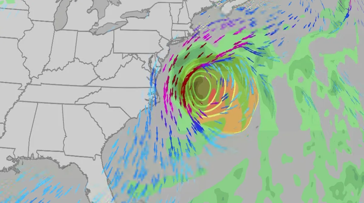
An October nor'easter is developing in the Atlantic, where it will bring high surf, rip currents, coastal flooding, winds and rain to parts of the East Coast for several days this week. The National Hurricane Center has it highlighted as an area to watch this week for potential subtropical development. However, regardless of development, this system will bring dangerous conditions to the East Coast this week. Fortunately, this system doesn't look to be as strong as the one in September. But the bad news? It could linger for much of the week, so impacts could have a longer duration than you would think. There are currently coastal flood alerts across parts of coastal North Carolina and Virginia, where anywhere from 1 to 4 feet of inundation is possible. Key takeawaysWe do not expect this storm to be as strong as the late September nor'easter. The area most likely impacted the longest appears to be from the Delmarva Peninsula to eastern North Carolina, with more models pointing to primarily eastern North Carolina.

Coastal homes burn as hot winds fuel California wildfires
Thousands evacuate Southern California as wind-fueled fires burn homesFire crews in Southern California gained ground Saturday on a wind-driven blaze that charred hills and damaged or destroyed at least six large coastal homes, allowing evacuation orders to be lifted and thousands of people to return home. The fast-moving Norte Fire sparked the previous day in San Clemente amid hot, strong Santa Ana winds that drove it into San Juan Capistrano, prompting the evacuation of about 16,000 residents. Firefighters work to douse a house fire during the Norte Fire on Friday, Oct. 16, 2026, in San Juan Capistrano, Calif.(AP Photo/Jae C. Hong)Hundreds of firefighters deployed to combat the blaze in the hills of Orange County. At one home engulfed in smoke and fire, photos showed them using hoses to try to douse the flames. Most of the evacuations were lifted Saturday evening, except for one street in San Clemente. The Norte Fire was one of several in the region hit by the Santa Anas, which blow from the interior and toward the coast.

Meet the marine technician documenting Antarctica's beauty while protecting its future
Marine technician crosses world's roughest sea to document AntarcticaFor Andrew Naslund, Antarctica is his “favorite place in the world.”He’s a marine technician for Scripps Institution of Oceanography. And while not a professional photographer, he’s capturing Antarctica’s beauty along his research journey. Andrew Naslund, Scripps Institution of Oceanography marine technician.(Andrew Naslund)The researchNaslund spends months aboard a research vessel, the R/V Roger Revelle (AGOR 24), which he describes as “basically a floating laboratory.”“The purpose of this ship is to provide a platform for scientists to reach some of the most remote reaches of our oceans,” Naslund said. A big part of his role is assisting the scientists to safely deploy and recover their instrumentation over the side of the ship. He also keeps track of incoming data, ensuring the scientists are getting the information that they came out there to get. “[We’re] a mobile weather station. So anywhere that we travel in the world, we’re collecting meteorological weather data,” he says.

Weather Of The World: October 18
Wander the world one snapshot at a time. Explore striking moments of weather in motion in this week's slideshow. ByAda Wood•9 hours agoUpdated: October 18, 2026, 7:05 am EDTPublished: October 18, 2026, 7:00 am EDTA view of the Garonne River at a historically low level due to a lack of rainfall, successive summer heat waves and the prefecture's low-water management policy in Toulouse, in southwestern France, on Oct. 14, 2026.(Pat Batard/Hans Lucas/AFP via Getty Images)From a river in need of rainfall in France to a mountain range with changing leaves in Poland, it has been another busy week of weather around the world. Here are some of the most jaw-dropping and awe-inspiring weather photos we found this week. A view of the Tatra Mountains from the village of Niedzica, Lesser Poland Voivodeship, on Oct. 14, 2026.(Sergei GAPON/AFP via Getty Images)Rain drops cover fall leaves in Denver, Colorado on Wednesday, Oct. 14, 2026.(Hyoung Chang/The Denver Post)Chilies hang from branches in a rooftop garden in Lalitpur, Nepal, on Oct. 14, 2026, following the complete withdrawal of the monsoon. (Subaas Shrestha/NurPhoto via Getty Images)A poisonous fly agaric grows in the Harz National Park.
0 comments
No comments yet. Be the first to share your thoughts!