BBlogFlow

Categories

Weather

5149 articles

Weather

300+ mm: Tropical Storm Moke threatens flooding rains in Hawaii

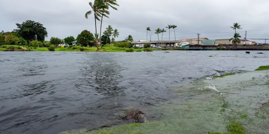
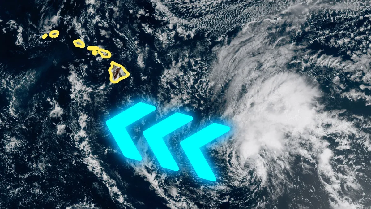
Tropical Storm Moke may bring additional dangerous weather to Hawaii on Sunday, just days after Hurricane Lala brought extreme rainfall and damaging winds to the island chain. Forecasters expect significant impacts on the Big Island despite Moke’s core likely tracking far south of the Pacific archipelago. DON’T MISS: What’s the difference between hurricanes, typhoons, and cyclones? Folks across Hawaii continued cleaning up this week after Hurricane Lala brought flash flooding, landslides, and wind damage to the islands last weekend. One community on the Big Island saw more than 1,100 mm of rain from Lala as it swiped the region. Additional heavy rainfall is expected as Tropical Storm Moke grows organized about 500 km south of Hawaii. The U. S. National Hurricane Center (NHC) predicts Moke to remain at tropical storm strength over the next several days as it moves west and tracks south of the Hawaiian Islands. Numerous hazards are expected as the tropical storm passes through the region. Content continues belowVery heavy rainfall is the greatest threat, with totals potentially hitting up to 380 mm locally on the Big Island.
The Weather Network·
Weather

Bryan Norcross: Andrew peaks in intensity 34 years ago today plus development chances increase in the Atlantic

Tropical Storm Moke to approach Hawaii’s Big Island with growing flood threats Tropical Storm Moke targets the Big Island of Hawaii on Sunday with mounting flood risks in a rare back-to-back threat for the state. As it makes its closest approach to the island, over a foot of rain is possible in some areas, accompanied by strong gusts. FOX Weather Meteorologist Melanie Black breaks down Moke’s tracking and impacts:Updated at 10:15 A. M. ET on Sunday, Aug. 22.34 YEARS AGO TODAYCoincidentally, it was a Sunday that year, too: Sunday, August 23, 1992. A couple of quick showers blew across Miami in the morning. Otherwise, it was a bright and sunny summer day. By afternoon, there was a nice breeze – the outer reaches of Hurricane Andrew's circulation. TROPICAL STORM MOKE EYES HAWAII, PACKING DANGEROUS TROPICAL DOWNPOURS AND FLASH FLOOD THREAT FOR BIG ISLANDAt 8:31 that morning, this iconic high-resolution image was taken. It was just by chance that the NOAA-12 polar-orbiting satellite was in just the right place at that moment to take the historic shot. Hurricane Andrew seen on satellite imagery 34 years ago.

Fox Weather·
Weather

Earthquake shakes Tokyo, Japan, injuring more than 30 people

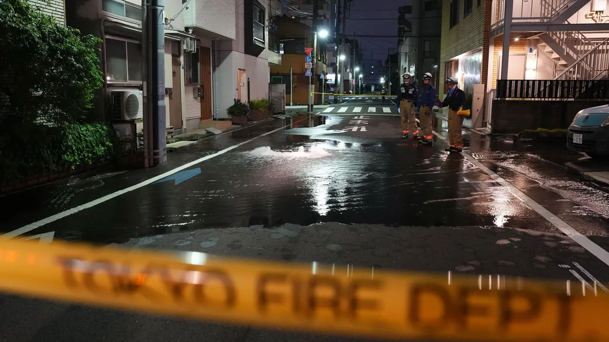
First responders from the Tokyo Fire Department stand on a street partially flooded in the early hours of Sunday, Aug. 23, 2026, following the rupture of a water pipe after an earthquake that struck the area and neighboring prefectures.(Kazuki Kozaki/Kyodo News via AP)An earthquake rattled eastern Japan, including the Tokyo area, early Sunday. Officials said 37 people were injured, most of them lightly. This follows a powerful quake last month that left tens of thousands displaced, killing 38 people and injuring 364.(MORE: Japan earthquake toll climbs as rescuers comb through rubble)The quake had a magnitude of 5.9 and its epicenter was in the southern Ibaraki prefecture with a depth of 42 miles, according to the Japan Meteorological Agency. The agency had warned residents in the area to use caution against another possible moderate earthquake for about a week. But there was no danger of a tsunami, according to officials. Dozens injuredPeople were injured across five prefectures in the region — 15 in Tokyo, nine in Saitama, eight in Kanagawa, four in Chiba and one in Ibaraki.

The Weather Channel·
Weather

Tropical Storm Moke unleashes a rare back-to-back threat, driving up the flood danger for the Big Island

Tropical Storm Moke to approach Hawaii’s Big Island with growing flood threats Tropical Storm Moke targets the Big Island of Hawaii on Sunday with mounting flood risks in a rare back-to-back threat for the state. As it makes its closest approach to the island, over a foot of rain is possible in some areas, accompanied by strong gusts. FOX Weather Meteorologist Melanie Black breaks down Moke’s tracking and impacts:THE TAKEAWAYHawaii faces a rare tropical threat for the second time in two weeks. Tropical Depression Two-C strengthened into Tropical Storm Moke on Friday. Hawaii's Big Island is once again in the bull's-eye for heavy rain after Hurriane Lala dumped nearly 3 feet of rain last week. HONOLULU — Hawaii, which rarely sees tropical activity, is facing its second tropical system in two weeks as Tropical Storm Moke tracks toward the Islands, on the heels of the torrential rain Hurricane Lala brought last week. The system is expected to dump another round of heavy rain on the Big Island, in particular, as well as other islands across the state on Sunday.

Fox Weather·
Weather

Relentless downpours, waterspouts target the East as severe storms cool off parts of the Gulf Coast

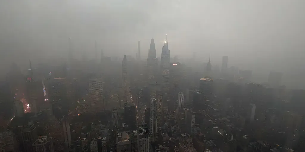
THE TAKEAWAYRain and severe storms target the Northeast and Great Lakes, spreading south to Georgia and the Gulf Coast. Numerous waterspouts will be possible across the Great Lakes. Storms will help provide relief from the intense heat across the Southeast. Another day of rain will keep the weekend soggy across the Northeast and lower Great Lakes on Sunday, as a dip in the jet stream helps fuel thunderstorms from eastern New York and Pennsylvania into southern New England. Recent torrential downpours have left some soils saturated, which could heighten the risk of localized flash flooding. FIRST TASTE OF FALL ON THE WAY AS COOLER AIR TARGETS THE EASTERN USSome storms could turn severe, bringing damaging winds, hail and even waterspouts across the Great Lakes, where peak waterspout season is underway. Rain and severe storms will also extend southward into Georgia and the Gulf Coast. next NEW YORK, NY - AUGUST 20: A thunderstorm passes through midtown Manhattan, seen from the 102nd-floor observation deck of the Empire State Building on August 20, 2026, in New York City.

Fox Weather·
Weather

How animals cool off in heat: Some bizarre cooling tricks

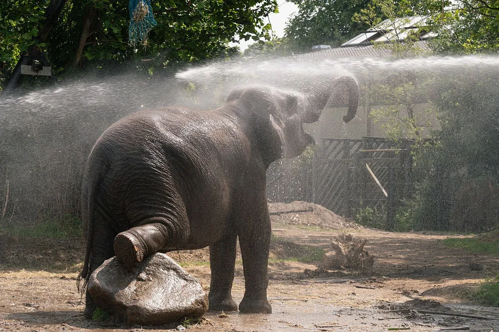
Miami elephants get hosed down as city ties 130-year-old heat recordWhen temperatures soar, humans aren't the only ones looking for relief. Animals have their own ways of handling extreme heat — and for some zoo residents, keepers step in with a helping hand. From giant hoses and frozen treats to some truly bizarre biological tactics, staying cool can look very different across the animal kingdom. Animals have their own ways to cool off Elephants don't need much help. They use their trunks to splash water across their bodies, then coat themselves in mud to shield their skin from the sun. Rhinos wallow in mud or water for the same reason, and kangaroos lick their forearms. These are all forms of evaporative cooling, using moisture on or around the body to carry excess heat away. For many animals, a quick splash or a coating of mud makes a real difference when temperatures climb.(MORE: Splooting: the adorable way animals beat the heat) Mud beats water.

The Weather Channel·
Weather

Torrential downpours expected in the Maritimes on Sunday

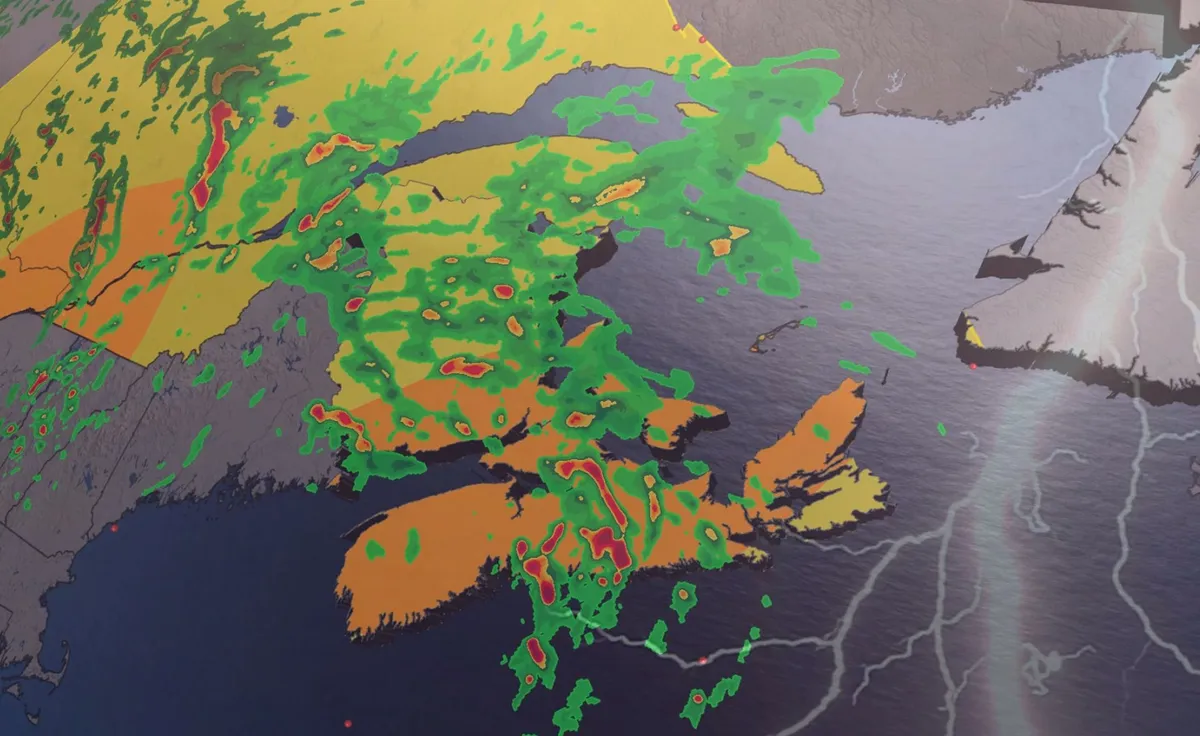
Grab your umbrella if you’ve got plans in the Maritimes on Sunday. Strong to severe thunderstorms may produce torrential downpours throughout the region during the day. Beware the threat for localized flooding beneath the heaviest storms. DON’T MISS: Trouble may lurk beyond hurricane season’s very quiet startA warm front lifting across the Maritimes will drag a rich reserve of atmospheric moisture over the region. Showers and thunderstorms will tap into this ample moisture to produce very heavy rainfall throughout the region. We’ll see patches of heavy rainfall begin to sweep across southern Nova Scotia, New Brunswick, and eventually Prince Edward Island on Saturday night. Localized totals of 30-50 mm of rainfall are possible with this first round of heavy showers through the pre-dawn hours on Sunday. RELATED: Tips to stay safe during a flash flood as peak season draws nearDownpours and thunderstorms will continue throughout Nova Scotia much of Sunday morning, padding the totals of any precipitation that fell the night before. Content continues belowSeveral rounds of torrential rains are forecast to sweep north across the Maritimes through Sunday before easing into Sunday night.

The Weather Network·
Weather

Weather Of The World: August 23

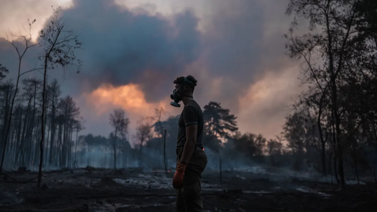
Wander the world one snapshot at a time. Explore striking moments of weather in motion in this week's slideshow. ByAda Wood•August 23, 2026Updated: August 23, 2026, 7:05 am EDTPublished: August 23, 2026, 7:00 am EDTA local resident wearing a protective face mask stands in front of a scorched forest as a wildfire continues to burn in Deliblatska Pescara, in Serbia on Thursday, Aug. 20, 2026. Firefighters were battling wildfires across the Balkans as days of high temperatures and drought conditions continue to drive blazes in several countries.(Uros Arsic/AFP via Getty Images)F​rom wildfires in a scorched forest in Serbia to low water levels at Lake Powell in Arizona, it has been another busy week of weather around the world. Here are some of the most jaw-dropping and awe-inspiring weather photos we found this week. A boat passes the “bathtub ring,” created by the water level when the reservoir was full, on Lake Powell on Thursday, Aug. 20, 2026, near Page, Arizona.

The Weather Channel·
Weather

Weather Whiz: August 23

Airborne Lightning Observatory for Fly's Eye GLM Simulator and Terrestrial gamma-ray flash(NASA Earthdata)How well have you been paying attention to the weather this week? Here are five questions that will test your knowledge of what's been going on. QUESTIONSNew research shows that thunderstorms create dark lightning from gamma rays and even ______. On days that reach at least 90 degrees, do birth rates increase or decrease? Astronomers have discovered a pair of supermassive black holes on the verge of ______, and it could change how we understand the early universe. How many earthquakes struck Granada, Spain, on Tuesday? Dolphins were caught using shells as ______, and a calf may have learned it from mom..... ANSWERSAntimatterIncreaseMergingThreeToolsHow did you do this week? Come back for more exciting weather questions next week, or risk showing up to trivia night unprepared! Get More of Our News on GoogleSet The Weather Company as a 'Preferred Source' to get quicker access to the news you value.

The Weather Channel·
Weather

Rainy, thundery Saturday night in Ontario before a fall-like Sunday

Rounds of strong to severe thunderstorms pushed through parts of southern Ontario on Saturday, providing an unsettled kickoff to the weekend. Expect the risk for showers and thunderstorms to continue overnight across the region. Once the active weather is behind us, an atmospheric reward is in the forecast for your Sunday. Be sure to stay alert to the changing conditions, and monitor any weather warnings or alerts in your area. DON'T MISS: How a strong El Niño could shape Ontario's fall weatherFall-like feel to SundaySunday will bring a sharp shift in weather as northwesterly winds move in. Temperatures will struggle to reach the 20s in the GTA, and much of the region will experience scattered afternoon showers. Expect a cooler day with a noticeably fall-like feel compared to earlier in the week. Occasional showers are expected to linger across Ontario through Monday and potentially into Tuesday morning, accompanied by brisk northwest winds. Daytime highs will range from the upper teens to lower 20s. Temperatures are forecast to return to near-seasonal values mid-week, with another chance for showers or thunderstorms late Thursday into Friday.

The Weather Network·
Weather

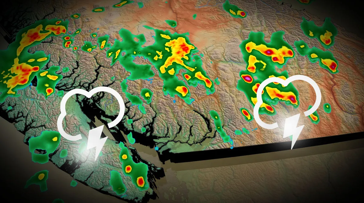
Downpours, severe storms possible in B.C. Saturday

Prepare for an active Saturday across much of southern British Columbia as a pattern change brings the region a chance for widespread thunderstorms. Some of the thunderstorms could turn severe with a risk for strong winds and large hail. Saturday’s potential may be the first rain we’ve seen all August for many communities in the area. DON’T MISS: Latest El Niño forecast calls for historic heat by this autumnSaturday severe storm potential in British ColumbiaThe ridge responsible for the recent heat will shift to the Prairies this weekend, taking the bulk of the elevated temperatures with it. We’ll see conditions cool off by more than 10 degrees from Friday to Saturday, with a 5-7 degree drop for the Lower Mainland. Rising instability will follow a low-pressure system expected to form along the coast and track northward over B. C. We’ll see pockets of downpours and thunderstorms as this system swings through the region. Most guidance highlights the risk for thunderstorms through the day on Saturday across much of the South Coast, including Vancouver Island and the Sea to Sky Corridor.

The Weather Network·
Weather

What happens when a hurricane collides with Hawaii’s massive volcanoes?

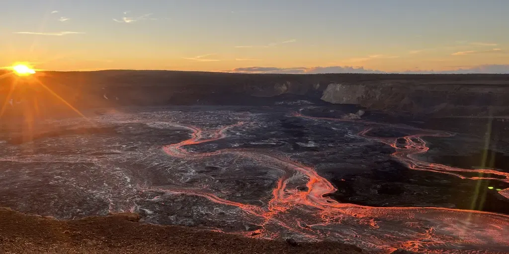
HAWAII – As any hurricane barrels toward Hawaii, it poses a threat to Mount Kilauea and the rest of the islands. With a second tropical storm expected to impact Hawaii in the span of a week, there is a lingering threat to Mount Kilauea, which has erupted 53rd times in less than two years. The 54th eruptive episode is imminent, and is expected to happen any time between now and Aug. 27, according to the USGS. HAWAII'S KILAUEA ERUPTS FOR 53RD TIME IN LESS THAN 2 YEARS, SENDS SMOKE PLUME SOARING 18,000 FEET INTO THE SKYDuring the latest eruption, lava fountains peaked at 500 feet, and the ash plume reached over 18,000 feet above sea level. Kilauea's 53rd eruptive episode on Aug. 12, 2026. (USGS / FOX Weather)If an eruption were to occur during a hurricane, it could lead to catastrophic events such as deadly flooding from rain and strong winds. When volcanic ash mixes with enough water, it can erode, be transported and eventually move downslope. UNDERSTANDING THE PACIFIC RING OF FIRE: WHERE EARTHQUAKES AND VOLCANOES MEETAccording to the United States Geological Survey, when this occurs, it can look like a mass of wet concrete flowing down violently.

Fox Weather·
Weather

Watch: 2 fishermen rescued after being trapped floating inside cooler in Pacific Ocean for several days

Mexican authorities said the two fishermen had been lost at sea for five days. THE TAKEAWAYThe Mexican Navy rescued two fishermen stuck at sea inside a cooler. Both fishermen were reported missing and were located five days later. Staff from a fishing cooperative reported the men missing after losing communication with them. Two fishermen were found in quite the conundrum after being spotted floating inside a cooler in the Pacific Ocean, according to the Mexican Navy. Mexican authorities said the two had been lost at sea for five days, about 150 miles from Chiapas, Mexico. SCIENTISTS UNCOVER POTENTIALLY SIGNIFICANT MOVEMENT AT ONE OF AMERICA'S MOST DANGEROUS FAULT LINES Two fishermen floating in a cooler about 150 miles from Chiapas were rescued on Aug. 19, 2026. (SEMAR Mexico / FOX Weather)Officials received a distress call from the staff of a fishing cooperative, requesting support in the search for the two fisherman, aged 53 and 32, who set sail aboard a vessel named Camaronera. The fishing cooperative reported to have last communicated with them on Aug. 14. The Secretariat of the Navy deployed surface and air units to assist in rescue efforts.

Fox Weather·
Weather

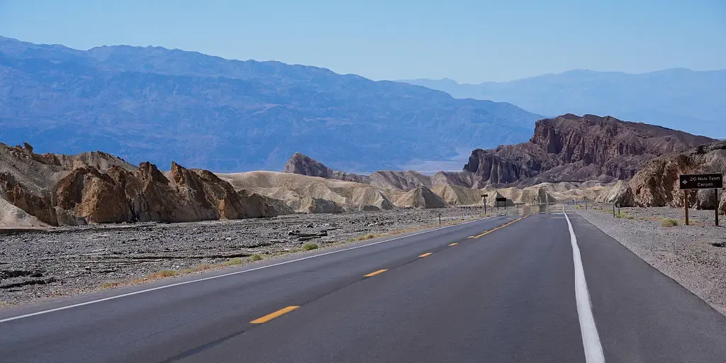
Tourist dies in Death Valley National Park after becoming stranded in triple-digit heat

The vehicle became stuck in mud, facing dangerous conditions as temperatures soared into the triple digits. THE TAKEAWAYA 68-year-old French tourist died in Death Valley National Park. The tourist sought help after his vehicle became stuck on a remote road. High temperatures reached 116 degrees. DEATH VALLEY, Calif. – A French tourist died in Death Valley National Park on Monday after their vehicle became stuck in mud along a remote road while traveling with a companion amid extreme Mojave Desert heat. After Pierre Michel Formosa, 68, and his travel companion, both from France, became stranded in the remote California desert, the pair began walking across the salt flats to seek help because there were no other vehicles in the area, the National Park Service said in a news release. ICONIC COTTONWOOD TREE IN WHITE SANDS NATIONAL PARK TOPPLES AFTER INTENSE MONSOON STORMS Death Valley is widely recognized as the hottest air temperature location on Earth, holding an official record of 134 degrees set at Furnace Creek on July 10, 1913, though modern experts debate this reading. (Tayfun Coskun/Anadolu via Getty Images) / Getty Images)With temperatures reaching 116 degrees on Aug.

Fox Weather·
Weather

First taste of fall on the way as cooler air targets the eastern US

First taste of fall coming for millions across the US A sweeping cold front will push across the eastern U. S. early next week, bringing a refreshing, fall-like air mass and relief from the late-summer heat. FOX Weather Meteorologist Bayne Froney breaks down the forecast. THE TAKEAWAYSweeping cold front to usher in fall-like temperatures across the Northeast, Mid-Atlantic and Ohio Valley. Parts of the South will get a break from the late-summer heat. Coolest temperatures will settle into higher elevations and northern interior areas of the East. The taste of fall weather may be coming early for millions in the East this week. After a weekend of stormy weather, a sweeping cold front will dive across the eastern United States early next week, putting summer heat on humidity on hiatus and ushering refreshing, fall-like air. DEW POINT VS. HUMIDITY: WHICH ONE IS A BETTER MEASURE OF HOW MUGGY THE AIR FEELS? Millions across the Eastern U. S.

Fox Weather·
Weather

After weather disruptions, Bonnaroo taking 'much-needed year off' in 2027

After severe weather with heavy rain, wind and lightning, there were safety evacuations and a halt to performances for several hours during the 2026 Bonnaroo Music and Arts Festival on June 14, 2026, in Manchester, Tennessee.(Photo by Gary Miller/Getty Images)The Bonnaroo Music and Arts Festival, mired by years of weather disruptions, is "taking a much-needed year off in 2027," organizers announced Friday. The hugely popular festival, held (nearly) every June since 2002 in Manchester, Tennessee, has had more than its fair share of rainy days in recent years. (MORE: Burning Man 2023: 70,000 people stuck in a three-day mud trap)In 2021 (the first festival in two years because of COVID-19), the event was pushed to September because of COVID, and then it was canceled because of waterlogged grounds from Hurricane Ida. Last year, it started on time, but had to be canceled on the second day because of heavy rain. Waterlogged farms and huge crowds don't mixThese disruptions prompted significant investment into the infrastructure before this year's event, which drew an estimated 45,000 people.

The Weather Channel·
Weather

South heat wave to bring dozens of records this week

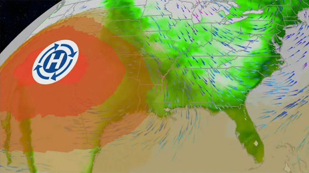
This weekend's pattern features a heat dome in the western U. S. and drier conditions in the East. A shift in a dangerous heat dome will allow some to see drier air off while the Southern Plains continues to bake into this weekend. Triple-digit highs, stifling humidity and little relief at night are expected in Texas and Oklahoma. Where it's hot nowIt's already hotter than even August standards in the South. Days of highs in the 90s and 100s and extremely muggy air have baked much of the South, but some less hot air is beginning to work its way into the Deep South. You can see current actual temperatures on the map below: The map below shows where the National Weather Service has issued heat alerts, ranging from heat advisories to extreme heat warnings. These alerts mean it's hot enough to take extra precautions to avoid heat exhaustion or heat stroke. (CURRENT MAPS: Temperatures | Dew Point | Heat Index)Get More of Our News on GoogleSet The Weather Company as a 'Preferred Source' to get quicker access to the news you value. Heat dome heads westThe heat isn't going anywhere soon for places like Oklahoma City and Houston, but much of the Southeast will see the first false fall ...

The Weather Channel·
Weather

Northeast tornadoes, Indiana flooding tied to same pattern

Cleanup efforts ongoing after tornado struck Atlantic Beach in Long Island, New York, United States on Friday, August 21, 2026. Cleanup efforts are underway after a tornado struck Atlantic Beach on Long Island Thursday evening. The state of emergency put in place following the tornado in Nassau County was lifted Friday morning. (Kyle Mazza/Anadolu via Getty Images)Rounds of storms brought tornadoes in New York, Pennsylvania and Delaware, record flooding in Indiana and powerful storms even in Alabama. These were all brought and enhanced by a heat dome in the Southeast. When you think of tornadoes, you're probably picturing the Midwest or Great Plains, not the Northeast. And you would be right, but they do happen and can be pretty damaging. (MORE: Tornado hits New York)That was the case in Atlantic Beach in Nassau County, New York. A powerful storm moved through the area on Thursday evening. Storm surveyors were sent out by the National Weather Service and found EF-1 damage with estimated peak winds of nearly 100 mph. But it wasn't just New York. There was an EF-1 in Dover, Delaware, that will require more surveying.

The Weather Channel·