BBlogFlow

Categories

Weather

5149 articles

Weather

Using thunderquakes to X‑ray Earth – a new study using urban seismology

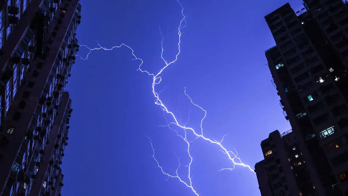
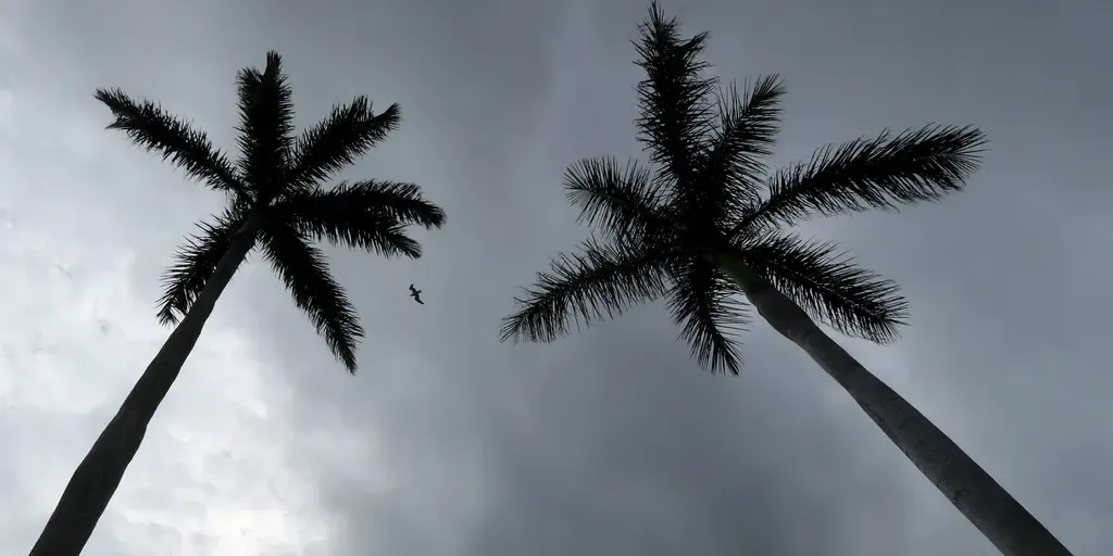
As lightning lights up apartment buildings, the thunder creates useful vibrations.(Philip Fong/AFP via Getty Images)When lightning strikes, it superheats the air around it and creates a shock wave that we hear as thunder. But thunder doesn’t just travel through the atmosphere to our ears. When that energy reaches the ground, some of it is converted into seismic waves that ripple through the soil and rock beneath. The resulting vibrations are known as “thunderquakes.”(MORE: America's mystery 'skyquakes': Unexplained booms have rattled windows for centuries)Until now, scientists haven’t understood these signals well enough to make practical use of them. Our team’s research shows that thunderquakes can be used to map the structure beneath the Earth’s subsurface — such as groundwater movement, environmental contamination, sinkholes, or evaluating building sites and foundations — just like X-rays image inside the human body. We discovered this by listening to thunder with something found in communities around the world but unusual as a seismic measuring instrument: fiber-optic cable.
The Weather Channel·
Weather

Sinking cities: land subsidence doubles sea level rise

Sinking land doubling sea level rise in populated coastal citiesYou’ve probably heard by now that global sea levels are rising. But in populated coastal towns, only half of that threat is from ocean levels increasing. The other half comes from something called subsidence – the gradual sinking of the Earth’s surface. A new study looked at roughly two-thirds of the world’s coastal population and found that people on densely populated coasts are now experiencing about a quarter inch of relative sea level rise per year. That’s close to double that from climate-driven ocean levels rising alone. When averaged across the world’s coastlines, the rate is nearly one third of that. The difference is where people build. About 90% of the world’s coastal population lives in an area that extends along only roughly 10% of the global coastline. And those populated stretches are the ones disproportionately sinking. 71% of people living in low-lying coastal zones are on land that is sinking. Get More of Our News on GoogleSet The Weather Company as a 'Preferred Source' to get quicker access to the news you value. Why is the ground sinking? Subsidence is driven by various natural and human processes.

The Weather Channel·
Weather

Slow-moving summer storms to soak the Southeast through the week, driving flood threat across a dozen states

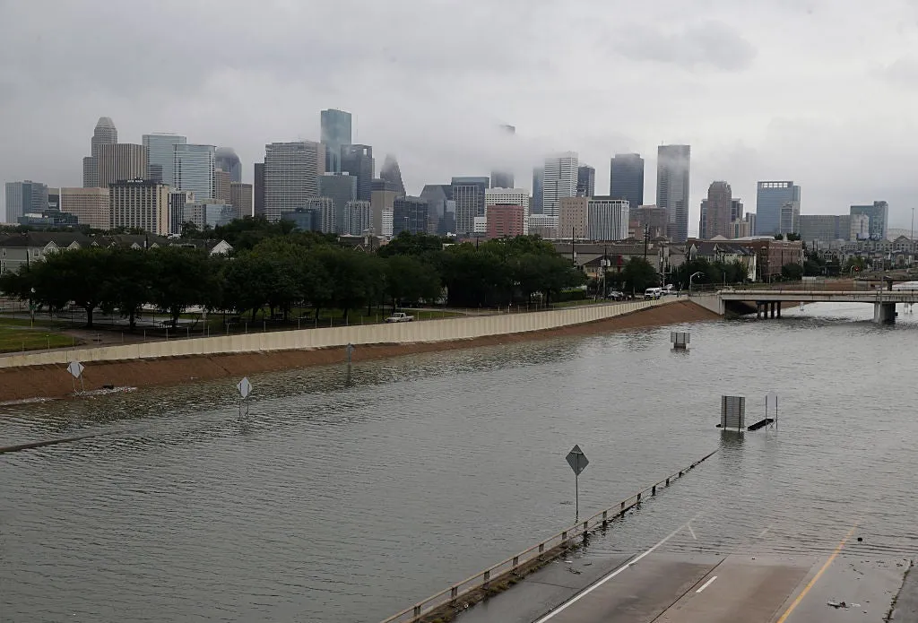
Severe storms, flooding rain to fuel unsettled stretch across the Sout A prolonged stretch of unsettled weather is taking hold across the South, bringing a one-two punch of severe storms and flooding rain. The threat begins Wednesday, when thunderstorms could turn severe across parts of the region, before repeated rounds of tropical moisture and a slowing cold front shift the focus to flash flooding through the weekend. FOX Weather Meteorologist Steve Bender analyzes the forecast. THE TAKEAWAYThe Southeast is seeing rounds of storms all week. A prolonged stretch of nasty weather has settled across the southern U. S. A Level 1 out of 4 flash flood threat is in place through Thursday. Residents across the Mid-South and Southeast are facing a soggy week as repeated rounds of heavy rain and thunderstorms threaten little relief between downpours. The active weather pattern is taking hold across the South, beginning with a heightened severe storm threat Wednesday before transitioning to a daily flood threat heading into the weekend.

Fox Weather·
Weather

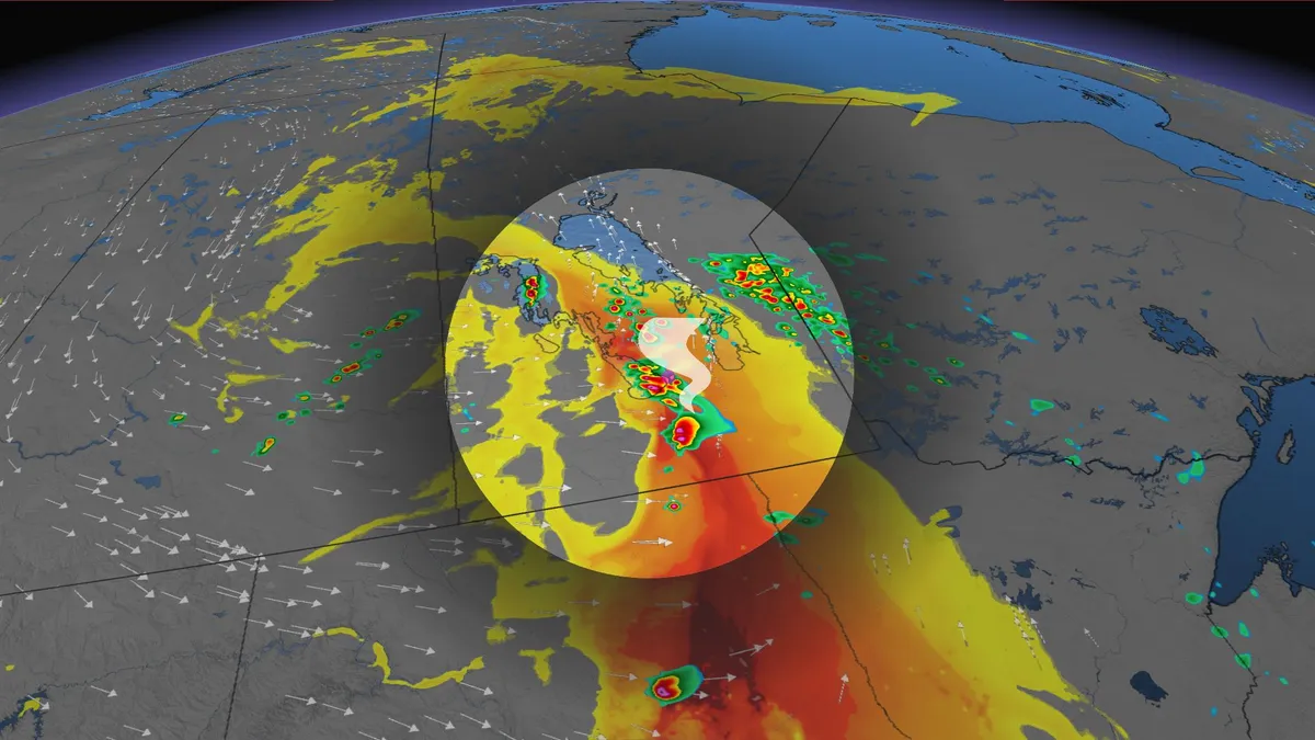
Storm risk stays in Manitoba as tornado potential shifts into NW Ontario

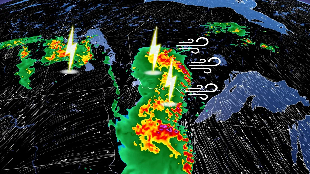
The week got off to a stormy start on parts of the eastern Prairies, and that potential will stick around on Tuesday. The chance for severe weather will stick around in parts of southern Manitoba, mainly along the border with northwestern Ontario. The main area to watch will be in the latter region, where a tornado threat will be present. SEE ALSO: Scud clouds are scary tornado lookalikes – how to tell them apartKeep an eye out for local weather alerts and approaching storms on Tuesday. Severe storm, tornadic threat shifts east on TuesdayWidespread rain and embedded thunderstorms will track west to east across northwestern Ontario on Tuesday afternoon, well west of Lake Superior. The unsettled weather will continue through Wednesday and into Thursday morning for some areas. DON'T MISS: Rare hazard: This town saw an earthquake during a tornado warningA large low pressure system with a moist and unstable atmosphere is creating conditions for rounds of thunderstorms on Tuesday, starting from morning into the evening. Content continues belowThe main area of concern on Tuesday will be northwestern Ontario, from Thunder Bay to the Manitoba border.

The Weather Network·
Weather

Southern B.C experiences ‘haze’, wildfire smoke moves north

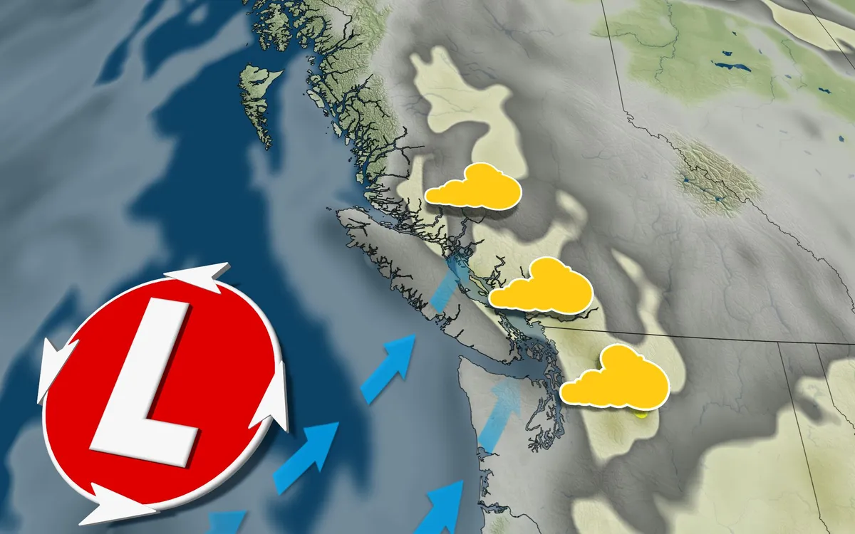
Wildfire smoke coming from down south is blowing into British Columbia’s Lower Mainland and Metro Vancouver. The smoke will even reach parts of Vancouver Island, though it won’t be as bad as on mainland B. C. STAY INFORMED: The Weather Network’s Wildfire HubHowever, air quality isn’t projected to be as bad as in eastern B. C., where wildfires are still ongoing. Southern wildfire smoke to be briefThe smoke is originating from wildfires in Washington state and the Okanagan. By Tuesday afternoon and evening, a noticeable haze is expected across the Lower Mainland as the smoke settles in. READ MORE: Tips for making your home a clean air refuge during wildfire seasonThe wildfire smoke is expected to be short-lived, as a low pressure system is forecast to move ashore on Wednesday. This system will bring a shift to westerly winds, preventing the smoke from continuing its northward movement into B. C. The system will bring light rainfall Wednesday evening along Vancouver Island, with stronger rainfall north of Campbell River. Content continues belowFollowing Saturday’s lightning event across the South Coast, 67 new wildfires were sparked in just 24 hours in B. C. alone.

The Weather Network·
Weather

Powerful storm kills 2, leaves thousands without power in Baltics

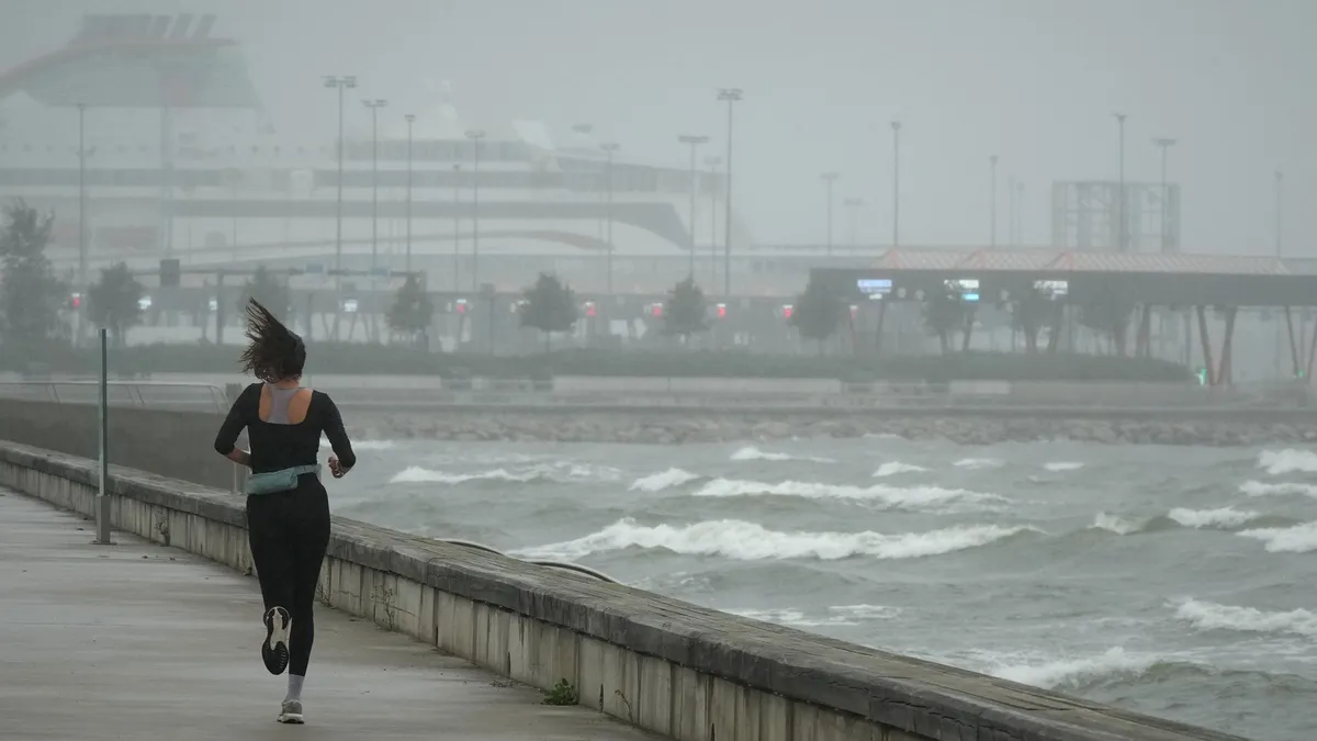
A jogger runs at the beach along the Tallinn bay of the Baltic sea on a rainy and windy day in Tallinn, Estonia, Sunday, Aug. 23, 2026. (AP Photo/Sergei Grits)WARSAW, Poland (AP) — Two people died, and around half a million people were left without electricity across Latvia and Lithuania after a powerful storm, bringing rain and strong winds, hit the region on Saturday and into Sunday morning. “This seems to be the most severe storm in Latvia since 2005 in terms of its overall impact,” Andris Viksna, from the Latvian Environment, Geology and Meteorology Center, told the AP. The impactsOne person died in Jelgava, central Latvia, when part of a building collapsed on Saturday, and others were injured across the country. Wind speed exceeded 67 mph on Saturday in the capital, Riga. At many stations, half of the average monthly rainfall was recorded on Saturday. More than a quarter-million people were left without electricity, and mobile services were disrupted. Rail and other public transport services were affected by trees and other objects falling on infrastructure. The Riga airport said on Sunday morning that flights could be delayed or rerouted because of the severe storm overnight.

The Weather Channel·
Weather

11 hikers trapped by Bryce Canyon National Park flooding

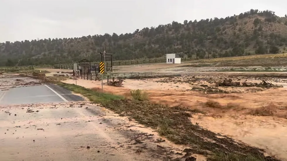
A view of Thor's Hammer in Bryce Canyon National Park(Bryce Canyon National Park)Flash floods trapped nearly a dozen hikers Monday in Bryce Canyon National Park. The water stranded 11 adults in four groups of hikers, the Garfield County Sheriff's Office said. Two of the hikers showed signs of hypothermia and were taken to a hospital, according to the Salt Lake Tribune. The other nine were released.(MORE: Lightning strike kills mother and 2-year-old child in Florida)Trails affected by the floods included Fairyland Loop, Navajo Loop, Queen’s Garden and Peek-a-Boo Loop, the Tribune said. In addition to Garfield County Search and Rescue team members and sheriff’s deputies, national park rangers helped with the rescue. Get More of Our News on GoogleSet The Weather Company as a 'Preferred Source' to get quicker access to the news you value. Bryce Canyon National Park, in southwestern Utah, is known for its towering rock formations known as hoodoos.

The Weather Channel·
Weather

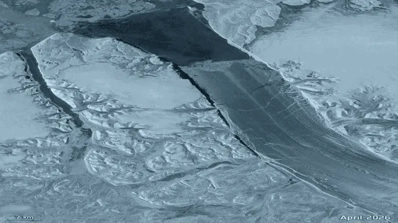
Huge iceberg breaks apart from Greenland's Petermann Glacier

(European Space Agency)A gigantic chunk of Greenland just broke free, and it’s roughly the size of Manhattan. The 29-square-mile section of Petermann Glacier snapped off earlier this month, creating a massive tabular iceberg, or “ice island.” Scientists estimate the slab could be nearly 500 feet thick. Satellites watched it happenEurope’s Copernicus Sentinel-1 mission captured cracks spreading rapidly through the glacier weeks ago. By Aug. 3, the area was showing major deterioration. On Aug. 4, the slab completely separated.(European Space Agency)This particular glacier hasn’t experienced a break this large since 2012, making this its biggest ice loss in more than a decade. Get More of Our News on GoogleSet The Weather Company as a 'Preferred Source' to get quicker access to the news you value.

The Weather Channel·
Weather

Bryan Norcross: Eventually we might have to watch the Atlantic disturbance (#96L)

FILE: Exclusive Analysis: Back-to-back storms set to soak Hawaii Future Tropical Storm Moke is on track to impact the Big Island of Hawaii just days after Hurricane Lala caused significant damage to the Aloha State. FOX Weather Hurricane Specialist Bryan Norcross joins FOX Weather to talk about all of the tropical activity lightning up the Pacific as well as what we can expect in the Atlantic. Updated at 8:45 a.m. ET on Monday, August 25. The robust tropical disturbance that the National Hurricane Center officially tagged Invest 96L has begun its trek across the tropical Atlantic in the general direction of the northeast Caribbean. It's carrying a reasonable amount of moisture, so it has a chance to fight off the Saharan dust sufficiently to develop into a tropical depression or tropical storm over the next day or two. The National Hurricane Center now has the development odds in the high range.

Fox Weather·
Weather

Sneak peak of the Wildlife Photographer of the Year photos

Wildlife Photographer of the Year 2026: a first look at the winnersThe world's biggest and most prestigious wildlife photography competition, the U. K.'s National History Museum Wildlife Photographer of the Year, drew a record 65,000 entries from 121 countries this year. Here is a first look at some of the entries. An international panel of expert judges anonymously ranked the images on their creativity, originality, technical excellence and the powerful stories they tell. The museum released a sneak peek of some of the "Highly Commended" images, showcasing some of the world's best wildlife photography and photojournalism, taken by both amateur and professionals alike. The newly released images include the beautifully intertwined lives of a rhino and a oxpecker by Ernest Porter, young photographer Jack Crockford's swift silhouetted against an incoming plane at London's Heathrow Airport and Allegra Hutton's shot of a young leopard chasing a squirrel up a tree. The full set of 100 "Highly Commended" images for 2026 will be showcased in an exhibition at the museum in London starting Oct. 16.

The Weather Channel·
Weather

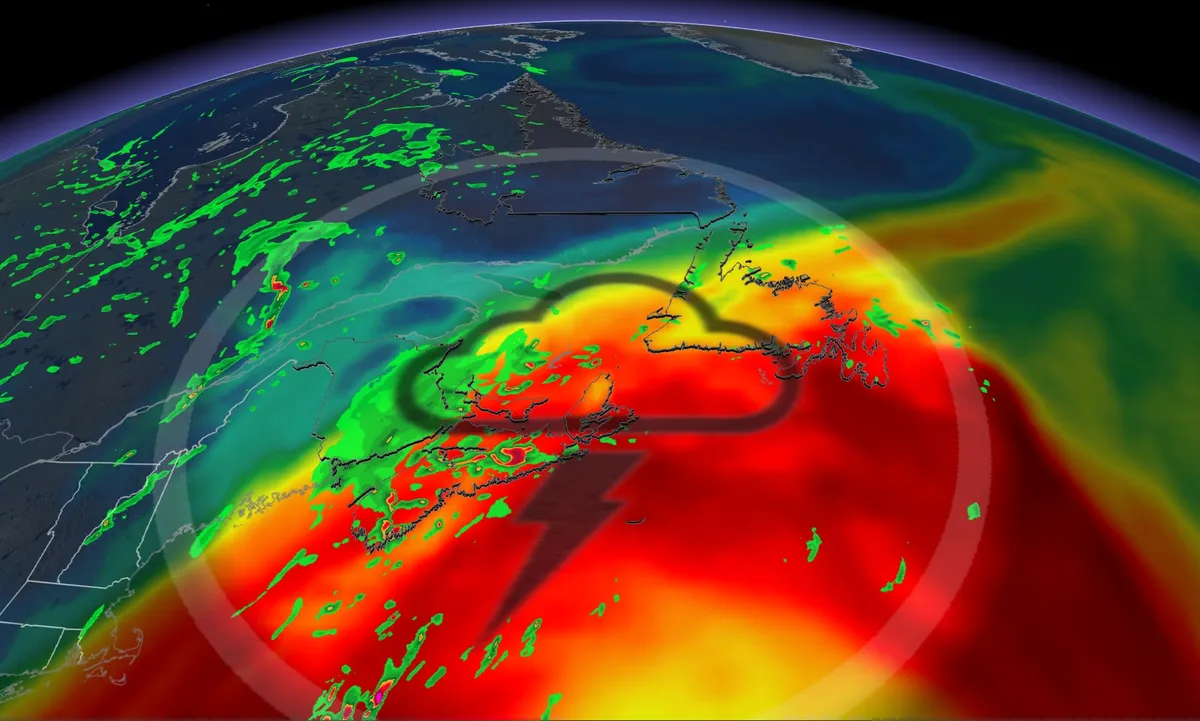
3,000-km-long tropical air mass covers Atlantic Canada to the Bahamas

Have you felt the mugginess in the air? After recent torrential rains and moisture from the subtropics, you can trace the current air mass that’s surrounding Atlantic Canada back to the Bahamas--more than 3,000 kilometres away from Newfoundland. DON’T MISS: Trouble may lurk beyond hurricane season’s very quiet startThe dew points on Monday were raising eyebrows, spilling into the low 20s across most of Atlantic Canada. Dew points above 20°C can be uncomfortable for some individuals. High dew points are often a precursor to incredibly mild nights, and that’s exactly what’s on tap through the pre-dawn hours on Tuesday. It’s also a recipe for dense fog, which may be hazardous to drivers all along Nova Scotia, the Bay of Fundy, and portions of Newfoundland through Tuesday. And all this excess moisture makes it easier to generate thunderstorms. Content continues belowMuggy night with rain and storm risk MondayWith a highly unusual amount of moisture, thunderstorm risk continues across eastern Nova Scotia and Newfoundland through the pre-dawn hours on Tuesday. Monday overnight lows are forecast to remain at or above 20°C for Sydney and Cape Breton, N. S., Gander, St. John’s, N.

The Weather Network·
Weather

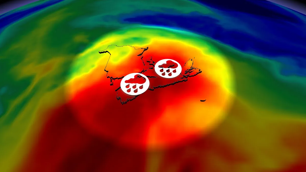
Oh, what a tropical night in the Maritimes as humid air mass sinks in

The dew points on Monday were raising eyebrows, spilling into the low 20s across most of Atlantic Canada. Dew points above 20°C can be uncomfortable for some individuals. DON’T MISS: Trouble may lurk beyond hurricane season’s very quiet startHigh dew points are often a precursor to incredibly mild nights, and that’s exactly what’s on tap through the pre-dawn hours on Tuesday. It’s also a recipe for dense fog, which may be hazardous to drivers all along Nova Scotia, the Bay of Fundy, and portions of Newfoundland through Tuesday. And all this excess moisture makes it easier to generate thunderstorms. Muggy air, rain, storm risk Monday nightAfter recent torrential rains and moisture from the subtropics, you can trace the current air mass that’s surrounding Atlantic Canada back to the Bahamas--more than 3,000 kilometres away from Newfoundland. With a highly unusual amount of moisture, thunderstorm risk continues across eastern Nova Scotia and Newfoundland through the pre-dawn hours on Tuesday. Monday overnight lows are forecast to remain at or above 20°C for Sydney and Cape Breton, N. S., Gander, St. John’s, N. L., and most of Newfoundland.

The Weather Network·
Weather

Storm, tornadic threat shifts onto eastern Prairies Monday

This past weekend's storm risk may have been centred on Alberta and Saskatchewan, but the focus will shift east into Manitoba on Monday as forecasters track a low-pressure system that could trigger severe thunderstorms. Southern Manitoba will be near the "triple point," where cold air, warm air, and an occluded front all intersect. This typically supports an environment for increased wind shear and low-level lift—the main ingredients for tornadic, severe weather. SEE ALSO: Scud clouds are scary tornado lookalikes – how to tell them apartKeep an eye out for local weather alerts and approaching storms on Monday evening and into the nighttime hours. Severe storm threat builds in southern Manitoba late MondayBehind the low's fronts, folks across southern Alberta and Saskatchewan will feel the winds pick up, with gusts of 40-60 km/h that may toss loose items. However, ahead of the fronts is where forecasters are paying the closest attention as a tornadic risk looms over southern Manitoba. DON'T MISS: Rare hazard: This town saw an earthquake during a tornado warningSevere storm activity is most likely between 6 and 11 p.m. CT.

The Weather Network·
Weather

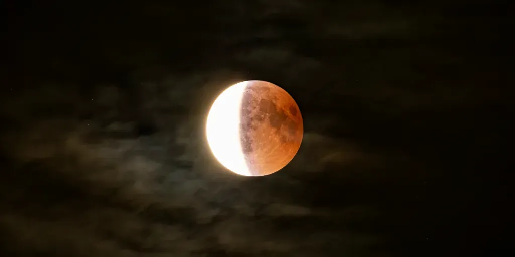
Another celestial show is coming as partial lunar eclipse takes center stage for billions

Starting on the night of Aug. 27 and continuing into Aug. 28, the full moon will slip through Earth's shadow, creating a partial lunar eclipse. THE TAKEAWAYA partial lunar eclipse will occur from Aug. 27 to 28. Around 3.3 billion people will be able to experience the event. The moon will turn a coppery color during the earlier phase. Yet another celestial event will dazzle the sky this week as a partial lunar eclipse becomes visible across much of North and South America. Starting on the night of Aug. 27 and continuing into Aug. 28 for some locations, the full moon will slip through Earth's shadow, creating a partial lunar eclipse. NATIONAL PARK WEEK KICKS OFF AS NATIONAL PARK SERVICE PREPARES TO CELEBRATE 110 YEARS"At maximum eclipse, about 93% of the moon's diameter will be inside Earth's dark central shadow, called the umbra," NASA said. "The moon will not be completely covered, but it can look dramatically darkened, with a rusty, coppery tint along the covered edge. " Partial Lunar Eclipse phases. (Ernie Wright / NASA's Scientific VIsualization Studio)This shadow gets smaller as it goes away from the sun, and it is the dark center of the eclipse shadow.

Fox Weather·
Weather

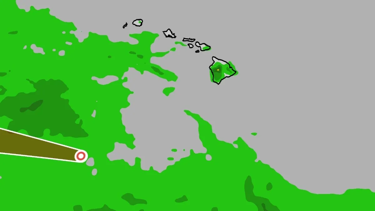
Hawaii's Big Island is facing more flooding rain, just after Lala

Hawaii faced flooding from Moke just a week after destructive flooding and winds from Hurricane Lala last weekend.(MORE: Hurricane Lala cleanup begins in Hawaii, 100 Big Island homes damaged)Where is Moke right now? Moke was pronounced "MOH-keh. "The National Hurricane Center issued its first advisory on Tropical Depression Two-C Thursday morning. It was upgraded to a tropical storm Friday morning. It then weakened to a tropical depression over the weekend. (MORE: What tropical terms mean)What were the impacts to Hawaii? The most serious concern is additional heavy rain and flash flooding just days after Hurricane Lala triggered damaging flooding on the Big Island, and locally flooding rain in other parts of the island chain. Get More of Our News on GoogleSet The Weather Company as a 'Preferred Source' to get quicker access to the news you value. A flood watch was in effect for the Big Island.

The Weather Channel·
Weather

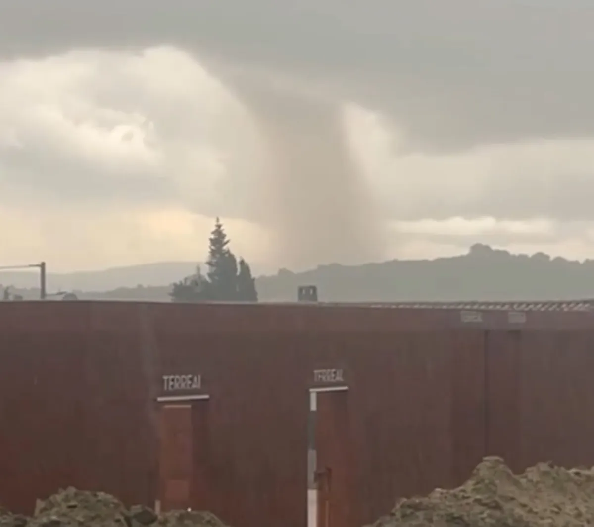
Popular spot in southern France hit by rare, damaging tornado

When word comes out about a destructive tornado, many would immediately look to a location somewhere in North America. But on Monday, southern France was the site of a damaging tornado, a rare intensity for the region--captured in videos and photos by onlookers, and posted to social media. While no injuries have been reported, several homes incurred damage and thousands are without power, according to local media accounts. As well, multiple roads were reportedly closed due to fallen trees and to allow for easier access for emergency services. Early reports and social media videos put the tornado location south of Carcassonne, France, in the Limoux-Pomas-Couffoulens corridor, during late-Monday afternoon. Significant damage to homes was reported, but results of a formal damage survey and intensity rating is still to be released. Content continues belowThe twister was created by a rotating supercell ahead of a broad complex of thunderstorms crossing Occitanie. While France records tornadoes every year, a mature, damaging supercell tornado of this intensity is rare.

The Weather Network·
Weather

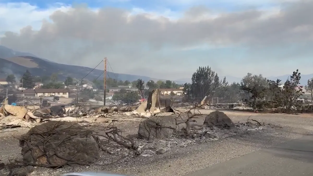
Nevada's Hawk Fire prompts more than 90,000 evacuations

Thousands evacuate as Reno’s Hawk wildfire destroys homesA wildfire that mushroomed over the weekend in the Sierra Nevada foothills spread perilously close to neighborhoods in Reno, Nevada, forcing authorities to urge more than 90,000 residents to leave their homes. The out-of-control fire has already burned some homes, but there's concern that winds could push the flames into newly developed and densely packed neighborhoods in Nevada's largest city outside of metro Las Vegas. Schools across Washoe County were closed Monday because of the evacuations and to keep roads clear for emergency crews. Nevada's governor declared a state of emergency in the county and mobilized the National Guard to help with aerial firefighting and protecting evacuated neighborhoods northwest of downtown Reno. At one roadblock, residents expressed frustration Monday that they could not get back into their homes. "There’s no fire here! Why are the National Guard here?” a driver yelled.

The Weather Channel·
Weather

Earth is simmering in its hottest water temps on record, and that's bad for fish and us

Tourists enjoy the cool summer at Shilaoren Beach on August 21, 2026, in Qingdao, Shandong Province of China. The beach has attracted numerous visitors seeking relief from the summer heat.(Yang Xuemei/VCG via Getty Images)The world's oceans simmered to their hottest temperatures on record over the weekend and are likely to warm even further in the next few months, putting stress on life in the water and on land too, the European climate service Copernicus announced Monday. Spurred by a still growing but already supersized natural El Niño and human-caused climate change, the world's ocean temperatures hit 21.1 degrees Celsius (70 degrees Fahrenheit) on Friday and Saturday, narrowly edging out the daily record set in March 2024, said Samantha Burgess, strategic climate lead for Copernicus. “This is yet another sign of our climate system under strain and the ocean under immense pressure,” Burgess said. Jane Lubchenco, an oceanographer and former chief of the U. S.

The Weather Channel·