11 hikers trapped by Bryce Canyon National Park flooding
This story deserves to be shared
Send it to someone who'd care, or post it on your networks.
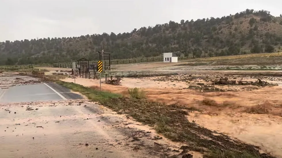
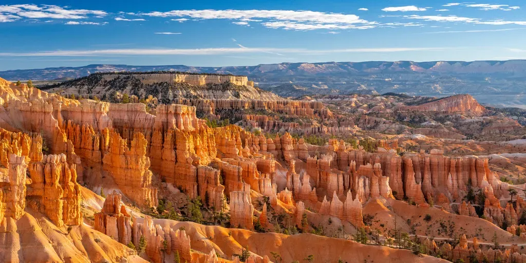
A view of Thor's Hammer in Bryce Canyon National Park(Bryce Canyon National Park)Flash floods trapped nearly a dozen hikers Monday in Bryce Canyon National Park. The water stranded 11 adults in four groups of hikers, the Garfield County Sheriff's Office said. Two of the hikers showed signs of hypothermia and were taken to a hospital, according to the Salt Lake Tribune. The other nine were released.(MORE: Lightning strike kills mother and 2-year-old child in Florida)Trails affected by the floods included Fairyland Loop, Navajo Loop, Queen’s Garden and Peek-a-Boo Loop, the Tribune said. In addition to Garfield County Search and Rescue team members and sheriff’s deputies, national park rangers helped with the rescue. Get More of Our News on GoogleSet The Weather Company as a 'Preferred Source' to get quicker access to the news you value. Bryce Canyon National Park, in southwestern Utah, is known for its towering rock formations known as hoodoos.
This article is an excerpt. To read the full content, visit the original source. The Weather Channel
Related articles
11 rescued after flash flooding sweeps Bryce Canyon National Park in Utah
FILE: Bryce Canyon National Park a stunning national playground FOX Weather’s Robert Ray visits Utah’s Bryce Canyon National Park which is known for its unique rock formations called hoodoos, expansive hiking trails and breathtaking views of the natural landscape as part of our week-long celebration of National Parks Week. THE TAKEAWAYFlash flooding swept through Bryce Canyon National Park on Monday. Nearly a dozen people from different hiking groups had to be rescued. The flash flooding comes amid peak monsoon season, which occurs during August and September. Eleven people in four different hiking groups visiting Bryce Canyon National Park on Monday were rescued after flash flooding swept through the park. The hikers were rescued after heavy rain caused flash flooding along several of the national park's popular trails, leaving them trapped, according to FOX 13 Salt Lake City. KILAUEA PUTS ON FIERY SHOW AS 54TH ERUPTION EPISODE SENDS LAVA FOUNTAINS SOARINGNone of the hikers were swept away by the rushing waters, but conditions wouldn't allow them to continue. Chaco Culture National Historical Park hosts a large concentration of ancient pueblos.
Two Utah hikers rescued after perilous, freezing 36-hour trek on Mt. Shasta
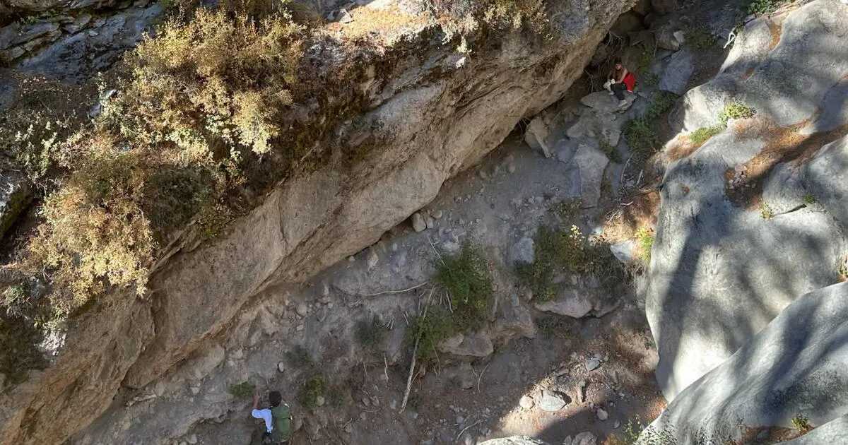
Staff Writer Oct. 17, 2026 Updated 4:45 PM PT Two Utah residents who hiked Mt. Shasta in Northern California were rescued after they became stranded during a perilous 36-hour journey through freezing conditions. The Siskiyou County Sheriff’s Office received a distress call around 10:20 p.m. Monday from a 19-year-old man and a 20-year-old woman, both from Salt Lake City, who were in the Avalanche Gulch area, about 11,000 feet above sea level, according to a news release from the office. The hikers, who had planned only for a daylong hike, said they were cold and unable to finish their descent of the towering volcano. At the time of their call, temperatures hovered around 15 degrees, and the pair lacked adequate clothing, food or water to safely endure the night, according to the Sheriff’s Office. Siskiyou County Sheriff’s deputies rescued two hikers who became stranded on Mt. Shasta in freezing conditions. (Siskiyou County Sheriff’s Office) Authorities advised the hikers to continue descending the mountain to maintain their body heat. By 2 a.m., the hikers called authorities again to say they had arrived at Helen Lake (about 10,400 feet above sea level).
Hurricane season maps tracker: Latest forecasts and more
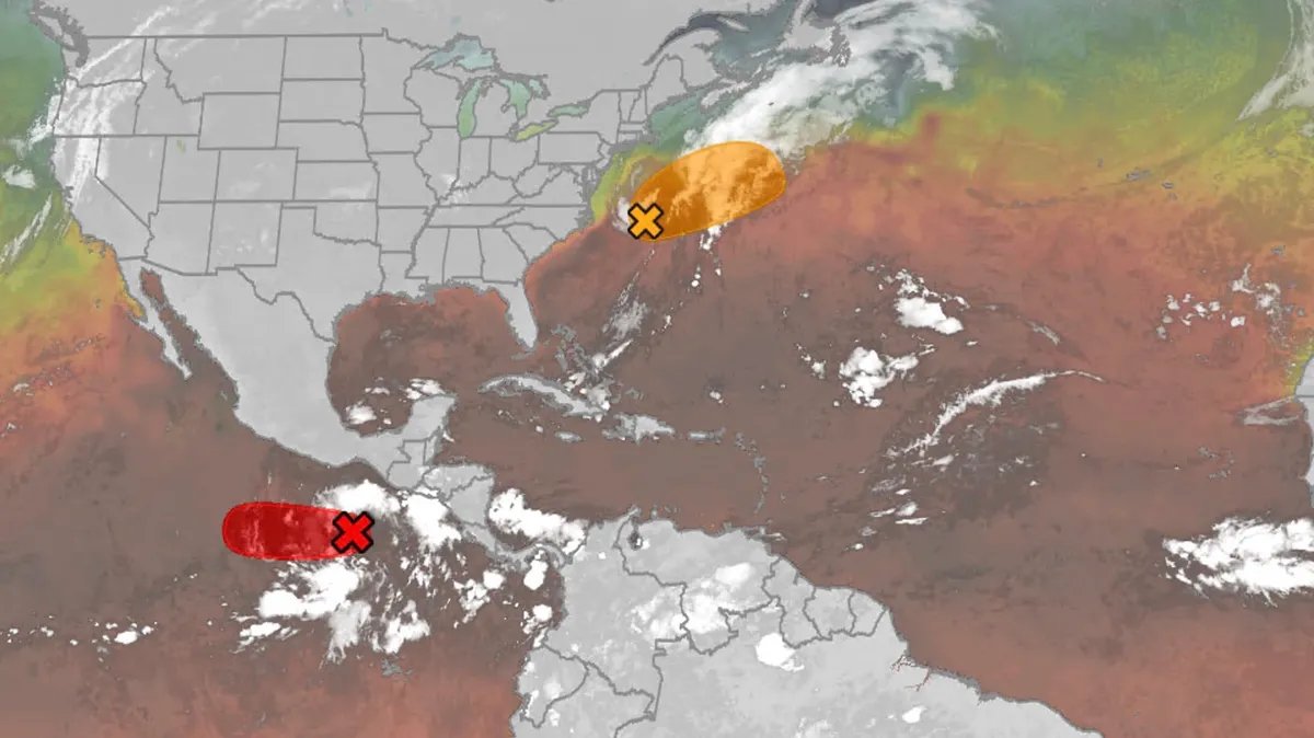
We have the maps you need to track all the systems ongoing in the Pacific and Atlantic below. Tracking the AtlanticTropical development areasSea surface temperatures Wind shear These are areas of strong wind shear, the difference in wind speed and direction with height, which are shown in purple. High wind shear is hostile to mature tropical cyclones and those trying to develop.(MORE: What is wind shear?)Get More of Our News on GoogleSet The Weather Company as a 'Preferred Source' to get quicker access to the news you value. Dry, dusty airAnother nemesis of tropical systems is dry air. In hurricane season, plumes of dust-laden air stream across the basin from Africa's Sahara Desert, as you can see in the map below. This sinking, dry air squelches thunderstorm development, the building blocks of tropical storms and hurricanes. So areas in the brown shading below are generally unfavorable for development. Atlantic tracks so far this seasonThese are the tracks of systems that were at least tropical or subtropical storms so far in the Atlantic Basin.
Nor'easter lashes coast from Carolinas to Northeast
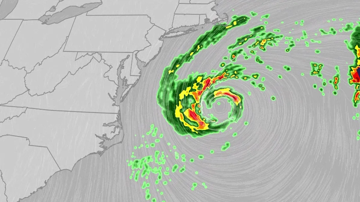
An October nor'easter is meandering off the Atlantic coast, where it will bring high surf, rip currents, coastal flooding and winds to parts of the East Coast for several days this week. The National Hurricane Center has highlighted it as an area to watch this week for the potential development of Josephine. However, regardless of whether we call this system a nor'easter or Josephine, the impacts will be the same. The bottom line: This system will bring dangerous conditions to the East Coast for multiple days this week.(MORE: What is a nor'easter?)ImpactsWhile we do not expect this storm to be as strong as the late September nor'easter, there will still be some impacts. They are broken down below: Coastal floodingGet More of Our News on GoogleSet The Weather Company as a 'Preferred Source' to get quicker access to the news you value. The area most likely to be impacted the longest appears to stretch from the Delmarva Peninsula to eastern North Carolina. Coastal flood alerts are in effect for parts of coastal North Carolina, where anywhere from 1 to 4 feet of inundation is possible.
Orionid meteor shower 2026: cloud cover forecast by region
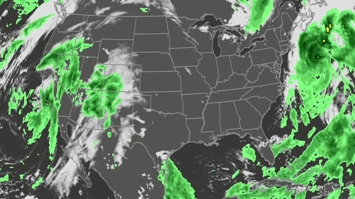
A meteor streaks across the sky over a desert in China during the Orionid meteor shower on Oct. 22, 2023.(VCG/VCG via Getty Images)The Orionid meteor shower is peaking this week, and it promises to be one of the most dazzling displays of the year. And while some of you will have clear skies, rain and clouds could impact the view for others. Here's what you need to know about the Orionids and your forecast:Fast factsPeak day: The meteor shower peaks Wednesday night, Oct. 21, into the early hours of Thursday morning, Oct. 22. Peak time: From midnight to dawn are the best hours to catch the meteors streaking through the sky, so plan on a late night or really early morning. What the Orionids are known for: The Orionid meteors are known for their brightness and their speed. As they streak across the sky at around 41 miles per second, the meteors leave behind a glowing "train" that can last several seconds to minutes. While you can make the perfect plan to catch the Orionids, the key to stellar viewing is still in Mother Nature's hands. The good news is that many of you should have good meteor shower-watching conditions. Much of the central and eastern U. S.
0 comments
No comments yet. Be the first to share your thoughts!