Storm risk stays in Manitoba as tornado potential shifts into NW Ontario
This story deserves to be shared
Send it to someone who'd care, or post it on your networks.
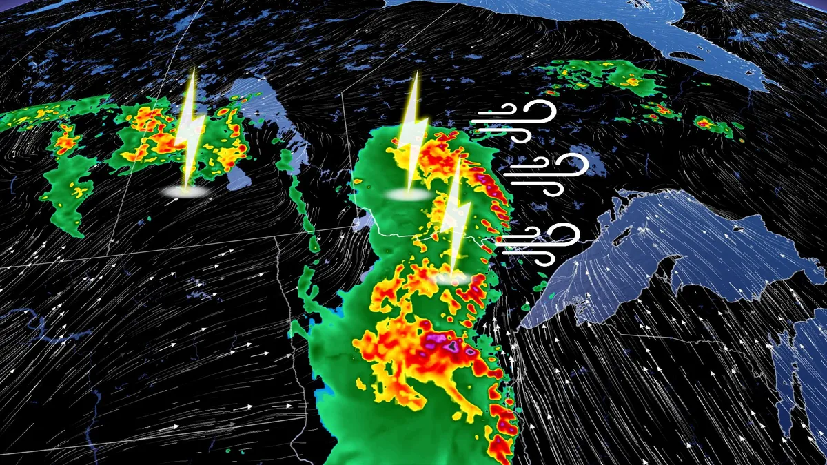
The week got off to a stormy start on parts of the eastern Prairies, and that potential will stick around on Tuesday. The chance for severe weather will stick around in parts of southern Manitoba, mainly along the border with northwestern Ontario. The main area to watch will be in the latter region, where a tornado threat will be present. SEE ALSO: Scud clouds are scary tornado lookalikes – how to tell them apartKeep an eye out for local weather alerts and approaching storms on Tuesday. Severe storm, tornadic threat shifts east on TuesdayWidespread rain and embedded thunderstorms will track west to east across northwestern Ontario on Tuesday afternoon, well west of Lake Superior. The unsettled weather will continue through Wednesday and into Thursday morning for some areas. DON'T MISS: Rare hazard: This town saw an earthquake during a tornado warningA large low pressure system with a moist and unstable atmosphere is creating conditions for rounds of thunderstorms on Tuesday, starting from morning into the evening. Content continues belowThe main area of concern on Tuesday will be northwestern Ontario, from Thunder Bay to the Manitoba border.
This article is an excerpt. To read the full content, visit the original source. The Weather Network
Related articles
Trudy’s moisture will trigger a flood risk for Southwest US
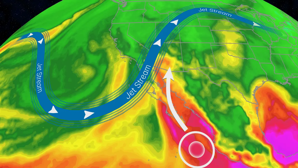
Hurricane Trudy will bring flood threat to the Southwest USTrudy is off the Mexican coast, but its moisture will pour into the southwestern U. S. and will help fuel a multiday flood risk across seven states this week from California to Colorado. A dip in the jet stream will also funnel in moisture from the Pacific as a strong low-pressure system moves into the region. Timing out this week’s rainfallWednesday: The highest risk of flooding on Wednesday covers much of Arizona and New Mexico, and portions of Colorado and Utah, as well as Southern California. There will be an abundance of moisture available to support heavy downpours and training storms. This means storms will produce heavy rain over the same areas for long periods of time. The Weather Prediction Center is forecasting rainfall rates as high as 2 inches per hour. Some of the biggest concern will be the possibility of mudslides over recent burn scar areas as well as slow canyons and arroyos. If you have plans to visit any of the national parks in the West this week, make sure you check the forecast daily and pay attention to any warnings or advisories issued.
Typhoon Champi churns across Pacific as another tropical threat begins to take shape
THE TAKEAWAYChampi is expected to peak as a violent super typhoon with winds exceeding 160 mph. Another tropical threat — designated Invest 94E — is taking shape in the Pacific. The Pacific basin remains active amid a brewing Super El Niño. The Pacific remains a hotbed of tropical activity this week as Typhoon Champi churns across the region, while the FOX Forecast Center keeps a close eye on another area for potential development. The basin remains supercharged, fueling monster storms across the basin, including Champi, which has impacted Guam in recent days, with little sign of relief as Tropical Storm Trudy lingers near Mexico. CALIFORNIA STORMS COULD BRING MUCH-NEEDED RAIN AND RELIEF TO WILDFIRE-WEARY AREASThe FOX Forecast Center is also monitoring an additional storm that could develop in the near future. Satellite imagery showing the Northeast Pacific tropics. (NOAA / FOX Weather)Behind Tropical Storm Trudy, an area to watch with highly conductive environmental conditions is being observed south of Mexico, with a high probability of tropical development over the next seven days.

Spooky and safe: Halloween decorations that won't harm wildlife
With Halloween around the corner, here are some simple swaps to make your display a treat for the neighbourhood...without tricking our wildlife. Skip the stretchy, fake spider webs outdoors. Birds and bats can get tangled in them. Try window clings or indoor webs instead. Keep lighting low and warm. Avoid bright spotlights and flashing lights, and turn decorations off overnight. Secure your decorations. Loose strings, fishing line and dangling decorations can entangle wildlife or blow away. (Marta Czurylowicz/The Weather Network)To prevent potential fires, choose battery-operated candles or lights instead of open flames. Be mindful of noise and motion. Loud, startling props can disturb animals, especially at night. Clean up daily. Pick up loose plastic, check for fallen decorations and make sure nothing has become a hazard. When you're done with those gourds, diispose of them responsibly so they don't attract wildlife, potentially putting them in harm's way on roads or in spaces near humans. The goal is to keep things spooky for the neighbours, not dangerous for nature.
Spooky season is here, and these 10 American streets have chilling histories
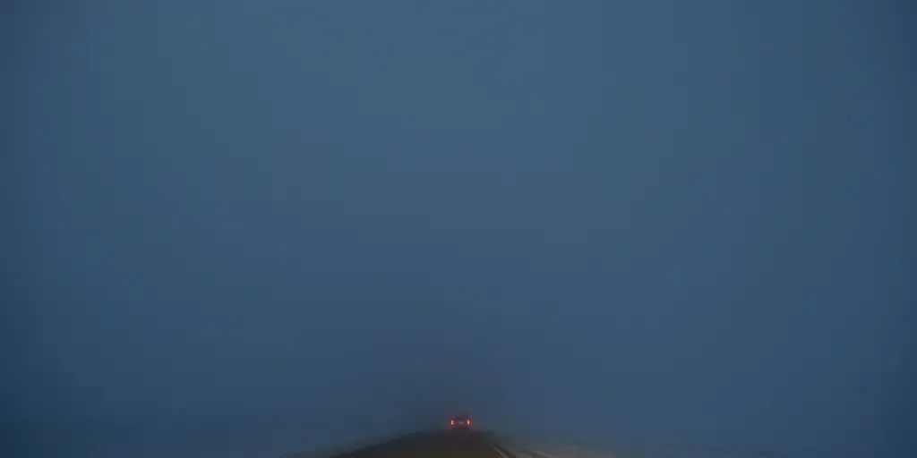
As fall continues, we inch closer to Halloween, when millions flock outdoors in crisp fall temperatures to enjoy the holiday and spooky vibes. October is synonymous with candy, and some locations across the country have gained a reputation for being haunted over the years. So, what are the top 10 most haunted roads in the U. S.? HALLOWEEN HAZARD: WILDLIFE OFFICIALS WARN SPOOKY SEASON DECORATIONS POSE A HIDDEN DANGERHaunted enthusiasts from Sixt.com break down the most frightening streets to visit this month. Clinton Road, New JerseyNumber one on the list is Clinton Road in West Milford, New Jersey, one of the country's most famous haunted streets, thanks to the chilling backstory of a dead young boy who hangs out under a bridge and returns coins you toss into the water. spooky scene with headlights apparition in deep fog at night. (Floriana / Getty Images)Kancamagus Highway, New HampshireComing in at number two is Kancamagus Highway, near Lincoln, New Hampshire, where the haunted roadway is also known for stunning fall foliage views. The highway is well known for its scary history, as a man named Thomas Colbath disappeared after leaving his home. TRAVELING FOR FALL FOLIAGE?
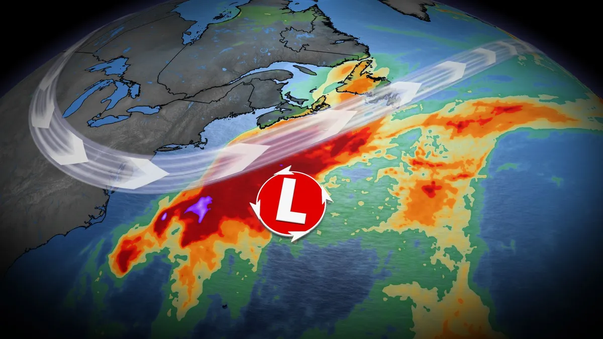
U.S. East Coast bracing for nor'easter this week. Will Canada be impacted?
Atlantic Canada may be in for a rough middle of the or late week, with forecasters keeping a close eye on the formation of a nor'easter. A non-tropical, low-pressure system between the U. S. East Coast and Bermuda will meander for the next few days, and evolve into a hybrid system with some subtropical characteristics. DON'T MISS: Canada's Winter Sneak Peek: El Niño puts record warmth in playThis system is expected to intensify, track northeast, and may become a nor’easter for Atlantic Canada late week. Widespread winds and rainy conditions, especially for eastern Nova Scotia and Newfoundland, are possible. However, there is still a high amount of uncertainty right now. Here is what we know so far. Nor'easter in development this weekThe U. S. National Hurricane Center (NHC) has a 40 per cent chance of a storm-force, non-tropical low development along a frontal boundary. The area will continue to develop and remain near stationary for the early part of this week. Strong winds and surf expected to impact parts of the U. S. Eastern Seaboard, stretching from the Carolinas to New Jersey. Most showers will remain offshore, but could clip a swath of regions from Virginia to North Carolina
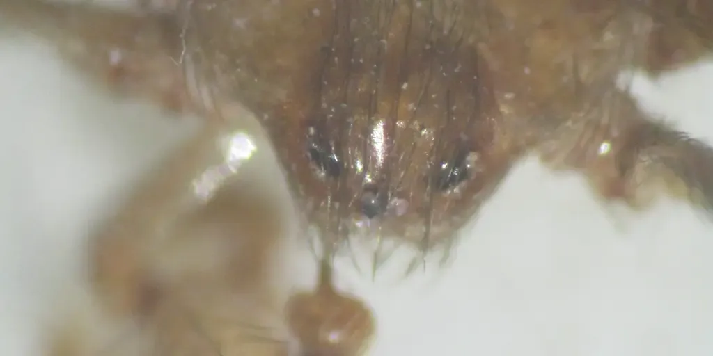
Venomous spiders lurking inside DC government buildings have surprising benefits, expert says
WASHINGTON, D. C. – A secretive, venomous spider native to the Mediterranean has been discovered living inside government buildings in Washington, D. C., raising questions about how the unusual critter arrived in the nation's capital and whether they pose a danger to people. Known as the Mediterranean recluse spider, the species originates from parts of Europe and North Africa and has a history of turning up in buildings far from its native habitat. SCIENTISTS DISCOVER BIZARRE NEW HAPPY-FACED SPIDER WITH UNIQUE GENETICS IN INDIAA study published in American Entomologist documented the spiders in 14 federal government buildings in the Washington, D. C., area over a 10-year period, with researchers finding them primarily in basements, foundation walls and other underground spaces. A close-up of the Mediterranean recluse spider. (Dr. Gale Ridge / FOX Weather)Unlike spiders commonly seen spinning webs around homes, Mediterranean recluses are nocturnal and extremely shy, often disappearing into cracks and crevices when disturbed. Dr. Gale E.
0 comments
No comments yet. Be the first to share your thoughts!