BBlogFlow

Categories

Weather

4070 articles

Weather

5 planets and the Harvest Moon light up the sky this week

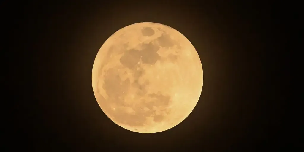
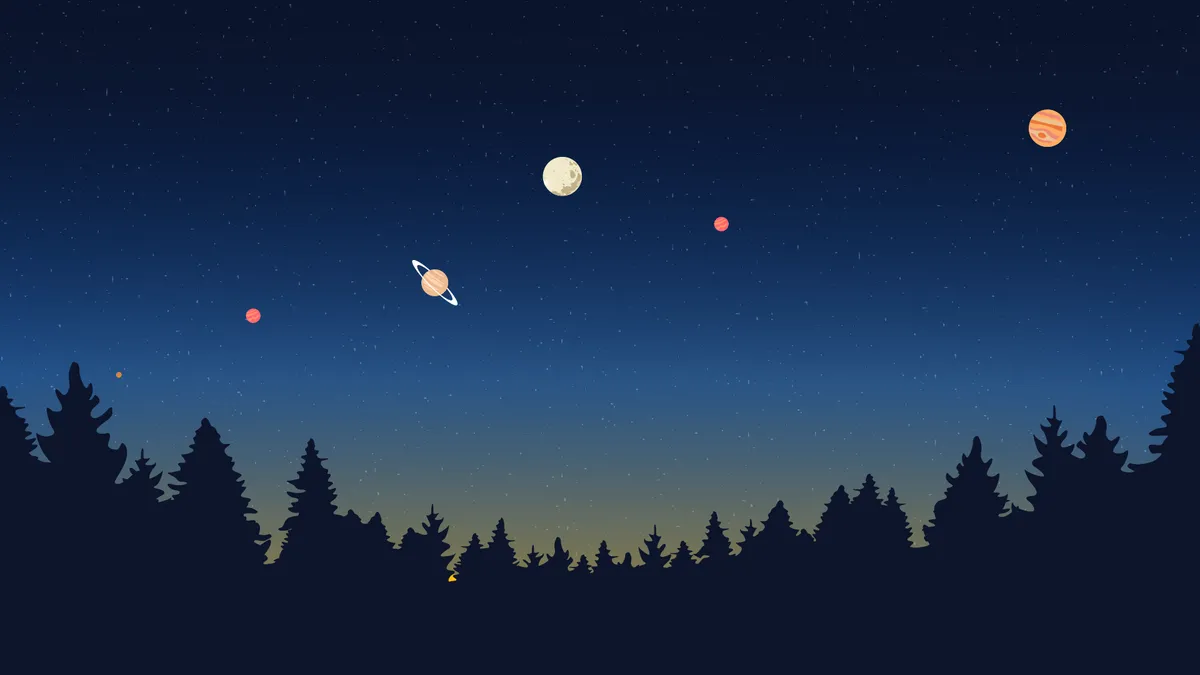
See 5 planets and the Harvest Moon light up the sky this weekLate September is shaping up to be one of the best stargazing stretches of the year, and you don’t need a telescope or any special equipment to enjoy it. All five of the “naked-eye” planets will be visible at various times this week, all leading up to September’s full moon, the Harvest Moon. Right now: Venus is slipping away fastVenus has been dominating the evening sky all month, and it hit peak brilliance on Sept. 18. It's still visible low in the west for about 45 minutes after sunset, but it's not going to last much longer. As September winds down, Venus slips lower and lower into the sunset glow before disappearing from the evening sky altogether. If you haven't caught it yet, this is your last real window for a while. Look east before sunrise and you'll find Jupiter blazing bright and white. It's one of the steadiest, most reliable objects in the night sky all month long. Reddish Mars is nearby, though noticeably fainter. Mars has been gradually gaining a bit of brightness as the month goes on, making it slightly easier to pick out than it was earlier in the summer.

The Weather Channel·
Weather

Tropical Depression Fifteen-E redevelops, could make rare landfall on Hawaii as a major hurricane

Tropical Depression Fifteen-E redeveloped near the Hawaiian Islands and is now forecast to approach the Big Island, potentially as a major hurricane, bringing torrential rain and life-threatening flooding this weekend. Hawaii, which generally doesn't see much tropical activity, could see impacts from another tropical system after being impacted by three systems this season, including destructive Hurricane Lowell. next A flooded road is seen the day after Hurricane Lala in Hilo, Hawaii, Sunday, Aug. 16, 2026. The Category 1 hurricane brought heavy rain and strong winds to the island of Hawaii before moving away without making landfall.

Fox Weather·
Weather

Bryan Norcross: Another Hawaii hurricane threat developing and a new disturbance moves off the African Coast

Updated at 10:30 a.m. on Wednesday, Sept. 23, 2026 In the AtlanticA robust disturbance that just crossed the African coast into the Atlantic could develop into a tropical depression or tropical storm. But it's expected to make a quick turn to the north. The National Hurricane Center has the odds of the system becoming a tropical depression or tropical storm over the next several days in the medium range. Computer forecast models that show development show a tropical storm threat for the Cabo Verde Islands. The name would be Gonzalo. Atlantic status as of Sept. 23, 2026 at 10:30 a.m.  (Bryan Norcross / FOX Weather)In any case, after a few days, the system is likely to dissipate over the ocean. To the north, Ex-Tropical Storm Fay might regenerate into at least a depression. The NHC has the odds in the low category. In any case, it would not be a threat to land. The developing nor'easterThe pieces are coming together for an unusual early-season nor'easter to form off the coast of the Northeast. Tropical moisture will stream into the system meaning heavy rain will be likely in some areas.

Fox Weather·
Weather

Fat Bear Week 2026 predictions: Our meteorologists vote

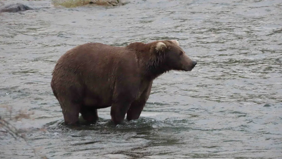
Fat Bear Week is back, and it’s about to get bear-y competitiveThe fur is flying, the salmon are disappearing and Fat Bear Week is officially underway! Our team of meteorologists has studied the contenders, and they have each picked the bear they think has what it takes to go all the way. Before you make your own pick, watch our video above to meet the contestants, then grab our Fat Bear Week bracket and bingo cards and join us for all the bear-y big fun. Bear 132 and familyBear 132 and cubs compete during Fat Bear Week 2026.(C. Loberg)WHO: Caitlin Kaiser, meteorologistWHY: What's better than one fat bear? Four fat bears! This mother bear is known for being one of the biggest and most experienced at Brooks River, meaning she has been around the block a few times. Bear 132 knows how to keep her cubs safe and healthy, including helping them bulk up for the winter ahead. The fact that she could add on the pounds while also making sure her three cubs did too is downright impressive!(MORE: Scout last year's Fat Bear Week champion)Bear 909Bear 909 competes during Fat Bear Week 2026.(T.

The Weather Channel·
Weather

Your El Niño questions answered: What to expect in your region

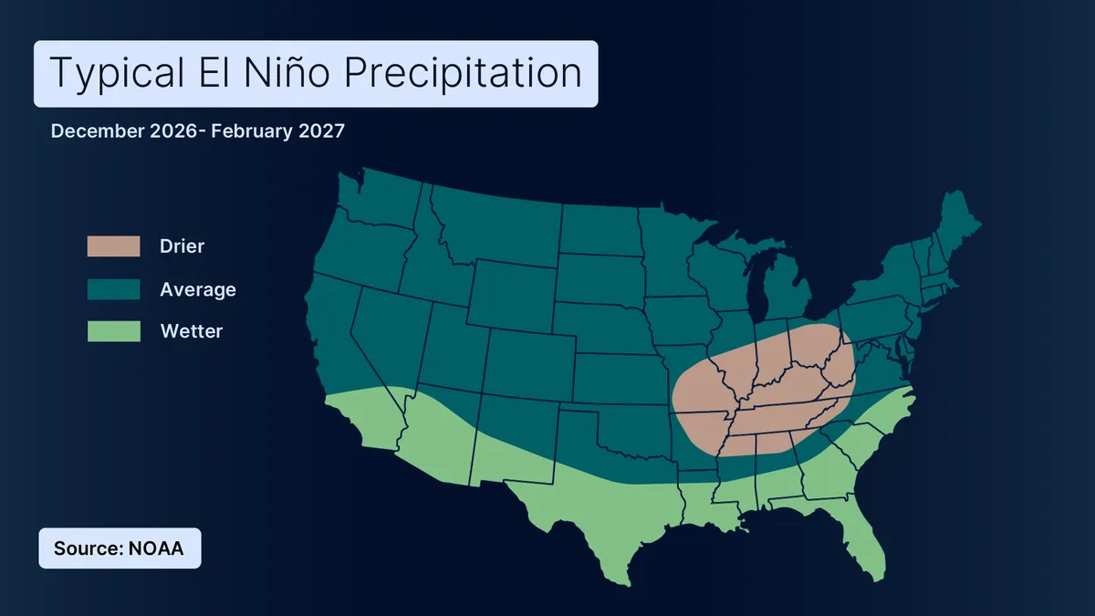
The weather myths about El Niño you’re probably getting wrongIf you’re wondering whether El Niño means a snowy winter, tons of rain or something in between, here’s the simplest answer: It depends where you live. These maps give you a plain picture of what you can expect from December through February. Warmer vs. colderThe Northern Tier has the strongest odds of a warmer-than-average winter, including the Pacific Northwest, northern Rockies, northern Plains and parts of the Great Lakes. But don't read "warmer" as "warm. " Basically, if January normally averages 35 degrees where you live, an El Niño winter might average 38. You'll still have cold days, and even snow. The West, Midwest, South and East coast are expected to be closer to normal, temperature-wise.(MORE: Prepare your bank account and grocery cart for a record El Niño)Get More of Our News on GoogleSet The Weather Company as a 'Preferred Source' to get quicker access to the news you value. Wetter vs. drierThe South and parts of California are among the wetter spots. That can mean heavy rain and flash flooding in lower elevations, while higher elevations could get significant snow.

The Weather Channel·
Weather

Hurricane Polo explodes into one of Pacific’s strongest hurricanes ever

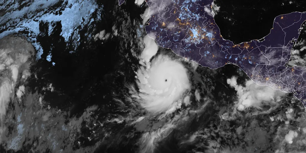
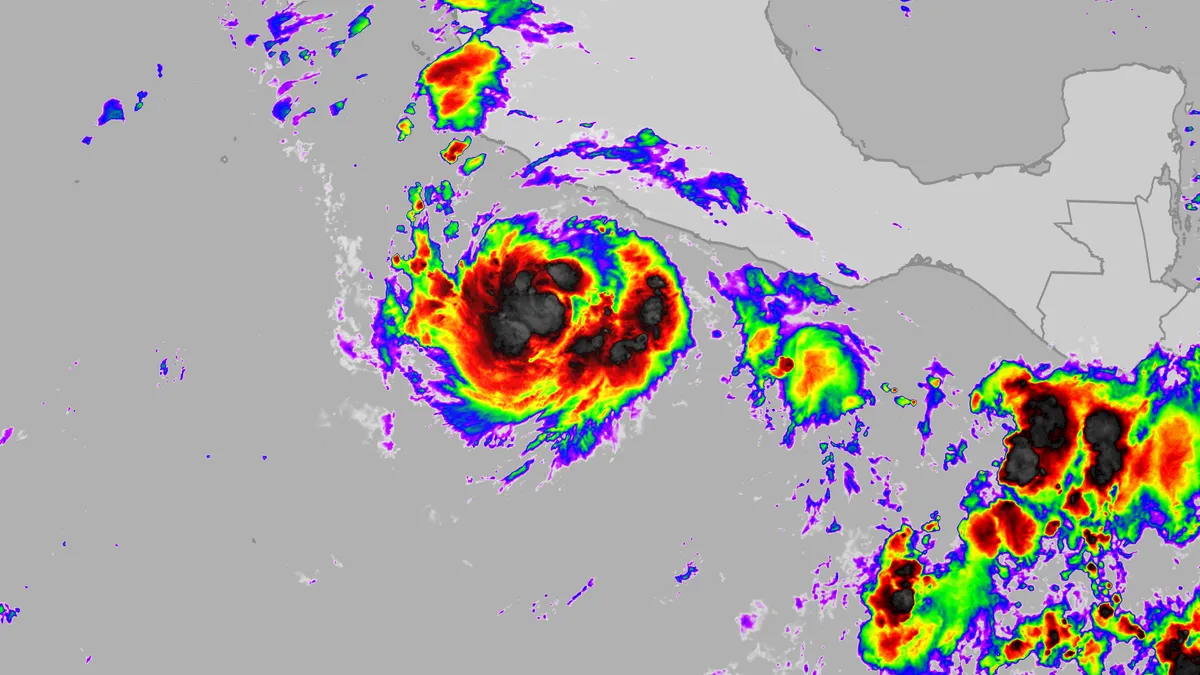
Hurricane Polo rapidly intensified into a Category 5 storm Tuesday morning, less than 24 hours after becoming a hurricane. FLASH FLOOD EMERGENCY ISSUED AS HURRICANE POLO INTENSIFIES INTO CATEGORY 5 STORM IN LESS THAN 24 HOURSThe National Hurricane Center (NHC) is now monitoring four areas of tropical activity across the Pacific, including Polo, which has exploded into one of the strongest hurricanes the Pacific has ever seen. Satellite imagery of Hurricane Polo on Sep. 22, 2026. (CIRA / FOX Weather)The storm is currently about 210 miles south of Zihuatanejo, Mexico, and is nearly stationary, with maximum sustained winds of 165 mph, according to the NHC. LATEST FROM FOX WEATHER HURRICANE SPECIALIST BRYAN NORCROSSPolo underwent extreme rapid intensification, with its maximum sustained winds increasing by 110 mph in just 24 hours. The rate of intensification is among the fastest ever observed in the Eastern Pacific. The last hurricane to intensify at a comparable rate was Hurricane Otis in 2023, which devastated Acapulco, Mexico.

Fox Weather·
Weather

Full moon could worsen nor’easter flooding along East Coast — here are 5 places to watch

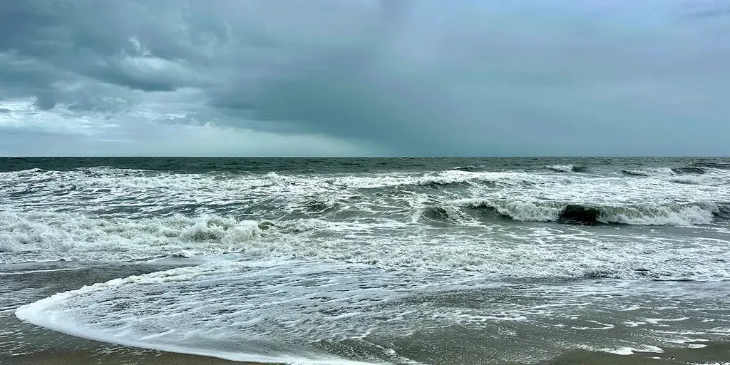
THE TAKEAWAYThe full moon will amplify high tides along the East Coast as a powerful nor’easter approaches. Coastal communities from the Outer Banks to New England could face flooding, pounding surf and severe beach erosion. Full moon tides can run higher than normal for several tide cycles. A brewing nor’easter is set to slam the East Coast with high winds, rough surf and coastal flooding — with an ill-timed full-moon high tide threatening to make the flooding even worse. During a full moon, high tides rise higher than normal as the moon’s and sun’s gravitational forces align, intensifying their pull on the oceans. DEVELOPING NOR'EASTER THREATENS MILLIONS ALONG EAST COAST WITH DANGEROUS COASTAL FLOODING, POWERFUL WINDSOver the weekend, elevated full moon tides will collide with a powerful nor’easter, creating a dangerous one-two punch that could unleash devastating coastal flooding. What we know about the weekend nor'easter(FOX Weather) The upcoming full moon will reach peak illumination at 12:49 p.m. EDT Saturday, Sept. 26, just as a brewing nor’easter threatens to unleash its worst impacts along the East Coast.

Fox Weather·
Weather

Nor'easter live tracker: Future radar, winds, storm surge, rain and alerts

Here is everything you need to know about the nor'easter, including future radar, wave heights, wind speed, alerts and more. THE TAKEAWAYDays of dangerous conditions are expected through the workweek as a nor'easter develops. The storm could bring high surf, strong winds, coastal flooding and severe beach erosion. Impacts from the multiday storm could last through the weekend. A brewing nor'easter has the potential to cause significant impacts as it batters the East Coast this week. Parts of the East Coast will be battered by gusty winds and rain through the workweek as the first nor'easter of fall develops. TIMELINE: HERE'S WHERE AND WHEN MAJOR US CITIES WILL SEE IMPACTS FROM THE DEVELOPING NOR'EASTERThe storm is expected to emerge off the coast toward the end of the week and could bring high surf, strong winds, coastal flooding and severe beach erosion through the weekend. next

Fox Weather·
Weather

Churchill, Man., or Toronto, Ont.? Toss-up for who will be warmer on Wednesday

Even though fall is here, not every part of Canada is seeing the same, seasonal weather this week. Some areas could see snow, while at least one northern location on the Prairies could end up seeing a warmer temperature than multiple Southern Canadian communities on Wednesday. DON'T MISS: Three reasons why you could see an early-fall snow in CanadaSuch may be the case in Churchill, Man., which is forecast to see a daytime high of 18°C-- the same value that is projected in Toronto, Ont. It's possible that Churchill or Toronto ends up warmer than the other locale. That will come after a contrasting weather divide in the Greater Toronto Area (GTA) on Tuesday to kick off the fall. Wednesday remains cool in southern Ontario after a contrasting TuesdayOn the Priaries, there is a seperate high pressure and ridge that's bringing in sun and a warm, southerly wind, allowing for above-normal temperatures in northern areas of the region, including Churchill. Meanwhile, in southern Ontario, temperatures aren't quite as rosy.

The Weather Network·
Weather

This nor’easter may follow the same path as Superstorm Sandy, but it’s nothing like it

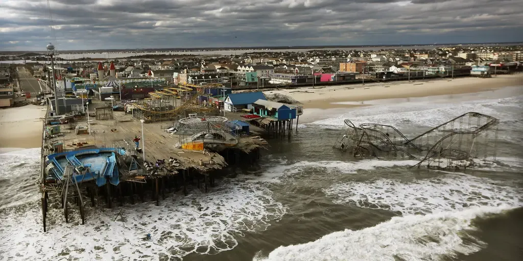
THE TAKEAWAYThe first nor’easter of the fall is developing and is raising questions about whether the storm could become another Superstorm Sandy. The two storms are fundamentally different, aside from both impacting the Northeast and having non-tropical characteristics during part of their life cycles. The first nor’easter of the fall is developing, bringing gusty winds and rain to parts of the East Coast and raising questions about whether the storm could become another Superstorm Sandy. DEVELOPING NOR'EASTER THREATENS MILLIONS ALONG EAST COAST WITH DANGEROUS COASTAL FLOODING, POWERFUL WINDSThe storm is forecast to bring a prolonged period of pounding surf, significant beach erosion and coastal flooding, with impacts beginning days before the nor’easter tracks northward toward the Northeast. The overview of the nor'easter.(FOX Weather) Once the storm strengthens near New England, a tightening pressure gradient is expected to bring the strongest winds to the region, with wind gusts potentially exceeding 60 mph and waves reaching 15 to 18 feet along the coast.

Fox Weather·
Weather

Fall chill arrives along East Coast ahead of brewing nor’easter

Here’s how traders on prediction markets are assessing Boston’s overnight low amid a brewing nor'easter. Astronomical fall begins with the autumnal equinox The autumnal equinox will happen at 8:05 p.m. ET, marking the start of astronomical fall in the Northern Hemisphere, including the U. S. Across most of the Lower 48, fall marks the beginning of progressively cooler temperatures as the country begins to angle away from the Sun and daylight begins to get shorter. The equinox occurs when the sun's center crosses the Earth's equator, marking nearly 12 hours of daylight and 12 hours of night across the globe. THE TAKEAWAYFall temperatures arrive ahead of a brewing nor'easter. Crisp, cool air will surge into the Northeast. Afternoon highs fall into the 50s, 60s and 70s. BOSTON – Ahead of a brewing nor’easter expected to impact the East Coast, a surge of fall-like air is sweeping across the region as the seasons change, bringing a noticeable chill and locking in the autumn feel. A sprawling area of Canadian high pressure building across the Northeast will deliver an unmistakable taste of fall before the nor’easter arrives.

Fox Weather·
Weather

Fall equinox sun glare: Why your commute gets dangerous

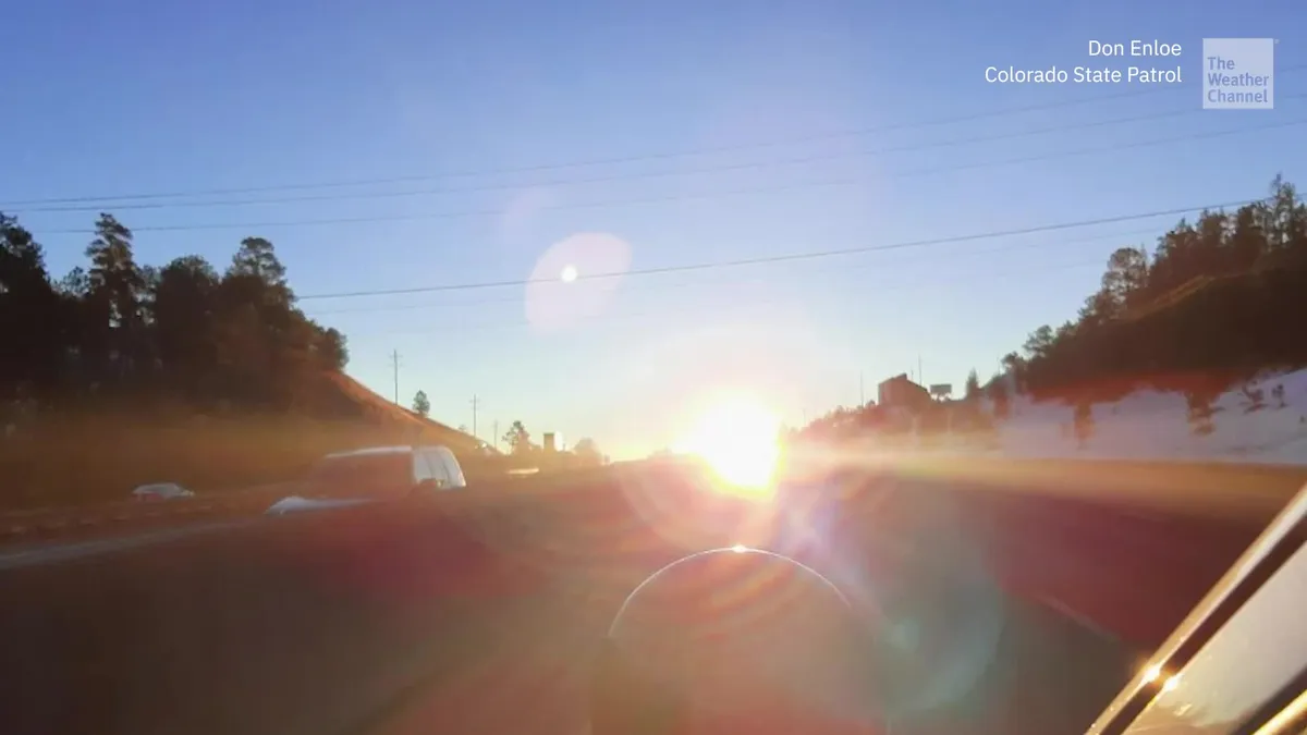
Why the fall equinox makes your commute dangerousOn Sept. 22 at 8:05 p.m. EDT, the sun crosses the equator, marking the fall equinox. For several days, it will rise almost due east and set almost due west, lining up with east-west roads and highways right around rush hour. The National Highway Traffic Safety Administration ties roughly 9,000 crashes each year to sun glare, making it second only to slick roads among environmental causes. “The most dangerous times of day in terms of sun glare are early morning and late afternoon into the evening, so really commute times,” according to meteorologist Caitlin Kaiser. And because the sun gets so low, your car’s sun visor may not be enough to block it. The sun drops below 10 degrees above the horizon about an hour before sunset, below the area most vehicle visors can reach. “Sun glare is more dangerous in the fall and winter,” she said.

The Weather Channel·
Weather

Category 5 Hurricane Polo among most intense on record

This is a 24-hour loop showing the rapid intensification of Polo from a tropical storm on Sept. 21 to a Category 5 hurricane on Sept. 22, 2026. Each National Hurricane Center advisory in that 24-hour period is shown in the upper-left corner.(Data: NOAA/NHC)Hurricane Polo not only exploded into a Category 5 hurricane Tuesday just one day after it was a tropical storm, but it later became one of the most intense Eastern Pacific hurricanes on record while hovering off the coast of Mexico. (MORE: Hurricane season tracking maps)The timelineMonday morning, Tropical Storm Polo was located about 200 miles off Mexico's Pacific coast, with winds of 50 mph. Just 24 hours later, Hurricane Polo reached Category 5 intensity. That's the strongest category on the Saffir-Simpson Hurricane Wind Scale. You can see the explosive growth in the satellite loop above, put together by senior meteorologist Jonathan Belles. Notice Polo going from a few thunderstorm clusters Monday to an ominous, classic intense hurricane with a tiny eye. Get More of Our News on GoogleSet The Weather Company as a 'Preferred Source' to get quicker access to the news you value. But then came a mic drop moment.

The Weather Channel·
Weather

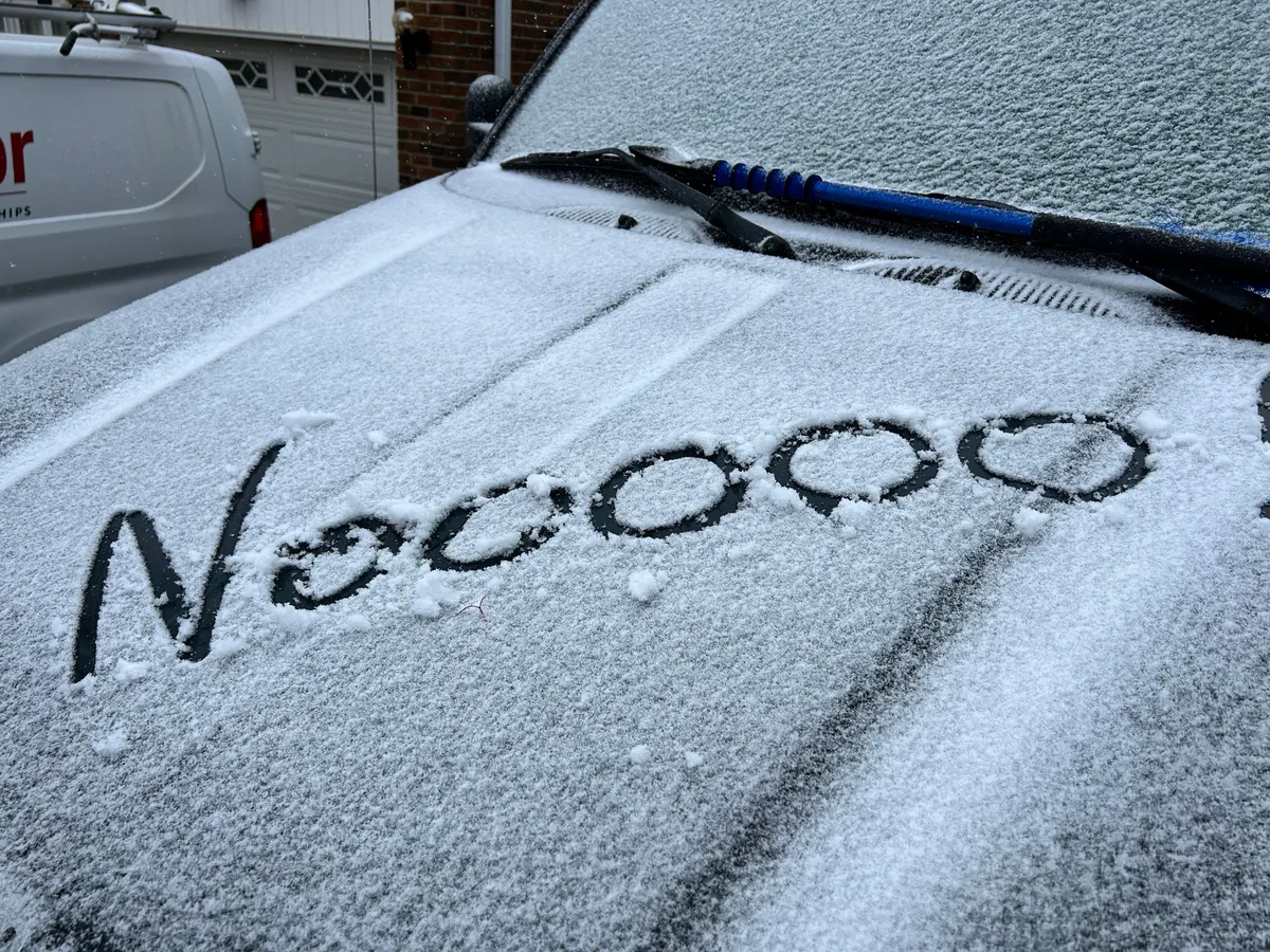
Fall begins with early signs of snow

Fall has only just begun, but signs of winter are already making an appearance across parts of the country. Iqaluit and Labrador City have reported their first snowfalls of the season, right on schedule with their historical averages—Sept. 6 for the former and Sept. 15 for the latter. DON'T MISS: Three reasons why you could see an early-fall snow in CanadaSnowfall has also been reported at higher elevations in the Rockies and North Shore Mountains, with freezing levels dropping to 1,500 metres in Jasper earlier this month. Another low-pressure system this week may bring a renewed chance of flurries to lower elevations. Rainfall for the Sunshine Coast, with signs of snow across Whistler, Banff and JasperTroughing over British Columbia and Alberta will lead to colder conditions starting Thursday. A developing low-pressure system over Washington is expected to pull Pacific moisture into the region, delivering rain to the Sunshine Coast and a beneficial soaking for Vancouver, which has seen just 2.5 mm of rain this month compared to the monthly average of 51.9 mm. Content continues belowUp to 20-30 mm of rainfall is expected for Vancouver by Saturday.

The Weather Network·
Weather

2 pilots killed in helicopter crash while battling wildfire at popular national park

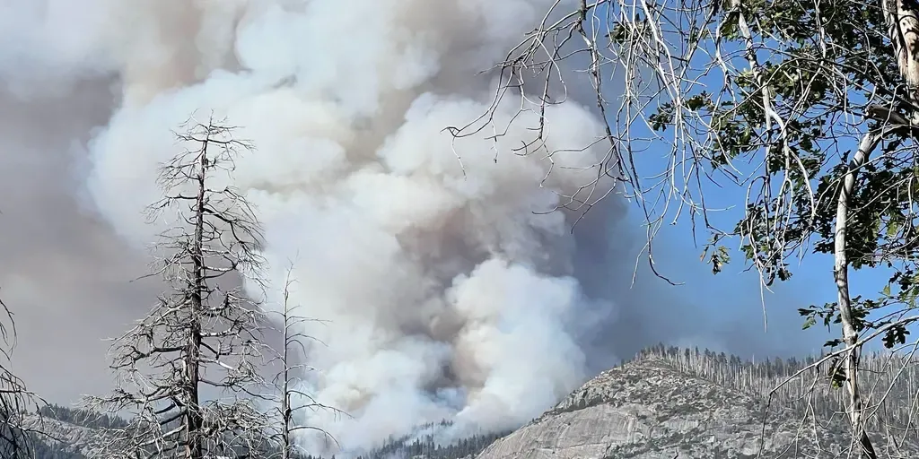
Investigators are working to determine what caused the deadly crash. THE TAKEAWAYTwo pilots were killed when a helicopter crashed during Dome Fire operations in Yosemite National Park. Investigators are working to determine what caused the deadly crash. The wildfire has burned more than 3,400 acres and remains only 15% contained. MARIPOSA, Calif. – Two pilots were killed when a helicopter crashed while supporting firefighting operations in Yosemite National Park, officials said. On Sunday, a helicopter carrying pilots Greg King and Ryan Cutter crashed into the Dome Fire. The Dome Fire was first reported on the morning of September 15, 2026. (National Park Service)"We are devastated by this loss and are struggling to find the words. We ask for privacy and compassion for their families and our team as we grieve this tremendous loss," Precision, an aviation and helicopter services company, said in a social media statement identifying the pilots. According to the Federal Aviation Administration (FAA), the Eurocopter AS32 helicopter crashed in Mariposa, California, around 2:55 p.m. local time on Sunday, Sept. 20, while battling the wildfire.

Fox Weather·
Weather

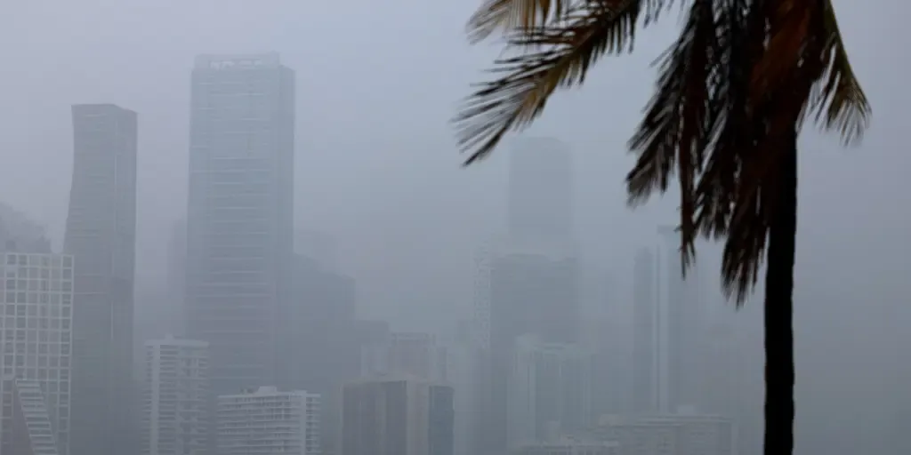
Tropical downpours soak Florida, fuel flash flood threat as weeklong storms persist

Surge of Caribbean moisture targets South Florida South Florida is expected to see several inches of rain through Sunday. as tropical moisture from the Caribbean invades the region. The rain is helpful to ease the severe drought ongoing in most of the state, but flash flooding is also a risk with 2 to 3 inches forecast for some places. FLORIDA - Flash flooding and heavy, persistent downpours will be a concern for Florida this week, helping to ease the severe drought that the Sunshine State has been in for most of the year. According to the FOX Forecast Center, a robust mid-level low-pressure system is forecast to sit across Florida as it tracks beneath the massive heat dome anchored over the South. WHAT IS A HEAT DOME AND HOW CAN IT AFFECT YOU? Florida pattern set up(FOX Weather) As it approaches Florida, this low will become "cut off," separating from the jet stream, bringing lots of rain to the state. Flash flooding will be the main concern with these downpours, and isolated thunderstorms that bring frequent lightning, gusty winds and reduced visibility are all possible. WHAT IS THE JET STREAM?

Fox Weather·
Weather

Fay weakens to a tropical depression due to brutal conditions in the Atlantic amid brewing 'Super' El Niño

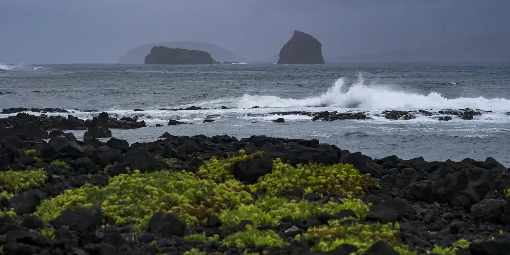
Tropical Storm Faye is expected to become a post-tropical remnant low by Tuesday and eventually dissipate later this week. THE TAKEAWAYFay has weakened to a tropical depressionThe storm is currently producing wind gusts as strong as 35 mph. Tropical Depression Fay is expected to become post-tropical later on Tuesday. Tropical Depression Fay. the former tropical storm, is expected to become post-tropical later on Tuesday. The tropical depression is currently about 645 miles southwest of the Azores region in Portugal, exhibiting sustained winds of up to 35 mph, according to NOAA. This comes as the storms strength steadily decrease, at one point producing winds as strong as 65 mph on Monday. WHAT ARE KELVIN WAVES? EL NIÑO’S HIDDEN THREAT THAT COULD IMPACT SEVERAL STATES ON THE WEST COASTNo coastal watches or warnings are currently in effect. This graphic shows the latest information on Tropical Storm Fay.(FOX Weather) On Monday, the storm was just under hurricane intensity. Despite this, time is running out to reach such strength, as Fay is expected to become a post-tropical cyclone later today.

Fox Weather·
Weather

Extended dry spell in B.C. fuels wildfires across Vancouver Island

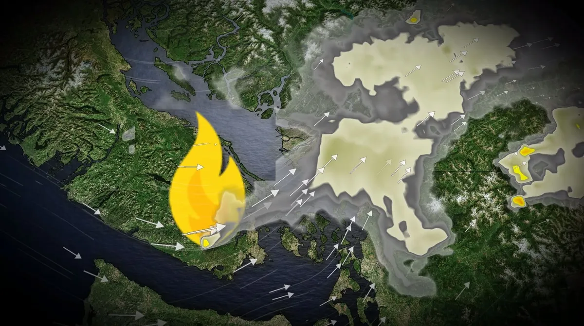
Persistent dry conditions across British Columbia have allowed the wildfire season to extend into the start of fall. The Mount Jack wildfire, discovered Sunday west of Victoria, remains out of control, as rainfall in the region has been well below average. DON'T MISS: Warmer fall in B. C. may turn active with alpine snow chancesIn Vancouver, only 2.5 mm of rain has been recorded in September so far, significantly below the monthly average of 51.9 mm. Victoria has seen just 1.8 mm, compared to a typical 35.7 mm. Air quality to deteriorate across the Lower Mainland WednesdayWinds from the southwest are expected to push wildfire smoke into the Lower Mainland by Tuesday evening, with air quality deteriorating across the region by Wednesday morning. However, a cold front arriving Wednesday evening is forecast to bring light showers, which should help ease fire conditions. DON'T MISS: Canada officially welcomes fall with early signs of...snow? A low pressure system over Washington will also draw Pacific moisture to B. C.’s southern coast. Content continues belowAfter an 18-day stretch without measurable rain in Vancouver, the return of rainfall will be beneficial.

The Weather Network·