BBlogFlow

Categories

Weather

4070 articles

Weather

The rare tropical storm that swamped Los Angeles in flooding rains

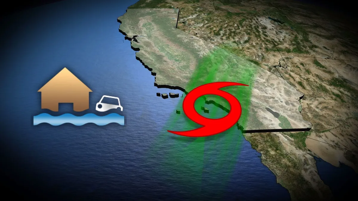
One of the few tropical storms on record to strike California came ashore near Los Angeles on Sept. 25, 1939. The storm brought a tremendous amount of rain to a typically dry region of the world, unleashing major floods that killed dozens of people. This tropical storm in 1939 remains the last time a storm officially made landfall in California. DON’T MISS: Climate change may boost California’s hurricane flood risk: studyA prolific rainmakerFolks across southern California likely believed that a brutal heat wave roasting the region in the middle of Sept. 1939 would be the worst weather that month. Temperatures in Los Angeles topped 38°C every day for an entire week, and readings down in San Diego reached 41.1°C on Sept. 21. Nobody knew that a hurricane lurking off the western coast of Mexico would break that heat wave and cause its own set of problems throughout the region. Moving along an unusual track, the unnamed storm spread heavy rain and high winds across southern California. The centre of the storm made landfall a few dozen kilometres south of Los Angeles as a high-end tropical storm.

The Weather Network·
Weather

Hurricane Polo eyes restrengthening to Category 5 storm as it fuels ongoing flood threat in the Southwest

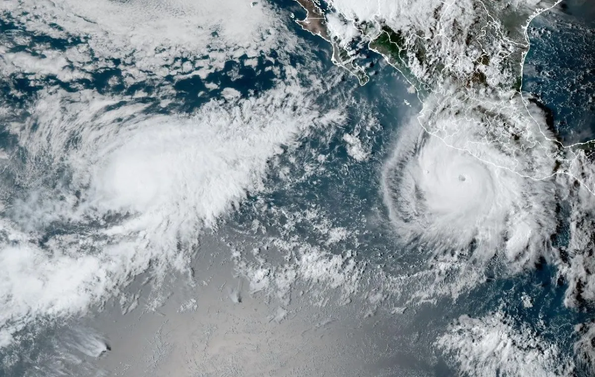
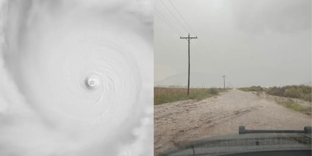
Powerful Hurricane Polo set to bring heavy moisture to Southwest and Mexico Hurricane Polo is still a major hurricane, after briefly dropping to a Category 4 storm and undergoing an eyewall replacement cycle and becoming a Category 5 once again. As the storm shifts west, it will make another turn to the east, making a landfall in Baja California, Mexico early next week as a hurricane.  THE TAKEAWAYHurricane Polo became the second-strongest hurricane ever recorded in the Eastern Pacific Tuesday and is now a Category 4 storm. Tropical Storm Warnings and Watches are in effect for parts of southwestern Mexico. Hurricane Polo is forecast to make landfall in Baja California, Mexico on Monday night. Hurricane Polo weakened to a Category 4 storm on Thursday afternoon as it churns through the East Pacific, forecast to make landfall in Mexico and fuel a renewed flooding threat in the Southwestern U. S. next week. Tropical Storm Warnings and Watches are in effect for parts of southwestern Mexico. The exact location and severity of impacts will depend on how close Polo gets to the coast.

Fox Weather·
Weather

Tropical Storm Nolo nearing hurricane strength as it churns in the Pacific, targeting Hawaii

THE TAKEAWAYTropical Storm Nolo is strengthening in the Pacific and is expected to become a major hurricane this weekend. Precipitation totals ranging from 8 to 12 inches and 19 to 24 inches on the eastern side of the island are possible. A Hurricane Watch has been issued for Hawaii's Big Island and Tropical Storm Watches and Warnings are in effect for the other Islands. As an active week of severe weather unfolds across the U. S., Tropical Storm Nolo could strengthen into a major hurricane and make a rare direct landfall in the Hawaiian Islands. Tropical Storm Nolo is among multiple other storms churning in the Pacific, including Hurricane Polo and Odalys, which are barreling toward Mexico. Conditions in the Pacific are not easing up as Tropical Storm Nolo, located southeast of the Hawaiian Islands, enters much more favorable environmental conditions for further development. THE LATEST FROM FOX WEATHER HURRICANE SPECIALIST BRYAN NORCROSSThe National Hurricane Center said Nolo is currently about 285 miles from South Point, Hawaii, with sustained winds of 70 mph.

Fox Weather·
Weather

Northern lights forecast: Why the equinox means more auroras

See A Stunning Time-Lapse Of Auroras Over New HampshireThe fall equinox arrived this week, and that means Earth is entering a roughly two-month window when geomagnetic storms, and the auroras they can produce, become more common. That means, starting now, and for the rest of the season, you'll have a greater chance of spotting the northern lights. The reason comes down to some pretty simple (and cool) geometry and physics. How it worksThe Sun is constantly blowing a stream of charged particles known as "solar wind" toward Earth. Luckily, our planet's magnetic field acts as a giant shield, deflecting much of that material. But around the equinoxes, Earth's magnetic field is oriented in a way that can make it easier for energy from the solar wind to get into our atmosphere, which eventually helps power those spectacular auroral displays.(MORE: The best northern lights photos from across the U. S.)Get More of Our News on GoogleSet The Weather Company as a 'Preferred Source' to get quicker access to the news you value. Scientists call this seasonal effect the Russell-McPherron effect. NASA describes the geometry as especially favorable around the spring and fall equinoxes.

The Weather Channel·
Weather

Strengthening nor’easter charging North, causing coastal flooding, dangerous surf along the East Coast

THE TAKEAWAY A powerful nor'easter is threatening millions along the East Coast from Virginia to Massachusetts. The storm is bringing high surf, strong winds, coastal flooding and severe beach erosion to multiple states. Depending on the storm's track, Boston and the Massachusetts coast could face 60-70 mph wind gusts, heavy rainfall, major storm surge, and significant disruptions. The East Coast is beginning to see the impacts of a developing nor'easter, with major coastal flooding from New Jersey to Virginia. All told, millions from New England to the Carolinas will experience days of coastal flooding, strong winds and pounding surf through the weekend. The system that will become the first nor'easter of the season is set to emerge off the Mid-Atlantic coast between Thursday and Friday before charging towards the heavily populated Northeast.

Fox Weather·
Weather

Super El Niño's possible impact on your weather this fall

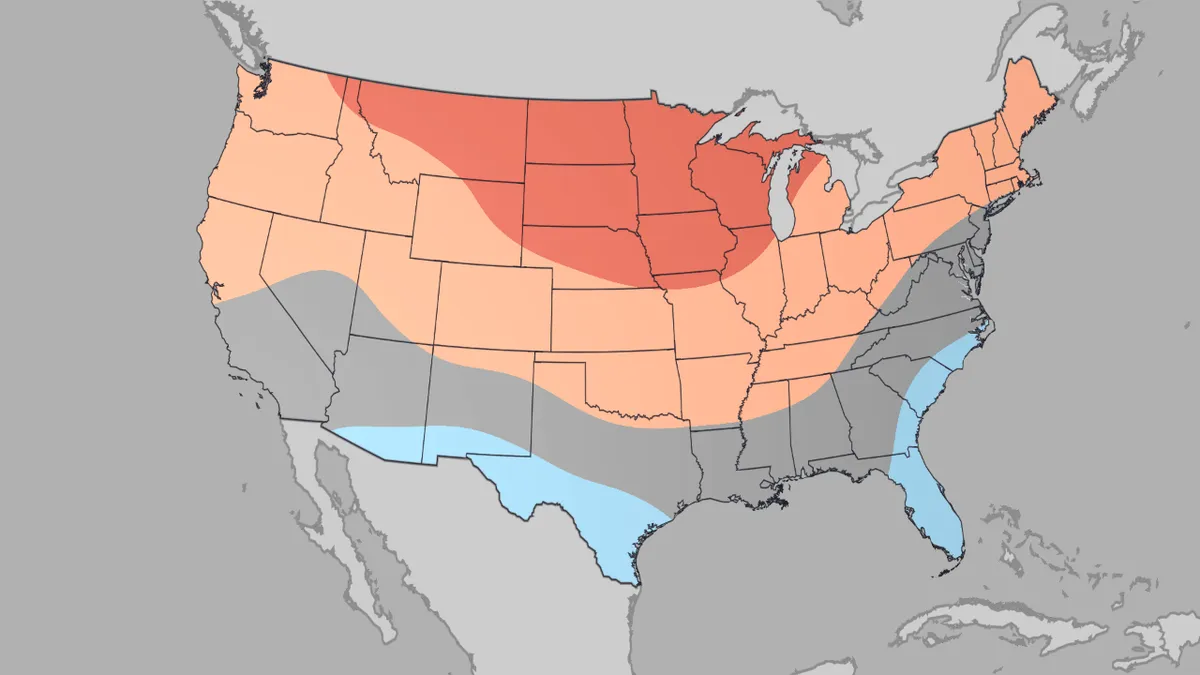
October outlook: Who will get a true taste of fall? October and the rest of fall's weather in the U. S. may have some temperature and precipitation patterns typical of a strong El Niño. October temperatures: chill delayedAccording to the latest outlook released by The Weather Company, October is forecast to be warmer than average over much of the northern U. S. That's particularly the case from the Northern Rockies across the Northern Plains into the upper Midwest. This doesn't mean there won't be stretches of cooler weather across the northern tier from the occasional fall cold front. But considering the month as a whole, it's expected to skew warmer in these areas. And it could mean a later first freeze of fall in at least parts of the north this year. But October may be a tad cooler than usual from parts of the Southwest and South Texas to Florida and the Southeast. Get More of Our News on GoogleSet The Weather Company as a 'Preferred Source' to get quicker access to the news you value. To explain that, let's look at our October precipitation outlook. This is the October 2026 temperature outlook from The Weather Company issued on Sept. 21.

The Weather Channel·
Weather

Fat Bear Week 2026 so far: Who’s still in the competition?

Fat Bear Week is back, and it’s about to get bear-y competitiveThe bears have officially broken the internet. But honestly, can you blame us all for wanting a front-row seat to the fattest showdown of the year? When Fat Bear Week voting opened Tuesday, the rush was so big it overwhelmed the voting site. Explore.org said it was the biggest Day 1 turnout in the competition’s history, with the system experiencing an overload. And the first four matchups delivered some seriously bear-y big results.132 Family and 806 Family lumbered past their rivals, while 909 and 910 also punched their tickets to the next round. The bracket is already getting slimmer (although, the bears are not). Bear 909 competes during Fat Bear Week 2026.(T. Carmack)Now, the reigning champ is back in action. Bear 32, better known as "Chunk," is facing Bear 164, “Bucky,” in today’s matchup. Get More of Our News on GoogleSet The Weather Company as a 'Preferred Source' to get quicker access to the news you value. Even the feds are getting in on the fun.

The Weather Channel·
Weather

Bryan Norcross: Out-of-season nor’easter threatens East Coast as Nolo eyes Hawaii, Polo nears Baja California

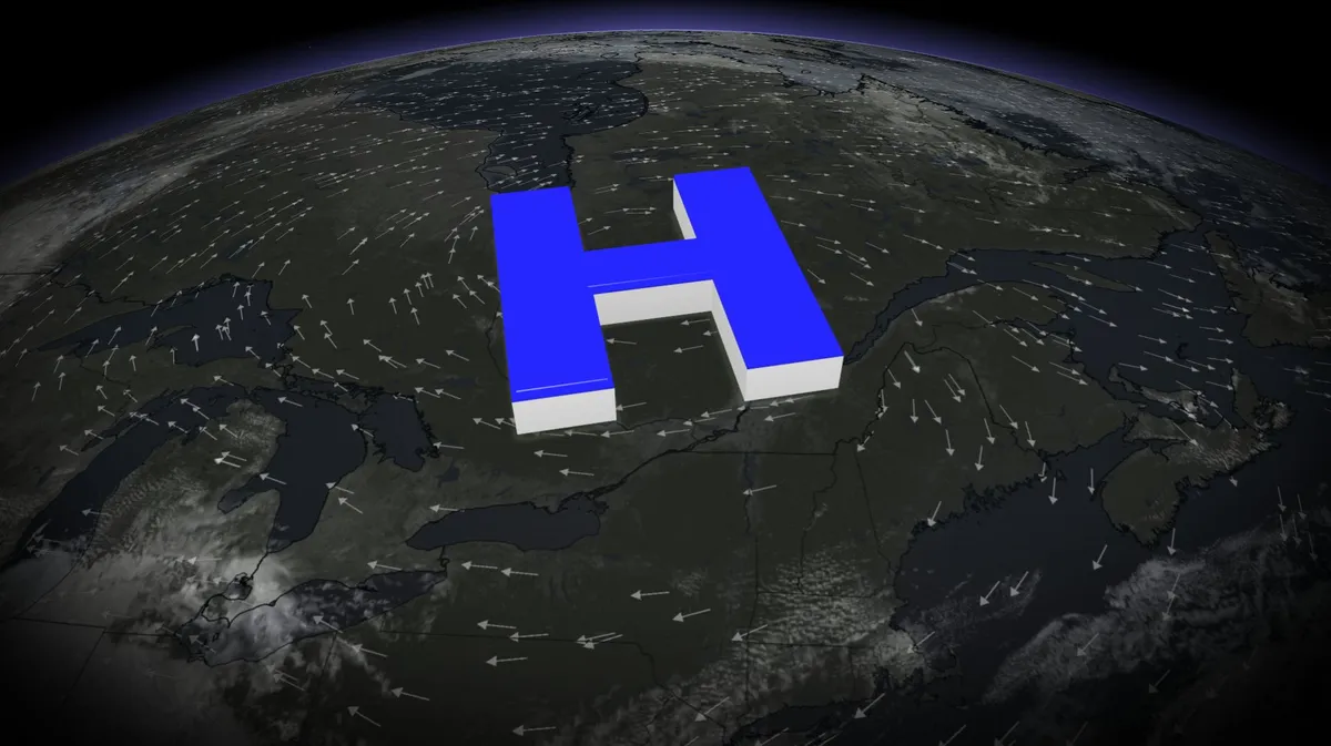
First Nor'easter of the fall charges North as millions brace for impact 🌧️ EXCLUSIVE ANALYSIS: FOX Weather Hurricane Specialist Bryan Norcross shares his exclusive analysis of the developing Nor'easter barreling across the Mid-Atlantic region and parts of the Northeast, triggering flood advisories. Norcross also touches on Hurricane Polo and Tropical Storm Nolo and their impacts in the Pacific. Stay with FOX Weather as we continue our coverage of these threats. Last updated at 10:40 a.m. on Thursday, Sept. 24, 2026. Live podcast today Join me along with NHC Deputy Director Jaime Rhome at 3:00 PM ET on YouTube, Facebook, TikTok, X, Instagram, or LinkedIn. We'll answer your questions about what's going on in the tropics, the unusual hurricane season, or whatever is on your mind. Live today!!! Developing nor'easterThe developing storm is part of a big frontal system off the Mid-Atlantic coast. Strong high pressure over Quebec is squeezing the air north of the front, causing the relentless wind along the Carolina and Mid-Atlantic coast. Extra-high tides are causing significant coastal flooding from the high-pressure-driven wind.

Fox Weather·
Weather

Fay restrengthens into Tropical Storm as brewing 'Super' El Niño continues to dominate the Atlantic

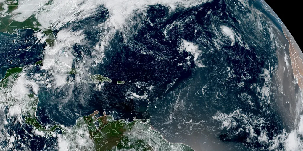
THE TAKEAWAYNHC is monitoring Invest 90L just off the coast of West Africa. Tropical Depression Fay restrengthened into Tropical Storm Fay. The Atlantic is off to its quietest start on record in the satellite era (1966). The National Hurricane Center (NHC) is monitoring an area to watch for tropical development just off the coast of West Africa amid the slowest start to an Atlantic hurricane season in the satellite era (since 1966) as hostile El Niño-driven winds have dominated much of the basin. EL NIÑO INTENSIFIES WITH NEARLY 100% ODDS STRENGTHENING INTO 'SUPER' STATUS AS ATLANTIC HURRICANE SEASON PEAKSAtlantic Basin(FOX Weather)The NHC has designated this tropical wave — an area of disturbed weather with a burst of thunderstorms — as Invest 90L after it moved off the coast of Africa. The hurricane center is giving 90L high odds of developing over the next seven days. WHAT IS AN INVEST DURING HURRICANE SEASON? "The El Niño-driven prohibitive upper winds don't quite reach that corner of the Atlantic, although the atmospheric environment is still marginal," FOX Weather Hurricane Specialist Bryan Norcross said Tuesday. 2026 Atlantic Basin storm  names.

Fox Weather·
Weather

September record heat wave for Plains, Mississippi Valley

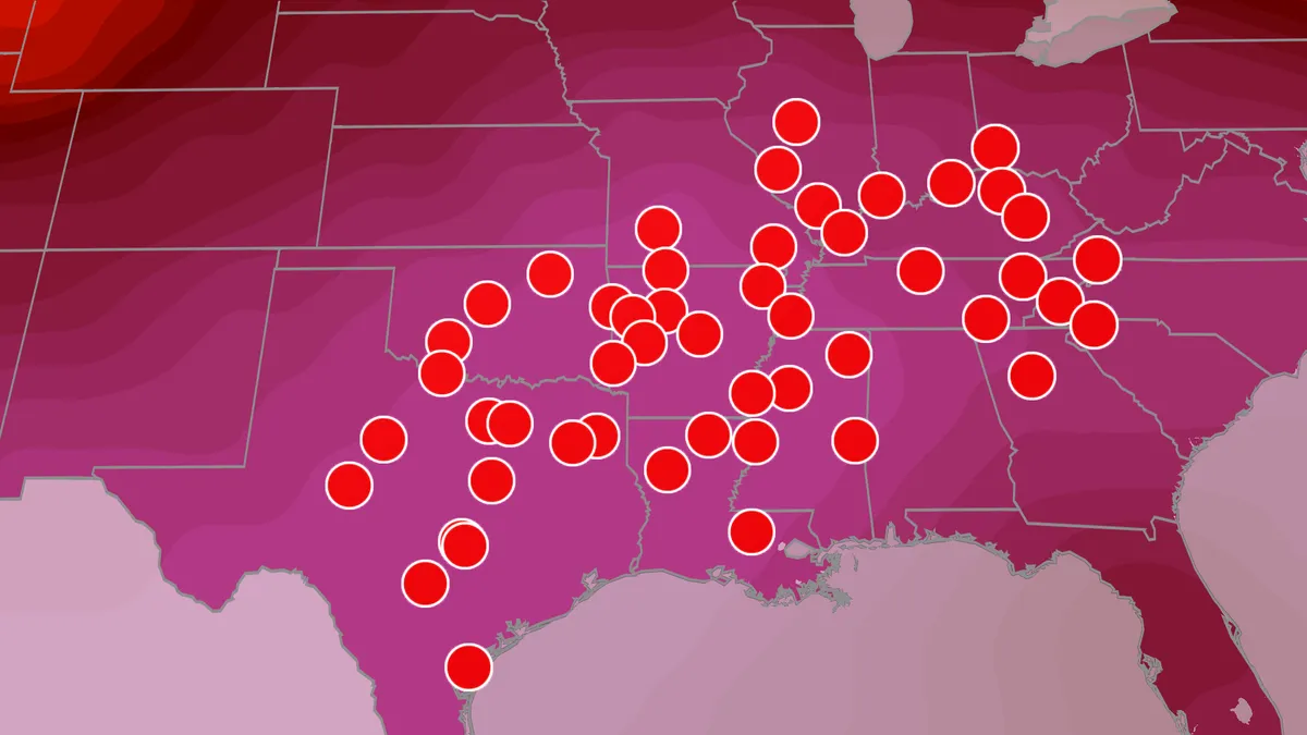
Heat dome continues this weekend, cooler temps next weekWhile Sept. 1 marked the start of meteorological fall, most of us have yet to feel anything close to fall temperatures. More record heat ahead could leave some areas hoping for relief this weekend. And for millions, that relief is coming next week as a pattern shift will bring the first real taste of fall temperatures. More record highs forecast through the weekendThis map shows where record highs for the date could be tied or set this weekend. Before the heat relief arrives, we have to get through the weekend. A heat dome currently sits across the Southern Plains and lower Mississippi Valley, bringing more brutal heat to the region for the next few days. Several cities could break daily record highs this weekend. Much of the Southern Plains and Southeast will have highs in the 90s through the weekend, with cities like Oklahoma City, Dallas, Little Rock and Nashville flirting with triple digits. Get More of Our News on GoogleSet The Weather Company as a 'Preferred Source' to get quicker access to the news you value. Will there be any relief?

The Weather Channel·
Weather

Europe’s scorching summer could give champagne a stronger kick

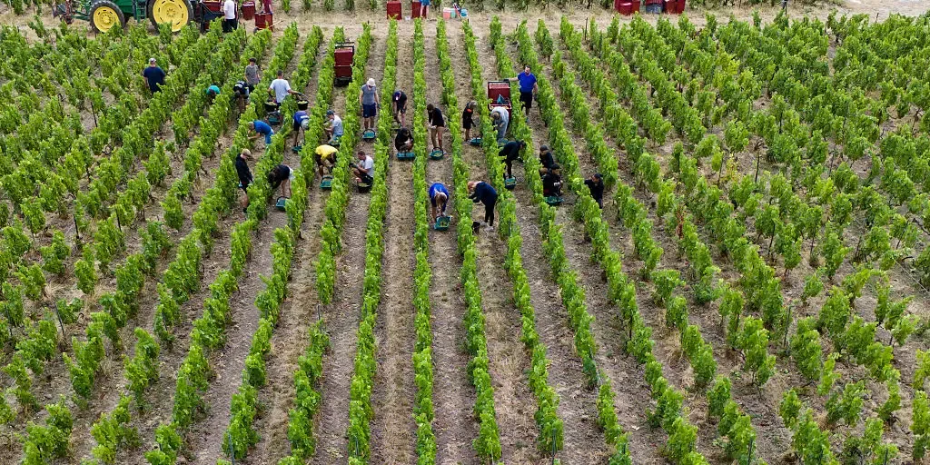
Extreme heat in Europe boosts Champagne's alcohol content This summer, France experienced a record-breaking heat wave that caused grapes to ripen faster than usual. Now, winemakers may temporarily produce Champagne with an alcohol content as high as 15%. Daniela Garrido, a wine and travel contributor, joins FOX Weather to discuss the impact of extreme heat on Champagne production. THE TAKEAWAYExtreme weather disrupted France’s champagne harvest. Heat accelerated ripening and concentrated grape sugars. Some 2026 champagne wines could reach higher alcohol levels. FRANCE - Deadly summer heat waves battered Europe, and in France, their effects could linger long after temperatures cool, all the way into a future glass of champagne. A combination of extreme weather shaped the 2026 harvest in France’s Champagne region, with severe spring frosts reducing overall production and repeated summer heat waves accelerating ripening and concentrating sugar in the grapes — potentially producing higher alcohol levels in some wines that might make you more tipsy down the line.

Fox Weather·
Weather

Hurricane Polo regains powerful Category 5 status; Pacific sees multiple storms

Hurricane Polo, now the second-most powerful hurricane ever recorded in the Pacific Ocean, is back to a powerful Category 5 storm. It is expected to be near the coast of southwestern Mexico through Thursday morning before it moves farther out to sea. According to the U. S. National Hurricane Center (NHC), the storm remains about 235 kilometres south-southwest of the tourist town of Zihuatanejo, and 425 km south-southeast of Manzanillo. Polo regained its Category 5 status on Wednesday evening. Satellite intensity estimates indicated that Polo has quickly strengthened into a Category 5 hurricane with estimated and maximum, sustained winds of 260 km/h. Hurricane Polo is forecast to bring 100-150 mm of rain, with isolated areas possibly reaching 200 mm, along coastal regions of Guerrero through Thursday. These rainfall amounts may lead to life-threatening flooding and mudslides, particularly in steep terrain. Rainfall totals of 50-100 mm are also expected across coastal areas of Michoacan, Colima, and Jalisco during the same period. Residents in affected areas should stay updated on weather alerts and take necessary precautions.

The Weather Network·
Weather

Nor’easter to bring rain and coastal impacts to the East Coast this weekend

A brewing nor’easter is expected to bring rain, strong winds, coastal flooding and rough surf along much of the East Coast this weekend. From the Outer Banks to New England, the developing coastal storm is forecast to hammer the East Coast. POWERFUL NOR'EASTER THREATENS MILLIONS ALONG EAST COAST WITH INTENSE COASTAL FLOODING, LIFE-THREATENING SURFPrediction markets are pointing to several Northeast cities as the most likely locations to see measurable rainfall from Sept. 26 to 27. Across the I-95 corridor, cities including Boston, Philadelphia and New York City have high percentages of measurable rainfall, with the developing coastal storm taking aim over the weekend. The FOX Forecast Center said the slow-moving coastal storm will produce heavy rainfall, significant coastal flooding, strong rip currents, beach erosion and gusty winds along different areas of the East Coast. THIS NOR’EASTER MAY FOLLOW THE SAME PATH AS SUPERSTORM SANDY, BUT IT’S NOTHING LIKE ITWhile the brewing nor’easter is expected to affect much of the East Coast, the storm’s eventual track will determine how conditions vary from region to region.

Fox Weather·
Weather

With Hurricane Polo still a Pacific menace, Nolo arises as new Hawaii threat

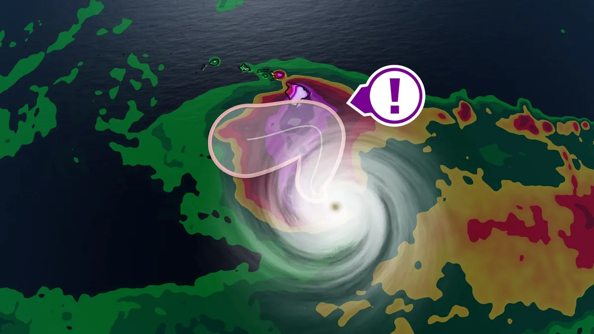
Hurricane Polo, now the second-most powerful hurricane ever recorded in the Pacific Ocean, remains a strong Category 4 storm and a threat to Mexico. And now comes Tropical Storm Nolo, which is expected to become a hurricane soon and take a path towards Hawaii's Big Island for this weekend. It won't make landfall, but it will come close enough to bring torrential rainfall, flooding and strong winds. DON'T MISS: From Hawaii to Halifax, why is this hurricane season so bizarre? A hurricane watch a already been issued for Hawaii’s Big Island, ahead of what is expected to be major hurricane impacts this weekend. Nolo expected to become a hurricane and impact Hawaii this weekendTropical Storm Nolo formed south of Hawaii on Wednesday, and is expected to strengthen into a hurricane late week as it moves northwards. Rainfall from the outer bands will intensifiy Thursday into Friday with very heavy rain continuing through the weekend. Its closest approach is expected on Saturday, just south of the Big Island of Hawaii. Content continues belowAt this time, the U. S. National Hurricane Center (NHC) forecasts Nolo to become a major, Category 3 hurricane.

The Weather Network·
Weather

Record high pressure in Ontario and Quebec also extends a dry stretch

A powerful ridge of high pressure that established itself over Eastern Canada set records in Ontario and Quebec, and has led to a unusual dry streak in Ontario. DON’T MISS: What does a classic fall storm look like in your part of Canada? The system's intensity is notable, with the highest September pressure recorded in Montreal, Quebec City, Chibougamau and Val-d'Or, Que. Meanwhile, a record was also set in Ottawa, Ont. Pressure levels on Wednesday morning reached 1041 mb in Saguenay, 1036.9 mb in Quebec City (record), 1039.2 mb in Chibougamau (record), Montreal 1037.4 mb (record) and 1037.5 mb in Val-d'Or (record). Ottawa's pressure hit 1037.4 mb (record). The values were much higher than the standard, sea-level pressure of 1013 mb. RELATED: Longest dry streak of 2026 in the works across southern OntarioImpacts from this system also include extended dry spells across Ontario and Quebec. The longest dry streak this year at Pearson International Airport is seven days (May 29-June 4) and will likely be broken this week. As of Wednesday, we have had six consecutive days without rainfall at Pearson. Content continues belowAt this point, the next legitimate chance for rain is Sept.

The Weather Network·
Weather

Watch: Rescues unfold in New Mexico as Hurricane Polo moisture fuels statewide flood threat

THE TAKEAWAYRescue operations unfolded in Albuquerque and Mora County as flooding impacted New Mexico. The dangerous flood threat is not over, with more heavy rain possible across the state. A statewide Flood Watch remains in effect as officials warn of additional flooding. NEW MEXICO - New Mexico has been hit by dangerous flooding fueled by moisture associated with powerful Hurricane Polo, triggering several intense rescue operations as the threat continues. Pacific moisture from the monster hurricane hundreds of miles away will continue funneling into New Mexico, setting the stage for another day of potentially significant flooding across the state on Wednesday. EL NIÑO JUST BROKE A HISTORIC TEMPERATURE RECORD — AND IT’S STILL INTENSIFYINGSouthwest flood alerts.(FOX Weather) The prolonged threat is another step in a chapter of dangerous flooding that triggered numerous rescues across the state on Tuesday. Albuquerque first responders remained busy Tuesday evening as heavy rain created dangerous conditions in low-lying arroyos across the city.

Fox Weather·
Weather

Outer Banks first in line for developing nor’easter as dangerous impacts begin Wednesday

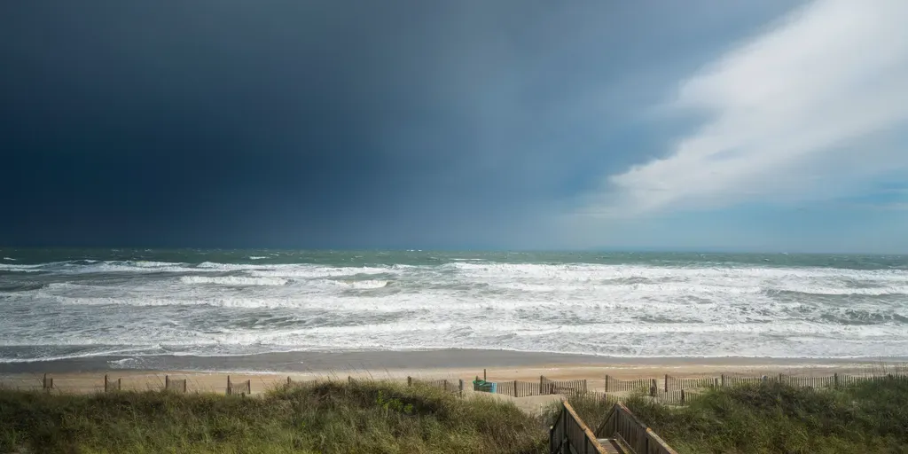
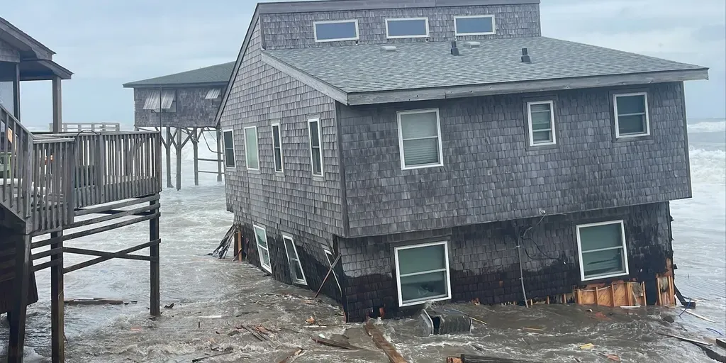
THE TAKEAWAYThe Outer Banks in North Carolina are at risk of seeing major impacts from the nor'easter brewing in the Atlantic. This nor'easter is expected to bring gusty winds, heavy rain and flooding to the Mid-Atlantic and parts of the East Coast. Wind gusts will reach 40 to 50 mph, fueling dangerous offshore waves of 15 to 18 feet along the Outer Banks. OUTER BANKS, N. C. – The Outer Banks are getting slammed by the first nor’easter of the season, with strong winds, heavy rain, dangerous surf, coastal flooding and beach erosion expected along the coast. North Carolina's Outer Banks will see moderate flooding, which is has already begun. With the increasing threat to the region, officials expect hazardous travel conditions at Cape Hatteras National Seashore, a popular destination for the metro area. WILL THE MONSTER NOR'EASTER CANCEL YOUR WEEKEND PLANS? HERE'S WHAT TO KNOWRoad conditions along the stretch of N. C. Highway 12 are vulnerable to overwash during prolonged periods of strong northeast winds and large surf slamming against the coast, according to the National Park Service.

Fox Weather·
Weather

Fall in full swing as first nor'easter of the season brews

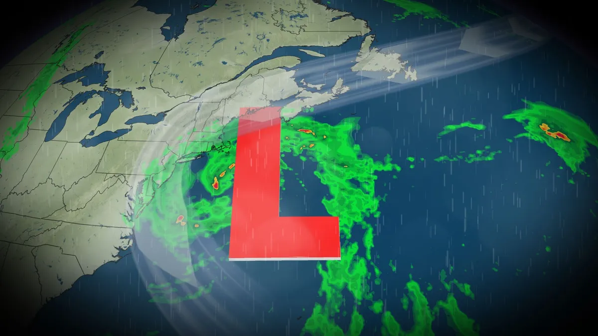
It was a quiet summer across the Atlantic this year, with no hurricanes to stir up any trouble for folks living across the Eastern United States and Canada. Now, as temperatures begin to drop with the changing season, forecasters must keep an eye out for any late-season tropical activity as well as everyone's favourite messy weather: nor'easters. A broad area of low pressure is already beginning to bubble east of the Carolinas and is forecast to grow into the first nor'easter of the fall season. SEE ALSO: Experts warn that new measures required to prevent flooding in N. S. An area of strong high pressure over Ontario and Quebec will block the low from advancing north into Atlantic Canada for the first half of the week, but it is expected to erode and allow the system to strengthen and advance by the end of the week. Strong northeasterly winds are forecast along parts of the East Coast ahead of the system, thanks to the steep pressure gradient formed between the two systems. DON'T MISS: Atlantic Canada's hurricane-free streak in jeopardy. Could Fay be the first?

The Weather Network·