Europe’s scorching summer could give champagne a stronger kick
This story deserves to be shared
Send it to someone who'd care, or post it on your networks.

Extreme heat in Europe boosts Champagne's alcohol content This summer, France experienced a record-breaking heat wave that caused grapes to ripen faster than usual. Now, winemakers may temporarily produce Champagne with an alcohol content as high as 15%. Daniela Garrido, a wine and travel contributor, joins FOX Weather to discuss the impact of extreme heat on Champagne production. THE TAKEAWAYExtreme weather disrupted France’s champagne harvest. Heat accelerated ripening and concentrated grape sugars. Some 2026 champagne wines could reach higher alcohol levels. FRANCE - Deadly summer heat waves battered Europe, and in France, their effects could linger long after temperatures cool, all the way into a future glass of champagne. A combination of extreme weather shaped the 2026 harvest in France’s Champagne region, with severe spring frosts reducing overall production and repeated summer heat waves accelerating ripening and concentrating sugar in the grapes — potentially producing higher alcohol levels in some wines that might make you more tipsy down the line.
This article is an excerpt. To read the full content, visit the original source. Fox Weather
Related articles

From first frost to scorching temperatures as New England feels fall while dozens of states bake
From frost-covered mountains in New England to triple-digit heat in the Southern Plains, the U. S. will experience a dramatic temperature tug-of-war this week as fall arrives in the Northeast while summer refuses to let go elsewhere. A sharp change in temperatures will spread across the Northeast early Tuesday, with some areas experiencing their first widespread frost and freeze conditions of the season. WHAT’S THE DIFFERENCE BETWEEN FROST, A FREEZE AND A HARD FREEZE? A strong cold front will push off the East Coast Monday night, followed by a cold Canadian air mass. Clearing skies, dry air and lighter winds will allow temperatures to drop quickly overnight, the FOX Forecast Center said. Forecast lows in New England on Tuesday.(FOX Weather) The coldest conditions will develop in higher elevations, including New York’s Adirondacks, Vermont’s Green Mountains, New Hampshire’s White Mountains and far northern Maine. Temperatures there could fall into the lower 30s, leading to localized freezes. LEAF-PEEPING SEASON IS ALMOST HERE.
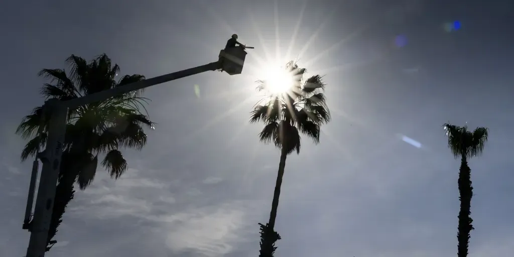
Scorching summer temperatures lead to consecutive days of extreme heat along the West Coast
With little relief on the horizon for the West, prediction markets at Kalshi are looking at how many consecutive days temperatures will exceed 90 degrees. FILE: New sunscreen ingredient approved as summer heats up across the country As summer kicks into gear across the U. S., a new sunscreen ingredient, bemotrizinol (BEMT), has been FDA approved and protects against UVA & UVB. Board-certified dermatologist & clinical professor at NYU Langone, Dr. Doris Day, joins FOX Weather to talk about the new ingredient and how it could help you and your family. The summer heat is ramping back up across parts of the West Coast this week, with scorching temperatures over 90 degrees sizzling thousands of Americans. Forecasters are monitoring an extended heat wave returning to the Southwest and South Central U. S. as a strong ridge hovers over the regions, bringing sweltering conditions this week. Locations like Los Angeles could see 13 days in a row of temperatures over 90 degrees, according to the FOX Forecast Center. EXTREME HEAT SAFETY: RECOGNIZING SIGNS OF HEAT ILLNESS AND HOW TO TREAT ITThis would mark the longest streak for such temperatures in the city since 1995.
Scorching weather expected to break more B.C. records - CityNews Vancouver
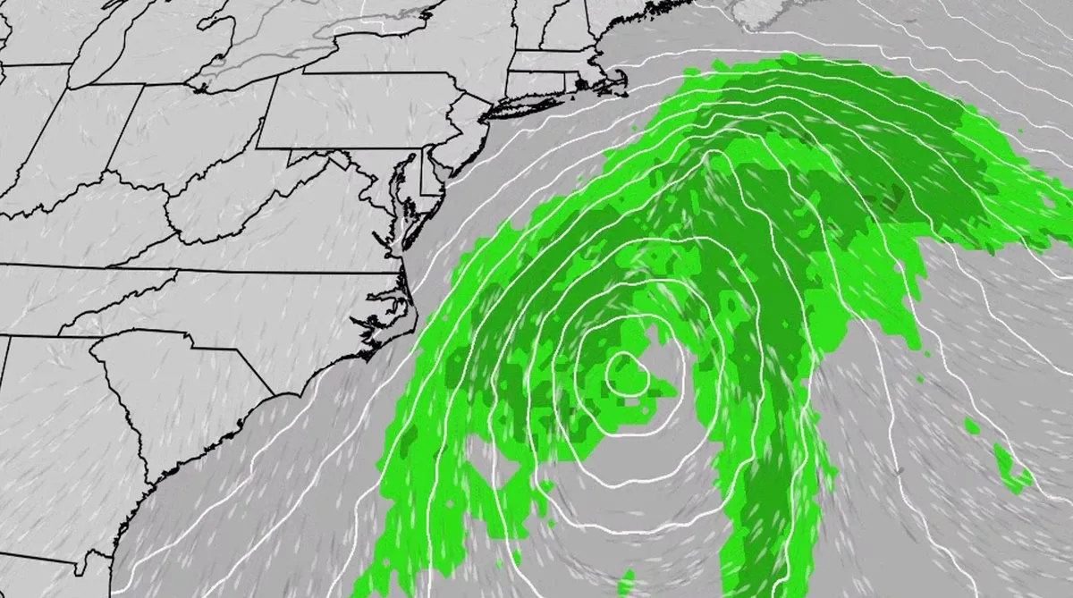
Nor' easter to bring coastal flooding, winds to East Coast
An October nor'easter is developing in the Atlantic, where it will bring high surf, rip currents, coastal flooding and winds to parts of the East Coast for several days this week. The National Hurricane Center has highlighted it as an area to watch this week for the potential development of Josephine. However, regardless of whether we call this system a nor'easter or Josephine, the impacts will be the same. The bottom line: This system will bring dangerous conditions to the East Coast for multiple days this week.(MORE: What is a nor'easter?)Fortunately, this nor'easter doesn't look to be as strong as the one in September. But the bad news? It could linger for much of the week, so impacts could have a longer duration. Coastal flood alerts are in effect for parts of coastal North Carolina and Virginia, where anywhere from 1 to 4 feet of inundation is possible. Get More of Our News on GoogleSet The Weather Company as a 'Preferred Source' to get quicker access to the news you value. Key takeawaysWe do not expect this storm to be as strong as the late September nor'easter.
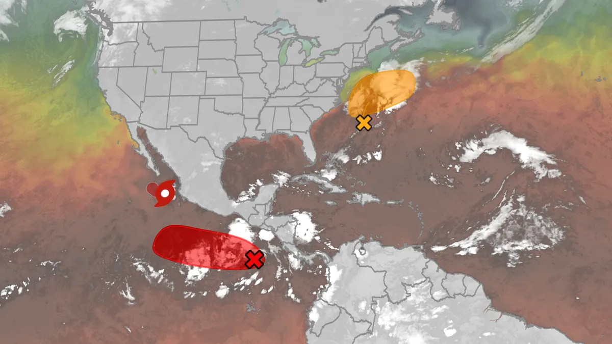
Hurricane season maps tracker: Latest forecasts and more
We have the maps you need to track all the systems ongoing in the Pacific and Atlantic below. Tracking the AtlanticTropical development areasSea surface temperatures Wind shear These are areas of strong wind shear, the difference in wind speed and direction with height, which are shown in purple. High wind shear is hostile to mature tropical cyclones and those trying to develop.(MORE: What is wind shear?)Get More of Our News on GoogleSet The Weather Company as a 'Preferred Source' to get quicker access to the news you value. Dry, dusty airAnother nemesis of tropical systems is dry air. In hurricane season, plumes of dust-laden air stream across the basin from Africa's Sahara Desert, as you can see in the map below. This sinking, dry air squelches thunderstorm development, the building blocks of tropical storms and hurricanes. So areas in the brown shading below are generally unfavorable for development. Atlantic tracks so far this seasonThese are the tracks of systems that were at least tropical or subtropical storms so far in the Atlantic Basin.
0 comments
No comments yet. Be the first to share your thoughts!