BBlogFlow

Categories

Weather

4070 articles

Weather

Hurricane Polo to slam Mexico as monster Cat 4 storm, fuel major flood threat across the Southwest next week

THE TAKEAWAYHurricane Polo is expected to make a sharp right turn and head directly toward Mexico. Several inches of rain are expected, with the threat of mudslides and landslides. Hurricane Polo is forecast to spread tropical moisture across the Southwest, triggering a renewed flood threat. Category 4 Hurricane Polo continues to churn through the East Pacific, and is forecast to make landfall in Mexico, fueling a renewed flooding threat across the southwestern U. S. next week. EL NIÑO JUST BROKE A HISTORIC TEMPERATURE RECORD — AND IT’S STILL INTENSIFYINGMexico’s Meteorological Service issued tropical storm warnings and watches for parts of southwestern Mexico as Polo tracked toward the coast. However, those alerts have since been discontinued. Hurricane hunters ventured into the storm once again on Friday afternoon and recorded 180 mph winds. The storm was downgraded to a Category 4 hurricane on Saturday, according to the National Hurricane Center (NHC). Hurricane Polo forecast cone(FOX Weather) As the weekend progresses, Polo will shift north before turning northeastward and approaching Baja California Sur on Monday. WHAT ARE KELVIN WAVES?
Fox Weather·
Weather

See this stunning, powerful nor’easter captured from space

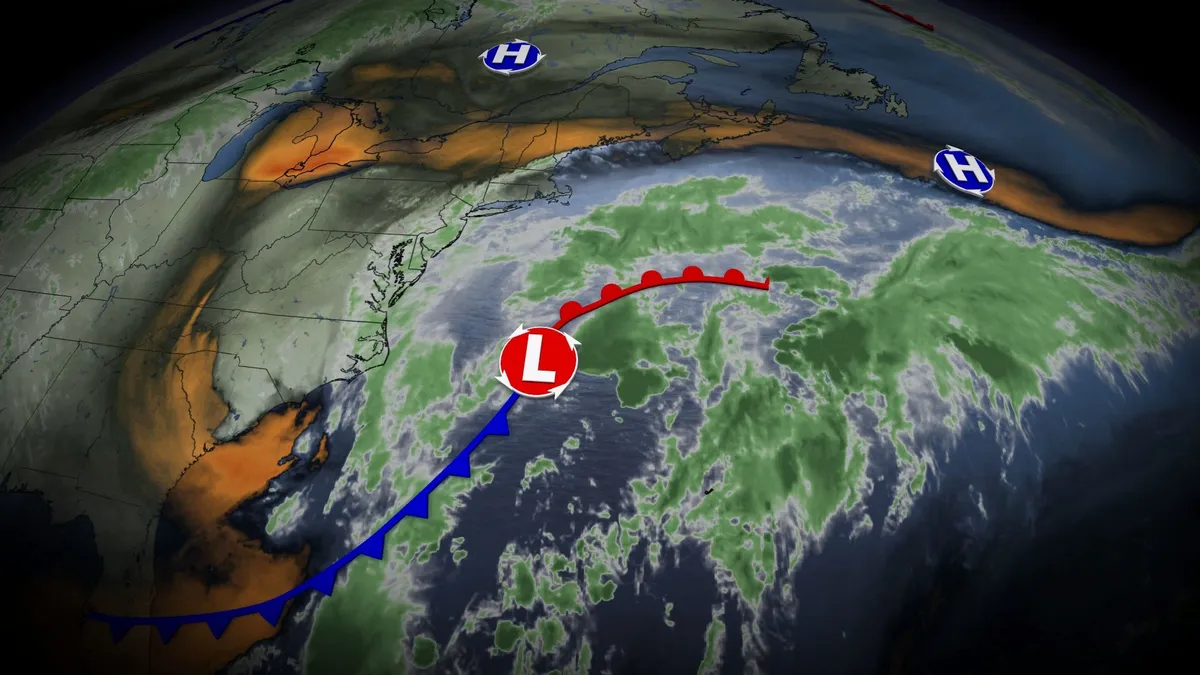
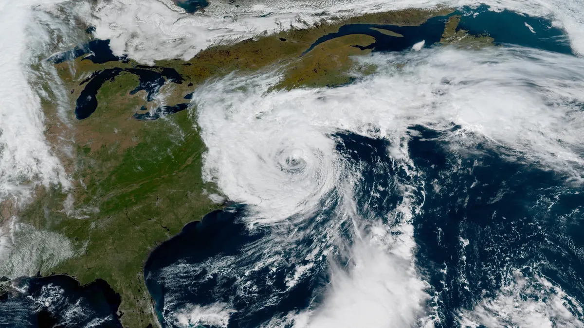
An unusually early and powerful nor’easter looked absolutely stunning from space as it rolled up the U. S. East Coast this weekend. The impactful system continues to produce gusty winds and heavy rainfall from Philadelphia to Halifax, with some areas experiencing a significant storm surge. DON’T MISS: The strongest nor’easters are getting even stronger, study findsSatellites captured remarkable imagery of the nor’easter as it developed and strengthened off the eastern seaboard on Friday and Saturday. We had a vivid view of the tight, exposed centre of the low-pressure system during the day Friday as the system ramped up in a hurry. Low-level cumulus clouds traced intricate details of the wind pattern as they swirled around the storm. Saturday brought an even more remarkable sight as the system reached its peak intensity. Daylight revealed a large, swirling low-pressure system almost completely surrounded by crystal-clear skies. Bands of clouds and rain spiralled around the low-pressure system. A clearing near the centre of the low bore a striking resemblance to the eye of a hurricane.

The Weather Network·
Weather

Strong winds, sharp temperature drop coming to Alberta

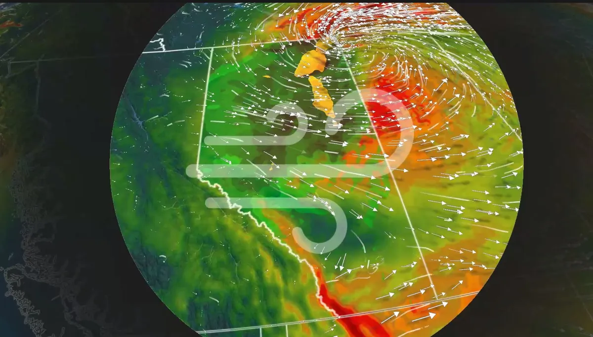
A powerful cold front will bring significant changes to Alberta's weather, with strong winds and a sharp drop in temperatures. Visit our Complete Guide to Fall 2026 for an in depth look at the Fall Forecast, tips to plan for it and much more! A developing, low-pressure system over Alberta will move northward into Saturday. Friday could mark the season's last 30°C temperature. On average, Medicine Hat experiences 2.9 days with temperatures of 30°C or higher in September. Northern Alberta may experience gusts of 60-80 km/h by Saturday as the low moves into Saskatchewan. The gusty winds also heighten the risk of power outages. Major temperature drop by SaturdayThe passage of the cold front Saturday will bring a dramatic temperature drop, with most areas seeing a decline of 10°C or more. Content continues belowRELATED: Some of Canada’s first frost advisories of the season issuedKeep an eye on local forecasts for updates and possible advisories. WATCH: Prairies’ 2026 Fall Forecast: Warmer temperatures on average

The Weather Network·
Weather

Strong nor’easter won’t spare Atlantic Canada from foul weather

A potent, early-season nor’easter off the U. S. East Coast will bring some foul weather to portions of Atlantic Canada this weekend into early next week. The system will hit the northeastern states the hardest with high winds, heavy rainfall, and coastal flooding. Travel delays are likely at major hubs throughout the region. DON’T MISS: The strongest nor’easters are getting even stronger, study findsA major nor’easter in the worksMillions of people from North Carolina to Nova Scotia are in line for unsettled weather over the next few days from an early-season nor’easter. Strong winds will whip up rough surf, dangerous rip currents, and coastal flooding. Heavy rain is likely up and down the Interstate 95 corridor. The hardest-hit areas will see 50-75+ mm of rain from now until Tuesday. A centre of high pressure over Quebec will force the system to slow down or stall, prolonging the high winds and heavy rainfall over the region. Expect flight delays in New York and Boston due to wind and visibility, as well as slow and slick travel on area highways. Nova Scotia next in line for impactsGloomy conditions sticking around in Nova Scotia into early next week.

The Weather Network·
Weather

WATCH: Inside the eye of Polo as it grows into a historic hurricane

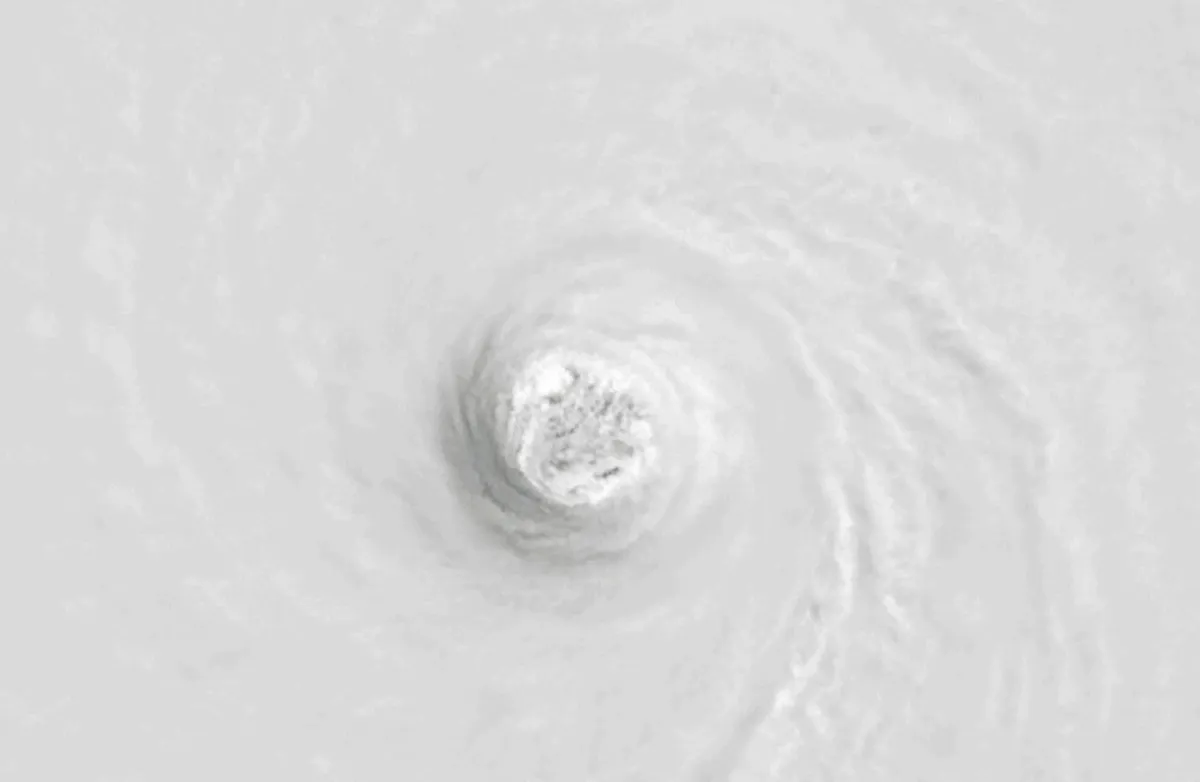
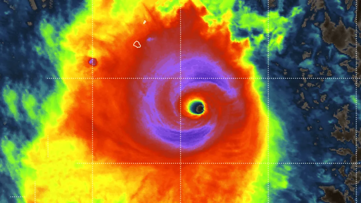
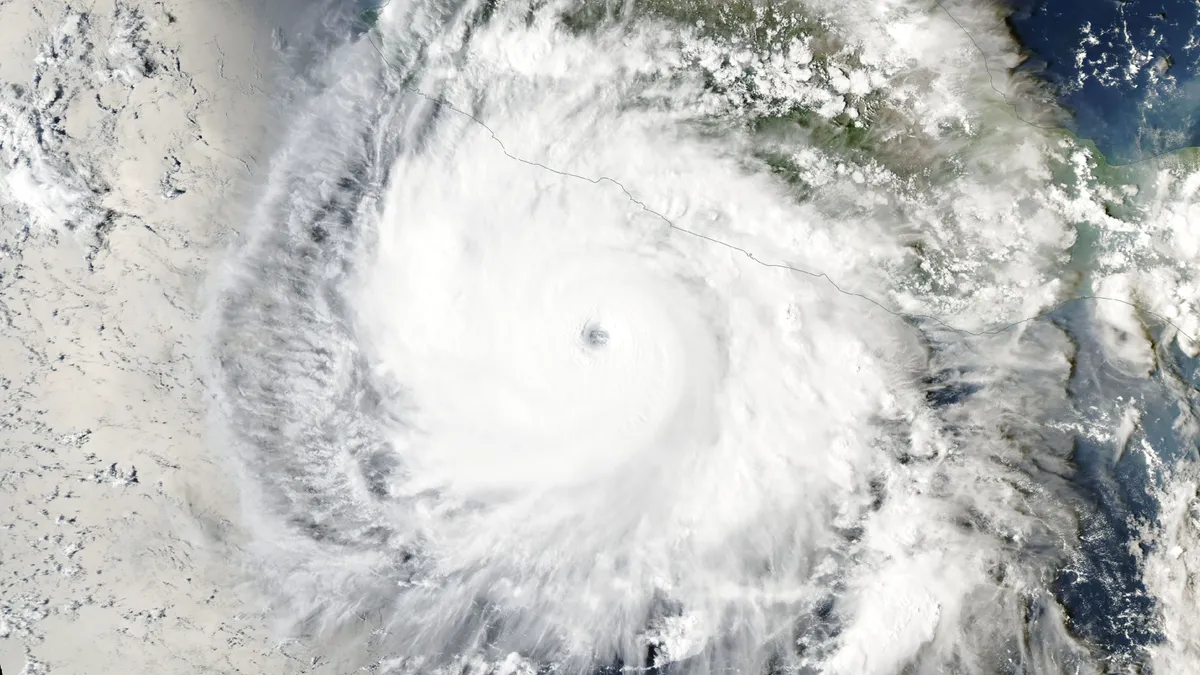
While Hurricane Polo has lost some of its power, the storm remains dangerous as it tracks towards a projected Monday landfall on the Baja California Peninsula in northwestern Mexico. Earlier this week, NOAA's Hurricane Hunters recorded footage from inside the eye of Polo, now the second-most intense storm (by pressure standards) ever documented in the eastern Pacific basin. In response to the rapid strengthening, NOAA's U. S. National Hurricane Center (NHC) called the intensification process “truly remarkable.” NOAA-20 infrared and visible instrument captured Hurricane Polo on Sept. 22. (NOAA/Visible Infrared Imaging Radiometer Suite)A near-historic El Niño fuelled the perfect setup for the hurricane to approach the upper limit of how strong a tropical cyclone can grow. Polo underwent rapid intensification, growing from a tropical depression into a Category 5 hurricane in about 40 hours. It obtained a peak instensity om Tuesday, Sept. 22, with maximum, sustained winds of over 285 km/h, according to the NHC.

The Weather Network·
Weather

Mexico, Hawaii face major impacts from pair of menacing Pacific hurricanes

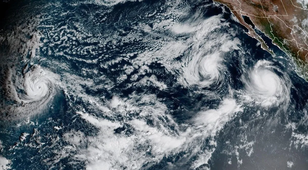
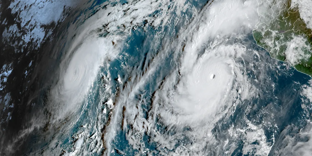
The Pacific remains firmly under the influence of El Niño this week as a few hurricanes move through the region. Hurricane Polo has lost some strength and is now at Category 4 strength as of Saturday, as it churns off Mexico’s west coast. The system threatens an impactful landfall on Monday. Hurricane Nolo is gathering strength as it inches toward Hawaii over the next few days, but will remain well south. It is expected to become a major hurricane by Saturday night or early Sunday morning. The storm will threaten major flooding across areas already hard-hit by storms this year. DON'T MISS: From Hawaii to Halifax, why is this hurricane season so bizarre? Hurricane Polo's remnants could reach Canada next weekThe fact that we have two concurrent storms named “Polo” and “Nolo” is a coincidence of how storms are named both in the eastern and central Pacific basins. Polo is the history-making hurricane lurking off the western shores of Mexico. The system reached the scale-topping Category 5 intensity several times week. The intense hurricane is currently moving west away from land. Polo has started to weaken and more is forecast during the next couple of days.

The Weather Network·
Weather

Bryan Norcross: Major nor'easter impacts increase as Hurricane Nolo is closest to Hawaii, Polo heads to Mexico

Updated at 10:30 a.m. on Saturday, Sept. 26, 2026. The out-of-season nor'easter is strengthening southeast of southern New Jersey. Strong winds along and near the coast from Massachusetts to south of New Jersey will gust to 50 to 70 mph today, tonight and into tomorrow. Power outages are likely. Some areas near the coast will have to be evacuated so people don't get stranded by flooding. Strong winds on the north side of the storm have already elevated the ocean levels along the coast. Now the intensifying storm will push them even higher. At high tide, peak water levels at the Jersey Shore are forecast to be just under those experienced in Hurricane Sandy, so significant coastal flooding along the beaches and in the back bays and harbors is expected. POWERFUL NOR'EASTER LASHES THE EAST COAST AS MILLIONS BRACE FOR WORST COASTAL FLOODING SINCE SUPERSTORM SANDYNor'easter impacts overview(FOX Weather) Around New York City, the west end of Long Island Sound possibly including LaGuardia Airport might experience significant flooding at high tide due to the easterly wind developing tomorrow. Flooding along the East River and in southern Manhattan is also likely.

Fox Weather·
Weather

Rare Atlantic September hurricane shutout appears likely

We're nearing the end of September, and we have yet to see a hurricane anywhere in the Atlantic. It's already, by far, the longest wait on record for the season's first hurricane in the satellite era. Previously, that record long wait was Sept. 11 in both 2013 and 2002. An average Atlantic hurricane season would have five hurricanes by September 28, according to the National Hurricane Center. This graph shows the average number of Atlantic hurricanes (in dark black) compared to 2026 (in blue) through Sept. 25, 2026. (Data: NOAA/NHC)0 for September? Only twice since World War II has this peak month of hurricane season failed to generate a single Atlantic hurricane. Those two seasons – 1962 and 1994 – each produced seven tropical storms throughout the season and both seasons saw multiple late-season hurricanes. 1962: Four hurricanes, none of which became a Category 3 hurricane. Three of them formed after October 1. Neither El Niño, nor La Niña conditions were prevalent throughout the season. 1994: Three hurricanes, none of which became a Category 3 hurricane. Two of them formed after November 1 and none formed in October. The peak of the season featured a building El Niño.

The Weather Channel·
Weather

How to make cyanotype sun prints at home: your DIY guide

Cyanotype printing and how you can make art using the sunThere’s a nearly 200-year-old art form that uses sun as paint, and you can easily do it at home. You may not have heard of it, but cyanotype printing is so popular among photographers and crafters that there’s a whole day dedicated to it: World Cyanotype Day, which is celebrated the last Saturday of September every year. Cyanotype originated as a form of photography in 1842 that uses ammonium iron(III) citrate + potassium ferricyanide to turn a material into a beautiful shade of Prussian blue when it is exposed to UV light (aka the sun). By coating a piece of paper or other material in a cyanotype solution and then only exposing parts of that material to the sun, you can create monochromatic works of art using the sun itself. It’s surprisingly easy and definitely something you can do at home as a unique craft (and as a chemistry experiment).

The Weather Channel·
Weather

Ask a met: Isn't a nor'easter a winter storm? How's it happening in September?

"Isn't a nor'easter a winter storm? How's it happening in September? "If you’re thinking it’s too early for a nor’easter, you’d be right. The peak time for nor’easters and coastal storms in general is January to March when there is a strong jet stream, plentiful cold air from Canada and often a strong high pressure system over New England or eastern Canada. But sometimes, those ingredients come into play earlier in the season. That’s what happened this week. We’ve got all of those ingredients coming together across the Northeast for a storm system just off the Carolina and Jersey coasts through this weekend. This early season formation means that the storm won’t have snow, but the wind it does produce will have to fight with leaves that are still on the trees across much of the Northeast. That means that there will likely be more wind damage now than there would be this winter. Get More of Our News on GoogleSet The Weather Company as a 'Preferred Source' to get quicker access to the news you value. One other difference is that “cooler” air is all relative. Storms like this one feed on the difference in temperature between the warm Gulf Stream current and the cooler Canadian air.

The Weather Channel·
Weather

Tropical Storm Gonzalo to soak Cabo Verde before weakening amid historically quiet Atlantic hurricane season

THE TAKEAWAYTropical Storm Gonzalo is forecast to soak the Cabo Verde Islands before weakening. Tropical Depression Fay restrengthened into Tropical Storm Fay. The Atlantic is off to its quietest start on record in the satellite era (1966) as hostile El Niño-driven winds have dominated much of the basin. Tropical Storm Gonzalo has strengthened after forming late Thursday off the coast of Africa, just the seventh named storm in the Atlantic Basin, amid the slowest start to hurricane season in the satellite era (since 1966) as hostile El Niño-driven winds have dominated much of the basin. Gonzalo is forecast to soak the Cabo Verde Islands before gradually weakening this weekend. It is currently located 35 miles south-southeast of Cabo Verde, moving north at 9 mph, according to the National Hurricane Center. EL NIÑO INTENSIFIES WITH NEARLY 100% ODDS STRENGTHENING INTO 'SUPER' STATUS AS ATLANTIC HURRICANE SEASON PEAKSAtlantic Basin(FOX Weather)Gonzalo strengthened from Invest 90L, which was designated earlier this week, according to the National Hurricane Center (NHC).

Fox Weather·
Weather

Category 5 Hurricane Polo Explosively Intensifies in the Eastern Pacific: Historic Pressure Drops Near Mexico

An extraordinary display of tropical power is unfolding off Mexico’s Pacific coast, where Hurricane Polo explosively intensified into a monster Category 5 storm with sustained winds of 180 mph (155 kt = 285 km/h) and a minimum central pressure plummeting to 892 mbar. Polo is driven by record-warm ocean temperatures fueled by the ongoing super El Niño and underwent one of the most violent rapid intensification cycles on record. Hurricane Polo strengthened from a tropical storm to a high-end Category 5 system in under 24 hours. The primary engine behind this rapid intensification is an exceptionally favorable thermodynamic environment off southwestern Mexico, with sea surface temperatures hovering near 31-32 °C and extremely low vertical wind shear. This is an ideal scenario for extreme tropical system intensification. Hurricane Hunter reconnaissance missions confirmed that Polo reached an incredible central pressure of 892 hPa, making it the second-most intense Pacific hurricane in recorded history, only falling just behind Hurricane Patricia (2015). Polo has reached Category 5 status three times, making it the first Pacific hurricane on record to do so.

Severe Weather Europe·
Weather

Polo cements status as Pacific’s second-most intense hurricane

Hurricane Polo will live in the records as one of the most intense hurricanes ever observed in the eastern Pacific basin. A near-historic El Niño fuelled the perfect setup for the hurricane to approach the upper limit of how strong a tropical cyclone can grow. DON’T MISS: What’s the difference between hurricanes, typhoons, and cyclones? A monstrous eastern Pacific hurricanePolo formed off Mexico’s west coast amid an extremely active hurricane season in the eastern half of the Pacific Ocean. Very warm water temperatures, relatively calm wind shear, deep atmospheric moisture, and conditions favourable for rising air allowed one disturbance after another to develop throughout the region through the summer and early autumn. The system rapidly intensified from a tropical depression to a scale-topping Category 5 hurricane in about 40 hours, marking one of the fastest rates of strengthening ever observed in this part of the world. Hurricane Hunters found that the storm reached peak intensity on Tuesday, Sept. 22, with maximum sustained winds of 285 km/h and a minimum central pressure of 892 mb. For context, standard atmospheric pressure at sea level is 1013 mb.

The Weather Network·
Weather

Bryan Norcross: Nor'easter targets Northeast while Hurricane Nolo impacts Hawaii and Polo threatens Mexico

Updated at 10:45 a.m. on Friday, Sept. 25, 2026. Strengthening nor'easterThe low-pressure system that formed off the Southeast coast is being lifted north and energized by a dip in the jet stream. It will become marooned off the coast of New Jersey meandering and looping through the weekend. The computer forecast models show the storm peaking in intensity on Saturday. Unlike a well-developed tropical storm or hurricane, the winds are not concentrated around the center with this type of cyclone. Coastal damage can and is expected to occur over a long stretch of the coastline from the Carolinas to New England. STRENGTHENING NOR’EASTER BRINGS DANGEROUS COASTAL FLOODING, DAMAGING WINDS AS IT CHARGES ALONG EAST COASTFlooding is also likely in bays, harbors, and inlets where the water can pile up. Long Island wave height forecast(FOX Weather) Because the storm is forecast to stall or make a small loop, the winds will be pushing ocean water in about the same direction for multiple high tide cycles. In some cases, this will mean the tide will not be able to go out, and the next high tide will add to the water level.

Fox Weather·
Weather

Timeline: Where and when you will see impacts from the strengthening nor'easter this weekend

Long Island readying for powerful Nor'easter that's barreling up the East Coast Long Island is expecting to see heavy rain, strong winds and dangerous surf conditions from a nor'easter that's making its way up the East Coast into the Northeast. FOX Weather Storm Specialist Mike Seidel reports from Greenport, New York, ahead of the most severe impacts, which will begin taking shape Friday evening. THE TAKEAWAYFriday: The nor'easter will continue to consolidate and intensify. Winds will start to increase along the East Coast, with rain moving in by the evening. Saturday: The storm will bring widespread heavy rain across the coast and areas inland. Winds along the coast will be gusting over 60-70 mph as the storm approaches peak strength. Sunday: The nor'easter will maintain intensity and impacts will continue across the region. Monday: Rain will linger but the storm will finally begin to dissipate. A strengthening nor'easter is threatening more than 40 million people as it begins its charge up the East Coast, lashing North Carolina's Outer Banks and the Mid-Atlantic coast with more intense wind, severe beach erosion and high tide flooding.

Fox Weather·
Weather

Hurricane Polo may bring high surf threat to Long Beach

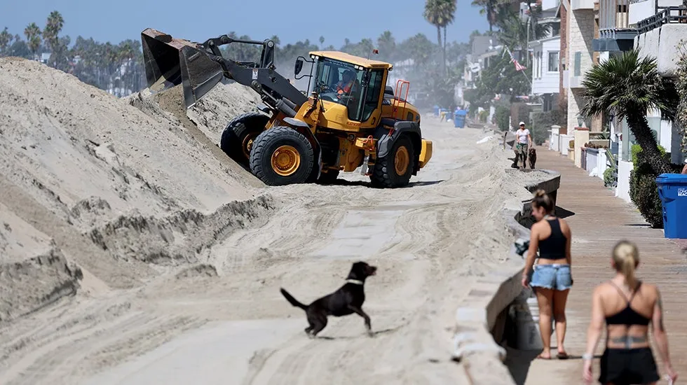
Fly straight into the eye of one of the most powerful hurricanesHurricane Polo is not expected to make landfall in California, but coastal cities there are still working to shore up a seawall and berms battered by an earlier storm. Polo is expected to bring higher than normal surf to Southern California through the weekend, according to weather.com meteorologist Jennifer Gray. The threat could linger into early next week. That's of particular concern in Long Beach, California, which is still trying to rebuild after the damage caused by Hurricane Marie. Powerful waves churned up by Marie damaged parts of the city's boardwalk and seawall, destroyed sand berms and flooded homes. At one point, 19 homes had to be evacuated.(WATCH: Tropical storm waves flood Long Beach homes, force evacuations)On Wednesday, the City Council declared a local emergency because of the Marie damage and threats from the El Niño weather pattern and winter storm season. Get More of Our News on GoogleSet The Weather Company as a 'Preferred Source' to get quicker access to the news you value. This week, work has continued to shore up tall sand berms and repair the seawall and boardwalk.

The Weather Channel·
Weather

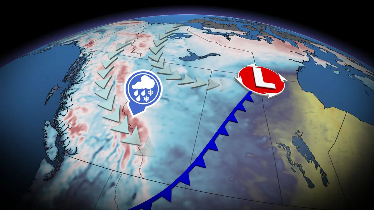
Thunderstorm threat pops up in B.C., Alberta before cooldown with alpine snow

A significant cooldown is set to arrive this weekend across B. C. and Alberta, with high-elevation snow, but before that happens, there will be a chance of thunderstorms for both provinces. Widespread and much-needed rainfall totals of 20-40+mm are likely for parts of B. C., including the Lower Mainland. The rain will come with a non-severe thunderstorm risk on Friday, stretching into parts of Alberta, too. Visit our Complete Guide to Fall 2026 for an in depth look at the Fall Forecast, tips to plan for it and much more! By Saturday, temperatures across B. C. and Alberta will drop noticeably, with the cooldown also leading to high-elevation snow in parts of both provinces. Thunderstorm threat before cooldown arrives in B. C., AlbertaAfter a seasonably warm stretch of sun and temperatures in the mid-20s, change is coming to B. C. and Alberta. A strong low and cold front will develop stateside, tracking northwards over the Rockies and onto the Prairies through Friday. Widespread rainfall is expected, along with a non-severe storm chance, on Friday.

The Weather Network·