WATCH: Inside the eye of Polo as it grows into a historic hurricane
This story deserves to be shared
Send it to someone who'd care, or post it on your networks.
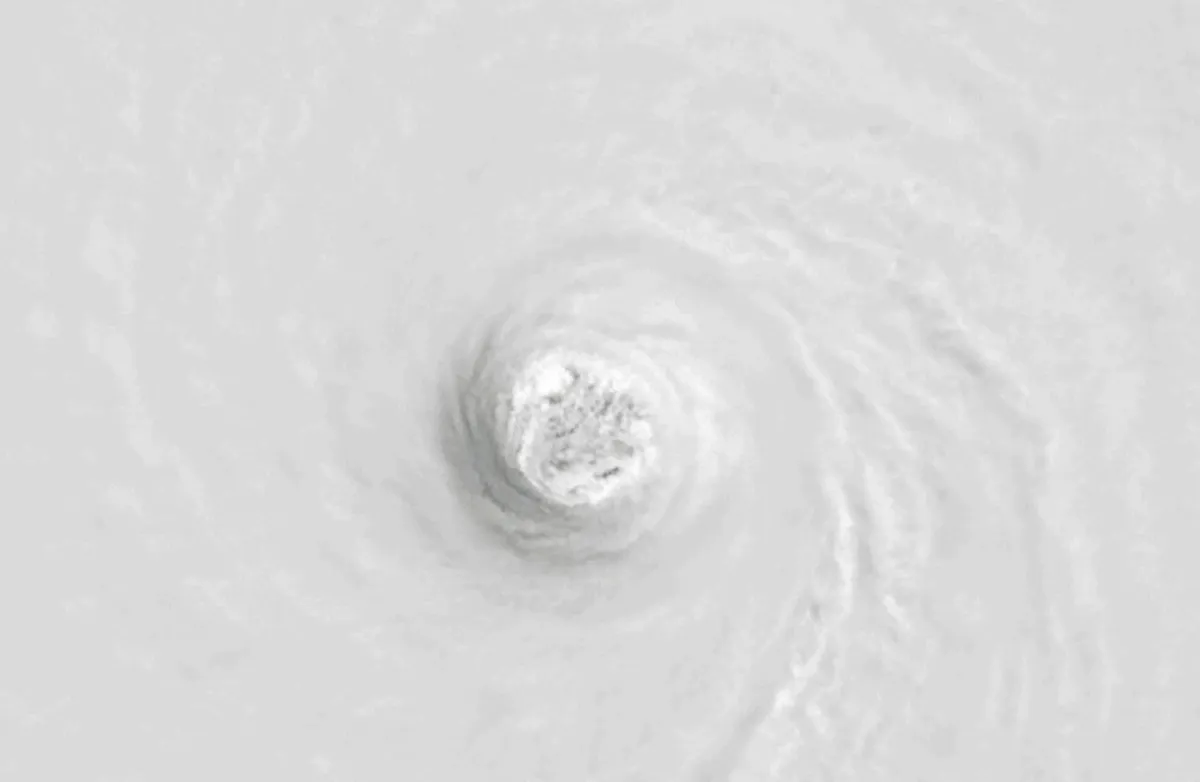
While Hurricane Polo has lost some of its power, the storm remains dangerous as it tracks towards a projected Monday landfall on the Baja California Peninsula in northwestern Mexico. Earlier this week, NOAA's Hurricane Hunters recorded footage from inside the eye of Polo, now the second-most intense storm (by pressure standards) ever documented in the eastern Pacific basin. In response to the rapid strengthening, NOAA's U. S. National Hurricane Center (NHC) called the intensification process “truly remarkable.”
NOAA-20 infrared and visible instrument captured Hurricane Polo on Sept. 22. (NOAA/Visible Infrared Imaging Radiometer Suite)A near-historic El Niño fuelled the perfect setup for the hurricane to approach the upper limit of how strong a tropical cyclone can grow. Polo underwent rapid intensification, growing from a tropical depression into a Category 5 hurricane in about 40 hours. It obtained a peak instensity om Tuesday, Sept. 22, with maximum, sustained winds of over 285 km/h, according to the NHC.
This article is an excerpt. To read the full content, visit the original source. The Weather Network
Related articles
Nor' easter to bring coastal flooding, winds to East Coast
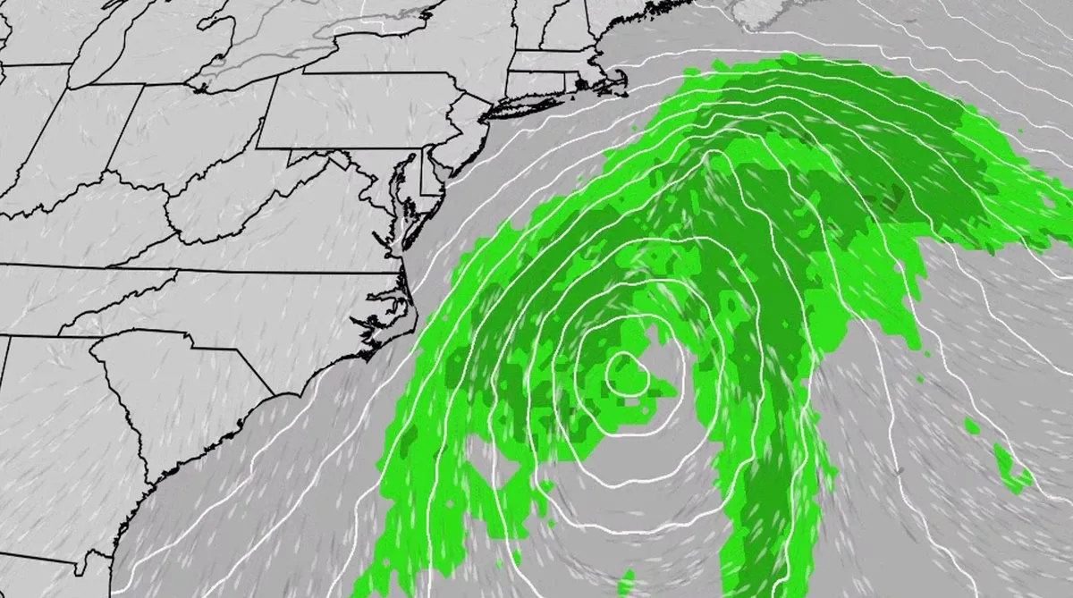
An October nor'easter is developing in the Atlantic, where it will bring high surf, rip currents, coastal flooding and winds to parts of the East Coast for several days this week. The National Hurricane Center has highlighted it as an area to watch this week for the potential development of Josephine. However, regardless of whether we call this system a nor'easter or Josephine, the impacts will be the same. The bottom line: This system will bring dangerous conditions to the East Coast for multiple days this week.(MORE: What is a nor'easter?)Fortunately, this nor'easter doesn't look to be as strong as the one in September. But the bad news? It could linger for much of the week, so impacts could have a longer duration. Coastal flood alerts are in effect for parts of coastal North Carolina and Virginia, where anywhere from 1 to 4 feet of inundation is possible. Get More of Our News on GoogleSet The Weather Company as a 'Preferred Source' to get quicker access to the news you value. Key takeawaysWe do not expect this storm to be as strong as the late September nor'easter.
Hurricane season maps tracker: Latest forecasts and more
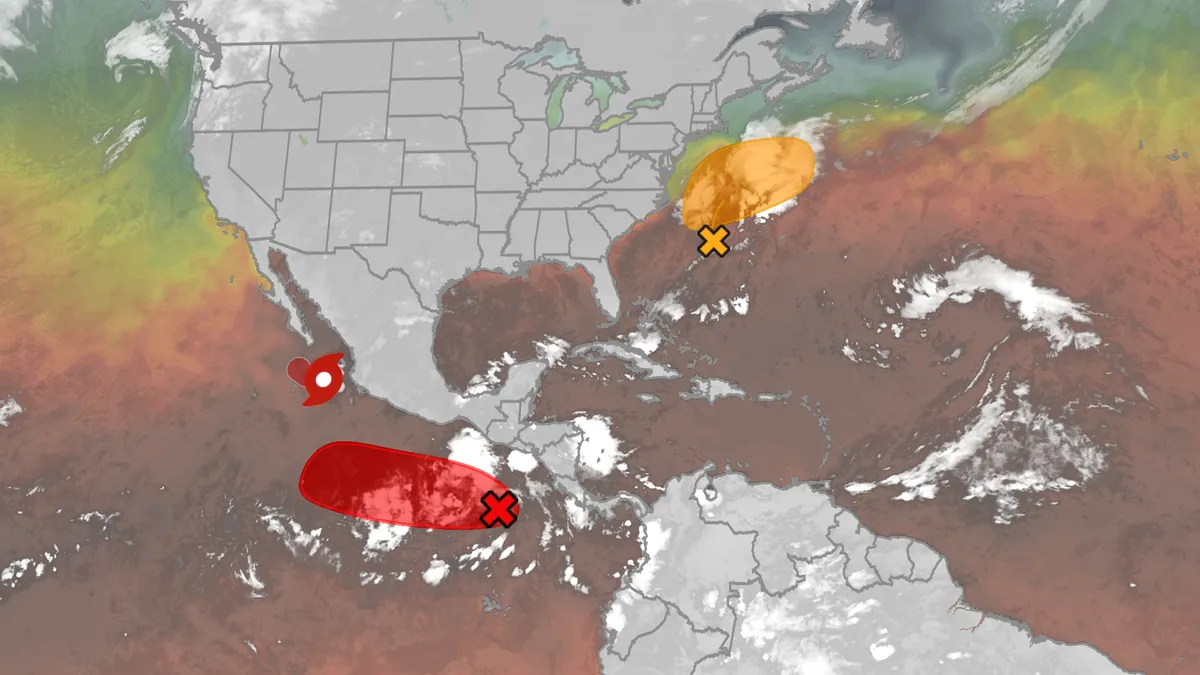
We have the maps you need to track all the systems ongoing in the Pacific and Atlantic below. Tracking the AtlanticTropical development areasSea surface temperatures Wind shear These are areas of strong wind shear, the difference in wind speed and direction with height, which are shown in purple. High wind shear is hostile to mature tropical cyclones and those trying to develop.(MORE: What is wind shear?)Get More of Our News on GoogleSet The Weather Company as a 'Preferred Source' to get quicker access to the news you value. Dry, dusty airAnother nemesis of tropical systems is dry air. In hurricane season, plumes of dust-laden air stream across the basin from Africa's Sahara Desert, as you can see in the map below. This sinking, dry air squelches thunderstorm development, the building blocks of tropical storms and hurricanes. So areas in the brown shading below are generally unfavorable for development. Atlantic tracks so far this seasonThese are the tracks of systems that were at least tropical or subtropical storms so far in the Atlantic Basin.

Winter storm checklist: What to do 72, 48, and 24 hours before it hits
Winter storm prep checklist: what to do 72, 48 and 24 hours outYou get the warning that a winter storm is coming: When you prepare matters as much as how you prepare. So I asked experts what you should do in the 72 hours, 48 hours and 24 hours before the storm arrives.(MORE: Your first freeze is coming — see average dates by region)Dan Stoneking spent a career in the U. S. Army and 15 years at FEMA. He’s now the founder and owner of Stoneking Strategic Communications. Remy Kennedy is a communications program manager with the American Red Cross. Both say you should create a checklist, and here’s what should be on it.72 hours before a storm: stock up and run errands“At 72 hours out, I like to tell people that’s basically the time you do all the things outside of your house,” Stoneking said. “One of the first things you want to do is evaluate your home situation,” Kennedy said. Who might need extra care in the cold? Kids, pets, older relatives, neighbors living alone. Then you need to make your errands list.
Brewing nor’easter threatens East Coast with days of coastal flooding, strong winds and pounding surf
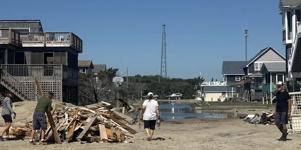
The next fall nor’easter is brewing off the North Carolina coast, setting the stage for extensive impacts throughout the week. The National Hurricane Center is now highlighting this area for potential tropical development, with a 30% chance over the next seven days. WHAT IS A NOR’EASTER? Regardless of tropical development, the Outer Banks are expected to see long-term impacts, including intense wind gusts from the approaching nor’easter, while the storm sits off the coast. The main concern for the Outer Banks region will be intense wind gusts as strong as 40 to 60 mph, fueling moderate coastal flooding and destructive waves. A mandatory evacuation for locals on Hatteras Island is in effect, as storm conditions are expected to worsen, with the potential for significant ocean overwash. This graphic shows the Wind Alerts for the upcoming Nor’easter.(FOX Weather) According to the FOX Forecast Center, the impacts will last through late Wednesday evening and into Thursday, totaling three days of nasty storms with ferocious wind gusts.
Where’s the frost? Southern U.S. hits freezing before Toronto, Montreal
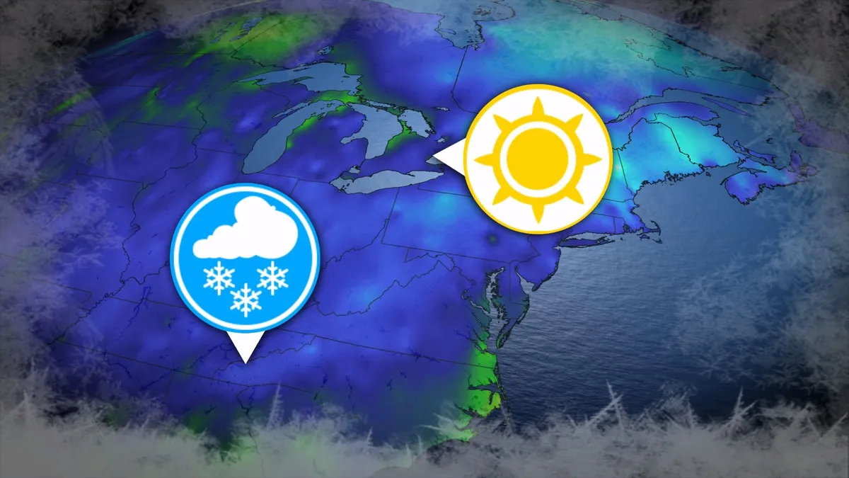
Toronto and Montreal have remained above the freezing mark every day for almost six months. While frosts and even some snowflakes have intruded across parts of Ontario and Quebec in recent weeks, the two cities have yet to reach that magic number. What’s even more remarkable is that a handful of communities across the southern United States have already dipped to the freezing point--and some have even seen accumulating snowfall. DON’T MISS: Official: Canada records first -30°C reading of the seasonThe last time we saw a freezing temperature in either Toronto or Montreal was the second-to-last week of April. Toronto hit -1.3°C early on April 20, while Montreal dipped to -2.0°C the following morning. Our average first frost in both cities occurs right around the middle of October. But warmer-than-normal years can see this milestone slide several weeks past due. Montreal once had to wait 207 consecutive days for its first frost, with the city’s first subfreezing temperature in 2017 waiting until Nov. 7. The latest Toronto’s had to wait to hit the zero-degree mark was Nov. 13, 2022.
345 km/h: Meet the world’s strongest tropical cyclones
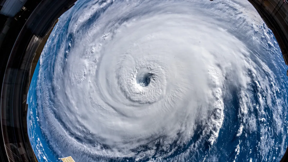
Tropical cyclones top the list of nature’s most powerful storms. Larger than tornadoes and more intense than any single thunderstorm, these systems can change the landscape when they swirl ashore. A handful of tropical cyclones take full advantage of their surroundings to achieve the apex of their potential, the strongest storms nature can produce. DON’T MISS: What’s the difference between hurricanes, typhoons, and cyclones? Tiny fraction of storms achieve upper limitsOnly about 4 per cent of all the world’s recorded tropical cyclones have reached the equivalent of Category 5 strength. Most tropical cyclones are relatively weak and short lived because it’s tough for all the necessary ingredients to align just right. But explosive development can result when all those factors come together in perfect harmony. Strongest Winds: Hurricane PatriciaAn exceptionally favourable setup off the western shores of Mexico in late-Oct. 2015 allowed Hurricane Patricia to grow into the world’s strongest hurricane since reliable observations began in 1966.
0 comments
No comments yet. Be the first to share your thoughts!