BBlogFlow

Categories

Weather

4070 articles

Weather

Steve Bender: Reflecting on Hurricane Helene 2 years later from a place close to home

NORTH CAROLINA — There are places you cover as a meteorologist that you know you'll remember. Then there are places that become part of you. For me, western North Carolina is one of those places. Long before the historic flooding from Hurricane Helene, before the images of homes ripped apart by rushing water, and the piles of debris and roads washed away from muddy landslides, I knew Asheville as a place of adventure. A place I experienced as a kid where I once wandered. REMAINS BELIEVED TO BE LINKED TO HURRICANE HELENE VICTIM DISCOVERED YEARS AFTER DEADLY STORMI have fond memories with my family coming up to Asheville to hike, ride bikes and take in the fall foliage. I remember the rows of mountains, the winding roads and that feeling you get when you look out across the Blue Ridge and realize just how small you are. Meteorologist Steve Bender reports on Hurricane Helene from Asheville, North Carolina, in 2024. (David Rubin / FOX Weather)It was a place to explore and a place to slow down. A place that, even as a kid, somehow felt different. It was a place that my parents wanted to share with us.

Fox Weather·
Weather

Gateway Arch goes dark for bird migration; how you can help

The Gateway Arch is going dark all month. Here's why you should tooThe Gateway Arch in St. Louis is going dark for bird migration all September long. But this is just a start; below are some tips for how you can help at home. Why St. Louis? St. Louis sits along the Mississippi Flyway, a corridor used by about 40% of the nation's migratory waterfowl, which makes the city's glow especially costly. Birds often mistake the glow of the arch for a celestial object, becoming confused and disoriented. The National Park Service has been doing this every spring and fall since 2002, and it has helped save millions of birds. Mississippi River night view of the St. Louis skyline. The Gateway Arch turns off its night lights during the month of September to protect migrating birds. (Bettmann Archive)Why birds migrate at nightAbout 80% of birds migrate overnight. After all, flying takes a lot of work, especially when they keep going for hours. Birds may be little meteorologists because they know that those cooler nights are helpful for maintaining body temperatures. Birds flying on a November night in Hamburg, Germany.

The Weather Channel·
Weather

Bryan Norcross: Last day of nor'easter as the Atlantic minimally stirs, Polo to bring flooding to Southwest

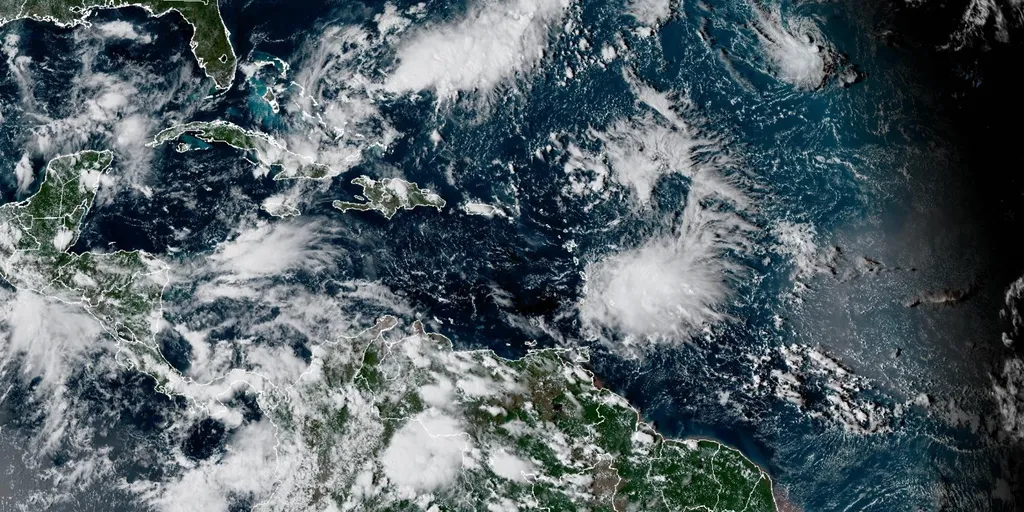
Updated at 12 p.m. on Monday, Sept. 28, 2026. NOR'EASTER FADESThe system that was the mighty nor'easter has fully merged with an upper-level low-pressure system. It's now a weak version of its former self, but it's still going to spread gusty winds and rain from Long Island, New York, through New England. The storm's moisture will move out of the Northeast later today and clear New England tomorrow. NOR'EASTER TO BRING FINAL DAY OF RAIN TO MILLIONS AS COMMUNITIES ASSESS FLOOD AND BEACH DAMAGEWarm weather returns to the East Coast by midweek as the leftovers of the Midwest heat dome shift east behind the nor'easter. IN THE ATLANTIC Tropical activity in the Atlantic basin. (Bryan Norcross / FOX Weather)Tropical Depression Fay is still chugging along but going nowhere. It will die out in a day or two in the middle of the Atlantic. To Fay's north is another small disturbance. The National Hurricane Center gives it a high chance of becoming a depression or Tropical Storm Hanna. In any case, it won't be a threat to land. HURRICANE POLO WILL MAKE LANDFALL TODAY, FUELING A FLOOD THREAT FOR MILLIONS AS TROPICAL STORM RACHEL FORMSHURRICANE POLO AND THE U. S.

Fox Weather·
Weather

After the hottest summer on record, where will September rank in the history books?

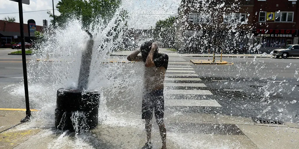
Let's see what the prediction markets, sponsored by Kalshi, are saying about where September will rank among the hottest months on record. The U. S. experienced its hottest summer on record in 2026. Now, as September enters its final act, where will the month rank in the history books? September has cooled slightly, but it's towing a close line towards being the hottest on record around the world.  People cool off at fountains in Madrid Rio district in the Spanish capital during a heat wave, on September 6, 2026.  (Oscar DEL POZO / AFP via Getty Images / Getty Images)Global temperatures remain on pace to make September one of the warmest ever measured, despite tracking about 0.2 degrees Fahrenheit below the record set in September 2023, according to the Copernicus Climate Change Service. The five hottest Septembers on record were 2023 at 61.5°F, 2024 at 61.1°F, 2025 at 61.0°F, 2020 at roughly 60.7°F and 2019 at roughly 60.6°F, according to Copernicus’ ERA5 dataset. If September 2026 finishes near its current projection of about 61.3°F, it would rank as the second-hottest September on record, behind 2023.

Fox Weather·
Weather

Three earthquakes strike off the coast of British Columbia, no tsunami threat

Between Sunday night and early Monday morning, three earthquakes occurred off the coast of British Columbia. The largest of the quakes measured magnitude 5.4 and was located west-southwest of Port Hardy. The two other quakes had magnitudes of 4.9 and 5.2. According to the National Weather Service, there is no tsunami threat stemming from these seismic events. Additionally, there are no reports of injuries or damage to infrastructure in the affected region. Such seismic activity is not uncommon off the coast of B. C., where tectonic plates interact along the Cascadia Subduction Zone. This event marks the most significant earthquake activity in the area since August 1, 2026. DON'T MISS: Earthquakes are a risk in Canada. Here’s how to stay safeB. C. is prone to earthquakes, a reminder to be preparedWhile these recent earthquakes caused no damage and did not trigger a tsunami threat, they emphasize the importance of emergency preparedness for British Columbians. Content continues belowThe Pacific Coast is the most earthquake-prone region of Canada, and seismologists with the Geological Survey of Canada record and locate more than 1,000 earthquakes in Western Canada each year.

The Weather Network·
Weather

Ontario’s weeks-long dry streak continues, tropical moisture may lurk

Many communities across southern Ontario are in the midst of their longest dry streaks of 2026. Expect this rain-free spell to continue for a while longer, potentially matching or besting the 16 consecutive dry days Toronto experienced in 2025. Signs of change lurk on the horizon heading into the end of next week as Hurricane Polo eventually pushes inland. DON’T MISS: El Niño could delay persistent frost and hard freezes across CanadaSeveral weeks without measurable precipitationConditions for most of September have been a welcome reprieve for southern Ontario after a damp, stormy, and rainy summer throughout the region. Persistent centres of high pressure over the Great Lakes have deflected most opportunities for precipitation; in fact, southern Ontario hasn’t seen a drop of rain since Sept. 16. We have to look back to the end of May to find the last equivalent dry streak. An average September produces about 69 mm of rain at Toronto-Pearson Airport. This month has only recorded 48.1 mm of rain, almost all of which fell during the severe thunderstorms on Sept. 2. Content continues belowSuch a spell of dry weather isn’t terribly unusual for this time of year.

The Weather Network·
Weather

Atlantic goes more than 300 days without a hurricane as historic drought nears milestone

Eyeing the Atlantic for potential tropical activity Tropical Depression Fay is expected to dissipate in the Atlantic in the next day or so, as forecasters monitor a new potential tropical threat, with Invest 91L having a medium chance of development over the next 48 hours. THE TAKEAWAYThe Atlantic remains unusually quiet as El Niño-driven winds suppress activity, with just seven named storms so far. The National Hurricane Center has designated Invest 91L and is showing increased signs of development as it quickly moves northeast. Meanwhile, Tropical Depression Fay is barely maintaining its tropical characteristics, producing only a few thunderstorms around its center. It has been over 330 days since the last hurricane formed in the Atlantic, extending the drought as September nears its end without a single hurricane developing in the basin. The last hurricane to form in the Atlantic was Hurricane Melissa, which developed on Oct. 13, 2025. HURRICANE POLO EXPECTED TO FUEL SOUTHWEST FLOOD THREAT AMID ACTIVE PACIFICThe hostile El Niño-driven winds have suppressed activity across the Atlantic this season, with just seven named storms so far.

Fox Weather·
Weather

Deadly nor'easter lingers; tens of thousands without power

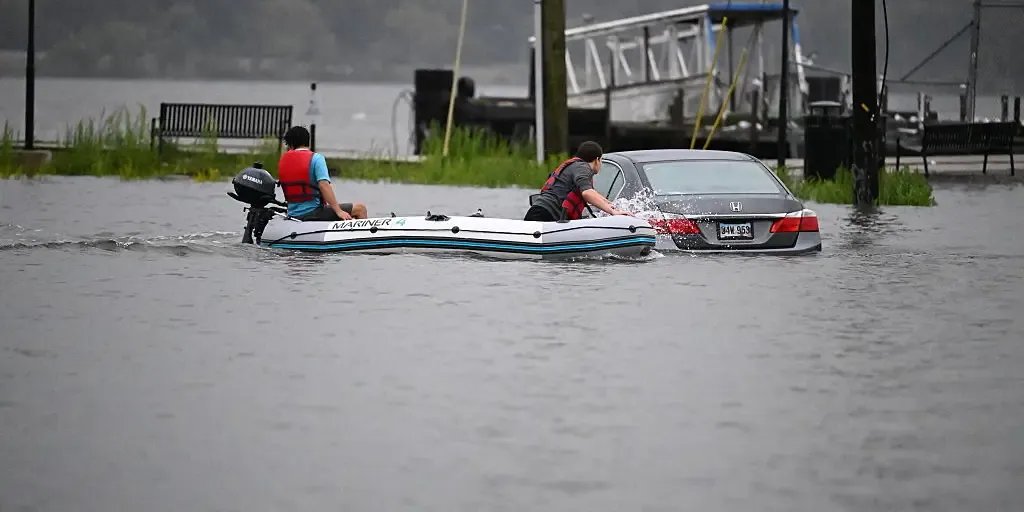
A sluggish but potent nor'easter is lingering over the Northeast Monday after submerging communities from North Carolina to New England while knocking out power to well over 100,000 customers. Some rain and windy conditions will continue, as well minor coastal flooding during high tides. The early-season storm comes amid the highest king tides of the month for the East Coast. A state of emergency was declared in New Jersey, southern New York and in multiple local communities across the Northeast ahead of the storm. (FORECAST DETAILS: Nor'easter to hammer New England through Monday) Strong winds turn deadlyThe New York City Housing Authority said one of its employees was killed by a fallen tree in Brooklyn as the storm pelted the city with rain and strong winds. ABC7NY reports that the 56-year-old man was walking in a parking lot when the tree came crashing down. Get More of Our News on GoogleSet The Weather Company as a 'Preferred Source' to get quicker access to the news you value. "We are deeply saddened by this tragic loss and extend our heartfelt condolences to his family and the NYCHA community," the statement from the NYCHA said.

The Weather Channel·
Weather

See it: Powerful nor’easter unearths 19th-century shipwreck on New England shore

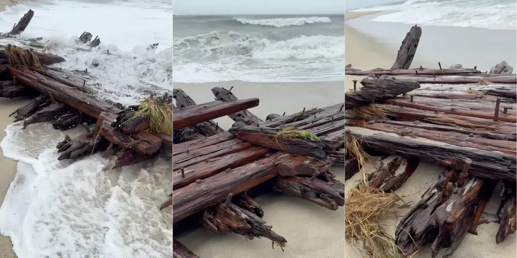
THE TAKEAWAYNor’easter erosion exposes long-buried shipwreck remains. The wreckage may be connected to a schooner that ran aground in 1884. The ship’s crew was rescued in a dramatic overnight operation. NANTUCKET, Mass. - As a powerful nor’easter lashed the East Coast, relentless wind, rain and waves triggered colossal coastal erosion on Nantucket, unearthing a piece of the island’s maritime history. A large section of a shipwreck was spotted Saturday along Nantucket’s south shore on the beach near Point of Breakers and the Sewer Beds, where relentless waves caused significant coastal erosion. The wooden wreckage is believed to be part of the 19th-century schooner Warren Sawyer, which ran aground near Miacomet Beach on Dec. 22, 1884, the Nantucket Current reported. The doomed ship was traveling to Boston from New Orleans, hauling a cargo of cotton and scarp iron when it was blown off course by gale-force winds. HOW WEATHER TURNED THE GREAT LAKES INTO A SHIPWRECK GRAVEYARD Coastal erosion along Nantucket’s south shore, visible in the background, uncovered a piece of history as a nor’easter sent crashing waves toward the East Coast.

Fox Weather·
Weather

Nor’easter batters East Coast with flooding and dangerous surf — here’s where impacts are the worst

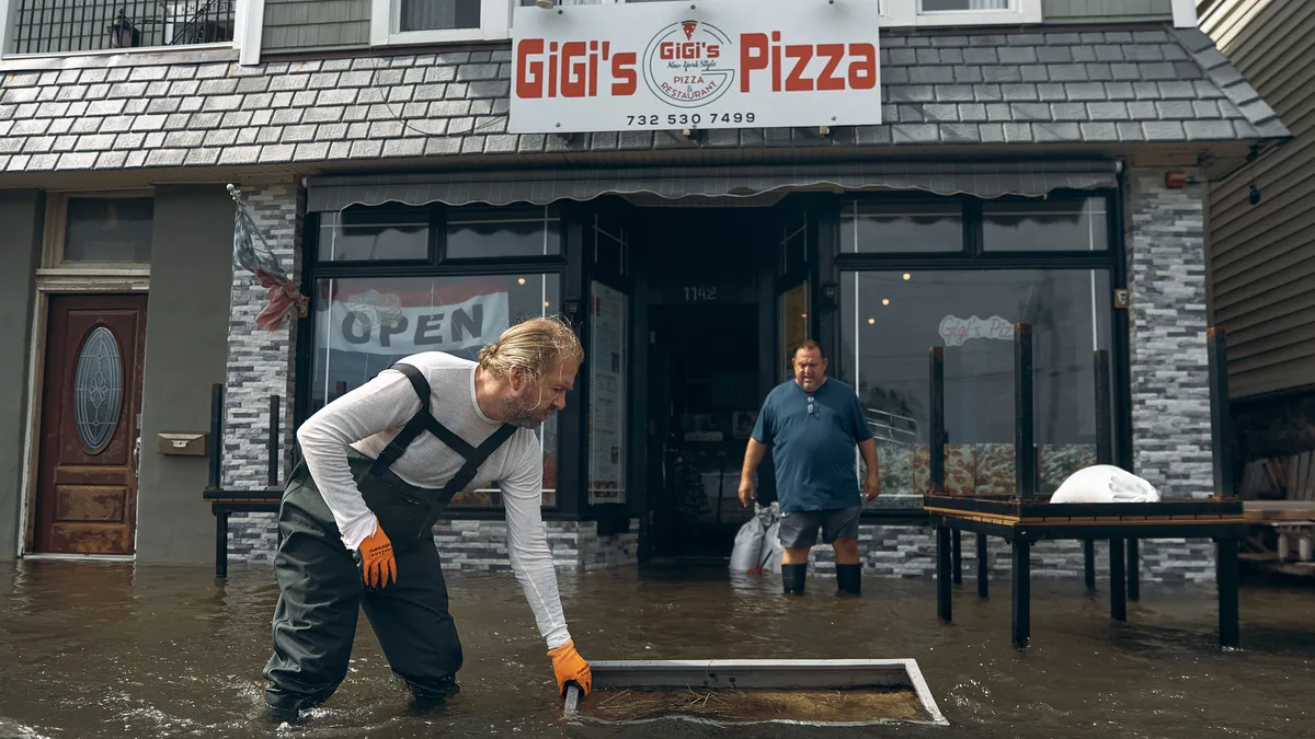
THE TAKEAWAYThe East Coast sees significant impacts from heavy rain and strong winds to flooding. The nor'easter is affecting over 40 million Americans. Areas such as Kill Devil Hills, North Carolina, have experienced waves as tall as 12 to 15 feet. The first nor’easter of the fall has arrived and is packing a punch for over 40 million Americans this weekend, bringing dangerous storm conditions to the East Coast. Communities in the Mid-Atlantic and Northeast regions are seeing significant rain, flooding and coastal erosion, with more severe weather to come. "As the low-pressure center tracks northward towards Long Island, rain will become heavy at times across southern New England where several inches may lead to inland flooding," the FOX Forecast Center said. TIMELINE: WHERE AND WHEN YOU WILL SEE IMPACTS FROM THE STRENGTHENING NOR'EASTER THIS WEEKENDAs conditions worsen, FOX Weather meteorologists and correspondents will keep you up-to-date with the latest conditions. New JerseyNew Jersey has been the center of attention on Saturday, with popular locations such as Ocean City and Belmar under a High Wind Warning and Coastal Flood Warning.

Fox Weather·
Weather

This 'spaceship' isn't headed to Mars — it's drifting in Arctic ice

Crew begins 8-month Arctic drift as test for Mars missionsA dozen people are about to undergo an incredible journey, all in the name of science. For eight long months, they won’t leave the confines of a laboratory drifting across the Arctic Ocean — an oval-shaped, 88-foot, alien-looking vessel called Tara Polaris I. They won’t even see the sun for most of that time, in a place where average winter temperatures sit at minus 13 degrees Fahrenheit. And this journey is just the first of 10 research drifts planned over the next 20 years by the Tara Ocean Foundation. But why are they doing it? The research covers a broad range: studying the human ability to endure extremes, serving as a trial run for future deep-space exploration to Mars and uncovering secrets about our own planet’s changing climate by analyzing the biodiversity of the world’s fastest-warming region. An infographic explaining the technology and what it is capable of studying on the Tara Polaris I.(Tara Ocean Foundation)Human studyBefore we zoom out to the planet or even farther, space, let’s start with the smallest, but not least important, subject of this study: the human individual.

The Weather Channel·
Weather

The 2026 Super El Niño is Breaking Records, With Winter 2026/2027 Weather Impacts Ahead

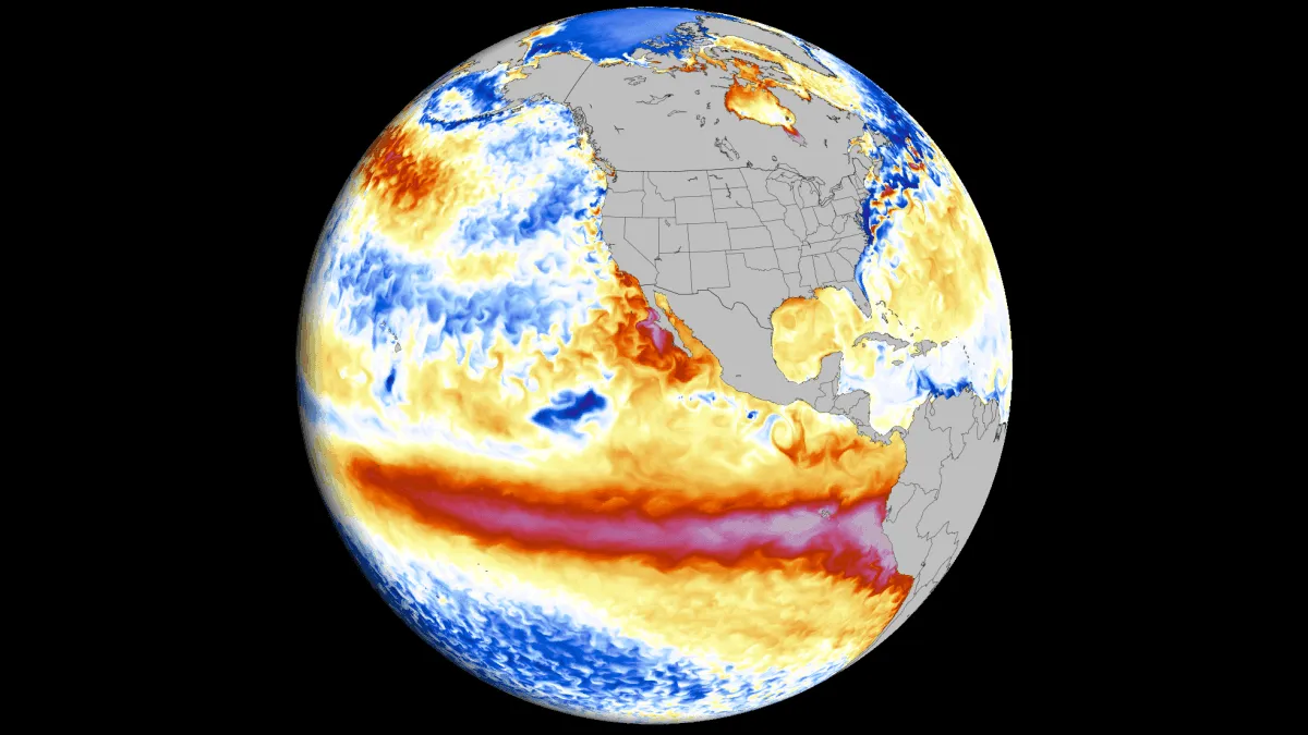
The 2026 Super El Niño continues its historic rapid intensification across the equatorial Pacific ahead of Winter 2026/2027. New oceanic and atmospheric data confirm another major jump in strength. Latest long-range data predict this event is on track to become one of the most intense El Niño events in over a century. This surge in power is driven by record-breaking westerly wind bursts and a collapse of the Pacific trade winds. The atmosphere is already responding worldwide, locking in a stationary wave pattern that will dominate global circulation for several months, likely deep into Spring. Below, I break down the record atmospheric and ocean anomalies, the deep subsurface Kelvin wave, and the latest peak projections for early Winter, including pressure-pattern impacts. Finally, you will be able to use my new Winter Forecast Explorer to see the latest temperature, precipitation, and snowfall forecasts for every state/province in the United States and Canada, and countries across Europe and Asia. Super El Niño 2026: How Extreme Events Reshape Winter Weather El Niño is a warm ocean anomaly in the central and eastern Tropical Pacific.

Severe Weather Europe·
Weather

Strong jolt shakes Dominican Republic as magnitude 4.8 earthquake strikes

The earthquake struck at 5:49 p.m. EDT about 6.8 miles west of Guaymate, at a depth of 66.7 miles. THE TAKEAWAYResidents across the Dominican Republic were rattled by a magnitude 4.8 earthquake. The earthquake struck at 5:49 p.m. EDT about 6.8 miles west of Guaymate. Light to moderate shaking was reported across parts of the island, according to the USGS. Residents across the Dominican Republic were rattled by a magnitude 4.8 earthquake Sunday evening. SEE IT: FIERY TORNADO-LIKE 'TEPHRA DEVIL' SWIRLS ON HAWAII'S KILAUEA VOLCANOThe U. S. Geological Survey (USGS) said the earthquake struck at 5:49 p.m. EDT about 6.8 miles west of Guaymate, at a depth of 66.7 miles. Light to moderate shaking was reported across parts of the island, according to the USGS. A magnitude 4.8 earthquake hit Dominican Republic.  (FOX Weather)This means the shaking was felt indoors by many people, while only a few people reported feeling it outdoors. Dishes, windows and doors were disturbed, while some people reported cracked walls and described the shaking as feeling like a truck had struck the building. Parked motor vehicles were also reported to have rocked noticeably.

Fox Weather·
Weather

Bryan Norcross: Nor'easter winds down while the Atlantic is mostly quiet as Hurricane Polo heads for landfall

Hurricane Polo and Nolo continue to churn in the Pacific HURRICANE UPDATE: A parade of storms continues to brew across the Pacific as Hurricane Nolo is expected to become a major hurricane as it gradually strengthens. Meanwhile, Hurricane Polo threatens the Southwest U. S., fueling a level 3 out of 4 flood threat across more than 10 states. Updated at 12 p.m. on Sunday, Sept. 27, 2026. NOR’EASTER UPDATEThe nor'easter just offshore of the New Jersey coast is weakening. The trend will continue through the day as the system slowly moves away from New Jersey tonight. Where winds are onshore, flooding is still likely at high tide times today. Flooding is still possible in bays, harbors, and sounds where the water is trapped. Midday high tides at the western end of Long Island Sound might affect operations at LaGuardia Airport in New York, for example. NOR'EASTER TURNS DEADLY AS STORM LASHES THE EAST COAST WITH MORE DESTRUCTIVE FLOODING, VIOLENT WINDSStay aware of National Weather Service alerts for your area. Later in the day, as the winds subside, the floodwaters that have been held in place will be able to begin to drain. next SURF CITY, NEW JERSEY, USA - SEPTEMBER 26: A view of a

Fox Weather·
Weather

Nor'easter turns deadly as storm lashes the East Coast with more destructive flooding, violent winds

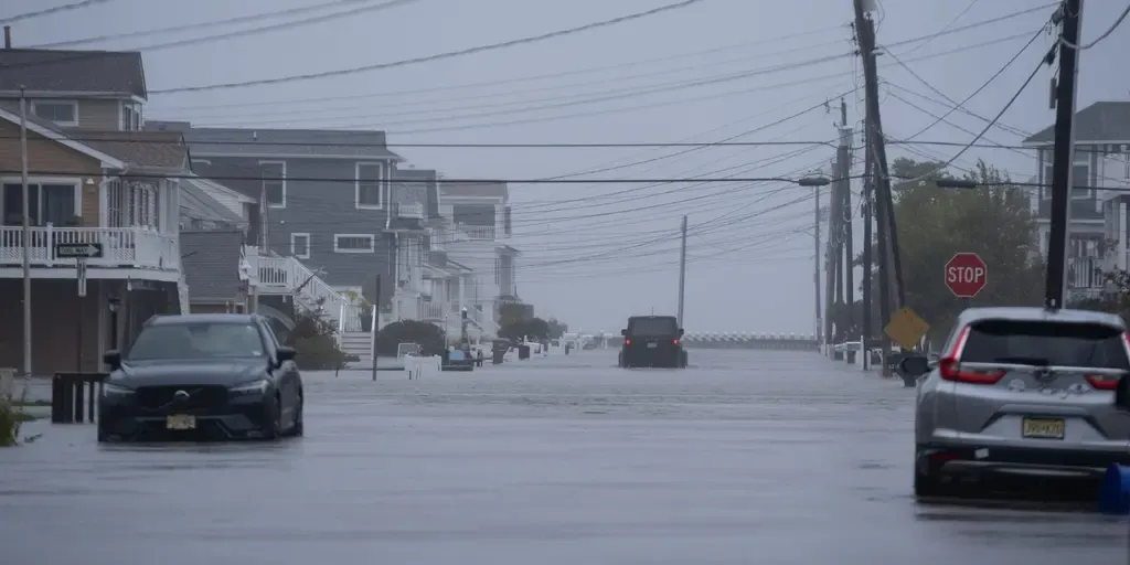
THE TAKEAWAYBoston metro and coastal Massachusetts: Pounding rain, street flooding and powerful wind gusts up to 60 mph continue. Long Island and NYC corridor: Vicious 50 mph wind gusts, driving heavy wave action along south-facing ocean beaches. Outer Banks and the Jersey Shore: Waves remain extremely high (up to 18 ft) with ongoing severe beach erosion and persistent inundation during high tide cycles. The monster nor'easter is still slamming millions as it makes a direct hit along the New Jersey coastline, lashing the East Coast from North Carolina's Outer Banks all the way up to New England with intense wind gusts, severe beach erosion and destructive high tide flooding. The storm makes its dramatic turn onshore in New Jersey today, fueling its final act of violent winds that may knock out thousands of more power outages. As a result of the deadly weather conditions, a 56-year-old man was killed by a falling tree in Brooklyn, New York, as strong winds slammed New York City and the Northeast on Saturday. Nor’easter FOX Weather Threat Zone.(FOX Weather) The nor’easter has already left behind a wide swath of damage along the East Coast, from New England to the Outer Banks.

Fox Weather·
Weather

Weather Of The World: September 27

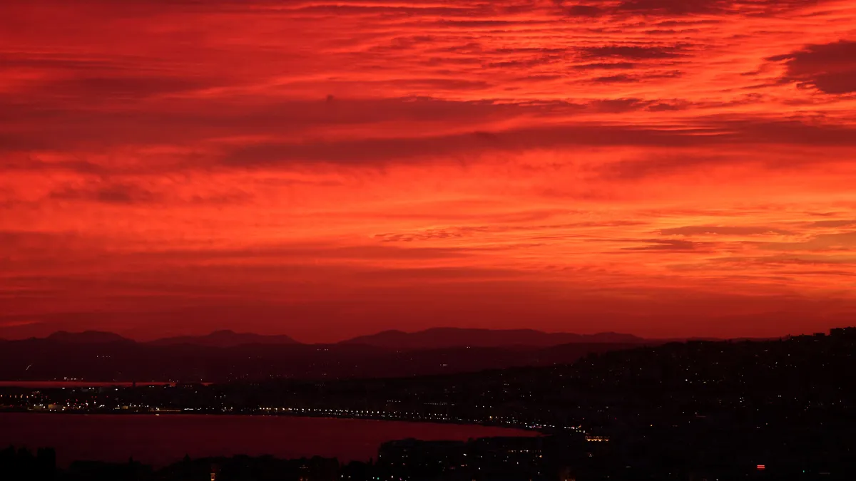
Wander the world one snapshot at a time. Explore striking moments of weather in motion in this week's slideshow. ByAda Wood•September 27, 2026Updated: September 27, 2026, 7:18 am EDTPublished: September 27, 2026, 7:00 am EDTA sunset over the "Baie des Anges" on the French Riviera city of Nice, southeastern France, on Sept. 24, 2026.(Valery HACHE/AFP via Getty Images)F​rom a burning red sunset in France to a burning wildfire in Spain, it has been another busy week of weather around the world. Here are some of the most jaw-dropping and awe-inspiring weather photos we found this week. Spain's firefighters attempt to extinguish a forest fire near the hamlet of Baltar, close to the town of Xinzo de Limia in northwest Spain, on Sept. 24, 2026. The blaze has burned more than 345 acres. Eight helicopters and nine aircraft were deployed alongside ground crews.(Adrian Irago/AFP via Getty Images)A tourist visits the Mer de Glace Ice Cave in the "Mer de Glace" glacier in the Mont Blanc Massif, French Alps, central-eastern France, on Sept. 23, 2026.

The Weather Channel·
Weather

Weather Whiz: September 27

How well have you been paying attention to the weather this week? Here are five questions that will test your knowledge of what's been going on. QUESTIONSWhat is the name of the annual tournament currently underway that celebrates one species' preparation for winter hibernation? Fire tells a story through the way it moves. By reading how a blaze traveled, ________ can trace its path in reverse, straight back to where it started. Yellowstone's geysers ate 280 ________ this year — blame the wind. A combination of deep low pressure and winds made which hurricane the strongest tropical cyclone anywhere on Earth so far in 2026? The ________ opens a roughly two-month stretch when geomagnetic storms and northern lights become more common..... ANSWERSFat Bear WeekFire investigatorsHatsPoloFall equinox How did you do this week? Come back for more exciting weather questions next week, or risk showing up to trivia night unprepared! Get More of Our News on GoogleSet The Weather Company as a 'Preferred Source' to get quicker access to the news you value.

The Weather Channel·
Weather

A gap the size of a pencil is all mice need to get inside

How to keep mice out of your home before the first cold nightWhen temperatures drop in fall and winter, mice might seek your home for food and shelter. And it only takes a quarter-inch gap — about the diameter of a pencil — or a hole as small as a dime for them to squeeze through and make it inside. Here’s your guide on how to protect your home from any uninvited mouse friends. Where they get inThere are many small, hidden places mice can use to get inside your home.

The Weather Channel·