BBlogFlow

Categories

Weather

4067 articles

Weather

Tropical one-two punch threatens Southwest with days of heavy rain and major flooding

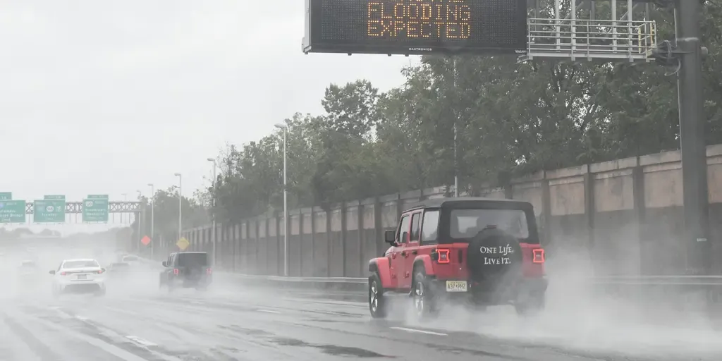
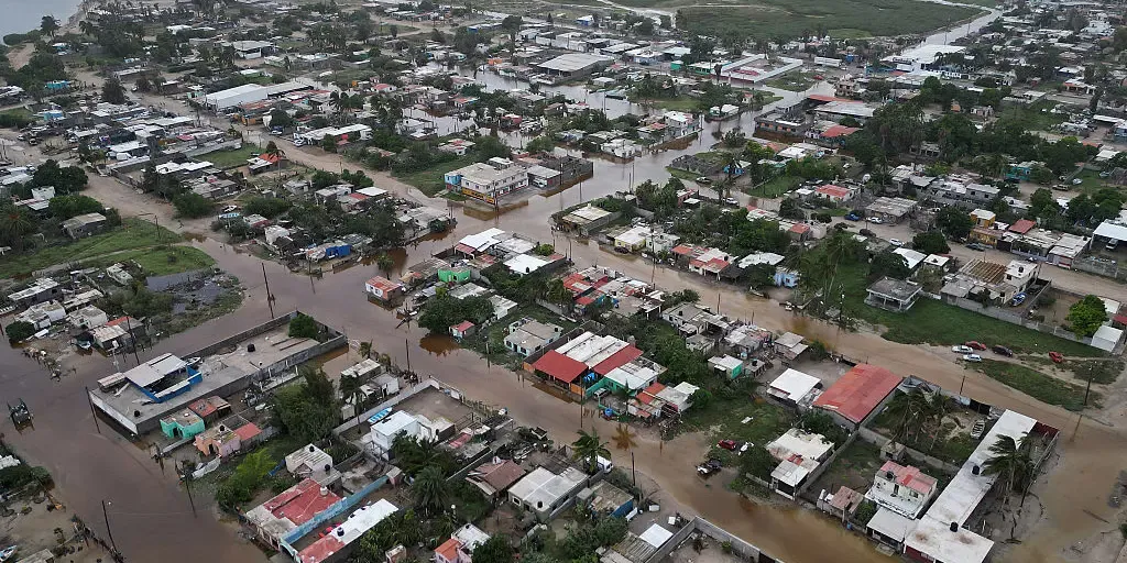
Hurricane Polo blasts across Mexico, moisture fueling dangerous flood threat across US Southwest Hurricane Polo made landfall as a Category 2 storm on Baja California Sur, Mexico, late Monday. Polo is bringing damaging wind gusts and life-threatening flash flooding to the region, according to the National Hurricane Center (NHC). The storm is forecast to make a second landfall in mainland Mexico later Tuesday after tracking over the Gulf of California. In addition, moisture from Hurricane Polo is fueling life-threatening flooding across the southwestern U. S. The Southwestern U. S. is set for wet, nasty storm conditions this week as Tropical Storms Polo and Rachel threaten the region with flooding. A major flood threat over the next few days will plague the Southwest as tropical moisture from Polo and Rachel surges northward from Mexico. TIMELINE: WHEN WILL DANGEROUS, TROPICALLY ENHANCED FLOODING REACH THE SOUTHWEST, SOUTHERN PLAINS AND MIDWEST? On Tuesday, a surge of tropical moisture will target the Southwest across Arizona, New Mexico and Colorado, with 1 to 2 inches of rain, and over 2 inches for the Texas and Oklahoma Panhandles.
Fox Weather·
Weather

Warmest El Niño on record as Pacific temperatures hit new high

The current El Niño has now been confirmed as the strongest ever observed, with sea surface temperatures in the critical Niño 3.4 region of the equatorial Pacific surpassing all previous records. This area, where NOAA officially monitors ENSO patterns, registered a record-breaking temperature of +29.822°C on September 25, edging out the previous high of +29.82°C set on November 17, 2015. Remarkably, this milestone has been reached nearly two months ahead of the typical peak of El Niño events — a phenomenon that is continuing to intensify. DON'T MISS: Latest forecast calls for a historic El Niño to peak this winterCurrent forecasts suggest this El Niño will reach its peak between late fall and early winter, potentially adding further strength to its already significant impacts. Why does this matter? The unprecedented marine heatwave created by this event is expected to fuel Pacific hurricanes and could contribute to heat, flooding, and drought patterns worldwide. El Niño’s widespread influence underscores the importance of closely monitoring its progression. WATCH: A strengthening El Nino impacts fall & winter across CanadaWith files from MétéoMédia

The Weather Network·
Weather

Hurricane Polo lashes Mexico with life-threatening flooding as Tropical Storm Rachel churns in the Pacific

Hurricane Polo blasts across Mexico; Polo's moisture fueling dangerous flood threat across US Southwest Hurricane Polo made landfall as a Category 2 storm on Baja California Sur, Mexico, late Monday. Polo is bringing damaging wind gusts and life-threatening flash flooding to the region, according to the National Hurricane Center (NHC). The storm is forecast to make a second landfall in mainland Mexico later Tuesday after tracking over the Gulf of California. In addition, moisture from Hurricane Polo is fueling life-threatening flooding across the southwestern U. S. THE TAKEAWAYHurricane Polo made landfall as a Category 2 storm on Baja California Sur, Mexico, late Monday. Polo's moisture and moisture from Tropical Storm Rachel are expected to fuel a weeklong flood threat 30 U. S. states. Rachel became the 20th named storm in the Central and Eastern Pacific this season as a strengthening El Niño supercharges the basins. Hurricane Polo made landfall as a Category 2 storm on Baja California Sur, Mexico, late Monday. Polo is bringing damaging wind gusts and life-threatening flash flooding to the region, according to the National Hurricane Center (NHC).

Fox Weather·
Weather

Nor'easter brings final day of rain to millions as communities assess flood and beach damage

THE TAKEAWAYA 56-year-old man was killed by a falling tree in Brooklyn, New York, Saturday; 67 people have been rescued in Sea Bright, New Jersey. Millions from North Carolina's Outer Banks to New England saw intense wind gusts, severe beach erosion and high tide flooding along the coast. By Tuesday, what's left of the storm will spread light rain into northern New England while the Mid-Atlantic and New York Tri-State Area dry out. A lingering nor'easter delivered a final round of rain to most of the Northeast after the monster storm blasted the coast with 60 mph wind gusts over the weekend, toppling trees and power lines, as well as bringing significant flooding to some coastal communities. Millions from North Carolina's Outer Banks to New England saw intense wind gusts, severe beach erosion and high tide flooding along the coast as the storm meandered just off New Jersey before moving onshore Saturday. SEE IT: POWERFUL NOR’EASTER UNEARTHS 19TH-CENTURY SHIPWRECK ON NEW ENGLAND SHORE next EDGEWATER, NEW JERSEY, USA - SEPTEMBER 26: Two people on a boat look closely at a vehicle submerged in floodwaters in the parking lot along the Hudson River during a nor'easter storm in

Fox Weather·
Weather

Why eclipses feel so frequent: Eclipse seasons explained

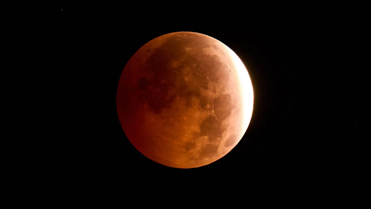
Why are there so many eclipses? It's not because they're more commonSome people think an eclipse is a super rare phenomena — but most people don't know that there are actually "eclipse seasons" every year. If it feels like eclipses happen much more often than they used to, there’s an explanation for that too. What is an eclipse season? First, what even is an eclipse? In simple terms, it’s an alignment of the Earth, sun and moon. When the moon passes between the sun and Earth, that’s a solar eclipse. When Earth passes between the sun and moon, that’s a lunar eclipse. An eclipse doesn’t happen every time they pass one another; only at specific times of the year when they align in a particular way. This is how regularly occurring eclipse seasons are possible. An eclipse season is a period of about one month that occurs roughly every six months. During a season, there is usually at least one lunar eclipse and one solar eclipse, totaling two lunar and two solar eclipses every year.

The Weather Channel·
Weather

Maui wildfire survivors show elevated metals linked to lung harm, study says

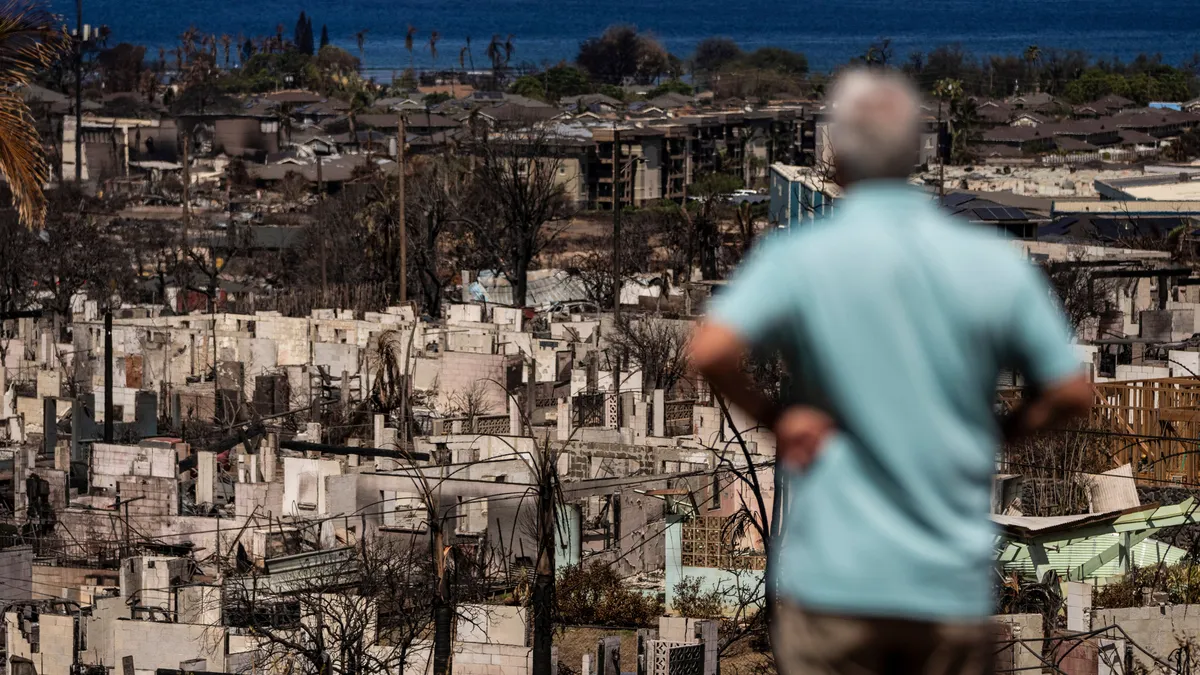
Destroyed buildings and cars are seen in the aftermath of the Maui wildfires in Lahaina, western Maui, Hawaii on August 17, 2023. (Yuki Iwamura/ AFP via Getty Images)Metal mixtures found in the leftover smoke, ash and debris from the deadly 2023 Maui wildfires were harmful to the lung health of people living nearby long after the burning ended, a new study says. The work shows that major wildfires could have lasting effects beyond immediate exposure. Post-wildfire air quality needs to be monitored longer term, the research suggests, and recovery efforts need to consider what might remain in contaminated soot, residue and dirt well after burning stops.(WATCH: Wildfire smoke effects on your body can last for years)The wildfires, caused by wind spreading a brushfire spurred by downed power lines, burned on the Hawaiian island of Maui in August 2023, destroyed the town of Lahaina and killed more than 100 people. They were among the deadliest in U. S. history. New research published in the journal Proceedings of the National Academy of Sciences on Monday found higher metal levels, associated with respiratory harm, in nearby residents up to a year and a half after the fires.

The Weather Channel·
Weather

Gutter cleaning: one of your most dangerous fall chores

Gutter cleaning safety: how to avoid a dangerous fallLeaves are falling and clogging your gutters. When the time comes to clean/clear those gutters, it might be one of the most dangerous things you'll do around the house this fall. Here’s what you need to know before you pull out the ladder. Why you should clean your guttersGutters are made to channel rainwater away from your home and prevent water damage and basement flooding. When they’re clogged by leaves, they can’t do their job. Water pooling around your foundation can cause cracks, which can be a costly repair and may lead to structural problems. That water can also damage your roof shingles, leading to rot, leaks and mold growth.(MORE: Fall homeowner checklist: Do these 17 things before winter)A clogged gutter is also the perfect home for unwanted pests, including mosquitoes, rodents and birds. These can carry dangerous diseases or lead to infestations. Get More of Our News on GoogleSet The Weather Company as a 'Preferred Source' to get quicker access to the news you value.

The Weather Channel·
Weather

Bryan Norcross: A tropics update plus the question: should the nor'easter have been named?

Nor'easter naming? The nor'easter produced winds that gusted near hurricane force and major coastal damage from the Carolinas to New England. So should the storm have gotten a name? My answers are no and yes. next POINT PLEASANT, NEW JERSEY - SEPTEMBER 26: A flooded road is seen in front of homes during a nor'easter storm where a voluntary evacuation has been issued in the community on September 26, 2026 in Point Pleasant, New Jersey. New Jersey Gov. Mikie Sherrill has declared a state of emergency for eight counties as a powerful nor'easter is expected to bring damaging winds, heavy rainfall, coastal flooding and beach erosion beginning Friday night and lasting through the weekend.

Fox Weather·
Weather

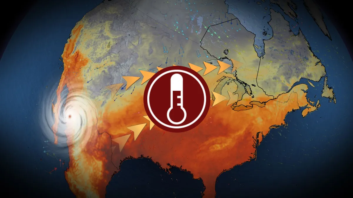
Feels like 28 this week? Hurricane Polo sends humid air into Ontario

Moisture from Hurricane Polo, expected to hit Mexico’s Baja Peninsula early Tuesday, is set to extend across the United States and into Ontario by midweek. DON'T MISS: Polo cements status as Pacific’s second-most intense hurricaneFlood watches have been issued for the U. S. desert states as tropical moisture fuels training thunderstorms. Some areas could see 50–100 mm of rainfall, an amount equal to months’ worth in a short time frame. Humidex values soar with influence of PoloTropical air from Polo will surge into Ontario, making the final days of September feel more like summer across southern and eastern sections of the province. Communities including Windsor, London, Toronto, Ottawa, and Montreal are forecast to experience muggy conditions, with humidex values reaching 27–28 on both Wednesday and Thursday afternoons. The warm and humid conditions are driven by high atmospheric moisture moving from the Pacific, through the U. S., and into the Great Lakes region.

The Weather Network·
Weather

Food systems are falling behind on water. Your grocery bill may already show it

STOCK PHOTO - Cornfield with crop damage and cracked soil from drought. (JJ Gouin/Getty Images)Your grocery bill is higher this year for plenty of reasons: inflation, tariffs, weaker harvests. But a new global report points to a quieter factor – water. In a new report from The Food Systems Countdown Initiative, researchers looked at 197 countries and found that food-system emissions worldwide are running about 75% above recommended levels.  The report published in the journal Nature Food concluded that not one country is closing the gap fast enough. One key in those food systems is water. Farms use huge amounts of it to grow crops and raise animals, pulling it from rivers and reservoirs. Thirsty crops like almonds, rice and cotton add extra strain on places already short on water — including parts of the western U. S.(MORE: Lake Mead now at record-low level)From dry fields to your grocery billThat strain can ripple into the prices you pay. A separate study found that water scarcity alone can explain nearly 75% of annual swings in global wheat prices between 2000 and 2021. It showed that a drought far away can nudge up the price of bread in your local store.

The Weather Channel·
Weather

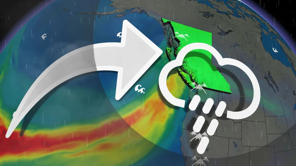
100+mm: Strongest storm of the month hits British Columbia with rain, winds

The strongest storm so far this month is rolling across British Columbia to kick off the week, bringing gusty winds and locally heavy rain for some areas. This final system is needed to salvage any hope of a normal precipitation month after a relatively dry September throughout the region. WATCH: Inside the eye of Polo as it grows into a historic hurricaneAtmospheric river arrivesAn atmospheric river carrying moisture direct from southeast Asia hit the B. C. coast to start the week. This atmospheric river will rank as an AR-2 for the Central Coast and western Vancouver Island, with an AR-1 expected just about everywhere else. In general, AR-2 brings mostly beneficial rains with a risk for localized flooding. These rankings, which range from AR-1 to AR-5, measure the intensity and duration of water vapour transport to estimate the impacts of an atmospheric river. Heavy rain, gusty winds expectedHeavy rain will spread to western Vancouver Island by Monday evening as a weak, surface low develops off the northwestern tip of the island. Content continues belowRainfall rates up to 10 mm per hour are possible on western Vancouver Island during the event’s peak on Monday night.

The Weather Network·
Weather

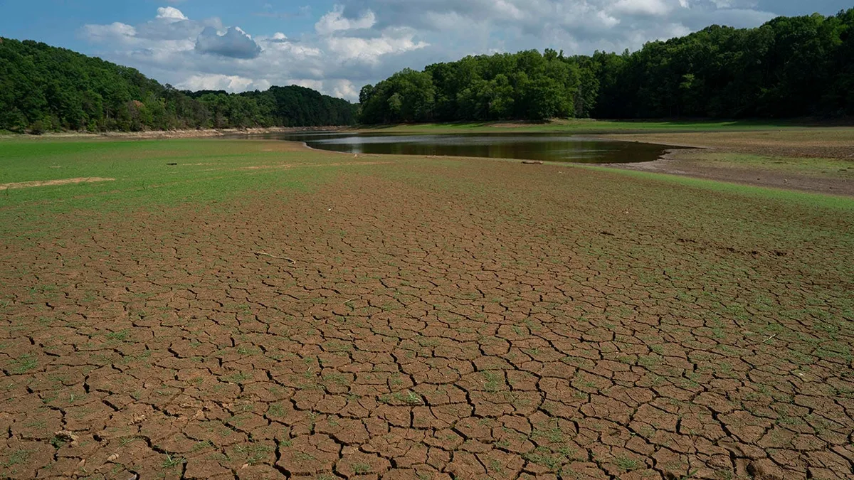
Over half the US is in drought. Will El Niño quench it?

How will El Niño impact how your winter feels? El Niño could help erase or improve drought conditions for many in the U. S. this winter and spring, but some may not be so lucky, if history is a guide. Most of the US in droughtAs the first full day of fall arrived, 40 of the Lower 48 states had at least some drought conditions, as the map below shows. The status of the nation's drought as shown by the Drought Monitor analysis on Sept. 22, 2026. Darker contours show areas of more extreme drought.(NDMC/USDA/NOAA)The worst of the drought was spread across parts of the South, Rockies, Northern Plains and upper Midwest. It's been among the top two or three driest 12-month October-September periods on record in parts of the Carolinas and Oklahoma, according to the Southeast Regional Climate Center. Earlier last summer, over 60% of the continental U. S. was classified in drought, something that happened only three other times this century in the Drought Monitor analysis. A dry lakebed is seen at Lake Michieon on June 29, 2026, in Bahama, Durham County, North Carolina.

The Weather Channel·
Weather

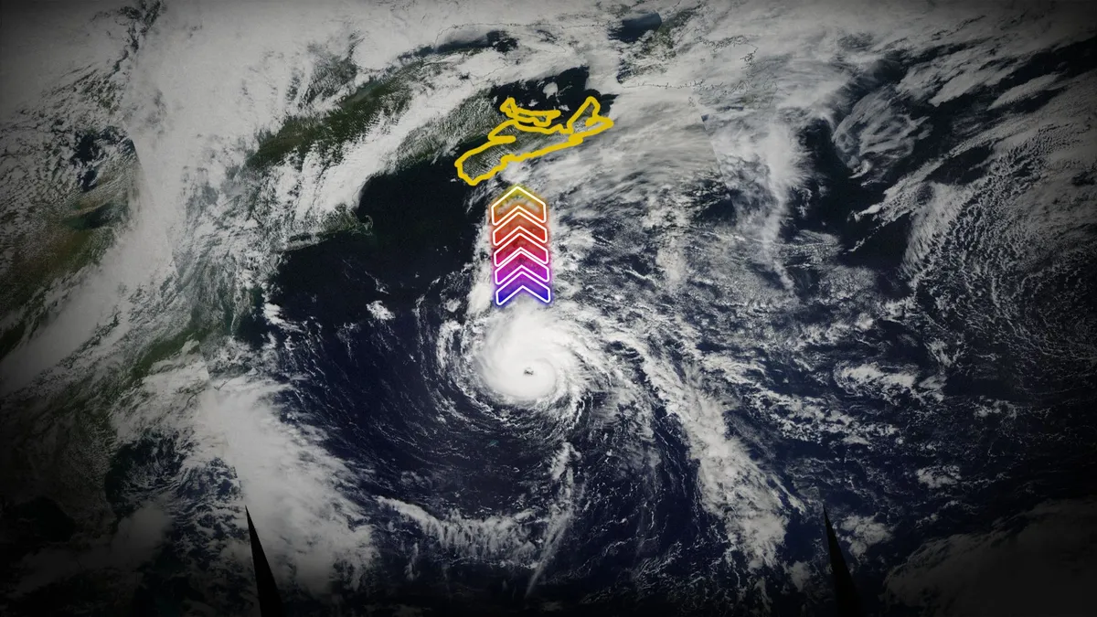
Hurricane Juan was one of the East Coast’s most destructive storms

Hurricane Juan cemented its place in history during the early morning hours on Sept. 29, 2003, when it swept across Atlantic Canada with ferocious winds. The first hurricane to directly strike Halifax since the late 1800s, Juan caused hundreds of millions of dollars in damage and killed several people throughout the region. DON’T MISS: Hurricane Fiona, two years later: Could it happen again? Juan quickly developed and strengthenedA tropical disturbance around 550 km southeast of Bermuda served as the seed that would eventually grow into Hurricane Juan. The disturbance encountered a complex setup influenced by the remnants of Hurricane Isabel that hit the U. S. Mid-Atlantic one week earlier. The system quickly advanced from a tropical depression the morning of Sept. 24 into a full-fledged hurricane just 48 hours later. A ridge of high pressure to Juan’s northeast quickly steered the storm directly toward Nova Scotia. This speedy forward motion didn’t allow any time for the storm to weaken as it crossed the Gulf Stream on approach to Atlantic Canada. Hurricane Juan made landfall just west of Halifax shortly past midnight on Sept. 29, 2003, with maximum sustained winds of 160 km/h.

The Weather Network·
Weather

A Violent Atlantic Bomb Cyclone Targets UK and Ireland Tuesday night, heads for Iceland on Thursday

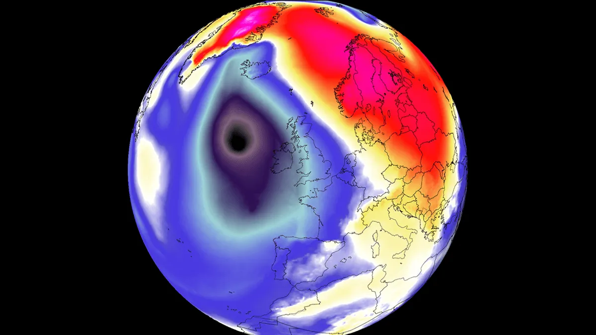
The explosive development is powered by a high-amplitude upper-level trough swinging out of the North Atlantic, colliding with an expansive 1035 hPa blocking high-pressure system anchored over Central Europe and Scandinavia. This steep baroclinic gradient will squeeze isobars across the UK and Ireland, unleashing severe gale-to-storm-force winds, intense squall lines, and high Atlantic swells reaching 8 to 12 meters along Atlantic-facing shores. While the primary core of lowest pressure remains west of the UK and Ireland and will track north between Iceland and Scotland, the storm’s huge circulation will affect a wide swath of Western Europe. Peak wind gusts between 100 and 130 km/h will batter Ireland, Northern Ireland, Scotland, and Western England. Strong southerly winds will pull a warm plume northward, fueling heavy rainfall bands and high temperatures far north towards Scandinavia and Iceland. On Monday night, the rapidly developing Atlantic storm was already visible on the satellite imagery. The following image is the water vapor satellite spectrum, showing a strong baroclinic zone and a developing jet stream, suggesting we will be dealing with a so-called bomb cyclone.

Severe Weather Europe·
Weather

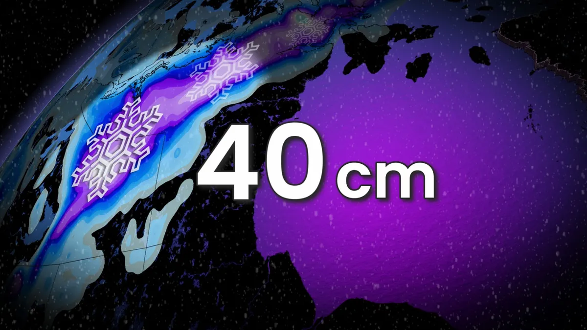
40 cm of snow: First storm of the year for parts of Canada

A remarkably mild September for parts of Canada will end with a hefty thump of snow over the next couple of days. The same cold trough that’s brought snow to Whistler and portions of Western Canada will produce a spell of heavy snowfall across sections of Northern Canada. Some remote areas that saw readings as high as 20°C this past week are in line for up to 40 cm of snow from this system. DON’T MISS: What’s the snowiest month in your corner of Canada? The predominant pattern over Canada this month has kept portions of the Northwest Territories and southern Nunavut very mild for September. Fort Reliance, N. W. T., hit 20.4°C on Monday, Sept. 21. A sharp temperature contrast over Alberta and Saskatchewan this weekend created the ideal region for a powerful low-pressure system to develop and move north. This system will continue to deepen as it moves into southern Nunavut. Moisture streaming in from the south will allow plenty of precipitation to fall along the system’s path, including heavy, wet snow on the cooler side of the storm. Content continues belowThe heaviest snow is expected from the eastern fringes of Great Slave Lake extending toward regions north of Baker Lake.

The Weather Network·
Weather

Steve Bender: Reflecting on Hurricane Helene 2 years later from a place close to home

NORTH CAROLINA — There are places you cover as a meteorologist that you know you'll remember. Then there are places that become part of you. For me, western North Carolina is one of those places. Long before the historic flooding from Hurricane Helene, before the images of homes ripped apart by rushing water, and the piles of debris and roads washed away from muddy landslides, I knew Asheville as a place of adventure. A place I experienced as a kid where I once wandered. REMAINS BELIEVED TO BE LINKED TO HURRICANE HELENE VICTIM DISCOVERED YEARS AFTER DEADLY STORMI have fond memories with my family coming up to Asheville to hike, ride bikes and take in the fall foliage. I remember the rows of mountains, the winding roads and that feeling you get when you look out across the Blue Ridge and realize just how small you are. Meteorologist Steve Bender reports on Hurricane Helene from Asheville, North Carolina, in 2024. (David Rubin / FOX Weather)It was a place to explore and a place to slow down. A place that, even as a kid, somehow felt different. It was a place that my parents wanted to share with us.

Fox Weather·
Weather

Gateway Arch goes dark for bird migration; how you can help

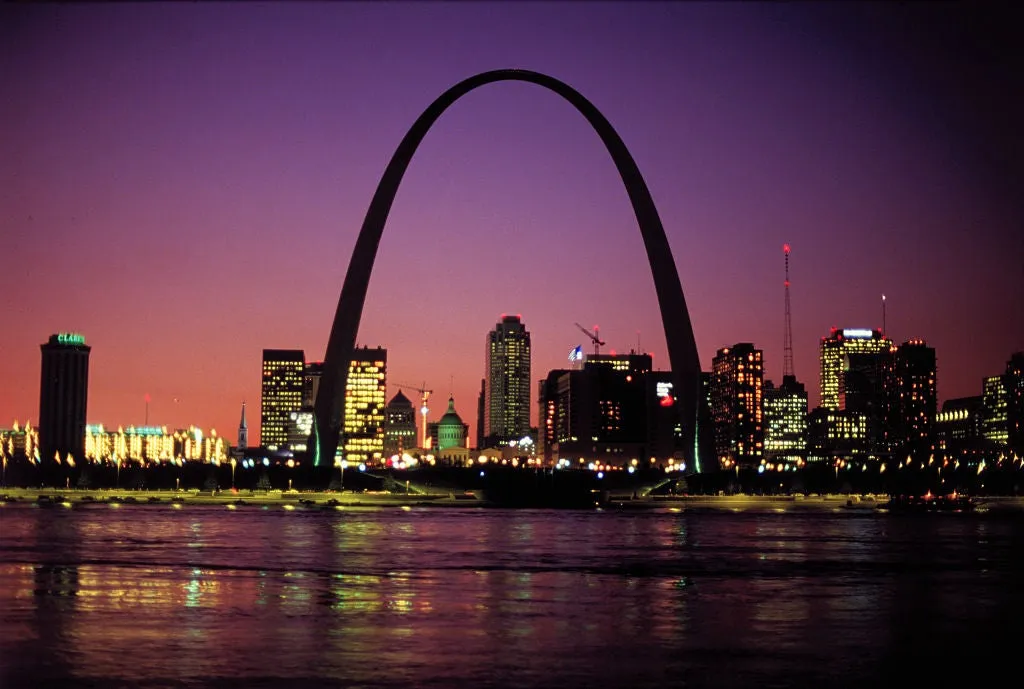
The Gateway Arch is going dark all month. Here's why you should tooThe Gateway Arch in St. Louis is going dark for bird migration all September long. But this is just a start; below are some tips for how you can help at home. Why St. Louis? St. Louis sits along the Mississippi Flyway, a corridor used by about 40% of the nation's migratory waterfowl, which makes the city's glow especially costly. Birds often mistake the glow of the arch for a celestial object, becoming confused and disoriented. The National Park Service has been doing this every spring and fall since 2002, and it has helped save millions of birds. Mississippi River night view of the St. Louis skyline. The Gateway Arch turns off its night lights during the month of September to protect migrating birds. (Bettmann Archive)Why birds migrate at nightAbout 80% of birds migrate overnight. After all, flying takes a lot of work, especially when they keep going for hours. Birds may be little meteorologists because they know that those cooler nights are helpful for maintaining body temperatures. Birds flying on a November night in Hamburg, Germany.

The Weather Channel·
Weather

Bryan Norcross: Last day of nor'easter as the Atlantic minimally stirs, Polo to bring flooding to Southwest

Updated at 12 p.m. on Monday, Sept. 28, 2026. NOR'EASTER FADESThe system that was the mighty nor'easter has fully merged with an upper-level low-pressure system. It's now a weak version of its former self, but it's still going to spread gusty winds and rain from Long Island, New York, through New England. The storm's moisture will move out of the Northeast later today and clear New England tomorrow. NOR'EASTER TO BRING FINAL DAY OF RAIN TO MILLIONS AS COMMUNITIES ASSESS FLOOD AND BEACH DAMAGEWarm weather returns to the East Coast by midweek as the leftovers of the Midwest heat dome shift east behind the nor'easter. IN THE ATLANTIC Tropical activity in the Atlantic basin. (Bryan Norcross / FOX Weather)Tropical Depression Fay is still chugging along but going nowhere. It will die out in a day or two in the middle of the Atlantic. To Fay's north is another small disturbance. The National Hurricane Center gives it a high chance of becoming a depression or Tropical Storm Hanna. In any case, it won't be a threat to land. HURRICANE POLO WILL MAKE LANDFALL TODAY, FUELING A FLOOD THREAT FOR MILLIONS AS TROPICAL STORM RACHEL FORMSHURRICANE POLO AND THE U. S.

Fox Weather·