Maui wildfire survivors show elevated metals linked to lung harm, study says
This story deserves to be shared
Send it to someone who'd care, or post it on your networks.
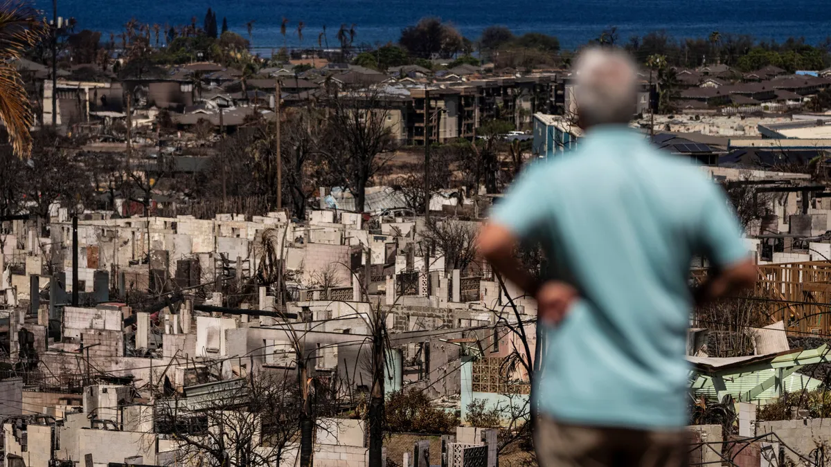
Destroyed buildings and cars are seen in the aftermath of the Maui wildfires in Lahaina, western Maui, Hawaii on August 17, 2023. (Yuki Iwamura/ AFP via Getty Images)Metal mixtures found in the leftover smoke, ash and debris from the deadly 2023 Maui wildfires were harmful to the lung health of people living nearby long after the burning ended, a new study says. The work shows that major wildfires could have lasting effects beyond immediate exposure. Post-wildfire air quality needs to be monitored longer term, the research suggests, and recovery efforts need to consider what might remain in contaminated soot, residue and dirt well after burning stops.(WATCH: Wildfire smoke effects on your body can last for years)The wildfires, caused by wind spreading a brushfire spurred by downed power lines, burned on the Hawaiian island of Maui in August 2023, destroyed the town of Lahaina and killed more than 100 people. They were among the deadliest in U. S. history. New research published in the journal Proceedings of the National Academy of Sciences on Monday found higher metal levels, associated with respiratory harm, in nearby residents up to a year and a half after the fires.
This article is an excerpt. To read the full content, visit the original source. The Weather Channel
Related articles
B.C. feeling the heat from the U.S. amid elevated wildfire danger
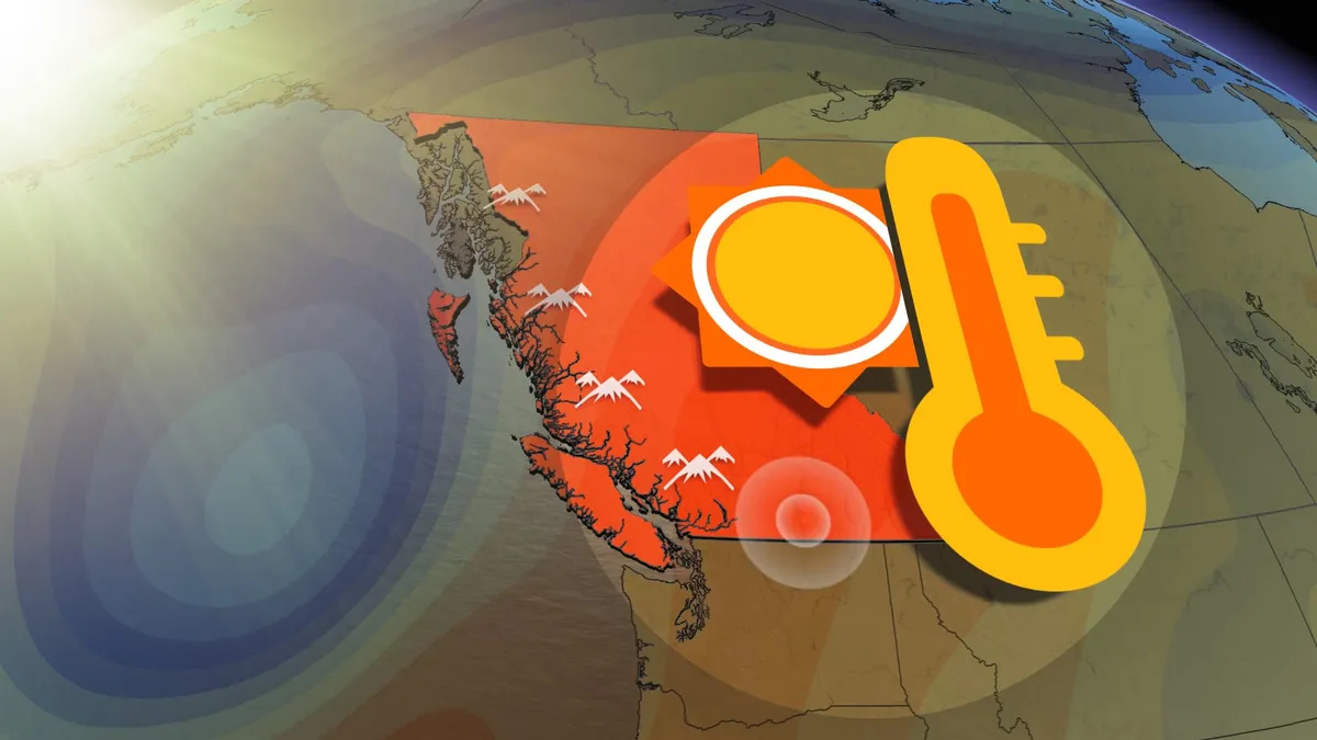
A heat dome situated over the southern U. S. is shifting westward, prompting a surge in high pressure conditions across Western Canada. DON'T MISS: The Weather Network's hub for all wildfire information in CanadaThis system will dominate British Columbia's weather through the week, maintaining dry, sunny conditions and a low risk of dry lightning—an important aspect amidst the province's ongoing wildfire crisis. With a ridge of high pressure offshore, moist air is being directed northward, sparing B. C.'s coastline from excessive heat. Temperatures along the coastal regions will stay near seasonal norms due to the moderating effects of onshore flow. However, Interior regions and valleys are expected to see above-seasonal heat Thursday and Friday, coinciding with peak wildfire activity. These conditions could exacerbate wildfire challenges in already hard-hit areas. RELATED: B. C.'s unique tug-of-war: Blue skies to orange haze in mere hoursA change in weather is expected heading into the weekend, as a northern low-pressure system brings cooler air, showers, and scattered thunderstorms.
Nor' easter to bring coastal flooding, winds to East Coast
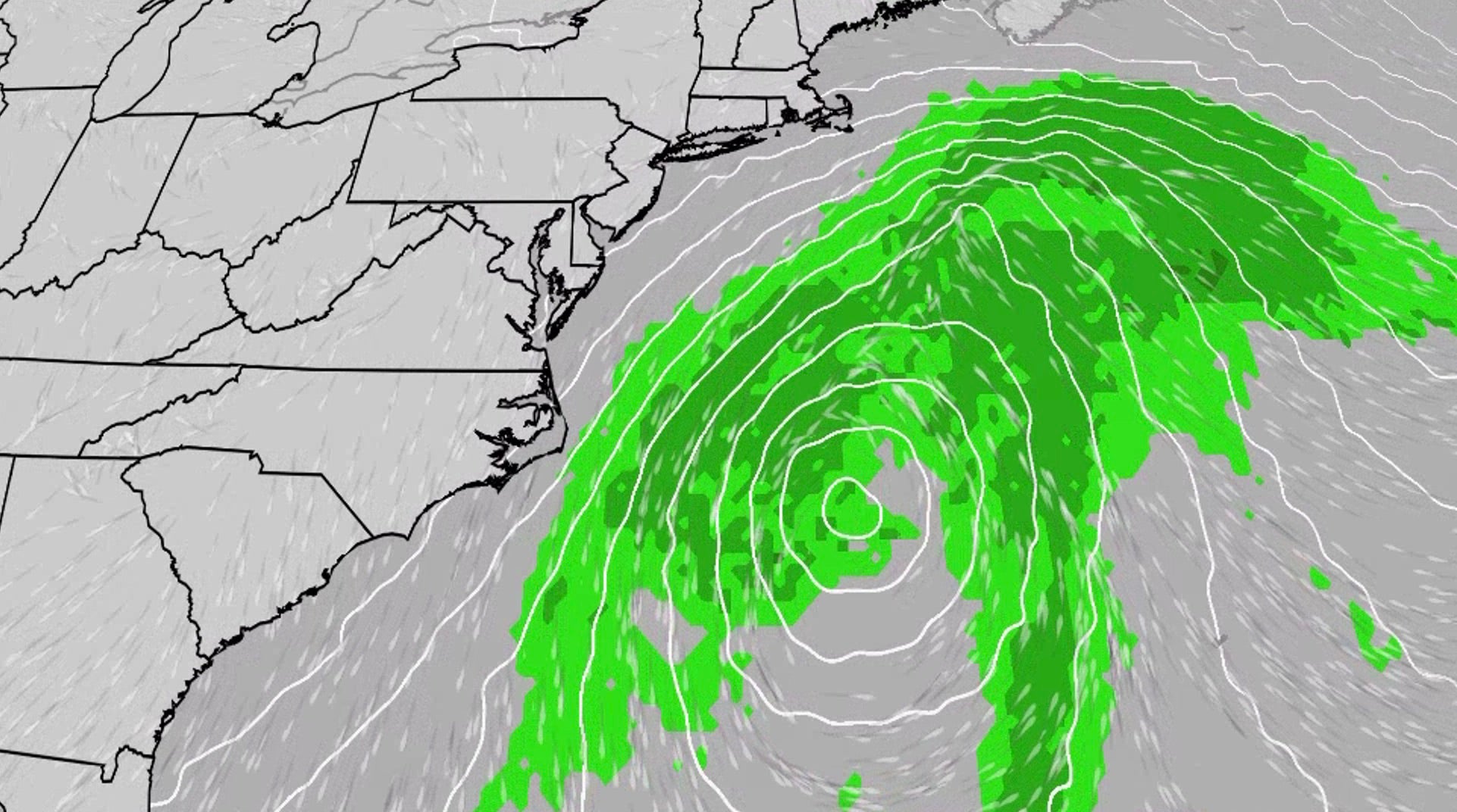
This week's nor'easter, which could be future Josephine, will meander off the East Coast, bringing multiple days of impacts from the Carolinas to Delaware.
Hurricane season maps tracker: Latest forecasts and more
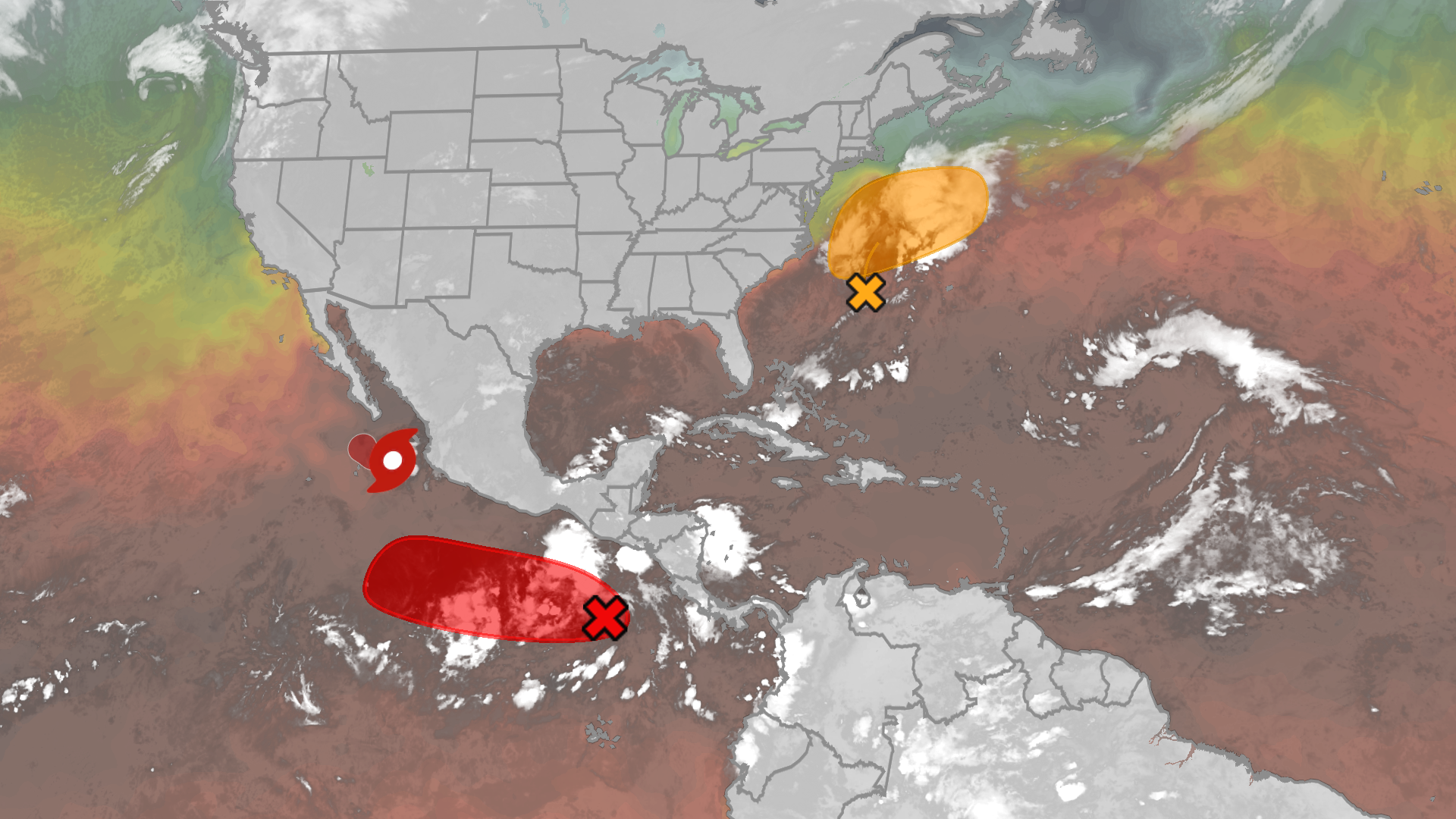
These are the maps to help you track ongoing Pacific and Atlantic tropical systems.

Winter storm checklist: What to do 72, 48, and 24 hours before it hits
A former FEMA official and the American Red Cross share the errands, apps and safety steps people most often forget before snow and ice arrive.
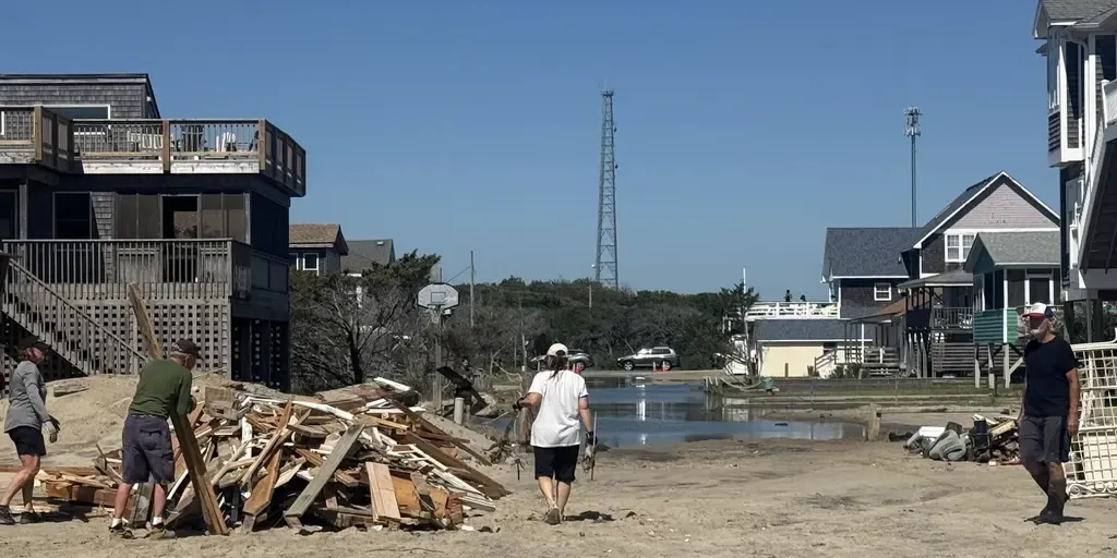
Brewing nor’easter threatens East Coast with days of coastal flooding, strong winds and pounding surf
The next fall nor’easter is brewing off the North Carolina coast, setting the stage for extensive impacts throughout the week. The National Hurricane Center is now highlighting this area for potential tropical development, with a 30% chance over the next seven days. WHAT IS A NOR’EASTER? Regardless of tropical development, the Outer Banks are expected to see long-term impacts, including intense wind gusts from the approaching nor’easter, while the storm sits off the coast. The main concern for the Outer Banks region will be intense wind gusts as strong as 40 to 60 mph, fueling moderate coastal flooding and destructive waves. A mandatory evacuation for locals on Hatteras Island is in effect, as storm conditions are expected to worsen, with the potential for significant ocean overwash. This graphic shows the Wind Alerts for the upcoming Nor’easter.(FOX Weather) According to the FOX Forecast Center, the impacts will last through late Wednesday evening and into Thursday, totaling three days of nasty storms with ferocious wind gusts.
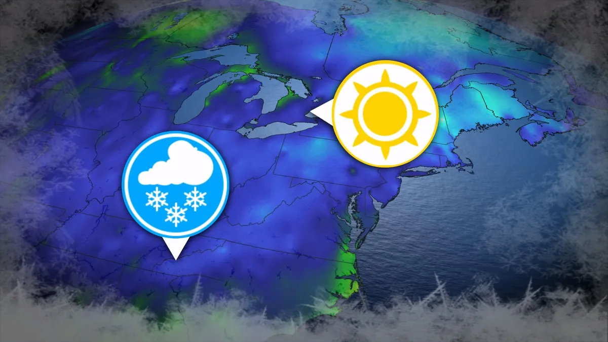
Where’s the frost? Southern U.S. hits freezing before Toronto, Montreal
Toronto and Montreal have remained above the freezing mark every day for almost six months. While frosts and even some snowflakes have intruded across parts of Ontario and Quebec in recent weeks, the two cities have yet to reach that magic number. What’s even more remarkable is that a handful of communities across the southern United States have already dipped to the freezing point--and some have even seen accumulating snowfall. DON’T MISS: Official: Canada records first -30°C reading of the seasonThe last time we saw a freezing temperature in either Toronto or Montreal was the second-to-last week of April. Toronto hit -1.3°C early on April 20, while Montreal dipped to -2.0°C the following morning. Our average first frost in both cities occurs right around the middle of October. But warmer-than-normal years can see this milestone slide several weeks past due. Montreal once had to wait 207 consecutive days for its first frost, with the city’s first subfreezing temperature in 2017 waiting until Nov. 7. The latest Toronto’s had to wait to hit the zero-degree mark was Nov. 13, 2022.
0 comments
No comments yet. Be the first to share your thoughts!