Tropical Depression Fifteen-E redevelops, could make rare landfall on Hawaii as a major hurricane
This story deserves to be shared
Send it to someone who'd care, or post it on your networks.
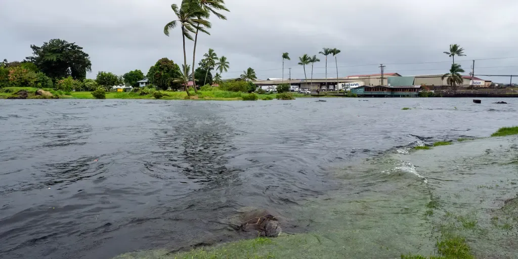
Tropical Depression Fifteen-E redeveloped near the Hawaiian Islands and is now forecast to approach the Big Island, potentially as a major hurricane, bringing torrential rain and life-threatening flooding this weekend. Hawaii, which generally doesn't see much tropical activity, could see impacts from another tropical system after being impacted by three systems this season, including destructive Hurricane Lowell. next
A flooded road is seen the day after Hurricane Lala in Hilo, Hawaii, Sunday, Aug. 16, 2026. The Category 1 hurricane brought heavy rain and strong winds to the island of Hawaii before moving away without making landfall.
This article is an excerpt. To read the full content, visit the original source. Fox Weather
Related articles

Fifteen years of tobacco tax reform show countries can make harmful products less affordable - World Health Organization (WHO)
Major tobacco-tax reforms in several emerging economies have sharply increased cigarette prices and helped drive down smoking, offering powerful lessons for countries seeking to protect health, raise revenue and advance the World Health Organization’s 3 by 35 Initiative. A new independent analysis of 15 countries finds that every country made improvements to cigarette taxation between 2009 and 2025. The strongest results came where governments acted boldly, substantially raising taxes, simplifying tax systems and preventing cigarettes from becoming more affordable as incomes rose. WHO urges countries to use health taxes to increase the real prices of tobacco, alcohol and sugary drinks by 2035. The 3 by 35 Initiative aims to reduce consumption of products that drive noncommunicable diseases and injuries, while generating resources that governments can invest in health and development. “The evidence is clear: when governments make harmful products significantly more expensive, people consume less, lives are saved and public revenues rise,” said Dr Etienne Krug, Director, Department of Health Determinants, Promotion and Prevention, WHO.
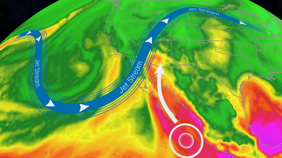
Trudy’s moisture will trigger a flood risk for Southwest US
Hurricane Trudy will bring flood threat to the Southwest USTrudy is off the Mexican coast, however, its moisture will pour into the Southwestern U. S., helping fuel a multiday flood risk across seven states this week from California to Colorado. A dip in the jet stream will also funnel in moisture from the Pacific as a strong low pressure system moves into the region. Timing out this week’s rainfallWednesday: The highest risk of flooding on Wednesday covers much of Arizona and parts of New Mexico, as well as southern portions of Colorado and Utah. There will be an abundance of moisture available to support heavy downpours and training storms. This means storms will produce heavy rain over the same areas for long periods of time. The Weather Prediction Center is forecasting rainfall rates as high as 2 inches per hour. Some of the biggest concern will be the possibility of mudslides over recent burn scar areas as well as slow canyons and arroyos. If you have plans to visit any of the national parks in the West this week, make sure you check the forecast daily and pay attention to any warnings or advisories issued.
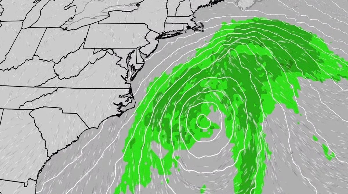
Nor' easter to bring coastal flooding, winds to East Coast
An October nor'easter is developing in the Atlantic, where it will bring high surf, rip currents, coastal flooding and winds to parts of the East Coast for several days this week. The National Hurricane Center has highlighted it as an area to watch this week for the potential development of Josephine. However, regardless of whether we call this system a nor'easter or Josephine, the impacts will be the same. The bottom line: This system will bring dangerous conditions to the East Coast for multiple days this week.(MORE: What is a nor'easter?)Fortunately, this nor'easter doesn't look to be as strong as the one in September. But the bad news? It could linger for much of the week, so impacts could have a longer duration. Coastal flood alerts are in effect for parts of coastal North Carolina and Virginia, where anywhere from 1 to 4 feet of inundation is possible. Get More of Our News on GoogleSet The Weather Company as a 'Preferred Source' to get quicker access to the news you value. Key takeawaysWe do not expect this storm to be as strong as the late September nor'easter.
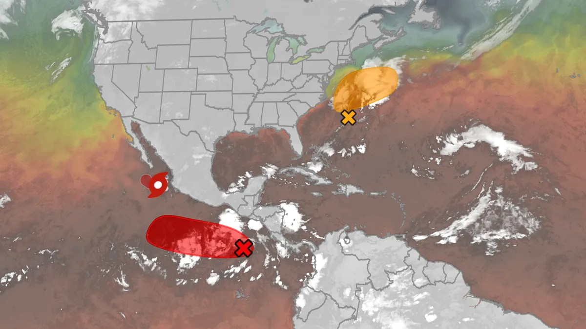
Hurricane season maps tracker: Latest forecasts and more
We have the maps you need to track all the systems ongoing in the Pacific and Atlantic below. Tracking the AtlanticTropical development areasSea surface temperatures Wind shear These are areas of strong wind shear, the difference in wind speed and direction with height, which are shown in purple. High wind shear is hostile to mature tropical cyclones and those trying to develop.(MORE: What is wind shear?)Get More of Our News on GoogleSet The Weather Company as a 'Preferred Source' to get quicker access to the news you value. Dry, dusty airAnother nemesis of tropical systems is dry air. In hurricane season, plumes of dust-laden air stream across the basin from Africa's Sahara Desert, as you can see in the map below. This sinking, dry air squelches thunderstorm development, the building blocks of tropical storms and hurricanes. So areas in the brown shading below are generally unfavorable for development. Atlantic tracks so far this seasonThese are the tracks of systems that were at least tropical or subtropical storms so far in the Atlantic Basin.
0 comments
No comments yet. Be the first to share your thoughts!