BBlogFlow

Categories

Weather

2858 articles

Weather

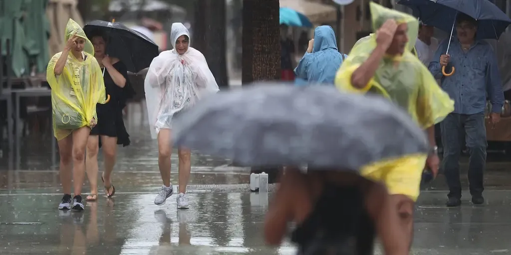
Florida braces for a month’s worth of rain in just days as flash flood threat grows

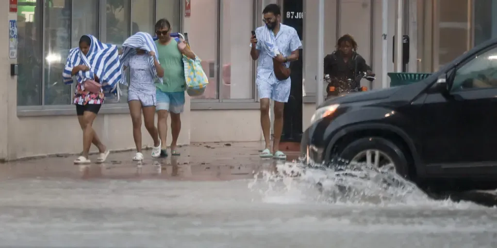
THE TAKEAWAYA slow-moving cold front taps into tropical moisture to trigger a Florida flood threat into next week. Parts of North to Central Florida could see 5 to 8 inches of rain. A Level 1 out of 4 flash flood threat is in place for Monday and Tuesday. FLORIDA — Unfortunately for Floridians, the stretch of wet weather isn't letting up for the next several days, bringing necessary rain to drought-stricken parts of the state. Some parts of Florida could see upwards of 8 inches of rain by Thursday, the FOX Forecast Center said.🌧️KEY WEST WATERWORKS: Duval Street in Key West turned into a river Thursday as torrential downpours soaked South Florida. Key West broke a daily rain record that had stood since 1943. Watch FOX Weather for details about an upcoming week of rain on tap for the Sunshine State: pic.twitter.com/SLjl6HFv7C— FOX Weather (@foxweather) October 2, 2026MILLIONS ACROSS SOUTHEAST FACE DAYS OF HEAVY RAIN, INCREASED FLOOD THREAT IN WET START TO OCTOBERThe slow-moving cold front that has triggered flooding in parts of the Southwest and Southern Plains is set to begin today, helping fuel nasty wet weather for the Sunshine State in the Southeast.

Fox Weather·
Weather

First October weekend will feel like summer across Western Canada

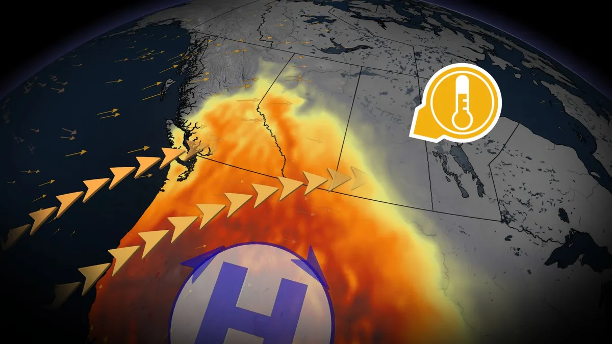
Summer-like conditions made a return to Western Canada this weekend, as temperatures climbed well above seasonal norms thanks to a strengthening ridge of high pressure. The warm spell spread north and east across B. C. and the Prairies, bringing dry conditions and significantly warmer daytime highs. In southwestern Canada, early October’s typical daytime highs sit in the mid-teens. This weekend, however, many areas saw highs in the low- to mid-20s. DON'T MISS: El Niño could delay persistent frost and hard freezes across CanadaThe Okanagan region could even experience temperatures feeling like the high 20s on Sunday. Temperatures soar across the Prairies by SundayAlberta will see its warm-up begin Sunday, peaking Monday. Cities like Edmonton, Saskatoon, and Regina may reach 20°C, while Calgary could hit 23°C. Southern areas, including Lethbridge and Medicine Hat, might approach 26°C or higher. Saskatchewan will see widespread warmth Sunday and Monday, and Manitoba, though starting the weekend on the cooler side, will see temperatures rise by Monday, peaking Tuesday with Winnipeg expected to hit 21°C.

The Weather Network·
Weather

Fall chill grips millions across the East as temperatures tumble toward first October frost

The first frost of October is likely to develop across parts of the Northeast and Mid-Atlantic this week. Gloomy Sunday sets the stage for first October frost of the year in the East The first fall frost of October will greet millions across parts of the East Coast this week, as a gloomy Sunday sets the stage for a chilly temperature drop. Light rain and cloudy skies will mainly affect Virginia, New Jersey and Delaware, with showers potentially reaching New York City later in the day. THE TAKEAWAYA cold front is ushering in lower temperatures and the potential for morning frost. Below-average temperatures are expected across the Northeast and Mid-Atlantic through the week. The first fall frost of October will greet millions across parts of the East Coast this week, after a gloomy Sunday set the stage for a chilly temperature drop. Temperature departures along the East Coast.(FOX Weather) A gray and chilly weather pattern took shape across the East Coast Sunday as an area of low pressure developed over the Mid-Atlantic.

Fox Weather·
Weather

Report reveals stunning scope of Europe’s record-hot summer

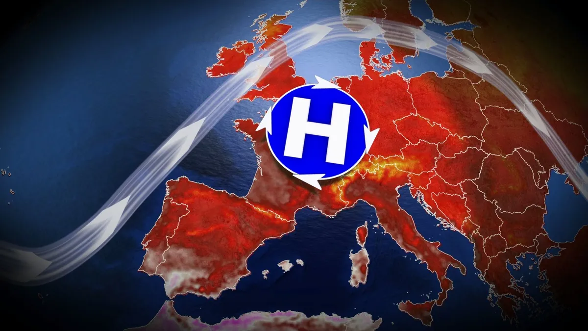
It’s official: Western Europe just endured its hottest summer on record. A recent report issued by the Copernicus Climate Change Service (C3S) found a tremendous number of heat records set in and around the continent. Tens of thousands of people reportedly died as extreme temperatures roasted the region between May and August. DON’T MISS: Major global heat records shattered this summerHistoric heat waves roasted Europe this summerExcessive temperatures between June and August produced the hottest summer ever observed in Austria, Belgium, France, Ireland, the Netherlands, Spain, and the United Kingdom. More than half of Europe experienced “very strong” heat stress at some point during the summer months, the C3S report said. Heat stress is the factor that causes injuries and fatalities during periods of excessive temperatures. This season saw four of the region’s ten most intense heat waves ever observed, including May 23-29, Jun. 18-28, Jul. 6-12, and Aug. 11-15. Content continues belowJune’s event ranked as Europe’s second-most intense heat wave on record; while it was more intense than the deadly Aug. 2003 spell, this year’s heat didn’t last quite as long.

The Weather Network·
Weather

El Niño danger could create 'perfect storm' of coastal flooding in Canada

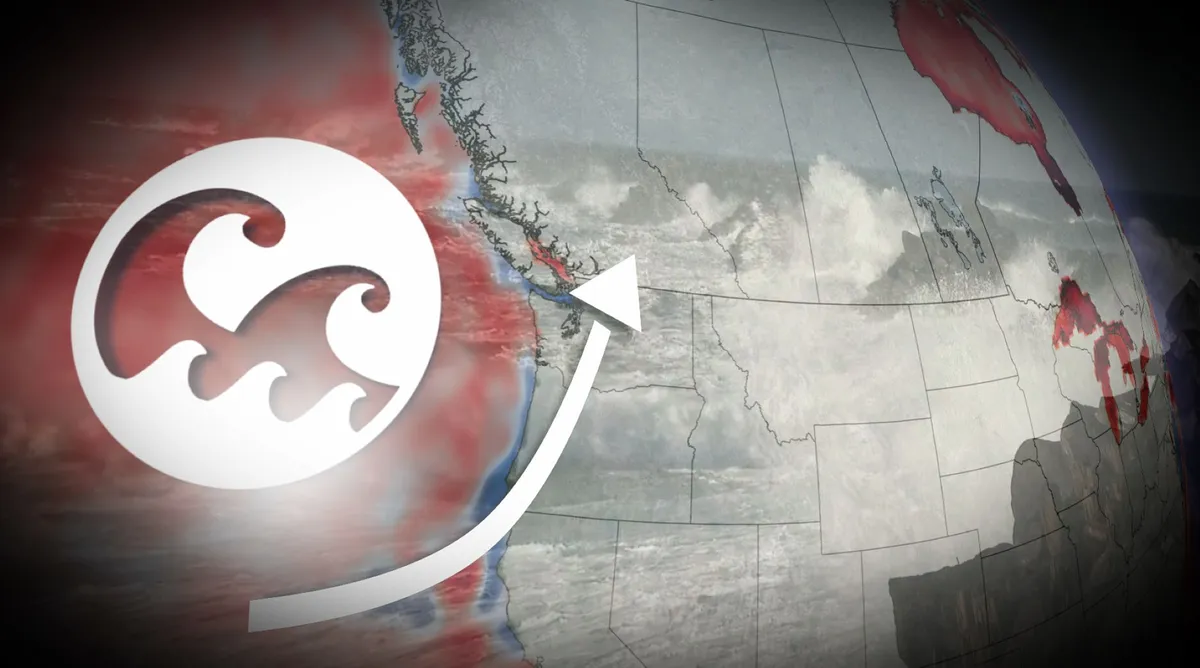
Most Canadians associate El Niño with milder winter temperatures. But this year’s exceptionally strong event may have another impact along the Pacific Ocean: Temporarily elevated ocean levels. A massive pulse of unusually warm water, known as a planetary-scale Kelvin wave, has been propagating eastward from the equator. Once that energy reaches the Americas, some of the energy will be directed northward along the coast from California, eventually reaching the coastal waters of British Columbia. For B. C., the hazard isn’t massive by itself: The risk is maximized because the peak rise is forecast during the traditionally stormiest months of the year. How much could sea levels rise in B. C.? The sea level rise gradually weakens as you head north from the tropical eastern Pacific, so we can’t take the forecast of a 15-30 cm sea level rise from California and directly apply it to B. C. Content continues belowBut, we have the 2015-16 strong El Niño event as a benchmark. Scientists observed significant, positive sea level anomalies along western Vancouver Island.

The Weather Network·
Weather

Why we love the smell of rain

There's nothing like the smell associated with rain on a crisp day. If you enjoy the smell and wonder why it is so appealing, there is a good reason for it. But the aroma isn't from the rain itself, technically. It's an odour that results primarily from a chemical called geosmin, according to Sahil Bhandari, researcher and consultant, formerly associated with a community science project called Smell Vancouver. "When people say, 'the smell of rain,' people usually mean after [the] rain. What that means is the raindrops fall, [are] falling or have fallen on the soil," said Bhandari, in a 2023 interview with The Weather Network. (Getty Images-691761646)Content continues belowRELATED: We know what causes the scent of spring, but what's it actually for? Smell can arise even before it rains, can generate other odoursGeosmin is a very specific molecule, a compound that's released by micro-organisms in the soil, mostly from bacteria, he noted. In some instances, people can pick up on the smell even before it starts to rain. "That's because there might be some lightning or thunderstorms in that area.

The Weather Network·
Weather

Evacuations underway as Bouquet Fire rapidly spreads, encroaching on homes in Los Angeles County

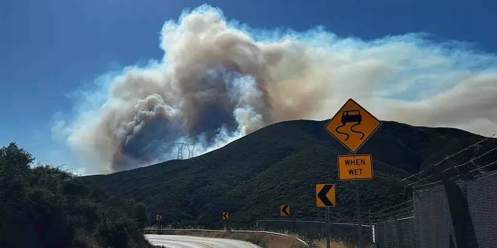
The Bouquet Fire broke out in the Angeles National Forest around 3:30 p.m., quickly growing from 20 acres to 1,000 overnight. THE TAKEAWAYA wildfire has scorched over 1,000 acres in Angeles National Forest. The fire — coined the Bouquet Fire — broke out Saturday evening. People in the Santa Clarita area were ordered to evacuate as the wildfire spreads. LOS ANGELES COUNTY, Calif. - Evacuations are underway after a wildfire broke out in Los Angeles County on Saturday evening, quickly growing to over 1,000 acres, according to local fire officials. CAL FIRE said the fire, coined the Bouquet Fire, broke out in the Angeles National Forest around 3:30 p.m., quickly growing from 20 acres to 1,000 overnight. MEET THREEHALVES: THE VIRAL ROBOT DESIGNED FOR EARTH'S MOST DANGEROUS ENVIRONMENTSJust before 5 p.m., the fire had already spread to over 700 acres. In their most recent update, the Angeles National Forest said Bouquet Canyon Road remains closed from Spunky Canyon to Vasquez Canyon. Evacuations are ongoing, with officials saying the Bouquet Fire is threatening structures and power lines. Firefighters said the blaze is 40% contained.

Fox Weather·
Weather

Why does Oktoberfest start in September instead of October

Inside a packed beer tent at Oktoberfest in Munich, where the party runs from mid-September through the first weekend of October.(Johannes Simon/Getty Images)Oktoberfest has a dirty secret: despite the name, it barely touches October. Munich's Wiesn (say VEEZ-n, not "Vee-ESS-en," you're not spelling it out) wraps up before the month really gets going, and the festival has spent nearly 150 years actively engineering it that way, all because of weather nobody wanted to drink outside in. A royal wedding, not a beer festivalOktoberfest didn't start as a drinking holiday at all. In October 1810, Bavarian Crown Prince Ludwig married Princess Therese of Saxe-Hildburghausen (teh-RAY-zeh of sax-HILD-burg-how-zen, a name that doubles as a pub quiz tiebreaker), and Munich threw the city gates open for the party: five days of festivities capped by a horse race on a meadow just outside town. That meadow, Theresienwiese (teh-RAY-zee-en-VEE-zeh, five syllables, zero of which you'll need after this paragraph), is still where the festival happens. Locals just call it the Wiesn, for obvious reasons. The party was popular enough to become an annual tradition.

The Weather Channel·
Weather

Bryan Norcross: A new area to watch in the southwestern Gulf this week

Last updated at 9:30 a.m. on Oct. 4, 2026. The National Hurricane Center is painting a potential development area in the southwestern Gulf. The odds that a system, even a tropical depression, will develop there are in the low range, but it's something we'll watch this week. The computer forecast models have been picking up on the possibility. On the forecast map for Thursday morning, you see that both the European and the Google AI models show possible development near Mexico. The more dots you see concentrated in one area, the higher the odds of development according to the model. THE LATEST FROM FOX WEATHER HURRICANE SPECIALIST BRYAN NORCROSS Latest tropical activity in the Atlantic basin. (Bryan Norcross / FOX Weather)There are 64 possible Google dots and 50 Euro dots. If 114 dots showed up, the joint message would be a 100% chance of development. In this case, you see a 25 to 30% showing. But having said that, both models have overstated the chances of development this year. The bottom line is that it's something to keep an eye on, but nothing major is likely to develop. And the odds of anything organized developing are low.

Fox Weather·
Weather

Flood threat ramps up across the South as millions face more heavy rain through the weekend

THE TAKEAWAYRain will continue across most of the South heading into Sunday. An expansive Level 2 out of 4 flood threat extends from Mobile, Alabama, to the Carolinas. A large upper-level low parked across the southern Gulf is pumping in rich, tropical moisture, setting the stage yet again for flash flooding. A weekend washout is underway for parts of the South and Gulf Coast states, prompting an increased flash flood risk through the weekend for Louisiana, Alabama, Mississippi and northern Florida. A large upper-level low parked across the southern Gulf is pumping in rich, tropical moisture, setting the stage yet again for flash flooding on Sunday. OCTOBER OUTLOOK: SUMMER TRIES TO HOLD ON WITH EL NIÑO IMPACTS EXPECTED TO MAKE A SPOOKY APPEARANCEThat rain will then spread across the Carolinas, with some of the moisture reaching the Mid-Atlantic and Northeast, the FOX Forecast Center said. Southeast rain forecast(FOX Weather) A wide and expansive Level 2 out of 4 flood threat extends from Mobile, Alabama, to the Carolinas on Sunday. The highest rain totals through Monday will be across southern Alabama into Georgia and South Carolina, where a widespread 2 to 3 inches is likely.

Fox Weather·
Weather

Weather Of The World: October 4

Wander the world one snapshot at a time. Explore striking moments of weather in motion in this week's slideshow. ByAda Wood•October 4, 2026Updated: October 4, 2026, 7:40 am EDTPublished: October 4, 2026, 7:00 am EDTA man paddleboards along a flooded street following heavy rainfall in Sea Isle City, New Jersey, U. S., on Sept. 27, 2026. New York, Boston and Philadelphia were all in the firing line of the nor'easter which brought flooding, downed trees and damaged power lines.(Matthew Hatcher/AFP via Getty Images)F​rom paddleboarding through nor'easter floodwaters in New Jersey to a river of duckweed in Belgium, it has been another busy week of weather around the world. Here are some of the most jaw-dropping and awe-inspiring weather photos we found this week. This aerial view shows a canal of the River Lys, choked with duckweed, in Ghent, Belgium, on Oct. 1, 2026. The duckweed has proliferated spectacularly at the end of this summer due to high temperatures and the lack of water caused by the drought.

The Weather Channel·
Weather

Weather Whiz: October 4

Phases of a lunar eclipse, with a total eclipse shown on the right.(NASA)How well have you been paying attention to the weather this week? Here are five questions that will test your knowledge of what's been going on. QUESTIONSHow many of the Lower 48 states had at least some drought conditions as the first full day of fall arrived? El Niño winters typically bring ______ weather to the South and a drier winter to the Northern Tier. SpaceX set a U. S. speed record by reaching the International Space Station in just ______ hours, a U. S. speed record. The world's oldest grapevine just produced another harvest in Maribor, Slovenia, despite the region's ______ summer ever recorded. An ______ lasts about a month and recurs roughly every six months, each one producing at least one lunar and one solar eclipse..... ANSWERS40WetterEightHottestEclipse seasonHow did you do this week? Come back for more exciting weather questions next week, or risk showing up to trivia night unprepared! Get More of Our News on GoogleSet The Weather Company as a 'Preferred Source' to get quicker access to the news you value.

The Weather Channel·
Weather

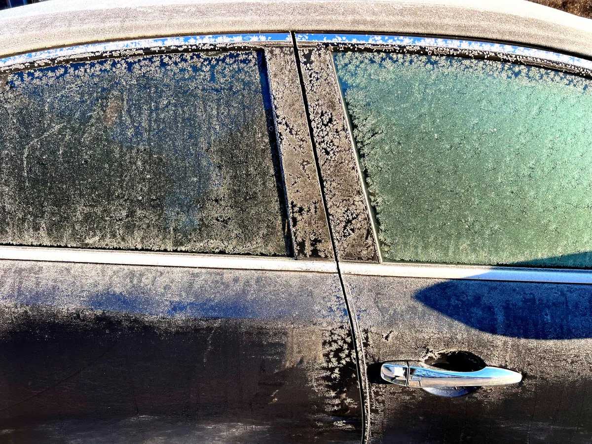
7 things to not leave in your car before the first freeze

7 things to bring inside before the first freeze hits your carWinter is knocking — and it is about to impact your car. Arizona's Snowbowl saw two inches of snow just days ago. Meteorologists say the best chance for the season's first widespread frosts will hit Monday through Wednesday morning, with some of the coldest spots in the northern Great Lakes, upstate New York and New England already seeing theirs.(MORE: First snow of the season hits Arizona Snowbowl in Flagstaff)Wherever you are, that first hard freeze doesn't wait for a warning — it just happens, quietly turning your car into a different kind of storage space than the one you got used to all summer. All those months, the back seat and trunk turned into a junk drawer — sunscreen, snacks, a gym bag and old sports gear. But once temperatures drop below freezing, some of those forgotten items can crack, rupture or get ruined for good. Here's what to bring inside before the cold catches up to you. Get More of Our News on GoogleSet The Weather Company as a 'Preferred Source' to get quicker access to the news you value.(MORE: Our complete coverage of El Niño)1.

The Weather Channel·
Weather

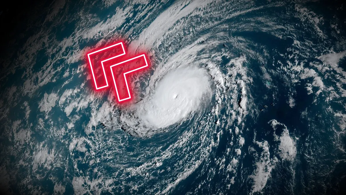
A rare feat, Hurricane Nolo will soon transition into a typhoon

Hurricane Nolo is the storm that just won’t quit. The powerful storm found new life this weekend, and it’s on its way to a relatively rare transition from a hurricane to a typhoon by Sunday. DON’T MISS: What’s the difference between hurricanes, typhoons, and cyclones? The hurricane that just keeps goingHurricane Nolo is in its third week of life this weekend as it spins across the Pacific Ocean. This level of longevity is rare for any storm, let alone one with such an unusual trajectory. The storm grew into a Category 4 as it brought heavy rain and blustery conditions to parts of Hawaii last weekend. Parts of the Big Island saw more than 350 mm of rain from the storm, which caused additional flooding across areas still recovering from Hurricane Lala earlier this summer. After weakening to a tropical storm this past week, Nolo caught a second wind and quickly intensified back to a major hurricane on Saturday. The storm is expected to strengthen further over the next few days as it heads west. Nolo set to become a typhoonOn its current path, Hurricane Nolo will soon cross the International Date Line and become Typhoon Nolo from that point on.

The Weather Network·
Weather

Top 10 US destinations for snowbirds to flock to escape the winter cold

THE TAKEAWAYStorageCafe compiled the rankings of the best escapes for snow birds. The top 10 destinations are located in southern states. The destinations offer mild winter weather, beaches, outdoor recreation and access to nature. As temperatures drop across much of the U. S. with the arrival of fall, many snowbirds are heading south in search of sunshine, mild weather and an escape ahead of winter’s chill. A new analysis from StorageCafe ranked the 10 best snowbird destinations in the U. S., with Florida and Texas dominating the list. A woman runs along the waterfront in St. Petersburg, Florida, on December 17, 2025.  (Ronen Tivony/NurPhoto via Getty Images / Getty Images)The analysis considered the latest available data from the National Centers for Environmental Information, the U. S. Environmental Protection Agency, FEMA, the U. S. Census Bureau, the Centers for Disease Control and Prevention, and other sources. So, if you're looking to trade a cold winter for a warm one, here are America's top 10 best snowbird locations according to StorageCafe.1. Winter Haven, FloridaIn Winter Haven, the name is all you need to hear.

Fox Weather·
Weather

Meet the air traffic controller who flies himself to work

Above the clouds: paramotor flight goes viralPUEBLO, Colo. (AP) — Jake Hutzler spends his workdays directing planes from an airport tower. Once a week, he gets there by strapping a propeller to his back and taking to the skies of Colorado. Before his commute, the 28-year-old air traffic controller lays out a large wing on the road outside his apartment complex, fires up the motor and starts running. Within seconds, his feet leave the ground. For the next 20 minutes, Hutzler flies at a leisurely 35 mph above the expansive fields around Pueblo, a city near the Front Range mountains. He soars over a highway, a water tower and finally the airport while listening to his favorite music.(MORE: Beyond the runway: The invisible science keeping your flight smooth)Before taking off, Hutzler calls the tower where he works and lets his colleagues know he's coming. Once airborne, he keeps them updated on where he's at and how high he's flying.

The Weather Channel·
Weather

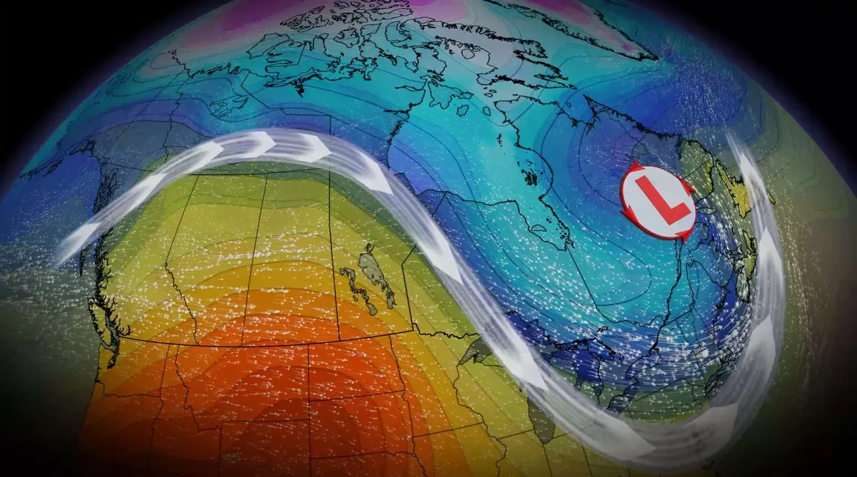
How a typhoon will reinforce temperature flip-flop in Canada

A temperature shift is ongoing in Canada and will continue into next week, with cooler fall conditions expected in the East while the West retains warmer patterns. Typhoon Choi Wan is going to reinforce that pattern into the middle of the week as the storm injects itself into the jet stream, with the oscillation leading to troughing in the East and ridging in the West. SEE ALSO: October Outlook: Canada's great fall flip—what to expect this monthTyphoons that recurve out of the western Pacific Ocean often race toward the Arctic Circle and disrupt the jet stream. These interruptions can have ripple effects that carry for thousands of kilometres downwind. Dry, warm weather settles in the WestA ridge of high pressure will strengthen and spread north and east across B. C. and the Prairies through this weekend. As a result, dry conditions and above-normal temperatures are expected. Southwestern Canada's normal daytime highs for early October range in the mid-teens. This weekend, however, a large region will likely tip into the low- to mid-20s. Sunday will see feels-like values in the 20s in B. C.'s Okanagan Valley.

The Weather Network·
Weather

Bryan Norcross: Atlantic goes quiet again, Southern California prepares for another round of strong swells

The atmosphere over the Atlantic, the Caribbean, and the Gulf is taking on a winter-like appearance. Strong upper winds dominate. Nothing tropical is forecast to develop over the next week. Occasionally, a pocket that could be conducive to tropical development is forecast to appear in the Gulf, but those opportunities look to be fleeting. Anything that develops is unlikely to amount to much. Atlantic basinLATEST FROM FOX WEATHER HURRICANE SPECIALIST BRYAN NORCROSSThe potential Gulf disturbance that could eventually develop fits in that "unlikely to amount to much" category – if it has a chance to develop at all. The odds are very low. Overall, the wet weather pattern is forecast to continue over Florida, however, until a cold front arrives around the middle of the month. At least that's the indication right now.60 years ago todayFor the third year in a row, a hurricane was tormenting South Florida. As with Cleo in 1964 and Betsy in 1965, forecasters predicted that Inez would affect Miami, then it wouldn't, then it might, and on it went. On this date in 1966, Inez stalled over the Bahamas before turning back and pouncing on the Florida Keys as a Category 2.

Fox Weather·