A rare feat, Hurricane Nolo will soon transition into a typhoon
This story deserves to be shared
Send it to someone who'd care, or post it on your networks.
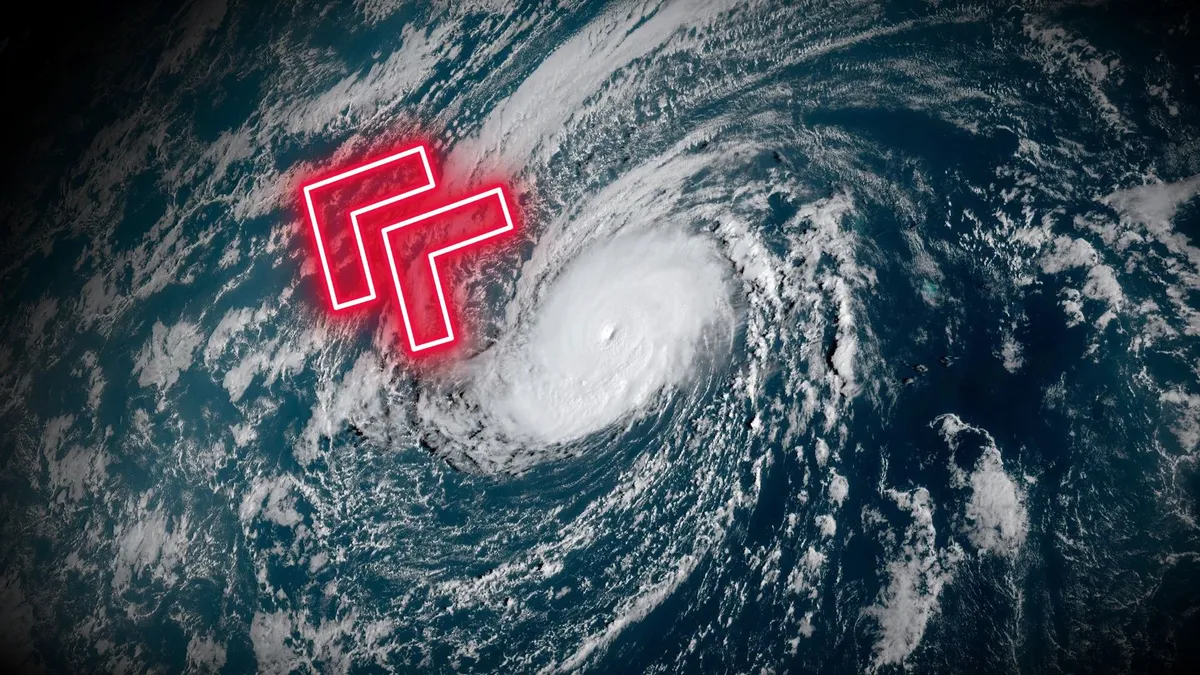
Hurricane Nolo is the storm that just won’t quit. The powerful storm found new life this weekend, and it’s on its way to a relatively rare transition from a hurricane to a typhoon by Sunday. DON’T MISS: What’s the difference between hurricanes, typhoons, and cyclones? The hurricane that just keeps goingHurricane Nolo is in its third week of life this weekend as it spins across the Pacific Ocean. This level of longevity is rare for any storm, let alone one with such an unusual trajectory. The storm grew into a Category 4 as it brought heavy rain and blustery conditions to parts of Hawaii last weekend. Parts of the Big Island saw more than 350 mm of rain from the storm, which caused additional flooding across areas still recovering from Hurricane Lala earlier this summer. After weakening to a tropical storm this past week, Nolo caught a second wind and quickly intensified back to a major hurricane on Saturday. The storm is expected to strengthen further over the next few days as it heads west. Nolo set to become a typhoonOn its current path, Hurricane Nolo will soon cross the International Date Line and become Typhoon Nolo from that point on.
This article is an excerpt. To read the full content, visit the original source. The Weather Network
Related articles
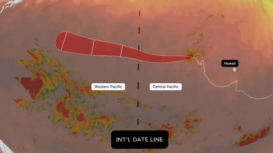
Why Hurricane Nolo could become Typhoon Nolo this weekend
Nolo has had quite a week. After weakening to a tropical storm, it remains active and is forecast to cross the International Date Line this weekend. When it does, it won't get a brand-new name — it will simply become Typhoon Nolo. Typhoons are what hurricanes are called in the Western Pacific basin. Whether a storm is called a hurricane or a typhoon depends entirely on geography, not its physical structure. (MORE: Hurricane season maps tracker)Sitting at 180 degrees longitude, the International Date Line marks the boundary between the Central Pacific basin and the Western Pacific basin. Crossing that line from east to west — or vice versa — automatically changes a storm's official title on the map while leaving its assigned name completely intact. Get More of Our News on GoogleSet The Weather Company as a 'Preferred Source' to get quicker access to the news you value.(MORE: Our complete coverage of El Niño)What actually happens:Classification changes: Nolo shifts from "hurricane" to "typhoon" purely because of its geographical position relative to the International Date Line. If sustained winds top 150 mph, it would even be designated a Super Typhoon.

Ask a met: Polo, Nolo, Lala? What's the deal with these Pacific hurricane names?
"Polo, Nolo, Lala? What's the deal with all the Pacific hurricane names that are just two repeating syllables? " — KevinA lot of this comes down to coincidence and time of the year, but there are some linguistics embedded in the Central Pacific names that tipped the chances of repeated syllables. Let’s start with Marco Polo, err… Polo 'n Nolo. These are the names that have gotten the most chatter in the newsroom and online in the last few weeks. Coincidental timing of names has been a theme this year, starting with Tropical Storm Dolly being named within days of Dolly Parton’s death. That name first appeared on naming lists when Dolly Parton was just 7 years old. It happens to be on a list that rotates every six years, and nobody knew or planned for that name to be on the list in the same year the beloved singer and philanthropist would pass. Likewise, Polo is on another rotating list that appears every six years and goes from A to Z through the year. This was just the 16th storm of this season in the East Pacific. Polo isn’t a popular name in English-speaking countries, but it is a nickname in Spanish and Italian for common names like Paolo and Pablo.

Several inches of rain continue to soak Hawaii as Nolo weakens to tropical storm, begins turn into Pacific
THE TAKEAWAYNolo weakened to a tropical storm on Wednesday. Rain is expected across Kaua'i through Thursday, with no flooding expected. The system will turn away from Hawaii later in the week. Tropical Storm Nolo is preparing to complete a remarkable journey around Hawaii, set to dump a final round of rain on Kaua'i as it passes about 250 miles west of the state's westernmost island, after sweeping south of the Big Island over the weekend. From there, Nolo is forecast to reintensify later this week and remain a long-lived hurricane for more than two weeks as it crosses into the open Western Pacific. HURRICANE POLO CHURNS IN THE PACIFIC, FUELING FLOOD THREAT FOR MILLIONS AS TROPICAL STORM RACHEL FORMS next Flooding on Hawaii's Big Island as Hurricane Nolo passed 140 miles to the south on Sep. 26, 2026.
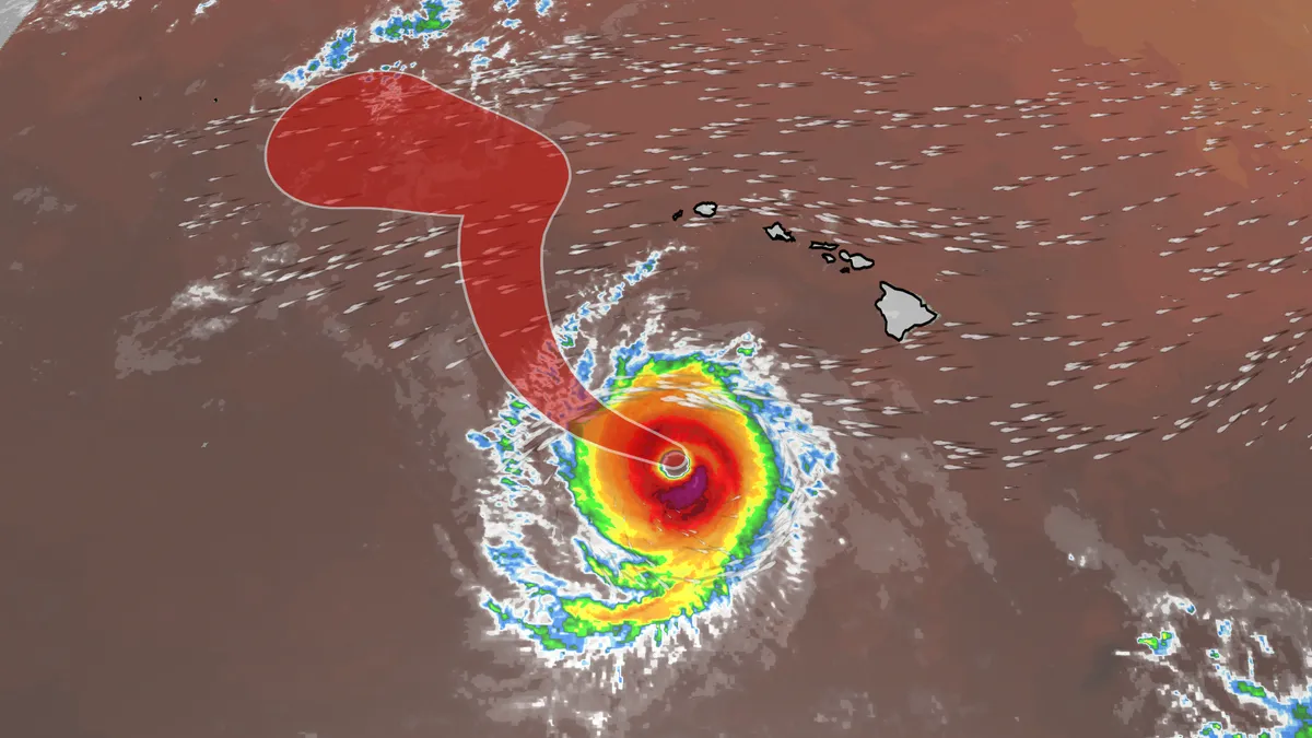
Hurricane Nolo slammed Hawaii with wind, waves and rain
Hurricane Nolo became the fourth named system to bring heavy rain, gusty winds and large waves to Hawaii this hurricane season. Its lifecycle was more interesting than the others. GenesisHurricane Nolo actually has a more unique story than most tropical systems. It was actually first monitored way back on September 8 as a low area of development. The map below shows the yellow blob that would eventually become Nolo, but we have to a wait a while to see the name. This is the East Pacific just before 8 a.m. on September 8. The yellow area would eventually become Nolo, but a lot of time would have to pass before then. By 2 p.m. PDT on September 13, Tropical Depression Fifteen-E formed in the East Pacific. But the system didn't last long. Just two days later, the tropical depression lost its organization due to moving into higher shear. Shear, or changes in wind speed and direction as you move higher in the atmosphere, hinders tropical development, so this system fell apart and was no longer receiving advisories from the National Hurricane Center on September 15 at 8 p.m. Tropical Depression Fifteen-E first formed on September 13 but then dissipated just two days later.
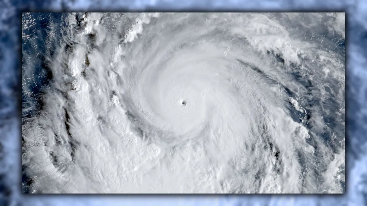
Super Typhoon Champi is chasing the strongest storm on Earth
Typhoon Champi has an opportunity to grow into the world’s strongest tropical cyclone of 2026. The system in the western Pacific Ocean is already a powerhouse with 240 km/h winds, the equivalent of a high-end Category 4 storm. Further intensification is expected over the next 24 to 48 hours, and Champi will soon become the world’s seventh Category 5 storm of the year. DON’T MISS: What’s the difference between hurricanes, typhoons, and cyclones? Typhoon Champi rapidly intensified as it approached the tiny Pacific island of Guam this weekend, threatening the U. S. territory with destructive winds and flash flooding. Its maximum sustained winds doubled from 110 km/h to 220 km/h in just 24 hours. The system is in a highly favourable environment for strengthening, and forecasters now expect Champi to achieve the equivalent of a Category 5 storm within the next 24 hours. If the current predictions come to pass, this typhoon would be the world’s seventh Category 5 storm so far in 2026.
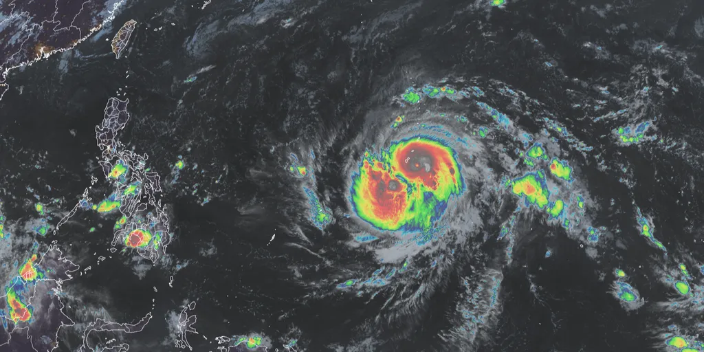
Champi slams Guam after rapidly intensifying into violent typhoon, bringing life-threatening conditions
Typhoon Champi passes just 10 miles south of Guam 🌧️ TYPHOON THREAT: Typhoon Champi brings intense storm conditions to Guam, despite no landfall, as it passed 10 miles south of the island, triggering heavy rain and a flash flood threat this weekend. THE TAKEAWAYChampi has rapidly intensified into a violent typhoon with sustained winds of 150 mph. An Extreme Wind Warning is in effect across far southern Guam for catastrophic, life-threatening winds. A parade of intense systems has made the 2026 Eastern Pacific hurricane season the most energetic on record. Champi has rapidly intensified into a violent super typhoon with sustained winds of 150 mph and is bearing down on Guam, barely avoiding a direct hit. The storm is expected to bring intense, damaging wind gusts, torrential rain and flooding during its closest approach on Sunday. LATEST FROM FOX WEATHER HURRICANE SPECIALIST BRYAN NORCROSSViolent Typhoon Champi(FOX Weather) The National Weather Service (NWS) office in Guam has issued an Extreme Wind Warning for far southern Guam for catastrophic, life-threatening winds between 115 and 135 mph. "Venturing outside can result in death from flying projectiles," the NWS office warned.
0 comments
No comments yet. Be the first to share your thoughts!