How a typhoon will reinforce temperature flip-flop in Canada
This story deserves to be shared
Send it to someone who'd care, or post it on your networks.
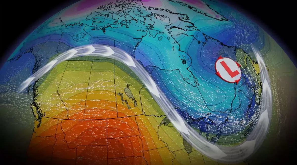
A temperature shift is ongoing in Canada and will continue into next week, with cooler fall conditions expected in the East while the West retains warmer patterns. Typhoon Choi Wan is going to reinforce that pattern into the middle of the week as the storm injects itself into the jet stream, with the oscillation leading to troughing in the East and ridging in the West. SEE ALSO: October Outlook: Canada's great fall flip—what to expect this monthTyphoons that recurve out of the western Pacific Ocean often race toward the Arctic Circle and disrupt the jet stream. These interruptions can have ripple effects that carry for thousands of kilometres downwind. Dry, warm weather settles in the WestA ridge of high pressure will strengthen and spread north and east across B. C. and the Prairies through this weekend. As a result, dry conditions and above-normal temperatures are expected. Southwestern Canada's normal daytime highs for early October range in the mid-teens. This weekend, however, a large region will likely tip into the low- to mid-20s. Sunday will see feels-like values in the 20s in B. C.'s Okanagan Valley.
This article is an excerpt. To read the full content, visit the original source. The Weather Network
Related articles
Super Typhoon Champi is chasing the strongest storm on Earth
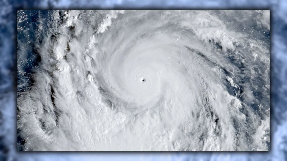
Typhoon Champi has an opportunity to grow into the world’s strongest tropical cyclone of 2026. The system in the western Pacific Ocean is already a powerhouse with 240 km/h winds, the equivalent of a high-end Category 4 storm. Further intensification is expected over the next 24 to 48 hours, and Champi will soon become the world’s seventh Category 5 storm of the year. DON’T MISS: What’s the difference between hurricanes, typhoons, and cyclones? Typhoon Champi rapidly intensified as it approached the tiny Pacific island of Guam this weekend, threatening the U. S. territory with destructive winds and flash flooding. Its maximum sustained winds doubled from 110 km/h to 220 km/h in just 24 hours. The system is in a highly favourable environment for strengthening, and forecasters now expect Champi to achieve the equivalent of a Category 5 storm within the next 24 hours. If the current predictions come to pass, this typhoon would be the world’s seventh Category 5 storm so far in 2026.
Champi slams Guam after rapidly intensifying into violent typhoon, bringing life-threatening conditions
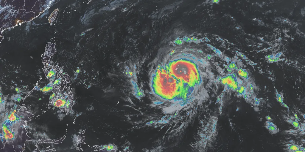
Typhoon Champi passes just 10 miles south of Guam 🌧️ TYPHOON THREAT: Typhoon Champi brings intense storm conditions to Guam, despite no landfall, as it passed 10 miles south of the island, triggering heavy rain and a flash flood threat this weekend. THE TAKEAWAYChampi has rapidly intensified into a violent typhoon with sustained winds of 150 mph. An Extreme Wind Warning is in effect across far southern Guam for catastrophic, life-threatening winds. A parade of intense systems has made the 2026 Eastern Pacific hurricane season the most energetic on record. Champi has rapidly intensified into a violent super typhoon with sustained winds of 150 mph and is bearing down on Guam, barely avoiding a direct hit. The storm is expected to bring intense, damaging wind gusts, torrential rain and flooding during its closest approach on Sunday. LATEST FROM FOX WEATHER HURRICANE SPECIALIST BRYAN NORCROSSViolent Typhoon Champi(FOX Weather) The National Weather Service (NWS) office in Guam has issued an Extreme Wind Warning for far southern Guam for catastrophic, life-threatening winds between 115 and 135 mph. "Venturing outside can result in death from flying projectiles," the NWS office warned.
Hurricane Trudy makes its way toward Mexico as Typhoon Champi threatens Guam
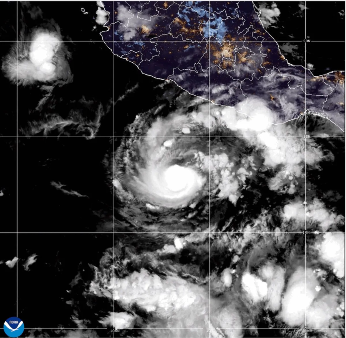
This GOES-19 GeoColor satellite image provided by the National Oceanic and Atmospheric Administration (NOAA) and taken on Thursday, Oct. 15 2026, shows Hurricane Trudy in the Pacific.(NOAA via AP)Hurricane Trudy moved toward southwestern and west-central areas of Mexico's Pacific coast and could keep growing through Saturday, forecasters said. The center of Trudy will approach the coast on Saturday, making its closest pass Sunday. A hurricane warning was in effect from Manzanillo in Colima state to Cabo Corrientes in Jalisco. The storm was a Category 1 hurricane with maximum sustained winds of 90 mph on Saturday morning.(MORE: Nor'easter to bring flooding, winds, rain to parts of East Coast)Trudy was about 250 miles west of Acapulco, in the Mexican state of Guerrero, and under 200 miles south-southeast of Manzanillo, Colima state, while moving northwest at 8 mph, the U. S. National Hurricane Center said. The Mexican navy urged the maritime community and coastal residents to exercise extreme caution due to high waves, heavy rains and the risk of rising river levels, flooding and landslides in vulnerable areas.
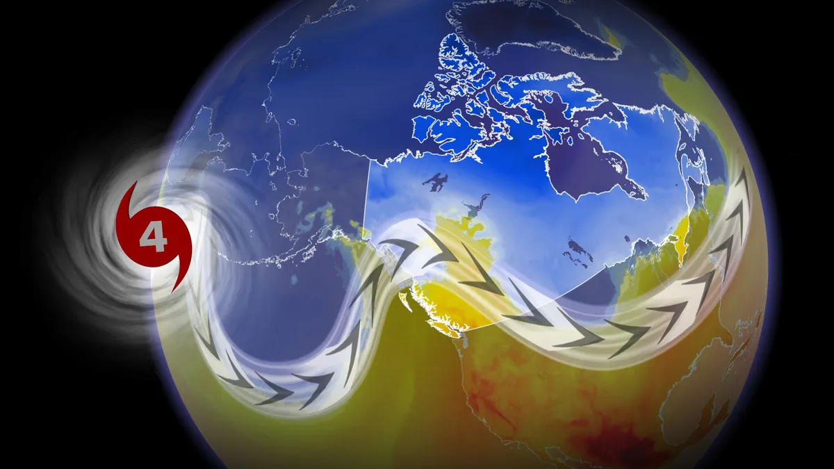
A super typhoon may determine Canada’s late-October pattern
Canada’s forecast this Halloween may come down to a growing typhoon half a world away. Champi is expected to grow into a super typhoon by next week as it passes through the western Pacific basin. One scenario holds the potential that the typhoon will recurve and influence the pattern over Canada, potentially sending chilly air swooping south toward some areas. DON’T MISS: Winter has a few tricks up its sleeve for Eastern Canada this yearA budding tropical storm about 1,200 km east of Guam will grow into Typhoon Champi heading into this weekend. Forecasters expect the system to bring dangerous winds and rain to Guam and the Northern Mariana Islands this weekend as it moves west and quickly intensifies. The system should reach the equivalent of a major hurricane by Saturday or Sunday, and it may achieve super typhoon status with winds of 240+ km/h by early next week. Content continues belowRecurving typhoons can have a significant impact on downstream weather patterns over Canada.
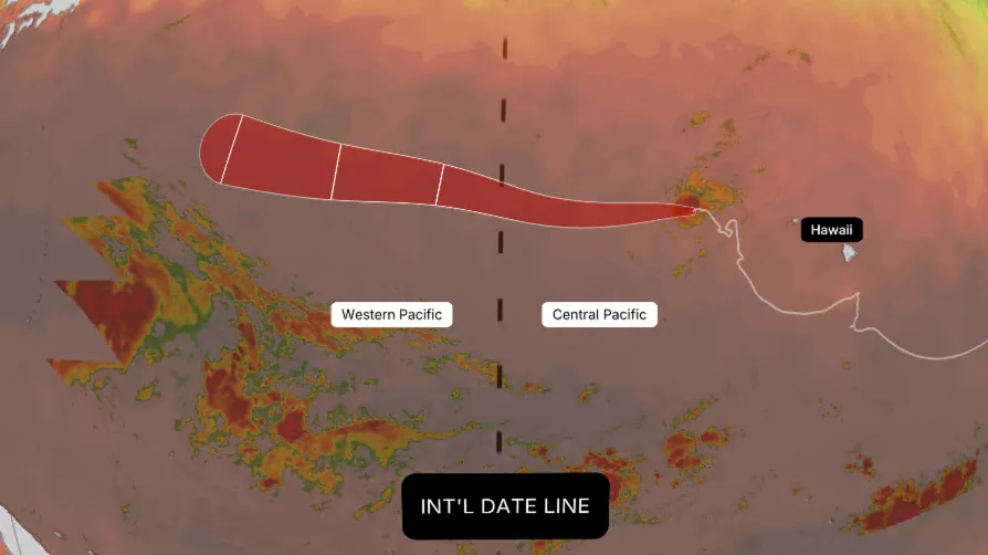
Why Hurricane Nolo could become Typhoon Nolo this weekend
Nolo has had quite a week. After weakening to a tropical storm, it remains active and is forecast to cross the International Date Line this weekend. When it does, it won't get a brand-new name — it will simply become Typhoon Nolo. Typhoons are what hurricanes are called in the Western Pacific basin. Whether a storm is called a hurricane or a typhoon depends entirely on geography, not its physical structure. (MORE: Hurricane season maps tracker)Sitting at 180 degrees longitude, the International Date Line marks the boundary between the Central Pacific basin and the Western Pacific basin. Crossing that line from east to west — or vice versa — automatically changes a storm's official title on the map while leaving its assigned name completely intact. Get More of Our News on GoogleSet The Weather Company as a 'Preferred Source' to get quicker access to the news you value.(MORE: Our complete coverage of El Niño)What actually happens:Classification changes: Nolo shifts from "hurricane" to "typhoon" purely because of its geographical position relative to the International Date Line. If sustained winds top 150 mph, it would even be designated a Super Typhoon.
0 comments
No comments yet. Be the first to share your thoughts!