BBlogFlow

Categories

Weather

2567 articles

Weather

Fall heat, storm risk preludes major cooldown in Ontario

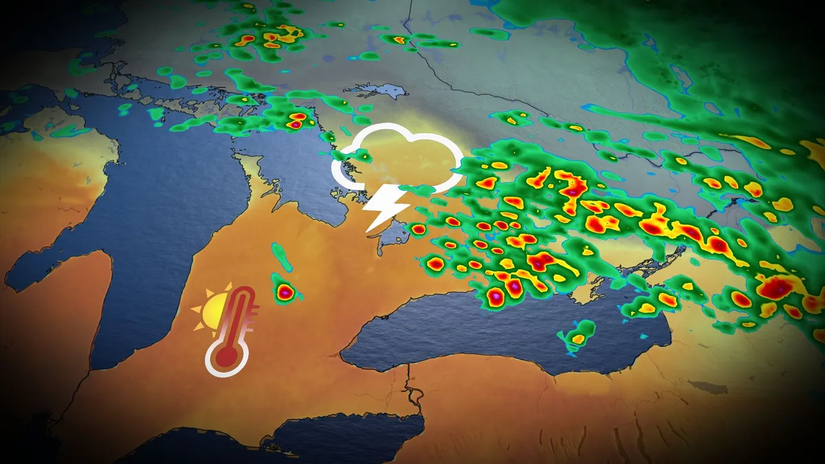
The remarkable heat and humidity will likely be a parting gift from the summer season in southern Ontario this week. Thanksgiving across southern Ontario was notable for its mild temperatures. Toronto reached a high of 22 degrees Celsius, while Windsor reached 26 degrees with a humidex of 31! But don't get used to the warmth; the summer-like conditions and a risk of thunderstorms, perhaps for the final time this year, are expected to continue Tuesday before a sharp cooldown settles in. DON'T MISS: Canada's Winter Sneak Peek: El Niño puts record warmth in playBe sure to stay alert to the changing conditions, and check for any weather warnings in your area. Temperatures to soar early this week, with thunderstorm riskMonday was nice, but it will feel even warmer on Tuesday as moisture from the remnants of post-tropical storm Rachel will sweep across southern Ontario, bringing about three times the atmospheric moisture than we'd typically see this time of year. With the intense humidex, temperatures will feel more like the low- to mid-30s across much of the region, including the Greater Toronto Area (GTA) and London corridor.
The Weather Network·
Weather

Hurricane Isaias death toll hits 8 in Florida and Alabama

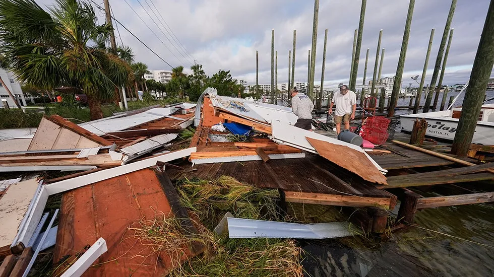
In this aerial view, an apartment complex is seen on Saturday, Oct. 10, 2026, after the roof was blown off when Hurricane Isaias passed through Milton, Florida. Residents were still inside when it happened.(Joe Raedle/Getty Images)At least eight people have died in storm-related incidents across Florida and Alabama after Hurricane Isaias battered the region, leaving behind dangerous conditions, widespread power outages and damage. Florida has reported six deaths, while Alabama has confirmed two. The storm brought powerful winds, heavy rain and flooding to the Gulf Coast, creating hazards that persisted even after the worst of the weather moved through.(MORE: Why falling trees are an underestimated storm danger)“We’ve had some where there were a lot more so I think people did take precautions and I think that local officials did a good job of helping spread the word,” Florida Gov. Ron DeSantis said. Baleigh Ziglar walks around downed trees in front of her mother's home in the aftermath of Hurricane Isaias in Milton, Florida, on Saturday, Oct.

The Weather Channel·
Weather

Rain chances increase across central US as storm system taps Gulf moisture

Let’s take a look at how trading on prediction markets is gauging where rain or snow is most likely across the U. S. on Tuesday. Moisture from Rachel's remnants enhances storms blasting Upstate New York, New England Moisture from the remnants of Rachel, which battered Southern California over the weekend, is being carried over 3,000 miles high in the atmosphere, along a large dip in the jet stream, and is enhancing storms that are blasting parts of Upstate New York and New England Tuesday. Parts of Western and Central New York could see severe thunderstorms with damaging wind gusts and a few isolated tornadoes. Those areas, as well as parts of northern New England including Vermont, New Hampshire and Maine, could see up to 2 inches of rain through Wednesday morning. A developing storm system will trigger showers and thunderstorms from the Rockies into the Plains and Midwest, possibly bring rain to major cities in the region.

Fox Weather·
Weather

SpaceX launch creates glowing 'space jellyfish' in the sky

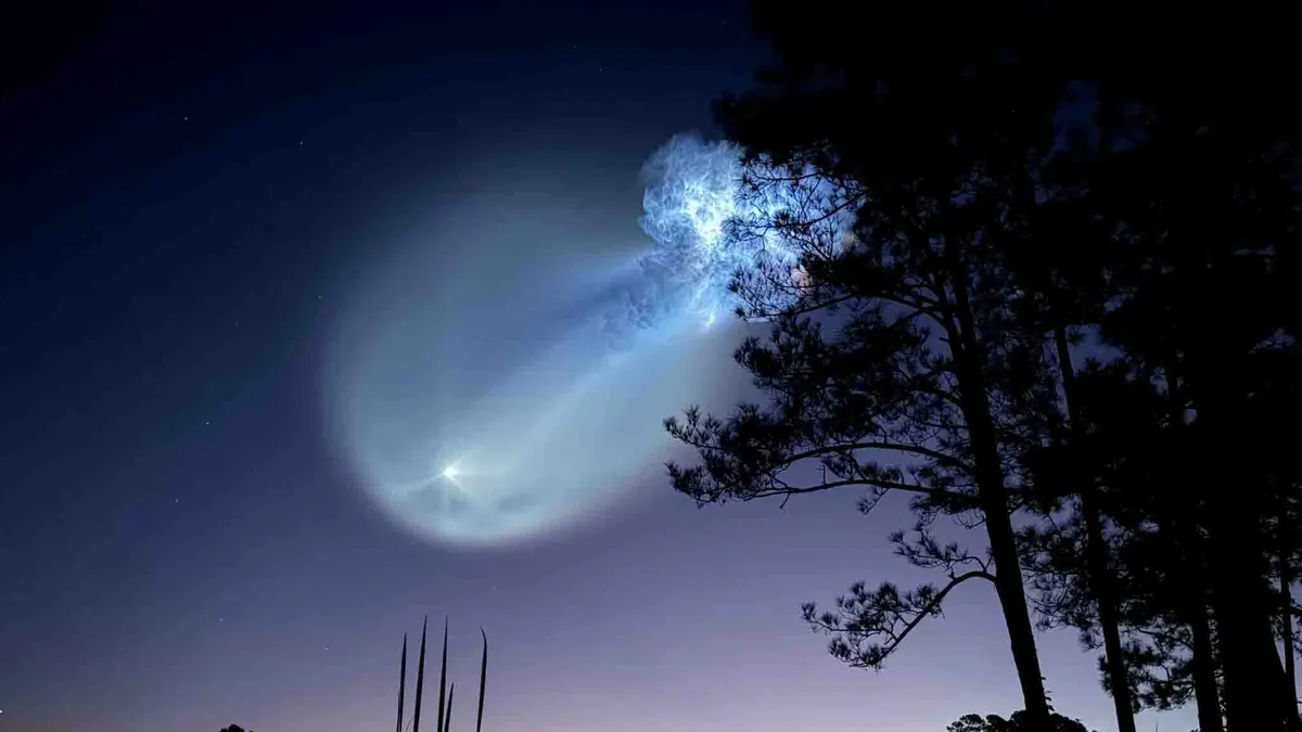
Wow! SpaceX Launch creates mesmerizing ‘space jellyfish’A giant, glowing jellyfish appeared in the morning sky Tuesday, and people across multiple states had a front-row seat. The spectacular light show came courtesy of a SpaceX Falcon 9 rocket, which blasted off from Cape Canaveral Space Force Station in Florida at 6:33 a.m. EDT. The launch was visible across parts of Florida, Georgia and beyond, with reports of sightings extending into North Carolina and Virginia. The SpaceX Falcon 9 launch creates a glowing "space jellyfish" over St. Augustine, Florida.(Bryan Lacouture)Lucky skywatchers got an unexpected bonus: a glowing, jellyfish-shaped plume that looked straight out of science fiction.(MORE: Spooky nebulas haunt the October night sky)What caused the space jellyfish? It takes a perfect combination of sunlight, rocket exhaust and timing. Get More of Our News on GoogleSet The Weather Company as a 'Preferred Source' to get quicker access to the news you value. The Falcon 9 launched shortly before sunrise, when the ground was still dark but the rocket's exhaust plume had climbed high enough to catch the sun's rays.

The Weather Channel·
Weather

'Historic' El Niño increasingly likely, with 83% chance of becoming the strongest on record

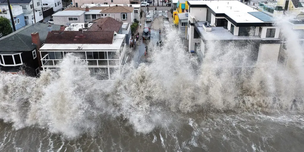
THE TAKEAWAY: September marked the first full month of Super El Niño conditions in the Central Pacific, where El Niño is measured. NOAA's forecast now indicates an 83% chance that this will be the strongest El Niño on record (1950). The Super El Niño will cause the West and South to experience a more active winter. The chances of a potentially historic El Niño are increasing as the U. S. heads into winter, according to NOAA’s latest forecast. El Niño is expected to play a significant role in determining which regions across the country will see more rain and snow this winter. POWERFUL WAVES BATTER SOUTHERN CALIFORNIA COAST, DAMAGING HOMES AND TRIGGERING SINKHOLE Red color indicates above-average water temperatures in the central Pacific where El Niño is measured. (FOX Weather)NOAA's October forecast now indicates an 83% chance that this will be the strongest El Niño since record-keeping began in 1950, up from a 75% chance last month. WHAT’S THE DIFFERENCE BETWEEN A TROPICAL DEPRESSION, TROPICAL STORM AND HURRICANE? El Niño is one of three phases of a climate cycle called the El Niño-Southern Oscillation (ENSO).

Fox Weather·
Weather

Bryan Norcross: The Atlantic looks quiet while hurricanes still threaten Mexico

Is hurricane season over? There's a reasonable chance it is for us, but that's not 100%. Bryan Norcross Moisture from Rachel's remnants enhances storms blasting Upstate New York, New England Moisture from the remnants of Rachel, which battered Southern California over the weekend, is being carried over 3,000 miles high in the atmosphere, along a large dip in the jet stream, and is enhancing storms that are blasting parts of Upstate New York and New England Tuesday. Parts of Western and Central New York could see severe thunderstorms with damaging wind gusts and a few isolated tornadoes. Those areas, as well as parts of northern New England including Vermont, New Hampshire and Maine, could see up to 2 inches of rain through Wednesday morning. Between cold fronts pushing south over the Gulf and Florida, and the El Niño-driven band of upper-level winds over the Atlantic, no tropical development is expected in the foreseeable future that could affect the U. S. or nearby areas. Is hurricane season over? There's a reasonable chance it is for us, but that's not 100%.

Fox Weather·
Weather

Moisture from Rachel's remnants enhances storms blasting Upstate New York, New England

"Getting Pacific moisture into New England is not unheard of, but this has tropical origins making it unique," the FOX Forecast Center said. THE TAKEAWAYMoisture associated with the remnants of former Tropical Storm Rachel has traveled from California to New EnglandParts of New England, particularly the northern portions of Vermont, New Hampshire and Maine, could see up to 2 inches of rain through Wednesday morning. A Level 1 out of 5 risk of severe storms has also been issued for parts of upstate New YorkMoisture from the remnants of Rachel, which battered Southern California over the weekend, is being carried over 3,000 miles high in the atmosphere, along a large dip in the jet stream, and is enhancing storms that are blasting parts of Upstate New York and New England Tuesday. EYE OF THE SEASON: THE MOST NOTABLE ATLANTIC HURRICANES DURING EL NIÑO YEARS🌊 UNDER WATER: Las Vegas was at the epicenter of some intense flooding Sunday as the remnants of Rachel barreled through the region. Video shows water gushing down streets and instantly flooding roadways.

Fox Weather·
Weather

The historic October snowstorm that brought 30 cm to Ontario

An unusually early band of lake-effect snow caused millions of dollars in damages when it blew off Lake Erie during the middle of October 2006. Dubbed the “October Surprise” by residents affected by the storm, the potent squall produced snowfall rates as high as 10 cm per hour in the hardest-hit areas. DON’T MISS: Snow and ice are heavy hazards that can damage trees, roofsLake-effect snow season typically runs from late autumn into the winter months. But conditions occasionally align to bring hefty totals early in the season. One of those early-season setups developed during the second week of October 2006. A strong low-pressure system over the Upper Midwest and northern Ontario sent a potent cold front sliding east across the Great Lakes. Water temperatures on Lake Erie ran several degrees warmer than normal for this point in the year, with surface readings hovering in the middle to upper teens. Meanwhile, the storm system ushered in unusually cold air aloft. The sharp contrast between warm waters and cold air triggered convection over Lake Erie. Strong, persistent winds oriented perfectly down the length of the lake organized that convection into one long squall.

The Weather Network·
Weather

Fall offers southern Ontario a final summer heat boost, severe storm risk

Get ready for what will likely be a parting gift from the summer season in southern Ontario. Summer-like conditions and a risk of thunderstorms, perhaps for the final time this year, are expected early in the week before a sharp cooldown settles in. Some of the storms on Monday night and Tuesday could reach severe limits in many locales, so stay alert. DON'T MISS: Canada's Winter Sneak Peek: El Niño puts record warmth in playBe sure to stay alert to the changing conditions, and check for any weather warnings in your area. Don't get used to the warmth: A significant temperature drop in time for the weekend. Temperatures to soar early this week, with thunderstorm riskConditions will change Monday overnight into early Tuesday, when a potent low and warm front will spread showers and thunderstorms across southern Ontario. Folks can expect some strong storms ahead of and along the warm front, bringing heavy rain and strong 80+ km/h wind gusts into Tuesday morning.

The Weather Network·
Weather

Frost advisory vs. freeze warning: What's the difference?

A layer of frost covers plants on a lawn on Edwards Street in Quincy, Massachusetts.(Pat Greenhouse/The Boston Globe via Getty Images)As we transition into the winter season, the National Weather Service may issue a combination of frost advisories, freeze warnings and hard freeze warnings for your area — but what do these all mean? They each have unique criteria and can have different impacts on your plants and your house, which in turn can impact how you prepare for each one. Let's break down the differences:Frost advisoriesCriteria: Issued when the low temperature is forecast to be between 33 to 36 degrees on a clear night with light winds. Frost can form without the temperatures creeping all the way down to freezing.(MORE: First real cold comes this weekend)Get More of Our News on GoogleSet The Weather Company as a 'Preferred Source' to get quicker access to the news you value. This is because of a combination of wind, humidity and cloud cover that allows surfaces like roofs, grass, leaves and car windshields to cool below the dew point — leaving behind that dusting of frost. While the growing season can continue after a frost, it can damage sensitive plants.

The Weather Channel·
Weather

Isaias: Google's DeepMind AI model keeps outperforming rivals

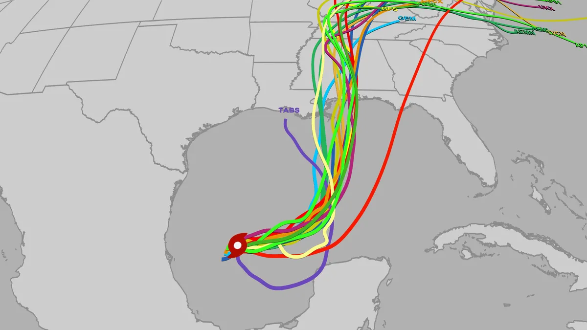
We got a glimpse of what the Google DeepMind (GDM) model could do during last hurricane season, and we’ve been watching all of the AI models this season, too, but Hurricane Isaias provided the first real test for it this Atlantic hurricane season. The model began to hint at tropical development in the Bay of Campeche as many as 12 days before the system actually formed, but it did lose the signal for several days. It and other models brought back development chances just over three days before the tropical depression that became Isaias formed. (MORE: Hurricane Isaias recap)This storm then brought an interesting conundrum several days before landfall: Do we trust the models that we have been using for years such as the European model and GFS American model or the HAFS and HMON hurricane models — or do we trust the new kid on the block, this Google DeepMind AI model? The two camps of models were decidedly split several days before landfall, and it happened that the Google model was on the right eastern side of the models.

The Weather Channel·
Weather

What is freezing fog? Plus, how to stay safe when it hits

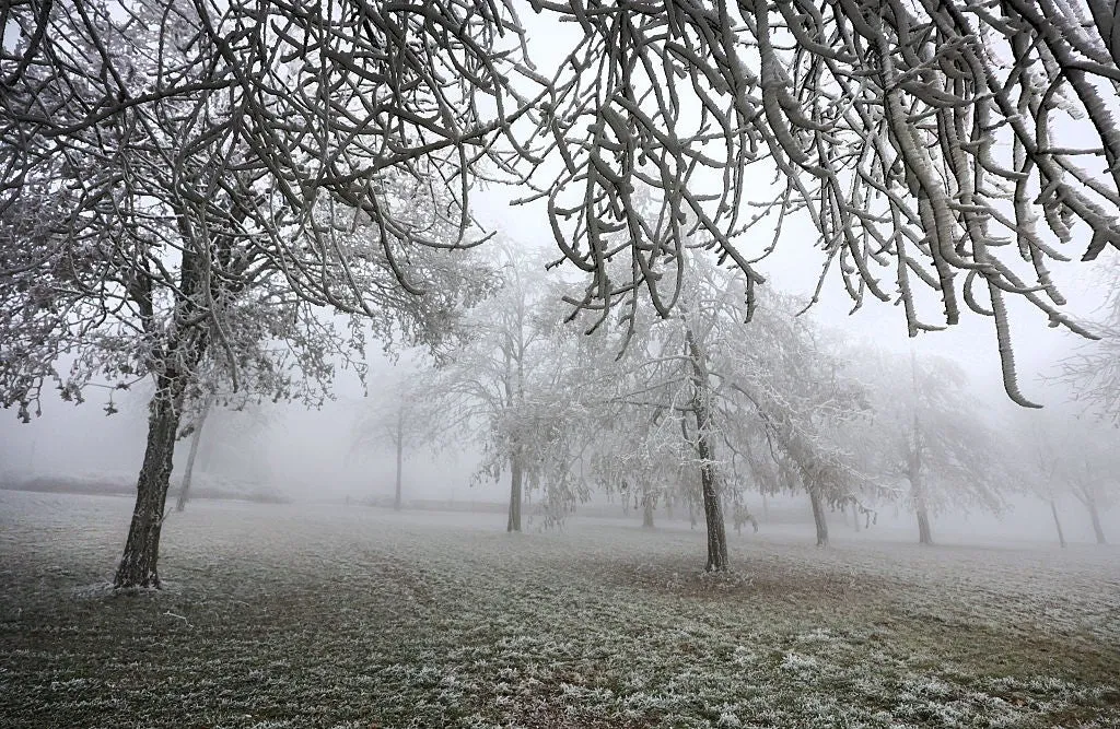
Freezing Fog: What Is It And How Can It Impact You? As temperatures begin to drop below freezing, fog can become a much more dangerous threat, turning a normal commute into a travel nightmare. Fog often forms when air near the ground cools enough that water vapor in the air condenses into tiny suspended water droplets. This typically occurs at night and in the early mornings when Earth’s surface loses heat. But when the air temperature is below freezing (32 degrees Fahrenheit), these water droplets are “supercooled,” meaning they’re liquid even though it’s below freezing. When this happens, it’s known as freezing fog. Freezing fog can be extremely dangerous because when these water droplets land on surfaces like roads, trees and sidewalks, they instantly freeze on contact, creating a thin, nearly invisible layer of ice. 18 January 2026, Baden-Württemberg, Uttenweiler: Trees covered in hoarfrost stand in a meadow in Upper Swabia. Photo: Thomas Warnack/dpa(Thomas Warnack/picture alliance via Getty Images)Freezing fog can cause black ice to form on sidewalks and roadways. Black ice is difficult to see because it’s thin and clear, but it’s also particularly dangerous to drive on.

The Weather Channel·
Weather

Tornado warning and frost alert in October shows fall's changeability

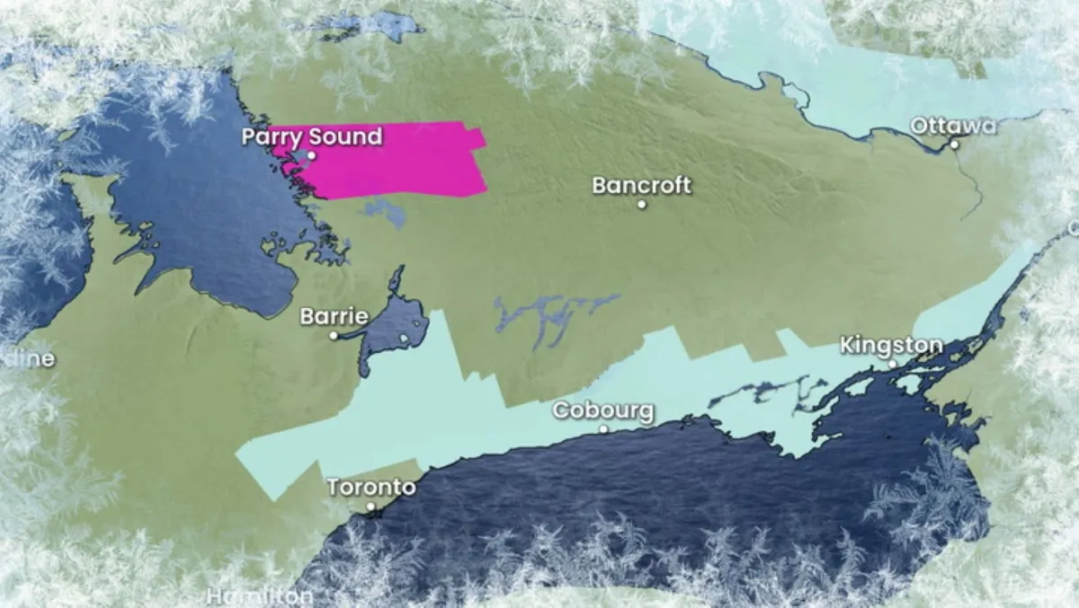
A tornado warning and a frost advisory were in effect concurrently in Ontario on Friday, Oct. 9, with the former alert catching many off guard. The alerts weren't too far apart, either, with a tornado warning in effect east of Georgian Bay and the frost advisory lining parts of the Greater Toronto Area (GTA) and extending as far north as the shores of southeastern Lake Simcoe. "Yeah, it's a little weird, a little bit unusual, but not unheard of," said Mark Robinson, Storm Hunter and meteorologist at The Weather Network. Because fall and spring are known as shoulder seasons, with the right parameters, you can get severe thunderstorms and tornadoes, Robinson said. With the right amount of wind shear and heat, "everything is balanced" so you can get them, he added. And typically, frost does occur in the fall under the right conditions. In Ontario, the average occurrence of the first frost will vary, as outlined in the graphic above. Content continues belowWhat led to the tornado warning? Daytime heating and a lakeside boundary gave way to the development of isolated supercells off of Georgian Bay in northeastern Ontario on Friday.

The Weather Network·
Weather

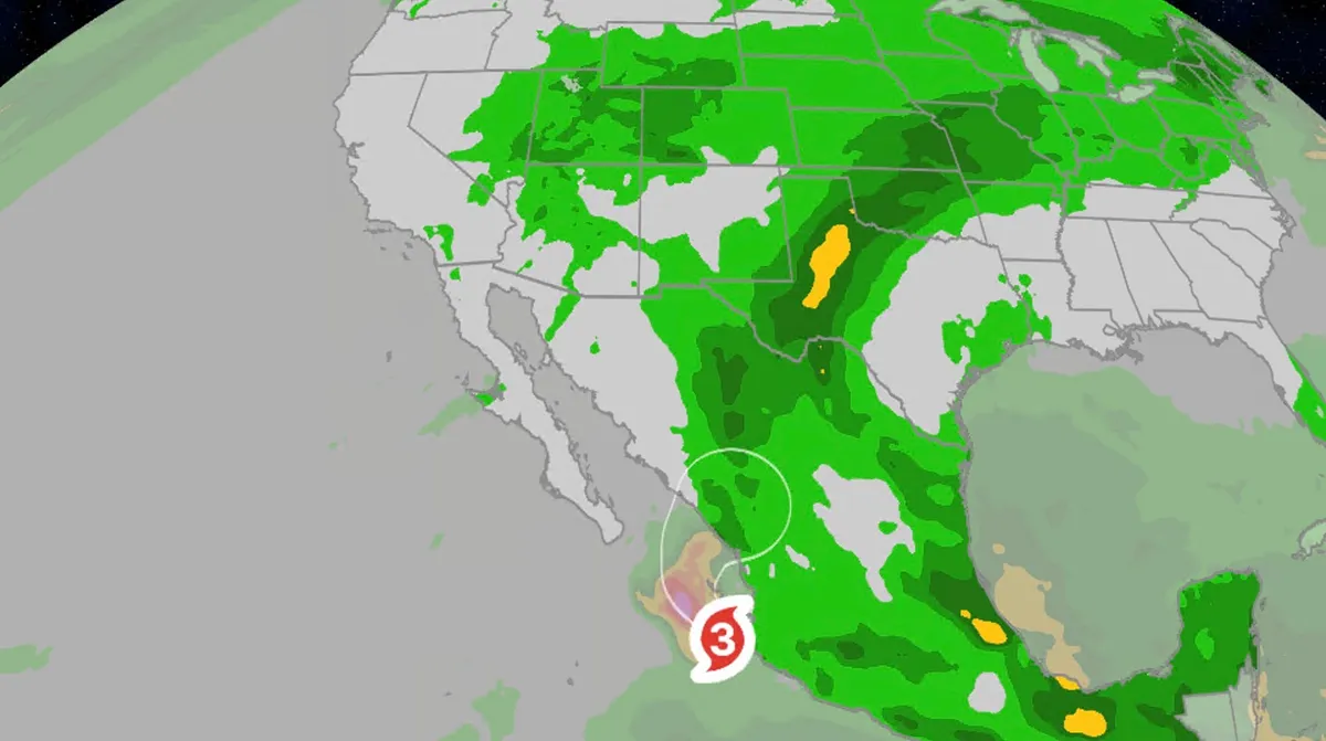
Rachel's remnants to flood SW while Simon targets Mexico

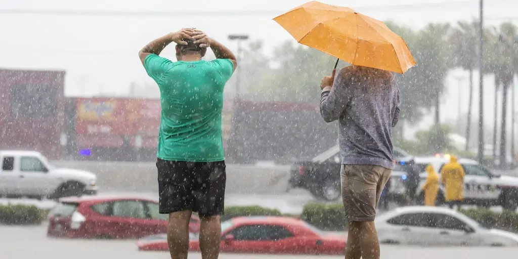
Rachel’s remnants bring soaking rain to Desert Southwest, CaliforniaRachel's remnants will trigger flooding rain and strong winds well inland across the Desert Southwest, including cities like Las Vegas. We'll also see heavy snow in parts of the northern Rockies and Hurricane Simon is poised to rake western Mexico. First, RachelAs the remnant moisture and upper-level spin from Rachel moves across the Southwest, heavy rain could bring flash flooding across the region, from Southern California to Wyoming, lingering into Tuesday for some. Widespread rain totals of 1 to 5 inches are expected with locally higher amounts possible. This could lead to flash flooding of normally dry creeks, arroyos, slot canyons and urban areas, including parts of the L. A. Basin, San Diego metro, Las Vegas and Salt Lake City. If you had plans for any of the national parks in the Southwest, we would suggest canceling those plans until Wednesday, given the threat of both flash flooding and thunderstorms. Get More of Our News on GoogleSet The Weather Company as a 'Preferred Source' to get quicker access to the news you value.(MORE: What to do before, during and after a flood)Wait – is that snow on the map?

The Weather Channel·
Weather

So long, summer: A final checklist for properly closing your cottage

Now with summer firmly in the rearview mirror, despite what the forecast says for early this week in southern Ontario, it is a good time to do a final inspection before shutting down your cottage until the springtime. If you don't give it a thorough check before closing up, things such as frozen pipes, pest infestations, and ice damage can lead to costly repairs come springtime. First thing: Drain the sinks. "Drain everything because water expands as it freezes, and if you don't get all the water out, you could have ruptured lines. Add antifreeze to toilets and drains to ensure any remaining water doesn't freeze. Pull the lines that go out into the lake, and ensure they're drained and stored in a safe place, well away from the lake water," said Mark Robinson, Storm Hunter and meteorologist at The Weather Network. (Pexels)Once the power is off, empty your water heater. Content continues belowNext, you can properly manage your electricity. According to Robinson, you have two choices: Turn off the power completely or leave it on. But, make sure to unplug appliances and entertainment systems.

The Weather Network·
Weather

Dodger Stadium didn't flood — here's what you're looking at

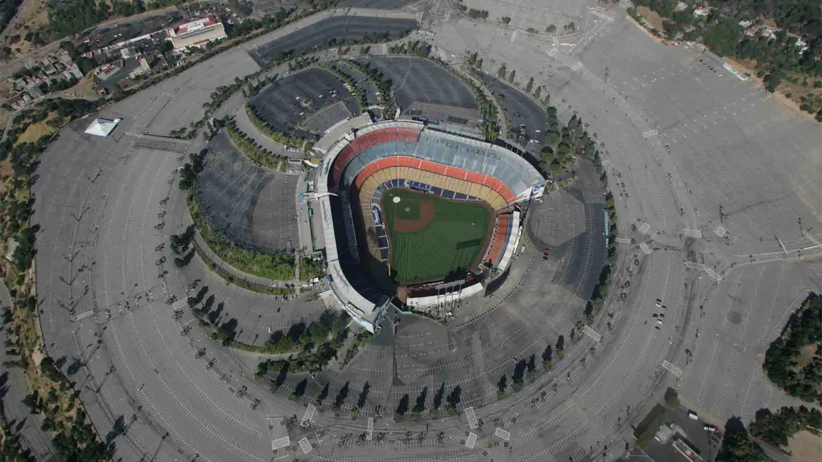
Aerial view of Dodger Stadium(Don Kelsen/Los Angeles Times via Getty Images)Did Dodger Stadium flood? A viral video might make you think so, but the answer is no. What looks like a massive pool of water surrounding the stadium is actually a series of empty parking lots creating an optical illusion. The misleading video is making the rounds online again, just as it did during Tropical Storm Hilary in 2023. Debunking the illusionFrom above, the dark pavement can look remarkably like floodwater, especially when the stadium's parking areas blend together from certain angles. Cloudy skies in the video make the illusion even more convincing. Without direct sunlight, the parking lots can look darker from above.(MORE: Giant waves crash into Long Beach, California homes)Get More of Our News on GoogleSet The Weather Company as a 'Preferred Source' to get quicker access to the news you value. That reduces the contrast between the pavement and surrounding surfaces, making the lots appear more like a reflective sheet of water. The stadium's elevation is another clue. Dodger Stadium sits about 250 feet higher than downtown Los Angeles.

The Weather Channel·
Weather

Hurricane Isaias hit Gulf Coast, spread rain and wind inland

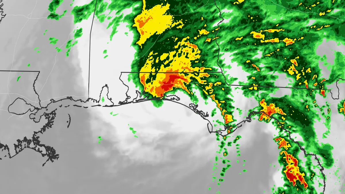
Hurricane Isaias rips roofs off homes with residents huddled insideHurricane Isaias slammed into the Florida Panhandle's Gulf Coast, then spread its heavy rain, winds and spawned tornadoes over the South and East fighting off winds shear during a super El Niño Atlantic hurricane season. The landfallIsaias made landfall near Destin, Florida, on the evening of Oct. 9 with sustained winds of 105 mph, a Category 2 hurricane. That was the first hurricane to landfall in the mainland U. S. in two years, since Milton slammed into western Florida on Oct. 9, 2024. Isaias' storm surge, windsIsaias' highest storm surge inundation was generally along and to the east of its landfall. According to preliminary data from the National Weather Service in Mobile, Alabama, the highest inundation was measured in Panama City (5.6 feet), while 4-feet of inundation was recorded in Destin and 2.73 feet occurred in Pensacola. Post-storm surveys will likely be done to determine what the final peak storm surge inundation was along the Gulf Coast. Get More of Our News on GoogleSet The Weather Company as a 'Preferred Source' to get quicker access to the news you value.

The Weather Channel·
Weather

Winter weather brings parts of the Prairies their first fall snow

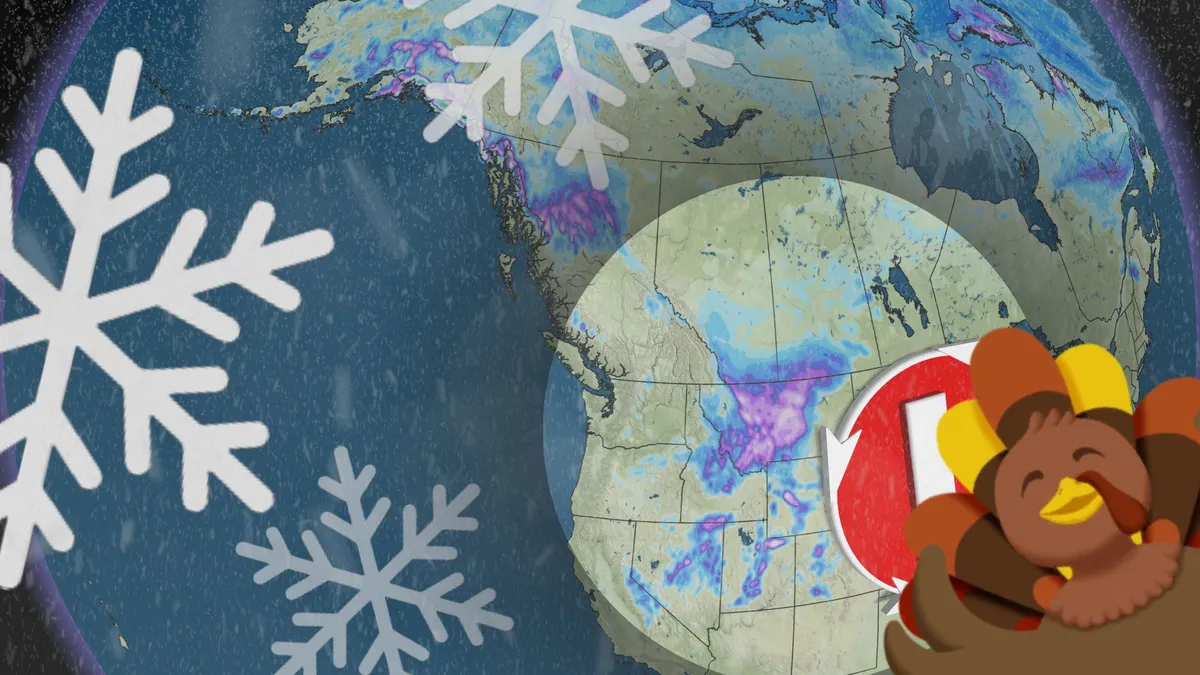
Parts of Alberta saw their first snowfall of the season during this Thanksgiving long weekend. An upper-level trough bringing a long-weekend chill to Western Canada helped bring some snow to Alberta Saturday and Sunday. Calgary and Edmonton, Alta., saw their first fall snowfall this weekend, with minimal accumulations recorded. DON’T MISS: Canada's Winter Sneak Peek: El Niño puts record warmth in play Calgary, Alta., saw its first fall snowfall this weekend. (Connor O'Donovan/The Weather Network)Up next for the snowfall will be southwestern Saskatchewan, forecast to see it move in on Monday as it exits southeastern Alberta. Temperatures plunge across southern Alberta as snow lingersBoth Calgary and Edmonton received their first fall snowfall this weekend. Environment and Climate Change Canada (ECCC) has continued some of the snowfall warnings for parts of Alberta, along with special weather statements. Content continues belowBands of wet snow pushed across the Calgary area Saturday evening, with the airport officially reporting 1 cm of snowfall accumulation by early Sunday morning. Last fall, the first snowfall of the year at the Calgary airport occurred on Oct. 12 (1 cm).

The Weather Network·