BBlogFlow

Categories

Weather

2511 articles

Weather

Hurricane Hazel was one of Ontario’s worst modern disasters

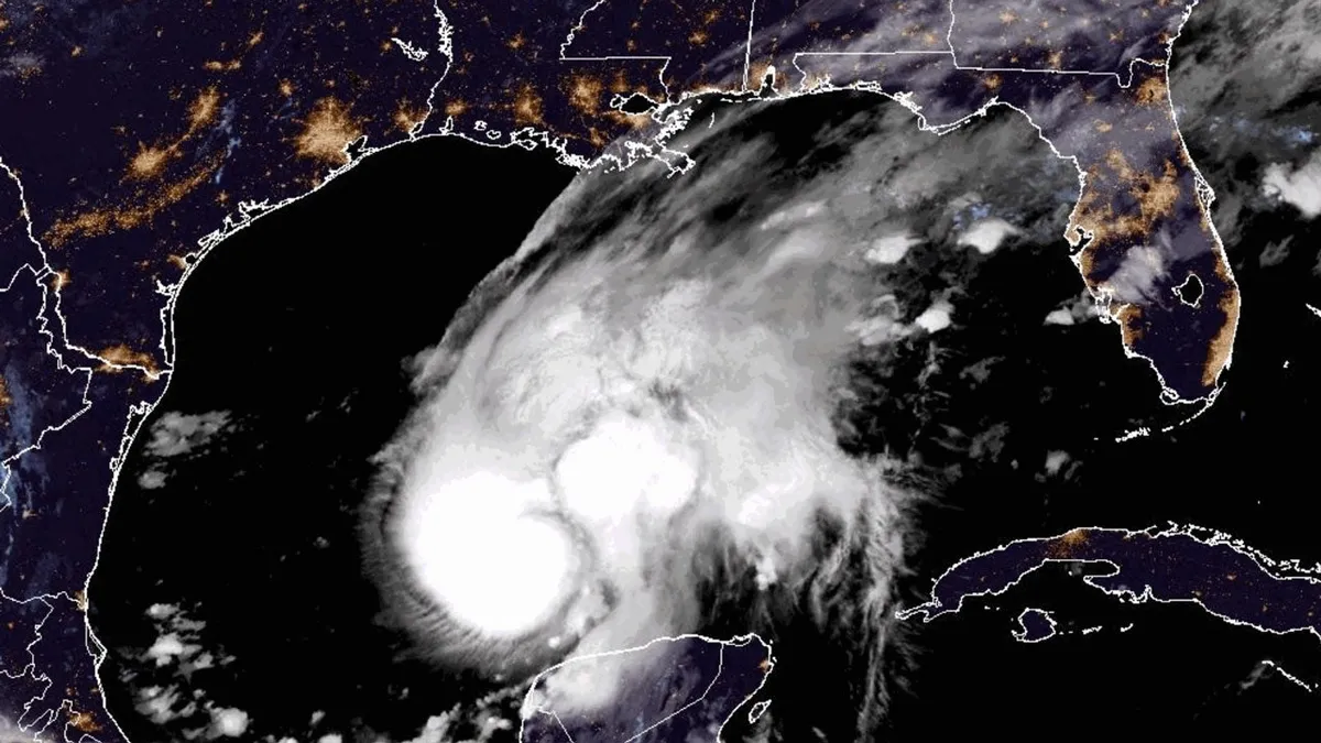
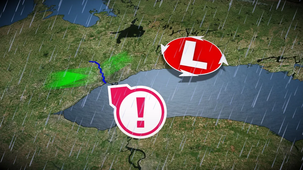
Hurricane Hazel grew into one of Ontario’s most destructive storms in modern history--and the storm made landfall more than 1,000 kilometres away. Dozens of people died when the storm’s drenching rains unleashed flash floods throughout portions of the Greater Toronto Area. Gusty winds caused additional damage and power outages. DON’T MISS: Hurricane remnants can bring dangerous weather deep into CanadaHazel began as a tropical storm near Barbados on the morning of Oct. 5, gaining major hurricane status five days later as it turned toward Haiti. The hurricane's destructive winds and flooding rains killed hundreds of people in the country. The storm strengthened further as it accelerated toward the U. S. East Coast, making landfall near Myrtle Beach, South Carolina, as a Category 4 hurricane. Hazel produced wind gusts as high as 225 km/h and a storm surge of 5.5 metres above ground level where it came ashore. A few hours after landfall, Hazel underwent an extratropical transition in a process very similar to what we saw during Sandy in 2012 and Fiona in 2022. The system, now akin to an exceptionally strong nor’easter, raced toward Ontario.

The Weather Network·
Weather

Flash flood threat grows as Simon's moisture fuels intense storms, slams millions across Central US

THE TAKEAWAYThunderstorms broke out across a 1,500-mile corridor from Texas to West Virginia on Wednesday. Some of the heaviest rain concentrated over parts of Central Oklahoma, including Oklahoma City, where a Level 3 out of 4 risk of flash flooding was in effect. A large dip in the jet stream is funneling moisture north from Tropical Storm Simon and will enhance storms across parts of the Central U. S. and Ohio Valley through Thursday. Storms enhanced by moisture from Tropical Storm Simon impacted millions of people across the Central U. S., churning over 1,000 miles away in the Pacific. RACHEL'S REMNANTS FUEL MAJOR WEST COAST FLOOD THREAT WITH HEAVY RAINFALL SOAKING MILLIONS Storms roll through Wichita, Kansas, on Tuesday, Oct. 13, 2026. (Gary Brown / FOX Weather)Thunderstorms capable of producing rain rates of 1 to 2 inches of rain per hour broke out across a 1,500-mile corridor, covering more than 35 million people from Texas' Big Bend region to Morgantown, West Virginia. Some of the heaviest rain concentrated over parts of Central Oklahoma, including Oklahoma City, where a Level 3 out of 4 risk of flash flooding was in effect.

Fox Weather·
Weather

These cities will see the biggest temperature drop this week

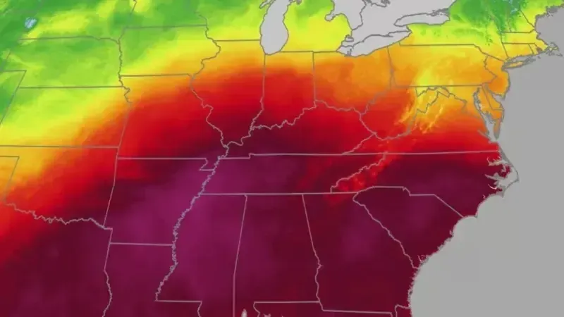
Coldest air of the season set to arrive this weekend for millionsA sprawling cold front is about to end a stretch of record October warmth across a huge swath of the country over the next 48 hours, from the Southern Plains to the Tennessee Valley, and temperatures are about to plummet. Afternoon highs that have felt like summer, in the 80s and 90s, are set to fall by 20 degrees or more in a single day for millions. Get ready for a wild temperature roller coaster. Who will see the biggest drops? Areas from Dallas to Nashville will experience the biggest swings, with temperatures dropping as much as 15 to more than 25 degrees cooler in 24 hours. Little Rock might have the steepest fall of all. The forecast high on Thursday is 93, then will drop 27 degrees in 24 hours, to a high of only 66 degrees on Friday. St. Louis is waiting in line for a similar ride. They will see a high of 78 degrees on Thursday, and drop 23 degrees to a high of 55 on Friday. Get More of Our News on GoogleSet The Weather Company as a 'Preferred Source' to get quicker access to the news you value.

The Weather Channel·
Weather

Fall weather can still turn your parked car into an oven

(Getty Images)A parked car doesn't care what the season is. Even highs in the 50s can turn your car into an oven. Sunlight passes straight through glass and heats the inside, and that heat has nowhere to go. Most of us think of dangerous heat inside a car as just a summer problem. But temperatures we might consider "cool" can still be dangerous, and even deadly. If the outside air is a cool 57 degrees, it can still push a parked car's interior past 110 within about an hour, according to research cited by the National Highway Traffic Safety Administration.(MORE: How meteorologists forecast peak fall foliage weeks in advance)In the first 10 minutes, interior temperatures can climb by roughly 19 degrees. Most of that rise happens fast. Cracking a window doesn't help as much as you might expect. Research on the subject has found a slightly open window makes almost no difference to either how fast a car heats up or how hot it ultimately gets inside.

The Weather Channel·
Weather

Winter 2026/2027 Snowfall Forecast: How October Data Changed Your Region’s Outlook

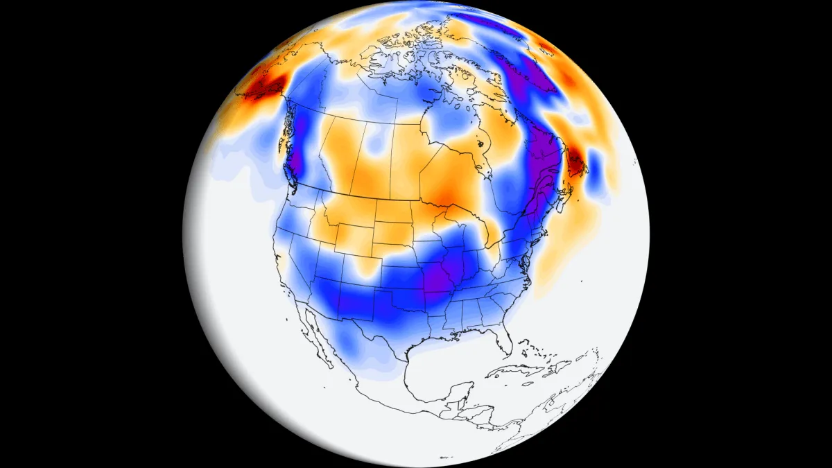
The latest October data from six seasonal models now broadly agree on the overall Winter 2026/2027 snowfall pattern. A Super El Niño footprint is clear, with more snow across much of the southern and central United States and less snow for the northern U. S., southern Canada, and most of Europe. The models also agree on the timing: a slow start to the snow season in December, with the strongest snowfall signal arriving in the second half of winter and likely continuing into early spring. That is a clear Super El Niño signature. In this article, I present the full set of snow maps, including the change from the previous month’s snow forecast, the snow spatial distribution, and the forecast for ski areas. I also added a Snowfall Explorer where you can check the detailed snow forecast for your own state, province, region, or country in the United States, Canada, and Europe. October Update: What Changed in the Snowfall Forecast The image below shows how the latest ECMWF snowfall forecast changed from the September to the October run. Blue colors show where the new run has more snow than before, and brown colors show where there is less.

Severe Weather Europe·
Weather

Amelia Earhart mystery could be a step closer to being solved as researchers investigate possible plane wreck

THE TAKEAWAYA 17-person joint-effort crew arrived at Nikumaroro Island to begin investigating the Taraia Object, believed to be Amelia Earhart's plane. Research crews will conduct biological and environmental surveys. The next phase will use sonar to detect objects beneath the lagoon floor sediment. NIKUMARORO, Kiribati – The search for Amelia Earhart’s crashed plane is entering a new phase as the Taraia Object expedition team travels to the island where researchers believe she may have disappeared. This comes after satellite imagery revealed an object off the coast of Nikumaroro Island, leading researchers to believe it could be Earhart’s aircraft. A 17-person joint effort crew, part of the Taraia Object Expedition Team, Archaeological Legacy Institute, Purdue Research Foundation and Purdue University, arrived on the island on Monday to begin investigations of the visual anomaly, known as a Taraia Object, which is a commonly used name for a visual anomaly in the lagoon of Nikumaroro Island.10 PLACES IN THE US WITH A HAUNTED HISTORY TO VISIT IF YOU DAREThe Taraia Object was first located in 2020, but has been in the same spot since 1938, about 10 feet from the lagoon's shore.

Fox Weather·
Weather

Multimillion-dollar California oceanfront homes battered by relentless Pacific waves as coastline crumbles

THE TAKEAWAYPowerful waves from Tropical Storm Rachel damaged multimillion-dollar homes and destroyed sections of Long Beach’s historic boardwalk. Eight buildings representing 13 residential addresses were red-tagged as unsafe to enter, while one additional building received a yellow tag. Long Beach is launching emergency repairs and a multistep coastal-protection plan as El Niño threatens to bring more erosion and high-surf events. LONG BEACH, Calif. – Powerful waves generated by Tropical Storm Rachel tore through the Long Beach Peninsula over the weekend, damaging lavish multimillion-dollar oceanfront homes and destroying sections of the historic boardwalk as the California city continues battling rapid coastal erosion.

Fox Weather·
Weather

Big Sky braces for winter as early snowfall raises questions about what's ahead in December

As fall progresses, temperatures will steadily drop as northern states begin preparing for the season's first snow. The temperature shift comes as a massive cold front moves across the U. S. later this week, accompanied by an area of low pressure moving into the Great Lakes and Northeast region starting Friday and intensifying on Saturday. "As this area of low pressure strengthens, the pressure gradient between it and the strong high to its west will increase the coverage of gusty winds across much of the Northeast, helping usher in cooler air," the FOX Forecast Center said. RAIN, WIND AND… SNOW? TROPICAL STORM LALA BRINGS A WINTRY SURPRISE TO HAWAIIA surge in low pressure across portions of the Midwest and Great Lakes on Thursday will help bring rain showers later in the evening to parts of the Northeast and northern New England. A cold front associated with this low-pressure area will center over Southeastern Canada, bringing heavy rain to cities such as Syracuse, New York, Burlington, Vermont, and Bangor, Maine, by mid-afternoon Friday. This graphic shows the winter weather trends beginning across portions of the Northern U.

Fox Weather·
Weather

Pacific Coast Highway crack shuts lane near Laguna Beach

Blue sky over the farthest south end of Crystal Cove beach, Southern California in summer(Getty Images/iStockphoto)Months of pounding surf have left a massive crack in the cliff supporting California’s iconic Pacific Coast Highway, raising concerns that more of the coastal roadway could be at risk as El Niño strengthens. The damage near Laguna Beach, next to the Crystal Cove State Park lifeguard headquarters, forced Caltrans to close one southbound lane between El Morro Canyon and Irvine Cove. The closure is expected to last several days or longer, with no reopening timeline announced. State Parks has already closed portions of Crystal Cove and San Onofre State Beach following damaging surf from Tropical Storm Rachel. Visitors staying in 26 beach cottages were also evacuated as crews assessed the damage. Waves, high tides and El Niño take a tollThe crack follows months of powerful waves battering Southern California, fueled by recent hurricane swells, high tides and developing El Niño conditions. Get More of Our News on GoogleSet The Weather Company as a 'Preferred Source' to get quicker access to the news you value.

The Weather Channel·
Weather

Is hurricane season over? Here's what past super El Niños have shown

Mother and daughter survive as Isaias rips off their roofThe Atlantic hurricane season may already be over if previous super El Niños are a guide, at least when it comes to any tropical threat to the mainland U. S. Quiet for a whileAs you can see in the map below, there aren't any areas with a significant chance of development in the next week, according to the National Hurricane Center. In fact, there's not a really strong signal in any of the forecast models, including AI models, for the next two weeks in the Atlantic Basin. (MORE: AI models shined again during Hurricane Isaias)Have we seen our last hurricane for 2026? The short answer is "it's probably over, as far as a significant threat goes. "Officially, the Atlantic hurricane season goes through the end of November. Get More of Our News on GoogleSet The Weather Company as a 'Preferred Source' to get quicker access to the news you value. But wind shear typically becomes stronger as we head toward November. And that shear is being enhanced by the current super El Niño. Wind shear is hostile for systems trying to become tropical storms. What's a typical hurricane season?

The Weather Channel·
Weather

Record heat this week: warmest Jan.-Sept. on record in US

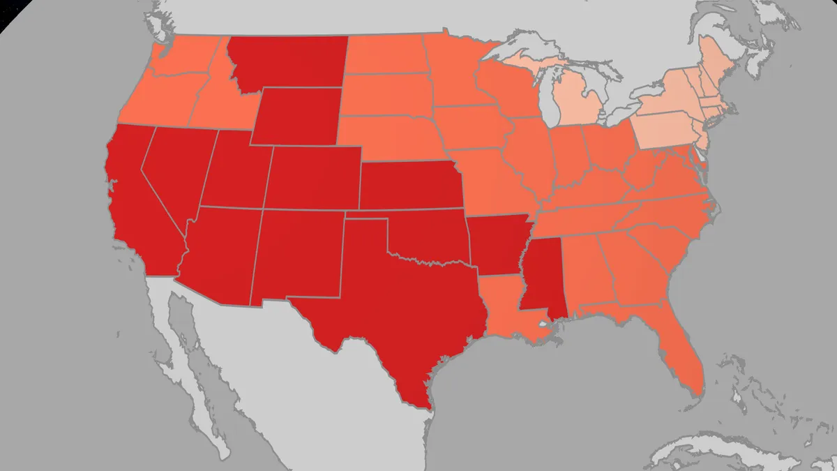
If it feels like summer never left, the numbers back you up. This week brought a fresh wave of record-breaking heat across the country, even as calendars flip toward Halloween. How hot has it been? In a word: hot. According to U. S. National Climatic Data Center (NCDC), we have seen more than 600 daily high records tied or broken in the past week, primarily across the central and eastern U. S. Another 700 daily warm low records were tied or broken as well, so there was little relief when the sun went down.(MORE: These cities will see the biggest temperature drops)St. Louis nearly tied its all-time October heat record, hitting 93 degrees at Lambert International Airport. Its all-time record is 94 degrees, set back in 1953. The 93 degrees did shatter a daily record that had been in place for over 100 years, dating back to 1899. Get More of Our News on GoogleSet The Weather Company as a 'Preferred Source' to get quicker access to the news you value. The Twin Cities saw back-to-back record days, reaching 90 on Oct. 10 and 11 and running more than 20 degrees above the historical average. Denver has seen its longest streak of 80-plus-degree days in October since record-keeping began.

The Weather Channel·
Weather

Bryan Norcross: Sting jet or no sting jet & Simon and Trudy give forecasters fits in the Pacific

Two of the season's strongest hurricanes could be brewing in the Pacific Two potential monster hurricanes could be brewing in the Eastern and Western Pacific basins that could make landfall. Tropical Storm Trudy is expected to rapidly intensify into a Category 4 hurricane before potentially making landfall along the western Mexican coast. Meanwhile, Invest 96W could pass over the U. S. territories of Guam and the Northern Mariana Islands as a typhoon, en route to matching Super Typhoon Sinalaku as the strongest storm on earth this year, with sustained winds of 185 mph. Last updated at 9:30 a.m. on Oct. 14, 2026The El Niño-driven band of upper-level winds stretches from the Gulf to the Caribbean to Africa. We still can't rule out a system developing in a random pocket of slightly supportive atmosphere outside of the band before this hurricane season ends, however, so we'll continue to watch. LATEST FROM FOX WEATHER HURRICANE SPECIALIST BRYAN NORCROSSFor now, no tropical development is expected for the foreseeable future. Atlantic Basin on Oct.

Fox Weather·
Weather

Record fall heat wave at its peak in Central and Eastern US ahead of plunge into weekend chill

THE TAKEAWAYOver 20 states will see above-average temperatures amid a fall heat wave through Thursday. Temperatures will dramatically drop 40 degrees from late week into the weekend. Much of the country from Texas to New England could see its coldest air since spring. The end of summer might finally be near in the Central and Eastern U. S., as a fall heat wave fades to more autumnal temperatures. Millions of people across the Great Plains, Midwest, Deep South and Southeast are at the peak of another round of unseasonable October heat, with temperatures soaring well above average through Thursday. A sprawling dome of high pressure is pumping warm, humid air north, sending temperatures into the upper 80s and 90s across the Midwest, while the Southern Plains, Mid-South and Southeast climb into the mid to upper 90s. FALL ALLERGIES OR A COLD? HERE’S HOW TO TELL WHAT’S MAKING YOU MISERABLE SAN DIEGO, CALIFORNIA - OCTOBER 27: A man runs on a palm tree-lined street in La Jolla as the sun sets on the horizon of the Pacific Ocean on October 27, 2025 in San Diego, California.

Fox Weather·
Weather

Winter arrives early across the Northern Rockies as heavy snow blankets the West

THE TAKEAWAY: Heavy snow and rain to slam Montana and the Northern Rockies until Wednesday. The heaviest snowfall is expected to impact high-elevation passes and mountain peaks. Elevations above 8,000 feet could see an additional 8 to 12 inches of snow. Winter is arriving early across Montana and the Northern Rockies as heavy snow and rain blanket the region through Wednesday. WINTER MAKES AN EARLY APPEARANCE AS MOUNT WASHINGTON RECORDS FIRST MEASURABLE SNOWThe winter weather comes as moisture from the remnants of former Tropical Storm Rachel moves across the region. The amount of snow expected.(FOX Weather) As Rachel’s remnants continue east toward New England, a deep dip in the jet stream is bringing colder air into the West, driving snowfall across the central and southern Rockies. Meanwhile, cold air is pushing south, allowing snow to accumulate across higher elevations in Wyoming, Utah and Colorado. The heaviest snowfall is expected to affect high-elevation passes and mountain peaks across Utah’s Wasatch Range and the western and central slopes of Colorado.

Fox Weather·
Weather

Mapping Hurricane Isaias' deadly path: How the violent Category 2 storm unfolded across Florida and Gulf Coast

PENSACOLA, Florida – The most dangerous Gulf Coast impacts from Hurricane Isaias have passed, but the deadly storm continues to spread heavy rain, damaging winds and flooding inland after making landfall along Florida’s Gulf Coast Friday night. From the U. S. Gulf Coast to the East Coast, Isaias has already carved a destructive path with damaging winds, torrential rain, life-threatening storm surge and a tropical tornado threat, in total resulting in the deaths of least four people and injuring others. WHAT'S THE DIFFERENCE BETWEEN A HURRICANE MAKING A DIRECT HIT AND LANDFALL? next In an aerial view, an apartment complex is seen after the roof was blown off when Hurricane Isaias passed through the area on October 10, 2026, in Milton, Florida.

Fox Weather·
Weather

Summer and snow split Canada: Now comes the whiplash

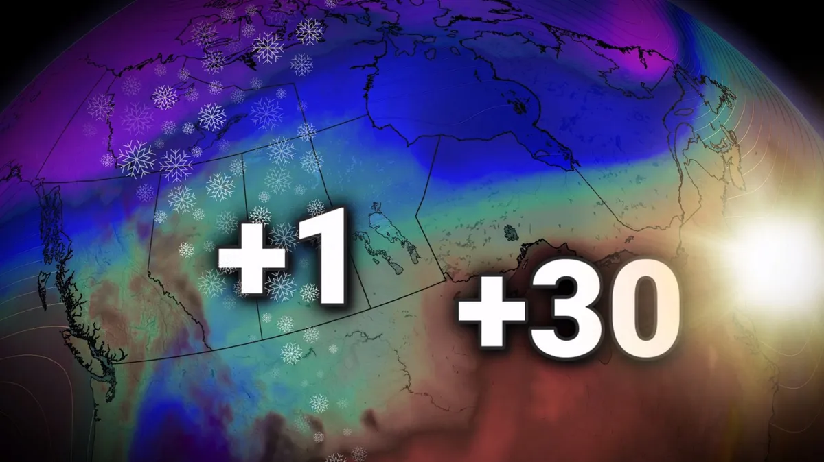
Thanksgiving has delivered a striking weather split across Canada, with millions on the Prairies seeing their first snowflakes of the season. Alberta and Saskatchewan both received their first snowfalls of the fall season through the long weekend. Temperatures tumbled over 10°C below seasonal across pockets of the Prairies. Rush Lake, Sask., highway webcam. (Government of Saskatchewan)Will the West snow last? Prairie snow gets a short stay. By late week, some regions that dealt with accumulating snowfall will be surpassing 20°C by Friday and Saturday, highlighting how stubborn the warmer weather has been in Western Canada. This interruption fits the broader theme of our fall forecast, highlighting how even an extended fall can still bring sharp bursts of winter-like weather. Content continues belowThis rapid temperature rebound is courtesy of a strong, building ridge of high pressure in the atmosphere, vaporizing the recent snowfall. The forecast ridge extends from the Pacific Northwest north across the Northwest Territories. Southern Ontario burst of summer! While parts of the Prairies shake off the wet snow, southern Ontario gears up to feel like the low 30s through Tuesday.

The Weather Network·
Weather

Hurricane Isaias death toll rises to 6 in Florida as storm recovery continues

THE TAKEAWAYFlorida’s storm-related death toll from Hurricane Isaias has risen to six, Gov. Ron DeSantis announced Tuesday. The deaths include a tree-related accident during cleanup, a fatal car crash and two deaths linked to disruptions in medical treatment. Florida experienced the storm’s worst impacts, including destructive wind gusts reaching 118 mph, torrential rain and storm surge that left Panhandle communities devastated. VERNON, Florida – The death toll in Florida from Hurricane Isaias has risen to six, Gov. Ron DeSantis announced during a news conference Tuesday. The updated storm-related death toll follows reports of two additional deaths: a woman who was killed when a tree fell on her home in Escambia County and a man who died from carbon monoxide poisoning after improperly using a generator. In an aerial view, trees litter the street and tops of homes after Hurricane Isaias passed through the area on October 10, 2026, in Milton, Florida. Hurricane Isaias made landfall as the season's first Atlantic hurricane with category two winds.  (Joe Raedle/Getty Images / Getty Images)Gov.

Fox Weather·
Weather

Golden Gate Bridge gets major seismic makeover to withstand powerful earthquakes

FILE: Earthquake swarm beneath Hawaii volcano raises new questions An earthquake swarm under Hawaii's Mount Kīlauea have geologists looking deeper for what's going on under the Earth's surface. Geologist and CEO Earth Evolution Stefan Burns joins FOX Weather to provide analysis on earthquake activity and what could lead to the next mega quake. THE TAKEAWAYThe Golden Gate Bridge is undergoing its final major seismic retrofit phase. The billion-dollar project is designed to limit earthquake damage and help keep the bridge operational for emergency response. The retrofit is being designed to withstand a magnitude 8.3 earthquake centered on the San Andreas Fault. GOLDEN GATE, Calif. – The Golden Gate Bridge is preparing for the "Big One" as crews begin a billion-dollar seismic upgrade designed to limit damage and help keep the iconic crossing operational in the aftermath of a major earthquake. One of the world's most iconic bridges, the Golden Gate Bridge, connects San Francisco with Marin County and serves as a critical transportation link to the North Bay, carrying up to 40 million vehicles annually.

Fox Weather·