Fall heat, storm risk preludes major cooldown in Ontario
This story deserves to be shared
Send it to someone who'd care, or post it on your networks.
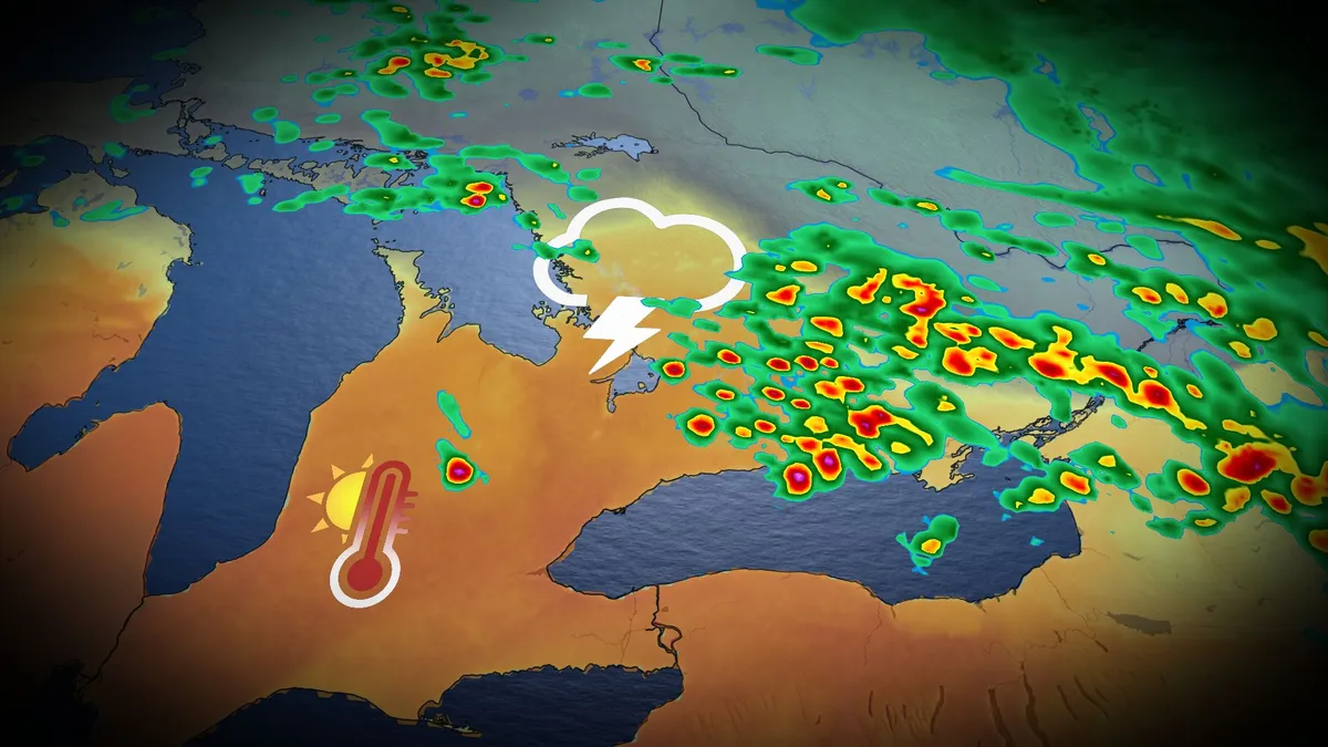
The remarkable heat and humidity will likely be a parting gift from the summer season in southern Ontario this week. Thanksgiving across southern Ontario was notable for its mild temperatures. Toronto reached a high of 22 degrees Celsius, while Windsor reached 26 degrees with a humidex of 31! But don't get used to the warmth; the summer-like conditions and a risk of thunderstorms, perhaps for the final time this year, are expected to continue Tuesday before a sharp cooldown settles in. DON'T MISS: Canada's Winter Sneak Peek: El Niño puts record warmth in playBe sure to stay alert to the changing conditions, and check for any weather warnings in your area. Temperatures to soar early this week, with thunderstorm riskMonday was nice, but it will feel even warmer on Tuesday as moisture from the remnants of post-tropical storm Rachel will sweep across southern Ontario, bringing about three times the atmospheric moisture than we'd typically see this time of year. With the intense humidex, temperatures will feel more like the low- to mid-30s across much of the region, including the Greater Toronto Area (GTA) and London corridor.
This article is an excerpt. To read the full content, visit the original source. The Weather Network
Related articles
Thunderstorm threat pops up in B.C., Alberta before cooldown with alpine snow
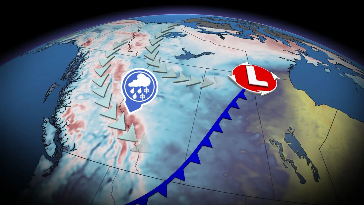
A significant cooldown is set to arrive this weekend across B. C. and Alberta, with high-elevation snow, but before that happens, there will be a chance of thunderstorms for both provinces. Widespread and much-needed rainfall totals of 20-40+mm are likely for parts of B. C., including the Lower Mainland. The rain will come with a non-severe thunderstorm risk on Friday, stretching into parts of Alberta, too. Visit our Complete Guide to Fall 2026 for an in depth look at the Fall Forecast, tips to plan for it and much more! By Saturday, temperatures across B. C. and Alberta will drop noticeably, with the cooldown also leading to high-elevation snow in parts of both provinces. Thunderstorm threat before cooldown arrives in B. C., AlbertaAfter a seasonably warm stretch of sun and temperatures in the mid-20s, change is coming to B. C. and Alberta. A strong low and cold front will develop stateside, tracking northwards over the Rockies and onto the Prairies through Friday. Widespread rainfall is expected, along with a non-severe storm chance, on Friday.

Fall cooldown to grip the Prairies this weekend, alpine snow included
A significant temperature drop is set to affect the Prairies starting Friday, with cooler conditions spreading from Alberta into Saskatchewan and Manitoba through the weekend. Visit our Complete Guide to Fall 2026 for an in depth look at the Fall Forecast, tips to plan for it and much more! Alberta will experience single-digit morning lows on both Saturday and Sunday, with Calgary potentially dropping to near 4°C—the coldest morning low since May 9 (3.7°C). Daytime highs across the region may struggle to reach double digits, sitting 5–10°C below the seasonal average for early to mid-September. Regina is expected to see a high of just 13°C on Saturday, the city's coldest day since May 15, which recorded 10.5°C. In the Rockies and Coastal Mountains, freezing levels will plunge to near 2,000 m, dropping as low as 1,600 m around Jasper. This will allow precipitation to fall as snow in alpine areas, with noticeable snowcaps expected by the weekend. RELATED: Some of Canada’s first frost advisories of the season issuedThe cooldown comes as an upper-level trough deepens, ushering in northerly winds and pulling in a chilly air mass from northern Canada.
Tropical rains, fall cooldown makes its way to B.C.
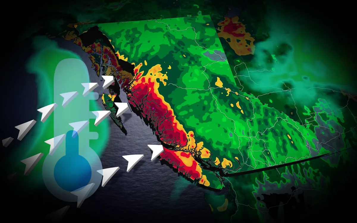
A typhoon set to make landfall in China will have impacts all the way in British Columbia. Typhoon Saudel has already pounded Japan's southwestern islands, dumping 230 mm of rain in 24 hours and cancelling over 150 flights at Okinawa Naha Airport. The storm made landfall in mainland China early Friday morning local time. TROPICAL STORMS: The Weather Network’s Hurricane and Tropical Storm HubSaudel’s moisture heads eastAlthough Saudel will weaken over China, its moisture will spread eastward across the Pacific. A low-pressure system over the Bering Sea will pull moisture into Alaska, while high pressure off the B. C. coast directs an atmospheric river toward the North Coast. The North Coast mountains could receive 50 to 75 mm of rain through Saturday, providing welcome relief after a drier-than-normal previous 30 days. Content continues belowREAD MORE: Krakatoa’s eruption created the loudest sound in human historyCooler weather aheadA cold front will drop temperatures below 20 C across the southern Interior. Kamloops could reach 17 C,, potentially making it the city's coldest day since May 15.
Nor' easter to bring coastal flooding, winds to East Coast
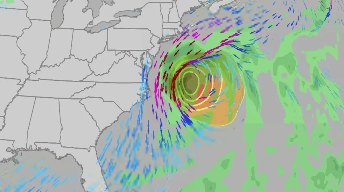
An October nor'easter is developing in the Atlantic, where it will bring high surf, rip currents, coastal flooding, winds and rain to parts of the East Coast for several days this week. The National Hurricane Center has it highlighted as an area to watch this week for potential subtropical development. However, regardless of development, this system will bring dangerous conditions to the East Coast this week. Fortunately, this system doesn't look to be as strong as the one in September. But the bad news? It could linger for much of the week, so impacts could have a longer duration than you would think. There are currently coastal flood alerts across parts of coastal North Carolina and Virginia, where anywhere from 1 to 4 feet of inundation is possible. Key takeawaysWe do not expect this storm to be as strong as the late September nor'easter. The area most likely impacted the longest appears to be from the Delmarva Peninsula to eastern North Carolina, with more models pointing to primarily eastern North Carolina.

Coastal homes burn as hot winds fuel California wildfires
Thousands evacuate Southern California as wind-fueled fires burn homesFire crews in Southern California gained ground Saturday on a wind-driven blaze that charred hills and damaged or destroyed at least six large coastal homes, allowing evacuation orders to be lifted and thousands of people to return home. The fast-moving Norte Fire sparked the previous day in San Clemente amid hot, strong Santa Ana winds that drove it into San Juan Capistrano, prompting the evacuation of about 16,000 residents. Firefighters work to douse a house fire during the Norte Fire on Friday, Oct. 16, 2026, in San Juan Capistrano, Calif.(AP Photo/Jae C. Hong)Hundreds of firefighters deployed to combat the blaze in the hills of Orange County. At one home engulfed in smoke and fire, photos showed them using hoses to try to douse the flames. Most of the evacuations were lifted Saturday evening, except for one street in San Clemente. The Norte Fire was one of several in the region hit by the Santa Anas, which blow from the interior and toward the coast.
0 comments
No comments yet. Be the first to share your thoughts!