Tropical rains, fall cooldown makes its way to B.C.
This story deserves to be shared
Send it to someone who'd care, or post it on your networks.
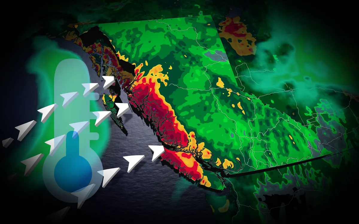
A typhoon set to make landfall in China will have impacts all the way in British Columbia. Typhoon Saudel has already pounded Japan's southwestern islands, dumping 230 mm of rain in 24 hours and cancelling over 150 flights at Okinawa Naha Airport. The storm made landfall in mainland China early Friday morning local time. TROPICAL STORMS: The Weather Network’s Hurricane and Tropical Storm HubSaudel’s moisture heads eastAlthough Saudel will weaken over China, its moisture will spread eastward across the Pacific. A low-pressure system over the Bering Sea will pull moisture into Alaska, while high pressure off the B. C. coast directs an atmospheric river toward the North Coast. The North Coast mountains could receive 50 to 75 mm of rain through Saturday, providing welcome relief after a drier-than-normal previous 30 days. Content continues belowREAD MORE: Krakatoa’s eruption created the loudest sound in human historyCooler weather aheadA cold front will drop temperatures below 20 C across the southern Interior. Kamloops could reach 17 C,, potentially making it the city's coldest day since May 15.
This article is an excerpt. To read the full content, visit the original source. The Weather Network
Related articles

Why does it smell so good after it rains? Meet petrichor
The smell of rain has a name; you're actually smelling three thingsThere is a very particular smell that happens when it rains, and it has a name: petrichor. It actually isn’t just one smell. There are three, and they come from totally different places. What are the three smells? The term petrichor was coined by Australian scientists in 1964 to describe the earthy and recognizable smell linked to rain. Let’s break down the three smells you are experiencing: Ozone: This almost metallic smell occurs when lightning strikes split oxygen and nitrogen molecules. These recombine into nitric oxide and ozone. The ozone molecules are brought down to the surface by downdrafts from powerful storms. Multiple lightning strikes are seen during a summer nighttime thunderstorm near the city of Thessaloniki, as seen from Kalochori Lagoon in Delta National Park in Northern Greece. Lightning strikes create ozone molecules which are then brought to the surface via downbursts. Ozone has an almost metallic smell to it and is one of the components of petrichor. (Getty Images)Geosmin: The earthy note comes from bacteria in the soil. They create compounds that our noses detect.
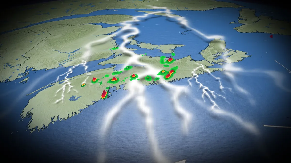
75-100 mm: Flood risk with drenching rains in the Maritimes
Grab your umbrella if you’ve got plans in the Maritimes on Sunday. Strong to severe thunderstorms may produce torrential downpours throughout the region during the day. Beware the threat for localized flooding beneath the heaviest storms. DON’T MISS: Trouble may lurk beyond hurricane season’s very quiet startA warm front lifting across the Maritimes will drag a rich reserve of atmospheric moisture over the region. Showers and thunderstorms will tap into this ample moisture to produce very heavy rainfall throughout the region. It has been drier than normal this month for all of Atlantic Canada, so this rain should close the gap on what's average for most areas, except for the Avalon Peninsula. We’ll see patches of heavy rainfall begin to sweep across southern Nova Scotia, New Brunswick, and eventually Prince Edward Island on Saturday night. Localized totals of 30-50 mm of rainfall are possible with this first round of heavy showers through the pre-dawn hours on Sunday.
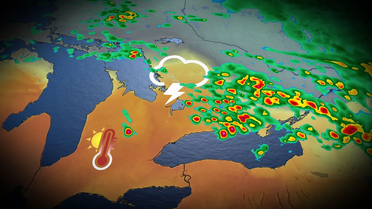
Fall heat, storm risk preludes major cooldown in Ontario
The remarkable heat and humidity will likely be a parting gift from the summer season in southern Ontario this week. Thanksgiving across southern Ontario was notable for its mild temperatures. Toronto reached a high of 22 degrees Celsius, while Windsor reached 26 degrees with a humidex of 31! But don't get used to the warmth; the summer-like conditions and a risk of thunderstorms, perhaps for the final time this year, are expected to continue Tuesday before a sharp cooldown settles in. DON'T MISS: Canada's Winter Sneak Peek: El Niño puts record warmth in playBe sure to stay alert to the changing conditions, and check for any weather warnings in your area. Temperatures to soar early this week, with thunderstorm riskMonday was nice, but it will feel even warmer on Tuesday as moisture from the remnants of post-tropical storm Rachel will sweep across southern Ontario, bringing about three times the atmospheric moisture than we'd typically see this time of year. With the intense humidex, temperatures will feel more like the low- to mid-30s across much of the region, including the Greater Toronto Area (GTA) and London corridor.
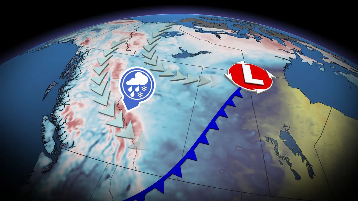
Thunderstorm threat pops up in B.C., Alberta before cooldown with alpine snow
A significant cooldown is set to arrive this weekend across B. C. and Alberta, with high-elevation snow, but before that happens, there will be a chance of thunderstorms for both provinces. Widespread and much-needed rainfall totals of 20-40+mm are likely for parts of B. C., including the Lower Mainland. The rain will come with a non-severe thunderstorm risk on Friday, stretching into parts of Alberta, too. Visit our Complete Guide to Fall 2026 for an in depth look at the Fall Forecast, tips to plan for it and much more! By Saturday, temperatures across B. C. and Alberta will drop noticeably, with the cooldown also leading to high-elevation snow in parts of both provinces. Thunderstorm threat before cooldown arrives in B. C., AlbertaAfter a seasonably warm stretch of sun and temperatures in the mid-20s, change is coming to B. C. and Alberta. A strong low and cold front will develop stateside, tracking northwards over the Rockies and onto the Prairies through Friday. Widespread rainfall is expected, along with a non-severe storm chance, on Friday.
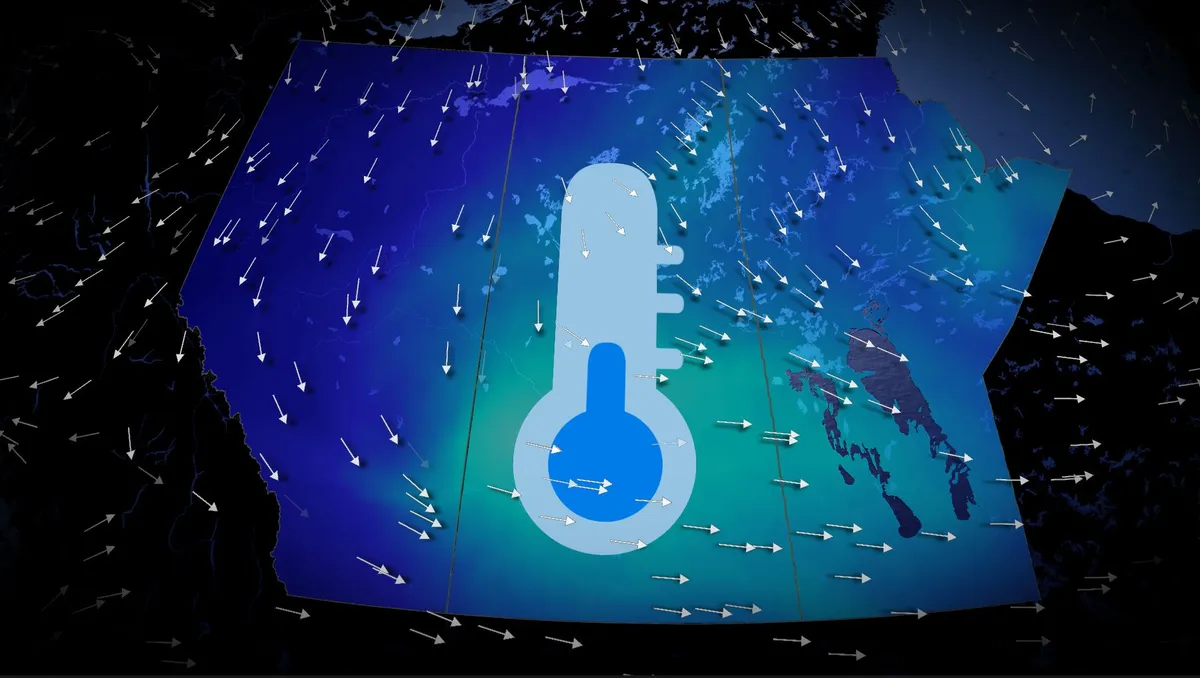
Fall cooldown to grip the Prairies this weekend, alpine snow included
A significant temperature drop is set to affect the Prairies starting Friday, with cooler conditions spreading from Alberta into Saskatchewan and Manitoba through the weekend. Visit our Complete Guide to Fall 2026 for an in depth look at the Fall Forecast, tips to plan for it and much more! Alberta will experience single-digit morning lows on both Saturday and Sunday, with Calgary potentially dropping to near 4°C—the coldest morning low since May 9 (3.7°C). Daytime highs across the region may struggle to reach double digits, sitting 5–10°C below the seasonal average for early to mid-September. Regina is expected to see a high of just 13°C on Saturday, the city's coldest day since May 15, which recorded 10.5°C. In the Rockies and Coastal Mountains, freezing levels will plunge to near 2,000 m, dropping as low as 1,600 m around Jasper. This will allow precipitation to fall as snow in alpine areas, with noticeable snowcaps expected by the weekend. RELATED: Some of Canada’s first frost advisories of the season issuedThe cooldown comes as an upper-level trough deepens, ushering in northerly winds and pulling in a chilly air mass from northern Canada.
0 comments
No comments yet. Be the first to share your thoughts!