BBlogFlow

Categories

Weather

5149 articles

Weather

New NASA space telescope launches on a quest to explore the hidden universe

A SpaceX Falcon Heavy rocket with the space observatory Roman Telescope lifts off from launch complex 39A at the Kennedy Space Center in Cape Canaveral, Florida, Sunday, Aug. 30, 2026. (AP Photo/John Raoux)NASA’s newest crown jewel blasted off Sunday morning to "soon reveal the universe’s darkest secrets. "SpaceX launched the $4.3 billion Roman Space Telescope shortly after daybreak aboard a triple-the-firepower Falcon Heavy rocket from Kennedy Space Center. Roman blazed toward an observation point 1 million miles away that's home to the Webb Space Telescope, one of NASA's other big-ticket eyes in the sky. “Roman is exactly the kind of success story we want to see across NASA,” said NASA Administrator Jared Isaacman. “Delivered ahead of schedule and on budget, this mission reflects more than a decade of dedication from the NASA workforce and our industry partners.
The Weather Channel·
Weather

Remnants of Dolly showing potential for redevelopment, as new area to watch is designated in the Gulf

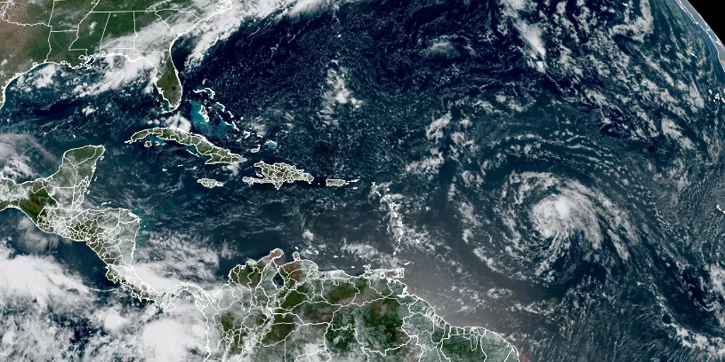
Dolly lasted for about 24 hours in the Atlantic as a Tropical Storm. Remnants of Dolly are targeting the Caribbean Just about 24 hours as a tropical storm, Dolly dissipated in the Atlantic Ocean on Friday after struggling to develop as it battled the hostile conditions produced by the inhibiting El Niño climate pattern. THE TAKEAWAYAfter just 24 hours, Dolly dissipated from a tropical storm in the Atlantic. The NHC has issued a 10% chance of development for Dolly's remnants. Dolly's remnants are bringing heavy rain to the Caribbean islands. Just about 24 hours as a tropical storm, Dolly dissipated in the Atlantic Ocean on Friday after struggling to develop as it battled the hostile conditions produced by the inhibiting El Niño climate pattern. In the last advisory, the National Hurricane Center issued a 10% chance of development for Dolly's remnants over the next seven days.

Fox Weather·
Weather

Bryan Norcross: We'll keep an eye on a small disturbance and eventually the remnants of Dolly in the Gulf

A dip in the jet stream left behind a cluster of thunderstorms which has turned into a small tropical disturbance in the northern Gulf. Officially, it’s tagged Invest 97L by the National Hurricane Center. The system is trapped under the heat dome high-pressure system that's bringing hot weather to the Midwest, which will slowly nudge it toward the upper Texas coast. WHAT IS A HEAT DOME AND HOW CAN IT AFFECT YOU DURING THE SUMMER MONTHS? The National Hurricane Center puts the odds it will reach tropical depression status in the low range. It only has a couple of days, but the Gulf water is plenty warm, and the atmospheric pattern looks reasonably conducive to development. Tropical activity in the Atlantic basin over the next week. (Bryan Norcross)There's a long history of small systems spinning up quickly in the northwestern Gulf, of course. The curvature of the coast and the extremely warm water contribute to that phenomenon. Everyone from Galveston to Southwest Louisiana should stay in touch with the forecast over the next couple of days just in case something unexpected happens.

Fox Weather·
Weather

Nepal warns of fresh flooding amid ongoing devastation and recovery efforts

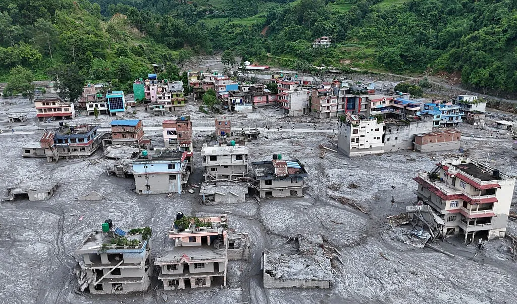
See the moment a mudslide engulfs buildings at Nepal-China borderRising water levels in the Bhotekoshi River prompted Nepalese authorities to warn of potential new flooding on Sunday, urging residents in vulnerable, devastated districts to stay on high alert. Mobile warnings were dispatched early in the day as rescue teams worked to clear debris from a crucial highway connecting Kathmandu to the flooded areas. At least 800 people are dead, and more than 3,000 are missing across Nepal and Tibet. In Dhading, one of the worst-hit regions in Nepal, some residents began returning to ruined homes to see what can be salvaged.(MORE: How did the deadly flood disaster in Nepal and Tibet happen? Here's what scientists are saying)Residents sat in homes with walls washed away by the floods, shoveling sludge-like mud and rubble off balconies or window frames. Others scanned the ground for items they could pick out of the mud and rinse off. One man had returned for his chickens, which he found alive. He tied them up and put them in the cabin of his truck. “Everything is finished. Nothing is left.

The Weather Channel·
Weather

After, Nepal-China flood, families await news of 3,000 missing

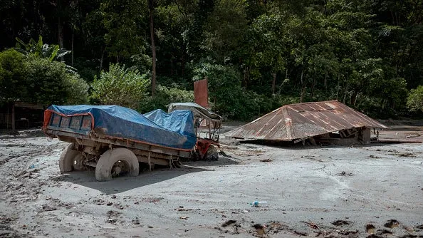
Incredible rescues in Nepal as glacier collapse death toll climbsNUWAKOT, Nepal (AP) — As rescue efforts in communities buried by catastrophic flash floods along the Nepal - China border entered their fourth day Saturday, authorities were still finding survivors and transporting them to safety. At relief centers, families of missing people waited anxiously for news of their loved ones as the death toll and the number of people unaccounted for continued to rise. The combined toll in Nepal and Tibet has risen to at least 800 dead and over 3,000 people missing.(MORE: How did the deadly flood disaster in Nepal and Tibet happen? Here's what scientists are saying)More than 3,700 people have been rescued in Nepal so far. In Nuwakot, one of the Nepali districts devastated by the floods, helicopters arrived loaded with boxes and bags of aid, including clothes, instant noodles, crackers and rice. Others returned from the flood-hit areas carrying survivors. Get More of Our News on GoogleSet The Weather Company as a 'Preferred Source' to get quicker access to the news you value. A truck and a structure is seen submerged in thick mud and debris following flash floods on Aug.

The Weather Channel·
Weather

Alaska’s Suicide Basin shows the hidden danger of glacial lake outburst floods

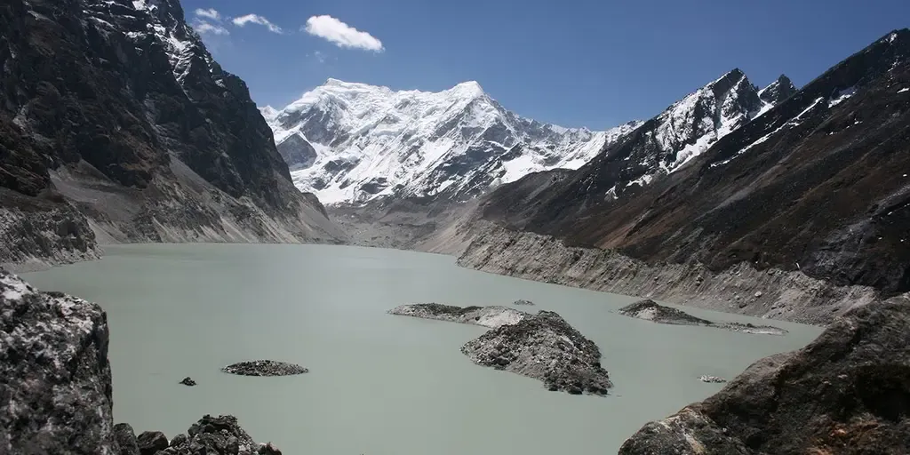
THE TAKEAWAYGlacial lake outburst floods (GLOFs) can send destructive waters and debris racing downstream with little warning. Alaska’s Suicide Basin produces near-annual GLOFs, but close monitoring helps protect Juneau. Remote Himalayan communities face greater danger when high-mountain lakes are not monitored. JUNEAU, Alaska – With little warning, water trapped behind a glacier or natural dam can suddenly break free, unleashing torrents of water, ice and debris that have caused some of the world’s most devastating and unexpected natural disasters. Known as a glacial lake outburst flood, or GLOF, the phenomenon occurs when water trapped behind a glacier or loose moraine dam suddenly breaks free, sending a powerful surge racing downstream. WHAT IS A GLACIAL COLLAPSE? HOW COLLAPSING ICE CAN TRIGGER DEADLY FLOODS, LANDSLIDES AND TSUNAMIS Tsho Rolpa Lake, a moraine-dammed glacial lake in Nepal’s Himalayas. The expanding lake remains closely monitored because a dam failure could trigger a destructive glacial lake outburst flood downstream. (ICIMOD)The U. S.

Fox Weather·
Weather

A strong El Niño is in sight; what does that look like?

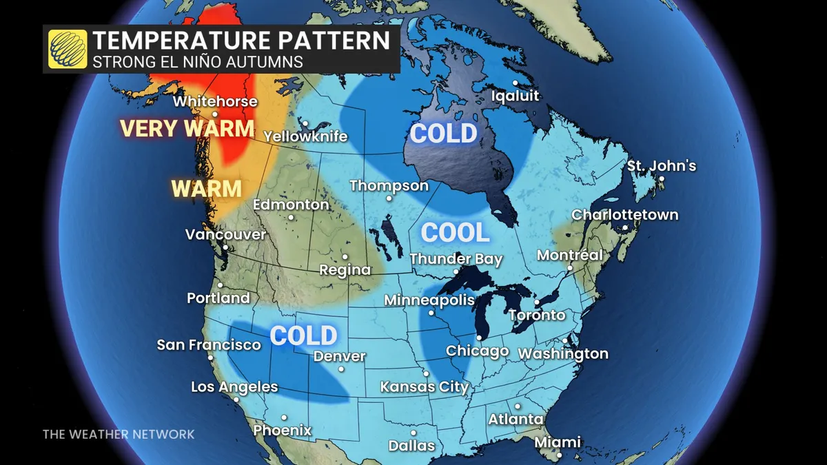
A historic El Niño may be right around the corner as we get closer to fall, with signs that it’s already here in some capacity. While strong El Niño events typically result in warmer winters across Canada, their influence on fall weather is different. The Pacific Ocean has been warming up along the equator, while the chance for the historic climate pattern to stick is building. Experts believe that a very strong El Niño will be present going into the fall and winter months, estimated at a 90 per cent likelihood. El Niño's impact on fall may be different than you expectSince 1950, we’ve seen seven separate years with a strong El Niño during the fall, or from September to November, with the last strong pattern from 2023. DON'T MISS: Latest El Niño forecast calls for historic heat by this autumnWarmer winter months are associated with a strong El Niño in Canada, but the effect is different in the fall months, depending on where you are in the country. A pronounced trough normally settles over Ontario, while a more dominant ridge covers the upper West Coast during these autumn months.

The Weather Network·
Weather

Weather Whiz: August 30

A foggy post-sunset scene in Dartmoor woods in England.(Simon Hodgkiss via Getty Images)How well have you been paying attention to the weather this week? Here are five questions that will test your knowledge of what's been going on. QUESTIONSThere’s something alive in fog — and it’s eating pollution. What is it? A storm formed in the Atlantic this week by the name of _______, coincidentally around the same time of the death of the American country, pop music icon's passing who shares its name. The _______ now ranks as the second largest wildfire in North Texas history. You’re about to have the chance to see a once-in-a-lifetime star explosion from a system known as the _______. What was the cause of flash floods on the Nepal‑China border that resulted in the death of hundreds of people?.... ANSWERSBacteriaDollyRoss Fire“Blaze Star"A glacier collapseHow did you do this week? Come back for more exciting weather questions next week, or risk showing up to trivia night unprepared! Get More of Our News on GoogleSet The Weather Company as a 'Preferred Source' to get quicker access to the news you value.

The Weather Channel·
Weather

Weather Of The World: August 30

Wander the world one snapshot at a time. Explore striking moments of weather in motion in this week's slideshow. ByAda Wood•August 30, 2026Updated: August 30, 2026, 7:08 am EDTPublished: August 30, 2026, 7:00 am EDTSchool students hold LED candles as they gather to pay their homage to people who died in Nepal's flash flood, in Chennai on Thursday, Aug. 28, 2026.(R. Satish BABU/AFP via Getty Images)F​rom a vigil for the hundreds of lives lost in flash floods in Nepal to a rare and destructive tornado in France, it has been another busy week of weather around the world. Here are some of the most jaw-dropping and awe-inspiring weather photos we found this week. An aerial view shows houses lying deluged in sludge after flash floods at Devighat, Bidur Municipality in Nepal's Nuwakot district on Thursday, Aug. 27, 2026. Nepal's disaster agency said that 823 people remained out of contact on Aug. 27, more than 24 hours after a deadly flood tore through the border region with Tibet.(Prabin RANABHAT/AFP via Getty Images)People wade through a waterlogged street in front of a temple after heavy rain in Varanasi, India on Tuesday, Aug.

The Weather Channel·
Weather

Prairie storms risk damaging winds, large hail on Sunday

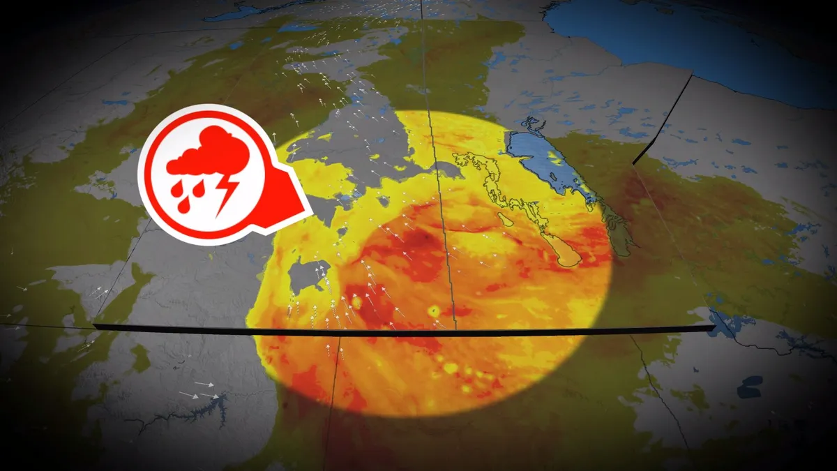
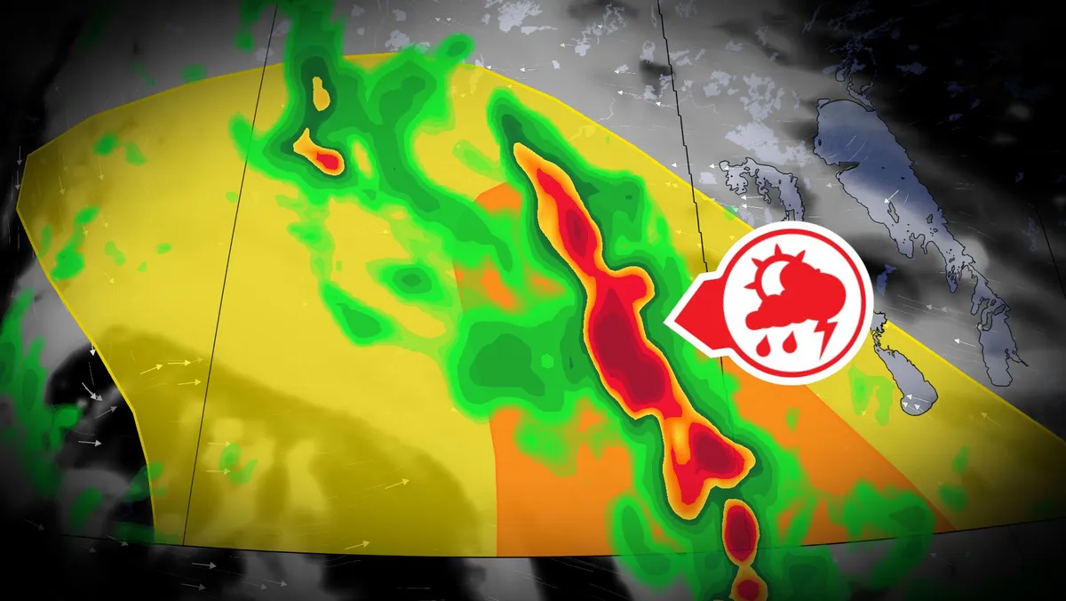
A stormy Saturday spawned very large hail and rotation across parts of the Prairies. We’ll see a renewed threat for severe storms develop throughout Sunday, with multiple rounds of hazardous weather expected. Be sure to monitor the radar if you’ve got plans through Sunday night, and stay aware of potential watches and warnings in your area. DON’T MISS: What is a mesoscale convective system? How an 'MCS' can spell dangerMoisture and instability streaming over the Prairies to end the weekend will bring a fresh threat for strong to severe thunderstorms across the region. The greatest concern will exist in southern Saskatchewan into southern Manitoba, including areas around Regina and Brandon. Sunday will start with morning thunderstorms across central Saskatchewan. These cells should remain non-severe, but downpours and small hail are possible. Content continues belowStorms will organize and tap into higher instability over eastern Saskatchewan by Sunday afternoon, quickly developing into one or more lines as a low-pressure system develops near the international border. This activity will increase the potential for damaging winds and large hail in southeastern Saskatchewan.

The Weather Network·
Weather

Tropical rains, fall cooldown makes its way to B.C.

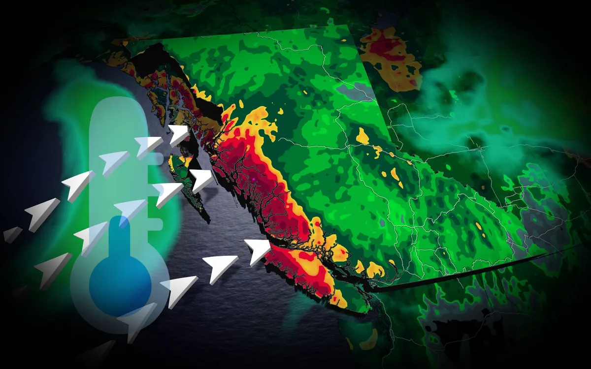
A typhoon set to make landfall in China will have impacts all the way in British Columbia. Typhoon Saudel has already pounded Japan's southwestern islands, dumping 230 mm of rain in 24 hours and cancelling over 150 flights at Okinawa Naha Airport. The storm made landfall in mainland China early Friday morning local time. TROPICAL STORMS: The Weather Network’s Hurricane and Tropical Storm HubSaudel’s moisture heads eastAlthough Saudel will weaken over China, its moisture will spread eastward across the Pacific. A low-pressure system over the Bering Sea will pull moisture into Alaska, while high pressure off the B. C. coast directs an atmospheric river toward the North Coast. The North Coast mountains could receive 50 to 75 mm of rain through Saturday, providing welcome relief after a drier-than-normal previous 30 days. Content continues belowREAD MORE: Krakatoa’s eruption created the loudest sound in human historyCooler weather aheadA cold front will drop temperatures below 20 C across the southern Interior. Kamloops could reach 17 C,, potentially making it the city's coldest day since May 15.

The Weather Network·
Weather

Illinois tornado count this year nearing all-time U.S. record

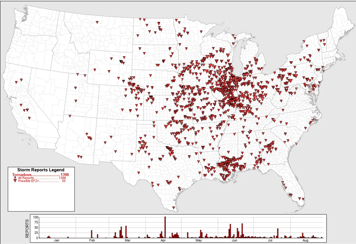
Unbelievably, this state approaches record for most tornadoes in a yearIllinois has already smashed its record for tornadoes in any year, and it's approaching an all-time U. S. record for any state, amid an active 2026 of severe weather in the Midwest.210, so farAs of Aug. 29, 210 tornadoes have been confirmed in Illinois so far this year, according to the National Weather Service in Romeoville, Illinois. This tally includes several tornadoes from the Aug. 11 derecho, one of which hit the southside suburbs of Chicago. That's by far the most the state has documented in any year in reliable records dating to the 1950s, crushing the previous record of 142 Illinois twisters from 2024. It's also more than three times their yearly average of 66 tornadoes, according to NOAA's Storm Prediction Center. (MORE: Chicago area hit twice by same tornado)This map shows tornado tracks in 2026 through August 12, as determined by National Weather Service post-storm surveys. (NOAA)U. S. record is in sightOnly one other state has had over 200 tornadoes in any year, dating to 1950. Get More of Our News on GoogleSet The Weather Company as a 'Preferred Source' to get quicker access to the news you value.

The Weather Channel·
Weather

Why rain turns Burning Man's Black Rock Desert into muggy mess

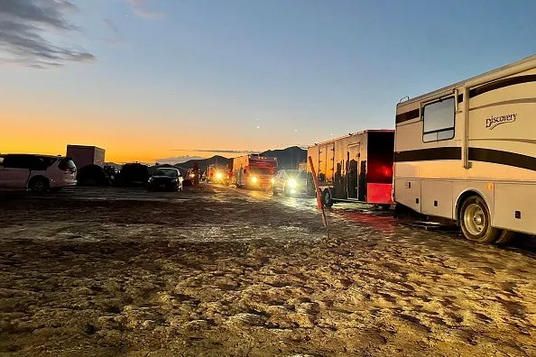
Burning Man's mud problem is a 15,000-year-old issueBurning Man has seen major impacts from rain and storms during the festival's previous years, which turns the venue into a muddy mess. But the flooding at the Black Rock Desert in Nevada isn't due to the amount of rain that falls; it happens because of the soil on which it falls on. What is going on with the soil here? The Black Rock Desert's origin story dates back 15,000 years. The Desert lies in the lake bed of the ancient Lake Lahontan. This lake deposited sediment that formed an extremely flat surface. Just how flat? In an area of about 119 square miles in the lake bed, the elevation changes by about 3 feet. (BURNING MAN FORECAST: Weather this year could include wildfire smoke, heat and thunderstorms)Get More of Our News on GoogleSet The Weather Company as a 'Preferred Source' to get quicker access to the news you value. The area is flat, but you also have the sediment itself. This sediment-covered soil struggles when water is present. It expands when wet, turning the ground into a very sticky mud that is difficult to traverse.

The Weather Channel·
Weather

Severe storms possible Sunday in Saskatchewan and Manitoba

Thunderstorms are expected to form across the Prairies on Sunday, extending from southern Saskatchewan to southern Manitoba. An upper-level low over southern B. C. will move toward the Prairies, pulling moisture north and causing atmospheric instability. That setup could help fuel a series of showers and thunderstorms throughout the day. The greatest concern is in southern Saskatchewan and Manitoba, including areas near Regina and Brandon. Storms may bring strong winds, heavy rainfall and large hail. CHECK OUT: How the weather could be influencing your music tasteStorms could start overnightThe first storms could arrive as early as Saturday night and Sunday morning, particularly in southern Saskatchewan. From there, the threat shifts eastward into southern Manitoba Sunday afternoon, with more storms possible Sunday evening and overnight as a front passes through. DON'T MISS: 5 astronomical events happening after we're goneA cooler day followsThe unsettled weather will also cause a noticeable drop in temperature in parts of Saskatchewan.

The Weather Network·
Weather

Tropical storms Karina and Lowell to become hurricanes as tropical traffic jam continues in the Pacific

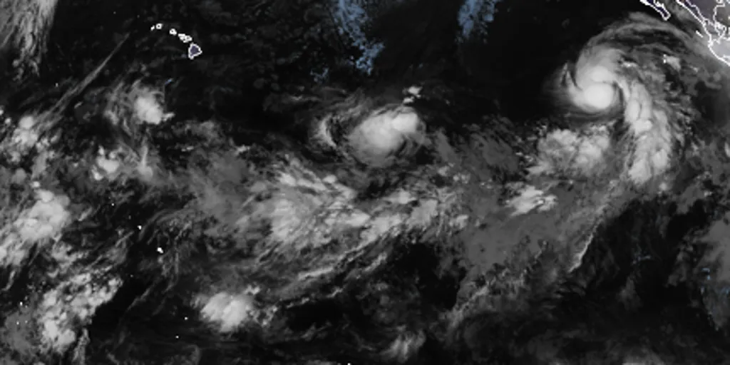
THE TAKEAWAYTropical storms Karina and Lowell are likely to become hurricanes. Two other areas to watch carry medium and high chances of development, respectively. Warm waters of the Central and Eastern Pacific are very favorable for tropical development amid strengthening El Niño. The flurry of tropical activity in the Pacific continues as tropical storms Karina and Lowell and two other disturbances cause a tropical ‘traffic jam,' fueled by a strengthening El Niño. Current tropical activity across the Pacific Basin, along with designated development percentages(FOX Weather) Tropical Storm Karina is moving northwest at 12 mph with 70 mph wind gusts, according to the National Hurricane Center. According to the National Hurricane Center (NHC), Karina is likely to become a hurricane on Saturday. REMNANTS OF DOLLY SHOWING POTENTIAL FOR REDEVELOPMENT, AS NEW AREA TO WATCH IS DESIGNATED IN THE GULFKarina is forecast to become a Category 3 or stronger hurricane by next week. This graphic shows what you need to know about Tropical Storm Karina.(FOX Weather) The agency also said Tropical Storm Lowell is moving west at 8 mph with 45 mph wind gusts.

Fox Weather·
Weather

More rain targets Upper Midwest putting millions already having wettest year on record under flood threat

THE TAKEAWAY Ridge-riding storms are taking hold of the North this weekend. They're bringing rain to the Upper Midwest and Great Lakes, where some places have seen their wettest year on record. Rain and storms move into the Northeast Monday and hang on through Wednesday. After a few quiet weather days in the Upper Midwest and Great Lakes, a soggy weather pattern is returning through ridge-riding storms, bringing a renewed flash flood threat to the region. As a ridge of high pressure remains across the South, energy and storms will continue riding along its edge from the Northern Plains into the Upper Midwest, Great Lakes and Northeast through early next week. Ridge-riding storms set up(FOX Weather) With plenty of moisture, southerly winds at the ground will be pulling humid air north, allowing storms capable of intense rainfall rates and localized flash flooding every day through Monday. On Sunday and Monday, an area of low pressure coming from the Rockies will increase moisture and instability as it moves into southern Canada. WHAT IS A RIDGE RIDER AND HOW DO THEY FORM?

Fox Weather·
Weather

Bryan Norcross: Dolly's remnants to bring rain and wind to the northeastern Caribbean islands starting today

Dolly is no longer a tropical storm, but the remnant disturbance still carries very gusty winds and pockets of heavy rain. The squally moisture surge will move over Antigua and the surrounding northeastern Caribbean islands today and Puerto Rico and the nearby islands beginning tomorrow. Dolly's moisture will linger until at least Tuesday. On the mountainous islands, heavy rain is possible, which could cause local flooding. Winds could gust to 40 mph or higher in squalls. Stay aware of any alerts issued by the National Weather Service in San Juan. Remnants of Dolly in Atlantic basin (Bryan Norcross)Last updated at 9:00 a.m. on Saturday, Aug. 29, 2026. There continues to be a slight chance that the leftover disturbance from Dolly will regenerate later this week as it heads in the general direction of Florida. There's no clear signal in the models about where that might happen. There's a high probability that Dolly's remnants will die out over the tall mountains of Puerto Rico and the Dominican Republic, and that will be that. Just in case, the National Hurricane Center is drawing a very low odds potential development area north of the Caribbean islands.

Fox Weather·
Weather

Remembering Hurricane Katrina, 21 years after one of America’s worst natural disasters devastated New Orleans

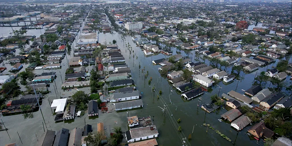
THE TAKEAWAYAug. 29, 2026 marks the 21st anniversary of Hurricane Katrina's landfall in Louisiana. Adjusted for inflation, NOAA estimates the 2024 value of damage caused by the storm to be north of $201 billion. Within 48 hours of landfall, authorities estimated that 80% of New Orleans was underwater. NEW ORLEANS – Twenty-one years ago, Hurricane Katrina roared ashore along the Gulf Coast, leaving an indelible mark as one of the deadliest and most destructive disasters in U. S. history. The cyclone first developed on Aug. 23, 2005, as a tropical depression over the southeastern Bahamas and, within a day, strengthened into Tropical Storm Katrina before moving toward Florida.  next Flood waters from Hurricane Katrina cover streets on August 30, 2005, in New Orleans, Louisiana.

Fox Weather·