Tropical storms Karina and Lowell to become hurricanes as tropical traffic jam continues in the Pacific
This story deserves to be shared
Send it to someone who'd care, or post it on your networks.
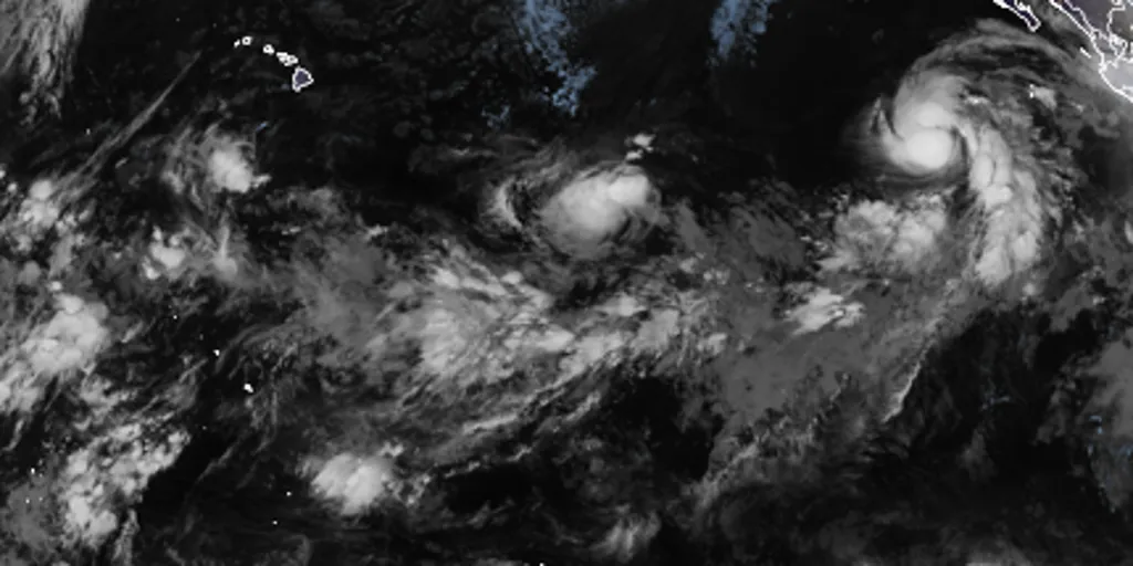
THE TAKEAWAYTropical storms Karina and Lowell are likely to become hurricanes. Two other areas to watch carry medium and high chances of development, respectively. Warm waters of the Central and Eastern Pacific are very favorable for tropical development amid strengthening El Niño. The flurry of tropical activity in the Pacific continues as tropical storms Karina and Lowell and two other disturbances cause a tropical ‘traffic jam,' fueled by a strengthening El Niño. Current tropical activity across the Pacific Basin, along with designated development percentages(FOX Weather) Tropical Storm Karina is moving northwest at 12 mph with 70 mph wind gusts, according to the National Hurricane Center. According to the National Hurricane Center (NHC), Karina is likely to become a hurricane on Saturday. REMNANTS OF DOLLY SHOWING POTENTIAL FOR REDEVELOPMENT, AS NEW AREA TO WATCH IS DESIGNATED IN THE GULFKarina is forecast to become a Category 3 or stronger hurricane by next week. This graphic shows what you need to know about Tropical Storm Karina.(FOX Weather) The agency also said Tropical Storm Lowell is moving west at 8 mph with 45 mph wind gusts.
This article is an excerpt. To read the full content, visit the original source. Fox Weather
Related articles
3 hurricanes in the Pacific at once: Lowell, Karina, Marie
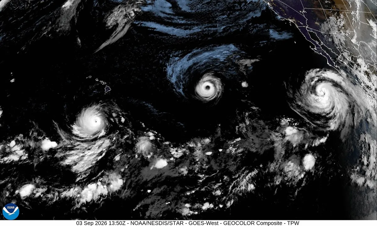
Three hurricanes are now spinning in the Pacific OceanThree hurricanes. One ocean. Right now. One. Two. Three. Lowell, Karina and Marie — three separate hurricanes, three distinct centers, all pinwheeling across the Central and/or Eastern Pacific at the same moment, close enough together to land in a single satellite frame. That's the part breaking people's brains this week. Not that a hurricane exists. That you can see three of them turning at once without zooming out. The last time three hurricanes spun simultaneously in the Eastern or Central Pacific was 2015 — Kilo, Ignacio and Jimena, notably another El Niño year. (MORE: 4 Hurricanes At Once In Atlantic Basin) While the Pacific is lighting up, we're still waiting for a single hurricane in the Atlantic, and that it could be record long wait, there. Wait — what if we run out of names? Great question, and one people are genuinely asking this week. Get More of Our News on GoogleSet The Weather Company as a 'Preferred Source' to get quicker access to the news you value. The Eastern Pacific gets 24 names a season — the whole alphabet minus Q and U.
Karina strengthens into a Category 4 hurricane as the Pacific tropical traffic jam intensifies
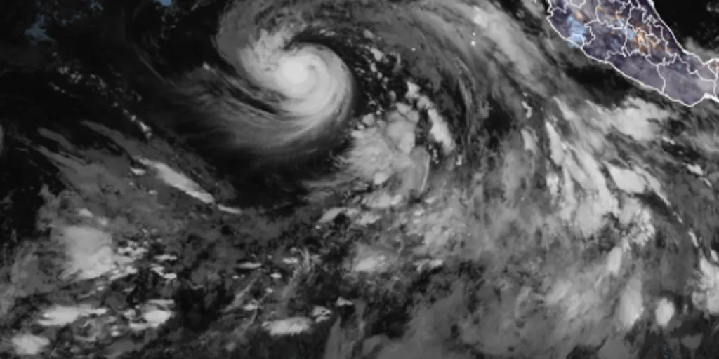
The National Hurricane Center said that Hurricane Karina reached 145 mph, officially designating it as a Category 4 hurricane. THE TAKEAWAY Karina became a major hurricane on Sunday night. Karina will not have any direct impacts on land. Karina will begin a gradual weakening trend through the middle and latter part of the week. Hurricane Karina formed in the Pacific on Sunday and strengthened into a major Category 4 storm early Monday morning. The National Hurricane Center (NHC) said that Hurricane Karina reached 145 mph, officially designating it as a Category 4 hurricane. BREWING SUPER EL NIÑO EXPECTED TO BE STRONGEST ANYONE ALIVE ON THE PLANET HAS EVER EXPERIENCEDHurricane Karina stats(FOX Weather) Once a tropical storm’s winds reach 74 mph, it is called a hurricane and maintains the same name it had when it was a tropical storm. Karina was declared a tropical storm last Thursday, forming just two days after Tropical Storm Julio, which quickly dissipated. Hurricane Karina is moving west at 9 mph and is currently being monitored by the NHC for further development.
Orionid meteor shower 2026: cloud cover forecast by region
A meteor streaks across the sky over a desert in China during the Orionid meteor shower on Oct. 22, 2023.(VCG/VCG via Getty Images)The Orionid meteor shower is peaking this week, and it promises to be one of the most dazzling displays of the year. And while some of you will have clear skies, rain and clouds could impact the view for others. Here's what you need to know about the Orionids and your forecast:Fast factsPeak day: The meteor shower peaks Wednesday night, Oct. 21, into the early hours of Thursday morning, Oct. 22. Peak time: From midnight to dawn are the best hours to catch the meteors streaking through the sky, so plan on a late night or really early morning. What the Orionids are known for: The Orionid meteors are known for their brightness and their speed. As they streak across the sky at around 41 miles per second, the meteors leave behind a glowing "train" that can last several seconds to minutes. While you can make the perfect plan to catch the Orionids, the key to stellar viewing is still in Mother Nature's hands. The good news is that many of you should have good meteor shower-watching conditions. Much of the central and eastern U. S.

Can duct tape keep out flood water? Here's what lab tests found
(urbanbuzz/shutterstock)Could a cheap roll of duct tape help protect your home from flooding? New research suggests it could make a surprisingly big difference. In controlled tests, correctly applied duct tape on the outside of a household door reduced water leakage by 97-98%. The findings suggest that a simple low-cost measure could substantially reduce the amount of water entering a home during a flood. This is important as one of the key lessons from flood resilience research is that the best time to protect a property is before floodwater arrives. The UK government’s 2025 FloodReady Review called for practical, affordable measures that help households understand their risks and to prepare for flooding. And one potential contribution to this agenda might sound unlikely, at first glance. Duct tape is more commonly associated with household repairs than flood protection. However, tests colleagues and I conducted at the University of Hull demonstrated how much water can enter a property through an unprotected doorway during a flood. Three doors, ready for flood-testing.
Trudy’s moisture will trigger a flood risk for Southwest US
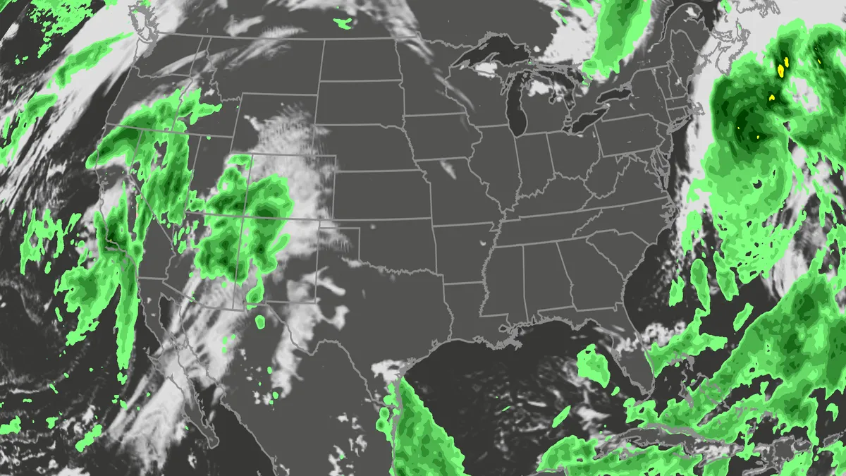
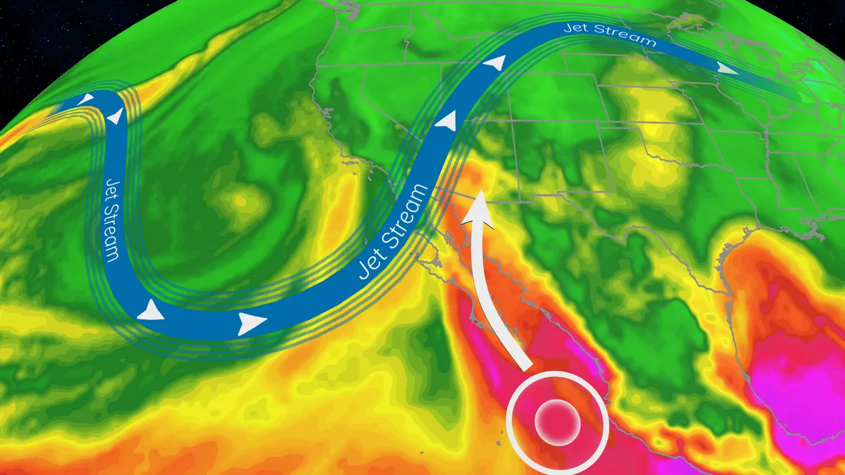
Hurricane Trudy will bring flood threat to the Southwest USTrudy is off the Mexican coast, however, its moisture will pour into the Southwestern U. S., helping fuel a multiday flood risk across seven states this week from California to Colorado. A dip in the jet stream will also funnel in moisture from the Pacific as a strong low pressure system moves into the region. Timing out this week’s rainfallWednesday: The highest risk of flooding on Wednesday covers much of Arizona and parts of New Mexico, as well as southern portions of Colorado and Utah. There will be an abundance of moisture available to support heavy downpours and training storms. This means storms will produce heavy rain over the same areas for long periods of time. The Weather Prediction Center is forecasting rainfall rates as high as 2 inches per hour. Some of the biggest concern will be the possibility of mudslides over recent burn scar areas as well as slow canyons and arroyos. If you have plans to visit any of the national parks in the West this week, make sure you check the forecast daily and pay attention to any warnings or advisories issued.
Nor' easter to bring coastal flooding, winds to East Coast
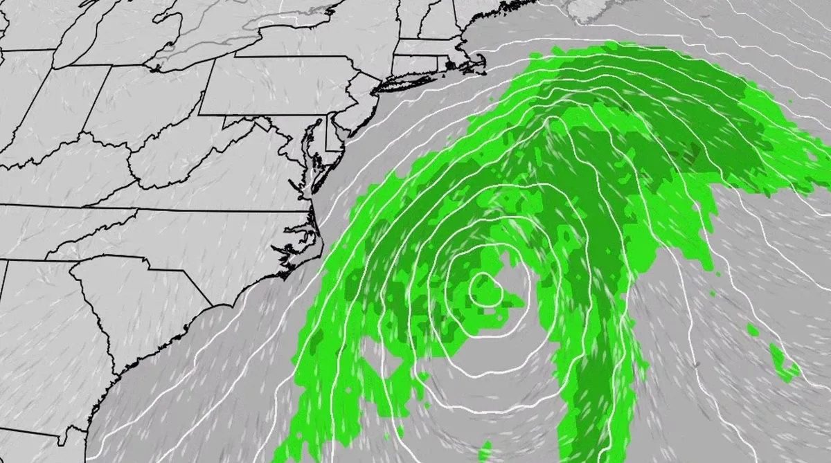
An October nor'easter is developing in the Atlantic, where it will bring high surf, rip currents, coastal flooding and winds to parts of the East Coast for several days this week. The National Hurricane Center has highlighted it as an area to watch this week for the potential development of Josephine. However, regardless of whether we call this system a nor'easter or Josephine, the impacts will be the same. The bottom line: This system will bring dangerous conditions to the East Coast for multiple days this week.(MORE: What is a nor'easter?)Fortunately, this nor'easter doesn't look to be as strong as the one in September. But the bad news? It could linger for much of the week, so impacts could have a longer duration. Coastal flood alerts are in effect for parts of coastal North Carolina and Virginia, where anywhere from 1 to 4 feet of inundation is possible. Get More of Our News on GoogleSet The Weather Company as a 'Preferred Source' to get quicker access to the news you value. Key takeawaysWe do not expect this storm to be as strong as the late September nor'easter.
0 comments
No comments yet. Be the first to share your thoughts!