BBlogFlow

Categories

Weather

5140 articles

Weather

Renewed risk for severe weather in southern Ontario on Thursday

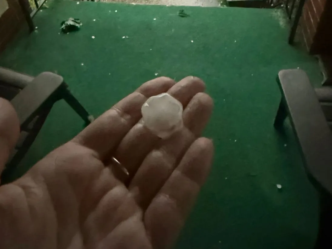
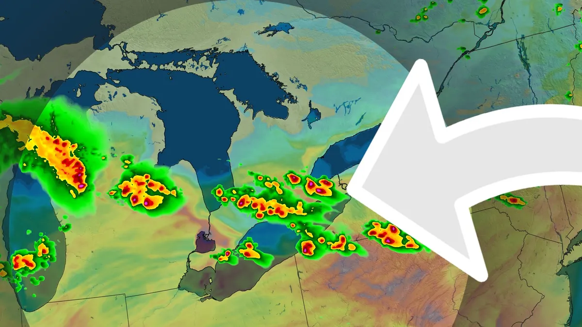
After a stormy Wednesday in southern Ontario, with numerous tornado alerts and reports of large hail, flooding and power outages, there will be another opportunity for severe storms on Thursday in parts of the region. DON'T MISS: ONTARIO STORM TRACKING: Latest photos and videos from Wednesday's thunderstormsBe sure to stay alert to the changing conditions, and check for any weather warnings in your area. Renewed risk for severe storms on ThursdayA muggy and unstable air mass will move in south of the United States-Canada border and has the chance to produce thunderstorms going into Thursday. With a stationary boundary draping itself across the region, it may help to trigger more spotty storms throughout the whole day. These storms will have their greatest chance to appear in the evening, with a chance they become more widespread. During the morning, forming as a complex of storms over Minnesota, the complex will make its way along the ring of fire into southwestern Ontario. The complex will allow severe storms to be possible from Windsor to London, including Sarnia and Long Point. With strong winds, torrential rain and small hail as the main concerns.

The Weather Network·
Weather

Man rescued from 7-foot-deep storm drain in Indiana town

(Martinsville Fire Department)A man was rescued from a storm drain in Martinsville, Indiana, on Tuesday afternoon after crews lowered a technician nearly 7 feet underground to reach him. The Martinsville Fire Department received the report around 3 p.m. according to a Facebook post from the department. Once additional personnel arrived, firefighters set up air monitors, positive pressure ventilation and a rope system before making a confined space entry. With safety precautions in place and the air confirmed safe, an MFD confined space technician was lowered into the drain to reach the victim. The man was placed in a rescue harness and raised out of the drain, the post said. Afterward, he told first responders he had entered the drain to clean it. He was taken to a nearby hospital for evaluation. Storm drain safety Storm drains are confined spaces, which means they can hold pockets of toxic gas, low oxygen and fast-rising water even on a dry day. Leave the climbing to trained crews and do this instead:Get More of Our News on GoogleSet The Weather Company as a 'Preferred Source' to get quicker access to the news you value. Clear only what you can reach from the curb.

The Weather Channel·
Weather

Winter 2026/2027 Snowfall Predictions: New Data Shows a Strong Super El Niño Snow Pattern

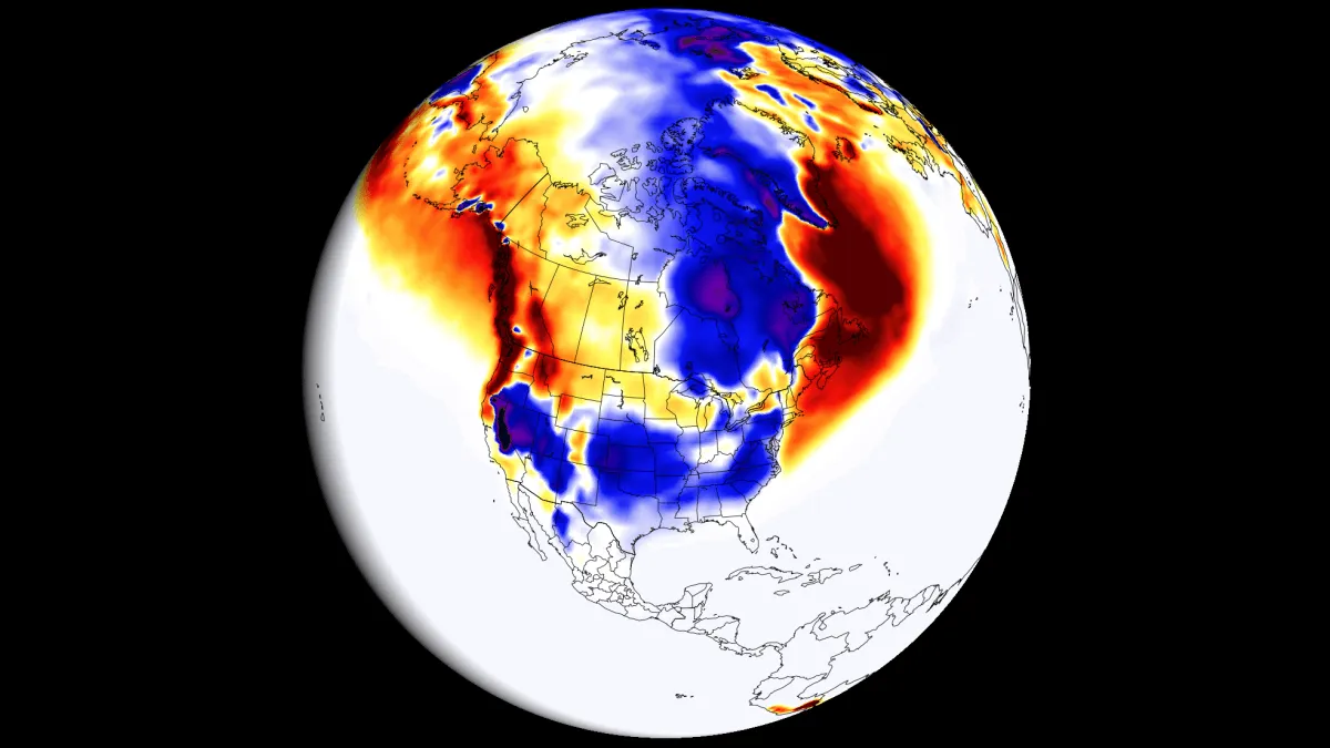
Latest Snowfall Forecast UPDATE 21st September, 2026: Winter 2026/2027 Snowfall Explorer: See the Latest Forecast for Your State and RegionFirst Winter 2026/2027 snowfall predictions are starting to show a strong Super El Niño impact. Forecast data shows clear snowfall contrasts emerging across the United States, Canada, and Europe. The developing Super El Niño is reshaping the jet stream and low-pressure system tracks, and past strong events already show where snowfall tends to increase or decrease. The latest long-range forecasts now give us the first look at how the snow pattern could develop through the upcoming Winter season. In this article, I will quickly look at the latest Super El Niño development. Then, looking at global long-range forecasting systems and historical data analysis, you will see in-depth month-by-month snowfall predictions for the upcoming Winter across the United States, Canada, and Europe. A lot has already been said about the development of a Super El Niño event in 2026, which is already established as a major global weather driver. The term “Super El Niño” might sound a bit extreme, but it is given for a reason, and only to the strongest such events.

Severe Weather Europe·
Weather

Powerful line of storms sweeps southern Ontario, causing localized damage

A stout line of severe thunderstorms swept through southern Ontario on Wednesday with high winds, hail, torrential downpours and tornado warnings. The storms brought down trees and power lines throughout the region, producing enough rainfall to cause localized flooding. Around 7:25 p.m. EDT on Wednesday, CP24 reported police were actively rescuing people from flooded cars across Toronto after a heavy downpour left about 65,000 residents without power. Jane Street and Highway 7 flooding and rescue operation in Vaughan, Ont. (Jeremy Cohn/Submitted to The Weather Network)According to other reports, another rescue operation happened at the Jane Street and Highway 7 intersection in Vaughan, Ont., after major flooding occurred. Numerous vehicles were trapped in floodwaters and people were rescued by the Vaughan Fire and Rescue Service. It was reported that 20 vehicles were caught in the floodwaters. Multiple road closures and accidents were reported across the Greater Toronto Area (GTA) as a result of flooding and winds. As well, numerous events were postponed or cancelled. Many areas picked up 20-130+ mm of rain in short order, which led to flooding issues on some area roadways.

The Weather Network·
Weather

Massive wildfire wiped out 80% of one of the world’s rarest plants — now scientists are fighting to save it

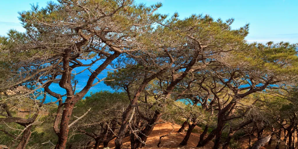
THE TAKEAWAYThe Santa Rosa Islands are home to one of the world's rarest plants. A wildfire wiped out 80% of the very rare Torrey pine tree. The National Park Service recovered thousands of seeds. SANTA BARBARA COUNTY, Calif. – Damage assessments continue for the Santa Rosa Islands just a few months after devastating wildfires destroyed some of the world's rarest plants. The Santa Rosa Fire broke out on May 15 and continued through June 4, when a stranded mariner used flares to signal for help on the island, but accidentally triggered a massive wildfire. SAILOR RESCUED IN THE NICK OF TIME AS MASSIVE, RECORD-BREAKING WILDFIRE ENGULFS CALIFORNIA ISLANDThe wildfire burned 18,279 acres. next SANTA BARBARA COUNTY, CA - JUNE 08: Sasha Travaglio, spokesperson for the BAER (burned area emergency response) team, hikes up to an overlook of the burned campground at Santa Rosa Island on Monday, June 8, 2026, in Santa Barbara County, CA. Santa Rosa Island is the second largest island in the Channel Islands National Park. The wildfire initially started May 15, 2026 on South Side of Santa Rosa Island and burned around 18,379 acres. The cause of the fire is still under investigation.

Fox Weather·
Weather

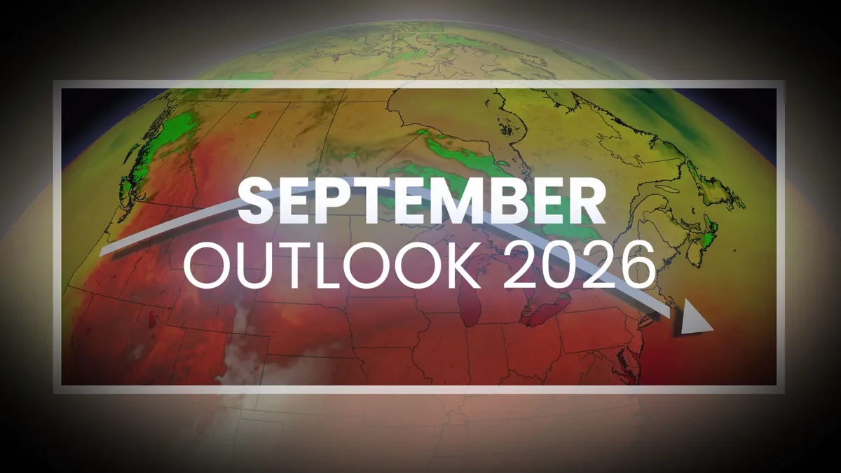
Summer lingers as warmth wins out across Canada in September

September is typically a month of rambunctious transition across Canada as summer’s iron grip fades against doses of increasingly chilly autumn air. But even as our seasonal temperatures steadily slide through September, our month ahead looks to feature a spell of extended late-summer weather across much of the country. We’ll still have to watch a few wild cards, though, that may throw a wrench into the upcoming patterns. DON’T MISS: Autumn can still produce intense hurricanes across the AtlanticSeptember starts with major heat south of the borderA major and unusual heat dome building across the U. S. will influence conditions across much of Southern Canada to kick off September. Some areas south of the border will experience midsummer heat as we begin climatological autumn. DON'T MISS: Wasps are aggressive right now; here's why and how to stay safeWhile the bulk of the heat will remain to the south, the ridge responsible for this late-season heat will nudge above-seasonal values into parts of Canada. Communities like Windsor, Ont., are on track to start the month with daytime high temperatures as warm as the mid-30s.

The Weather Network·
Weather

Fall-like storm targets B.C. with gusty winds, excessive rains, alpine snow

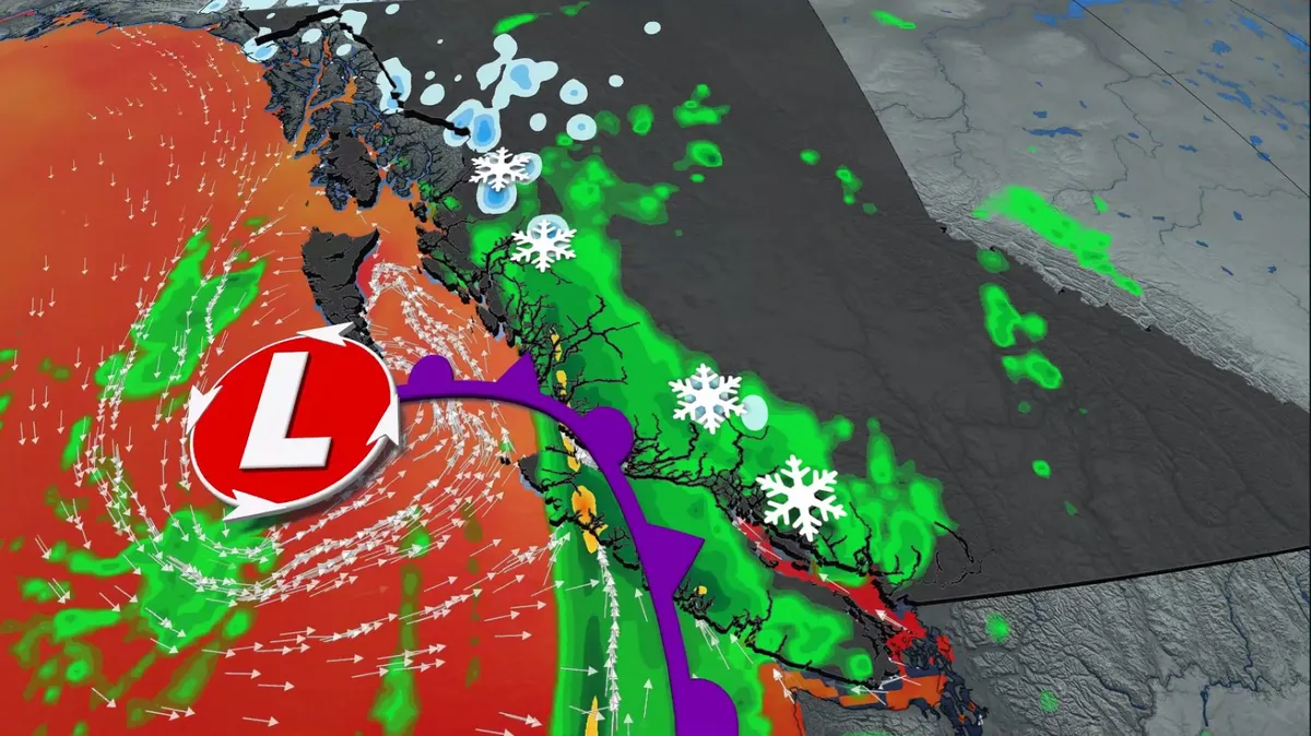
Prepare for an extended spell of foul weather in parts of British Columbia to kick off September. Meteorological fall isn't wasting any time along the West Coast as a formidable low-pressure system pushes into British Columbia. DON’T MISS: Staying safe from flash floods, a serious and deadly hazardA fall-like storm is bringing widespread rain to the South Coast and Vancouver Island, while strong wind gusts up to 75 km/h could cause ferry delays and power outages. Meanwhile, alpine snow is forecast for some of the high elevations. Potent storm hits B. C. coast this weekHeavy rains were built up through Tuesday along the North Coast as plumes of moisture streamed ashore. Localized totals up to 200 mm are forecast for the mountains of the North Coast. By Tuesday night, the cold front will slide south toward the northwestern tip of Vancouver Island, increasing both rainfall rates and winds across the region. This front will slide across the South Coast on Wednesday, with gusty southeasterly winds pushing up the Straits and shorelines. Wind gusts stronger than 70 km/h are possible for exposed coastal areas, with locally higher gusts possible. These winds should ease overnight Wednesday.

The Weather Network·
Weather

Watch: Man struck by lightning in terrifying moment caught on camera in Staten Island

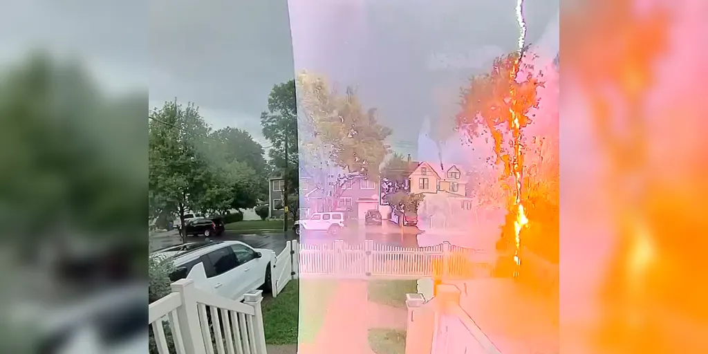
The man miraculously escaped with no burns or serious injuries from the violent burst of electricity. Staten Island man struck by lightning 🌩️ SHOCKING SURVIVAL: A Staten Island man is lucky to be alive after being directly zapped by a lightning bolt while walking along the sidewalk last week in New York. STATEN ISLAND, N. Y. – A startling incident unfolded in Staten Island, New York, this week when a man was suddenly struck by lightning while walking on a sidewalk. The man, Thomas Fahmy, was strolling through a Staten Island neighborhood amid dark and gloomy weather conditions, holding an umbrella to shield himself from the rain, when a lightning bolt struck him, video footage shows. Somehow, miraculously escaped with no burns or serious injuries from the violent burst of electricity. Photo of lightning strike victim in the hospital afterwards. (Thomas Fahmy)JET SKIER DIES AFTER LIGHTNING STRIKE IN FLORIDA AS STORMS IMPACT SOUTHEASTThankfully, a resident who captured the event on a home camera quickly offered a helping hand and called for help.

Fox Weather·
Weather

Early September Heat Dome Expands Across Europe: 40°C+ Highs Target the Mediterranean and Balkans

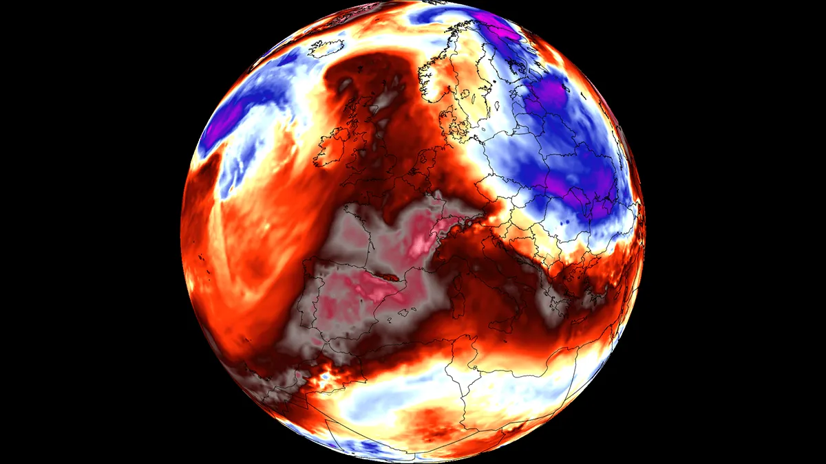
A new powerful early-September Heat Dome is expanding across Europe. It will bring an intense late-season heatwave with surface temperatures forecast to reach the upper 30s and locally exceed 40 °C in parts of Southern Europe and the Mediterranean. A broad warm plume surging out of North Africa is driving the pattern, with upper-air thermal anomalies climbing well above seasonal averages and setting the stage for unseasonably extreme temperatures across Spain, France, Italy, and the Balkan Peninsula. The primary driver of this late-summer thermal surge is an expansive blocking high-pressure system parked over the Mediterranean Basin. As sinking air adiabatically compresses and warms the lower atmosphere within the heat dome, peak afternoon temperatures across low-lying valleys and coastal interiors will range from 38 °C to 42 °C across Spain, southern Spain, and Italy, with dry continental winds rapidly depleting soil moisture. The following chart shows the mid-range forecast for Paris, France, and Zagreb, Croatia. Both indicate the heatwave will be long-lived, with temperatures significantly above the average.

Severe Weather Europe·
Weather

Ontario faces severe storms Wednesday with damaging winds, heavy rain, and tornado risk

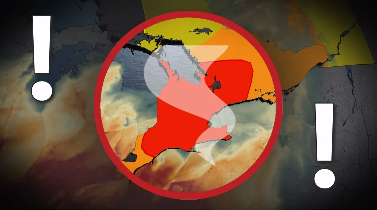
Severe weather conditions shaped up across southern Ontario Wednesday, driven by an unstable, humid atmosphere, and a sharp cold front from Michigan acting as the primary trigger. All severe hazards are possible this afternoon and evening, including torrential rain, damaging winds, and very large hail (larger than golf ball-size). There is also a potential for one or two tornadoes. DON'T MISS: Summer lingers as warmth wins out across Canada in SeptemberBe sure to stay alert to the changing conditions, and check for any weather warnings in your area. Round 2: Severe and dangerous storm setupSevere storms intensified ahead of the cold front, sweeping from Barrie through the GTA and into eastern Ontario through 8 p.m. STORM TRACKING: Scenes from Ontario's thunderstroms as they unfoldRisks include torrential rain, damaging winds, large hail (greater than golf ball-size), and isolated tornadoes. Areas west of Toronto to Lake Huron and east to Bancroft-Kingston show an elevated tornado risk. Trailing storms are possible near London around the dinner hour. Content continues belowPotential impacts:Power outages and tree damage due to strong winds. Localized flooding from heavy rain.

The Weather Network·
Weather

Rain delays US Open as New York City’s soggy September begins

Here's a look at how trading on prediction markets are assessing New York City’s total rainfall for the month. Blinding rain slams Union, New Jersey Blinding rain is slamming Union, New Jersey, leaving cars stranded as flash flooding continues across the area. A Level 3 of 4 flash flood risk is in effect for central and northern New Jersey. THE TAKEAWAYNew York City started September with rain, disrupting play at the U. S. Open in Queens. Central Park’s yearly rainfall total remains slightly below average despite a wet summer. NOAA’s long-range outlook favors above-normal precipitation across much of the Northeast this month. NEW YORK CITY – New York City is off to a wet start to September, with rounds of active weather casting a gloomy shadow over the month's first week. To start off the month, the Northeast fell under a multiday severe weather threat, with an active rotation of storms that brought rain to the Big Apple. VIDEO: OCEANIC MANTA RAY SPOTTED OFF LONG ISLAND COAST IN RARE NEW YORK SIGHTING People walk through Times Square during rainfall in New York City on September 01, 2026, in New York, New York.

Fox Weather·
Weather

2026 Atlantic hurricane season nears historic territory for latest first hurricane amid looming Super El Niño

THE TAKEAWAY:The Atlantic has only produced five named storms and not a single one has strengthened into a hurricane for the 2026 hurricane season. The latest first hurricanes in the Atlantic occurred between Sept. 2 and Sept. 11. History shows late-starting seasons can still produce intense activity in a compressed window. An average Atlantic hurricane season produces 14 named storms, seven hurricanes and three major hurricanes. While Nov. 30 marks the official end of hurricane season, this year is tracking to be a quiet season due to hostile conditions produced by the inhibitive El Niño climate pattern taking hold across the Pacific and thwarting activity in the Atlantic basin. STRENGTHENING EL NIÑO COULD SHAKE UP FALL WEATHER ACROSS THE US - HERE’S WHAT TO EXPECTSo far, the Atlantic has only produced five named storms—Arthur, Bertha, Cristobal, Dolly and Edouard—and not a single one has strengthened into a hurricane. El Niño impact on hurricane season. (FOX Weather / FOX Weather)El Niño is typically associated with reduced tropical cyclone activity in the Atlantic Basin and increased storm activity in the Eastern and Central Pacific basins.

Fox Weather·
Weather

Illinois record hail verified after state set tornado record

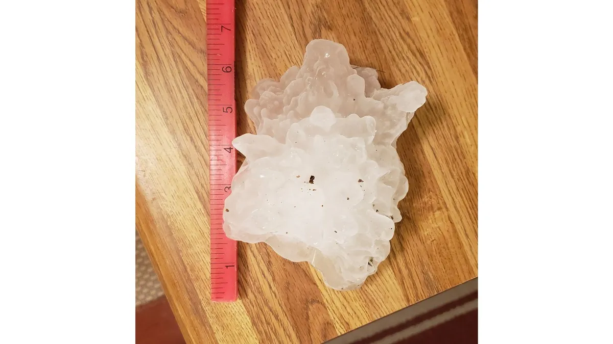
The Kankakee, Illinois, hailstone from March 10, 2026, which smashed an all-time state record. (NOAA via NIU, IBHS)A huge hailstone found in northern Illinois in March has been confirmed the state's largest, adding to a record year for severe weather and tornadoes in America's hardest-hit state. The hail's giant sizeOne hailstone from a severe thunderstorm in Kankakee, Illinois, on March 10, was measured by researchers to be up to 6.6 inches long. That easily shattered the previous Illinois state record hail, a 4.75-inch long stone near Minooka on June 10, 2015, according to a report released Tuesday by NOAA. That's roughly the diameter of a standard 1-gallon paint can. The stone weighed 1.228 pounds, slightly less than a standard NBA basketball. These measurements were taken one week after the storm by scientists at Northern Illinois University and the Insurance Institute for Business & Home Safety using 3D laser scanning. Get More of Our News on GoogleSet The Weather Company as a 'Preferred Source' to get quicker access to the news you value.

The Weather Channel·
Weather

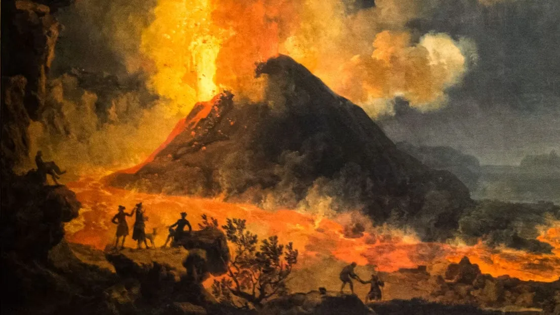
‘The Sun was dark and its darkness lasted for 18 months’ – what we can learn from worst volcanic eruptions in history

The worst volcanic eruptions in history: when the sun went darkEurope was plunged into darkness and suffered from intense crop failures and famines in the years A. D. 536 and A. D. 1258, after massive volcanic eruptions. When many people think of volcanic eruptions, they envisage deadly lava flows and suffocating ash fall. The fate of the inhabitants of Pompeii after the eruption of Mount Vesuvius in the year A. D. 79 still resonates today. Yet, volcanic eruptions have more wide-ranging consequences than is often realised, and this is recorded in historical accounts. Large volcanic eruptions emit gases and ash particles into the atmosphere. Although the ash itself settles within weeks, the aerosols spread around the planet and can remain suspended in the atmosphere for years. Ice cores – long cylindrical samples drilled from glaciers – reveal these past sediment layers over hundreds of thousands of years. What we can see from studying historic records is that volcanic eruptions can produce climatic changes, and rapid spread of disease such as plague. They can also affect weather systems far beyond the immediate vicinity of the volcano itself.

The Weather Channel·
Weather

SpaceX's new Starbase Louisiana faces a tough weather test

Will weather threaten SpaceX's $100B Louisiana spaceport? SpaceX announced its plan to build a spaceport — yep, that’s like an airport for rockets — with a $100 billion investment in Starbase, Louisiana. Now, if they can just get the weather to cooperate. Currently, Cape Canaveral in Florida is the country's most established, highest-volume rocket launch site. It serves as a good benchmark for comparison to this new location in Vermilion Parish, Louisiana, as to how the weather stacks up to benefit or inhibit launch operations.(MORE: The sun was dark for 18 months: what we can learn from history's worst volcanic eruptions)Here’s what’s at play. RainfallData from nearby Starbase, LA, shows 64.09 inches of rainfall on a yearly basis, but 50.79 inches near Cape Canaveral. For NASA’s Artemis I weather criteria, there’s a hard rule outright: “Do not launch through precipitation.”Get More of Our News on GoogleSet The Weather Company as a 'Preferred Source' to get quicker access to the news you value. A wet launch pad can be a ground-safety hazard for personnel and equipment.

The Weather Channel·
Weather

Bryan Norcross: Post Edouard the Atlantic goes quiet while we watch for tropical moisture in the West

The southern extent of an unusually strong early-season storm moving in on the Pacific Northwest looks likely to pull moisture out of Marie, however, and spread it over extreme Southern California and north in the Rockies beginning this weekend. Bryan Norcross Updated at 9:00 a.m. ET on Wednesday, September 2, 2025What's left of Tropical Storm Edouard is drenching East Texas. The storms winds have decreased, so Edouard is now classified as a tropical depression. On the radar, you can see that it still has an impressive structure so it can produce extreme rainfall. Over 20 inches of rain has been reported in some areas where Edouard's leftover bands have stalled along and near the I-45 corridor north of Houston. Rain is falling at up to 5 inches per hour in some locations. Flash flooding is occurring. LATEST FROM FOX WEATHER HURRICANE SPECIALIST BRYAN NORCROSS Radar imagery of Tropical Depression Edouard. (Bryan Norcross)Everyone in that area should stay aware of the latest flood alerts from the National Weather Service.

Fox Weather·
Weather

Tornado, large hail, damaging winds: Severe weather threatens southern Ontario

Warm weather continues across southern Ontario as meteorological summer ends, with widespread temperatures reaching above-seasonal norms. Daytime highs range from 28-30°C in areas like Hamilton and Windsor, with mid-to-upper 20s expected in the Greater Toronto Area (GTA). DON'T MISS: Summer lingers as warmth wins out across Canada in SeptemberHowever, high humidity is pushing feels-like values into the 40s from London to Windsor, enhancing discomfort and fuelling a daily thunderstorm threat. Wednesday brings the highest storm risk, with high atmospheric moisture sustaining muggy conditions. Storms may produce torrential rain, strong to damaging winds, and large hail. An isolated tornado cannot be ruled out. Be sure to stay alert to the changing conditions, and check for any weather warnings in your area. Wednesday: Risk for strong storms and isolated supercellsSouthern Ontario faces a heightened risk of severe thunderstorms Wednesday, with threats of damaging winds and an isolated tornado. Content continues belowHeavy rain is possible early in the morning across the region, including the northern GTA and Highway 401 corridor, potentially disrupting the morning commute.

The Weather Network·
Weather

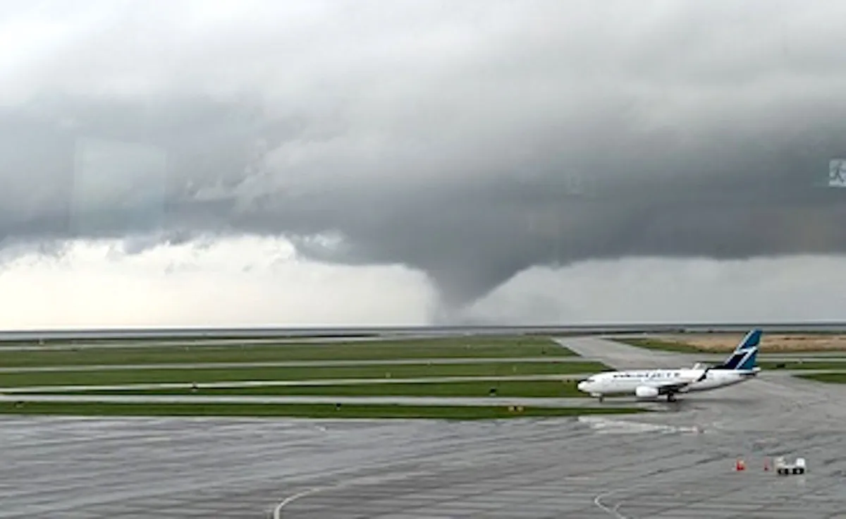
Tornadoes can happen anywhere—and cities aren't immune

Stick around any town long enough during storm season and you'll probably hear a bit of local lore about how the community is protected from twisters. “They just can’t happen around here,” the legends will insist, attributing this alleged immunity to rivers, mountains, or even tall buildings that disrupt a thunderstorm and stifle any attempt to spawn a tornado. Unfortunately, those myths aren’t just wrong—they’re flat out dangerous. Tornadoes are possible just about anywhere on Earth given the right conditions. Some areas are more prone to twisters than others, but we’ve seen formidable tornadoes touch down in areas where it didn’t seem like they could ever hit. DON’T MISS: Don’t fall victim to these seven dangerous tornado mythsTornadoes can and do strike citiesTens of thousands of spectators filled the Georgia Dome on the night of March 14, 2008, gripped by the tension of a college basketball tournament game thrown into overtime. As the teams duked it out on the court, the roof above the packed stadium began to shudder against the winds of an EF-2 tornado barreling through downtown Atlanta.

The Weather Network·