BBlogFlow

Categories

Weather

5140 articles

Weather

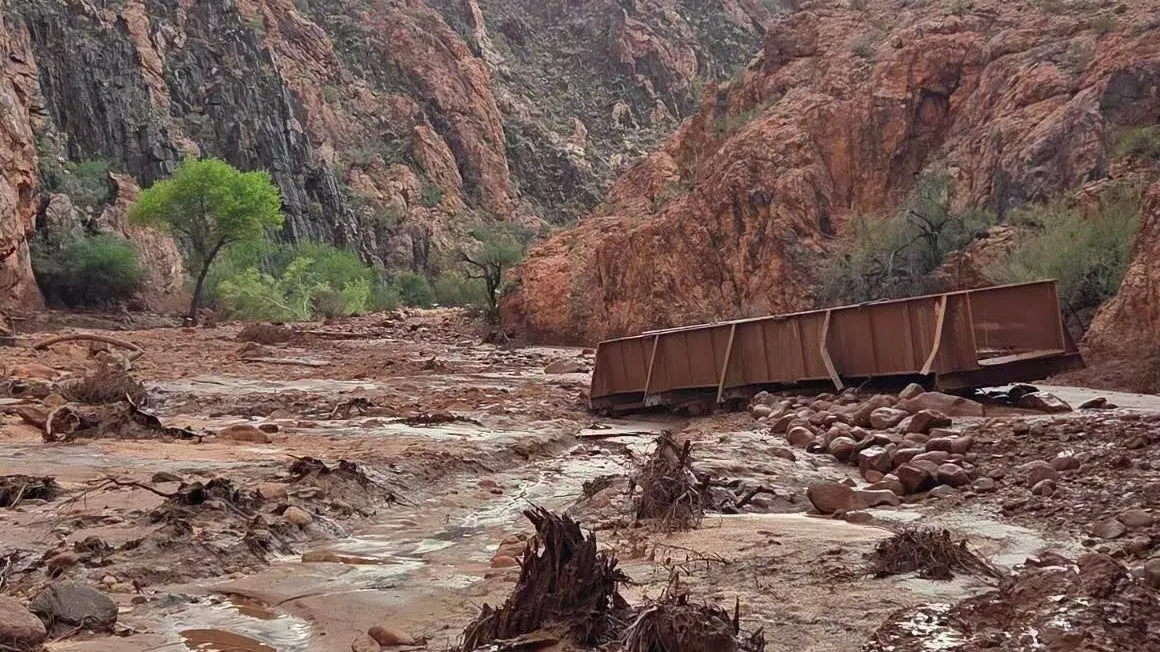
Hikers describe intense rain, wind before Grand Canyon flood

Why slot canyons can flood in just minutes, sending water rising quicklyLike clockwork, clouds build up in the afternoon, the wind starts to swirl and the skies darken. Then the rain comes. Sometimes it is just a few drops. But on this August afternoon, the monsoon kicked into high gear, setting its sights on a remote section of the Grand Canyon's North Rim. Down below, dozens of hikers were setting up camp along Bright Angel Creek and admiring the towering walls they eventually would have to traverse on the way back up. It wasn't long before muddy water came rushing down the creek. The sound was deafening as it crashed against the rocks, carrying with it tree branches, sediment and other debris. Violent thunderstorms and subsequent flash flooding are nothing new during the summer months in the southwestern United States. Those in the canyon last Saturday knew the risks, but this storm packed an extra punch, washing out key footbridges and doing more damage to infrastructure than previous decades of turbulent water. Two people died and at least one is still missing. More than 80 people were airlifted out of the canyon, and the National Park Service is assessing the damage.

The Weather Channel·
Weather

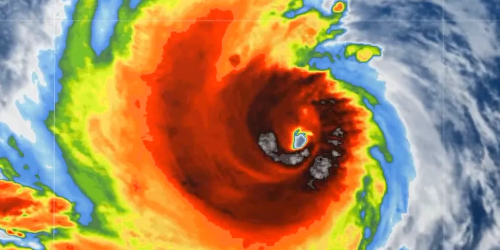
Hawaii braces for potential direct strike from major Hurricane Lowell as Pacific is supercharged with activity

Hawaii braces for potential direct strike from major Hurricane Lowell 🌀HAWAII ON ALERT: Part of Hawaii is now in the cone of major Category 4 Hurricane Lowell. The National Hurricane Center is warning people in Hawaii that Lowell could still be a major hurricane as it makes its approach early next week. A direct landfall is still possible. Watch FOX Weather for the LATEST update:THE TAKEAWAYHurricane Lowell has the potential for a dangerous, direct strike on Hawaii early next weekHurricane Marie could fuel rare storms across the Southwestern U. S. into the holiday weekend. Hurricane Karina is expected to weaken into the weekend with no threat to Hawaii at this time as all eyes track Lowell. Part of Hawaii is now in the cone of monster Category 4 Hurricane Lowell. The National Hurricane Center is warning people in Hawaii that Lowell could still be a dangerous, major hurricane as it approaches the westernmost islands early next week. According to the FOX Forecast Center, a direct landfall is possible.

Fox Weather·
Weather

Hiking in fall requires specific focus on these hazards

Are you ready to become one with nature and set out for a fall hike? Here are some hacks to help make your journey safer and more enjoyable. Don’t be afraid to make some noise. Fall is an active time for wildlife, and the last thing you want to do is sneak up on an animal. Let them know you’re present. Now if you’re setting out for your hike after a rainfall, wet leaves on a trail can be just as slippery as icy conditions, so you want to make sure you have boots with good grips, or even walking sticks can help. You want to stay cognizant of the sunset times. Beware of shorter days, especially if you’re hiking. You could even bring a headlamp. Along the coasts, you’ve got that cool ocean breeze, which can make the weather feel even colder in the fall. You may not be thinking about drinking as much water, but it’s still important to stay hydrated. You want to bring an insulated bottle, maybe put some tea in there, and drink the warm water even. That will keep you warm as well, and it will keep you functioning properly. WATCH: The do's and don'ts of using bear spray

The Weather Network·
Weather

Fall is here: When should you stop mowing the lawn?

As conditions get you cooler, you may be wondering when it’s time to stop cutting your lawn. Lawn care can be tricky, especially if you want your grass to survive the winter. In the video above, The Weather Network’s Victoria Fenn Alvarado speaks with Charlie Kerrigan, CEO of V. I. L. Landscaping Inc. Keep watching for his tips on how to prepare for the fall and when you should officially say goodbye to the mower for the next little while.(Header image credit: Getty Images/stoncelli. Creative #: 166736424)

The Weather Network·
Weather

Five pro tips to help you prep the garden for fall

Although it may seem like your plants are fading away, there is a lot you can do to make the garden ready to embrace cooler temperatures and flourish in spring. Horticulturalist Ken Brown of Whitby, Ont., has been dallying in the dirt for most of his life. He has 5 hacks to get ahead as we transition into fall.1) FERTILIZING THE LAWNLate October, when the ground starts to freeze, is a great time to fertilize the lawn. The grass crowns will store the fertilizer, increasing the chances for growth in the spring.2) SOAKING EVERGREENSAs the sun shines on evergreen trees in the spring, they wake up and ask the roots for water. If there is no water, the foliage will often turn brown. Soaking your evergreens in the fall will help prevent this from happening. Just like gardening guru Ken Brown says, "The cold doesn't kill the evergreens, the bright sun kills them when they can't replace the water. "3) PLANT PERENNIALSIt may not seem like a good time to plant perennials, but the beginning of September is great because the plants often go on sale. Perennials have a month-and-a-half to establish themselves in the ground, according to Brown. "I watch the signs go up and when they say half

The Weather Network·
Weather

Going apple picking? Here's what else you can make beyond pie

The perfect glass of apple juice is right at your fingertips—and all you need is a freezer, some apples, and a little bit of patience. Watch the video above to see The Weather Network's Nathan Coleman test out this simple and delicious TikTok hack.(Thumbnail photo of apples courtesy of Getty Images)

The Weather Network·
Weather

Meet the fly that emits an odour, leaves stains, and clusters in homes in fall

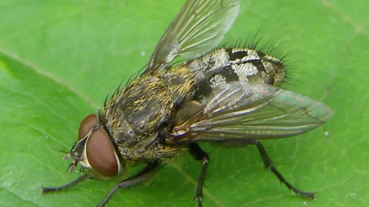
As temperatures drop in the fall, you may notice an influx of critters in your home. These temporary invaders hope to ride out winter inside, away from the cold. Most are harmless and can be ignored, provided they aren't bothering you. One group you may notice buzzing around goes by the name "cluster flies," and they can be hard to miss due to their tendency to gather in groups after letting themselves inside, as the name suggests. When disturbed, they will occasionally emit a faint, slightly sweet odour. Identifying a cluster fly House flies, blow flies, face flies, and cluster flies have different characteristics. {Graphic created by Cheryl Santa Maria. Images: Wikipedia (1, 2, 3, 4)}Cluster flies typically measure 8 to 10 mm long, have dark grey with black and silver checkered abdomens, and have golden hairs on their upper bodies (although older flies may not have these). Content continues belowSEE ALSO: Meet the destructive invasive species trying to get in your home this fallUnlike their more common cousins, house flies, cluster flies have wings overlapping at rest.

The Weather Network·
Weather

Say goodbye to wet feet: Waterproof your shoes with this simple hack

Heavy rain can create messy situations. As someone who knows the weather, I have some seriously waterproof boots that even Moses would envy. But if all you have are sneakers, don't worry - there's a solution to keep your feet dry. All you’ll need is a candle and a hair dryer. The first step is to rub the candle wax all over the shoe. Then, simply turn on the blow dryer and let the melting begin. No life hack video is complete without a test. Check out the video above to see how effective this one was. Looking for more life hacks? Check out the ones below:Never scrape your windshield again with this sandwich bag hackHow to make your own windshield washer fluid using simple ingredientsWhy you should never throw silica packets awayWhat to do with leftover bubble wrapDon’t throw your stale cookies away — this hack helps bring freshness backTransform your broken umbrella with this clever hackWindows fogging up? Try this simple hack using table saltThis simple move may save many kids' lives during a heat wave

The Weather Network·
Weather

Your water may taste 'off' this time of year. Here's why

The water that comes out of your taps has to come from somewhere. In the Greater Toronto Area, that's Lake Ontario. But as summer heats up, so does the lake, and that could have an impact on how your tap water tastes and smells. Unfortunately, this isn't a case of life handing you lemons for your water. "So as you get towards late summer and early fall, the temperature in the lake also goes up, and there is naturally occurring bacteria that give off chemicals in very low quantities, but they are the ones that give off taste and odour," says the City of Toronto's Deputy General Manager, William Fernandes. SEE ALSO: You aren’t imagining it: Asthma-related incidents DO peak in SeptemberThat taste and odour can best be described as "musty" or "earthy. "The main chemical that is released is called "geosmin," and it's also the reason for that famous post-rainfall smell outside. "It's not dangerous. It is very safe to drink tap water year round, even when you have taste and odour concerns," Fernandes states. Content continues belowThe good news is that this can be a short-lived event, lasting only a week or two.

The Weather Network·
Weather

Much-needed rain arrives as first fall storms soak Pacific Northwest, offering potential wildfire relief

First fall storms soak Pacific Northwest with much-needed rain The first meteorological fall storms of the year are bringing much-needed rain to the Pacific Northwest through Friday. While a Level 1 out of 4 flood threat is in place for portions of the region, the rain is also offering some relief from drought and wildfire conditions. Full forecast:THE TAKEAWAYFirst fall storms bring much-needed rain to the Pacific Northwest. Portions of the region have been issued a Level 1 out of 4 flash flood threat through Friday. Storms could help provide relief amid a historically bad wildfire season across the region. SEATTLE — The first fall storms of the season have begun drenching the Pacific Northwest, just as meteorological fall gets underway, and could provide beneficial rain that would ease wildfires amid a record-setting wildfire season for the region. August fires across Washington and Oregon alone burned more than 2.5 million acres, according to information from the National Interagency Fire Center. WASHINGTON'S MOST DESTRUCTIVE WILDFIRE IN STATE HISTORY Damage is seen on August 10, 2026, after the Old Trails Fire swept through multiple neighborhoods in Spokane, Washington.

Fox Weather·
Weather

Meet the destructive invasive species trying to get in your home this fall

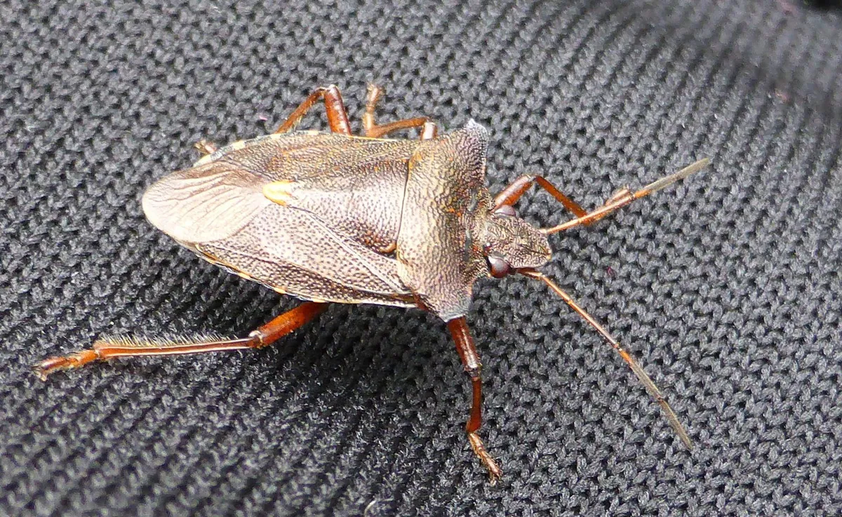
They don't bite or sting, but the brown marmorated stink bug can cause big problems. It's meteorlogical fall, and that means temperatures are starting to drop. With that, insects are looking for warm places, like your home, to hunker down for the cooler months ahead. Some of these bugs, like spiders and centipedes, likely won't come as a surprise. But others may look new to you. Take, for example, the brown marmorated stink bug. Measuring about 2 cm long and wide, with a flat, brown abdomen, it is native to Asia. It’s here in North America because it was accidentally introduced to the U. S. in 1998. "They were first detected in Ontario in 2010," Cynthia Scott-Dupree, Ph. D., a professor of sustainable pest management at the University of Guelph, told The Weather Network in 2022. "It has since become established in Ontario, Quebec, and British Columbia. "Content continues belowWhile we're focusing on this particular invasive stink bug species, there are several native stink bugs present in Ontario. Some are pests, like the brown marmorated stink bug, and other species are considered beneficial because they act like a natural biological control, hunting and consuming pest insects.

The Weather Network·
Weather

What does a classic fall storm look like in your part of Canada?

Canada’s rocky road to winter is paved with a constant flurry of rollicking fall storms sweeping across the country. Tropical systems and nor’easters buffet the East Coast during the autumn months. Changing seasons crank up the lake-effect machine across the Great Lakes. And folks in British Columbia start to come out of a long, dry summer as the rainy season begins. Here’s a primer on what a ‘classic’ fall storm looks like in your corner of Canada. DON’T MISS: 'Weather bombs' are explosive storms that create ferocious conditionsTropics influence Eastern Canada’s weatherThe most infamous fall storm in all of Canada is the dreaded nor’easter. These rollicking low-pressure systems roll up the East Coast with ferocious northeasterly winds (hence the name), heavy precipitation, and sometimes even coastal flooding. Nor’easters have a touch of the tropics in them. These powerful systems often feed off the warm waters of the Gulf Stream in order to supplement their sprawling power. It’s not just nor’easters that Maritimers have to watch out for.

The Weather Network·
Weather

Beware the dangers of fall snowstorms across Canada

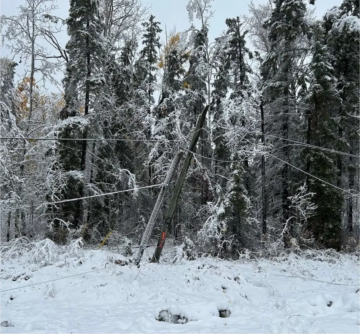
Snow is a defining part of everyday life for folks across Canada. But even a close relationship with frozen precipitation can turn into a dicey ordeal at times. Canadians should beware the dangers of autumn snowstorms. These early-season systems can prove more hazardous than meets the eye. DON’T MISS: How to prepare your vehicle for the cold weather aheadSnow can arrive pretty early from coast to coastWinter weather doesn’t wait for the seasons to change before flakes start flying across the country. Calgary saw 24.6 cm of snow on Sept. 29, 2019, an event that cancelled classes and knocked out power to communities across the region. Winnipeg saw the exact same amount of snow the day before Halloween in 1971. A coastal storm walloped Halifax with 38.6 cm of snow on Oct. 20, 1974, which still stands today as one of the city’s largest single-day snowfalls on record. First snow is dangerous as people acclimate to drivingThe first snow of the season is always a doozy on the roads as drivers get used to navigating slick conditions. Traffic accidents and long delays are a hazard during any storm, but especially during the first coating on the roads.

The Weather Network·
Weather

Over 30K still without power as remnants of Edouard bring more rain after prompting Flash Flood Emergencies

Edouard's remnants slam East Texas with heavy rain and flash flooding The remnants of Edouard have moved into East Texas, bringing more heavy rain and flash flooding, while more than 30,000 customers are still without power in the storm's wake. Edouard's remnants will continue to produce heavy rain across parts of East Texas and North Texas through Thursday afternoon. THE TAKEAWAYThe remnants of Edouard are swamping Southeast Texas with heavy rain and flash flooding. Intense rain triggered a life-threatening Flash Flood Emergency across parts of Hardin and Tyler counties Wednesday morning. A top wind gust of 90 mph was recorded in Port Arthur, with two other hurricane-force gusts measured in the area as Edouard made landfall Tuesday. PORT ARTHUR, Texas — The remnants of Edouard have moved into East Texas, bringing more heavy rain and flash flooding, while more than 30,000 customers are still without power in the storm's wake. A Flash Flood Emergency was issued for Hardin County, Texas, Wednesday night just to the southwest of Kountze. LATEST FROM FOX WEATHER HURRICANE SPECIALIST BRYAN NORCROSS next Heavy rain from Tropical Depression Edouard triggered Flash Flood Emergency in

Fox Weather·
Weather

Bryan Norcross: Last day for Edouard's rain in Texas while we watch Lowell and Hawaii for early next week

Updated at 9:15 A. M. ET on Thursday, September 3Former Tropical Storm Edouard has lost its circulation. But tropical moisture remains parked over Texas southeast of Dallas. The National Weather Service is painting a bull's-eye there for the possibility of continued excess rainfall causing flooding, especially in urban and low-lying areas. Be aware of any flood alerts issued by your local National Weather Service office. The rain is forecast to taper off significantly by later today as the moisture spreads out across North and Central Texas. The good side of Edouard was that it cooled things off. The clouds and lingering showers will provide a little shade. By the weekend, 90s to near 100-degree temperatures will return. LATEST ON FORMER TROPICAL STORM EDOUARD'S IMPACTS IN TEXASElsewhere in the Atlantic, there is no sign of development for the foreseeable future.  (FOX Weather)Over Florida, however, some of ex-Dolly’s moisture will add to the very wet weather pattern. Some heavy thunderstorms are likely through the Labor Day weekend.

Fox Weather·
Weather

Friendly reminder: Ticks are still active in fall

The cooler weather associated with fall makes it a popular time for the perfect time for nature walks, school field trips, and hikes. And that means it's time for your annual reminder: Ticks are still active in the fall and, if the weather remains warm enough, even survive through the winter. You're most likely to encounter ticks in shrubs, near trees, tall grass, and piles of wood and leaves. Ticks are active any time the temperature is consistently above freezing, and there isn't any snow on the ground, reads a statement on the Government of Canada's website. Ticks and Lyme diseaseNot all ticks cause Lyme disease. There are several types of ticks found in Canada. Only black-legged ticks can transmit the bacteria Borrelia burgdorferi that causes the condition, and that's only if the tick is infected with the bacteria. Content continues belowLab studies show that black-legged ticks are active anytime above four degrees Celsius, Katie Clow, an assistant professor at Ontario Veterinary College, told The Weather Network in 2021. Black-legged ticks prefer wooded and brushy areas and places where humidity is higher. They're most active in humid conditions when temperatures are lower.

The Weather Network·
Weather

The Prairies face a multi-day risk of severe storms with high rainfall totals

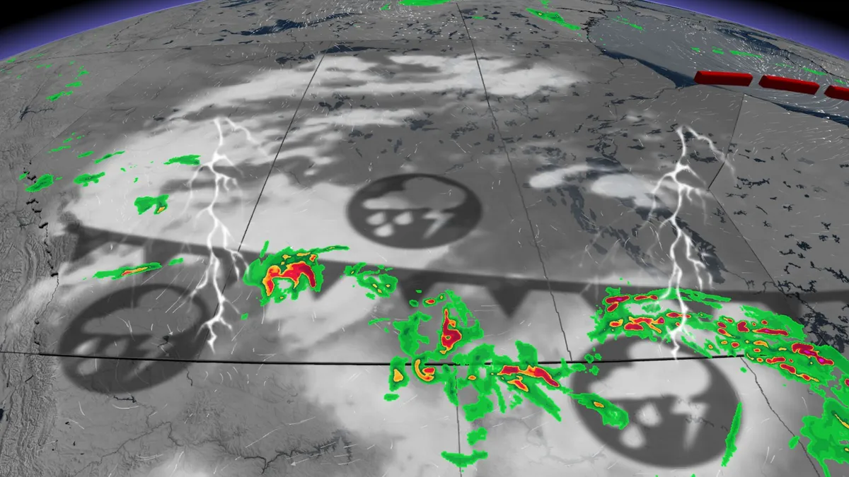
An active weather pattern has established itself across the Prairies, and will persist into early next week. Significant rainfall and thunderstorms are forecast in several regions over multiple days. Be sure to stay alert to the changing conditions, and check for any weather warnings in your area. Widespread thunderstorms threaten heavy rain and strong winds through FridayShowers and thunderstorms are expected along a warm front stretching into southern Saskatchewan overnight Wednesday. A low-pressure system will then lift northward across Alberta on Thursday, bringing widespread showers and embedded thunderstorms. The surface front associated with the low retrograding over Alberta will bring some severe weather for southern Manitoba. Through Thursday afternoon, the storms lift north along the front, lining out. The result will be strong winds with the risk of large hail. Content continues belowWinds can become damaging in nature, exceeding 100 km/h with heavy downpours. Rainfall amounts will vary, with the Elbow region in northern Alberta expected to see the highest totals, ranging from 75-100+ mm through Friday.

The Weather Network·