BBlogFlow

Categories

Weather

5049 articles

Weather

Hawaii's most damaging hurricanes have one thing in common

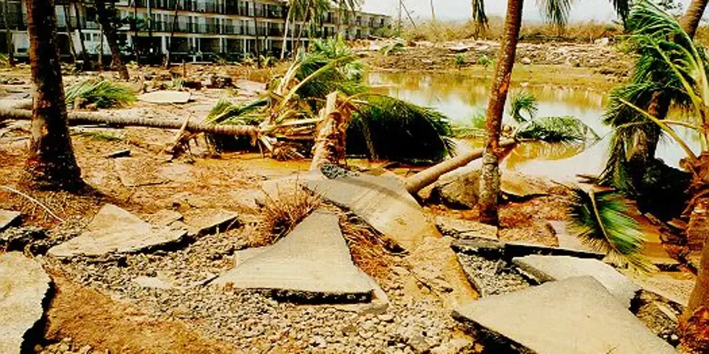
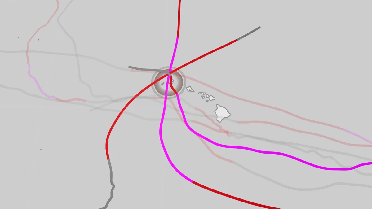
Hawaii has been hit by hurricanes before, and one of its main islands has arguably taken the hardest hits since it became the 50th state. How often do they happen? According to NOAA's historical database, only eight hurricanes have tracked within 70 miles of the Big Island, Maui, Oahu or Kauai since 1959. The last to do so was in late August 2026, when Hurricane Lala brought destructive floods and winds to the Big Island and a few other locations in the chain. (MORE: Hurricane season tracker | Hurricane Lowell's forecast)On average, four to five tropical storms or hurricanes occur in the Central Pacific Ocean basin — defined as longitude between 140-180 degrees west — each year. This map shows the tracks of all hurricanes that have tracked within 70 miles of Hawaii's main island chain from 1959 through August 2026's Hurricane Lala. Those that hit Kauai are highlighted and labeled.(Data: NOAA/NHC)One island hit hardestWhile several of these hurricanes have brought flooding rain and winds to the Big Island, the map above shows three of those tracks struck the westernmost main island of Kauai.
The Weather Channel·
Weather

Late summer outlook: Hot Northwest, Texas, cooler Northeast

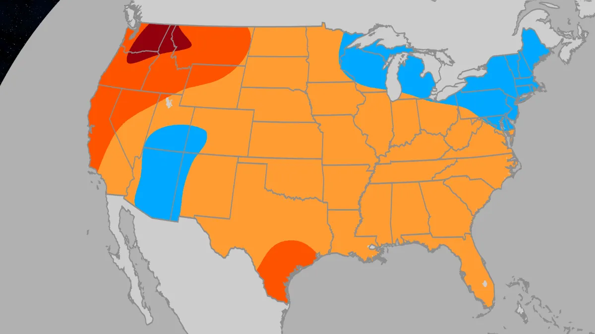
Here’s your July to September outlookThe rest of summer looks to be hot in parts of the U. S., cooler than average in others, and potentially much wetter than usual in a typically dry location. Here are the highlights:Parts of the Northwest and northern Rockies are expected to have a much hotter than average July and August, with at least some heat lingering into September. Parts of Texas are also expected to be hotter than average, especially in July and September. Much of the Florida Peninsula could also have a hotter than usual July. The Great Lakes and Northeast may have a somewhat cooler than average late summer. The Southwest monsoon, basically their season of summer thunderstorms, is expected to be wetter than usual. The Ohio Valley may be wetter than usual in late summer. Here are the monthly temperature maps:There is one big forecast factorThe forecast released Sunday by Atmospheric G2 and The Weather Company has the fingerprints of an intensifying El Niño all over it. This potential historic El Niño could be similar to those in 1997 and 2015, if not stronger, according to Todd Crawford, Vice President of Meteorology at Atmospheric G2 and chief author of the outlook.

The Weather Channel·
Weather

Atlantic hurricane season outlook update: El Niño developing

The 2026 Atlantic hurricane season is still expected to be less busy than usual, partially due to a developing El Niño, but that doesn't mean it won't be dangerous. The latest forecast numbersIn its latest update Wednesday, Colorado State University's tropical meteorology project team is forecasting 11 storms, five of which will become hurricanes and two of which will reach Category 3 status or stronger. That is below the 30-year average numbers of storms and hurricanes, and it is two fewer storms and one fewer hurricane than their initial outlook released in early April. El Niño is developingOne factor expected to exert a big influence on hurricane season is a developing El Niño. And it's increasingly possible it could become a super El Niño, one in which ocean temperatures along the equator in the Pacific Ocean warm to at least 2 degrees Celsius above average. Why does that matter? Get More of Our News on GoogleSet The Weather Company as a 'Preferred Source' to get quicker access to the news you value. El Niño warmed ocean water can affect weather patterns around the world. The stronger the El Niño, the more certain it may have a strong influence.

The Weather Channel·
Weather

How the new heat rule will change the US Open tennis tournament this year

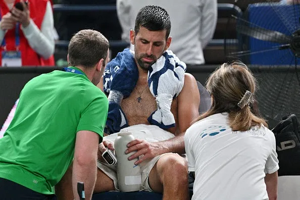
ATP's new heat rule could reshape the US OpenThe US Open, the fourth tennis major of the year, could see impacts both positive and negative from a new heat rule implemented in 2026. This rule was established to protect the players, ballkids and fans from oppressive heat during tennis matches. Serbia's Novak Djokovic refreshes himself during his men's singles match against Spain's Jaume Munar at the Shanghai Masters tennis tournament in Shanghai on Oct. 7, 2025.(Hector RETAMAL/AFP via Getty Images)It became obvious that men's tennis players were suffering in extreme heat in certain tennis tournaments. The Shanghai Tennis Masters tournament in 2025, which took place in late September and early October, was brutal in terms of heat. Novak Djokovic, seen above, struggled with the heat and even vomited before eventually winning his match. Jannick Sinner also struggled with the heat this tournament, suffering from leg cramps and heat-related illness. Jannik Sinner of Italy withdraws due to injury during the match against Tallon Griekspoor of Netherlands in the men's singles 3rd round match on day 7 of the 2025 Shanghai Rolex Masters Qi Zhong Tennis Center on Oct.

The Weather Channel·
Weather

World Cup hurricane, tropical storm risk low, but not zero

How weather may impact the World CupSeveral World Cup cities both in the U. S. and Mexico are within reach of tropical storms and hurricanes and though the threat is lower early in the season, history has shown those cities have been hit before in June and July. During the week before Father's Day, Tropical Storm Arthur briefly spun up near the Texas coast and spread flooding rain into the Deep South for several days. So you may be wondering whether something like this could happen again as the World Cup continues into mid-July. What is June and July risk? As you can see in the graph below, the risk of tropical storms and hurricanes in the first two months of the Atlantic hurricane season is generally low. According to National Hurricane Center statistics, two storms usually form by mid-July in an average hurricane season. This graph shows average tropical storm and hurricane activity in the Atlantic Basin during hurricane season. The timeframe of the 2026 FIFA World Cup is denoted by the highlight and white arrow.(NOAA/NHC)The early risk is near the USWhat storms do form in June and July typically do so near the U.

The Weather Channel·
Weather

Bryan Norcross: Atlantic sleeps while Hurricane Lowell makes its closest approach to Hawaii early next week

The statistical peak of Atlantic hurricane season is coming up next week, but the weather pattern over the tropical Atlantic has a very wintertime look. A strong band of hostile upper-level winds stretches across the Caribbean and all the way to Africa. This pattern will shut off any possibility of an African disturbance developing as it normally would this time of year. There are no signs of any potential development areas for at least the next week or 10 days, which would put us into record territory for the satellite era. The latest date for the first hurricane going back to 1966 is September 11. Hurricane Gustav in 2002 and Hurricane Humberto in 2013 both waited until September 11 to form. Atlantic basin (Bryan Norcross)WHAT’S THE DIFFERENCE BETWEEN A TROPICAL DEPRESSION, TROPICAL STORM AND HURRICANE? In the official record book, which goes back to 1851, 1907 and 1914 had no hurricanes. Obviously, there were also no satellites back then, so nobody thinks the record is necessarily complete. But the point is that a year without hurricanes is meteorologically possible. This is not a prediction. It’s just a thought based on the official record.

Fox Weather·
Weather

Humans can smell rain better than sharks can smell blood

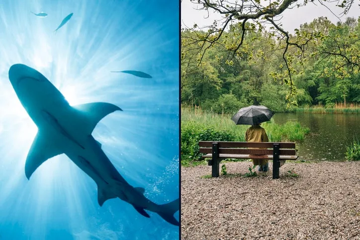
The nose knows: Why humans smell rain better than sharks smell bloodIt’s a common thing you might hear about sharks. “They can smell a single drop of blood from over a mile away!” But what if I told you that not only is that false, but humans are actually better at smelling something surprising: rain. Sharks do have an amazing sense of smell and can typically smell blood in water at concentrations as low as 1 part per million, depending on species and chemical composition of blood.(MORE: Weather.com's Week-Long Exploration Of Sharks, From Their Forecasting Capabilities To Their Public Perception)That’s a ratio of 1 part blood to 1 million parts water, and it’s about equivalent to a single drop of blood in a standard backyard swimming pool. This alone disproves the “one drop a mile away” myth, because the blood becomes more diluted as it gets farther from the source and ocean currents may not carry the molecules toward a shark. But here’s where things get interesting. Get More of Our News on GoogleSet The Weather Company as a 'Preferred Source' to get quicker access to the news you value.

The Weather Channel·
Weather

Vaughan: Road collapses into river after Wednesday's dangerous storms

The aftermath of Wednesday's powerful storms in southern Ontario continues to disrupt the region, with a section of Huntington Rd in Vaughan completely destroyed by floodwaters. Emergency responders successfully rescued drivers from two tractor trailers that fell into the water after the road collapsed into a fast-moving creek. Thankfully, no injuries were reported. DON'T MISS: Why Toronto's Don Valley Parkway floods so often Huntington Rd, between Rutherford Rd and Trade Valley Drive, is closed indefinitely due to a substantial sinkholeYork Regional Police announced that Huntington Rd, between Rutherford Rd and Trade Valley Dr, will remain closed indefinitely due to the damage. Authorities are urging drivers to avoid the area. The storms brought high winds, torrential rain, and hail, leading to widespread flooding across southern Ontario. Downed trees, power outages affecting approximately 65,000 residents, and multiple vehicle rescues were reported as heavy rain overwhelmed local drainage systems. Toronto police reported receiving approximately 300 calls about downed power lines within the past 24 hours.

The Weather Network·
Weather

Stationary system set to deliver several days of rain to the Maritimes

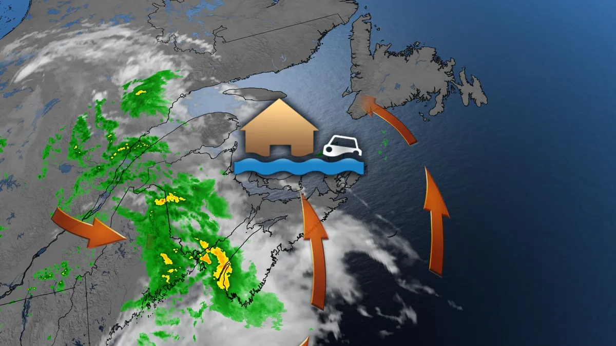
A slow-moving low pressure system is bringing prolonged rain to the Maritimes, with special weather statements in effect for parts of New Brunswick, Nova Scotia, and P. E. I. Heavy rain has already begun in western New Brunswick, and the system is expected to linger over the region through the weekend. DON'T MISS: Staying safe from flash floods, a serious and deadly hazardBe sure to stay alert to the changing conditions, and check for any weather warnings in your area. Heavy rain soaks the Maritimes through FridayRainfall will track west to east Thursday, with Halifax and surrounding areas seeing rain by the afternoon. P. E. I. will experience rain starting Thursday evening, with isolated thunderstorms possible in western Nova Scotia later at night. By Friday, the system will stall near Nova Scotia’s Atlantic coast, wrapping rain back into the Maritimes and western Newfoundland. Thunderstorms are possible Friday night in areas near the Northumberland Strait, affecting New Brunswick, eastern Nova Scotia, and P. E. I. Rainfall will persist across the Maritimes through Saturday and Sunday, with wind gusts of 50-80 km/h expected along exposed coastal areas by Sunday morning.

The Weather Network·
Weather

Pacific's three hurricanes: what Lowell and Marie mean for the US

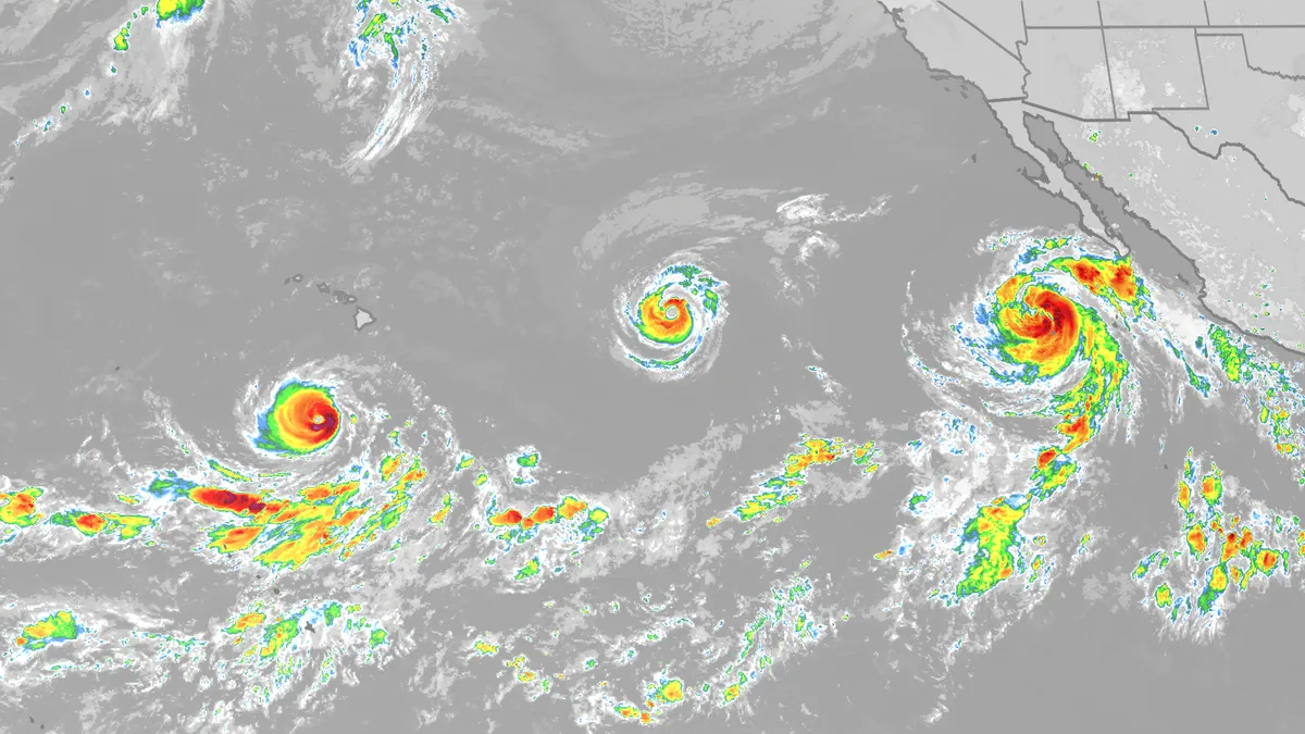
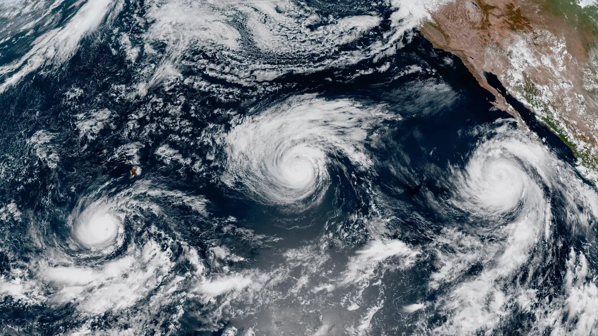
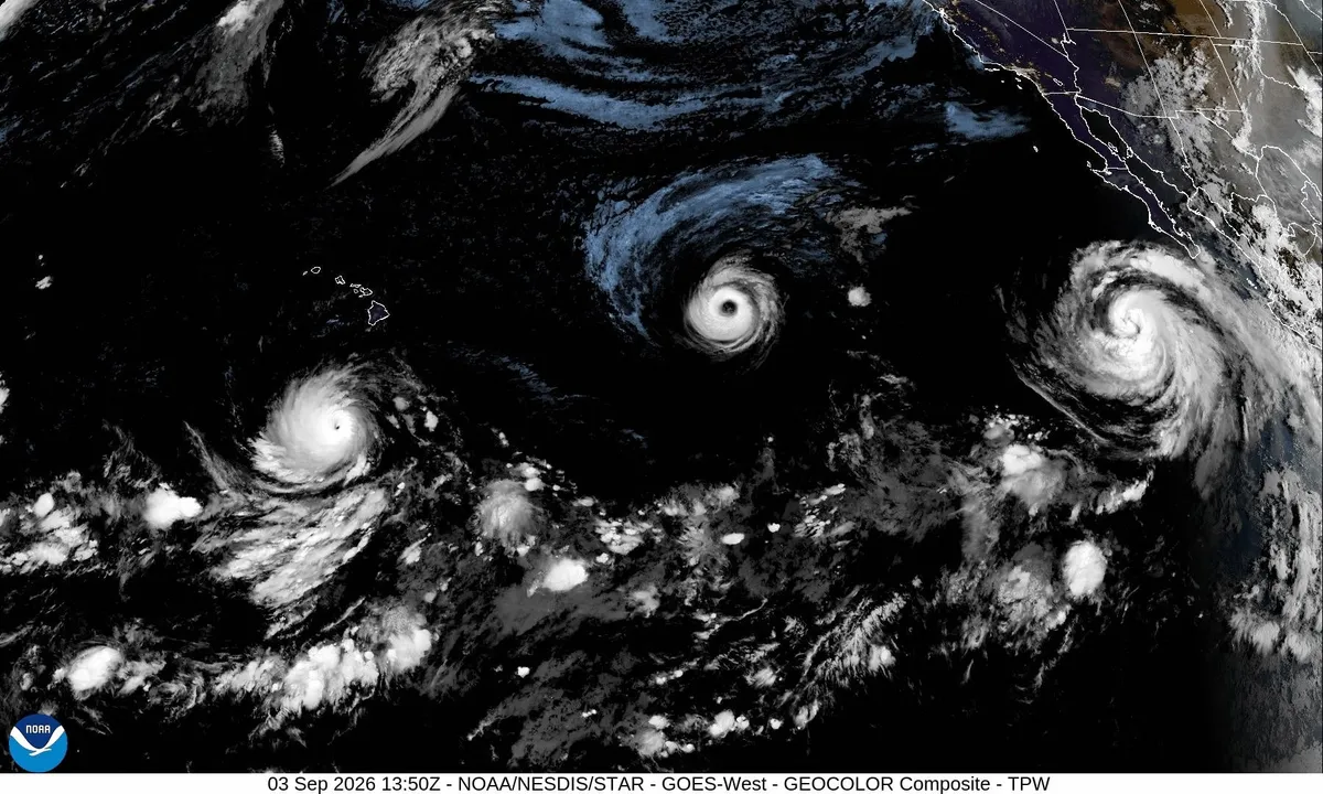
A tropical cyclone outbreak is ongoing in the Pacific with three fresh hurricanes – Lowell, Karina and Marie – all while the Atlantic is asleep. First, we'll start with a rundown of the current activity; then we'll jump into what the strengthening El Niño has to do with it, how common tropical cyclone outbreaks are and what this means going forward. (MORE: What is a tropical cyclone?)The latest stormsFrom west to east, between Hawaii and Mexico, we have hurricanes Lowell, Karina and Marie. Hurricane Lowell:Lowell poses a threat to Hawaii early next week. Lowell became a short-lived Category 5 on Wednesday before weakening. Get More of Our News on GoogleSet The Weather Company as a 'Preferred Source' to get quicker access to the news you value. Hurricane Karina: The middle child of the three hurricanes was once a Category 4 hurricane and was also temporarily in a rare group of hurricanes called annular hurricanes. Annular hurricanes are self-sustaining donuts of thunderstorms that are almost all eyewall with no outer rainbands that tend to survive much longer than other hurricanes over chilly waters. These are much more common in the Pacific than in the Atlantic.

The Weather Channel·
Weather

How the moon makes storm surge worse for coastal communities

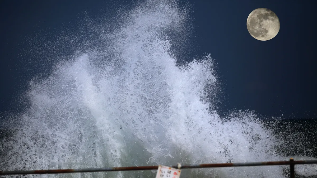
How the moon amplifies storm surge: tides, supermoons and the 2030sWhen a tropical storm or hurricane forces large amounts of ocean water on shore, causing inland flooding for coastal communities, this is known as a storm surge. But did you know that the moon can affect how strong this storm surge can become? Storm surge happens when strong winds push water onto the land. The higher the ocean is to begin with, the higher and farther inland this storm surge can go. And sea level is also affected by the gravitational pull of the moon, in what we know as tides.(MORE: Hurricane terms and definitions you need to know)So, here’s an explainer on what conditions of the moon are good and bad omens for coastal communities bracing for storm surge in the midst of a hurricane. Tides and the daily cycleTo start, here’s how tides work. On the sides of the Earth closest to and farthest from the moon, the ocean’s waters bulge out, resulting in higher water levels and therefore high tides. Get More of Our News on GoogleSet The Weather Company as a 'Preferred Source' to get quicker access to the news you value.

The Weather Channel·
Weather

Trio of hurricanes threaten Pacific tropical troubles

The eastern Pacific Ocean is bustling with activity to begin September as a powerful El Niño continues to influence the region’s weather patterns. Hurricane Lowell became this year’s sixth storm to achieve Category 5 intensity on Wednesday. Another hurricane may send tropical moisture surging northward into next week. DON’T MISS: Destructive Atlantic hurricanes can still happen during El NiñoHawaii on alert for possible impacts from LowellAll eyes are on Hurricane Lowell heading into this weekend as the powerful storm churns about 1,000 km south of the Hawaiian Islands. Lowell briefly achieved Category 5 intensity on Wednesday afternoon, becoming the world’s sixth storm to hit scale-topping strength so far this year. The system remained a Category 4 hurricane on Thursday with maximum winds of 220 km/h. Forecasters with the U. S. National Hurricane Center (NHC) expect Lowell to sustain major hurricane intensity in the coming days as it traverses warm waters and a favourable atmospheric setup.

The Weather Network·
Weather

Prolonged storms and heavy rain elevate flood risk on the Prairies

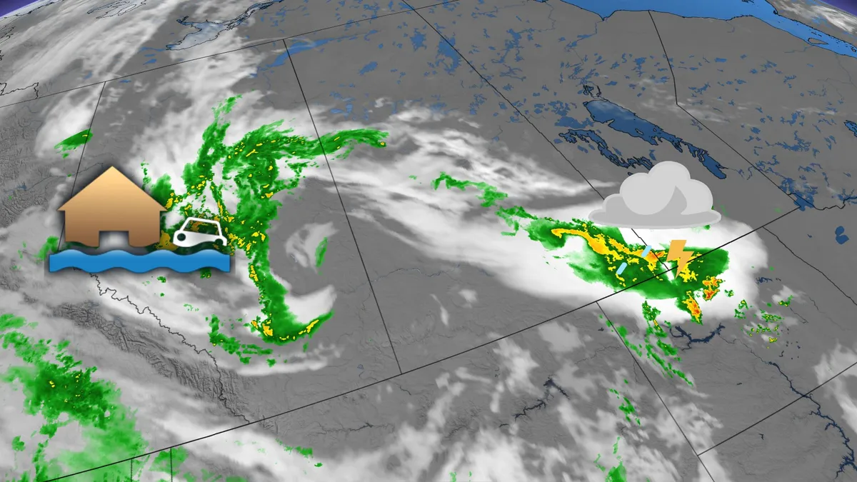
Rainfall warnings are now in effect for parts of northwest Alberta as an active weather period unfolds across the Prairies. Areas under the warnings include Hinton, Grande Cache, and Grande Prairie, with some regions preparing for over 75-100 mm of rain by Friday night. Meanwhile a severe thunderstorm threat is in place for extreme southern Saskatchewan and Manitoba on Thursday, with a potential for tornado development. DON'T MISS: Staying safe from flash floods, a serious and deadly hazardBe sure to stay alert to the changing conditions, and check for any weather warnings in your area. Thursday into Friday: Severe thunderstorms with a heightened flood and tornado riskA low pressure system is driving moisture and instability across Alberta, Saskatchewan, and Manitoba, leading to widespread showers and thunderstorms Thursday. The heaviest rainfall is expected in Alberta’s Elbow region, while Edmonton, Calgary, and Regina may see lesser amounts of 5-15 mm. Severe thunderstorms are anticipated in southeastern Saskatchewan and southwestern Manitoba Thursday afternoon, posing risks of large hail, strong winds, and localized heavy rainfall.

The Weather Network·
Weather

Severe storms and heavy rain threaten southwestern Ontario Thursday

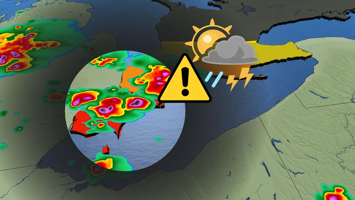
After a stormy Wednesday in southern Ontario, highlighted by tornado alerts, large hail, flooding, and power outages, another round of severe thunderstorms is expected Thursday in parts of the region. The primary focus will be on southwestern Ontario, with storm activity likely from late afternoon into the evening. DON'T MISS: Vaughan: Road collapses into river after Wednesday's dangerous stormsBe sure to stay alert to the changing conditions, and check for any weather warnings in your area. Severe storm risk spans the southwest Thursday afternoon and eveningA muggy and unstable air mass remains over southern Ontario, with daytime highs in the high 20s to low 30s. Humidex values will push temperatures into the mid-30s to mid-40s across southwestern areas. The presence of a stationary boundary over the southwest heightens the potential for severe storms. Spotty thunderstorms could develop earlier in the day, but the most significant activity is expected during the evening, bringing strong winds, torrential rain, and small hail. Content continues belowThe highest risk of severe storms is from Windsor to London, including Sarnia and Long Point.

The Weather Network·
Weather

Will Labor Day weekend be a washout? Here’s where rain could spoil plans

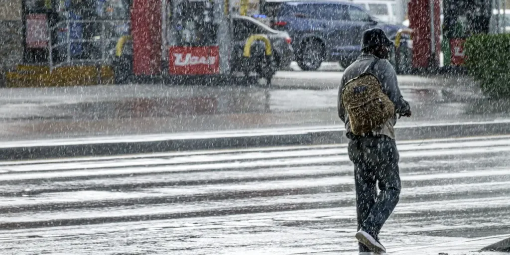
The holiday weekend is here, and millions of Americans are bracing to enjoy the last bit of warm weather for Labor Day before fall's cooling effects begin. As the holiday brings one of the last chances to enjoy the great outdoors with family, prediction markets at Kalshi are weighing the odds that rain will affect major cities this weekend. Experts at Kalshi are predicting an 85% chance of rain to dampen outdoor plans for thousands of people in Miami, along with an 81% chance for Seattle.10 OF AMERICA'S HIDDEN GEM SPOTS YOU CAN'T MISS THIS SUMMERIt is also worth noting that Boston has a 67% chance of precipitation. Other locations also have a substantial chance of wet weather, according to Kalshi. Saturday weather threatStarting Saturday, weather conditions will develop, especially in the Southeast, Four Corners and Southwest regions. Tropical downpours will plague Florida as easterly winds push moisture from the Atlantic Ocean into the region, fueling severe storms.

Fox Weather·
Weather

3 hurricanes in the Pacific at once: Lowell, Karina, Marie

Three hurricanes are now spinning in the Pacific OceanThree hurricanes. One ocean. Right now. One. Two. Three. Lowell, Karina and Marie — three separate hurricanes, three distinct centers, all pinwheeling across the Central and/or Eastern Pacific at the same moment, close enough together to land in a single satellite frame. That's the part breaking people's brains this week. Not that a hurricane exists. That you can see three of them turning at once without zooming out. The last time three hurricanes spun simultaneously in the Eastern or Central Pacific was 2015 — Kilo, Ignacio and Jimena, notably another El Niño year. (MORE: 4 Hurricanes At Once In Atlantic Basin) While the Pacific is lighting up, we're still waiting for a single hurricane in the Atlantic, and that it could be record long wait, there. Wait — what if we run out of names? Great question, and one people are genuinely asking this week. Get More of Our News on GoogleSet The Weather Company as a 'Preferred Source' to get quicker access to the news you value. The Eastern Pacific gets 24 names a season — the whole alphabet minus Q and U.

The Weather Channel·
Weather

Major Hurricane Lowell could follow eerily similar track to the worst hurricane in Hawaii's history

Hawaii braces for potential direct strike from major Hurricane Lowell 🌀HAWAII ON ALERT: Part of Hawaii is now in the cone of major Category 4 Hurricane Lowell. The National Hurricane Center is warning people in Hawaii that Lowell could still be a major hurricane as it makes its approach early next week. A direct landfall is still possible. Watch FOX Weather for the LATEST update:THE TAKEAWAYMajor Hurricane Lowell could follow a track eerily similar to that of 1992’s Hurricane Iniki. Hurricane Iniki also formed during an El Niño year. Iniki destroyed over 70% of the homes on Kauai and remains Hawaii’s deadliest and costliest hurricane. LIHUE, Hawaii — Major Hurricane Lowell, currently passing south of Hawaii, is forecast to turn northward over the weekend, and could follow a track eerily similar to that of 1992’s Hurricane Iniki, the most devastating storm in the state’s history. LATEST FROM FOX WEATHER HURRICANE SPECIALIST BRYAN NORCROSS Hurricane Lowell forecast cone compared to Hurricane Iniki's 1992 track. (FOX Weather / FOX Weather)Iniki made landfall on Sep.

Fox Weather·
Weather

France has hottest summer on record amid drought, wildfires

Your ‘Euro Summer’ is deadFrance recorded its hottest summer since measurements began more than a century ago, the environment minister said on Thursday. Firefighters relentlessly tackled wildfires throughout the summer, even in normally cooler and wetter regions in the north and Brittany, as France experienced one of its driest years ever. A historic fire devoured forests near Bordeaux and forced a quarter of a million people to evacuate from their homes. “We have experienced the hottest summer ever recorded since measurements began in 1900,” Environment Minister Monique Barbut said at a presentation of the climate report covering the months of June, July and August. According to national weather agency Meteo France, the summer of 2026 recorded an average temperature of 75.2 degrees Fahrenheit, covering day and nighttime. It's 6.5 degrees above the normal average, and higher than in 2003, when temperatures were 4.9 degrees above normal. Millions in France, Italy, Spain, the United Kingdom and elsewhere in Europe experienced extreme temperatures this summer.

The Weather Channel·