Summer lingers as warmth wins out across Canada in September
This story deserves to be shared
Send it to someone who'd care, or post it on your networks.

September is typically a month of rambunctious transition across Canada as summer’s iron grip fades against doses of increasingly chilly autumn air. But even as our seasonal temperatures steadily slide through September, our month ahead looks to feature a spell of extended late-summer weather across much of the country. We’ll still have to watch a few wild cards, though, that may throw a wrench into the upcoming patterns. DON’T MISS: Autumn can still produce intense hurricanes across the AtlanticSeptember starts with major heat south of the borderA major and unusual heat dome building across the U. S. will influence conditions across much of Southern Canada to kick off September. Some areas south of the border will experience midsummer heat as we begin climatological autumn. DON'T MISS: Wasps are aggressive right now; here's why and how to stay safeWhile the bulk of the heat will remain to the south, the ridge responsible for this late-season heat will nudge above-seasonal values into parts of Canada. Communities like Windsor, Ont., are on track to start the month with daytime high temperatures as warm as the mid-30s.
This article is an excerpt. To read the full content, visit the original source. The Weather Network
Related articles

Record fall warmth sends the mercury climbing in B.C.
It is unusual to hit a temperature exceeding 20°C this late in the month at Vancouver International Airport. In fact, 21.7°C is the warmest the station has been this late in the year and the ninth-highest October temperature on record. It’s also the warmest October temperature for the station since Oct. 1, 2010: 21.8°C. The October 2022 heat event stands alone for its duration and maximum intensity as recorded across many stations in southern British Columbia. Abbotsford: 28.5°C (Oct. 15, 2022Campbell River: 26.5°C (Oct. 1, 2022)Victoria: 25.3°C (Oct. 2, 2022)Comox: 23°C (Oct. 1 and 7, 2022)The unprecedented start to Oct. 22 had Port Alberni average more than 27°C during the first nine days in October, along with many other stations in the mid-20s. Wildfire smoke and poor air quality drifted as far north as Haida Gwaii during the strong, southerly flow of record-breaking air.

Deadly nor'easter lingers; tens of thousands without power
A sluggish but potent nor'easter is lingering over the Northeast Monday after submerging communities from North Carolina to New England while knocking out power to well over 100,000 customers. Some rain and windy conditions will continue, as well minor coastal flooding during high tides. The early-season storm comes amid the highest king tides of the month for the East Coast. A state of emergency was declared in New Jersey, southern New York and in multiple local communities across the Northeast ahead of the storm. (FORECAST DETAILS: Nor'easter to hammer New England through Monday) Strong winds turn deadlyThe New York City Housing Authority said one of its employees was killed by a fallen tree in Brooklyn as the storm pelted the city with rain and strong winds. ABC7NY reports that the 56-year-old man was walking in a parking lot when the tree came crashing down. Get More of Our News on GoogleSet The Weather Company as a 'Preferred Source' to get quicker access to the news you value. "We are deeply saddened by this tragic loss and extend our heartfelt condolences to his family and the NYCHA community," the statement from the NYCHA said.
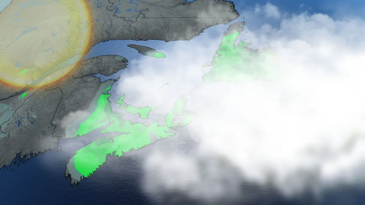
Sunshine returns on the East Coast as soggy storm lingers
A moisture-laden storm moseying through Atlantic Canada will linger into our Labour Day on Monday, though skies will begin to clear across areas that could use the sunshine. High rivers and saturated ground will make additional road damage a continuing concern for the next few days. Our centre of low pressure will pass by Newfoundland through the day Monday, sparking some scattered showers and thunderstorms across the island. The storm gradually pulling away from the region is good news for rain-soaked communities in the Maritimes. CHECK OUT: How the weather could be influencing your music tasteParts of Nova Scotia saw more than 200 mm of rainfall through this weekend, leading to flooding and road washouts across Cape Breton. Power has been restored to virtually all of the 38,000 customers who lost electricity on Saturday. A state of emergency has been declared in parts of Cape Breton as residents continue to deal with flooding and storm damage. Isolated showers will linger over parts of Prince Edward Island and Cape Breton, though certainly not to the extent we’ve seen in recent days. Content continues belowNew Brunswick will enjoy a good amount of sunshine on Monday, though P. E.
0 comments
No comments yet. Be the first to share your thoughts!