BBlogFlow

Categories

Weather

4033 articles

Weather

St. Louis Weather: Cooler and Sunny, Saturday Storm Risk — June 12, 2026

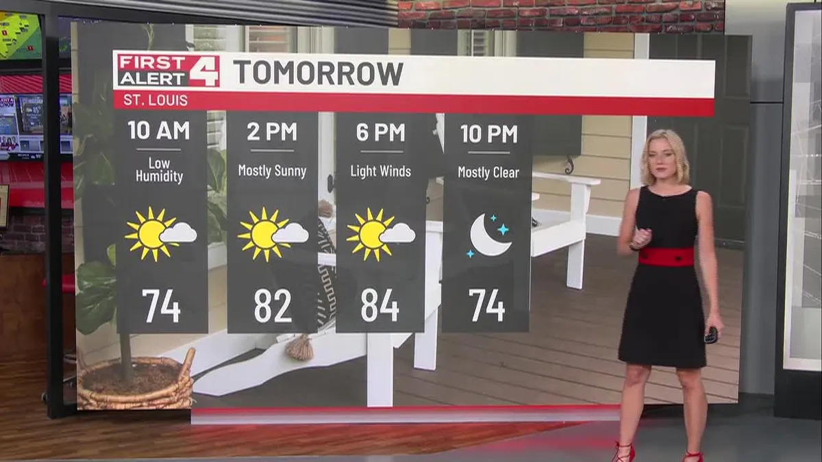
A Cooler and Sunny FridayFirst Alert Weather Day On SaturdayCooler This WeekendDownload the Free First Alert Weather App HereFriday: Get ready for some sunny skies and highs into the lower 80s this afternoon. Winds remain out of the northwest at around 4-8 mph making for a substantial decrease in the humidity from previous days. Saturday is a First Alert Weather Day: Scattered showers and storms remain possible Saturday lasting through Sunday morning, some of these storms could be stronger on Saturday as the cold front moves in. There is still some uncertainty given the potential for morning showers and storms which could limit the potential for stronger storms later during the evening hours. If things remain dryer during the am hours, the severe threat could increase substantially. Afternoon highs top out into the mid 80s. What’s Next: Temperatures decrease once again with highs into the upper 70s Sunday and Monday. Things remain relatively dry after Sunday morning showers clear lasting until mid-week next week.
The Weather Channel·
Weather

North Georgia Heat Index: Weekend to Feel Much Hotter — June 11, 2026

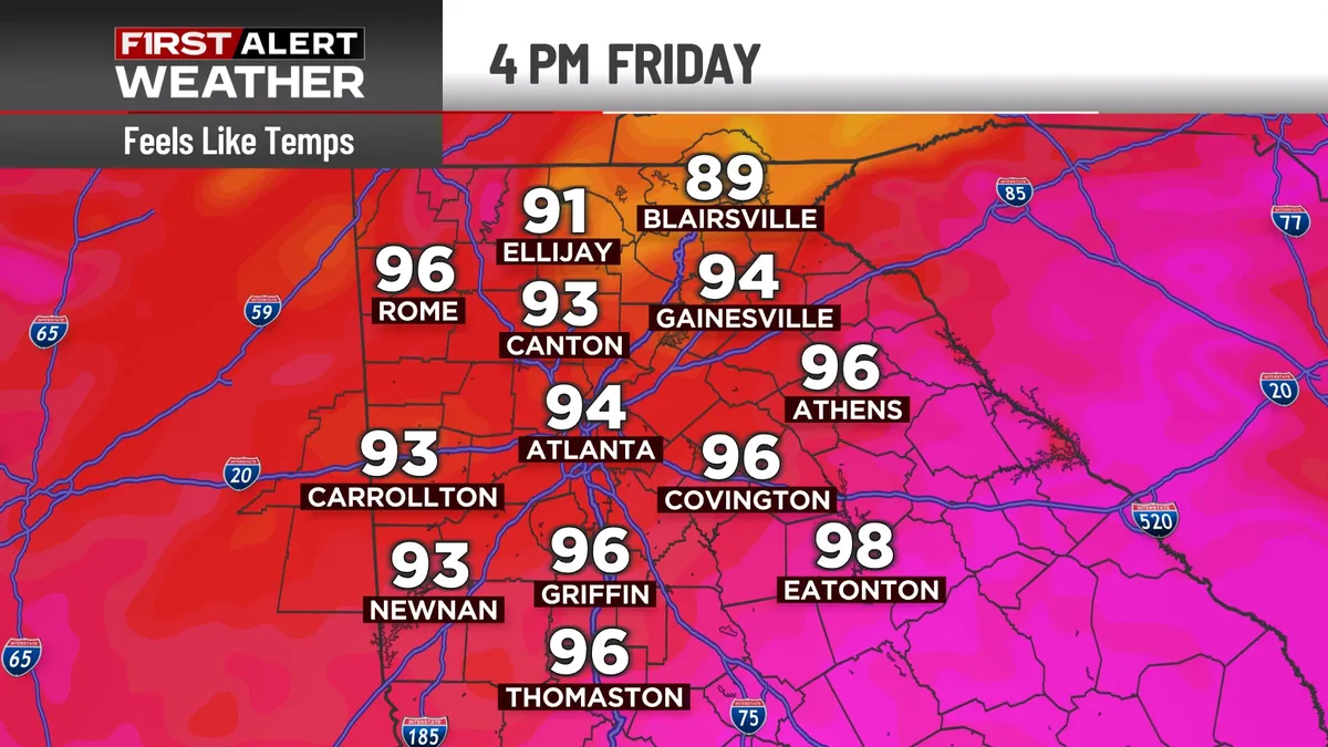
ATLANTA, Ga. (Atlanta News First) — You’ve probably heard the phrase, “It’s not the heat, it’s the humidity” — and there’s actually real science behind that saying. This weekend, that’s exactly what will ramp up even more as temperatures climb and humidity makes it feel even worse! So, what exactly is the heat index? Mathematically, it involves a giant equation with lots of numbers and calculations, but we won’t bore you with the details! In essence, the heat index is the “feels like” temperature, and it involves both the actual air temperature and humidity levels. It’s what your body actually experiences when you step outside, not just what a thermometer reads. Think of it this way: A dry 95° day in Arizona feels very different from a humid 95° day in Atlanta. That difference? That’s the heat index at work. How humidity makes it feel hotterWhen humidity is high, your body can’t cool itself as effectively. Sweat is supposed to evaporate off your skin to cool you down — that’s your body’s natural air conditioning system. But, when the air is already saturated with moisture, that sweat can’t evaporate as quickly.

The Weather Channel·
Weather

Atlanta Weather: Heavy Rain, Flood Watch — June 8, 2026

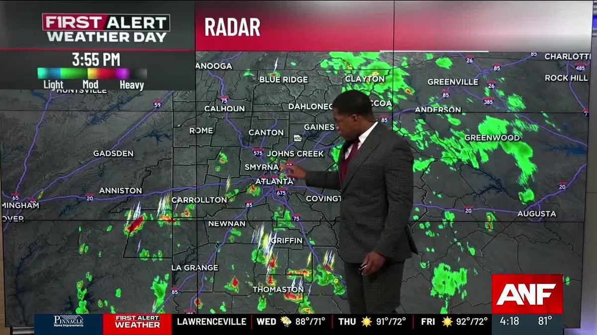
ATLANTA, Ga. (Atlanta News First) — Downpours and a few thunderstorms will continue into the evening hours, ad more heavy rain is expected Tuesday. Scattered, slow-moving downpours and a few storms will stick around through the early evening hours. In the heaviest rain, a quick-hitting 1 to 2 inches of rain will be possible...which could cause flooding. A flood watch remains in effect for north and west Georgia until 9 p.m. More rain TuesdayTuesday brings another First Alert Weather Day with additional rain expected during the afternoon and evening commute. Wet travel conditions will continue, so stay alert and keep checking for the latest updates. Daily storms Wednesday through the weekendStarting Wednesday, expect daily storms to develop with a lower coverage of 20-30%. Storm activity will peak during the late afternoon and evening hours. While not everyone will see rain each day, those who do should be prepared for strong storms. Heat and humidity build for second half of weekThe second half of the week will turn noticeably warmer and more humid. High temperatures will climb near 90 degrees, and with the high humidity in place, heat index values may approach 100 degrees.

The Weather Channel·
Weather

Atlanta Weather: Heat, Humidity & Pop-up Storms — June 9, 2026

ATLANTA, Ga. (Atlanta News First) — Buckle up, North Georgia. We’ve got quite a week ahead. After scattered storms move through tonight and Wednesday, things are going to heat up and get muggy through the weekend. But here’s the big story: Monday and Tuesday are shaping up to be First Alert Weather Days with widespread rain moving in. Tonight and Wednesday: Storms Rolling ThroughSpotty showers and thunderstorms are going to continue through this evening as a system moves across the area. If you’re heading out, watch out for heavy rainfall in spots. Wednesday? Things calm down a bit. You’ll still see a few scattered storms pop up in the afternoon, but nothing organized. It’s going to be hot and humid though — highs in the upper 80s to low 90s, but it’ll feel more like the mid to upper 90s when you factor in the humidity. Thursday Through Saturday: Summer Heat Kicks InThis is classic summer weather in North Georgia. Expect scattered afternoon and evening thunderstorms popping up each day — that’s just what happens when it’s this hot and humid. When these storms develop, lightning will be frequent and dangerous.

The Weather Channel·
Weather

Atlanta Weather: Heat & Humidity Rising, Rain Next Week — June 10, 2026

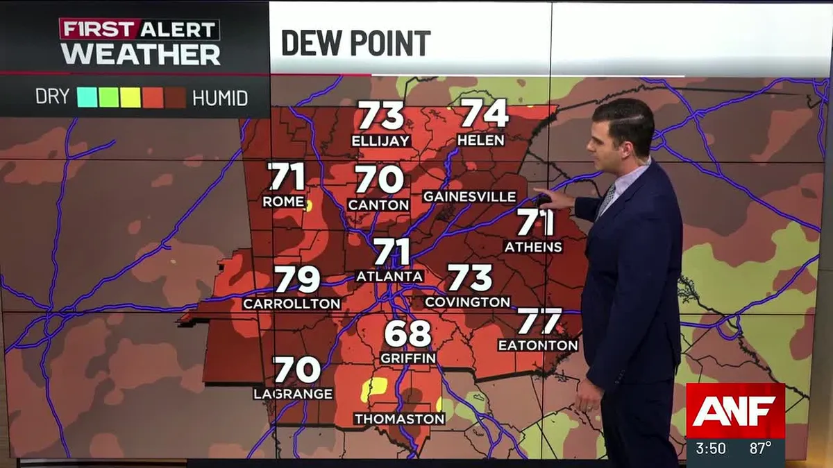
ATLANTA, Ga. (Atlanta News First) — North Georgia is heading into a summery through the weekend with heat index values climbing into the mid to upper 90s. More widespread rain chances return by early next week. Tonight Through Thursday: Hot and HumidExpect warm and muggy conditions tonight with lows only dropping to the low 70s — barely any relief from the daytime heat. Thursday will bring another hot day with highs in the low 90s, but the real story is the heat index. With dewpoints in the 70s, afternoon heat index values will climb into the mid to upper 90s — hot enough to make outdoor activities feel uncomfortable and be dangerous if you don’t stay hydrated. Isolated to scattered showers and thunderstorms are possible each afternoon, but coverage will be limited. If a storm does develop near you, watch for frequent lightning and heavy rainfall before it quickly moves out. Friday and Saturday: Peak Heat ContinuesThe hot pattern continues through the weekend with typical summer weather — hot, humid, and a daily chance of afternoon thunderstorms. Highs will remain in the low to mid 90s, with heat index values around 95-100 degrees across North Georgia.

The Weather Channel·
Weather

Atlanta Weather: Dangerously Hot Days, Weekend Rain — June 11, 2026

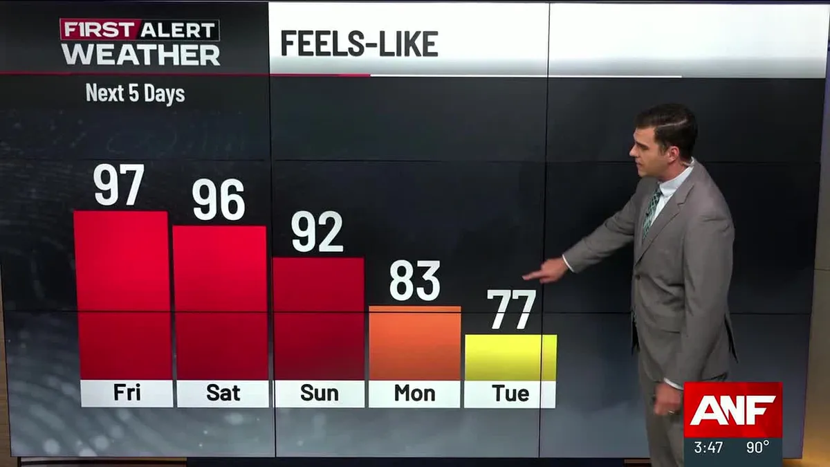
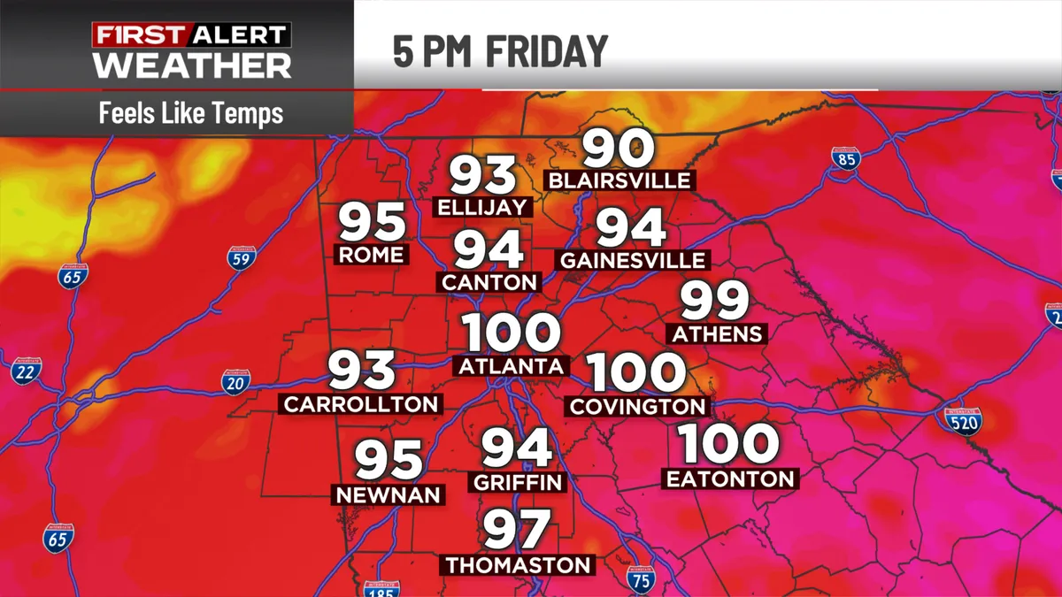
ATLANTA, Ga. (Atlanta News First) — North Georgia is experiencing the hottest stretch of the season so far, with dangerous heat index values climbing into the mid to upper 90s through Saturday. Relief is on the way, but it is still a few days away. Tonight: Still swelteringDon’t expect much cooling tonight. Temperatures will only drop into the low to mid 70s as humid conditions continue. If you’re heading out after work, stay hydrated and take breaks in air conditioning. Friday: The heat intensifiesFriday will be the second hottest day of this stretch. Afternoon highs will climb into the low 90s, but the real story is the heat index — expect widespread values between 95 and 105 degrees. Storm threat Friday evening: A few strong to isolated severe thunderstorms are possible across far North Georgia Friday afternoon and evening as a cold front approaches from the northwest. The main threat would be damaging wind gusts, frequent lightning, small hail, and heavy downpours. Coverage should remain scattered, and storms will gradually weaken and move out after sunset. Saturday: Peak heatSaturday will be the hottest day of this stretch.

The Weather Channel·
Weather

North Georgia Weather: Dangerous Heat, Storm Risk — June 12, 2026

ATLANTA, Ga. (Atlanta News First) — A dangerous combination of heat and storm chances will impact north Georgia through Sunday, with Sunday marking a First Alert Weather Day for scattered storms. Today: Dangerously hot with evening stormsToday will bring more heat and humidity to north Georgia, with heat index temperatures climbing to near 100 degrees this afternoon. The oppressive conditions will make outdoor activities feel even more dangerous than the actual air temperature. Scattered storms are expected to develop in the mountains this evening, with isolated strong storms possible prior to sunset. These storms could bring heavy rain, gusty winds, and frequent lightning to mountain communities. Saturday: More heat, more storm chancesSaturday will offer little relief from the heat. Expect another hot and humid day with heat index values near 100 degrees. The afternoon and evening will bring spotty storm chances across the region, though coverage will be more scattered than Sunday’s expected activity. Sunday: First Alert Weather Day for stormsSunday is a First Alert Weather Day as scattered storms are expected to move through the afternoon and evening hours.

The Weather Channel·
Weather

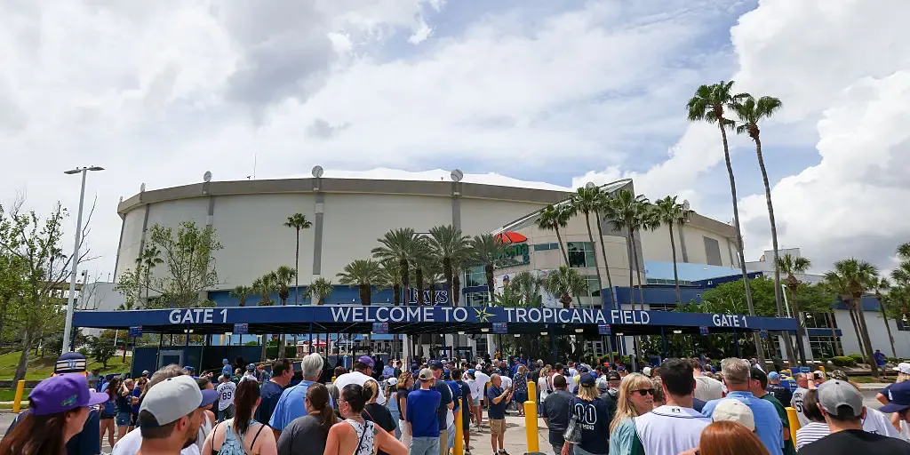
Tropicana Field hosts first playoff game since being devastated by Hurricane Milton as Rays take on Yankees

Milton destroyed most of the field's fiberglass roof as it carved a destructive path across the Florida Peninsula on Oct. 9, 2024, with wind gusts exceeding 100 mph. THE TAKEAWAYThe Tampa Bay Rays will host their first playoff game in Tropicana Field since Hurricane Milton destroyed the stadium's roof in 2024. The City of St. Petersburg said it approved nearly $60 million to repair and restore Tropicana Field, including about $23 million to replace the roof. In their first season back at The Trop, the Rays won 55 games, setting a new franchise record. ST. PETERSBURG, Fla. — Tropicana Field will host its first playoff game since Hurricane Milton devastated the stadium in 2024 as the Tampa Bay Rays entertain the New York Yankees for Game 1 of the American League Divisional Series Saturday evening. Milton destroyed most of the field's fiberglass roof as it carved a destructive path across the Florida Peninsula on Oct. 9, 2024, with wind gusts exceeding 100 mph. next

Fox Weather·
Weather

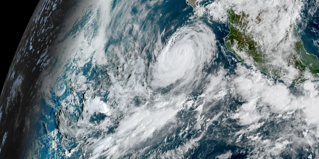
Hurricane Rachel becomes 8th major hurricane in the Pacific this year, fueled by rapidly strengthening El Niño

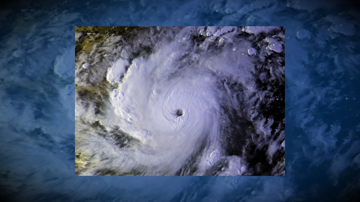
THE TAKEAWAYHurricane Rachel became the 8th major hurricane in the Pacific this season. Moisture from Hurricane Rachel and the remnants of Polo fueled a week-long flood threat across the Central U. S. Rachel became the 20th named storm in the Central and Eastern Pacific this season as a strengthening El Niño supercharges the basins. Hurricane Rachel became the latest major hurricane in the Pacific, briefly reaching Category 3 strength on Thursday, with winds of 120 mph, according to the National Hurricane Center (NHC). Rachel also became the 8th major hurricane in the Eastern Pacific this season. That is even above the average of five major hurricanes during El Niño years since 1990. OVER 150M FACE DANGEROUS, WEEKLONG FLOOD THREAT ACROSS 30+ STATES FUELED BY POWERFUL PACIFIC TROPICAL SYSTEMSMoisture from Rachel to fuel midweek flood threat across Central U. S.(FOX Weather) A large dip in the jet stream pulled moisture from Rachel across the Central U. S., bringing heavy rain throughout the week. This same pattern ushered the remnants of Polo across the Southwest on Tuesday after it made landfall in Baja California as a Category 2 hurricane. WHAT IS A TROPICAL STORM?

Fox Weather·
Weather

Responders rescue driver stranded on top of submerged car as strong floodwaters flow through Arizona

The helicopter quickly lowered one of the rescuers down to the victim who took refuge on top of the toppled vehicle, almost entirely submerged in floodwaters. TONOPAH, Ariz. – A disaster scenario unfolded for one driver traveling through Central Arizona on Wednesday after becoming stranded in floodwaters following severe storms in the region. The driver of a truck near the Hassayampa River in Tonopah, Arizona, needed a helicopter rescue because of the complex situation and strong floodwaters. This comes as the area experienced heavy rain that helped fuel a flood threat, and the driver fell victim to the flooding while on the road. "If you encounter a flooded roadway, find an alternate route and never drive around barricades," said the Arizona Fire and Medical Authority. The helicopter quickly lowered one of the rescuers down to the victim who took refuge on top of the toppled vehicle, almost entirely submerged in floodwaters. Car becomes stuck in heavy floodwaters in Arizona. (azfiremedical / Instgram)TIMELINE: WHEN WILL DANGEROUS, TROPICALLY ENHANCED FLOODING REACH THE SOUTHWEST, SOUTHERN PLAINS AND MIDWEST?

Fox Weather·
Weather

Bryan Norcross: Keeping an eye on the Southwestern Gulf while Mexico watches for the next storm to develop

Long-range signals show the potential for tropical mischief in the Gulf in October While the year without an Atlantic hurricane continues, forecasters are turning their attention to the Gulf, where historically many tropical systems develop in October. There are some long-range signals that the Central American Gyre (CAG) will form sometime later this month. The CAG is a sprawling area of low pressure near or over Central America that can produce locally heavy rain, rough surf and mudslides, and can generate tropical systems in both the Gulf and Eastern Pacific. However, while the ECMWF (European model) but more specifically the Google DeepMind models highlight potential development, the overall odds of development across the Gulf remain in the low category through October 10. Last updated at 9 a.m. on Oct. 2, 2026In the GulfLong-range computer forecast models show some possibility of a tropical depression or tropical storm eventually developing in the southwestern Gulf. A dip in the jet stream is forecast to push a cold front into the Gulf next week where it will settle and stall. Sometimes an orphaned front can be the trigger for a tropical system.

Fox Weather·
Weather

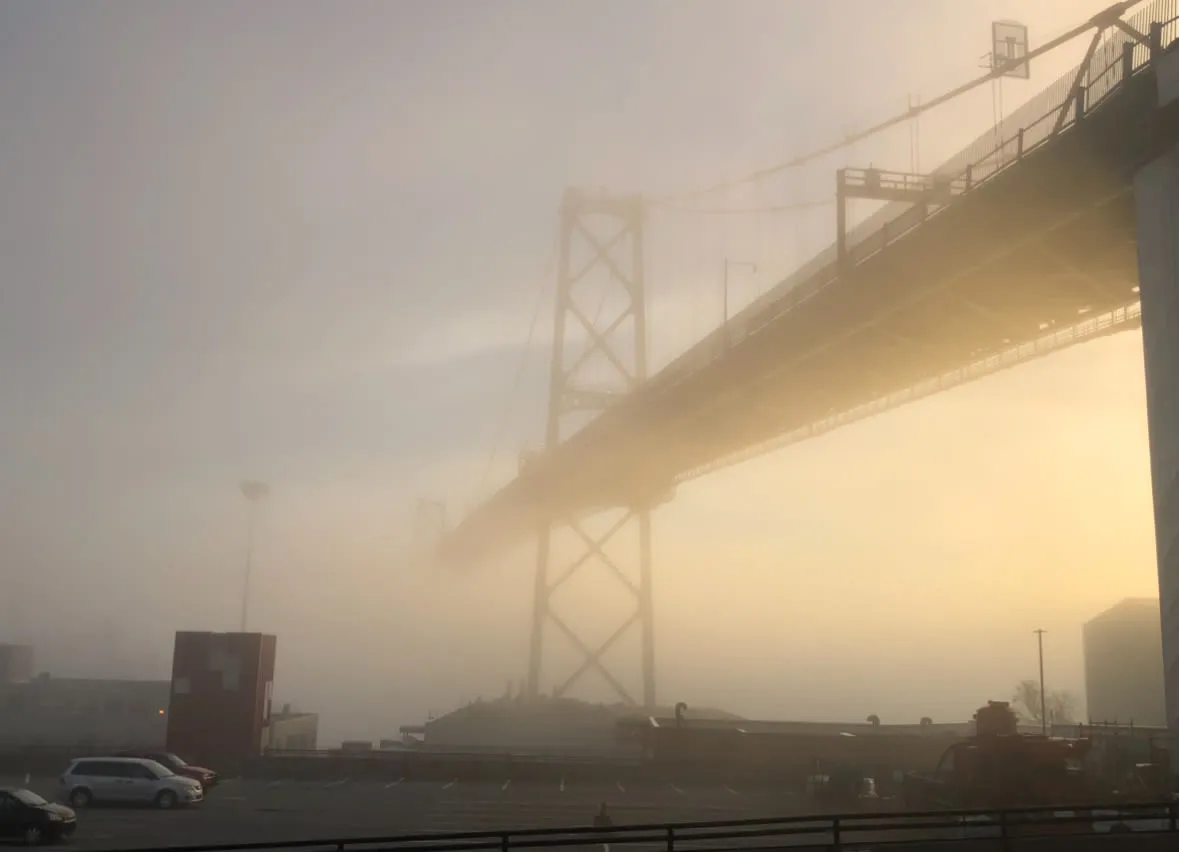
Driving in fog: 5 tips to stay safe on the road

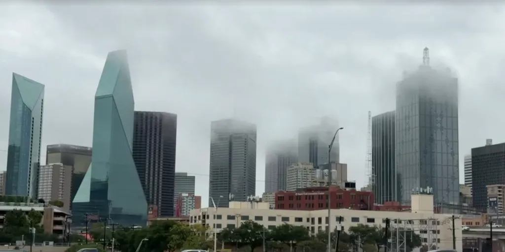
Foggy mornings are common during fall when warm lakes meet cool autumn air. DON'T MISS: Winter can wait: Exceptional El Niño favours an extended fallReduced visibility can make driving tricky, but these five tips will help improve road safety:1. Use Low BeamsHigh beams cause glare as light reflects off fog droplets, impairing vision further. Stick to low beams for better visibility.2. Listen for TrafficKeep music off and lower your windows. Sound becomes crucial in detecting other vehicles in dense fog.3. Avoid Cruise ControlMaintain manual control of your speed to adjust quickly if visibility suddenly worsens.4. Increase Following DistanceKeep 5-6 seconds of space between your vehicle and others to allow ample reaction time. Content continues below5. Use Defrosters and WipersPrevent condensation buildup on your windshield by turning on the defroster and wipers. DON'T MISS: It’s not your imagination—here’s why fall is the foggiest seasonImplementing these practices ensures safer driving in foggy conditions. Always stay alert and adjust driving habits to match visibility on the road. WATCH: Why is fall the foggiest season?

The Weather Network·
Weather

The 'smell of snow' isn't really a smell at all; it's this

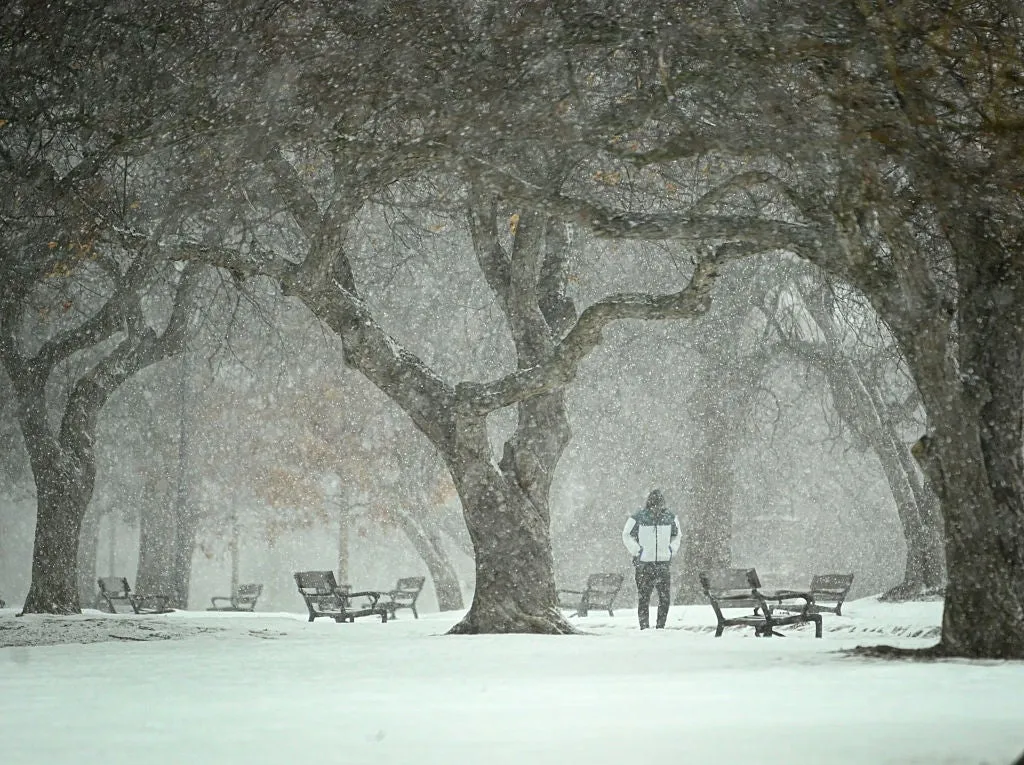
The ‘smell of snow’ is actually a trick of your noseIf you love freshly fallen snow like me, you definitely know that moment an hour or two before the first flakes fall, when we say we can smell it coming. It’s a clean, metallic smell in the air that promises those beautiful flakes. But the truth is that you aren’t smelling anything at all. Smell of snow is a mental thingWhat you're actually sensing is your trigeminal nerve. It’s the same facial nerve that causes menthol to feel cold or hot pepper to feel like a burn in your nose and mouth.(MORE: Why noises sound louder during the winter)When cold, dry air rushes in ahead of a winter storm, along with the pressure shift that comes with it, your trigeminal nerve picks up on that cold-and-pressure combination and sends that “it’s about to snow” signal to your brain, even though no odor molecule is actually involved. And because you've felt that specific sensation right before snow so many times, your brain has associated this feeling with snow coming. Get More of Our News on GoogleSet The Weather Company as a 'Preferred Source' to get quicker access to the news you value.

The Weather Channel·
Weather

Pileup accident in heavy fog closes major U.S. interstate

Heavy fog likely contributed to a major pileup accident on Interstate 95 in South Carolina on Thursday. Several dozen vehicles were reportedly involved in the chain-reaction accident on the I-95 southbound bridge over Lake Marion. RELATED: It’s not your imagination—here’s why fall is the foggiest season“All I-95 southbound lanes across Lake Marion in Clarendon County are closed due to a multi-vehicle crash,” the South Carolina Dept. of Transportation posted on Thursday. The agency added: “A detour is in place beginning at mile marker 102.”There were no immediate reports of casualties related to the incident. Reduced visibility due to fog, snow, rain, or dust is the leading cause of pileup crashes. These incidents unfold rapidly. Content continues belowIf you’re ever involved in a chain-reaction accident, remaining in your vehicle is the safest thing you can do. If you have to get out, quickly move as far away from the scene as safety allows. WATCH: What causes roads to ice over almost instantly?

The Weather Network·
Weather

NASA SpaceX flight sets speed record in latest ISS launch

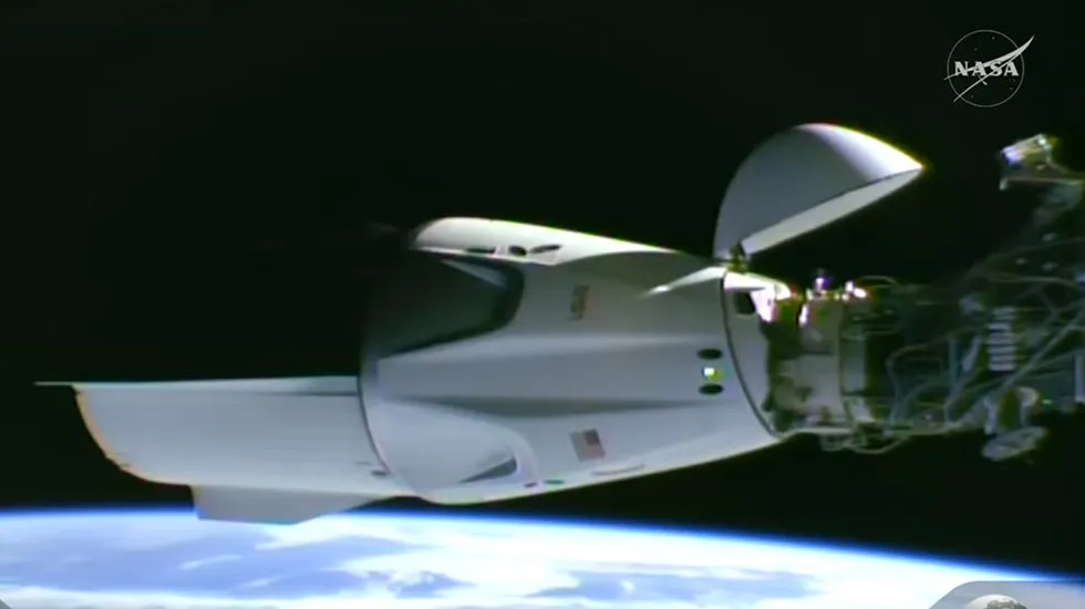
This image taken from video by NASA shows a SpaceX capsule carrying four astronauts docking at the International Space Station, Thursday, Oct. 1, 2026.(NASA via AP)CAPE CANAVERAL, Fla. (AP) — Four astronauts pulled up at the International Space Station on Thursday after launching on an eight-hour express that set a U. S. speed record. The fresh arrivals include a Canadian whose wife will give birth while he’s away. SpaceX launched commander Jessica Watkins and her crew for NASA after a three-week delay to fix their Dragon capsule’s leaking fuel system. Thick clouds threatened all morning to halt the countdown but in the end, the skies cleared enough to allow for a safe liftoff.(WATCH: Earth stuns in beautiful time-lapse from ISS)Although their stay at the International Space Station will last a long six months, the flight there was the quickest yet not only for Elon Musk’s company, but any American entity, including NASA. The space station's convenient location when the astronauts launched enabled the fast transit. With the late morning liftoff from Cape Canaveral Space Force Station, Watkins became the first Black woman to lead a crew to orbit.

The Weather Channel·
Weather

Texas in the bull's-eye of relentless flood threat as 50M from Southern Plains to East Coast face downpours

Texas in bull’s-eye of flood threat as 50M from Southern Plains to East Coast face Friday soaker The major Texas cities of Dallas, Austin and San Antonio face another round of potential flash flooding as thunderstorms fire along an 1,800-mile front draped border-to-border from South Texas to Upstate New York. More than 50 million people are under a flash flood threat, with another round of heavy rain fueled by tropical moisture expected to move into the Southeast this weekend. THE TAKEAWAYThe major Texas metros of Dallas, Austin and San Antonio are again in the bull's-eye of the greatest flash flood risk on Friday. Parts of the Midwest, Ohio Valley and Northeast could see a shot of rain on Friday as a massive 1,800-mile front slowly pushes eastward through the day. This follows a weeklong flood threat across the Central U. S, that was fueled by tropical moisture from the remnants of Polo and Hurricane Rachel. The major Texas cities of Dallas, Austin and San Antonio are in the bull's-eye of another round of flash flooding as thunderstorms fire along an 1,800-mile front stretching from South Texas to Upstate New York.

Fox Weather·
Weather

Magnitude 3.7 earthquake rattles Lake Tahoe in early morning hours

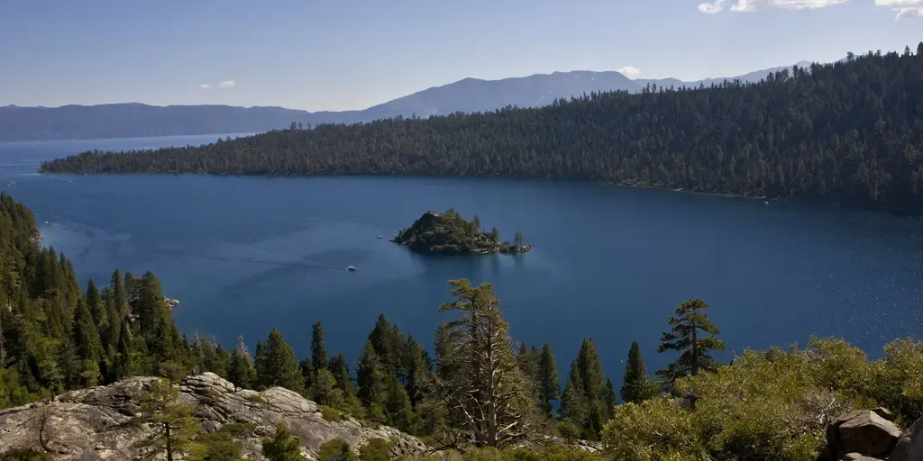
So far, no reports of shaking have been reported to USGS, but tremors are believed to have been felt in areas like Reno and Carson City, Nevada. LAKE TAHOE, Calif. – A magnitude 3.7 earthquake rattled the Lake Tahoe area on Friday. The United States Geological Survey (USGS) said that the quake struck at 3:00 a.m. about 6 miles west-southwest of South Lake Tahoe at a depth of around 4 miles. SOUTH LAKE TAHOE, CA - SEPTEMBER 28:  Emerald Bay is viewed on September 28, 2012, in South Lake Tahoe, California.  Lake Tahoe, straddling the border of California and Nevada, is the largest Alpine freshwater lake in the Western United States.  (Photo by George Rose/Getty Images / Getty Images)HOW TO WATCH FOX WEATHERSo far, no reports of shaking have been reported to USGS, but tremors are believed to have been felt in areas like Reno and Carson City, Nevada. It’s unknown at this time if any damage or injuries have been reported. No other information was immediately available. This is a developing story. Check back with FOX Weather for more.

Fox Weather·
Weather

The major hurricane that stalled and emptied a bay

A major hurricane striking land is bad enough. But a major hurricane stalling just offshore is a recipe for disaster. This scenario played out when Hurricane Keith meandered just off the coast of Central America in the autumn of 2000, lashing parts of the region with torrential rains and powerful winds for several days on end. DON'T MISS A stalled hurricane can produce disastrous flash floodingKeith was a prime example of a storm that can ramp up quickly, providing less lead time for communities in harm’s way. A tropical depression formed north of Honduras during the afternoon hours of Sept. 28. The system grew into Tropical Storm Keith a day later as it moved west across the southern Caribbean. Upper-level winds around the storm calmed as Keith approached the steamy waters of the southwestern Caribbean, allowing it to slow down and eventually stall off the coast of Belize. The storm rapidly intensified from a tropical storm to a Category 4 hurricane in just 37 hours. Relentless winds and rain pounded Belize and Mexico’s Yucatan Peninsula for several days as the hurricane lingered offshore.

The Weather Network·