BBlogFlow

Categories

Weather

4077 articles

Weather

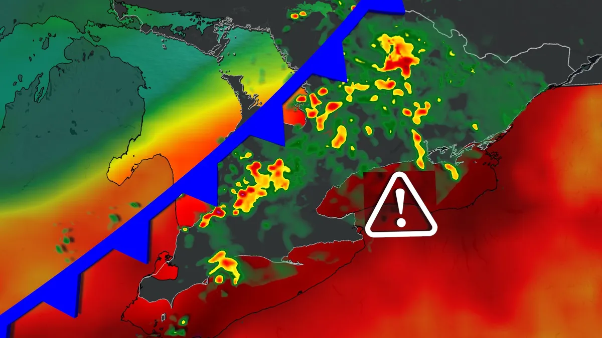
Severe thunderstorms and heavy rain threaten Ontario Wednesday

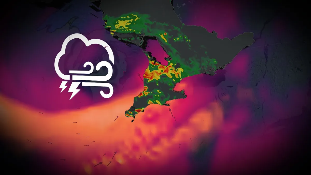
Widespread thunderstorms, including some severe, are expected across Ontario on Wednesday. Localized flooding presents the most significant hazard as atmospheric moisture levels are forecast between 40-60 mm, highlighting a heightened flood risk. Gusty winds of 80+ km/h are also possible in organized thunderstorm activity. Visit our Complete Guide to Fall 2026 for an in depth look at the Fall Forecast, tips to plan for it and much more! Be sure to stay alert to the changing conditions, and check for any weather warnings in your area. Severe thunderstorm risk in Ontario Wednesday with localized flooding a top concernA low pressure system from the Prairies is moving through Ontario, bringing a surge of muggy air across the province. Temperatures will reach the mid-20s, feeling close to 30°C in parts of southern Ontario, including the Greater Toronto Area (GTA). DON'T MISS: Meteor shower season is about to begin! Thunderstorms, some severe, are expected Wednesday as moisture and instability peak ahead of a cold front. Rain and storms will develop across cottage country and Muskoka before spreading southward. Areas near Parry Sound could see 20-30+ mm of rainfall.

The Weather Network·
Weather

Record-warm Gulf waters could fuel late-season tropical activity despite El Niño suppression

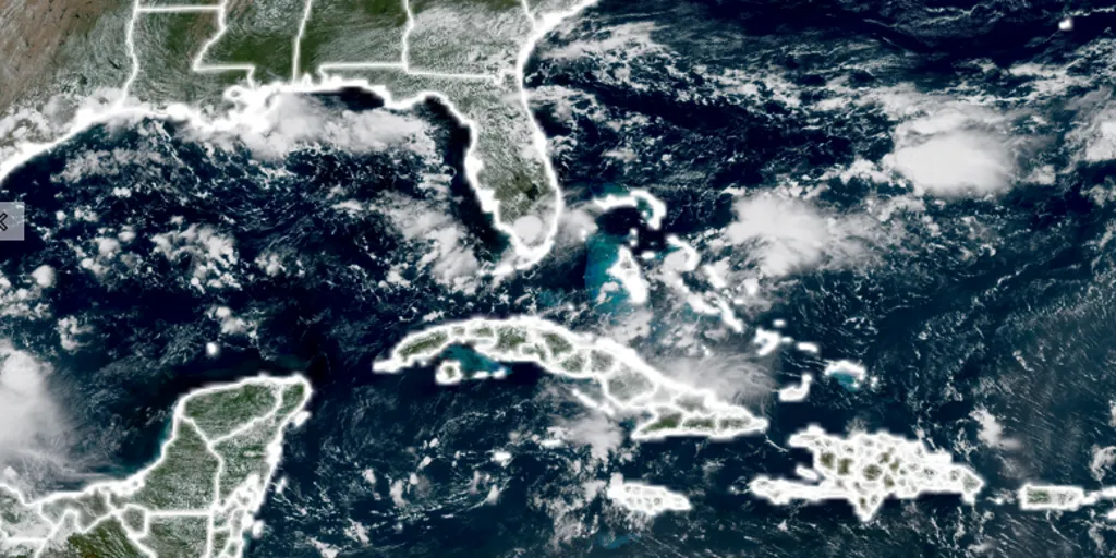
THE TAKEAWAYMuch of the Florida and Gulf waters have reached record-warm territory. An October tropical system could rapidly fuel up on the untapped ocean heat. Alternatively, ongoing El Niño-driven inactivity could prime the Florida Peninsula for a severe fall and winter weather season. FLORIDA - Record-warm waters around Florida and the Gulf are creating an unusual setup as El Niño continues to suppress tropical activity in the Atlantic, according to our affiliate, FOX 35 Orlando meteorologist Noah Bergren. PACIFIC TROPICS ROAR AS ATLANTIC APPROACHES HISTORIC MILESTONE WITH NO HURRICANES AMID BREWING ‘SUPER EL NIÑO’"A good majority of the water around Florida and in the Gulf is now at record territory for the surface temp," Bergren said. Despite ocean conditions that can easily support tropical development, no hurricanes have formed in the Atlantic so far this year. In fact, the basin is nearing historic territory for the latest first hurricane of the season.

Fox Weather·
Weather

Newfoundland hurricane is still Canada's deadliest natural disaster

This Day In Weather History is a daily podcast by Chris Mei from The Weather Network, featuring stories about people, communities and events and how weather impacted them.--On Saturday, Sept. 9, 1775, a hurricane hit Newfoundland. The hurricane killed around 4,000 people, making it the deadliest natural disaster in Canadian history. On Aug. 27, 1775, the hurricane hit North Carolina. A letter from North Carolina that recounted, "We had a violent hurricane...which has done a vast deal of damage here, at the Bar, and at Matamuskeet, near 150 lives being lost at the Bar, and 15 in one neighbourhood at Matamuskeet. "The hurricane also hit Virginia. Between the two states, 163 people died. Then the storm hit Newfoundland. It's unknown if the storm that hit the province was indeed the "1775 Newfoundland hurricane" or remnants from a previous system. Content continues belowNewfoundland was hit hard, especially the fisheries. It "received a very severe stroke from the violence of a storm of wind, which almost swept everything before it," said Commodore Governor Robert Duff.

The Weather Network·
Weather

Record 2026 El Niño: how to prepare your wallet and home

Prepare your home, bank account and grocery cart for El NiñoEl Niño may sound exotic and complicated, a weather pattern that no one really understands, happening thousands of miles away. But its effects can reach all the way to your home, grocery cart and bank account, so it's important to know how you'll be personally impacted. And this year could be a big one: NOAA says the 2026 El Niño is likely to be stronger from October through December than any event on record going back to 1950. So what can you actually do about it? Start with your walletAs Chloe Demrovsky of NYU's Center for Global Affairs puts it, “El Niño impacts energy markets and it impacts agricultural markets. And so those two things trickle down to consumers mainly through prices.”Agriculturally speaking, rice and wheat could face pressure from drought in parts of Asia and Australia. Get More of Our News on GoogleSet The Weather Company as a 'Preferred Source' to get quicker access to the news you value.(MORE: El Niño: Latest forecast, news and impacts)Meanwhile, excessive rain in South America could hurt crops like potatoes, onions and carrots. Sugar, coffee, tea and cocoa are also vulnerable.

The Weather Channel·
Weather

That burning smell: What's normal when first heat turns on?

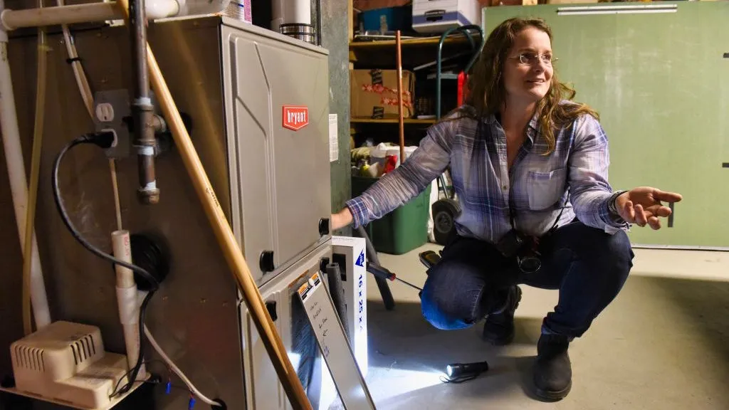
Home inspector Jolene Lomnes, owner of Informative Home Inspections, checks out the furnace at a home in the town of Ballston, New York(Paul Buckowski/Albany Times Union via Getty Images)Summer has finally gone away, but it now smells like something is going to burn to a crisp in your home after you turn on the heat for the first time. What gives? The good news: You've already roasted enough under heat domes this summer that your indoor furnace probably isn't going to finish the job. But those dust bunnies that have been loafing around on your heater all summer, yeah... they're toast. That burning smell is completely normal and you and your home are safe. The dust bunnies are burning! What can I do? The short answer: Just wait. The smell that populates your home will generally only last about an hour. Get More of Our News on GoogleSet The Weather Company as a 'Preferred Source' to get quicker access to the news you value. If this smell is too overwhelming, just leave the house for a little while and come back. The smell should pass pretty quickly. To reduce the smell, swap in a fresh air filter before firing up the furnace for the first time.

The Weather Channel·
Weather

Why is wildfire smoke worse in the morning and better later in the day?

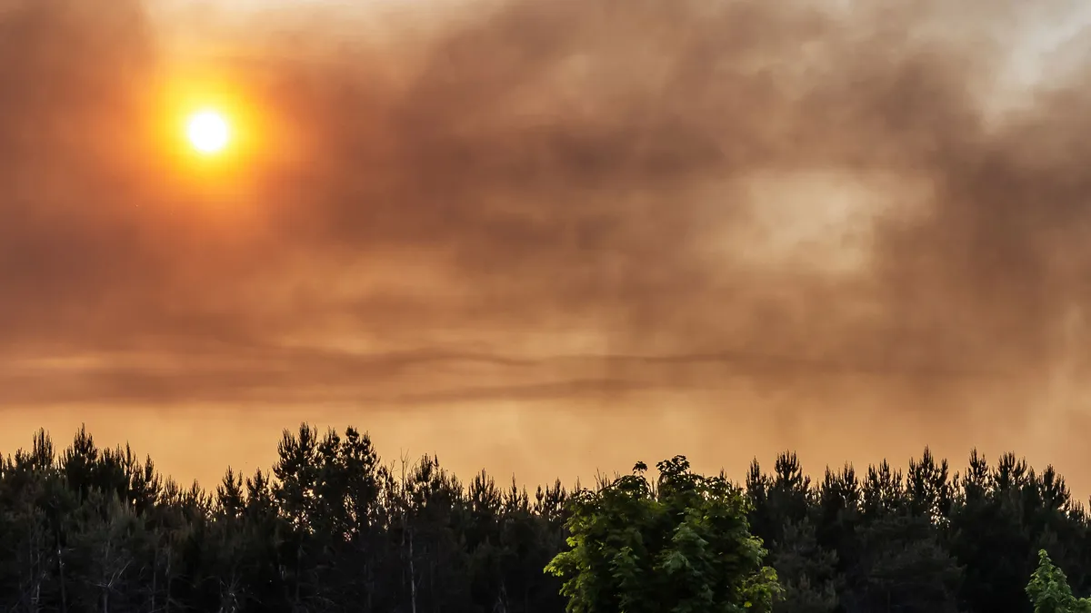
A large forest fire at an old abandoned Russian military training area, near the city of Jüterbog, south of the German capital Berlin.(FHM/Getty Images)If you've stepped outside on a smoky morning and thought the air felt worse than it did the day before, you're not imagining it. Wildfire smoke follows a predictable daily rhythm, and morning is usually its worst phase. Right now, that pattern is playing out across central and northeastern Washington, where smoke from the Little Giant and Sinlahekin Fires has triggered an air quality alert covering 33 cities across Chelan, Douglas, Ferry, Grant and Okanogan counties. (MORE: Bad air quality? Here’s what you can do)Wenatchee has logged multiple mornings with hazardous readings — at an Air Quality Index (AQI) of 301 or higher — only to see conditions ease later in the day. The mechanism: a nightly lid on the airThe reason comes down to a process called a temperature inversion. On clear, calm nights, the ground loses heat quickly while the air above it stays relatively warm. Because warm air is less dense, it settles on top like a lid, and the cooler air underneath — along with any smoke mixed into it — has nowhere to go.

The Weather Channel·
Weather

Remnants of Hurricane Marie bring rare September rain to Los Angeles and Southern California

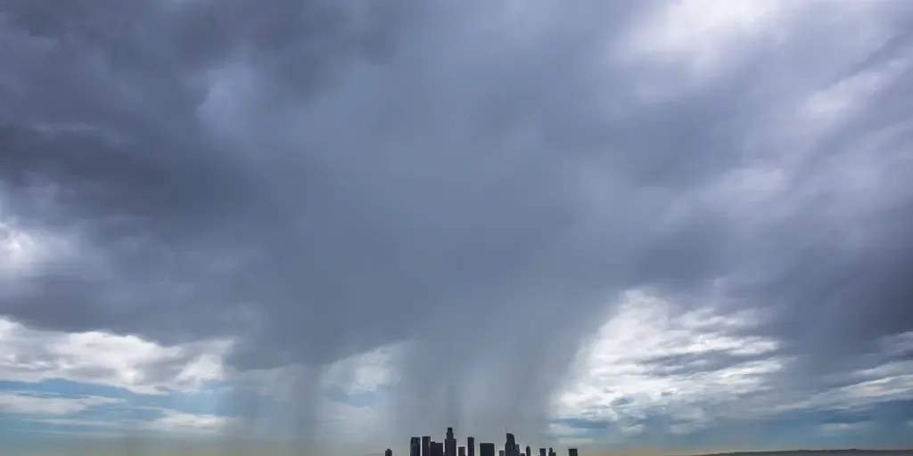
Here's what prediction markets are forecasting for Los Angeles' total rainfall by the end of September. Hurricane Marie brings rough surf to Southern California Category 1 Hurricane Marie is swirling southwest of the Baja California peninsula. FOX Weather Meteorologist Melanie Black breaks down how Southern California will see dangerous surf as an enhanced southwest monsoon increases the risk of flash flooding through Labor Day weekend. THE TAKEAWAYSouthern California experienced a rare September rainfall event as the remnants of Hurricane Marie moved through the region. The tropical system brought a combination of rain, high surf and coastal impacts to parts of the California coast. Hot, dry weather is expected to return as high pressure rebuilds over the Southwest later this week. LOS ANGELES – The active eastern Pacific hurricane season, fueled by a powerful Super El Niño, sent a rare burst of September rainfall into Southern California as the remnants of Hurricane Marie moved inland. According to the National Weather Service, Los Angeles typically receives just 0.21 inches of rain during the entire month of September.

Fox Weather·
Weather

Bryan Norcross: The Atlantic rests while the Pacific keeps cranking out tropical systems

Off the coast of Mexico, there's a hotspot where two systems have a good chance of developing. The first one is well on its way. It will likely be named Norbert. Bryan Norcross The atmospheric environment over the Caribbean and the tropical Atlantic continues to be hostile to any systems that are in a position to develop. Disturbances are moving off Africa on schedule, but the dust and dry air plus the El Niño-driven upper-level winds are prohibiting the systems from getting any traction. PACIFIC TROPICS ROAR AS ATLANTIC APPROACHES HISTORIC MILESTONE WITH NO HURRICANES AMID BREWING ‘SUPER EL NIÑO’There's no sign of any change in that weather regime for the foreseeable future. Atlantic Basin on Sept. 9, 2026. (Bryan Norcross)HOW TO WATCH FOX WEATHERYou might have seen some talk about a slight chance of a disturbance in the northwestern Gulf. There is no sign that that will develop into anything. The atmosphere is dry, the disturbance is extremely weak, and it’s not forecast to stall over the Gulf waters. It could enhance some showers along the Texas coast, but that looks to be about it. Enjoy the Zen.

Fox Weather·
Weather

Warmer fall in B.C. may turn active with alpine snow chances

Welcome to fall on the West Coast! Summer-like weather isn’t going to give up without a fight. Folks throughout British Columbia can expect defiant autumn weather over the next couple of months. An intense El Niño in the Pacific Ocean will heavily influence the season ahead, but not even the strongest El Niño can stop Canada’s inevitable slide into the cooler season. RELATED: Canada's 2026 fall forecastHere’s a look ahead at what you can expect from autumn across B. C. Fall will prove to be a defiant seasonThe cooler weather that arrived in early September doesn’t necessarily mark the end of warmth across the region. Temperatures in the B. C. Interior should return to a milder and drier pattern through a big chunk of autumn, with above-seasonal temperatures covering much of the region. The province’s coastal communities will likely see readings average out near-normal through the season. Content continues belowDON'T MISS: Meteor shower season is about to begin! El Niño isn’t the only actor on the stage this fall. We’ll also have to watch the potential for typhoons recurving out of the western Pacific, which may throw a wrench into the pattern and jostle B. C.’s conditions at times.

The Weather Network·
Weather

Alberta’s fall outlook holds mild weather with chilly interruptions

Fall is a season of transition and Alberta often takes a front-row seat to the swinging pendulum of autumn weather. The season ahead looks to buy some breathing room for folks throughout the province after a stormy summer left operations running behind. RELATED: Canada's 2026 fall forecastHiccups in the pattern are guaranteed during this season of change. A patient, changeable autumn in store for AlbertaWarmer and drier weather should provide a longer runway for delayed harvest operations after the relentless storms and heavy rain Alberta experienced during the summer months. El Niño will remain a significant driver of our autumn ahead, with mild Pacific air occasionally flowing across the Rockies. While it’s unlikely that wintry weather will lock in early across the region, early tastes of winter are still possible. This is Alberta, after all, where the average first snowfall arrives around Sept. 27 in Calgary and Oct. 1 in Edmonton. Content continues belowDON'T MISS: Meteor shower season is about to begin! But repeated spells of mild weather should follow chilly interruptions expected to bring early winter-like weather, during which we may see periods of snow or hard freezes.

The Weather Network·
Weather

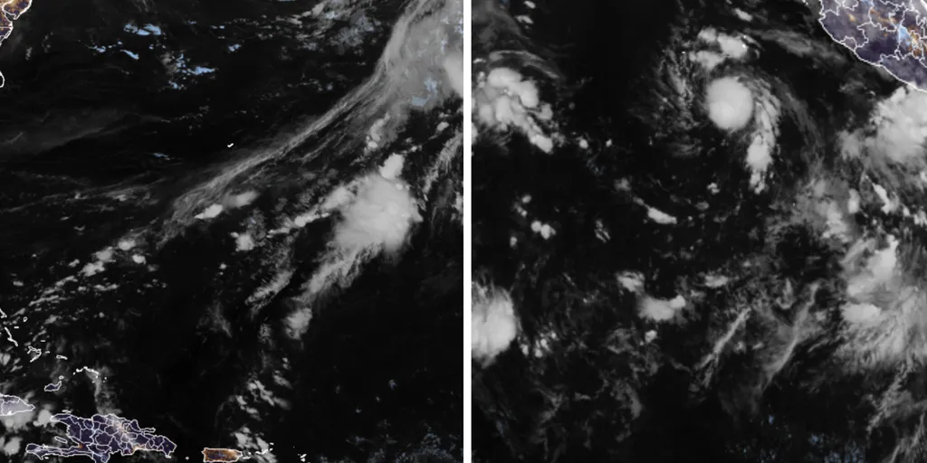
Pacific tropics roar as Atlantic approaches historic milestone with no hurricanes amid brewing ‘Super El Niño’

THE TAKEAWAY:A looming Super El Niño has caused activity in the Pacific Basin to surge, while quieting Atlantic activity. The Pacific Basin has nearly double the average Accumulated Cyclone Energy value. The Atlantic has yet to produce a hurricane this season, putting it within reach of historic territory for the latest first hurricane. Since the 2026 hurricane season began, we’ve seen two extremes: The Pacific Basin roaring with tropical activity while the Atlantic continues to stay quiet. This is largely due to both basins being influenced by an El Niño weather pattern. Typically, El Niño suppresses Atlantic activity by increasing wind shear while having the opposite effect in the Pacific, where warmer ocean temperatures help fuel increased activity. BREWING SUPER EL NIÑO EXPECTED TO BE STRONGEST ANYONE ALIVE ON THE PLANET HAS EVER EXPERIENCEDAdding to that, forecasts indicate this could be a "super El Niño," potentially making it one of the strongest events on record.

Fox Weather·
Weather

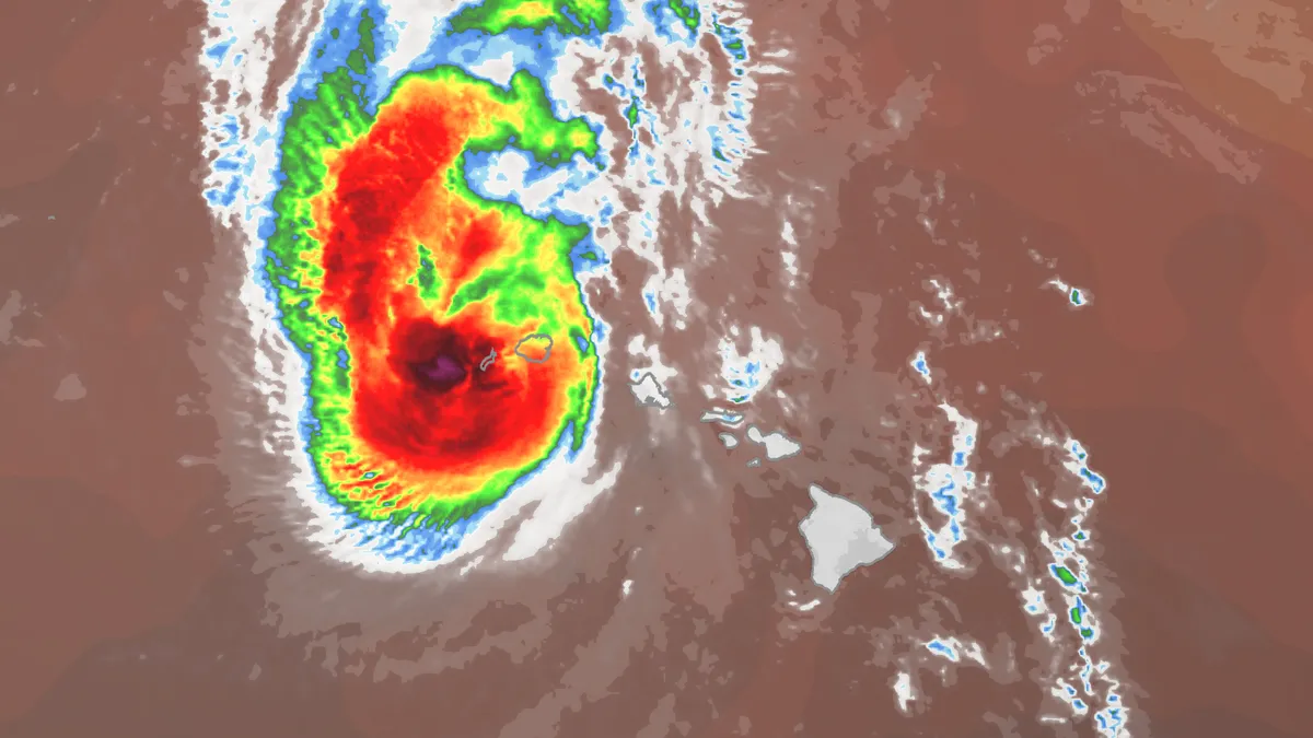
Lowell impacts Hawaii: Power outages, flooding reported

Popular Hawaii resort hit hard by Hurricane Lowell; see the damageLowell is now moving away from Hawaii's western islands after hammering the Aloha State as a hurricane early Tuesday. Lowell did not make landfall on Kauai or Niihau, passing just a few dozen miles west of the islands. But that mattered little, as the storm brought intense winds that knocked out power to more than 60,000 homes and businesses statewide, according to PowerOutage.us. All of the wind alerts for Hawaii have been discontinued as of now, but flood watches remain. Damages from Hurricane Lowell in Maui on Tuesday, Sept. 8, 2026.(County of Maui)Those outages were affecting 90% of all customers in Kauai County early Tuesday, meaning most traffic signals aren't working according to officials. Additionally, the county was placed under a tornado watch — the first one ever issued for any part of Hawaii.(MORE: Here's what's next for Lowell)And although this was the first tornado watch ever issued for any part of Hawaii, the state isn't immune to twisters. According to the National Weather Service's database, there were at least 42 tornadoes confirmed in the state from 1950 through 2018.

The Weather Channel·
Weather

Fall Forecast: Atlantic Canada will watch for impactful storms this fall

This year’s exceptionally quiet hurricane season may soon break a long-standing record for a lack of hurricanes in the Atlantic Ocean. But that doesn’t mean we can count the season out just yet. Autumn is a watchful time of year across Atlantic Canada, and this year is no exception. Here’s what you can expect across the Atlantic provinces this season from Halifax to Nain. Keeping a close watch for impactful stormsThis fall should feel closer to normal in Atlantic Canada than just about anywhere else in the country. Overall, temperatures should finish close to the seasonal mark, though cooler interruptions may be more noticeable through early fall. All eyes this season will remain on potential tropical activity. Hurricane activity here has been well below normal through early September, and the Atlantic basin is on the verge of breaking the record for the latest in the year we’ve gone without at least one hurricane. Residents shouldn’t let their guards down yet. Exceptionally warm waters nearby mean that late-season systems may still pose a risk. Home-grown tropical systems closer to North America will remain an important wildcard in the forecast later this season.

The Weather Network·
Weather

Fall Forecast: Ontario unlocks extended autumn through the season ahead

El Niño will cast a long shadow across Ontario’s fall this year. The province, along with much of Canada, will experience above-seasonal temperatures in the coming months. But this season won’t be all bad news for folks who love extended summer and those looking forward to classic autumn days. Here’s what you can expect from the next few months as Ontario takes the plunge from summer toward winter. An unhurried season of change for OntarioAlthough this fall as a whole may end up tilting above-seasonal for most of Ontario, we may actually run surprisingly close to seasonal for a large chunk of mid-September through mid-October. A larger signal for warmer conditions emerges by late fall, which will create concern for early ski-area snowmaking. Content continues belowWe expect below-normal precipitation for much of the province as we’ll see fewer classic fall storms than normal. Fewer doesn’t mean zero, of course, and it only takes one hefty storm to define the season. Warmer conditions overall doesn’t mean we’ll go entirely without classic doses of chilly air. But watch for a fall fake-out; an early season chill doesn’t spell the beginning of winter just yet.

The Weather Network·
Weather

Hot, muggy air mass sets up southern Ontario severe storm, flood potential

After the severe flooding, damaging winds, and tornadoes across parts of Ontario last Wednesday, a storm-free week would be welcome news. Unfortunately, that won't be the case. An upper trough will move across the Great Lakes throughout the day on Wednesday, elevating the risk of thunderstorms in southern Ontario. Some of them could turn severe, with heavy rain, gusty winds and localized flooding as the main threats. DON'T MISS: Vaughan: Road collapses into river after Wednesday's dangerous stormsBe sure to stay alert to the changing conditions, and check for any weather warnings in your area. Heat, humidity sneaks in for midweek storm threat in southern OntarioAs the Prairie low lifts across northwestern Ontario and moves into Hudson Bay, a more muggy southerly flow will develop across the heart of Ontario. Temperatures will climb into the mid-20s by Tuesday and Wednesday, with Windsor and Sarnia making a challenge at 30 degrees. On Wednesday, moisture values reach their peak across southern Ontario, along with the available energy to develop thunderstorms ahead of the cold front.

The Weather Network·
Weather

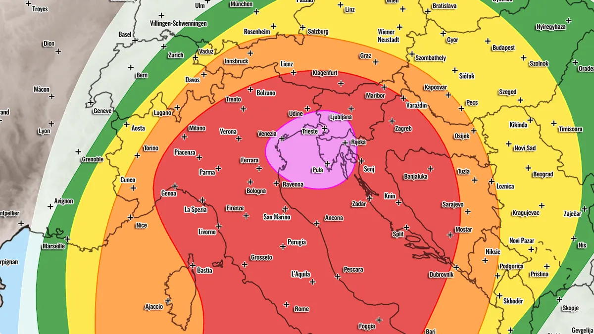
High Risk Issued: Two-Day Severe Weather Outbreak Targets Balearic Islands, Italy and the Adriatic region

Severe weather outlook – forecast across Europe. This forecast highlights areas of organized severe weather, along with risk levels and severe weather threats across Europe. SEVERE WEATHER OUTLOOK Forecaster: Marko KorošecSUMMARY*** A significant two-day severe weather outbreak is forecast across portions of western and northern Mediterranean from Wednesday through Friday afternoon this week. Moderate to extreme instability and strongly sheared environments combine for widespread thunderstorm activity with large to giant hail, severe winds, tornadoes, and damaging flash-flood potential from the Balearic Islands to southern France, northern Italy, and the Alps on Wednesday. Followed by another day of widespread severe thunderstorm activity across Northern Italy, Slovenia, Croatia, and across central Italy and the Central Adriatic region.***

Severe Weather Europe·
Weather

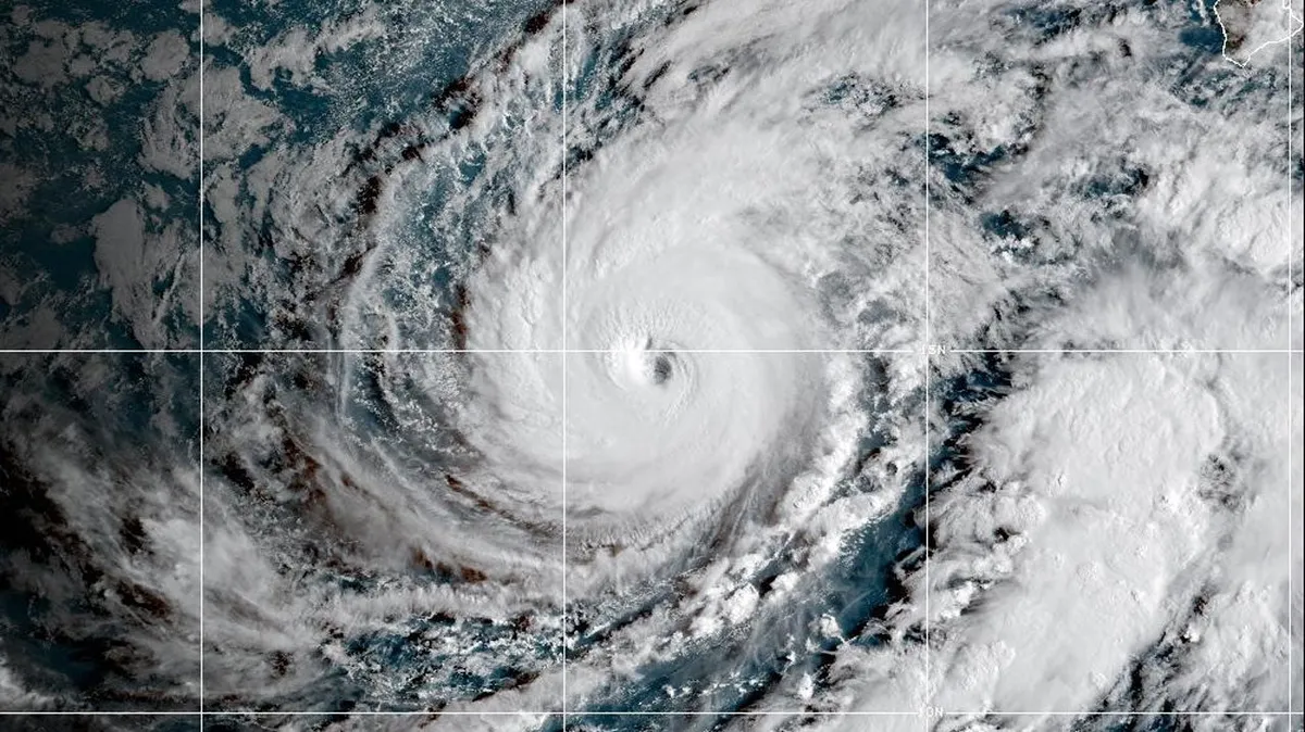
Hurricane Lowell slams Hawaii with flooding rain, wind

Popular Hawaii resort hit hard by Hurricane Lowell; see the damageHurricane Lowell hammered parts of Hawaii with strong winds, flooding rain, surge and huge waves, the third storm of the 2026 Pacific hurricane season to have impacts in the island chain. GenesisOn Aug. 23 at 11 P. M. PDT, the National Hurricane Center first highlighted what would eventually become Lowell. "A broad area of low pressure is forecast to form well to the east-southeast of the Hawaiian Islands during the middle part of the week. Some slow development of this system is possible later this week while it moves northeastward or northward across the western portion of the East Pacific," the NHC warned. The area of low pressure slowly got its act together and it eventually became Tropical Storm Lowell on Aug. 27 at 11 A. M. HST. The storm meandered for a couple of days and eventually began to head west, slowly strengthening as it did so. It became Hurricane Lowell on Sept. 1 at 5 A. M. HST. Rapid IntensificationThe storm then underwent rapid intensification as it moved into very favorable atmospheric conditions. From early Sept. 1 to Sept.

The Weather Channel·
Weather

Parts of Japan hit by flooding as Nagoya sees highest, one-hour rain total

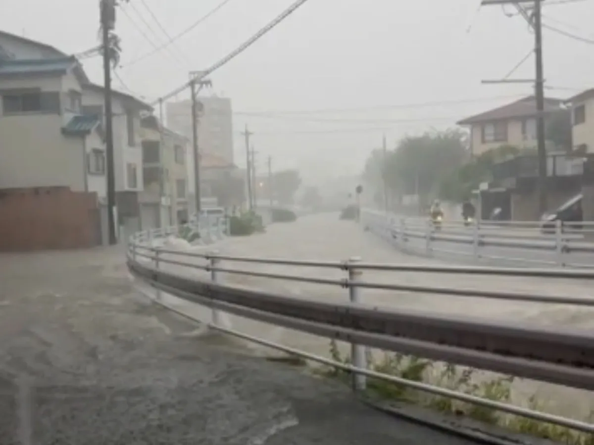
Torrential rain hammered parts of Japan's Tokai region on Tuesday afternoon, leading to significant flooding and transportation interruptions. Nagoya, Japan, recorded nearly 105 millimetres (104.5 mm) of rainfall in one hour, the highest ever documented in the city. In a matter of 12 hours, 213 mm of rainfall fell on the community. The downpour forced widespread train suspensions that stranded commuters, including a temporary halt to Tokaido Shinkansen bullet train services, reported by Spectee via Reuters. While the rain began on Sunday along the Pacific coast of Japan, the heaviest bout fell on Tuesday. As a result of the flooding, a Level 5 emergency warning was issued for Aichi and Gifu on Tuesday evening, the highest alert, which allows residents to examine their surroundings and move to the safest location. The Japan Meteorological Agency (JMA) issued a Level 5 emergency warning for landslides for the villages of Niijima and Toshima, and the town of Oshima on the Izu Islands. Content continues belowA woman in her 60s was declared dead after being found unresponsive in a submerged car at an underpass in Iwaki, the Fukushima prefecture, according to the local fire department.

The Weather Network·