BBlogFlow

Categories

Weather

4077 articles

Weather

Late-summer heat, humidity fuels southern Ontario thunderstorm risk

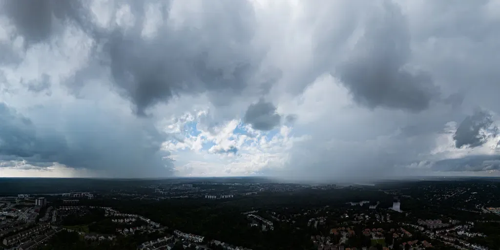
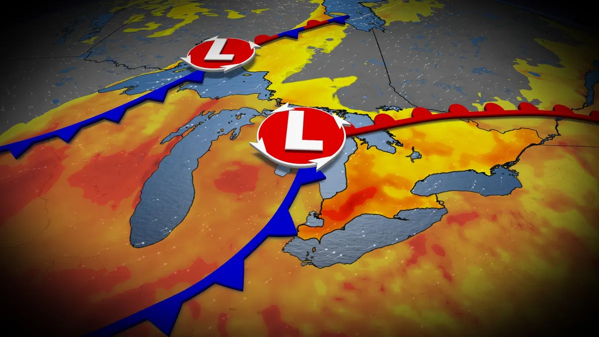
After the severe flooding, damaging winds, and tornadoes across parts of Ontario last Wednesday, a storm-free week would be welcome news. Unfortunately, that isn’t the case as an upper trough moves across the Great Lakes throughout the day on Wednesday. That means an elevated risk of thunderstorms, possibly severe, in a swath of southern Ontario, with heavy rain, gusty winds and localized flooding as the main threats. DON'T MISS: Vaughan: Road collapses into river after Wednesday's dangerous stormsBe sure to stay alert to the changing conditions, and check for any weather warnings in your area. Heat, humidity sneaks in for midweek storm threat in southern OntarioAs the Prairie low lifts across northwestern Ontario and moves into Hudson Bay, a more muggy southerly flow will develop across the heart of Ontario. Temperatures will climb into the mid-20s by Tuesday and Wednesday, with Windsor and Sarnia making a challenge at 30 degrees. On Wednesday, moisture values reach their peak across southern Ontario, along with the available energy to develop thunderstorms ahead of the cold front.


The Weather Network·
Weather

How humidity canceled a volleyball match at Wrigley Field

The Nebraska Cornhuskers help dry the playing surface against the Missouri Tigers at Wrigley Field on September 6, 2026 in Chicago, Illinois.(Jamie Schwaberow/NCAA Photos via Getty Images)Forget rain delays. Wrigley Field just experienced a humidity cancellation. It happened as college volleyball made its historic, outdoor debut at the iconic baseball stadium during the Big Ten/SEC Volleyball Challenge Week. More than 43,000 fans packed the stadium Sunday night, only to watch weather conditions force a match off the court. The first matchup, Kentucky versus Penn State, went off without a hitch. But by the time No. 1 Nebraska took to the field against Missouri, things had turned ... soggy. Teary Sigler #11 and Harper Murray #27 of the Nebraska Cornhuskers help dry the playing surface against the Missouri Tigers at Wrigley Field on September 6, 2026 in Chicago, Illinois.(Jamie Schwaberow/NCAA Photos via Getty Images)The match was suspended in the first set, with Nebraska leading 11–7, after players repeatedly slipped and slid across the court. Get More of Our News on GoogleSet The Weather Company as a 'Preferred Source' to get quicker access to the news you value. The culprit?

The Weather Channel·
Weather

Cloud Appreciation Day is this week; Ask me anything about clouds

Click Here To Join The Discussion! Cloud Appreciation Day is this week, so I thought it was the perfect time to talk all things clouds. We will be hosting an AMA on Thursday, Sept. 10th at 12:30 P. M. EDT for you to ask your most pressing cloud or sky-related questions. And if you've been following along with our content, then you likely already know how much I love the unique, ever-changing residents of the sky. There's something so universal and fascinating about clouds that makes them one of my favorite weather topics. And for a little about me, I have been a digital meteorologist with weather.com for over 2 years. I received both my undergraduate and graduate degrees in Earth and Atmospheric Sciences from Georgia Tech - Go Jackets! And you can follow me on social media here. What you should knowRegistration is required to participate in our live AMA sessions, ask questions and engage with others. This registration will also allow you to comment on any of our articles or videos. Just scroll down to the bottom of any article to join the conversation. Get More of Our News on GoogleSet The Weather Company as a 'Preferred Source' to get quicker access to the news you value.

The Weather Channel·
Weather

Post-Tropical Cyclone Marie bringing dangerous surf to California coast and fueling Southwest monsoon threat

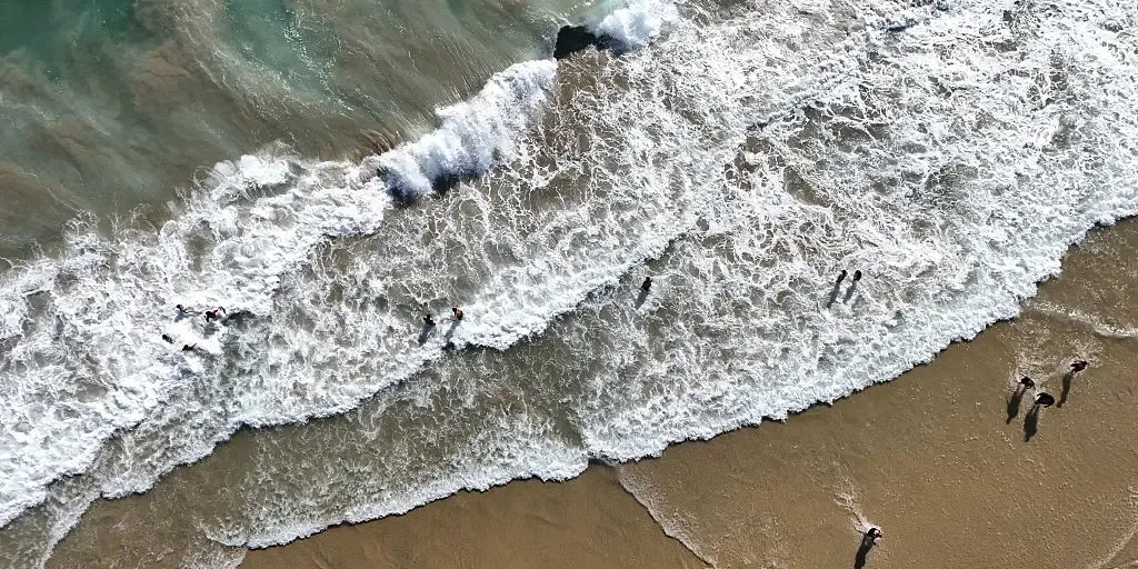
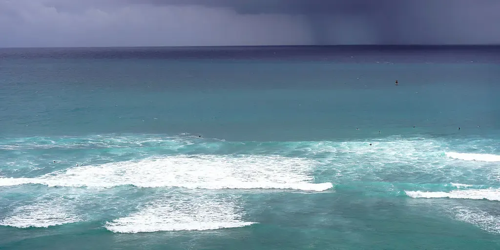
Tropical Storm Marie to produce dangerous surf across Southern California for several days Tropical Storm Marie is hundreds of miles southwest of San Diego, but is still expected to produce several days of life-threatening surf after moisture associated with Marie brought heavy rain to the region over the weekend. Los Angeles picked up its first measurable rain since April on Sunday. The 0.6 inches that fell also made Sunday the city’s wettest September day since 2015. THE TAKEAWAYPost-Tropical Cyclone Marie is bringing days of life-threatening surf to Southern California. Marie's tropical moisture brought rare September rains to parts of the Southwest. Rare annular Tropical Storm Karina will stay hundreds of miles away from Hawaii. LOS ANGELES — Post-Tropical Cyclone Marie is hundreds of miles southwest of San Diego, but is still expected to produce several days of life-threatening surf after moisture associated with Marie brought rare September rains to the region over the weekend. Los Angeles picked up its first measurable rain since April on Sunday. The 0.6 inches that fell also made Sunday the city’s wettest September day since 2015.

Fox Weather·
Weather

Bryan Norcross: Hurricane Lowell moving away from Hawaii while the Atlantic sleeps

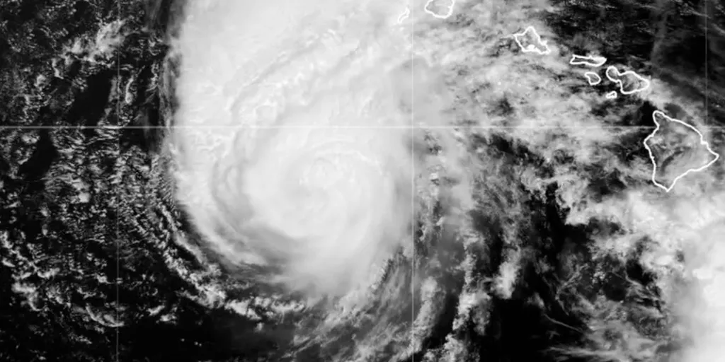
Hurricane Lowell has passed Hawaii and is heading north to die in the open Pacific. The center of the storm passed close to the westernmost main Hawaiian island called Niihau, but it stayed offshore. Still, there's no doubt that winds were near 100 mph on lightly populated Niihau. Kauai took a pounding from very strong winds over and around the mountains, torrential rain, and a combination of storm surge and huge waves on the south shore. When the sun comes up there today, we'll see how they fared, but we've already seen damage along the coast. Hurricane Lowell satellite (Bryan Norcross)The NHC forecast cone slowly shifted toward the islands as it tracked north. In the end, the storm tracked right over the edge of the Friday cone before Lowell made its turn to the north. As we discussed, when a storm slows down, the forecast tracks after that are subject to larger errors. The lesson, of course, is that we should never focus on the center of the cone. The cone means what the cone means. Be ready for the range of possibilities.

Fox Weather·
Weather

Atlantic hurricane season nears record for quiet conditions

The 2026 Atlantic hurricane season is tracking significantly behind historical norms and may set a new record for its delayed activity. As of this week, the first hurricane of the season has yet to form, far behind the average first occurrence date of August 11. The current record for the latest first hurricane formation in the Atlantic is September 11, set by Hurricane Gustav in 2002 and tied by Hurricane Humberto in 2013. The seven-day outlook from the National Hurricane Center (NHC) shows no significant tropical development expected in the Atlantic Basin, leaving open the possibility for a new record. DON'T MISS: Atlantic’s hurricane-less season on the verge of historyWhile the Atlantic remains unusually calm, the Pacific has been active, with 15 named storms so far this season, including six hurricanes and two Category 5 systems. Recent Pacific activity includes flooding tropical rains from Lala in Hawaii and ongoing impacts from Lowell, which prompted the first-ever tornado watch issued for the Hawaiian Islands. Stay updated for the latest tropical developments and potential record-breaking milestones in the Atlantic season.

The Weather Network·
Weather

Multiday severe storm and flash flood threat to sweep from Plains to East Coast

THE TAKEAWAYStrong to severe thunderstorms will develop across the Upper Midwest and central Plains on Tuesday, with hail, damaging winds and heavy rain possible. Storms will spread from the central Plains to the interior Northeast on Wednesday, with a few wind gusts topping 60 mph. The threat will shift south Thursday, when heavy rain and flash flooding could impact parts of the Ohio Valley, Appalachians and Mid-Atlantic. A powerful cold front will sweep across the Upper Midwest and central Plains on Tuesday, triggering strong to severe thunderstorms. Storms and rain will spread into the interior Northeast on Wednesday, with showers and rumbles of thunder possible from Kansas to Maine. By Thursday, the front will move south, bringing wet weather to the Mid-Atlantic, central Appalachians and Ohio Valley. Tuesday severe storm threat.(FOX Weather) Labor Day was a relatively quiet day, although two brief tornadoes were reported in the Dakotas, according to the FOX Forecast Center. Thunderstorms will continue Tuesday morning across parts of Minnesota and Wisconsin, bringing a risk of severe hail and wind gusts of 40 to 60 mph.

Fox Weather·
Weather

Some of Canada’s first frost advisories of the season issued

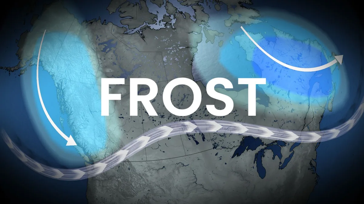
Cooler air settled into parts of Newfoundland early on September 2–3, bringing the season’s first frost to inland valleys. Badger registered early morning lows of 3.1°C and 2.5°C. Under clear skies and northerly winds, several areas saw temperatures near freezing, an early sign of the shifting season. For coastal regions like St. John's and Gander, the first frost typically doesn’t occur until mid to late October due to the Atlantic Ocean’s moderating effects. DON'T MISS: Understanding Canada's 'frost zones,' and when that first frost may hitMeanwhile, frost advisories have been issued for northern New Brunswick, including areas near Charlo, where temperatures are expected to dip to 2–3°C overnight into early Wednesday morning. This is an unseasonably early frost, as the region normally experiences its first frost around October 1. Radiational cooling, calm winds, and a cool northerly air mass are contributing to these conditions. Content continues belowAtlantic Canada will remain dry, but with below seasonal temperatures on Wednesday.

The Weather Network·
Weather

The U.S.’s deadliest disaster brought destruction to Canada

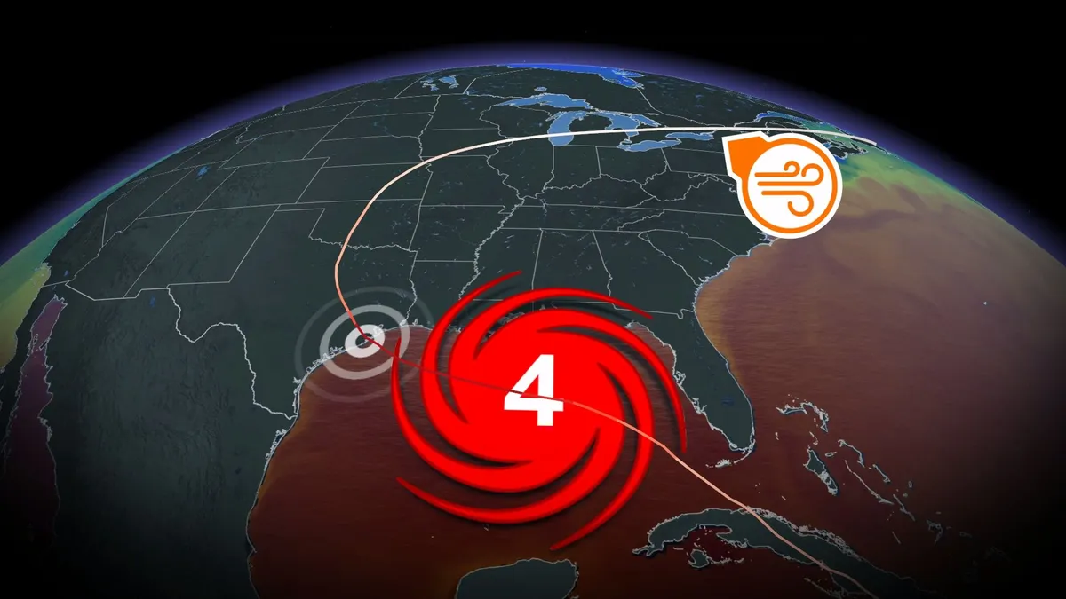
The hurricane that tore through Galveston, Texas, on the night of Sept. 8, 1900, remains the deadliest natural disaster in American history. A tremendous storm surge washed over the low-lying barrier island along the Texas coast, killing more than 8,000 people and destroying some 3,500 homes. Destruction didn’t stop south of the border. The unnamed hurricane transitioned into a powerful post-tropical cyclone and claimed hundreds of lives as the high winds and flooding rains swept into Canada. DON'T MISS: How a mammoth hurricane rapidly intensifies in mere hoursGalveston is a port city and popular tourist destination located on a barrier island a short drive from the city of Houston. Sailors first reported a tropical storm east of the Leeward Islands on Aug. 27, likely a classic disturbance that rolled off the African coast and slowly developed as peak hurricane season arrived. This system moved west over the following week, bringing heavy rain and gusty winds to the Greater Antilles before traversing the length of Cuba on Sept. 3-4. Content continues belowHurricanes largely struck by surprise in the days before modern technology.

The Weather Network·
Weather

Timeline: When Hurricane Lowell could make rare, direct hit on Hawaii

THE TAKEAWAYMonday: Lowell makes its closest approach with the potential for tropical storm-forced wind gusts. Tuesday: Lowell starts to pull away, but hazards linger, including the threat of flash flooding. Hurricane Lowell is expected to make a possible rare, direct hit on Hawaii as heavy rain associated with the Category 2 hurricane has already triggered flash flooding, and will bring a growing threat of dangerous surf, rain, strong winds and coastal impacts to the island chain. Lowell's track shifted farther east early Monday morning, Hawaii time, closer to the western islands Ni'ihau and Kaua'i. Hurricane Lowell forecast cone.(FOX Weather) The storm's center could come within 100 miles of Ni'ihau. Because of this, Lowell could make a rare, direct hit on Hawaii, the FOX Forecast Center said. As the storm churns across the Central Pacific, here's a day-by-day look at Lowell's forecast and when Hawaii is expected to begin feeling its impacts.

Fox Weather·
Weather

Never-ending heat dome targets Plains as nearly 45 million Americans face Heat Advisories

The sprawling heat dome will shift its focus to the Southern and Central Plains this week, bringing summer-like heat back to the region. Temperatures will approach triple digits for nearly 30 million people by midweek. Temperatures could climb 10 to 15 degrees above average for early September, while humidity pushes heat index values to 105 degrees or higher across parts of the eastern Plains and Heartland, including Oklahoma, Arkansas, Missouri and Mississippi. EXTREME HEAT SAFETY: RECOGNIZING SIGNS OF HEAT ILLNESS AND HOW TO TREAT ITDew points will be in the 70s, meaning there is a very high amount of moisture in the air, which feels oppressive, heavy and sticky to the human body. Central heat overview.(FOX Weather) Nearly 45 million Americans are under Heat Advisories and Extreme Heat Warnings, which will remain in effect through Labor Day, including in St. Louis. The heat is expected to intensify again Tuesday and Wednesday, when record highs could be possible from Dallas to St. Louis. HOW EXTREME HEAT IS FORCING SCHOOL SYSTEMS TO ADAPT FOR BETTER QUALITY LEARNINGSeveral Southern Plains cities are already having their hottest year on record.

Fox Weather·
Weather

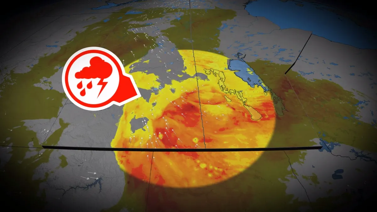
Stormy pattern keeps soaking the Prairies

Another round of rain and thunderstorms is expected to hit the southern Prairies on Monday, as an increasingly organized low-pressure system moves north from the south. Showers and storms will form in multiple clusters throughout the day, moving northeast to northwestern Ontario by Monday evening. Some storms could become severe, with damaging hail and heavy rainfall being the main threats. Rainfall totals will vary greatly, with Saskatchewan and western Manitoba receiving the heaviest amounts. CHECK OUT: How the weather could be influencing your music tasteWet weather lingers into TuesdayThe system will linger in parts of the Prairies until Tuesday before gradually clearing. Heavy rains could cause localized flooding and slow the fall harvest, while areas downstream in Alberta should keep an eye out for rising water levels as rain falls across the Rockies and Foothills, which serve as a source for several major rivers. The wet pattern may also bring hail to crops and buildings as storms pass through. Stay with The Weather Network for the latest updates across the PrairiesWATCH: El Niño almost certain to continue into winter with historic strength

The Weather Network·
Weather

Track Hurricane Lowell: Path, forecast cone, spaghetti models, wind and more

Large ocean swells from Hurricane Lowell are already impacting the Hawaiian Islands. THE TAKEAWAYHurricane Lowell is churning in the Pacific toward Hawaii, threatening a rare, direct hit. Large ocean swells from Lowell are already impacting the Hawaiian Islands. Powerful Category 2 Hurricane Lowell is approaching Hawaii, where it's expected to make a rare, direct hit overnight. HAWAII BRACES FOR POTENTIAL DIRECT STRIKE FROM MAJOR HURRICANE LOWELL AS PACIFIC IS SUPERCHARGED WITH ACTIVITY FILE: Waves start to pick up as a storm forms.  (Robert Ray / FOX Weather)According to the National Hurricane Center, large ocean swells from Lowell are already impacting the Hawaiian Islands. They noted that the swells are likely to cause life-threatening surf and rip current conditions. BREWING SUPER EL NIÑO EXPECTED TO BE STRONGEST ANYONE ALIVE ON THE PLANET HAS EVER EXPERIENCEDHere is everything you need to know about Hurricane Lowell. Where is Hurricane Lowell?

Fox Weather·
Weather

A Major Pattern Flip Arrives: Severe Weather Outbreak and Sharply Colder Air to End Europe’s Late-Summer Heat

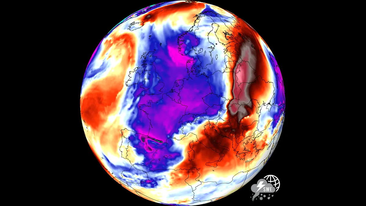
A dramatic summer-killer pattern is taking shape across Europe this week, bringing a sharp end to the prolonged early-September Heat Dome. A powerful upper-level trough that is emerging from the North Atlantic will drive a strong surface cold front across Western and Central Europe by mid-week, crashing directly into the extreme, record-warm air mass parked over the continent. This volatile clash will trigger a widespread severe weather outbreak from the Alps down into the Western Balkans, fueled by an extremely unstable air mass and a sheared environment, followed by a sharp drop in temperatures as unseasonably cold air surges in behind the frontal boundary. The transition begins Wednesday into Thursday as the high-amplitude ridge breaks down under intense upper-level forcing. As the front pushes east, extreme atmospheric instability, high moisture content from the historic Mediterranean marine heatwave, and strong vertical wind shear will combine to fuel severe thunderstorms across Eastern France, Switzerland, the Balearic Islands, Northern Italy, Austria, Slovenia, and Croatia.

Severe Weather Europe·
Weather

Climber dies after fall from towering 14,000-foot mountain summit in Colorado

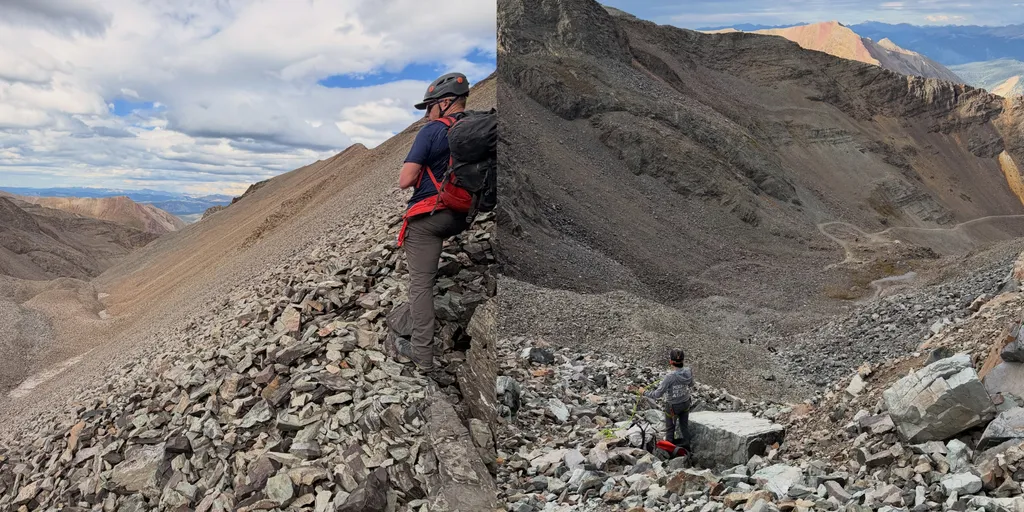
Castle Peak is the ninth-highest summit of the Rocky Mountains and is known as a 14er. THE TAKEAWAYA climber fell from a 14,000-foot mountain summit over the weekend. It happened in Aspen, which is a vibrant mountain town set in the Rocky Mountains. Nearly two dozen people assisted with rescue operations. ASPEN, COLORADO - A climber has died after falling from a massive mountain summit at a popular hiking destination near Aspen, Colorado, over the weekend. Mountain Rescue Aspen said the Gunnison County Sheriff's Office was notified that a climber had fallen on the north face of Castle Peak around 1 p.m. on Sunday. The Pitkin County Sheriff's Office was also called in to help due to the location of the incident. SNOWBOARDER AIRLIFTED AFTER CHALLENGING MOUNTAIN RESCUE IN COLORADO next

Fox Weather·
Weather

Labor Day forecast: Will weather ruin your outdoor plans?

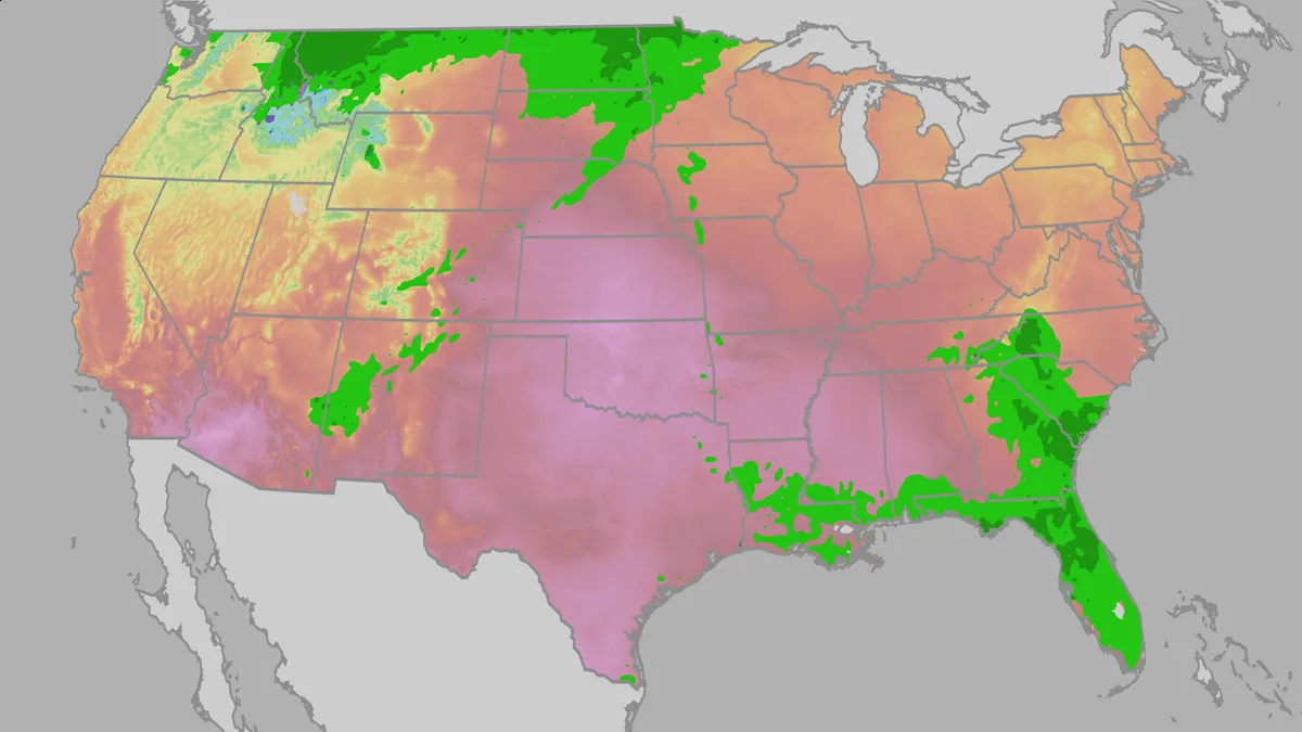
Whether you plan to spend your Labor Day out on the lake, grilling, watching college football or just soaking in the last bits of summer, you'll want to keep an eye on the weather. Heat across the central and eastern U. S. may make any outdoor plans feel miserable; meanwhile, parts of the Southeast and Rockies may see plans get rained out, at least in the afternoon. Here's a look at what the weather has in store for your holiday weekend. How hot will it be? Much of the central and eastern U. S. will be significantly hotter than average, especially across the Plains. Parts of the Southern and Central Plains will have triple-digit highs on the holiday, and most of the rest of the Central and Northern Plains will be in the 90s or 80s. Unfortunately, humidity will make it feel even worse outside. Heat indices up to 110 are possible across the Deep South and Southern Plains, and triple-digit heat indices are possible even as far north as Nebraska. Get More of Our News on GoogleSet The Weather Company as a 'Preferred Source' to get quicker access to the news you value.

The Weather Channel·
Weather

Several days of heavy rain and thunderstorms to persist across the Gulf Coast

Gulf Coast under threat of severe storms HOLIDAY STORM ☔️: The Gulf Coast region will see wet conditions for the remainder of the Labor Day holiday as severe storms could produce heavy rain, leading to potential flooding. Are you experiencing storm conditions in your area today? THE TAKEAWAYHeavy rain and thunderstorms will continue through next week. Persistent rain in the South will fuel a multiday flash flood threat. The storms will continue through Friday. As the holiday weekend nears an end, millions of Americans are chasing one last chance to enjoy the remaining summer warmth, but a sweeping cold front could ruin plans. According to the FOX Forecast Center, a stalled cold front across the Southeast U. S. this weekend is set to lose forward momentum, setting the stage for prolonged heavy rainfall. "As the boundary sinks south through Georgia, the Carolinas and Northern Florida, it will interact with a rich pool of tropical moisture advancing off the Gulf," the FOX Forecast Center said. "Daytime heating will fuel this tropical air mass, sparking strong sea breeze collisions and destabilizing the atmosphere each afternoon. "WHAT IS A COLD FRONT?

Fox Weather·
Weather

Sunshine returns on the East Coast as soggy storm lingers

A moisture-laden storm moseying through Atlantic Canada will linger into our Labour Day on Monday, though skies will begin to clear across areas that could use the sunshine. High rivers and saturated ground will make additional road damage a continuing concern for the next few days. Our centre of low pressure will pass by Newfoundland through the day Monday, sparking some scattered showers and thunderstorms across the island. The storm gradually pulling away from the region is good news for rain-soaked communities in the Maritimes. CHECK OUT: How the weather could be influencing your music tasteParts of Nova Scotia saw more than 200 mm of rainfall through this weekend, leading to flooding and road washouts across Cape Breton. Power has been restored to virtually all of the 38,000 customers who lost electricity on Saturday. A state of emergency has been declared in parts of Cape Breton as residents continue to deal with flooding and storm damage. Isolated showers will linger over parts of Prince Edward Island and Cape Breton, though certainly not to the extent we’ve seen in recent days. Content continues belowNew Brunswick will enjoy a good amount of sunshine on Monday, though P. E.

The Weather Network·