BBlogFlow

Categories

Weather

4073 articles

Weather

Millions of London homes at risk of sinking in extreme heat

The sun shines brightly over homes along Keystone Crescent in London, England. Millions of homes across the city are at risk of sinking as extreme heat shifts the ground beneath them.(Getty Images)Millions of homes across London and southeast England are at risk of sinking, and it's not bad construction — it's the weather. Extreme heat is drying out the ground beneath them and with this summer's onslaught of heat waves, homeowners are starting to see the telltale signs. The United Kingdom and the rest of Western Europe just recorded the hottest summer on record. By the end of August, millions of people had suffered through their fifth heat wave of the season, with widespread drought conditions across Britain, and the country is simply not built for this type of heat.(MORE: US vs. Europe: Same heat, very different danger)The problem is deep undergroundLondon sits on clay soil that behaves almost like a sponge. When it's wet, it swells. When it's hot and dry, it shrinks. That back-and-forth is normal — but when the shrinking happens unevenly under a building's foundation, it slowly drags parts of the structure down while other parts stay put.
The Weather Channel·
Weather

Bryan Norcross: The Atlantic stays mostly quiet while the Pacific stays busy

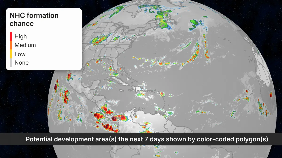
Last updated at 10 a.m. on Friday, Sept. 11, 2026. Our reliable record of tropical development only goes back to 1966. That's when weather satellites began giving us a view of the entire Atlantic Ocean. Since that time, it's unlikely that we would have missed any hurricanes. In those 60 hurricane seasons that have gone by, the latest date that the first hurricane developed was September 11. We are obviously going to blow past that modern record this year. A drier-than-normal atmosphere, higher-than-normal pressures, hostile upper-level winds, and subsiding air are prohibiting any development across the Caribbean and tropical Atlantic. No tropical development expected in the Atlantic over the next week.  (Bryan Norcross / FOX Weather)Before there was satellite coverage, a number of years in the record book had their first hurricane appear after this date. A couple of years, 1907 and 1914, had no hurricanes at all. In 1905, the first hurricane formed on October 7. But confidence in the record that depends mostly on ship reports and island impacts likely has gaps.

Fox Weather·
Weather

Ring of Fire region rattled by pair of earthquakes hours apart in Alaska, Southeast Asia

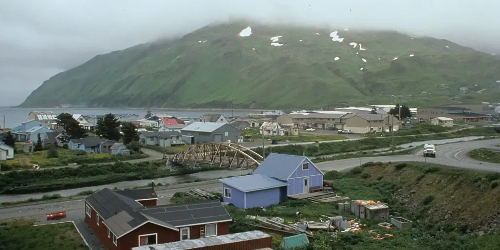
The Pacific Ring of Fire is a 25,000-mile belt of volcanoes and earthquake zones surrounding much of the Pacific Ocean, where 90% of the world's earthquakes occur. The Pacific Ring of Fire region was rattled by two earthquakes on Friday. A magnitude 5.3 earthquake struck off the Aleutian chain, about 93 miles west-southwest of Adak, Alaska, just after 2:45 a.m. Alaska time, according to USGS. The quake's epicenter was roughly 25 miles below the surface. HOW TO WATCH FOX WEATHER Earthquake map. (FOX WEather / FOX Weather)About an hour later, a magnitude 5.9 earthquake struck in Southeast Asia's Banda Sea, about 157 miles east-northeast of Lospalos in Timor-Leste, a Southeast Asian nation that shares the island of Timor with Indonesia, north of Australia. No Tsunami Warning was issued for either quake. The Pacific Ring of Fire is a 25,000-mile belt of volcanoes and earthquake zones surrounding much of the Pacific Ocean, where 90% of the world's earthquakes occur.

Fox Weather·
Weather

The deep blue sky that changed history on 9/11

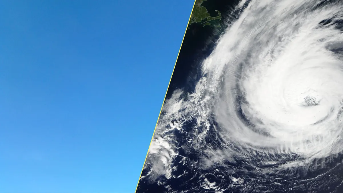
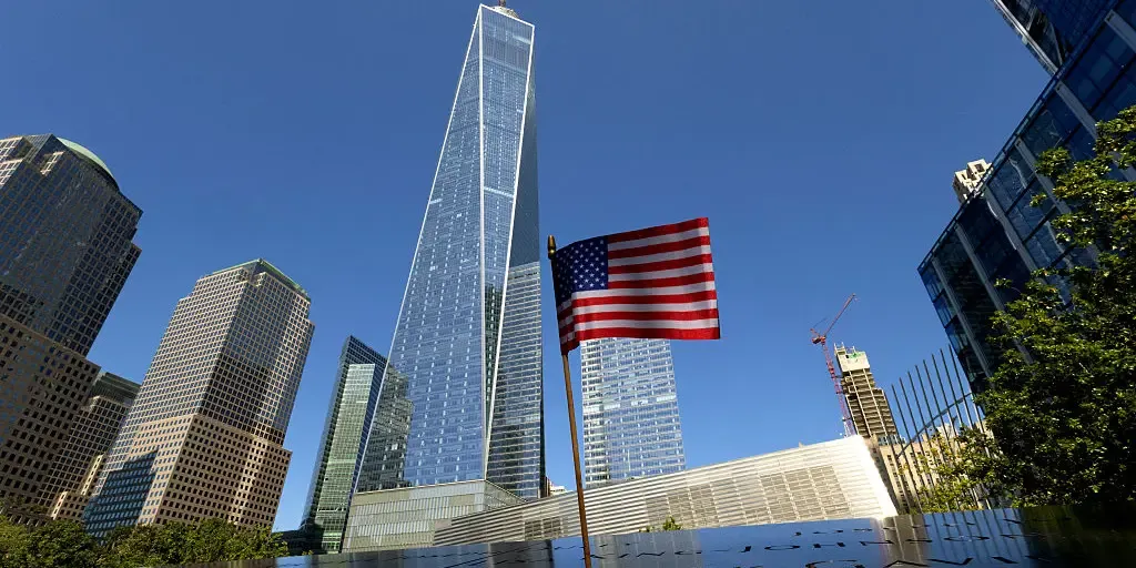
Weather is the unassuming backdrop of our daily lives. We rarely remember the conditions on any given day unless a sudden storm throws a wrench into our routines. The morning of Sept. 11, 2001, stands alone in opposition to that rule. The deep blue sky and near-perfect temperatures feature prominently in almost every personal story recounting the attacks in the U. S. on that early autumn day. Clear, blue skies are such a cornerstone of that day's memory that a large exhibit in the 9/11 Memorial & Museum, called "Trying to Remember the Color of the Sky on That September Morning," serves as a remembrance of those lost both that morning and during the previous attack in 1993. RELATED: Seven times weather unexpectedly changed the course of historyOne cold front very nearly changed the course of world history. A potent low-pressure system over far northern Quebec brought much of eastern North America their first taste of autumn after a long, hot summer. This front swept from the Great Lakes toward the East Coast late on Monday, Sept. 10, sparking showers and thunderstorms along its leading edge. One of those evening thunderstorms swept over New York City.

The Weather Network·
Weather

Cooler weather and signs of snow for parts of B.C. and the Prairies

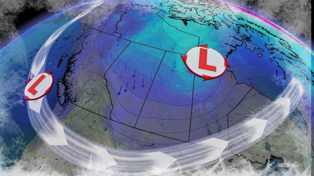
A significant cooldown is set to arrive later this week across the Prairies and parts of British Columbia, driven by a cold front moving through B. C. and Alberta in the late workweek. Visit our Complete Guide to Fall 2026 for an in depth look at the Fall Forecast, tips to plan for it and much more! By Friday, temperatures across B. C. and Alberta will drop noticeably, with the cooldown extending to Saskatchewan and Manitoba over the weekend. Coldest lows since May? Saturday and Sunday morning lows in Alberta may plummet to the single digits, reaching near 3°C in Calgary—potentially the coldest low since May 5. Daytime highs across the Prairies could struggle to exceed double digits, sitting 5-10°C below seasonal averages. RELATED: Some of Canada’s first frost advisories of the season issuedAlpine snow not out of the questionIn the Rockies and Coastal Mountains, freezing levels will dip to approximately 2000 metres, dropping near 1600 metres near Jasper. This could lead to snow in alpine areas, leaving visible snowcaps. An upper-level trough deepening over the region will bring northerly winds and a chilly air mass from northern Canada.

The Weather Network·
Weather

Nigerian village vanishing into sea — a warning for coastal America

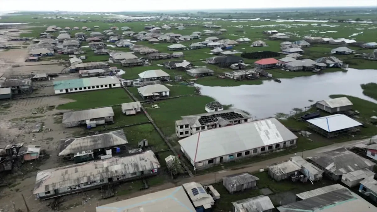
Rising seas are erasing this Nigerian village: Why US coasts are nextIn southern Nigeria, the once-vibrant fishing town of Ayetoro, home to 10,000 people, now looks like a ghost town. Ocean surge and relentless coastal erosion have swallowed up homes, displacing hundreds of families. This is not an isolated tragedy; it's a preview of what rising sea levels could do to vulnerable communities across the United States. Oluwambe Ojagbohunmi, the traditional king of Ayetoro told Agence France-Presse (AFP), "We have lost like 80% of the buildings. What is left now is the kitchen. People are just converting the kitchen into residential areas. " Oluwambe Ojagbohunmi, the traditional king of Ayetoro in southern Nigeria, describes the destruction caused by coastal erosion in this once-thriving fishing community.(AFP/AFPTV)The town's coastline receded by an average of 50 feet every year, between 1987 and 2022, according to AFP. Itunu Omosehin, 92, has lived in Ayetoro all her life and says she has nowhere else to go: "The houses I inherited from my parents have collapsed — my father's house has collapsed, and my mother's house has collapsed.

The Weather Channel·
Weather

Severe storms to target northwestern Ontario before the weekend

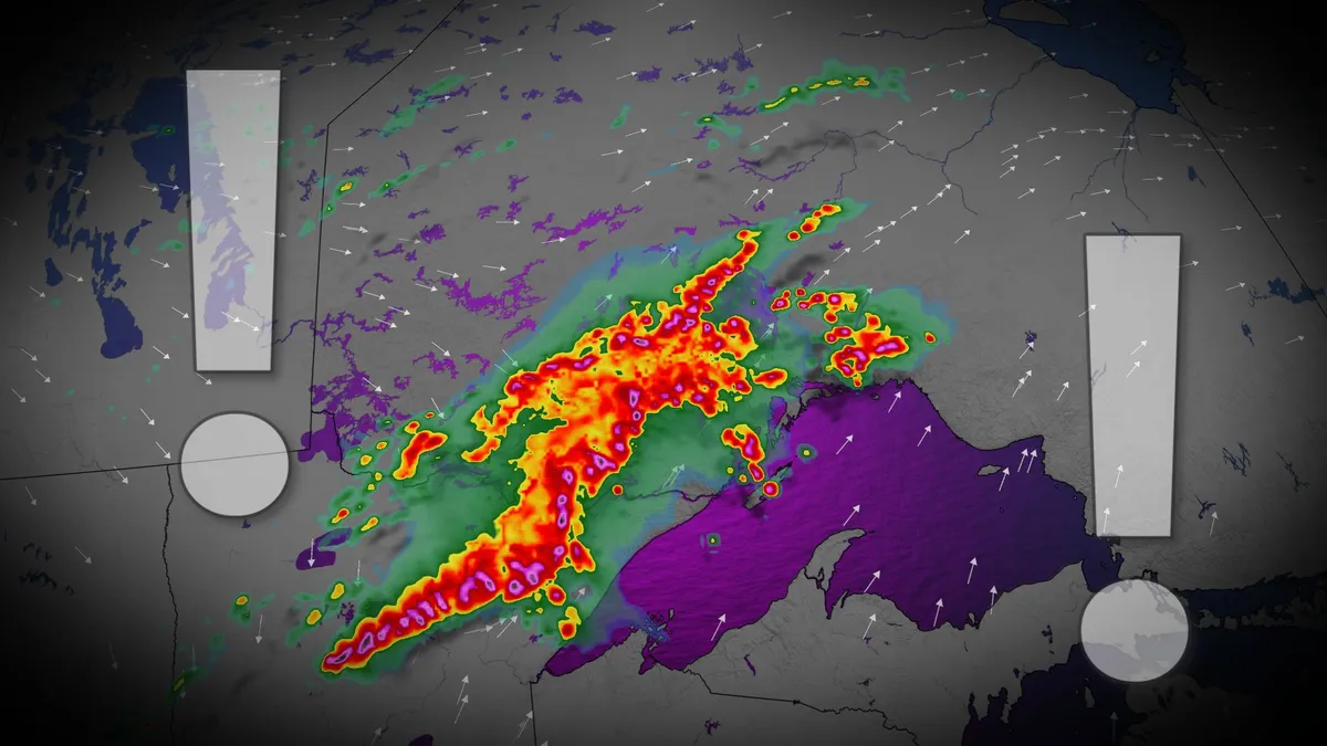
Active weather is set to move across the international border, bringing the risk of severe storms to parts of northwestern Ontario before the weekend. Visit our Complete Guide to Fall 2026 for an in depth look at the Fall Forecast, tips to plan for it and much more! A low pressure system developing in South Dakota will track towards the region by Friday evening. Be sure to stay alert to the changing conditions, and check for any weather warnings in your area. Risk for strong storms Friday evening and overnightStorm initiation will begin stateside Friday afternoon before moving into Ontario near the warm front. Thunderstorm activity will likely begin as discrete cells before evolving into linear storm systems as the associated cold front pushes in. Key hazards include large hail, heavy rain, and strong wind gusts. There is also potential for rotating storms, depending on the timing of the storm band. Thunder Bay is forecast to see storm activity later Friday evening into the overnight hours. While intensity may weaken by this time, some severe conditions, including torrential rainfall, remain possible.

The Weather Network·
Weather

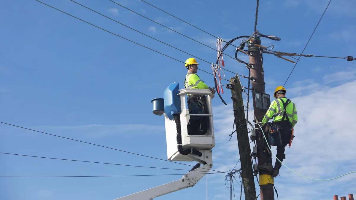
Thousands lose power in Los Angeles amid triple-digit heat

Salvador Rivera tries to find relief from the sun and heat on Wednesday, Sept. 9, 2026, in Los Angeles. Extreme heat led to power outages across the city on Thursday, Sept. 10, 2026.(Kayla Bartkowski / Los Angeles Times via Getty Images)As record-breaking heat and humidity blanket Southern California, thousands of families in Los Angeles are suffering through it without electricity, as the extreme temperatures triggered massive power outages. At least 10,000 homes and businesses were without power early Friday morning, and many residents say they haven't had electricity since Wednesday. The Los Angeles Department of Water and Power says more than 90 crews are out across the city working to restore electricity. They also urged people to conserve and reduce energy usage, as the high demand continues to strain the power grid. In a statement, the LADWP "especially requested" conservation from customers in Westside communities. Councilwoman Traci Park made a similar plea as she gave an update on the outages on social media.

The Weather Channel·
Weather

Winter outlook 2026-27: Where snow could be abundant

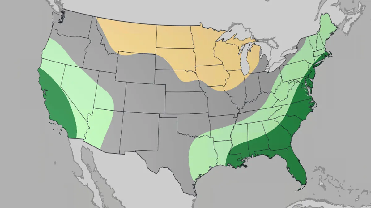
How will El Niño impact how your winter feels? This winter, El Niño could deliver parts of the Rockies and Sierra their best, most consistent snow in years, while a lack of cold air could mean early-season Northeast storms are mostly rain and little snow. Waxing the skis? Before you circle opening day, here's what this winter actually has in store, and it depends quite a bit on which mountain range you have on your list. The Weather Company just released its winter 2026-27 outlook, and it's a tale of two very different seasons. Key takeawaysDecember 2026 through February 2027 precipitation outlookThe Southern Rockies and Sierra are this winter's jackpot. An active storm track should deliver frequent, reliable snowfall from Lake Tahoe to the Wasatch and Colorado Rockies. This is a big step up from last year's inconsistent and lack-luster season. Northeast resorts face a rain-versus-snow gamble. A stormier pattern is expected along the East Coast, but without enough cold air behind it, especially early in the season, a lot of that precipitation may fall as rain instead of snow. A strong El Niño is driving the forecast.

The Weather Channel·
Weather

The man who named the clouds: Luke Howard names the sky

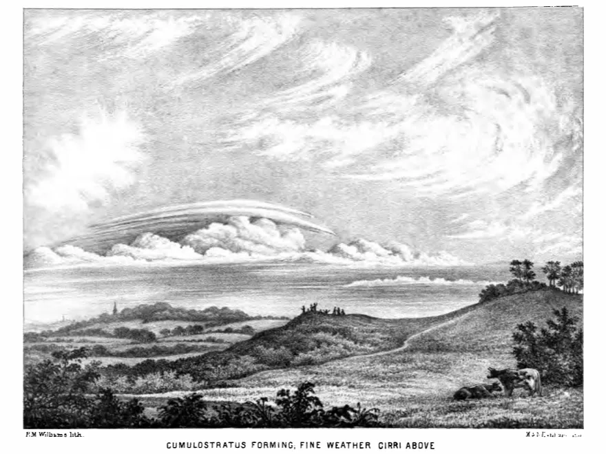
The real story of how clouds got their namesOn a December evening in 1802, a reserved London pharmacist by the name of Luke Howard stood before a small group of amateur thinkers and proposed a simple but radical idea: The sky had an underlying grammar, and he had figured out how to read it. Howard wasn’t a scientist by trade. He was a Quaker and a chemist, but he had spent hours upon hours obsessively watching the sky, filling notebooks with sketches, looking for patterns that formal science had ignored. Luke Howard, portrait by John Opie(John Opie)For centuries, naturalists had struggled to classify clouds. Plants and animals, meanwhile, had been catalogued and classified endlessly. Clouds, on the other hand, presented a simple problem: they were always moving. They shifted, merged and vanished. Most scientists assumed they were simply too chaotic to organize. A depiction of a cumulostratus cloud, included in Howard's 'On the modification of clouds.'Howard saw it differently. Presenting his paper, "On the Modification of Clouds," to London's Askesian Society, he introduced a surprisingly practical Latin naming system.

The Weather Channel·
Weather

Dark bus stop safety: How to keep kids visible this fall

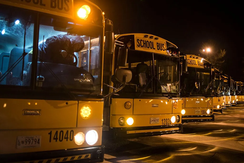
Your kid's bus stop is getting darker. Here's the danger to watchSunrise slips a minute or two later every morning this time of year. It continues until your children eventually get to the bus stop before the sun rises. This time is one of the most dangerous times for your children, but there are ways to help keep your children safe. Waiting for a bus on dark mornings can be very dangerous for children. (Photo By David Cupp/The Denver Post via Getty Images)What you can doFor parents:Use reflective gear on your children’s backpack, not just their jacket. After all, kids take coats off. Move the waiting spot back. Take 10 giant steps from the road’s edge to play it extra safe. Tell your children to wait there until the bus stops completely and the driver signals. Do not wear earbuds, and put your phone away at the bus stop. AAA says that distracted walking is as dangerous as distracted driving. Walk it once in the dark so you can spot blind corners. Be familiar with the area around the bus stop. Kids under 10 shouldn't wait alone. They should always have a parent or at least an older sibling to ensure safety.

The Weather Channel·
Weather

Latest forecast calls for a historic El Niño to peak this winter

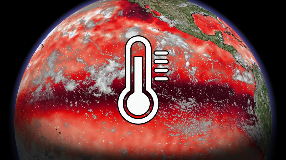
Exceptionally warm waters in the Pacific Ocean will very likely lead to the strongest El Niño observed since records began in 1950, according to the latest expert analysis. The U. S. Climate Prediction Center (CPC) expects El Niño to achieve an unprecedented peak during the final three months of this year, which could significantly affect the world’s weather patterns through the autumn and winter seasons ahead. FALL OUTLOOK 2026: Winter can wait: Exceptional El Niño favours and extended fallA very strong El Niño is imminentForecasters with the agency now say there’s a greater than 90 per cent chance that we’ll experience a very strong El Niño through the winter months. Sea surface temperatures around the equator in the eastern half of the Pacific are running more than 3°C warmer than normal in some areas, which reflects a strong and intensifying El Niño. Water temperatures 50-100 metres beneath the surface are running as much as 10°C above seasonal. Forecasters use the Relative Oceanic Niño Index (RONI) to judge the strength of an El Niño event. This index measures average sea surface temperature anomalies across a critical swath of the Pacific basin.

The Weather Network·
Weather

30 beluga whales rescued from closed Marineland Canada

Largest marine mammal rescue in history: beluga whale editionThirty beluga whales, a closed marine park and a ticking clock. That’s the very real scenario the beluga whales living at Marineland Canada found themselves in when the park closed in 2024 and could no longer take care of its residents. The whales faced the threat of euthanasia if they could not safely be relocated. Enter the heroes of our story: Representatives from Association of Zoos and Aquariums accredited aquariums, along with their respective governments, teamed up to safely transport all 30 whales to aquariums in the United States and Spain in the largest marine mammal rescue and transport mission in history.'Air Beluga'The logistics that have to go into a project like this can’t be overstated. Cooperation was necessary every step of the way between the aquariums and the Canadian, Spanish and U. S. governments to pull off a mission of this scale. That scale was amplified not only by the sheer number of animals needing transportation, but also by the fact that beluga whales are extremely large, heavy animals.

The Weather Channel·
Weather

The 'severe clear' weather of September 11, 2001 explained as we remember the day that changed America forever

The sky was almost completely cloudless and a shade of deep blue — a phenomenon in aviation known as "severe clear" — indicating exceptional visibility. NEW YORK — It was a beautiful, clear and unusually crisp morning that no one who lived through September 11, 2001, in New York City will ever forget. Temperatures in New York City were in the mid-to-upper 60s early in the morning before one of the worst tragedies in American history.  "Trying to Remember the Color of the Sky on That September Morning" art installation by Spencer Finch inside view of the 9/11 Museum in New York City, United States on October 23, 2022.  (Photo by Jakub Porzycki/NurPhoto via Getty Images / Getty Images)The sky was almost completely cloudless and a shade of deep blue — a phenomenon in aviation known as "severe clear" — indicating exceptional visibility. An area of high pressure had moved in behind a cold front that brought storms the night before, creating those remarkably clear and crisp late-summer conditions. This high pressure also shielded the Northeast from Hurricane Erin, a large storm about 500 miles off the East Coast. Weather on September 11, 2001.

Fox Weather·
Weather

The record-earliest first snow of fall in US cities

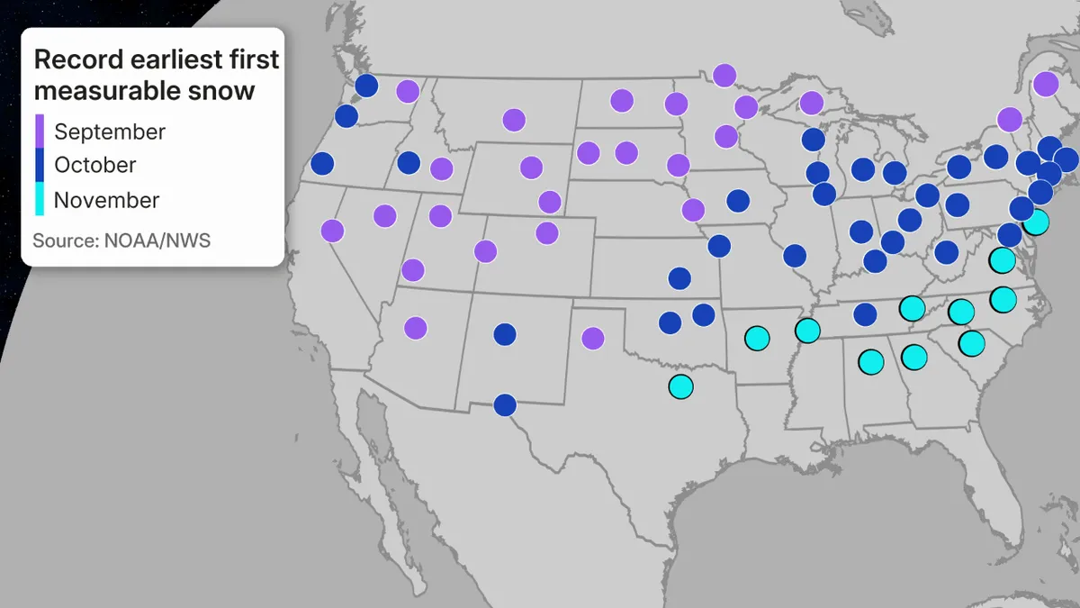
How early can it snow near you? Here's the record for each stateThe first snow of the season typically happens later in fall for most in the U. S. However, the record earliest snowfalls have happened much earlier, including in recent years. The national viewThe map below shows the month in which the earliest measurable snow has fallen in each of the U. S. cities where snowfall is considered typical each year. By measurable snow, we mean at least 0.1 inches of snow are recorded. That's usually just enough to at least dust your lawn, roof or the top of your vehicle. There are some general takeaways:September is when parts of the West and northern tier have seen their record-earliest snow. October is when many Midwest and Northeast cities have seen their record-early snow. November is when parts of the South from the Carolinas and Tennessee Valley to parts of northern Texas have had their record-early snow. The farther north and higher in elevation, the earlier in fall it can snow.

The Weather Channel·
Weather

Bryan Norcross: Peak of hurricane season arrives with a whimper while Pacific tropical explosion continues

El Niño silences Atlantic as climatological peak of hurricane season arrives The climatological peak of Atlantic hurricane season arrives today, September 10, yet the basin remains eerily quiet, largely due to El Niño’s influence. Wind shear remains high across the entire Main Development Region (MDR), while Saharan dust and low instability are severely limiting the numerous tropical waves moving off the coast of Africa. Updated 9:22 A. M. on Thursday, September 10, 2026On average, September 10 is the date when there is most likely to be a named storm in the Atlantic, the Caribbean, or the Gulf. In fact, it's rare that there is not a named storm somewhere in the Atlantic basin on this date. But here we are. In the interests of precision, the National Hurricane Center’s graph is based on 77 years of storm data from 1944 to 2020. A few weak storms could have been missed in the pre-satellite years between 1944 and 1965, but aircraft reconnaissance had begun, so the record is believed to be reasonably accurate.  Atlantic hurricane and tropical storm activity.

Fox Weather·
Weather

Earth just had its hottest August in 176 years, NOAA said

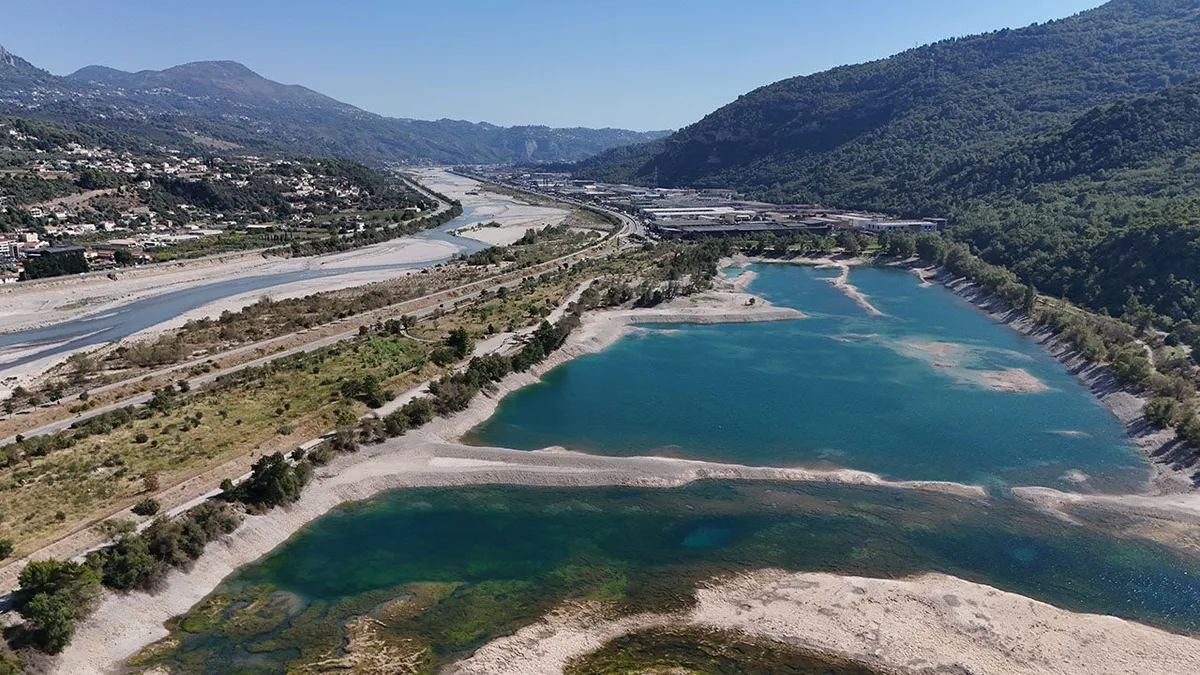
An aerial view shows low water levels and exposed dry areas at Lac du Broc near Nice in southern France as drought affects the region, on Sept. 3, 2026.(Mohamad Salaheldin Abdelghani Alsayed/Anadolu via Getty Images)Earth had its hottest August dating to the mid-19th century, while the U. S. and Western Europe had a record hot summer, according to two separate just-released government analyses. NOAA's August global climate report found August 2026 topped 2023 and 2024 as Earth's hottest August, with the planet's temperature 2.38 degrees Fahrenheit above the 20th-century average. NOAA global temperature records date to 1850. This graph shows how far above and below average global temperatures were in each August from 1850 through 2026, in degrees Celsius. The red arrow denotes August 2026's global temperature.(NOAA/NCEI)A separate analysis from the European Copernicus Climate Change Service found August 2026 not only was the hottest August, but it also tied for Earth's hottest month with July 2023. Global-average surface air temperature (°C) for 2023 (orange), 2024 (yellow), and 2026 (dark red).

The Weather Channel·
Weather

Atlantic hurricane season peak: a record hurricane delay

A satellite image of the Atlantic Basin on Sept. 10, 2026, showing no active areas the National Hurricane Center was monitoring for potential tropical development. The Atlantic hurricane season is still snoozing even during its typical mid-September peak amid its quietest start in at least 60 years and a record-long wait for its first hurricane during an intensifying El Niño. It's usually busy right nowSeptember is typically the most active month of the Atlantic hurricane season. Typical activity based on past hurricane seasons reaches a peak in the second week of September, as you can see in the graph below. That's because sea surface temperatures are at their warmest and atmospheric conditions are the most favorable for tropical development. This graph shows the average storm, hurricane and major hurricane tallies from 1944 through 2020 in the Atlantic Basin. The yellow area highlights an average September. (Data: NOAA/NHC)Not this yearInstead, there were no active tropical storms or hurricanes anywhere in the Atlantic Basin during this second week of September.

The Weather Channel·