BBlogFlow

Categories

Weather

4073 articles

Weather

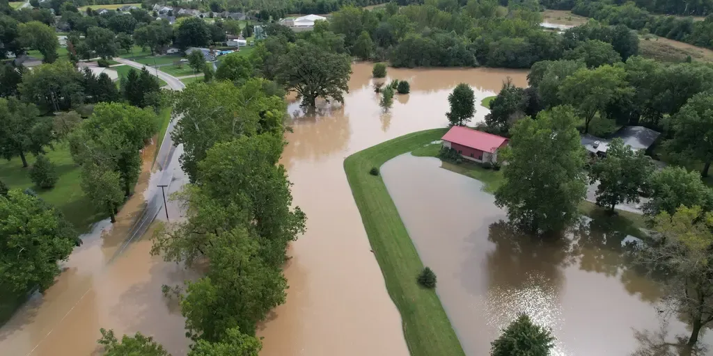
Waterlogged Midwest facing intense flooding through Sunday as severe storms lash region

THE TAKEAWAYRelentless heavy rain and flooding, brought on by severe storms, is targeting millions across the Midwest and the Great Lakes through Monday. The Storm Prediction Center is warning of "locally considerable urban flooding" in areas such as Chicago. The week-long firehose of storms aimed at parts of the Midwest, Plains and Ohio Valley will extend through Sunday, putting millions at risk of flash flooding as thunderstorms repeatedly track over the same corridor. NOAA's Weather Prediction Center (WPC) has issued a Level 2 out of 4 flash flood threat for parts of the Midwest through Monday. A widespread 3 to 5 inches of rain could still fall across the region, including Chicago, with some localized areas potentially seeing 5 to 8 inches. next Neighborhoods in Bluffton, Indiana, flooded on Sep. 17, 2026.

Fox Weather·
Weather

Why do bears eat 20,000 calories a day before hibernation

A coastal brown bear rolls through a field of fall-colored fireweed along Kinak Bay in Katmai National Park, Alaska, part of the same hyperphagia drive fueling this year's Fat Bear Week contestants.(Paul Souders/Getty Images)Right now, a black bear near you could be trying to eat 20,000 calories a day. Neither the number nor the urgency behind it is an exaggeration. This is what fall asks of every bear headed into winter. What's actually happeningThe behavior is called hyperphagia, a pre-hibernation feeding frenzy that kicks in as daylight shortens and temperatures drop. Bears eat and drink nearly nonstop for weeks, some packing away 15,000 to 20,000 calories in a single day. Processing that much food takes water, too: bears in hyperphagia can drink up to to 2 gallons a day just to keep up.(MORE: Humans don bear suits in adorable wildlife rehab effort)Why the math works this wayBears don't eat, drink or go to the bathroom during hibernation, so every calorie they'll burn over the winter has to be stored as fat before they den up. Hyperphagia is that stockpiling window, compressed into a few frantic weeks of near-constant foraging.

The Weather Channel·
Weather

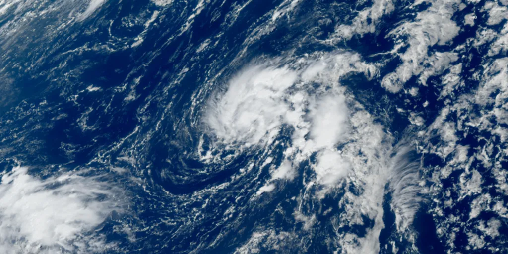
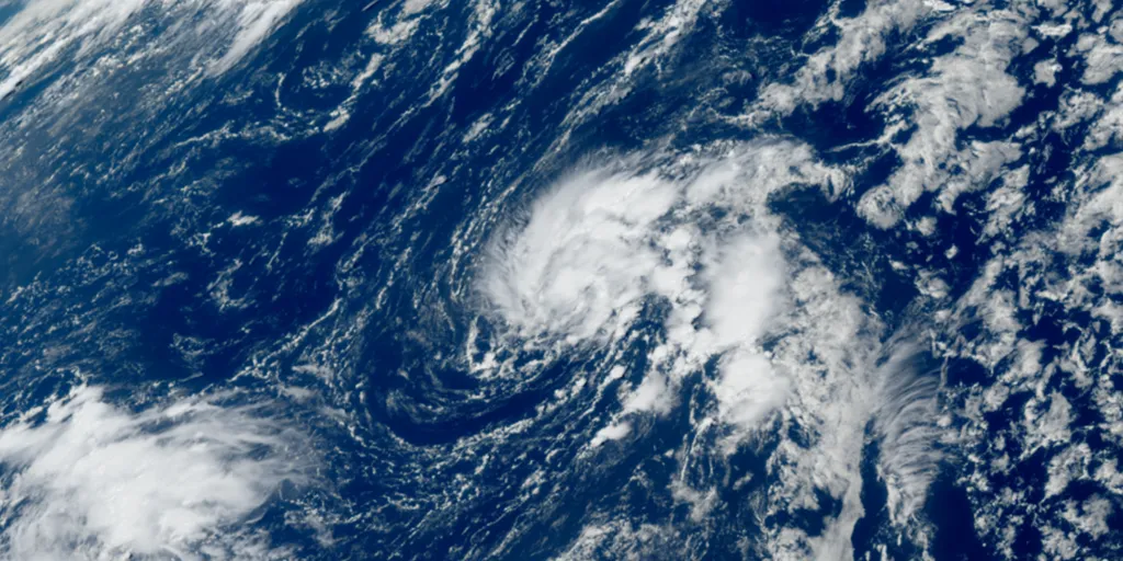
Tropical Storm Fay starts to intensify after forming in the Atlantic amid brewing Super El Niño

The system is not expected to impact land, according to the FOX Forecast Center. THE TAKEAWAYTropical Storm Fay, formerly Tropical Depression Six, has formed in the Atlantic Ocean. The Atlantic hurricane season is off to its quietest start on record, dating back to the beginning of the satellite era (1960). Fay is expected to ultimately encounter hostile conditions and eventually fizzle out, but not before strengthening in the next day or so. Tropical Storm Fay has started to intensify after forming in the Atlantic Ocean, southwest of the Azores, packing winds of 60 mph. According to the National Hurricane Center (NHC), Tropical Storm Fay is slow-moving at 3 mph and is forecast to move southwest across the Atlantic Ocean. WHAT IS A TROPICAL STORM? The latest on Tropical Storm Fay in the Atlantic. The storm, formerly known as Tropical Depression Six, is forecast to meander through the weekend before a dip in the jet stream approaches from the east, steering the system south into the central Atlantic next week. WHAT’S THE DIFFERENCE BETWEEN A TROPICAL DEPRESSION, TROPICAL STORM AND HURRICANE? According to the FOX Forecast Center, the system is not expected to impact land.

Fox Weather·
Weather

Magnitude 6.4 earthquake rattles Papua New Guinea in latest Pacific Ring of Fire activity

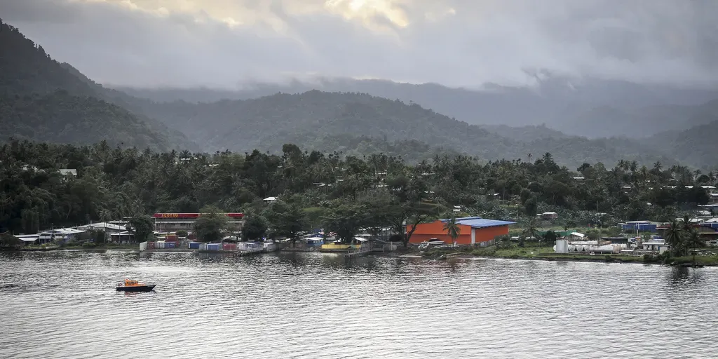
The USGS said the population in this area resides in structures that are a mix of vulnerable and earthquake-resistant construction. PAPUA NEW GUINEA - A magnitude 6.4 earthquake has once again rattled the Pacific Ring of Fire — this time in Papua New Guinea. The earthquake struck at 9:17 a.m. UTC, and was felt across the island country. The U. S. Geological Survey (USGS) said the quake struck at a depth of about 64 miles, approximately 30 miles from Kainantu. SCIENTISTS DISCOVER A NEW WAY TO IDENTIFY WHERE MAJOR EARTHQUAKES COULD STRIKE Alatou Milne bay, papua new guinea (Annemiek1962 / Getty Images)The USGS said the population in this area resides in structures that are a mix of vulnerable and earthquake-resistant construction. Recent earthquakes in this area have caused secondary hazards such as landslides and liquefaction. The agency reports that the quake happened on the Australia-Pacific plate boundary, which is about 2,500 miles long, spanning from the Sunda (Java) trench in the west to the Solomon Islands.

Fox Weather·
Weather

Bryan Norcross: Tropical Storm Fay forms in the Atlantic and a possible hurricane threat for coastal Mexico

Last updated at 10 a.m. on Sunday, Sept. 20, 2026. BUT FIRST… SEPTEMBER 20, 1926The Great Miami Hurricane left devastation in its wake across southeast Florida and the western edge of Lake Okeechobee. Two days after landfall, it was honing in on Pensacola. The center of the storm arrived near the western Panhandle 100 years ago this morning. It then crept slowly to the west, finally making landfall near the Florida/Alabama line in the late afternoon. WHAT IS A TROPICAL STORM? The front page of the Pensacola Journal on Sept. 22, 1926. (Bryan Norcross / FOX Weather)Hurricane-force winds arrived at Pensacola overnight and continued through the day. It ripped through the city a reported 17 hours in all. As the storm slowly passed to the south, the backside winds pushed storm-surge water into Pensacola Bay 9 to 10 feet above the normal tide. The waterfront was devastated. Boats of all kinds were tossed. Roofs were torn off. And power was out throughout the region. WHAT’S THE DIFFERENCE BETWEEN A TROPICAL DEPRESSION, TROPICAL STORM AND HURRICANE? The Pensacola Journal was unable to publish that Monday or Tuesday.

Fox Weather·
Weather

The highest-elevation tornadoes in US history prove twisters can strike almost anywhere

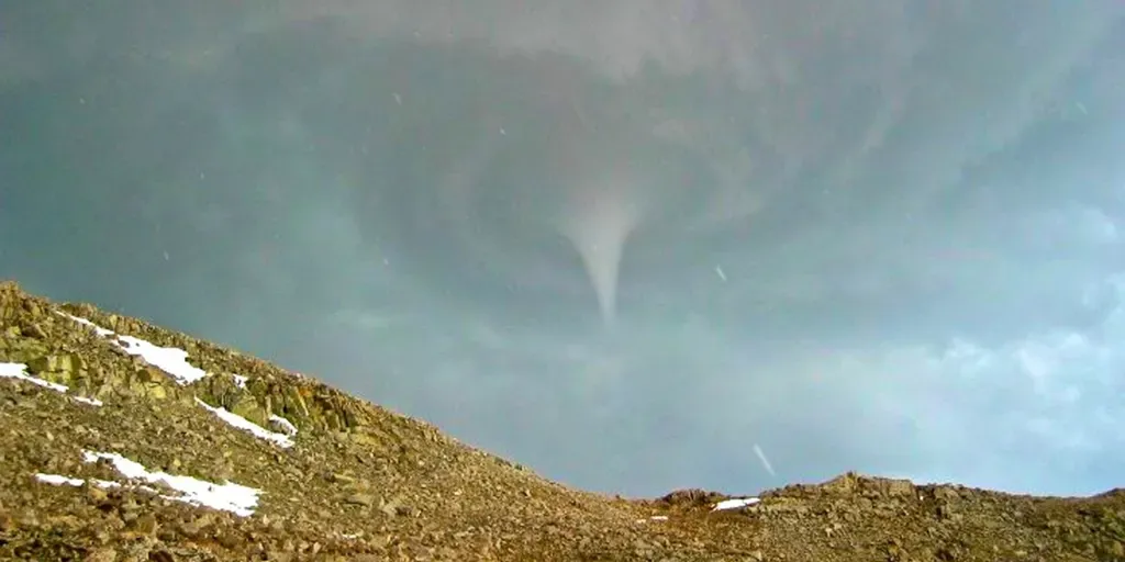
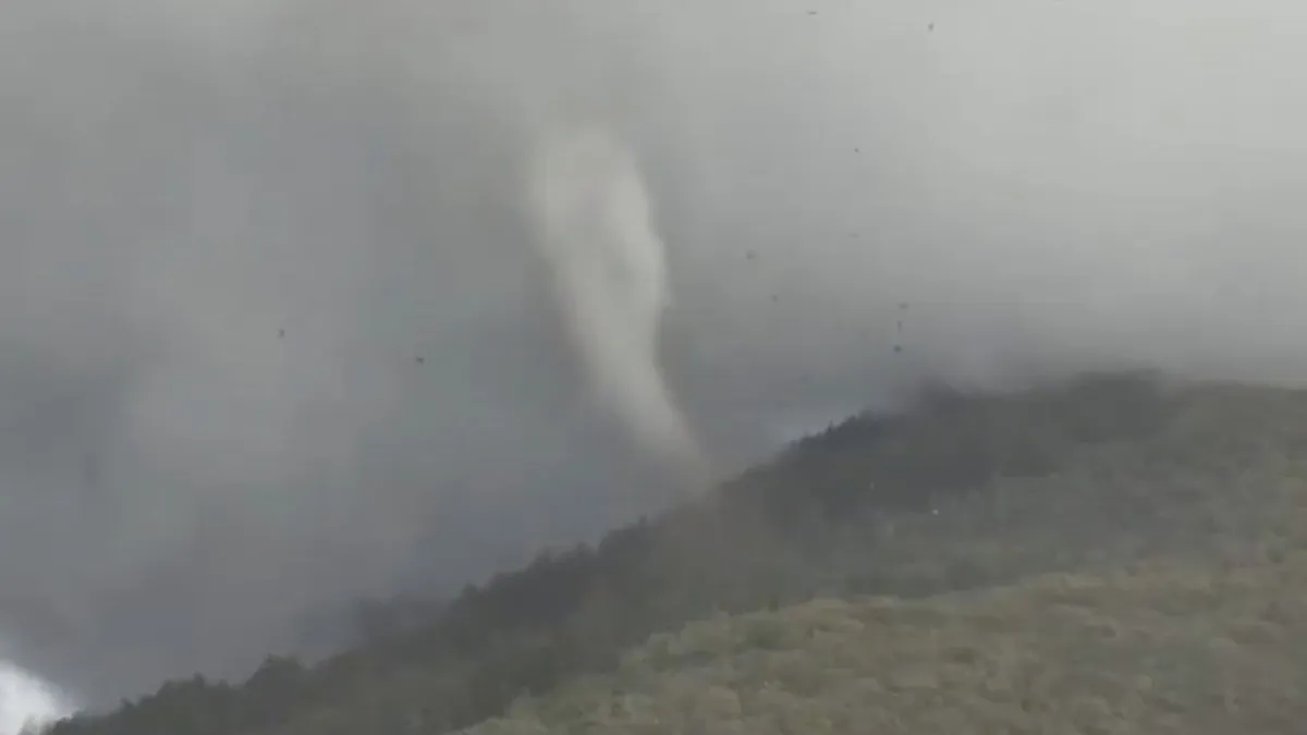
MUST WATCH: High elevation Utah tornado caught on camera spinning at 7,500 feet A confirmed tornado touched down Friday in the mountains east of Fruit Heights, Utah, with astonishing video capturing the twister on the ground. The National Weather Service said the tornado touched down shortly after 1:50 p.m. MDT along a ridge line near Francis Peak in Davis County at an elevation of about 7,500 feet, as severe thunderstorms moved through northern Utah. THE TAKEAWAYHigh-elevation tornadoes are rare but can develop in mountainous terrain. Several U. S. tornadoes have been documented above 11,000 feet. Remote locations make these tornadoes difficult to observe, survey and officially rate. Viral video of a tornado spinning along a ridge near Fruit Heights, Utah, at an estimated elevation of 7,500 feet captivated the internet, but the impressive twister falls well short of the highest-elevation tornado documented in the United States. While high-elevation tornadoes are rare, capturing and documenting them well enough for National Weather Service confirmation is even more difficult.

Fox Weather·
Weather

A jump in stomach bugs occurs during the colder months. Here's why

As temperatures drop, cases of gastrointestinal viruses like the norovirus increase. An infectious diseases physician explains to The Weather Network's Rachel Schoutsen the connection between colder weather and the spread of the virus, offering key advice on prevention and treatment. Watch the video above for the full explanation on the stomach bug-colder weather connection. Thumbnail courtesy of CANVA.

The Weather Network·
Weather

Weather Of The World: September 20

Wander the world one snapshot at a time. Explore striking moments of weather in motion in this week's slideshow. ByAda Wood•September 20, 2026Updated: September 20, 2026, 7:09 am EDTPublished: September 20, 2026, 7:00 am EDTA crescent moon and the planet Venus appear in the western evening sky behind a mosque minaret in Srinagar, Indian-administered Kashmir, India, on Sept. 14, 2026.(Kabli Yawar/NurPhoto via Getty Images)F​rom the moon and Venus together in the sky in India to glacier ice melting in Switzerland, it has been another busy week of weather around the world. Here are some of the most jaw-dropping and awe-inspiring weather photos we found this week. The Weisshorn's east side glacier where local authorities have increased the alert level following multiple ice break-offs, above Randa, southwestern Switzerland, on Sept. 15, 2026. Officials continue to monitor the unstable slope and have restricted access to the designated hazard zone amid concerns over further collapses.(Fabrice COFFRINI/AFP via Getty Images)Dew on a car in Dresden, Saxony, Germany, on Sept.

The Weather Channel·
Weather

Weather Whiz: September 20

Mineral rare earth element and CPU on green electronic circuit board background.(Getty Images)How well have you been paying attention to the weather this week? Here are five questions that will test your knowledge of what's been going on. QUESTIONS_______ from thunderstorms actually has the ability to fertilize your garden. What weather conditions are raising the alcohol level of grapes currently growing for French champagne? What is the most common mosquito-borne disease in the U. S. — an illness experiencing more frequent transmission-friendly temperatures? Which weather is better for you when you're sick with a cold or the flu: warm, humid air or cold, dry air?_______ could raise electronics prices and disrupt AI..... ANSWERSLightningRecord heat wavesWest Nile virusWarm, humid air El Niño How did you do this week? Come back for more exciting weather questions next week, or risk showing up to trivia night unprepared! Get More of Our News on GoogleSet The Weather Company as a 'Preferred Source' to get quicker access to the news you value.

The Weather Channel·
Weather

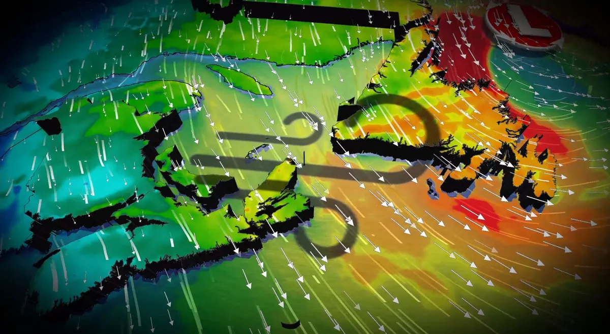
Wild Newfoundland winds of 100-120 km/h threaten power outages, damage

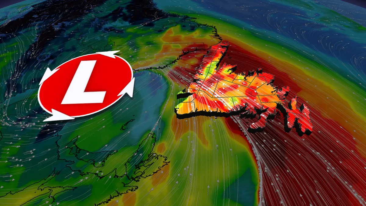
A low-pressure system tracking across Atlantic Canada will continue to bring potentially damaging winds and high swells on Saturday as it moves farther across Newfoundland. This system is bringing significant weather impacts, including heavy rainfall, strong winds, and high swells. Wind warnings are in effect, with the risk for power outages and disruptions to ferry services. Through 2 p.m. local time, the following wind gusts have been reported:Twillingate: 115 km/hBonavista: 112 km/hSagona Island: 101 km/hGander: 87 km/hSt. John’s: 82 km/hVisit our Complete Guide to Fall 2026 for an in depth look at the Fall Forecast, tips to plan for it and much more! Stay updated with the latest information on this developing system, and any weather warnings in your area. Damaging wind threat SaturdayThe primary concern on Saturday will be strong winds, particularly for Newfoundland’s northern coast, where wind gusts between 110-120 km/h are forecast. Wind warnings are in effect for Saturday in the region, with St. John’s set to experience its windiest day since May 13.

The Weather Network·
Weather

Are you a weather whiz? Take Canada’s weekend weather quiz

Autumn is a season of extremes in the atmosphere--and sometimes that includes “extremely boring” as the weather over Canada largely fell silent this week. There’s beauty and fascination in even the quietest of times, though, and we saw plenty of interesting happenings across the country and around the world over the past week. How well do you know the weather? Take our quiz below and grade yourself using the answer key at the end. DON’T MISS: What does a classic fall storm look like in your part of Canada? This week’s weather quiz1: 30-degree temperatures can stick around quite late into the year. Which of these towns holds the record for Canada’s latest 30°C of the year? A) Sherbrooke, Quebec; D) Victoria, British Columbia2: El Niño continues to strengthen toward record heights. Which of the following milestones did the pattern hit this week? A) Reached the criteria for ‘super’ El Niño;

The Weather Network·
Weather

A Super El Niño will significantly affect global marine life

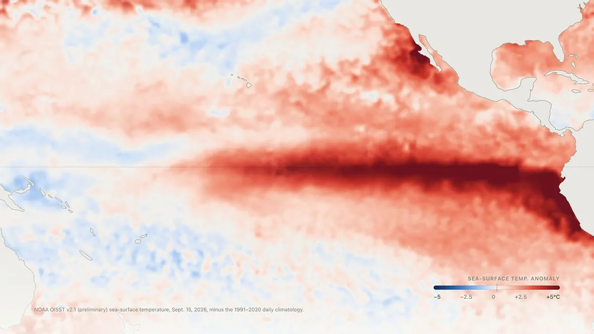
The world is in the midst of a strengthening Super El Niño that will likely set the record for the strongest ever observed. We’ve already seen how this pattern will affect global weather patterns, including this autumn’s conditions across Canada. Marine life is already on the front lines of climate change’s impacts. El Niño’s powerful temperature rise will make things worse from the seafloor to your pocketbook. DON'T MISS: Super El Niños can accelerate global sea level rise: studyEl Niño disrupts critical ocean currentsThe warmer-than-normal waters of an El Niño occur as trade winds change over the equatorial Pacific. Trade winds in the region typically blow from east to west, pushing warm surface water toward Oceania. This flow allows for the upwelling of cold, nutrient-rich waters off the west coast of South America, helping to feed critters large and small alike. El Niño results from these trade winds slowing down or reversing direction, which significantly slows the process of upwelling and robs the region of nutrients needed to sustain thriving marine life.

The Weather Network·
Weather

Bryan Norcross: Tropical Storm Fay could briefly form in the Atlantic and a busy week coming for the Pacific

Tropical Depression Six forms in the Atlantic Tropical Depression Six was declared on Saturday, forming out of invest 99L in the Atlantic. This system is southwest of the Azores, and is expected to not impact land. If it continues developing, it will be named Tropical Storm Fay. But first… September 19, 1926South Florida was reeling. Coastal cities and towns were devastated. Communications systems were down. Beach towns were impassable because the roads were up to 3 feet deep in sand. The water was undrinkable if it ran, and the word went out that septic systems might not work. Food was in short supply. The only newspaper that published that Sunday was the Miami Daily News, and they could only print one page without electricity. (Bryan Norcross / Miami Daily News)Reporters were just beginning to understand the magnitude of the disaster. Everywhere they looked, there was damage and death. It was actually worse than they understood in Miami because the footprint of the catastrophe included Hollywood, Dania, Fort Lauderdale, and other points north.

Fox Weather·
Weather

Rare, high-elevation tornado hits Utah mountainside at nearly 2,300 metres

When you're living near a mountainside, one of the last things you would expect to see moving fast at higher elevations would be a tornado, but that's what happened in Utah on Friday. According to the Salt Lake City, Utah, branch of the U. S. National Weather Service (NWS), a rare, strong twister occurred near Fruit Heights, Utah. The funnel first made contact with the ground near a summit along the ridgeline extending west from Francis Peak, at an elevation of about 7,500 feet (almost 2,300 metres). Tornadoes are uncommon at very high elevation due to drier air and less favourable thunderstorm dynamics. Brittany Whitlam, a NWS meteorologist who works at the Salt Lake City office, told Newsweek that radar signatures showed the twister lofted debris 4,000 feet into the air. She also noted that, based on the radar and videos sent in from residents in the area, NWS can confirm it was a "strong" tornado, but there won't be an official rating designated until a survey team is deployed to the scene to review any damage incurred. As well, a second tornado struck south of Vernal, Utah. Thumbnail courtesy of Shon Stevenson | Storyful.

The Weather Network·
Weather

Breaking down the El Niño myths you shouldn't fall for

The weather myths about El Niño you’re probably getting wrongEl Niño can trigger weather impacts around the world, but it isn't necessarily everything it's attributed to in the media. El Niños have happened for thousands of years. But they really entered into the national media during the historic 1982-83 record-setting event, and exploded into pop culture during the 1997-98 event. (Chris Farley, anyone?)Let's set the record straight on a few myths you may have heard before. (MORE: Comprehensive El Niño coverage)Myth: The 'El Niño storm'Don't get stressed out if you read or hear about any "El Niño storm. " El Niño is not a storm like the type of weather system that can bring a day or two of heavy rain to California or heavy snow to the East Coast. Get More of Our News on GoogleSet The Weather Company as a 'Preferred Source' to get quicker access to the news you value. Instead, it's a periodic warming of water over weeks and months near the equator in the central and eastern Pacific Ocean. That tongue of warmer water eventually influences weather patterns, especially from hurricane season into winter. But you can't really say, "El Niño caused this storm.

The Weather Channel·
Weather

Ask a met: How did two hurricanes with L names pass by Hawaii in the same summer?

"How did two hurricanes with L names pass by Hawaii in the same summer? " — KathyThanks for the question, Kathy. There are two reasons. First, the National Hurricane Center splits up the tropical Pacific Ocean east of the International Date Line. They do that because many more hurricanes form in the Eastern Pacific, much closer to Mexico, than the Central Pacific, much closer to Hawaii. Any storm that forms east of 140 degrees longitude works off an Eastern Pacific storm name list. That set of names repeats every six years unless one storm is so deadly or destructive that its name is retired from use for any future storms. Track histories for hurricanes Lala and Lowell from mid-August through mid-September are shown. The 140 degree West longitude line is also highlighted to explain why two storms starting with the letter L affected Hawaii in the same hurricane season.(Data: NOAA/NHC)Since Lowell first formed east of that 140 degree longitude line, and therefore was the 12th storm of the Eastern Pacific hurricane season, it was that basin’s “L” storm.

The Weather Channel·
Weather

Invest 99L rapidly organizing, likely to become Atlantic's sixth named storm today amid strengthening El Niño

THE TAKEAWAY:Invest 99L is being monitored for tropical development in the open Atlantic.99L could become Tropical Depression Six. The Atlantic hurricane season is off to its quietest start on record, dating to the beginning of the satellite era (1960). The National Hurricane Center (NHC) is monitoring a new area to watch for tropical development in the open Atlantic that is highly likely to continue developing, amid a record-slow start to hurricane season. This area to watch was designated Invest 99L on Friday morning several hundred miles southwest of the Azores. Per the latest update from the NHC, Invest 99L has an 80% chance of tropical cyclone formation within 48 hours. WHAT IS AN INVEST DURING HURRICANE SEASON? Invest 99L(FOX Weather) Currently, Invest 99L sits in an area of the Atlantic that's conducive for development, where wind shear is low, and ocean temperatures are in the 80s. The system is forecast to become Tropical Depression Six on Saturday, according to the NHC.

Fox Weather·
Weather

Powerful winds and high swells set to hit Newfoundland this weekend

A developing low pressure system over the northeastern United States will track into Atlantic Canada on Friday, strengthening as it moves across Newfoundland. This system will bring significant weather impacts, including heavy rainfall, strong winds, and high swells. Special weather statements and wind warnings are in effect, with the risk for power outages and disruptions to ferry services. Visit our Complete Guide to Fall 2026 for an in depth look at the Fall Forecast, tips to plan for it and much more! Stay updated with the latest information on this developing system, and any weather warnings in your area. Rain picks up through Friday, damaging wind threat SaturdayRain began over the Maritimes late Thursday, with the heaviest amounts expected in Nova Scotia Friday morning. By Friday afternoon, the rain will push into Newfoundland and continue into the evening. Forecast rainfall amounts are 10-20 mm for much of the Maritimes and Newfoundland, while the west coast and north coast of Newfoundland could see higher totals due to wraparound showers extending into Saturday.

The Weather Network·