BBlogFlow

Categories

Weather

2822 articles

Weather

Nepal ends search for 5,285 people missing after floods

Religious figures and family members gather to pray in Devighat, Nuwakot, Nepal, for victims of the deadly flooding. In some places, messages wishing peace for the souls of the dead have been written on brightly colored pieces of paper and hung as memorials.(Abdul Goni/Anadolu via Getty Images)The families of thousands of people who remain missing in Nepal weeks after catastrophic floods devastated the country have expressed mixed feelings after the government said this week that it is stopping the search for victims. The office of Prime Minister Balendra Shah decided on Monday that search and rescue operations for victims of the Aug. 26 floods will cease. Instead, authorities will concentrate on rehabilitation and reconstruction including restoring roads and bridges cut off by floods, particularly in remote areas where damaged infrastructure has made aid deliveries difficult. Rescuers have so far recovered the bodies of at least 1,455 people, but 5,285 others remain missing, including hundreds of foreign nationals. The government estimates reconstruction and recovery will cost $4.77 billion. Nearly 33,000 people have been affected and about 7,500 homes were damaged or destroyed.

The Weather Channel·
Weather

Hurricane category isn't everything: Speed and size matter

A hurricane's "category" provides information on its winds, but there are other important factors, such as the hurricane’s size and forward speed, that can determine a storm's impacts on surge, wind and rain. The ubiquitous "Category 1, 2, 3, 4 or 5" descriptor associated with a hurricane is based on the Saffir-Simpson Hurricane Wind Scale. This scale developed in the 1970s is strictly a scale of a storm's maximum sustained winds. While that's important to monitor for the wind damage potential of a hurricane, no single parameter can encapsulate all the impacts of a storm. Let’s dive into two other important aspects of hurricanes and tropical storms. How fast is it moving? How fast a storm's winds are blowing is one thing. How fast the entire storm is moving is another. You can find out how fast the storm is moving in our graphics, such as in the example storm graphic shown below. The storm’s motion is updated with each advisory from the National Hurricane Center (NHC). Get More of Our News on GoogleSet The Weather Company as a 'Preferred Source' to get quicker access to the news you value.

The Weather Channel·
Weather

State of emergency in Florida as Isaias forecast to become hurricane

Tropical Storm Isaias forecast to be significant hurricane at landfallThe Gulf Coast is wasting no time in preparing for Tropical Storm Isaias, which is expected to become a hurricane by the time it reaches the state's shores. Florida Gov. Ron DeSantis has declared a state of emergency for 25 counties. The declaration allows emergency officials to start moving resources and preparing for the impacts of the storm. DeSantis signed the executive order Tuesday afternoon saying, "This order will allow the Florida Division of Emergency Management to stage critical preparedness resources and ensure Florida is ready to respond. " (MORE: The complete Isaias forecast)The order covers the following counties:BakerBay CalhounColumbia Dixie Escambia Franklin  Gadsden  Gilchrist  Gulf Hamilton HolmesJacksonJefferson LafayetteLeonLibertyMadisonOkaloosaSanta RosaSuwanneeTaylorWaltonWakullaWashingtonDeSantis also encouraged Floridians to "take this time to get disaster plans in place and ensure their hurricane supply kit is stocked. "Get More of Our News on GoogleSet The Weather Company as a 'Preferred Source' to get quicker access to the news you value.

The Weather Channel·
Weather

West Coast still baking under summer-like heat, while fall chill starts to ease grip on the East

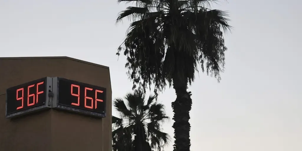
Los Angeles reported 100 degree temperatures for the fifth day in a row on Tuesday, marking the city's longest streak in 63 years. THE TAKEAWAYThe entire West Coast bakes in unseasonably high temperatures through the end of the week. Chilly fall weather that impacted the East Coast earlier this week fades away. Los Angeles records 100 degree temps for the fifth-straight day in a row. The chilly fall temperatures in the East are beginning to slip away, while unseasonably high temperatures refuse to fade on the West Coast. The East is beginning to see more mild temperatures in the 60s and 70s for the remainder of the week, after starting off with a nice chill and chance for a first frost for millions of people across the Northeast. Meanwhile, hot weather continues to plague California with temperatures as high as 100 degrees expected in several locations. PASADENA, CALIFORNIA - OCTOBER 05: An unofficial outdoor thermometer reads 96 degrees amid a long duration October heat wave on October 05, 2026 in Pasadena, California.

Fox Weather·
Weather

Bryan Norcross: Isaias to be a significant hurricane threat for the northern Gulf Coast

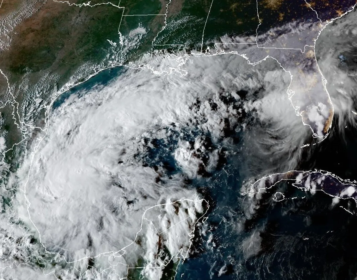
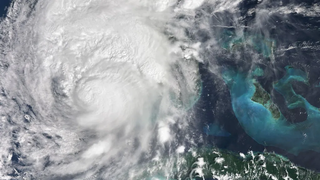
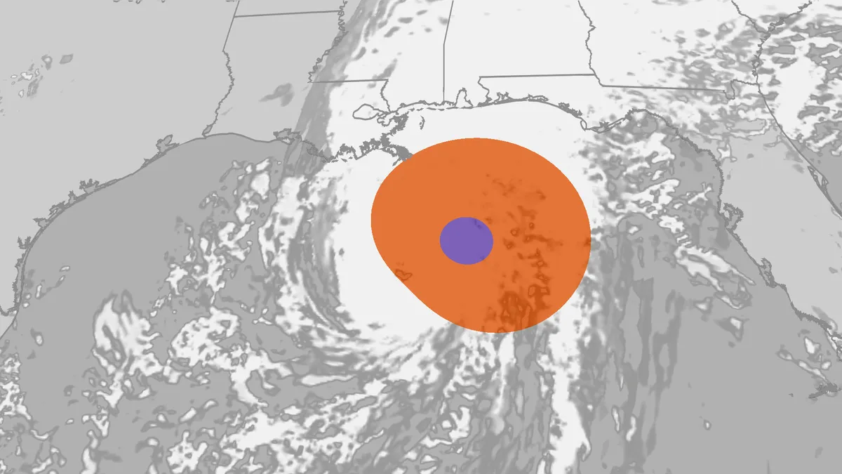
Bryan Norcross: Tropical Storm Isaias to rapidly intensify into dangerous Cat 2 hurricane 🌀EXCLUSIVE ANALYSIS: Tropical Storm Isaias is expected to rapidly intensify into a dangerous Category 2 hurricane and is shaping up to bring heavy rain and dangerous storm surge to the northern Gulf Coast. However, several dynamic factors still remain at play, which will determine how strong and exactly where Isaias will make landfall. FOX Weather Hurricane Specialist Bryan Norcross has the exclusive, in-depth analysis:Last updated at 9:45 a.m. on Oct. 7, 2026The disturbance we've been watching in the southwestern Gulf quickly wrapped up into Tropical Storm Isaias early today. The forecast from the National Hurricane Center and the consensus of the various computer model forecasts is that the storm will impact the northern Gulf Coast as a significant hurricane late Friday or early Saturday. LATEST FROM FOX WEATHER HURRICANE SPECIALIST BRYAN NORCROSS Satellite imagery of Tropical Storm Isaias on Oct. 7, 2026. (CIRA CSU)The exact landfall point is uncertain, but the storm surge, heavy rain, and tornado threat are likely to extend a long distance east of the center of circulation.

Fox Weather·
Weather

Northern Florida beach towns facing a coastal flood threat as relentless rain soaks region throughout the week

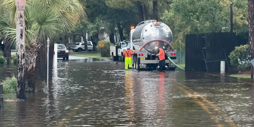
Relentless rain soak Northern Florida, triggers Flood Watches Soaking and relentless rains have been slamming the Sunshine State throughout the week, with up to 12 inches of rain already recorded in the Florida Panhandle. Flood Watches have been triggered along Florida's northern coast, from Jacksonville to Flagler Beach. THE TAKEAWAYA coastal storm has developed just off the northeastern Florida coast, bringing a coastal flood threat and high rip current risk for the First Coast. A Level 1 out of 4 flash flood threat remains in place across parts of the Florida Panhandle and from North Florida into Central Florida through Thursday. Flood Warnings and Flood Watches are in place along Florida's northern coast through Wednesday. The stretch of wet weather in Florida isn’t letting up anytime soon, with several inches of rainfall expected across the state through the end of the week. MILLIONS ACROSS SOUTHEAST FACE DAYS OF HEAVY RAIN, INCREASED FLOOD THREAT IN WET START TO OCTOBERAccording to the FOX Forecast Center, some parts of Florida could see an additional 2 to 5 inches of rain by Thursday. A Level 1 out of 4 flash flood risk covers most of the state through Thursday as well.

Fox Weather·
Weather

Winter 2026/2027 Forecast: New October Data Shows a Colder, Snowier U.S. Shift

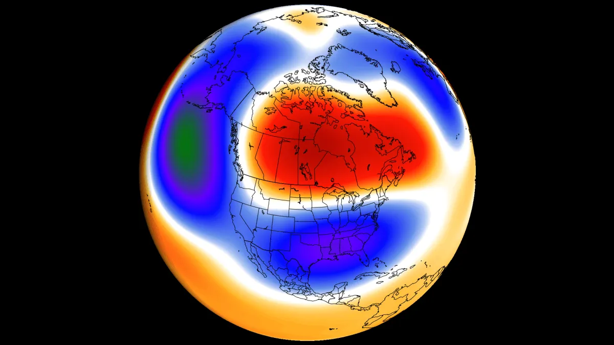
In February 1983, a blizzard buried Washington, Baltimore, and Philadelphia in up to two feet of snow. In January 2016, another historic blizzard shut down the same cities. Both events struck during Super El Niño winters, which most people expect to be mild. Now an even stronger Super El Niño is building toward its December peak ahead of Winter 2026/2027. The latest October forecast data points to a milder northern U. S. and southern Canada, an active and stormy South, and a mild Europe. It also shows a notable shift toward a colder, snowier south-central and eastern U. S., and an unusual Polar Vortex disruption signal around mid-winter. I will break down what shifted in the latest winter forecast data, how the season is expected to unfold, and which other major winter storms past Super El Niño winters delivered. You can also check the updated Winter Forecast Explorer for every state, province, and country across the United States, Canada, and Europe, with the latest temperature and precipitation forecasts.

Severe Weather Europe·
Weather

Tropical Depression Nine forms in the Atlantic on track to be first dangerous hurricane of the season

Tropical Depression Nine has formed off the coast of Mexico in the Gulf of America, and forecasts show it will be the Atlantic's first hurricane this season, making a dangerous landfall threat to the U. S. The system is currently getting better organized, and the National Hurricane Center (NHC) said it is forecast to be a tropical storm on Wednesday and a hurricane on Thursday. The NHC said the system is likely to be a Category 2 hurricane by Friday night, with estimated winds at 100 mph. FARMERS’ ALMANAC RELEASES 2026-2027 WINTER FORECAST: WHAT THEY SAY TO EXPECT FOR BLOCKBUSTER WINTER IN THE USIt will be named Isaias. Tropical Depression Nine stats(FOX Weather) A tropical depression has maximum sustained winds of 38 mph or less, and unlike tropical storms and hurricanes, tropical depressions are identified with numbers and not names. The depression is moving toward the east near 5 mph. HURRICANE RACHEL FORECAST TO TURN BACK TOWARD LAND, BRINGING DANGEROUS SURF TO CALIFORNIA AS SIMON LOOMSThe Hurricane Hunters on Tuesday afternoon are measuring the size of the storm, gathering crucial data for forecasters to help predict the severity of its impacts.

Fox Weather·
Weather

Florida’s wet pattern could bring more rain to Miami this month

Here's a look at what prediction markets are saying about Miami’s chances of seeing rain through the end of the month. THE TAKEAWAYA slow-moving front will keep Florida wet through Thursday. Miami and South Florida could see additional showers and thunderstorms. Saturated ground may lead to isolated flooding, especially in urban and poor-drainage areas. Miami and much of Florida could see more rounds of rain this week as a slow-moving front stalls across the state, adding to a widespread flood threat fueled by days of heavy rainfall. The FOX Forecast Center said up to a foot of rain has fallen across parts of the Florida Panhandle over the past week, with 4 to 6 inches reported from Gainesville to Jacksonville and 3 to 4 inches in pockets across the rest of the state. NORTHERN FLORIDA BEACH TOWNS FACING A COASTAL FLOOD THREAT AS RELENTLESS RAIN SOAKS REGION THROUGHOUT THE WEEKAnother 2 to 5 inches of rain could fall through Thursday. Flooding reported across Okaloosa County.

Fox Weather·
Weather

New Atlantic storm could become the basin's first hurricane this season

The lack of hurricanes in the Atlantic Ocean this season can at least be partly blamed on a "super" El Niño in progress. However, Tropical Depression Nine developed in the Gulf of Mexico on Tuesday and is expected to quickly become Isaias, with some models hinting that it could reach hurricane status shortly after to become the Atlantic basin's first of the season. Interests in the Yucatan Peninsula and the northern U. S. Gulf Coast should closely monitor the progress of this system. Isaias will come to life soonOn Tuesday, Tropical Depresson Nine was born in the Gulf of Mexico. As of Tuesday evening, its maximum, sustained winds are near 55 km/h with higher gusts. Steady strengthening is forecast, and the depression is expected to become a tropical storm by early Wednesday and a hurricane on Thursday. When it becomes named, it will take on the Isaias moniker. Content continues belowThe U. S. National Hurricane Center (NHC) said the depression is expected to pass to the north of the Yucatan Peninsula on Thursday, and approach the U. S. northern Gulf Coast on Friday..

The Weather Network·
Weather

Draconid meteor shower 2026: peak time and viewing guide

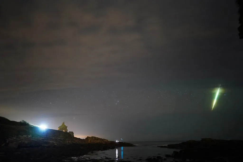
iew of a shooting star (Draconid) and northern light near Skekarsbo at the Farnebofjardens national park 150 kilometers north of Stockholm on October 8, 2011(Getty Images)Most meteor showers demand a 2 a.m. wake-up call. The Draconids are breaking that mold. Will the weather allow you to see the meteor shower? When is the meteor shower? This meteor shower peaks Thursday into the early morning hours of Friday, but there is some good news. The "main maximum" peak of the shower happens at 9 p.m. EDT, much earlier than most meteor showers. If you have to pick a time to go out, this is it.(MORE: The best way to watch a meteor shower)It is earlier because the Draconids’ radiant point, near the constellation Draco the Dragon, sits high in the sky during evening hours for Northern Hemisphere viewers, rather than climbing after midnight like most showers do. This is the year to view this meteor shower because the new moon arrives Saturday. This means the sky is moonless, and even faint, fast-fading meteors should be easier to catch. Get More of Our News on GoogleSet The Weather Company as a 'Preferred Source' to get quicker access to the news you value.

The Weather Channel·
Weather

Magnitude 5.5 earthquake rattles parts of Alaska along Pacific Ring of Fire, noticeable shaking reported

The United States Geological Survey (USGS) said that the quake struck at 10:34 a.m. local time. THE TAKEAWAYS: A magnitude 5.5 earthquake rattled Aleneva, Alaska. The quake struck at 10:34 a.m. local time. Light to moderate shaking was reported in the region. A magnitude 5.5 earthquake rattled the Aleneva, Alaska, region on Tuesday. SCIENTISTS DISCOVER A NEW WAY TO IDENTIFY WHERE MAJOR EARTHQUAKES COULD STRIKEThe United States Geological Survey (USGS) said that the quake struck at 10:34 a.m. local time (2:34 p.m. EST) about 57 miles north-northwest of Aleneva, Alaska at a depth of around 54 miles.  A magnitude 5.5 earthquake struck Aleneva, Alaska.  (FOX Weather / FOX Weather)Light to moderate shaking was reported in the region and residents who live in nearby areas, according to the USGS. WHAT ARE THE LARGEST EARTHQUAKES TO STRIKE THE US? This means the shaking was felt indoors by many people, while only a few people reported feeling it outdoors. An aerial view of Alaska.  (mantaphoto / Getty Images)Dishes, windows and doors were disturbed, while some people reported cracked walls and described the shaking as feeling like a truck had struck the building.

Fox Weather·
Weather

Winter makes an early appearance as Mount Washington records first measurable snow

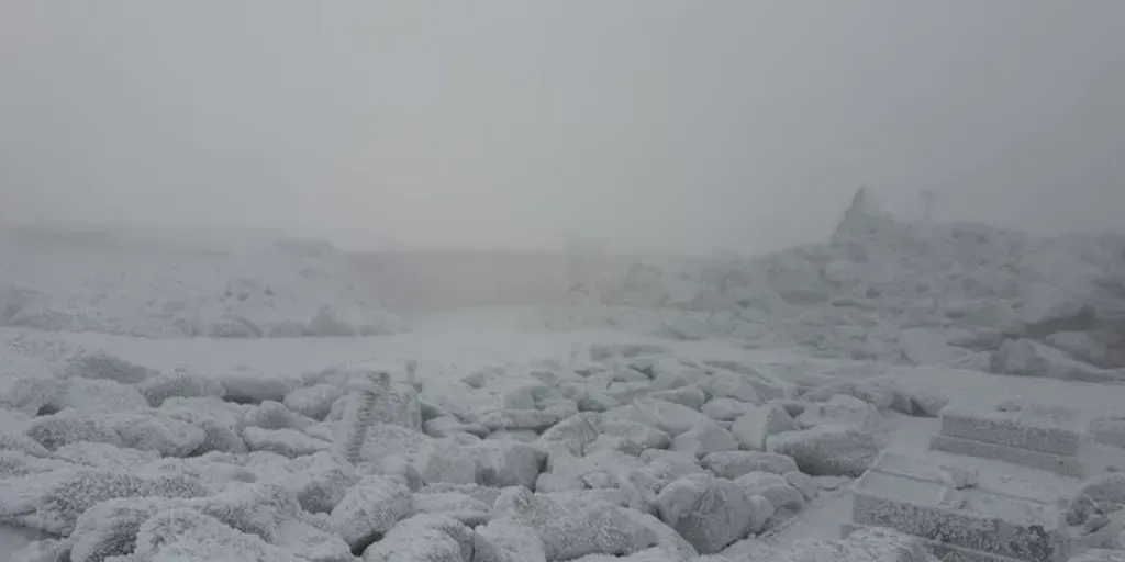
Mount Washington recorded 0.7 inches of snow on Oct. 5, marking the first measurable snowfall of the season at the Northeast’s highest peak. THE TAKEAWAYMount Washington recorded 0.7 inches of snow in its first measurable snowfall of the season. The summit averages nearly 24 feet of snow annually. Extreme winds, cold and ice are common as winter approaches. MOUNT WASHINGTON, N. H. – The Northeast's highest peak has recorded its first measurable snowfall of the season as colder temperatures settle across the region’s tallest summits, signaling the changing season in the mountains. On Oct. 5, nearly an inch of snow fell in 24 hours on New Hampshire's Mount Washington. The first measurable snowfall of the season was recorded yesterday (October 5th), with 0.7" of snow measured over the last 24 hours.  (@MWObs / X)Standing at an elevation of 6,288 feet, Mount Washington is the tallest mountain in the northeastern United States, and is often the first location to see measurable snowfall in the region each fall.

Fox Weather·
Weather

How do solar storms affect us?

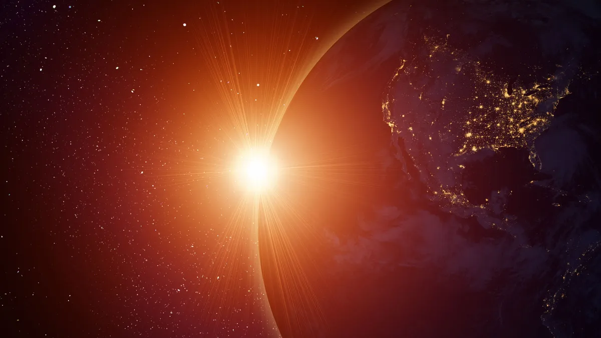
How a major solar storm could knock out GPS and power grids"If that had hit, it would have been a world-changing event. Billions of dollars — in terms of loss: power lines, communication grids, electronics in general … And honestly no one’s really prepared for that today. "That’s Andrew Gerrard, director at the Center for Solar-Terrestrial Research at the New Jersey Institute of Technology. He breaks down space weather: solar storms in their full range from the tiniest, practically unnoticeable storms to a global catastrophe. The science of solar radiation storms“When we talk about space weather, it’s kind of like talking about our daily weather here on the surface of the Earth,” Gerrard explains. “A large fraction of that variation comes from the sun. On the sun, there are very intense magnetic fields.”This can generate solar flares, which are bursts of electromagnetic waves of light.

The Weather Channel·
Weather

Saints mark 20th anniversary of the reopening of the Superdome after Hurricane Katrina

NEW ORLEANS — Sept. 25, 2006: A white jersey streaked right through the middle of the punt formation and New Orleans Saints special teams standout, Steve Gleason, blocked an Atlanta Falcons punt just outside their own end zone, leading to a scoop-and-score touchdown that sent more than 70,000 roaring fans into a frenzy in the Saints' first game in the Superdome since being ravaged by Hurricane Katrina. BASEBALL IN THE WILD? MLB EYES ICONIC NATIONAL PARK FOR FUTURE NEUTRAL-SITE GAMEThe Saints and the NFL marked the 20th anniversary of "The Rebirth" or "Domecoming" game, as it has come to be known by fans, Monday night with a special pregame remembrance ceremony. next NEW ORLEANS, LOUISIANA - OCTOBER 05: New Orleans Saints fans ride a float during the Rebirth Parade celebrating Steve Gleason prior to the game against the Atlanta Falcons at Caesars Superdome on October 05, 2026 in New Orleans, Louisiana.

Fox Weather·
Weather

Bryan Norcross: Gulf disturbance tagged Invest 92L showing some signs of organization

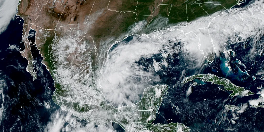
Last updated at 11:30 a.m. on Oct. 6, 2026The disturbance in the Gulf – officially designated by the National Hurricane Center as Invest 92L – is still disorganized but showing signs of coming together. The system is drifting off the coast of Mexico in a part of the Gulf where the curvature of the coastline sometimes helps circulations get going. LATEST FROM FOX WEATHER HURRICANE SPECIALIST BRYAN NORCROSS Satellite imagery of the Gulf on Oct. 6, 2026. (CIRA)The weather pattern is complicated. If the system organizes and strengthens over the next day or so, it will likely be pulled north as Tropical Storm Isaias. But if it stays weaker longer and lollygags over the southern Gulf, it's more likely to get stuck in the Gulf. GROWING POTENTIAL FOR INVEST 92L TO INTENSIFY INTO HURRICANE ISAIAS AS DATA REVEALS ITS TRACK UNCERTAINTYUpper-level winds are forecast to remain hostile over the extreme northern Gulf and only be moderately supportive over the central Gulf. Plus, there is very dry air over Texas that will wrap into the system. That combination of factors would seem to favor an upper limit on the system's intensity in the tropical-storm range. Atlantic Basin on Oct. 6, 2026.

Fox Weather·
Weather

What does the Saffir-Simpson Hurricane Wind Scale mean?

Hurricane categories explained: what each wind speed meansThe Saffir-Simpson Hurricane Wind Scale is one tool for assessing the intensity of a hurricane. Each Category has a description of what it means in terms of wind impacts, but there is more to hurricanes than just wind speed. What it measuresThe Saffir-Simpson Hurricane Wind Scale rates a hurricane's sustained winds. That means gusts can be higher than the category's range. Category 1: Sustained winds of 74 - 95 mphCategory 2: Sustained winds of 96 - 110 mphCategory 3: Sustained winds of 111 - 129 mphGet More of Our News on GoogleSet The Weather Company as a 'Preferred Source' to get quicker access to the news you value. Category 4: Sustained winds of 130 - 156 mphCategory 5: Sustained winds greater than 157 mphMajor hurricanes are Category 3 or higher on the scale. Saffir-Simpson Hurricane Wind ScaleDamage by categoryIn general, wind damage rises by about a factor of four for every category increase. Category 1 hurricanes have "some damage," which means that well-constructed homes could have some damage to roofs, shingles, vinyl siding and gutters.

The Weather Channel·
Weather

How you can prepare your pets big and small for hurricane season

How to build a hurricane-preparedness kit for your petsHurricane season is here, which means it's time to make sure both you and your pets are prepared in case any storms come your way. Hurricanes are slow movers, but once alerts are issued for your area or evacuation orders are in effect, it may be too late to fully prepare the furrier members of your family for the incoming storm. Step 1: Assemble your hurricane preparedness kitHaving supplies specifically set aside for emergencies like a hurricane means you are less likely to get caught unprepared when a hurricane impacts your area, whether that means power outages and water disruptions or evacuations.

The Weather Channel·