Northern Florida beach towns facing a coastal flood threat as relentless rain soaks region throughout the week
This story deserves to be shared
Send it to someone who'd care, or post it on your networks.
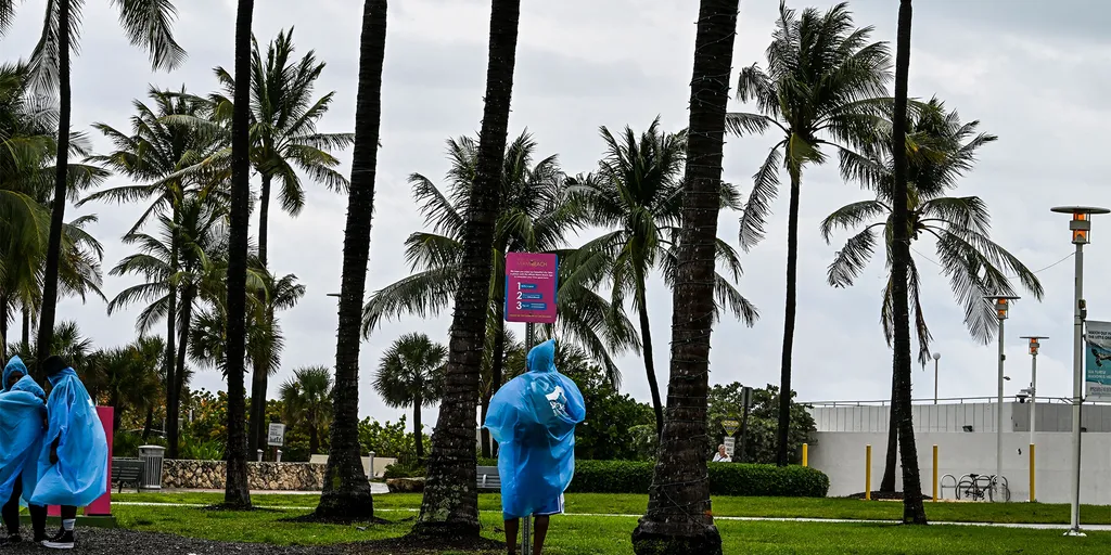
Relentless rain soak Northern Florida, triggers Flood Watches Soaking and relentless rains have been slamming the Sunshine State throughout the week, with up to 12 inches of rain already recorded in the Florida Panhandle. Flood Watches have been triggered along Florida's northern coast, from Jacksonville to Flagler Beach. THE TAKEAWAYA coastal storm has developed just off the northeastern Florida coast, bringing a coastal flood threat and high rip current risk for the First Coast. A Level 1 out of 4 flash flood threat remains in place across parts of the Florida Panhandle and from North Florida into Central Florida through Thursday. Flood Warnings and Flood Watches are in place along Florida's northern coast through Wednesday. The stretch of wet weather in Florida isn’t letting up anytime soon, with several inches of rainfall expected across the state through the end of the week. MILLIONS ACROSS SOUTHEAST FACE DAYS OF HEAVY RAIN, INCREASED FLOOD THREAT IN WET START TO OCTOBERAccording to the FOX Forecast Center, some parts of Florida could see an additional 2 to 5 inches of rain by Thursday. A Level 1 out of 4 flash flood risk covers most of the state through Thursday as well.
This article is an excerpt. To read the full content, visit the original source. Fox Weather
Related articles

Weekend washout to drench Southern Florida with relentless heavy rain and flooding
A level 1 out of 4 flash flood threat is in effect for Saturday and Sunday, with Fort Lauderdale and Miami included. Florida faces wet weekend ahead of peak King TIdes Showers and gusty winds are powering up for the Sunshine State, where a level 1 out of 4 flash flood threat is in effect for South Florida. A widespread 2 to 3 inches of rain is forecast for the region. THE TAKEAWAYDays of nasty weather full of heavy rain and gusty winds will hit South Florida this weekend. A widespread 2 to 3 inches of rain is expected across the Southeast through Monday. Temperatures in the mid-to-upper 80s will make conditions uncomfortable amid thunderstorms and heavy rain. FLORIDA – Wet weather returns to parts of the Sunshine State this weekend, after brief relief, as persistent rain and strong wind gusts create a messy scene for thousands. A stalled frontal boundary is hanging over Florida, bringing soggy, gusty conditions through the weekend for southern portions of the state.
Relentless rain prompts states of emergency in Nova Scotia
An impactful, slow-moving storm continues causing some major issues across Nova Scotia. Local states of emergency are in effect for Inverness, Richmond and Victoria counties as the region deals with the fallout from very heavy rainfall and gusty winds over the past couple of days. DON’T MISS: Staying safe from flash floods, a serious and deadly hazardSome areas have reported as much as 250 mm of rain as of Saturday evening, leading to rising waters and road washouts in some areas. The worst of the rain is over. However, we’ll continue to see precipitation through Monday as the system slowly pulls away from the Maritimes. Parts of Nova Scotia may see an additional 20-30 mm of rainfall through Monday. Gusty winds have also caused issues throughout the province, with 38,000 customers without power at one point. We’ll see the wind gusts ease into Saturday night, reducing the risk for additional outages. WATCH: What’s in store across Canada this September?
0 comments
No comments yet. Be the first to share your thoughts!