Will We Ever Be Able To Forecast Volcanic Eruptions Like Weather? - Quanta Magazine
This story deserves to be shared
Send it to someone who'd care, or post it on your networks.
This article is an excerpt. To read the full content, visit the original source. Quanta Magazine
Related articles
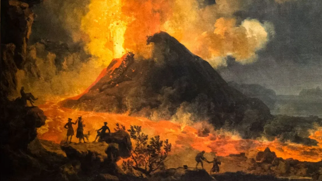
‘The Sun was dark and its darkness lasted for 18 months’ – what we can learn from worst volcanic eruptions in history
The worst volcanic eruptions in history: when the sun went darkEurope was plunged into darkness and suffered from intense crop failures and famines in the years A. D. 536 and A. D. 1258, after massive volcanic eruptions. When many people think of volcanic eruptions, they envisage deadly lava flows and suffocating ash fall. The fate of the inhabitants of Pompeii after the eruption of Mount Vesuvius in the year A. D. 79 still resonates today. Yet, volcanic eruptions have more wide-ranging consequences than is often realised, and this is recorded in historical accounts. Large volcanic eruptions emit gases and ash particles into the atmosphere. Although the ash itself settles within weeks, the aerosols spread around the planet and can remain suspended in the atmosphere for years. Ice cores – long cylindrical samples drilled from glaciers – reveal these past sediment layers over hundreds of thousands of years. What we can see from studying historic records is that volcanic eruptions can produce climatic changes, and rapid spread of disease such as plague. They can also affect weather systems far beyond the immediate vicinity of the volcano itself.
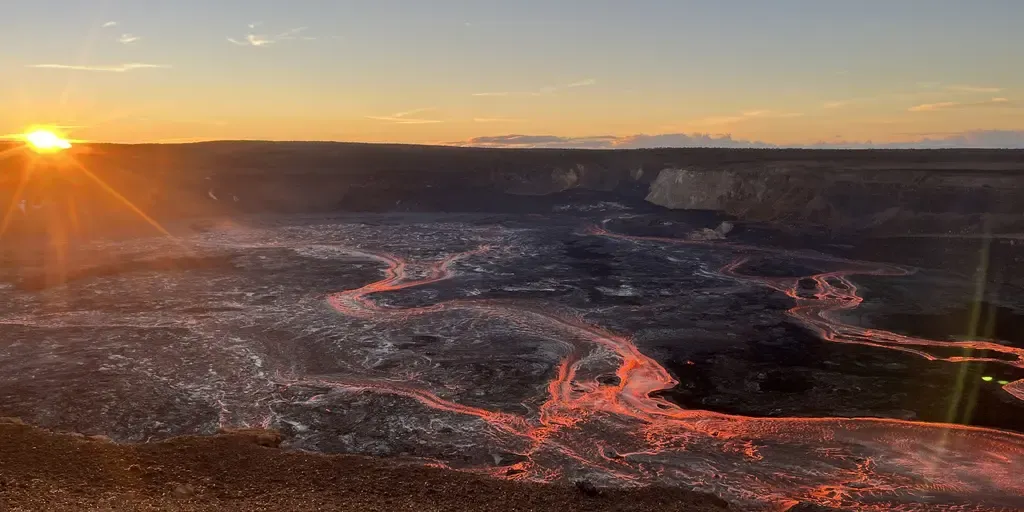
What happens when a hurricane collides with Hawaii’s massive volcanoes?
HAWAII – As any hurricane barrels toward Hawaii, it poses a threat to Mount Kilauea and the rest of the islands. With a second tropical storm expected to impact Hawaii in the span of a week, there is a lingering threat to Mount Kilauea, which has erupted 53rd times in less than two years. The 54th eruptive episode is imminent, and is expected to happen any time between now and Aug. 27, according to the USGS. HAWAII'S KILAUEA ERUPTS FOR 53RD TIME IN LESS THAN 2 YEARS, SENDS SMOKE PLUME SOARING 18,000 FEET INTO THE SKYDuring the latest eruption, lava fountains peaked at 500 feet, and the ash plume reached over 18,000 feet above sea level. Kilauea's 53rd eruptive episode on Aug. 12, 2026. (USGS / FOX Weather)If an eruption were to occur during a hurricane, it could lead to catastrophic events such as deadly flooding from rain and strong winds. When volcanic ash mixes with enough water, it can erode, be transported and eventually move downslope. UNDERSTANDING THE PACIFIC RING OF FIRE: WHERE EARTHQUAKES AND VOLCANOES MEETAccording to the United States Geological Survey, when this occurs, it can look like a mass of wet concrete flowing down violently.
Alert issued as plume of volcanic ash reaches West Coast - The Weather Network
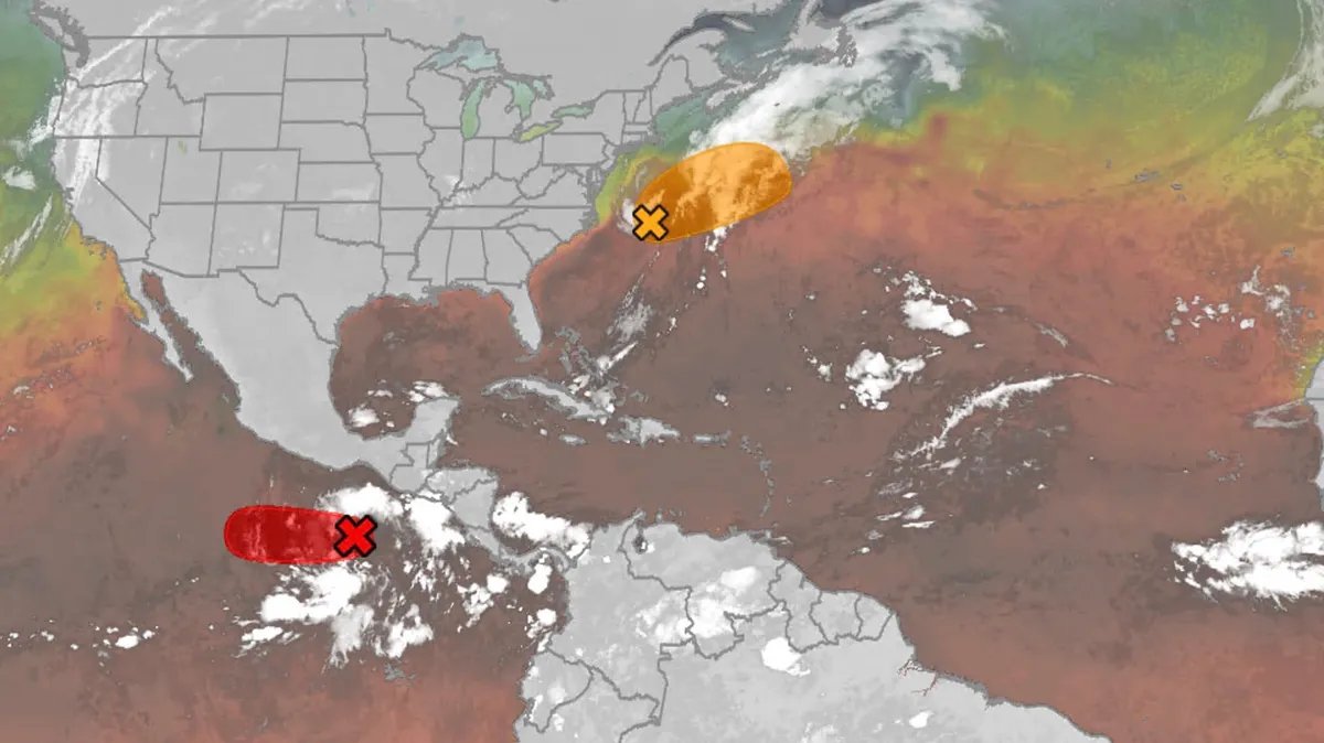
Hurricane season maps tracker: Latest forecasts and more
We have the maps you need to track all the systems ongoing in the Pacific and Atlantic below. Tracking the AtlanticTropical development areasSea surface temperatures Wind shear These are areas of strong wind shear, the difference in wind speed and direction with height, which are shown in purple. High wind shear is hostile to mature tropical cyclones and those trying to develop.(MORE: What is wind shear?)Get More of Our News on GoogleSet The Weather Company as a 'Preferred Source' to get quicker access to the news you value. Dry, dusty airAnother nemesis of tropical systems is dry air. In hurricane season, plumes of dust-laden air stream across the basin from Africa's Sahara Desert, as you can see in the map below. This sinking, dry air squelches thunderstorm development, the building blocks of tropical storms and hurricanes. So areas in the brown shading below are generally unfavorable for development. Atlantic tracks so far this seasonThese are the tracks of systems that were at least tropical or subtropical storms so far in the Atlantic Basin.
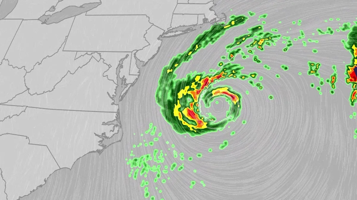
Nor'easter lashes coast from Carolinas to Northeast
An October nor'easter is meandering off the Atlantic coast, where it will bring high surf, rip currents, coastal flooding and winds to parts of the East Coast for several days this week. The National Hurricane Center has highlighted it as an area to watch this week for the potential development of Josephine. However, regardless of whether we call this system a nor'easter or Josephine, the impacts will be the same. The bottom line: This system will bring dangerous conditions to the East Coast for multiple days this week.(MORE: What is a nor'easter?)ImpactsWhile we do not expect this storm to be as strong as the late September nor'easter, there will still be some impacts. They are broken down below: Coastal floodingGet More of Our News on GoogleSet The Weather Company as a 'Preferred Source' to get quicker access to the news you value. The area most likely to be impacted the longest appears to stretch from the Delmarva Peninsula to eastern North Carolina. Coastal flood alerts are in effect for parts of coastal North Carolina, where anywhere from 1 to 4 feet of inundation is possible.
0 comments
No comments yet. Be the first to share your thoughts!