Sudbury weather update: Localized flooding possible as heavy rain expected - Sudbury Star
This story deserves to be shared
Send it to someone who'd care, or post it on your networks.
This article is an excerpt. To read the full content, visit the original source. Sudbury Star
Related articles

Powerful line of storms sweeps southern Ontario, causing localized damage
A stout line of severe thunderstorms swept through southern Ontario on Wednesday with high winds, hail, torrential downpours and tornado warnings. The storms brought down trees and power lines throughout the region, producing enough rainfall to cause localized flooding. Around 7:25 p.m. EDT on Wednesday, CP24 reported police were actively rescuing people from flooded cars across Toronto after a heavy downpour left about 65,000 residents without power. Jane Street and Highway 7 flooding and rescue operation in Vaughan, Ont. (Jeremy Cohn/Submitted to The Weather Network)According to other reports, another rescue operation happened at the Jane Street and Highway 7 intersection in Vaughan, Ont., after major flooding occurred. Numerous vehicles were trapped in floodwaters and people were rescued by the Vaughan Fire and Rescue Service. It was reported that 20 vehicles were caught in the floodwaters. Multiple road closures and accidents were reported across the Greater Toronto Area (GTA) as a result of flooding and winds. As well, numerous events were postponed or cancelled. Many areas picked up 20-130+ mm of rain in short order, which led to flooding issues on some area roadways.
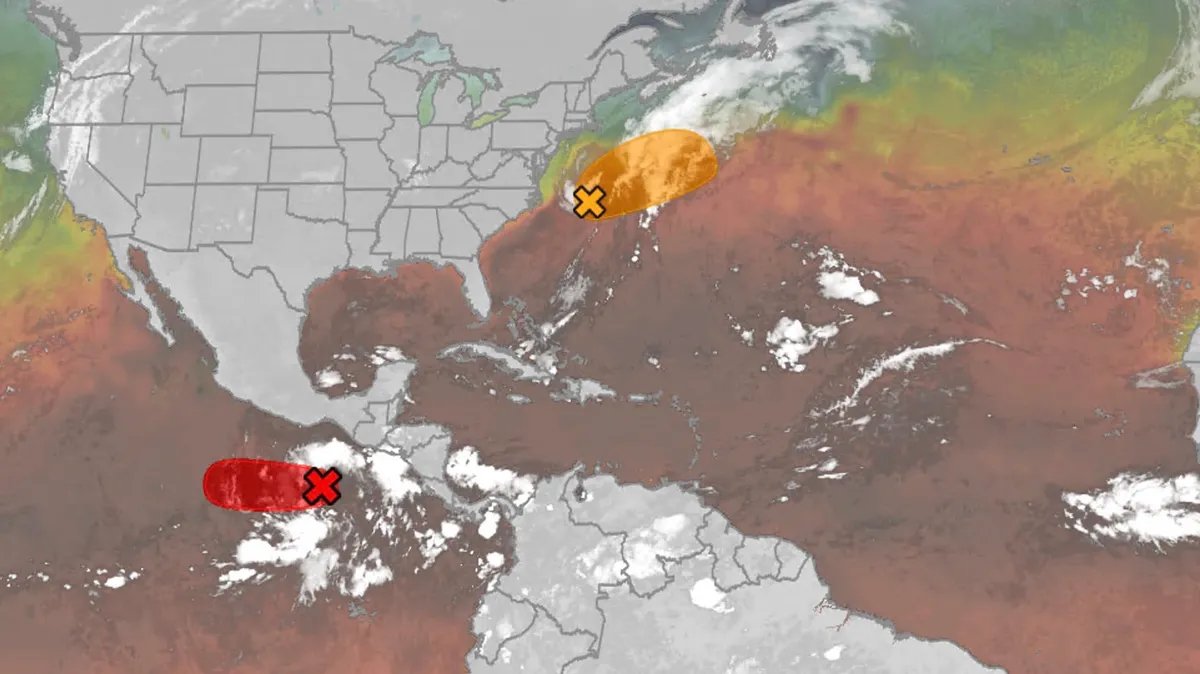
Hurricane season maps tracker: Latest forecasts and more
We have the maps you need to track all the systems ongoing in the Pacific and Atlantic below. Tracking the AtlanticTropical development areasSea surface temperatures Wind shear These are areas of strong wind shear, the difference in wind speed and direction with height, which are shown in purple. High wind shear is hostile to mature tropical cyclones and those trying to develop.(MORE: What is wind shear?)Get More of Our News on GoogleSet The Weather Company as a 'Preferred Source' to get quicker access to the news you value. Dry, dusty airAnother nemesis of tropical systems is dry air. In hurricane season, plumes of dust-laden air stream across the basin from Africa's Sahara Desert, as you can see in the map below. This sinking, dry air squelches thunderstorm development, the building blocks of tropical storms and hurricanes. So areas in the brown shading below are generally unfavorable for development. Atlantic tracks so far this seasonThese are the tracks of systems that were at least tropical or subtropical storms so far in the Atlantic Basin.
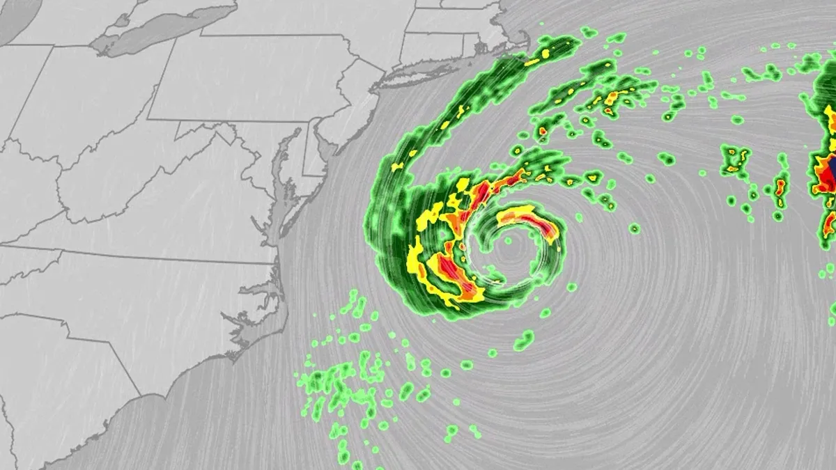
Nor'easter lashes coast from Carolinas to Northeast
An October nor'easter is meandering off the Atlantic coast, where it will bring high surf, rip currents, coastal flooding and winds to parts of the East Coast for several days this week. The National Hurricane Center has highlighted it as an area to watch this week for the potential development of Josephine. However, regardless of whether we call this system a nor'easter or Josephine, the impacts will be the same. The bottom line: This system will bring dangerous conditions to the East Coast for multiple days this week.(MORE: What is a nor'easter?)ImpactsWhile we do not expect this storm to be as strong as the late September nor'easter, there will still be some impacts. They are broken down below: Coastal floodingGet More of Our News on GoogleSet The Weather Company as a 'Preferred Source' to get quicker access to the news you value. The area most likely to be impacted the longest appears to stretch from the Delmarva Peninsula to eastern North Carolina. Coastal flood alerts are in effect for parts of coastal North Carolina, where anywhere from 1 to 4 feet of inundation is possible.
0 comments
No comments yet. Be the first to share your thoughts!