Relentless rain shifts east as flooding threat remains for parts of water-logged Southwest
This story deserves to be shared
Send it to someone who'd care, or post it on your networks.
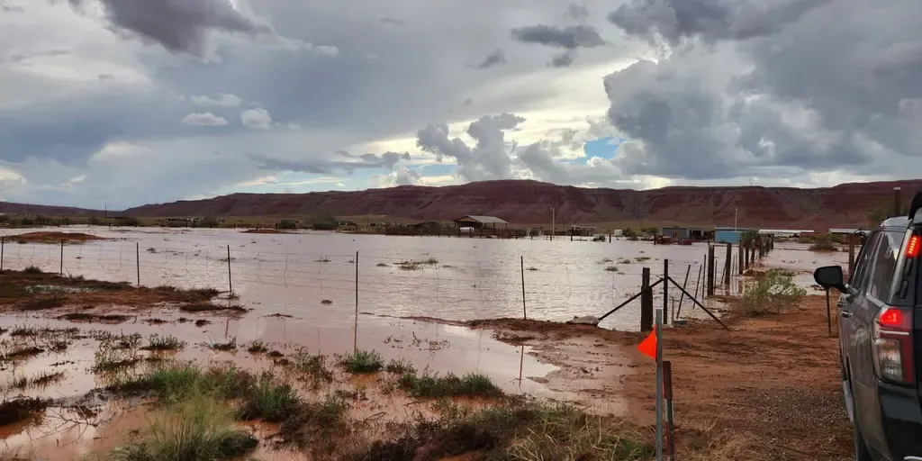
THE TAKEAWAYA Level 1 out of 4 flash risk covered parts of the Four Corners on Friday and Saturday. At least 3 people died as a monsoon-fueled storm triggered heavy rain and flooding. Storms weaken as they shift east. The relentless flood threat plaguing the Southwest this week is finally winding down, following deadly flash flooding in New Mexico on Wednesday. NOAA's Weather Prediction Center (WPC) issued a Level 1 out of 4 risk of flash flooding Friday for parts of eastern Arizona, eastern Utah and much of Colorado and New Mexico, including Albuquerque and Denver. A confirmed tornado touched down Friday in the mountains east of Fruit Heights, Utah, with astonishing video capturing the twister on the ground. MUST WATCH: High elevation Utah tornado caught-on-camera spinning at 7,500 feet A confirmed tornado touched down Friday in the mountains east of Fruit Heights, Utah, with astonishing video capturing the twister on the ground. The National Weather Service said the tornado touched down shortly after 1:50 p.m.
This article is an excerpt. To read the full content, visit the original source. Fox Weather
Related articles

Weekend washout to drench Southern Florida with relentless heavy rain and flooding
A level 1 out of 4 flash flood threat is in effect for Saturday and Sunday, with Fort Lauderdale and Miami included. Florida faces wet weekend ahead of peak King TIdes Showers and gusty winds are powering up for the Sunshine State, where a level 1 out of 4 flash flood threat is in effect for South Florida. A widespread 2 to 3 inches of rain is forecast for the region. THE TAKEAWAYDays of nasty weather full of heavy rain and gusty winds will hit South Florida this weekend. A widespread 2 to 3 inches of rain is expected across the Southeast through Monday. Temperatures in the mid-to-upper 80s will make conditions uncomfortable amid thunderstorms and heavy rain. FLORIDA – Wet weather returns to parts of the Sunshine State this weekend, after brief relief, as persistent rain and strong wind gusts create a messy scene for thousands. A stalled frontal boundary is hanging over Florida, bringing soggy, gusty conditions through the weekend for southern portions of the state.

Northern Florida beach towns facing a coastal flood threat as relentless rain soaks region throughout the week
Relentless rain soak Northern Florida, triggers Flood Watches Soaking and relentless rains have been slamming the Sunshine State throughout the week, with up to 12 inches of rain already recorded in the Florida Panhandle. Flood Watches have been triggered along Florida's northern coast, from Jacksonville to Flagler Beach. THE TAKEAWAYA coastal storm has developed just off the northeastern Florida coast, bringing a coastal flood threat and high rip current risk for the First Coast. A Level 1 out of 4 flash flood threat remains in place across parts of the Florida Panhandle and from North Florida into Central Florida through Thursday. Flood Warnings and Flood Watches are in place along Florida's northern coast through Wednesday. The stretch of wet weather in Florida isn’t letting up anytime soon, with several inches of rainfall expected across the state through the end of the week. MILLIONS ACROSS SOUTHEAST FACE DAYS OF HEAVY RAIN, INCREASED FLOOD THREAT IN WET START TO OCTOBERAccording to the FOX Forecast Center, some parts of Florida could see an additional 2 to 5 inches of rain by Thursday. A Level 1 out of 4 flash flood risk covers most of the state through Thursday as well.
Millions under prolonged flash flood threat as relentless storms pummel Midwest, Central Plains
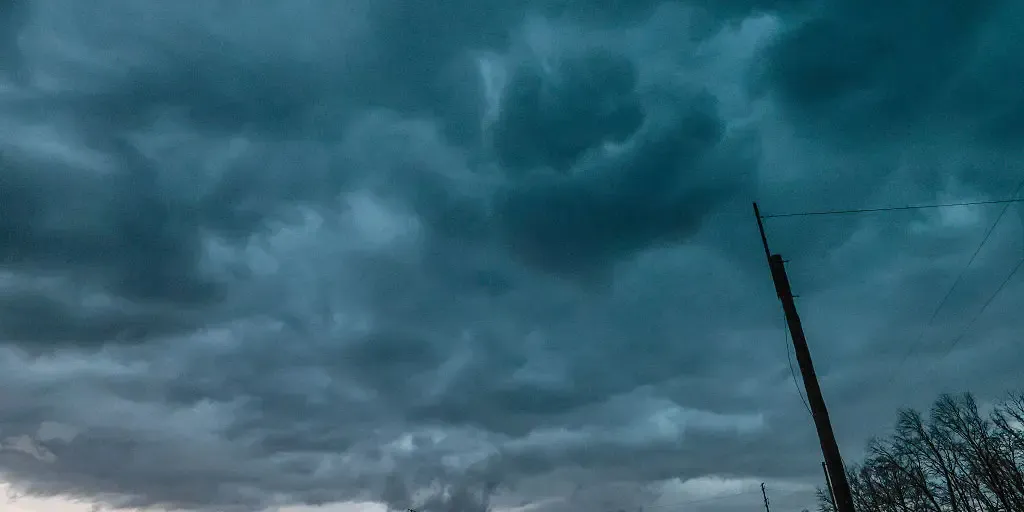
THE TAKEAWAYA persistent pattern is set to bring heavy rain, flooding and severe storms to the Midwest and Middle Mississippi Valley into Saturday. Rounds of thunderstorms and downpours developed from the Texas Panhandle, across the Midwest to the Great Lakes on Tuesday. The heaviest rain is expected just north of Kansas City, across parts of Kansas and Missouri, where a Level 3 flash flood threat is in effect into Wednesday morning. Relentless storms are slamming parts of the Midwest and Central Plains as a stalled weather pattern fuels a weeklong flash flood threat that will last into Saturday. A Level 2 out of 4 risk of flash flooding stretches across a corridor from Amarillo, Texas, across Missouri to northern Indiana. FLOODING RAIN, THUNDERSTORMS THREATEN MAJOR EAST COAST CITIES AS ONGOING DOWNPOURS DRENCH NORTHEASTThe storms will increase the danger of flash flooding as additional downpours move across an already waterlogged region. Intense rain slammed Council Bluffs, Iowa, on Monday, Sep. 15, 2026. (@weatherA_H via Storyful)The stormy pattern began Monday when severe storms swept through parts of Nebraska and Iowa.
Relentless rain prompts states of emergency in Nova Scotia
An impactful, slow-moving storm continues causing some major issues across Nova Scotia. Local states of emergency are in effect for Inverness, Richmond and Victoria counties as the region deals with the fallout from very heavy rainfall and gusty winds over the past couple of days. DON’T MISS: Staying safe from flash floods, a serious and deadly hazardSome areas have reported as much as 250 mm of rain as of Saturday evening, leading to rising waters and road washouts in some areas. The worst of the rain is over. However, we’ll continue to see precipitation through Monday as the system slowly pulls away from the Maritimes. Parts of Nova Scotia may see an additional 20-30 mm of rainfall through Monday. Gusty winds have also caused issues throughout the province, with 38,000 customers without power at one point. We’ll see the wind gusts ease into Saturday night, reducing the risk for additional outages. WATCH: What’s in store across Canada this September?
Relentless rain, blocked weather patterns and an occlusion graveyard - Royal Meteorological Society
Orionid meteor shower 2026: cloud cover forecast by region
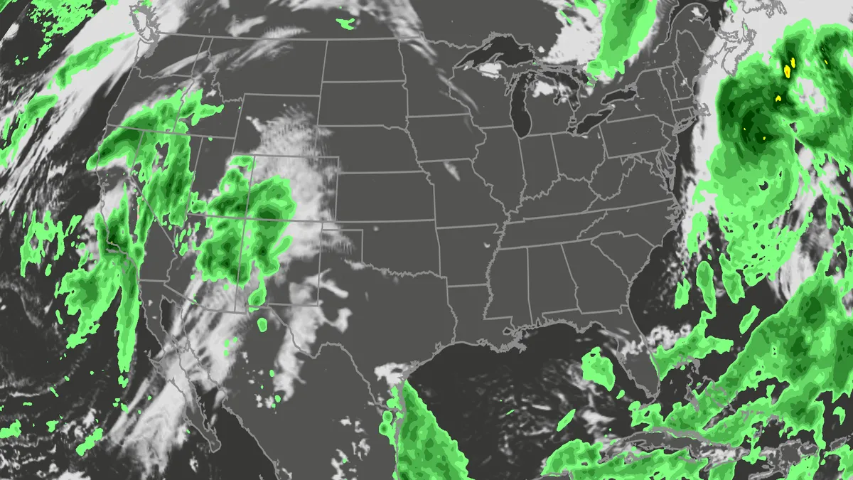
A meteor streaks across the sky over a desert in China during the Orionid meteor shower on Oct. 22, 2023.(VCG/VCG via Getty Images)The Orionid meteor shower is peaking this week, and it promises to be one of the most dazzling displays of the year. And while some of you will have clear skies, rain and clouds could impact the view for others. Here's what you need to know about the Orionids and your forecast:Fast factsPeak day: The meteor shower peaks Wednesday night, Oct. 21, into the early hours of Thursday morning, Oct. 22. Peak time: From midnight to dawn are the best hours to catch the meteors streaking through the sky, so plan on a late night or really early morning. What the Orionids are known for: The Orionid meteors are known for their brightness and their speed. As they streak across the sky at around 41 miles per second, the meteors leave behind a glowing "train" that can last several seconds to minutes. While you can make the perfect plan to catch the Orionids, the key to stellar viewing is still in Mother Nature's hands. The good news is that many of you should have good meteor shower-watching conditions. Much of the central and eastern U. S.
0 comments
No comments yet. Be the first to share your thoughts!