BBlogFlow

Categories

Weather

5146 articles

Weather

2026 Atlantic season's first hurricane: A record wait?

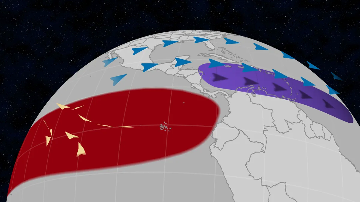
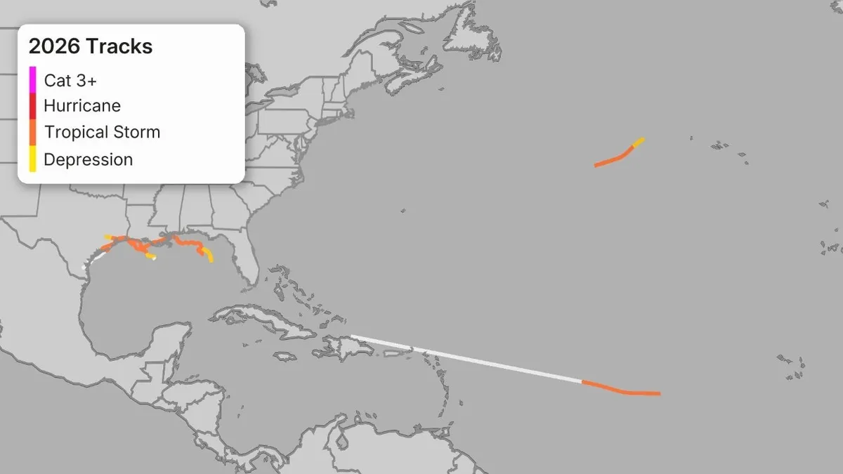
Hurricanes that didn’t care about super El NiñoThe 2026 Atlantic hurricane season has yet to produce a single hurricane, and it could become the longest wait on record in the modern era. None for 2026, so farWe've had five tropical storms so far, but no hurricanes in the Atlantic Basin as of early September, including Tropical Storm Edouard. But it's not called the Atlantic tropical storm season. It's hurricane season, and this one has been shut out of hurricanes for the first three-plus months. That's largely due to the intensifying El Niño generating hostile conditions for hurricanes, like high wind shear and dry, sinking air over key stretches of the tropical Atlantic Basin. When it usually happensWe examined data from the last 60 hurricane seasons, from the first year satellites routinely covered the basin in 1966 through 2025. The average date of the season's first hurricane in that 60-year satellite era was July 27. Get More of Our News on GoogleSet The Weather Company as a 'Preferred Source' to get quicker access to the news you value. As the graph below shows, that first hurricane arrived most often either in July or August.

The Weather Channel·
Weather

Eyewall replacement cycles: Why storms shed speed for size

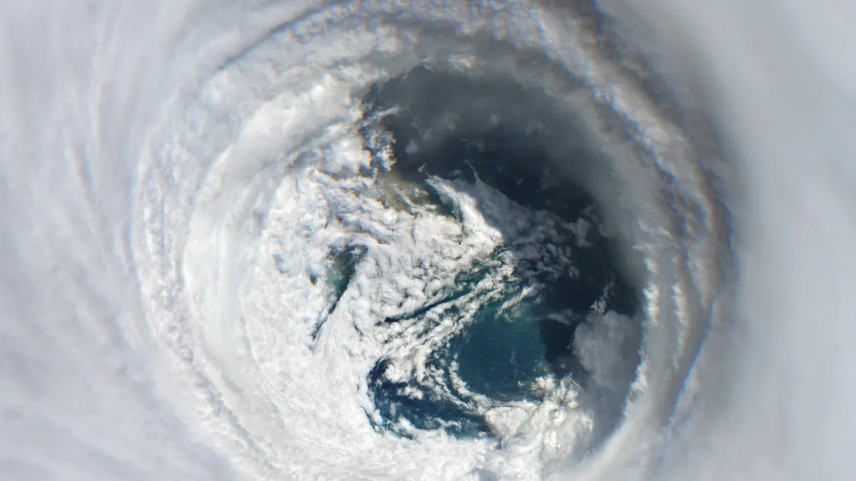
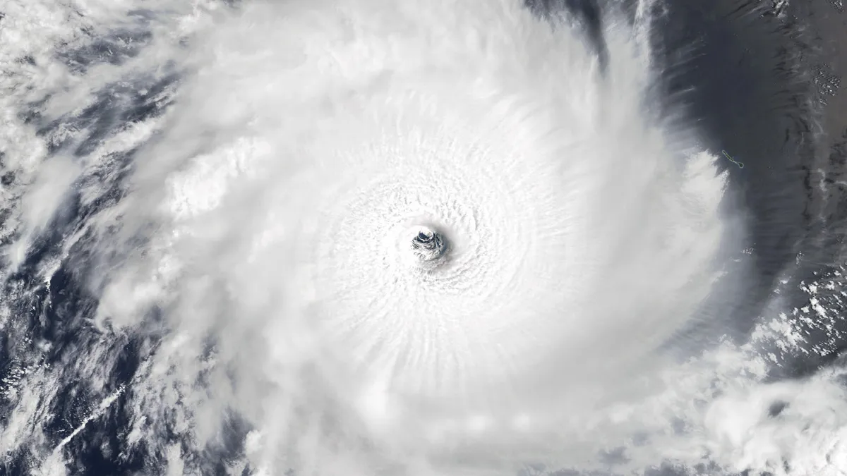
Meteorologist explains a hurricane’s eyewall replacement cycleDeep inside a hurricane, the fiercest part of the storm — the eyewall —can be quietly choked out and replaced. This is called an eyewall replacement cycle, and it comes with a major trade-off. The storm's peak wind speed falls temporarily, but the entire wind field expands, causing even more widespread impacts. Here's what you need to know: Q: What is an eyewall replacement cycle? It's the process by which a strong hurricane grows a second, larger eyewall outside its original one — and that new outer ring gradually strangles and then replaces the inner one. This new eye makes more room for convection and energy, which can spread the hurricane-force winds over a larger area. These cycles occur when the original eyewall can't maintain its structure. This can happen when the eye becomes too small or winds become too strong. This leads to the eyewall breaking down. (MORE: Why the eyewall is the most intense part of a storm)Get More of Our News on GoogleSet The Weather Company as a 'Preferred Source' to get quicker access to the news you value. Q: What are the phases?1.

The Weather Channel·
Weather

Burning Man weather: Wildfire smoke, heat, thunderstorms?

The Temple at Burning Man in the Black Rock Desert in Nevada on August 30, 2017.(Julia Beverly/Getty Images)Burning Man is underway in the Nevada desert and the weather could include wildfire smoke, heat and thunderstorms, each of which would have impacts on this year's event. The annual festival celebrating art and self-expression takes place in the Black Rock Desert about 120 miles north-northeast of Reno. The gates officially opened just after midnight early Sunday morning, and the event ends the following Sunday night, Sept. 6. Wildfire smoke is one concernThere are over a half dozen wildfires burning in parts of northwest Nevada, including the Hawk Fire, which earlier prompted evacuations of more than 90,000 residents northwest of Reno. None of these wildfires are directly threatening the Burning Man site. However, any southwest wind that persists long enough could blow some smoke from the Hawk Fire and two others (Bug, Stallion) north of Reno toward the Black Rock Desert. Get More of Our News on GoogleSet The Weather Company as a 'Preferred Source' to get quicker access to the news you value.

The Weather Channel·
Weather

Unusual, widespread snow blankets Chile's Atacama Desert

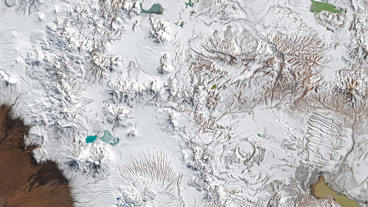
Part of northern Chile transforms from bare to snow-covered in these images captured before and after winter storms in August 2026 by the NASA-USGS Landsat 8 and Landsat 9 satellites.(NASA Earth Observatory/Lauren Dauphin)When you hear the word desert, your brain likely conjures images of vast, barren, sand-covered landscapes — but in August, the Atacama Desert looked anything but that. Rare, widespread snow covered one of the most notoriously dry places on Earth, leaving it looking like a winter wonderland. The weather behind the spectacleA winter storm brought about the dramatic change between the first photo taken on Aug. 6 and the second taken on Aug. 14. But wait — winter storms in August? Yes, remember that the Southern Hemisphere has opposite seasons from us in the Northern Hemisphere, so they are currently wrapping up their winter months. Another winter storm passed through on Aug. 19, blanketing an even wider area with fresh snowfall, shown in the image below. Get More of Our News on GoogleSet The Weather Company as a 'Preferred Source' to get quicker access to the news you value.

The Weather Channel·
Weather

Magnitude 3.6 earthquake rattles South Texas, shaking felt in Falls City

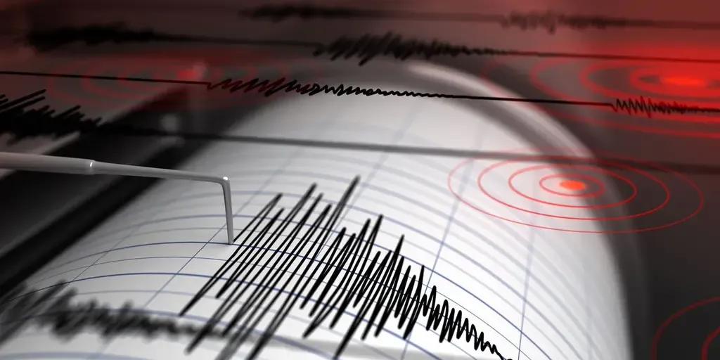
The quake was felt in Falls City and other places in Karnes and Wilson counties. FALLS CITY, Texas — A magnitude 3.6 earthquake shook part of South Texas Tuesday morning, with an epicenter about 45 miles north-northwest of San Antonio, according to the USGS. It happened just before 9:30 a.m. local time and struck just 5.3 miles below the surface. HOW TO WATCH FOX WEATHERThe quake was felt in Falls City and other places in Karnes and Wilson counties. There were no immediate reports of any damage. An aerial view of San Antonio’s River Walk lined with trees, surrounded by modern and historic buildings. The downtown skyline includes the Tower Life Building and other high-rises. A red-roofed riverfront building stands out among the greenery. No people are visible. (Alex Potemkin / Getty Images)The area is no stranger to seismic activity. Most of the U. S. east of the Rocky Mountains has earthquakes, but they are infrequent, according to the USGS. There is no major tectonic fault line nearby, but the area experiences frequent minor earthquakes linked to regional oil and gas activity, like wastewater disposal and fracking.

Fox Weather·
Weather

Houston flooding: Why the city is so prone to the problem

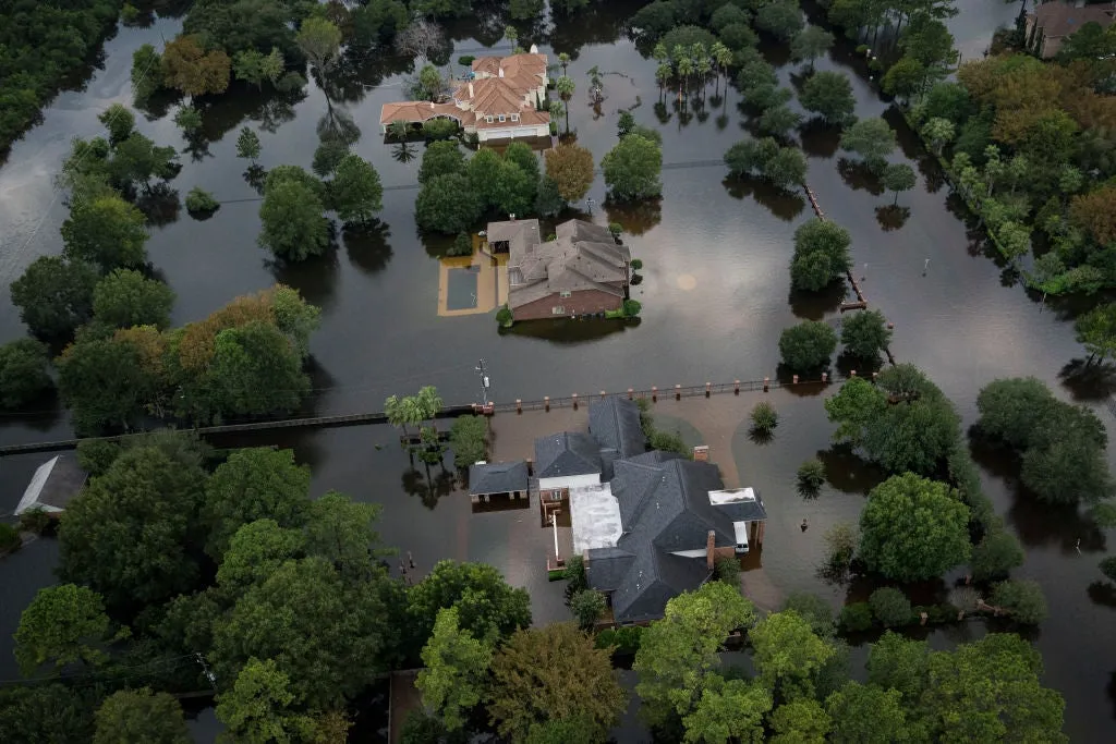
Severe flooding is seen in Houston next to the I-10 freeway after Hurricane Beryl made landfall on Monday, July 8, 2024.(Raquel Natalicchio/Houston Chronicle via Getty Images)Houston has a long history of extreme rainfall events, from tropical systems to stubborn weather patterns. It is pretty much becoming America's flooding capital. As someone who lives in Georgia, I see a lot of flooding, but it is rare and over pretty quickly. But Houstonians seem to have experienced flooding multiple times, even sometimes in the same year. Here's a rundown of some of the more notable flood events Houston has faced. (LIVE UPDATES: Get the lastest on Edouardo)Notable events- Hurricane Beryl (July 2024): Hurricane Beryl set many records, including becoming the first Category 4 hurricane in June and the farthest east hurricane in the Atlantic. By the time it got to Texas, it had weakened to a Category 1 hurricane with winds of 80 mph. Gusty winds and heavy rain slammed Houston. The metro area saw as much as 14.88 inches near Hilshire Village. Several other locations in Harris County picked up 10 or more inches of rain.

The Weather Channel·
Weather

Tropical Storm Edouard: landfall over northwest Gulf Coast

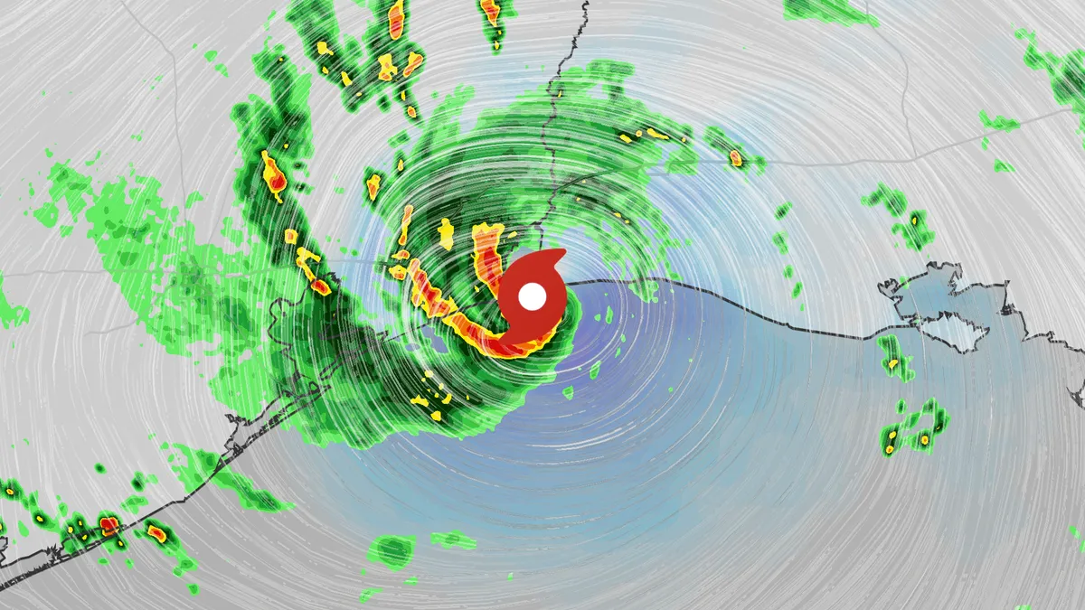
Tropical Storm Edouard has officially made landfall near the Texas-Louisiana border, according to an update from the National Hurricane Center. At landfall, the storm had sustained winds of 60 mph and higher gusts. Edouard may "only" be a tropical storm, but it still poses a considerable flood threat for parts of the lower Mississippi Valley and Southern Plains, and tornadoes are possible along the northwestern Gulf Coast as the storm moves ashore.(LIVE UPDATES: Latest news on Tropical Storm Edouard)We will continue to follow the storm's impacts as it moves over land, though it will quickly weaken as it is cut off from the warm water in the Gulf and is forced to travel over land.

The Weather Channel·
Weather

Bryan Norcross: How strong will Tropical Storm Edouard be when it makes landfall today?

The biggest flood threat will be east of I-45 in Texas, with pockets of heavy rain along the Louisiana coast as well. Bryan Norcross Last updated at 9:30 a.m. on Tuesday, Sept. 1, 2026. Small but shapely Tropical Storm Edouard is heading for landfall midday or early afternoon today near the Texas/Louisiana border. The Gulf water is in the upper 80s and the atmospheric environment is conducive for strengthening. The only question is how quickly Edouard's structure organizes so it can take advantage of the supportive conditions. Satellite image of Tropical Storm Edouard. (Bryan Norcross)LATEST FROM FOX WEATHER HURRICANE SPECIALIST BRYAN NORCROSSThe National Hurricane Center is forecasting Edouard to come together enough so that it could strengthen pretty dramatically before it reaches the coast. Just in case the system produces gusts over 75 mph, a Hurricane Watch is in effect for the potentially affected areas. Everybody on the Upper Texas Coast and the western half of Louisiana coast should stay updated on the latest information. Edouard has a potential to spin up quickly. The wind impacts won't be widespread, but some narrow band of coastline could be affected by damaging gusts.

Fox Weather·
Weather

Severe weather threat builds with Ontario heat this week

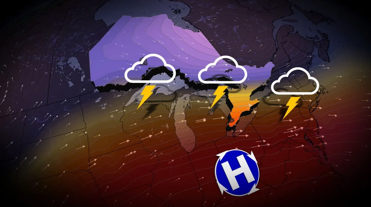
August and meteorological summer may be coming to a close, but the warm weather isn't ready to depart southern Ontario just yet. In fact, warmer-than-normal temperatures will be widespread from the Prairies to the Great Lakes, stretching into western Quebec, during the first week of September. Visit our Complete Guide to Fall 2026 for an in depth look at the Fall Forecast, tips to plan for it and much more! Midsummer heat and humidity will be present in southern Ontario this week, with a crack at hitting the 30-degree mark for many locales. But the warmth will come with multiple chances of rain and thunderstorms. Folks across northeastern Ontario will also likely see a stormy end to summer as the saturated airmass lifts over Lake Superior's northern shore. Atmospheric moisture from the Gulf of Mexico builds across much of Ontario this week. Tuesday and Wednesday will see a continued mix of sun and cloudy periods with a few rounds of rain and thunderstorms as southern Ontario will be in the ring of fire, with very hot and humid conditions over the U. S. Midwest. Content continues belowThat will bring a return of the high humidity we've felt on several occasions this summer.

The Weather Network·
Weather

The 1923 earthquake and firestorms that claimed 100,000+ lives

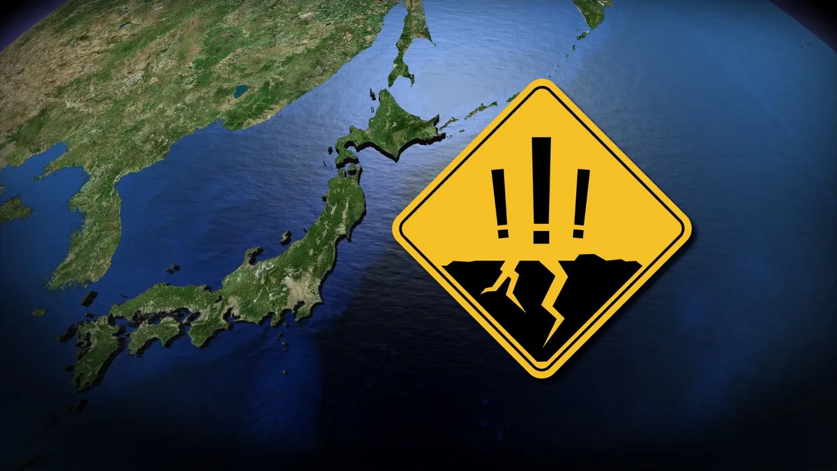
A calamitous disaster more than a century ago still sends reverberations through Japanese society today. The nation observes Disaster Preparedness Day on the first day of September in commemoration of the Great Kanto Earthquake of 1923. More than 100,000 people reportedly died in the earthquake and subsequent tsunami and firestorms that followed. DON'T MISS: How to safely react when an earthquake strikesA fault line ruptured southwest of Tokyo just before lunchtime on Sept. 1, 1923, unleashing a powerful earthquake across Japan’s east coast. Today’s estimates place the initial earthquake as a magnitude 8.0, with several additional intense tremors in the hours that followed. Earthquakes in populous areas are bad enough, especially in the days before adequate engineering to reinforce homes and businesses from the ground shifting and swaying beneath them. But the danger was far from over once the ground stopped rattling. Destructive tsunami waves crashed ashore in nearby communities, reaching as much as seven metres above ground level in the hardest-hit areas. Content continues belowFires broke out amid the destruction in Tokyo proper.

The Weather Network·
Weather

What is an areal flood watch?

An aerial view of severe flooding in Frankfort, Kentucky, caused by days of heavy rainfall across the Midwest on April 7, 2025. Violent storms battering the central-eastern United States have killed at least 17 people, officials said on April 5, 2025, with the National Weather Service warning of "devastating" flash flooding.(Leandro Lozada/AFP via Getty Images)As temperatures warm with the arrival of the summer months, flooding is also likely to occur more frequently due to the higher amount of moisture in the air. You’re also more likely to see an alert pop up for something called “areal flooding.” Here’s what that means. An areal flood watch is specifically issued when there is a threat of widespread flooding that is expected to develop gradually, usually from prolonged and persistent moderate to heavy rain.(MORE: Flash flood emergency: 3 things to know about this rare alert that signals Imminent Danger)It makes sense that this type of flooding is more likely in the warmer months, because many areas start to see what feels like endless rounds of rainfall from weather patterns that seem almost stuck.

The Weather Channel·
Weather

What is a hurricane eyewall? The storm's most dangerous part

Hurricane eyewall: where the most dangerous conditions live"Eyewall" may seem like just another term we throw around during hurricane season, but it's one of the most important parts of a storm's anatomy to understand. It's where a hurricane keeps its strongest winds and heaviest rain — and it's the reason the calmest moment of a storm can quickly become the most dangerous. Here's what you need to know. Q: What is the eyewall? A: It's the ring of towering thunderstorms wrapped tightly around the calm eye at a storm's center. It is the most dangerous part of a hurricane because it's where the highest surface winds and most intense rainfall typically are found. Q: How tall can the eyewall get? A: The towering cumulonimbus clouds that make up the eyewall can rise from near the ocean surface to roughly 70,000 feet. For perspective, commercial planes normally reach cruising altitude somewhere between 30,000 and 40,000 feet. A U. S. Air Force Reserve crew from the 53rd Weather Reconnaissance Squadron, known as the "Hurricane Hunters," flies through Hurricane Melissa on October 27, 2025 over the Caribbean Sea. (Lt. Col. Mark Withee/U. S.

The Weather Channel·
Weather

2026 NOAA Hurricane Season Outlook Predicts Quiet Season

NOAA Releases Below-Average Hurricane Season OutlookNOAA forecasters have released their seasonal outlook for the 2026 Atlantic hurricane season, and the numbers are in line with outlooks released by The Weather Company and Colorado State University. The OutlooksNOAA's newly released outlook is predicting eight to 14 named storms, with three to six becoming hurricanes. Of those that become hurricanes, one to three are expected to reach Category 3 or stronger, meaning winds higher than 111 mph. NOAA also predicts a 55% chance of a below-average number of storms this season, a 35% chance of a near-normal number of storms and only a 1o% chance of an above-average number of storms. This is in line with the outlook previously released by CSU as well as the outlook by The Weather Company and Atmospheric G2, though it is released as a range rather than a single number. Both outlooks are predicting a below-average season, with 12 (The Weather Company) or 13 (CSU) named storms, six hurricanes and two major hurricanes. These numbers all fall within the ranges predicted by NOAA.

The Weather Channel·
Weather

Ask A Met: What Is The Outlook For The Eastern Pacific Hurricane Season?

This week's question comes from Morning Brief readers Dennis and Ron, who ask, "What is the outlook for the Pacific hurricane season? " Meteorologist Caitlin Kaiser: Although the Atlantic hurricane season outlook typically steals the headlines, NOAA also releases a forecast for both the Eastern and Central Pacific basins each year. Eastern Pacific Hurricane SeasonTimeline: May 15 - Nov. 30This year NOAA's outlook calls for the following:15-22 Named Storms9-14 Hurricanes5-9 Major HurricanesThe 2026 outlook is forecasting more activity than average across the board, with an average season typically seeing 15 named storms, eight hurricanes and four major hurricanes. Get More of Our News on GoogleSet The Weather Company as a 'Preferred Source' to get quicker access to the news you value. Central Pacific Hurricane SeasonTimeline: June 1 - Nov. 30The Central Pacific basin is also expected to see an above-average season with five to 13 combined named storms and tropical depressions. This is compared to the 4.4 combined named storms and tropical disturbances seen in an average season.

The Weather Channel·
Weather

Death toll of Nepal-China flood disaster climbs above 1,000

Rescuers crawl through mud to reach people trapped in Nepal tunnelKATHMANDU, Nepal (AP) — Rescue teams with search dogs combed through mud, rocks and debris Tuesday in Nepal and China looking for thousands of people still missing after catastrophic flooding tore through communities across the Himalayas, leaving more than 1,000 dead. Nepal’s disaster agency said Tuesday that 987 deaths had been counted there, with 3,916 people missing, including 583 foreigners. Chinese authorities, in their latest update on Sunday, reported 16 deaths and 546 people still missing, including 261 foreigners. The scale of last week's disaster was hampering rescue efforts in both regions, with landslides, destroyed roads and widespread damage cutting off remote areas. Crews faced challenging conditions as they searched unstable terrain and piles of debris, raising fears the death toll could rise as rescuers reach isolated communities. Rescuers race to reach missing hydropower workersIn Nepal, rescuers were racing to reach hundreds of workers believed to be trapped inside tunnels at hydropower projects damaged by the floods.

The Weather Channel·
Weather

Wildfires, heat, hurricanes: Weekend home DIY projects

Wildfire prep DIY: Weekend tasks that could save your homeSummer can feel like the perfect time to catch up on your DIY home projects, but it’s also the time when the weather makes certain fixes urgent.  Wildfire season is at its peak in the West, heat waves are punishing rooftops from coast to coast, and the Atlantic hurricane season is barreling toward its crest.  The good news is that there are some high-impact tasks that you can knock out in a weekend to start protecting your home. Wildfire prepNinety percent of homes lost in a wildfire are ignited by embers, not direct flames, according to research from the Insurance Institute for Business and Home Safety, so here’s how to make your house ember-resistant:Clear the first 5 feet around your home of everything flammableIt’s Cal Fire’s newest standard called Zone 0. They’re telling homeowners to get rid of bark mulch (replace with stone or gravel), dry plants, wood piles, even patio cushions in the backyard.

The Weather Channel·
Weather

Texas chiropractor, martial artist killed in Grand Canyon flood, third hiker still missing

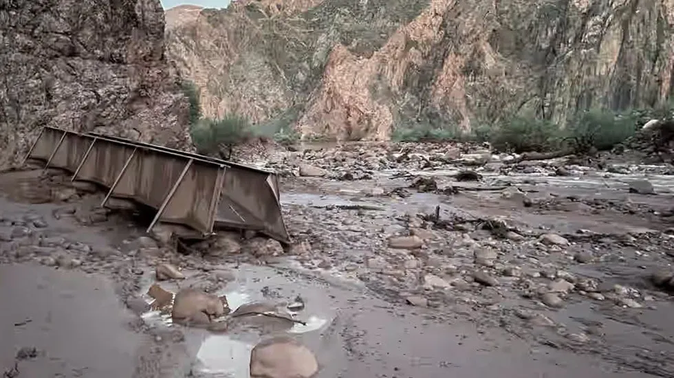
right Angel Canyon, the scene of flash floods, runs into the Colorado River in the Grand Canyon, Monday, Aug. 31, 2026, at Grand Canyon National Park, Arizona.(AP Photo/John Locher)GRAND CANYON NATIONAL PARK, Ariz. (AP) — The bodies of a Texas chiropractor and a lifelong martial artist have been found after a major flash flood swept through the Grand Canyon. One person remains unaccounted for after about 80 others were rescued over the weekend, officials said Monday. Saturday’s flash flood severely damaged the only water pipeline serving Grand Canyon National Park. Officials barred tourists from staying at lodges and hotels inside the park and issued emergency water restrictions for year-round residents. Waves of torrential rain hit the Bright Angel Creek area of the tourist destination that hosts 4.4 million visitors a year. Grand Canyon Deputy Superintendent Brian Drapeaux said officials haven’t fully surveyed the damage, but the park has said about 40% of the pipeline is damaged. Incident Cmdr. Dave Black said searchers used night vision and other equipment to find people who needed rescuing during the deluge.

The Weather Channel·
Weather

There's mind-blowing math behind a thunderstorm's raindrops

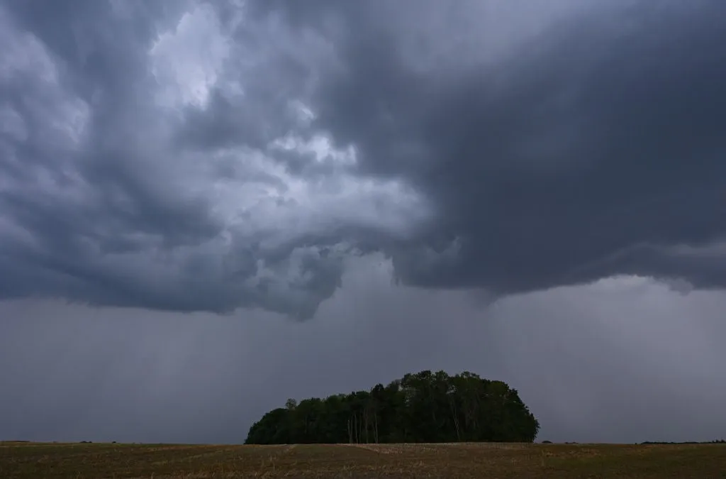
An astounding number of raindrops fall during a single stormAs you watch a summer downpour from the window, you may be thinking about how many raindrops are actually falling. It's hard to conceptualize because the numbers are staggering. Let’s start small. Just 1 inch of rain, falling over 1 square mile, comes out to 17.4 million gallons of water, the National Weather Service says. That water weighs about 143 million pounds, or roughly 72,000 tons. That’s equivalent to about 145 fully loaded Boeing 747s. The cloud holds even more than that before the first drop falls. An average thunderstorm cloud carries about 275 million gallons of water, according to National Center for Atmospheric Research calculations. That’s 1.1 million tons, or roughly 2,300 fully loaded Boeing 747s. If you take the 750,000 gallons of water that pours over Niagara Falls every second, it would take Niagara six minutes to move as much water as one ordinary thunderstorm is already holding in the sky.(Getty Images)Let's do some more mathNow let’s think about it in terms of an actual city. Atlanta's city limits cover roughly 84,100 acres.

The Weather Channel·