BBlogFlow

Categories

Weather

4073 articles

Weather

New study suggests we could weaken El Niño — but should we?

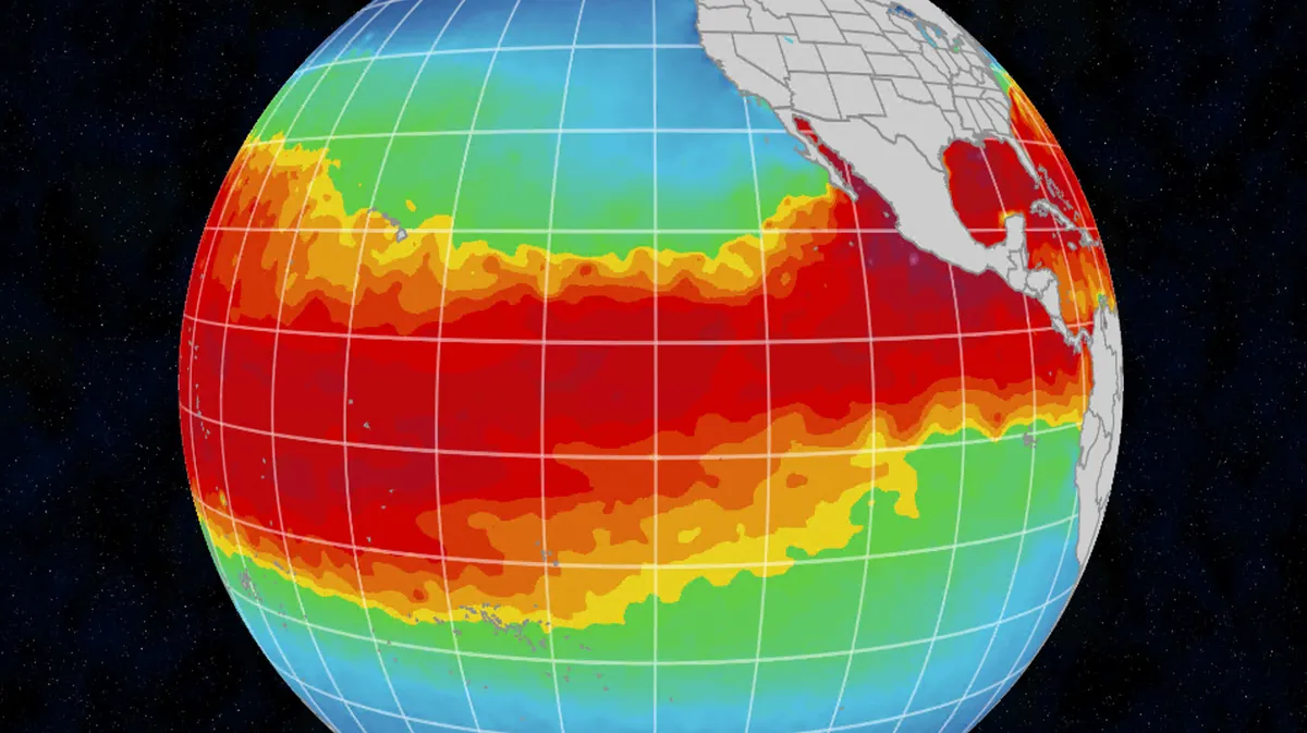
New study says we could weaken El Niño, but should we? With a strong El Niño running the show this summer, could it be possible to just turn it down? According to a new study, the answer is yes (at least inside a climate computer model), but is this even feasible, and if it is, is it a road we want to go down? Right now, El Niño is expected to keep strengthening into winter, with an 81% chance of ranking "very strong. " On the positive side, it could help keep a lid on Atlantic hurricanes, but El Niño has much farther-reaching impacts than hurricanes — it reshuffles weather around the globe, for better or worse. So scientists ask: If El Niño causes so much trouble, could we just turn it down? Take a deep breath.(MORE: Here's what El Niño really does to your weather)Get More of Our News on GoogleSet The Weather Company as a 'Preferred Source' to get quicker access to the news you value. This image shows the sea surface temperatures in the equatorial Pacific. This is the area that drives El NIño and La Niña. How scientists say we could 'turn down' El NiñoThe team ran simulations of a technique called marine cloud brightening.
The Weather Channel·
Weather

Prepare for the fall's first foggy, frosty morning commute

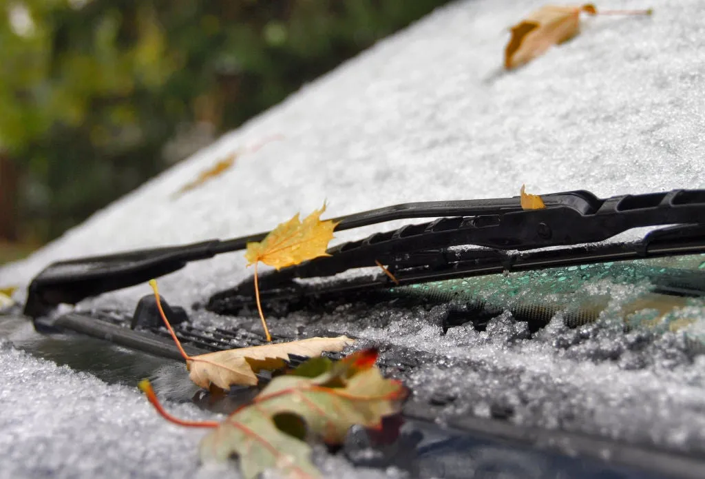
Why fall mornings bring fog, frost, and a riskier commuteFall's first cold morning can trigger a chain reaction before you even leave the driveway: Frost coats the windshield, the tire pressure lights up on your dash and fog hides the road ahead. The weather setup starts overnightFall's longer nights give the ground more time to release the heat it absorbed during the day. Clear skies let that heat escape more efficiently, while light winds keep warmer air above from mixing back down to the surface. High pressure often sets up these exact conditions — clear and calm.(MORE: Weather alerts decoded: What advisories, watches and warnings really mean) This process is known as radiational cooling, and it steadily lowers the temperature of the ground and the air just above it.

The Weather Channel·
Weather

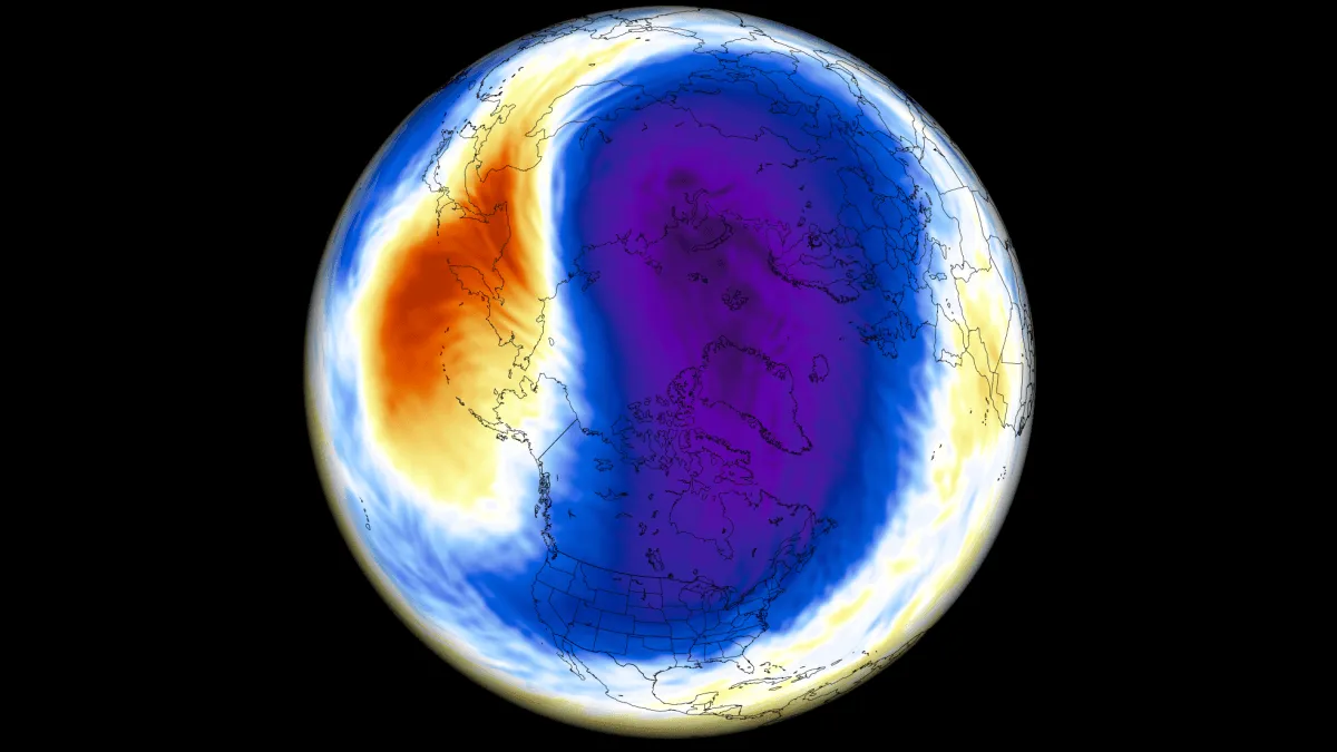
A New Polar Vortex Is Emerging Over the North Pole, With a Winter 2026/2027 Disruption Risk

A new Polar Vortex is now forming over the North Pole, with rapid stratospheric cooling and a pressure drop already visible in the latest data. It is starting the season stronger than last year, but the long-range forecasts show a very different signal for Winter 2026/2027. New seasonal trends agree on a notable slowdown of the Polar Vortex around mid-winter, with weakening winds and rising pressure in the stratosphere. A strong Super El Niño is also developing in the Pacific, adding another factor affecting the Polar Vortex winter development. In this article, I will look at the new Polar Vortex development from Fall to Winter 2026/2027, the Super El Niño connection, and what a major disruption or a Polar Vortex collapse would bring for winter weather across the United States, Canada, and Europe. To keep it simple, the Polar Vortex is the broad winter circulation over the Northern (and Southern) Hemispheres. You can imagine the Polar Vortex as a spinning wall over the polar regions, rising from the surface into the stratosphere (over 50 km/ 30 miles high), keeping the cold polar air inside.

Severe Weather Europe·
Weather

Millions under prolonged flash flood threat as relentless storms pummel Midwest, Central Plains

THE TAKEAWAYA persistent pattern is set to bring heavy rain, flooding and severe storms to the Midwest and Middle Mississippi Valley into Saturday. Rounds of thunderstorms and downpours developed from the Texas Panhandle, across the Midwest to the Great Lakes on Tuesday. The heaviest rain is expected just north of Kansas City, across parts of Kansas and Missouri, where a Level 3 flash flood threat is in effect into Wednesday morning. Relentless storms are slamming parts of the Midwest and Central Plains as a stalled weather pattern fuels a weeklong flash flood threat that will last into Saturday. A Level 2 out of 4 risk of flash flooding stretches across a corridor from Amarillo, Texas, across Missouri to northern Indiana. FLOODING RAIN, THUNDERSTORMS THREATEN MAJOR EAST COAST CITIES AS ONGOING DOWNPOURS DRENCH NORTHEASTThe storms will increase the danger of flash flooding as additional downpours move across an already waterlogged region. Intense rain slammed Council Bluffs, Iowa, on Monday, Sep. 15, 2026. (@weatherA_H via Storyful)The stormy pattern began Monday when severe storms swept through parts of Nebraska and Iowa.

Fox Weather·
Weather

How 2 satellites use precise ocean measurements to reveal what could fuel hurricanes during El Niño

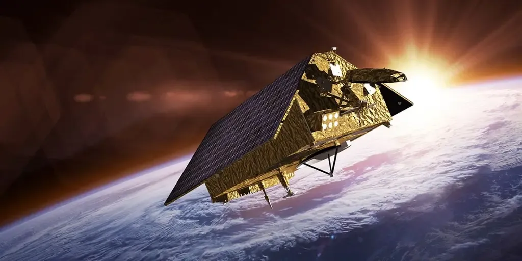
El Niño intensifies alongside high odds of a historic event El Niño continues to strengthen, with odds now exceeding 90% that it will become a very strong event and a 75% chance it could become a historic event from October through December, according to the latest release from the Climate Prediction Center. FOX Weather meteorologists Stephen Morgan and Marissa Torres break down what it all means. THE TAKEAWAYSentinel-6 Michael Freilich and Sentinel-6B monitor sea-level height, waves and ocean conditions from space. Their data helps scientists understand El Niño and improve hurricane forecasts, including predictions of storm intensity. The satellites continue a decades-long record that supports coastal planning, infrastructure protection, emergency response and industries such as shipping. From orbit, two satellites are tracking the emerging Super El Niño, collecting precise data that can improve hurricane forecasts and protect infrastructure. As part of a collaborative effort between NASA and its European Space partners, the Sentinel-6B satellite was launched in November, and now flies just 30 seconds behind its predecessor and twin, Sentinel-6 Michael Freilich.

Fox Weather·
Weather

Toxic red tide detected along Texas coastline — here’s how it can affect your health

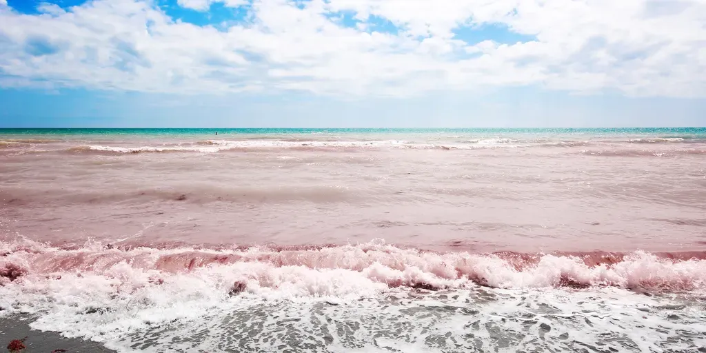
GALVESTON, Tex. - A red tide bloom along the Texas coast is prompting warnings from officials as the toxic algae could cause respiratory problems for beachgoers. Red tide is a naturally occurring, higher-than-normal concentration of microscopic algae that can affect fish and cause respiratory irritation to humans, according to Texas Parks and Wildlife. HURRICANE SWELLS REVEAL FORGOTTEN HISTORY BENEATH ICONIC CALIFORNIA BEACH red tide beach in florida (TriggerPhoto / Getty Images)The department said staff have been monitoring fish kills and taking water samples from Crystal Beach and Bolivar Penninsula south to the north jetty at Boliver Roads. Additional areas being monitored include southern Galveston Island from the south jetty for about 12 miles, including the Steward Beach and Pleasure Island Pier, according to Texas Parks and Wildlife. WHAT VIRUSES MAKE UP A RED TIDE BLOOM? Biologists with the department started receiving reports of a red tide bloom off the Galveston coast on Sept. 8.

Fox Weather·
Weather

Hurricane swells reveal forgotten history beneath iconic California beach

Hurricane Marie swell reveals hidden history beneath The Wedge Hurricane Marie sent massive swells crashing into Newport Beach's legendary surf break, The Wedge, producing the towering waves the spot is famous for. But the hurricane-driven surf also unearthed a piece of California history, exposing long-buried wooden pilings believed to date back to the construction of the jetty that helped create the world-famous wave. THE TAKEAWAYThe Wedge’s legendary waves are the unintended result of decades of harbor engineering and jetty construction. Hurricane Marie’s powerful swells exposed buried timber, jetty rock and other remnants of Newport Beach’s past. Historical research suggests the timber may belong to a temporary construction trestle, while some exposed rocks may be part of a 1930 groin. NEWPORT BEACH, Calif. – Mysterious wooden structures exposed at Newport Beach’s famed Wedge have offered a glimpse into the city’s past, as hurricane swells peeled back the sand to reveal a series of unidentified items from history.

Fox Weather·
Weather

Rain, storm risk in southern Ontario Tuesday, with more rainfall to follow

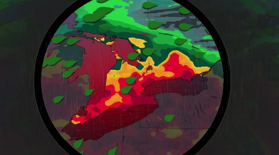
Humidity marks its return to southern Ontario this week as summer plays out the final days in the season. With southern Ontario's inclusion in the ring of fire situated south of the border, with very hot and humid conditions situated over the Mississippi Valley, folks can expect to see rain and a thunderstorm risk on Tuesday. Visit our Complete Guide to Fall 2026 for an in depth look at the Fall Forecast, tips to plan for it and much more! Be sure to stay alert to the changing conditions, and check for any weather warnings in your area. Sticky air mass as summer not ready to depart, yetA surface high established over the southern Mississippi Valley means a hot and humid air mass over it and the Southern Plains. As a result, the muggy and unsettled air mass will be transported into parts of southern Ontario. Temperatures across southern Onario will be into the mid-20s, but will feel like the high 20s with the humidex. Content continues belowHumidex values will be even higher in the southwest, which will feel more like the low- to mid-30s. The thunderstorm risk starts later in the day Tuesday, and will linger to the overnight hours across southwestern Ontario.

The Weather Network·
Weather

El Niño drives Kelvin wave closer to California

Sea level rise could enhance substantial California floodingOff the west coast of Mexico, a mass of unusually warm water is creeping north. This wave will reach California and could bring the threat of coastal flooding, beach erosion, impacts to surfing and even potential damage to roadways by the water. More of these waves could follow, enhancing a potentially wetter winter for California due to the ongoing El Niño. An aerial view of the incoming tide and swell at Aliso Beach in Laguna Beach in September, where recent storm surges caused damage to the parking lot area and erosion. (Los Angeles Times via Getty Image)How it worksNow, this wave isn’t anything like a tsunami. It is a slow-moving wave, only moving north at about 6 mph, that you probably won’t even see. It is called a coastal trapped Kelvin wave, if you want the technical term. El Niño is the culprit. It changes how the winds blow in the Pacific, allowing warm water to collect near South America. As water gathers, it can lead to a wave that moves along the shore and sets its sights on California, which we are seeing now.

The Weather Channel·
Weather

Which major US cities could see rain on Tuesday as moisture fuels showers across parts of the country?

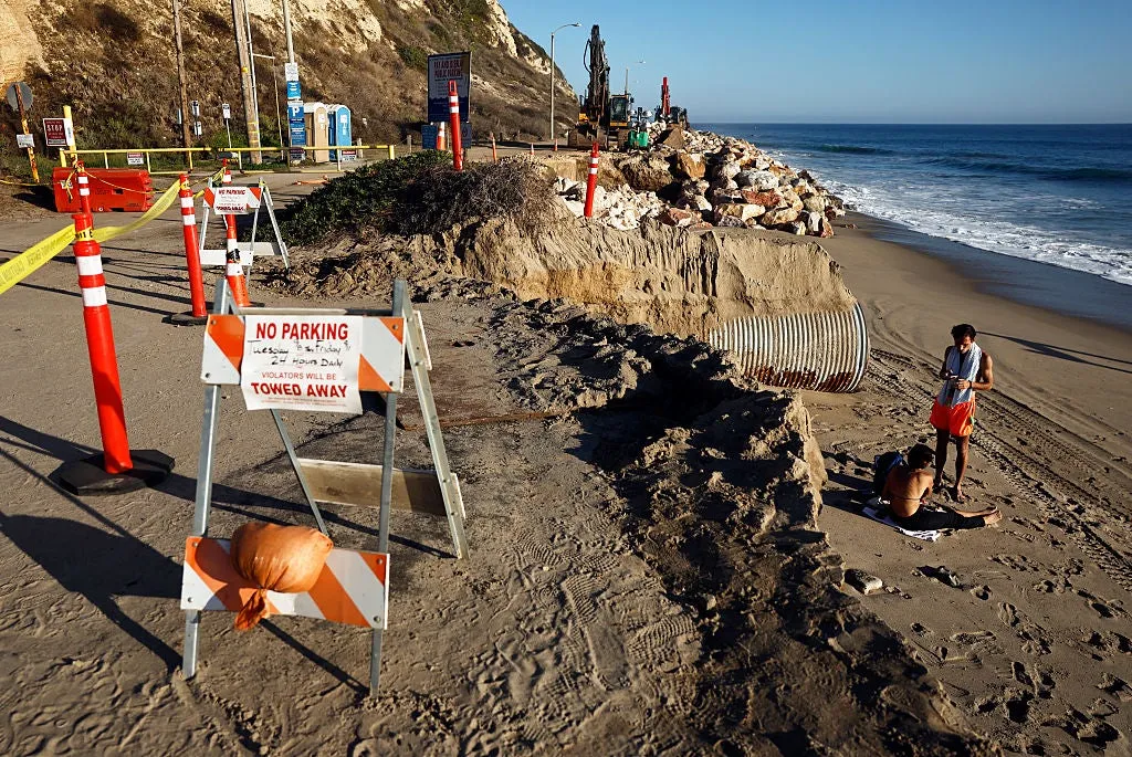
Let’s see what prediction markets, like Kalshi, are saying about the chances for rain in Miami, Phoenix and Denver on Tuesday. Several major cities across the U. S. could see rain and thunderstorms on Tuesday as moisture fuels showers across parts of the country. Miami, Phoenix and Denver are among the cities being watched for potential rainfall, with each facing a completely different weather setup. LOCAL EMERGENCY DECLARED IN CALIFORNIA BEACH CITY TO STABILIZE COASTAL BLUFFS AHEAD OF SUPER EL NIÑOAcross the Southeast, persistent easterly winds driven by an eastern U. S. heat dome will fuel daily tropical downpours across Florida through Thursday. Rain still to come across Florida.(FOX Weather) This strong onshore flow will continuously push deep Atlantic moisture inland, triggering waves of slow-moving thunderstorms with rainfall rates of 1 to 2 inches per hour along with afternoon sea breezes that will maintain a daily threat of minor flash flooding. Meanwhile, a massive heat dome over the central and eastern U. S. is blocking weather patterns, locking a relentless monsoon channel along its western edge.

Fox Weather·
Weather

When will Canada see its last 30°C of the year?

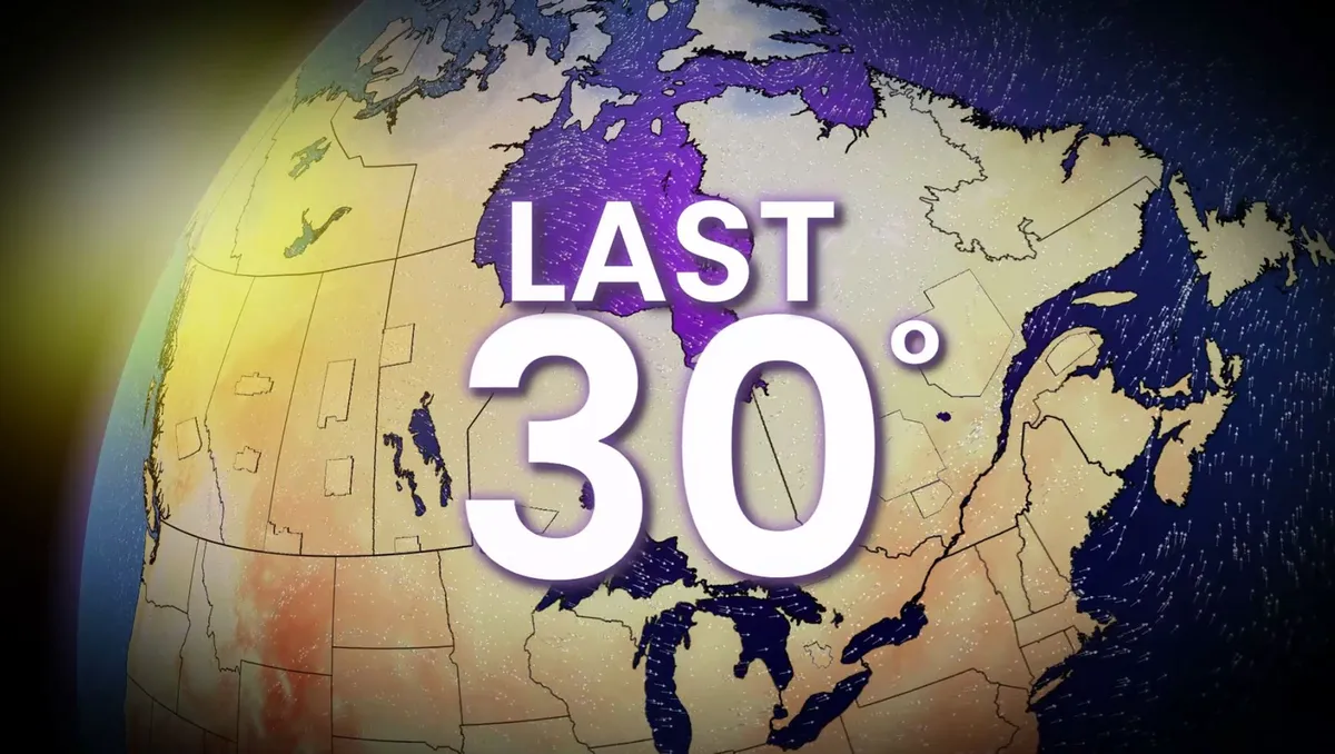
Canada just saw its first -10°C of the season. The heart of summertime is in the rearview mirror for much of the country, with most major cities past the average date for the last 30°C temperature of the season. Despite the cooldown, summer-like heat can still make an autumnal appearance, and this year looks to be no exception. Warmer-than-normal readings over the next week may still send some communities inching into the 30s. CANADA’S FALL FORECAST: Exceptional El Niño favours extended fallThe heat’s been on since Lytton, B. C., marked Canada’s first 30-degree temperature of the year back on April 20. While things have cooled off lately, forecasters continue to see increased odds of above-seasonal temperatures for much of Canada over the next five days. While the bulk of the heat will be centred stateside, where they’ll likely see a near-historic ridge for this time of year, the warmer temperatures will make their way well into Canada. The greatest potential for additional 30-degree heat in the coming days will arrive in British Columbia on Thursday and Friday. Temperatures will approach 30°C throughout the southern B. C. Interior, including Lytton, Kamloops, Osoyoos, and Ashcroft

The Weather Network·
Weather

When can you typically see peak fall foliage in your area?

Region by region, when to expect peak fall foliageThe leaves shrugging on their fall attire is one of Mother Nature’s most brilliant shows each year. But when can you can typically see the dazzling display? That depends on where you live. Peak fall foliage depends on a variety of factors: cooler nights, shorter daylight hours and rainfall, just to name a few. Fall foliage along the banks of the Neponset River near Milton, Massachusetts on November 5, 2025.(David L. Ryan/The Boston Globe via Getty Images)As the leaves take their cue that summer is coming to an end, they start slowing down the production of chlorophyll, the green pigment in leaves, until it comes to a stop. This is when the fiery red and brilliant yellows are revealed. But this happens on a different timeline across the country. Here’s when it's usually time to pull out the camera near you:Typical timelineLate September or early October: The Rockies, the northern parts of Minnesota through Michigan and a strip from upstate New York to northern New England see peak color first.

The Weather Channel·
Weather

Bryan Norcross: Middle-of-the-Atlantic development possible and looking back 100 years ago today

Tropical development odds increase in the Atlantic Tropical development odds are ticking up in the Atlantic. The area to watch now has a medium chance of organizing as it could drift into a brief window of more favorable conditions later this week. Full outlook:Sept. 15, 1926Reports arrived from the northeast Caribbean on Wednesday that the low-pressure system plotted north of the Virgin Islands had "considerable intensity. " Winds at St. Thomas in the Virgin Islands were blowing 40 to 45 mph in the morning. And a nearby ship reported 70 mph winds midday. The storm was thought to be moving "directly" to the west. The modern estimate is that the system north of the Caribbean was carrying winds of 115 mph on the morning of September 15, and they would continue to increase during the day. The storm was moving north of west, but without satellites and detailed ship reports, there was no way for them to know. Sept. 15, 1926 Atlantic tropics  (Bryan Norcross)There was some discussion of the storm in the Miami newspapers, but there was no sense of concern. The morning Herald had a small blurb on page 2 headlined "Storm Is Reported.

Fox Weather·
Weather

Nepal floods: Survivors return to unimaginable destruction

Twenty days after a massive flood roared through Himalayan valleys, here's a look at what the people are finding there. September 15, 2026Updated: September 15, 2026, 8:31 am EDTPublished: September 15, 2026, 6:31 am EDTA woman clears mud on Tuesday, September 15, 2026, after the devastating August 26, 2026, floods that struck Devighat, Nuwakot, Nepal. People in the affected areas of Nuwakot continue to return in search of their destroyed homes and the last remaining memories of their lives. (Abdul Goni/Anadolu via Getty Images)The floodwaters have receded, but the pain they brought might never go away. Twenty days after a massive flood roared through Himalayan valleys on the Nepal-China border, survivors struggle to rebuild their lives. In Devighat village in Nuwakot, Nepal, those whose homes are still standing try to shovel out the tons of mud and debris. Some salvage whatever they can find. Others stand silently where their homes once stood.(MORE: How did the deadly flood disaster in Nepal and Tibet happen?)Many buildings collapsed. On others, mud reaches as high as the fifth floor. More than 1,300 people died in the flooding on Aug. 26.

The Weather Channel·
Weather

3.8-magnitude earthquake hits south of Ucluelet, B.C.; no tsunami risk

A minor earthquake was recorded off the west coast of Vancouver Island early Tuesday morning. Light shaking was felt, but there were no reports of damage or tsunami threat. DON'T MISS: Earthquakes are a risk in Canada. Here’s how to stay safeThe 3.8-magnitude earthquake occurred at 2:30 a.m. PDT at a depth of five kilometres, about 34 km southwest of Ucluelet, B. C., according to the U. S. Geological Survey (USGS). B. C. is prone to earthquakes, a reminder to be preparedWhile this earthquake was minor, it serves as a reminder for British Columbians to be prepared for emergency situations. The Pacific Coast is the most earthquake-prone region of Canada, and seismologists with the Geological Survey of Canada record and locate more than 1,000 earthquakes in Western Canada each year. While technological advances make it easier to detect the size or location of a potential earthquake, it's still unclear when the next big one will arrive. What to do in an earthquake? In a previous interview with The Weather Network, Naomi Yamamoto, president of the B. C.

The Weather Network·
Weather

Multiday washout targets Florida as heavy downpours, thunderstorms linger through weekend

THE TAKEAWAY:Florida is facing a stormy week as tropical downpours target the region. Sea-breeze collisions could bring 1–2+ inches of rain per hour, creating a daily minor flash-flood threat. The odds remain low for any tropical disturbance to develop from the nearby low-pressure system. FLORIDA – Another stormy week has kicked off across the Sunshine State as tropical moisture surges across the region. This follows a soggy weekend that triggered numerous flood alerts, including in areas that had been unusually dry. Tropical downpours will drench portions of Florida all week long, through Wednesday, as a massive high pressure heat dome anchored over the eastern U. S. fuels gusty winds and thunderstorms. WHAT IS A HEAT DOME AND HOW CAN IT AFFECT YOU DURING THE SUMMER MONTHS? The FOX Forecast Center expects repeated rounds of slow-moving rain showers and thunderstorms, producing precipitation totals of over 1 to 2 inches per hour and fueling a daily flood threat. By Thursday, the storm pattern will intensify as a mid-level low pressure system is forecast to move out of the Atlantic, across the Florida peninsula and into the Gulf of America.

Fox Weather·
Weather

Renters: Your landlord has to turn the heat on soon — maybe even this week

Your landlord has to turn the heat on soon — maybe even this weekIf you rent your home, do you know when your landlord is required to turn on your heat? It depends entirely on where you live, and it may not be when you would think. Some start this weekThere is no single nationwide rule that says when safe, reliable heat must be provided or at what temperature. Requirements may vary by county, city or state. In Illinois and Massachusetts, "heat season" starts early: Sept. 15.(MORE: That burning smell: What's normal when the fall's first heat turns on?)In major mid-Atlantic cities such as New York City, Philadelphia and Washington, D. C., the season begins Oct. 1. Same for the states of Connecticut, New Jersey and Minnesota. Get More of Our News on GoogleSet The Weather Company as a 'Preferred Source' to get quicker access to the news you value. Moving a bit farther south, Virginia's "heat season" begins Oct. 15, and North Carolina's starts Nov. 1.

The Weather Channel·
Weather

2 injured, evacuations underway as brush fire engulfs homes in Los Angeles County

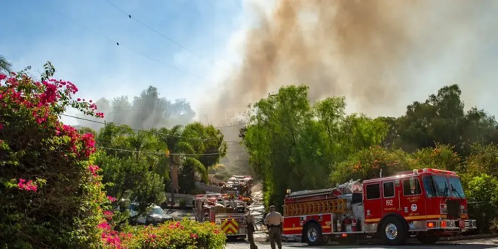
According to Cal Fire, the Palos Fire has spread across 17 acres and is believed to be human-caused. LOS ANGELES — Evacuation warnings are underway in parts of Los Angeles County on Monday as a fast-moving brush fire spreads across the region, encroaching on multiple homes. Two people, a firefighter and a civilian, have been injured, and four buildings have sustained damage in the fire. That includes two homes and two outbuildings, according to the Los Angeles County Fire Department. CAN YOU TASTE WILDFIRE SMOKE? SCIENTISTS SAY IT'S COMPLICATED next

Fox Weather·