The surprising reason your phone’s weather doesn’t match what’s outside your window - Futura, le média qui explore le monde
This story deserves to be shared
Send it to someone who'd care, or post it on your networks.
This article is an excerpt. To read the full content, visit the original source. Futura, le média qui explore le monde
Related articles
Orionid meteor shower 2026: cloud cover forecast by region
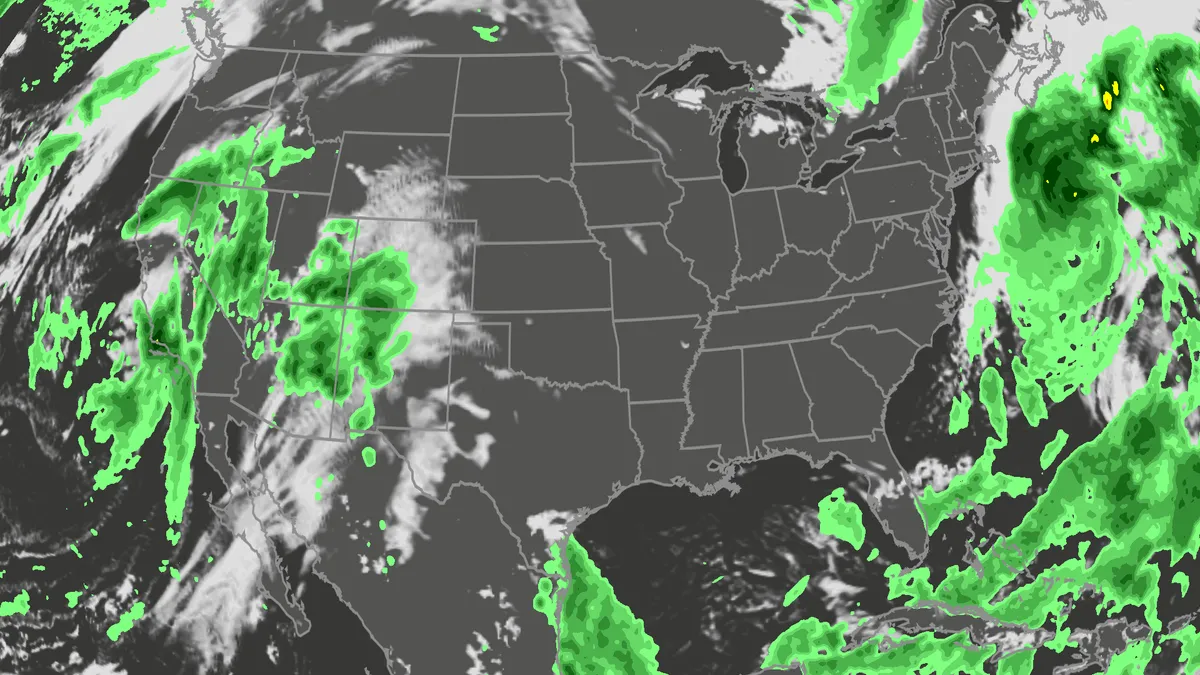
A meteor streaks across the sky over a desert in China during the Orionid meteor shower on Oct. 22, 2023.(VCG/VCG via Getty Images)The Orionid meteor shower is peaking this week, and it promises to be one of the most dazzling displays of the year. And while some of you will have clear skies, rain and clouds could impact the view for others. Here's what you need to know about the Orionids and your forecast:Fast factsPeak day: The meteor shower peaks Wednesday night, Oct. 21, into the early hours of Thursday morning, Oct. 22. Peak time: From midnight to dawn are the best hours to catch the meteors streaking through the sky, so plan on a late night or really early morning. What the Orionids are known for: The Orionid meteors are known for their brightness and their speed. As they streak across the sky at around 41 miles per second, the meteors leave behind a glowing "train" that can last several seconds to minutes. While you can make the perfect plan to catch the Orionids, the key to stellar viewing is still in Mother Nature's hands. The good news is that many of you should have good meteor shower-watching conditions. Much of the central and eastern U. S.
Flood risk, severe storms threat from California to Colorado
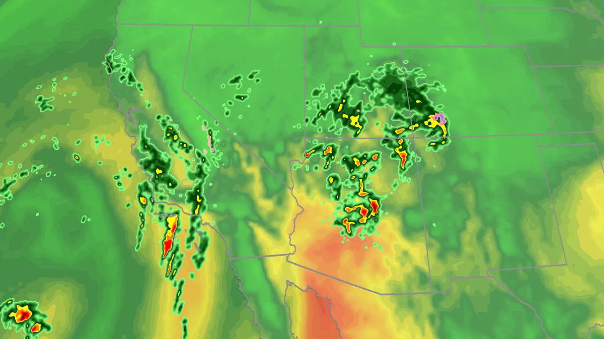
Hurricane Trudy will bring flood threat to the Southwest USTropical moisture and favorable atmospheric conditions will fuel a multiday flood risk this week across seven states from California to Colorado. Severe storms are also likely, especially across Arizona. Days of rain will bring a threat of debris flows and landslides, especially across burn scars. Timing out this week’s rainfallWednesday: The highest risk of flooding on Wednesday covers much of Arizona and New Mexico, and portions of Colorado and Utah, as well as Southern California. There will be an abundance of moisture available to support heavy downpours and training storms. This means storms will produce heavy rain over the same areas for long periods of time. The Weather Prediction Center is forecasting rainfall rates as high as 2 inches per hour. Some of the biggest concerns will be the possibility of mudslides over recent burn scar areas as well as slot canyons and arroyos. If you have plans to visit any of the national parks in the West this week, make sure you check the forecast daily and pay attention to any warnings or advisories issued.
Nor'easter tracker: Radar, forecasts, current info and more
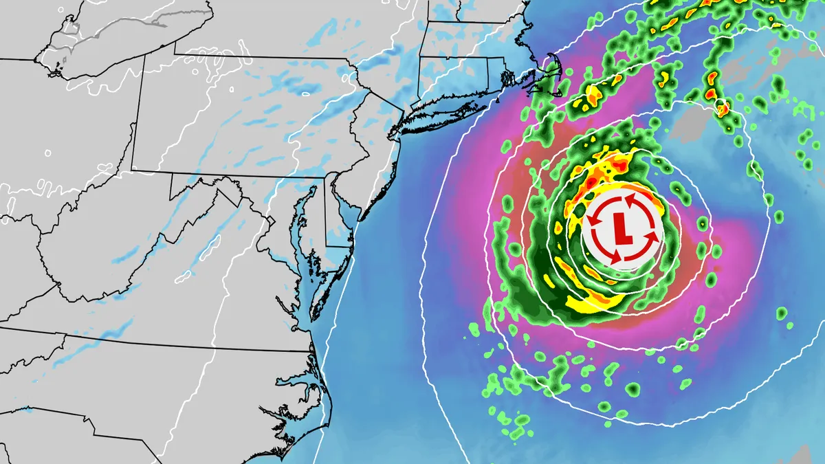
An October nor'easter is swirling off the East Coast, bringing gusty winds, coastal flooding and rip currents to much of the region. Track the storm here with all the maps you need. (MORE: Nor'easter lashes coast from Carolinas to Northeast)Current informationCurrent wind gustsCoastal flood alertsImpact forecastWave heightsGet More of Our News on GoogleSet The Weather Company as a 'Preferred Source' to get quicker access to the news you value. River gauge forecastCould it get a name? The National Hurricane Center is watching this nor'easter as well. Due to its unique properties, should it get a name, it will become Subtropical Storm Josephine.
Nor'easter lashes coast from Carolinas to Northeast
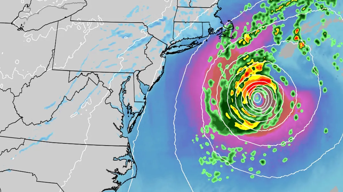
An October nor'easter is still hugging the Atlantic coast, where it will bring high surf, rip currents, coastal flooding and winds to parts of the East Coast for several more days. The National Hurricane Center is continuing to monitor this area for possible subtropical development. If it gets a name, it will be Josephine. However, regardless of whether we call this system a nor'easter or Josephine, the impacts will be the same. (MORE: What is a nor'easter?|nor'easter tracker)ImpactsWhile we do not expect this storm to be as strong as the late September nor'easter, there will still be some impacts. They are broken down below: Coastal floodingGet More of Our News on GoogleSet The Weather Company as a 'Preferred Source' to get quicker access to the news you value. The area most likely to be impacted the longest appears to stretch from the Delmarva Peninsula to eastern North Carolina. Coastal flood alerts are in effect for parts of coastal North Carolina, where anywhere from 1 to 4 feet of inundation is possible. High surf advisories are also in place across the North Carolina coastline, with waves potentially reaching up to 14 feet.
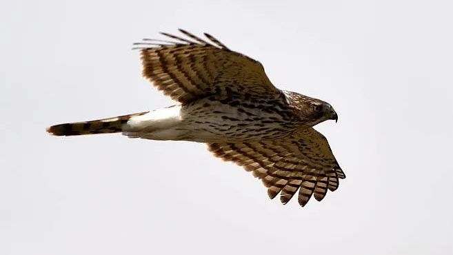
A hawk highway just opened overhead this October cold front
A Cooper's Hawk passing along the Dinosaur Ridge, counted as a local by a volunteer with Hawk Watch.(Denver Post via Getty Images)A hawk highway just opened overhead. Fall is migratory season for raptors, but the exact timing of their movement is determined most by the forecast. That's why when you see a cold front coming through in October, you can know they're on the move more now than ever. Here's your guide to October hawk watching if you want to catch these beautiful birds gliding through the sky. What birds are in flight? While weather influences exactly when most of these birds move, the phases in which each species moves are dictated a bit more by diet. Species that feed on insects during migration move the earliest. The broad-winged hawk is one example. Its movement is timed to follow when late-summer insects are most abundant, with its migration primarily happening in mid-September. But several other species all move around the same time in October. Get More of Our News on GoogleSet The Weather Company as a 'Preferred Source' to get quicker access to the news you value. Sharp-shinned hawks and Cooper's hawks feed primarily on other birds, moving along with their prey.
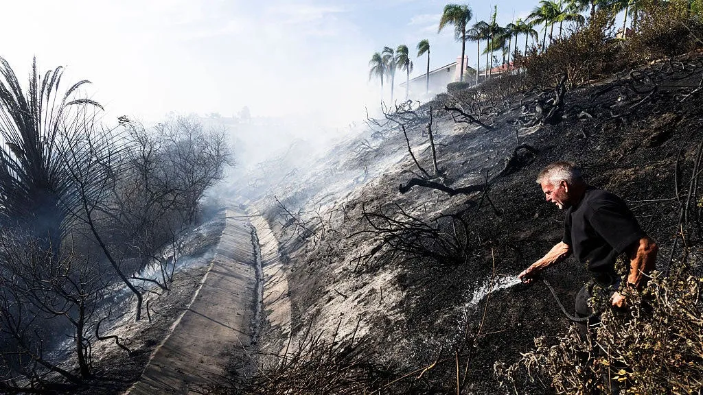
Rain threatens SoCal's new wildfire burn scars with debris flows
Scenes of destruction left behind by Southern California's Norte FireSouthern California was hit with wildfires this past week, and now rain forecast for the burn scars could mean danger ahead. We're watching two spots in particular: the burn scars left by the Bryson Fire in Malibu and the Norte Fire in San Clemente and San Juan Capistrano. Rain is expected to arrive Wednesday afternoon, with the heaviest falling Wednesday night into Thursday morning. On fresh burn scars, it doesn't take much to turn rain into a debris flow. Homeowner Steve Taylor uses a garden hose to put out hot spots behind homes on Calle Miramar during the Norte fire in San Juan Capistrano on Friday, Oct. 16, 2026.(Paul Bersebach/MediaNews Group/Orange County Register via Getty Images)How a debris flow could happen this weekHere's the number that matters: As little as 0.3 inch of rainfall in 30 minutes has triggered debris flows in Southern California, research from the U. S. Geological Survey has found. Any storm with intensities greater than about 0.4 inch an hour is at risk of producing debris flows.
0 comments
No comments yet. Be the first to share your thoughts!