Researchers advance aquifer mapping using remote sensing and statistical models to improve groundwater management - Phys.org
This story deserves to be shared
Send it to someone who'd care, or post it on your networks.
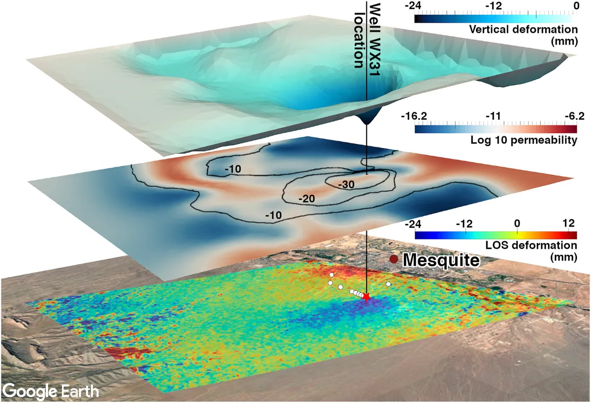
A conceptual figure from the study showing how researchers used InSAR deformation data to create a permeability map of the aquifer after about six months of groundwater pumping. The bottom layer is InSAR deformation data from remote sensing satellites laid over Google Earth images of the aquifer site. The middle layer is the inferred permeability map created using the Bayesian inversion framework. The top layer shows a view of vertical deformation experienced in the aquifer based on the permeability map, with peaks exaggerated to highlight changes. Credit: Alghamdi et al
Groundwater in many areas of the U. S. and across the globe is being depleted as pumping for drinking water and agriculture outpaces nature's ability to refill aquifers. In the most severe cases, this could lead to a point of no return, where an aquifer's physical structure collapses and it cannot be refilled.
This article is an excerpt. To read the full content, visit the original source. Phys.org
Related articles
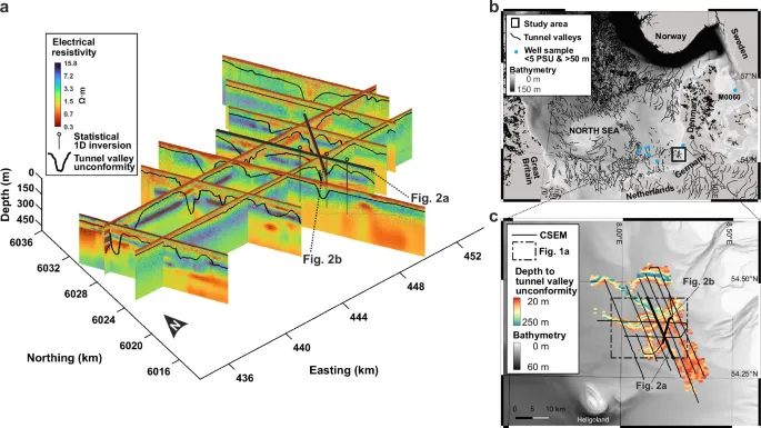
Subglacial landforms as proxy for offshore freshened groundwater in formerly glaciated margins - Nature
IntroductionOffshore freshened groundwater (OFG) is subsurface porewater with salinity below that of ambient seawater, occurring in sediments and rocks beneath or seaward of the shoreline. The definition refers to a salinity state rather than to a process and this distinction led to a recent proposal to rename the phenomenon Offshore Relatively Fresh Groundwater (ORFG), since "freshened" can be read as implying ongoing change1. OFG has emerged as a significant yet poorly constrained part of the global hydrological cycle, with reservoirs identified along continental margins worldwide2,3. Global water stress is growing, particularly in densely populated coastal regions. OFG is also of broader scientific importance for understanding geohazards, biogeochemical cycling, subseafloor microbiology, and the preservation of archaeological records. There is therefore an urgent need to better constrain the emplacement, stability, and distribution of OFG2,3,4,5,6,7,8,9,10.
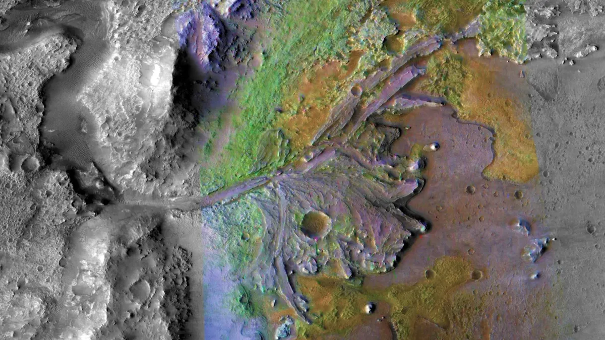
NASA's Perseverance Mars rover finds groundwater, lakes, and hot fluids in one place - Science Daily
A new study suggests that Jezero Crater's mysterious "Margin Unit" records a far more complicated history of water than scientists expected, involving ancient lakes, groundwater, and later hydrothermal activity. When NASA's Perseverance rover arrived at the inner rim of Mars' Jezero Crater in September 2023, researchers expected to encounter sedimentary rocks along what was once the shoreline of a Martian lake. Such rocks form as layers of material accumulate over long periods of time. On Earth, sedimentary rocks made from clay and silt can be especially valuable because they are capable of preserving evidence of ancient microbial life.
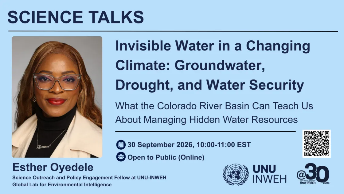
Science Talk: Invisible Water in a Changing Climate: Groundwater, Drought, and Water Security - UNU | United Nations University
Groundwater is one of the world’s most important yet least visible water resources, supporting communities, ecosystems, agriculture, and economies worldwide. As climate change intensifies drought and increases pressure on surface-water supplies, understanding groundwater responses is essential to building resilient and sustainable water systems. In this UNU-INWEH Science Talk, Esther Oyedele will explore the connections between climate change, groundwater, and water security, using the Colorado River Basin as a case study. Drawing on recent research into groundwater responses to severe surface-water shortages in the Upper and Lower Colorado River Basins, she will examine how responses can differ within the same river system and what these differences reveal about the hidden dimensions of drought. She will also connect these findings to broader global challenges in sustainable water management, environmental resilience, and human and ecosystem well-being, highlighting why groundwater must be central to discussions on climate adaptation and water security. You may watch the talk on the UNU-INWEH YouTube channel (no registration required).

[Talk] Yue Du and Nathan Lally — Data Science in Insurance: Connecting Statistical Methods, AI, and Industry Applications - The University of Rhode Island
AbstractIn this seminar, we will share what data science looks like in practice at Munich Re and HSB and how the skills students develop in statistics and computer science translate into industry applications. We will introduce Munich Re and HSB, discuss the role of data scientists within the organization, and walk through two example projects: a risk modeling application using conditional density modeling and a GenAI use case in the insurance domain. We will also share information about our 2027 Data Science Internship Program. BiosYue Du, Senior Data Scientist, HSBHer current work focuses on developing and implementing statistical and ML models, and AI applications in cyber insurance and market research.
0 comments
No comments yet. Be the first to share your thoughts!