Nikon Small World 2026 winners announced: See the photos
This story deserves to be shared
Send it to someone who'd care, or post it on your networks.

This microscopic view of an inkjet printer depositing ink onto paper was selected as the winning photo of the 2026 Nikon Small World competition. (Ole Bielfeldt via Nikon Small World)Colossal tornadoes, hurricanes and winter storms get plenty of attention. It's time to honor the tiniest phenomena among us. The Nikon Small World Photomicrography Competition has just announced its winner for 2026 — it's the picture above. Taken by Ole Bielfeldt in Cologne, Germany, it shows a printer dropping ink onto paper like raindrops falling on the flat ground. The annual competition honors the best of the best in photography under the light microscope. Simply put, it's some of the most awe-inspiring and downright coolest photography you'll see all year. Below, you can see a few of our favorite finalists. For the full top 20 and to see previous winners, head to the competition's website.(MORE: Video winners take us into worlds the eyes can't see)Second place — John-Oliver DumExtreme macro close-up of a jumping spider's face with large black eyes, white scales and pollen grains.(John-Oliver Dum via Nikon Small World)Third place — Kaelin Wulf and Ms.
This article is an excerpt. To read the full content, visit the original source. The Weather Channel
Related articles

Nikon’s Small World photomicrography competition winners – in pictures - The Guardian
The 52nd annual Nikon Small World competition honours the world’s most remarkable images captured through a microscope. The first-place prize was awarded to Ole Bielfeldt, a student and experimental photographer, for his image of ink droplets suspended inside an inkjet printer as it printsWinning image – a microscopic view of an inkjet printer depositing ink on to paper.
Orionid meteor shower 2026: cloud cover forecast by region
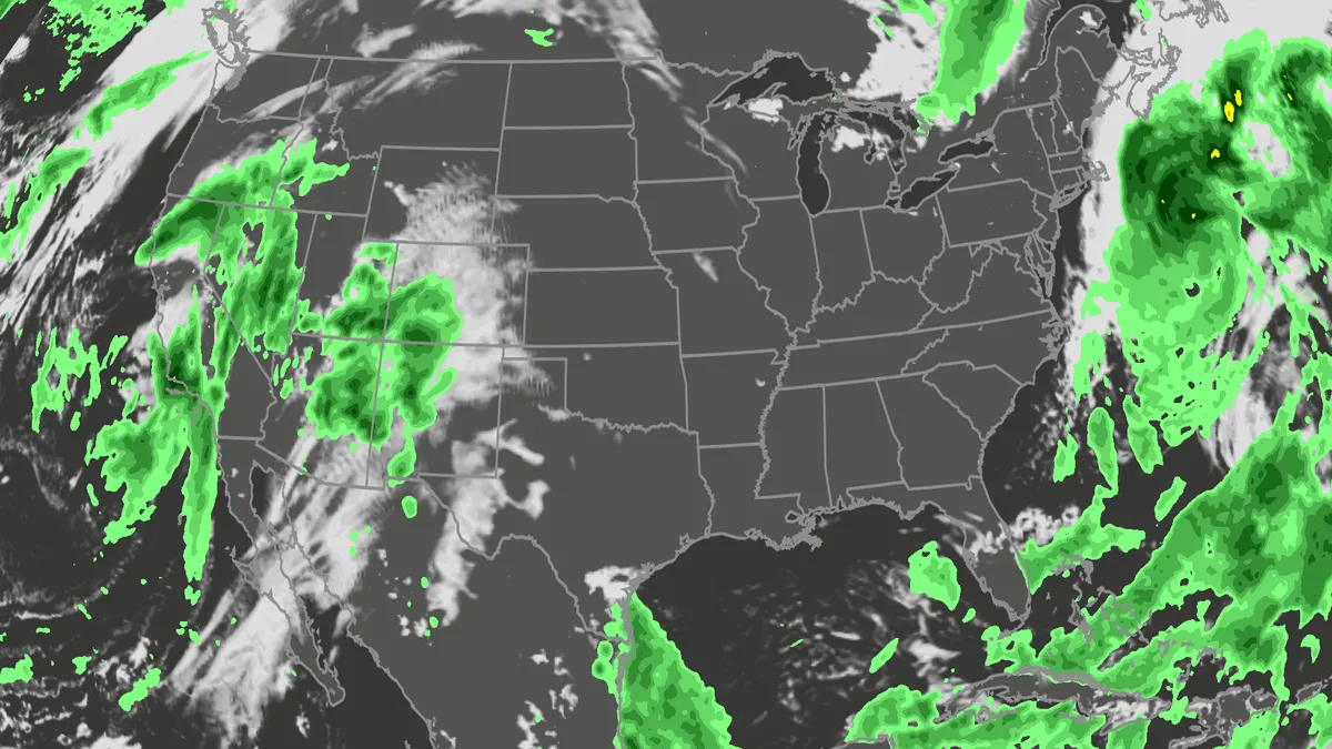
A meteor streaks across the sky over a desert in China during the Orionid meteor shower on Oct. 22, 2023.(VCG/VCG via Getty Images)The Orionid meteor shower is peaking this week, and it promises to be one of the most dazzling displays of the year. And while some of you will have clear skies, rain and clouds could impact the view for others. Here's what you need to know about the Orionids and your forecast:Fast factsPeak day: The meteor shower peaks Wednesday night, Oct. 21, into the early hours of Thursday morning, Oct. 22. Peak time: From midnight to dawn are the best hours to catch the meteors streaking through the sky, so plan on a late night or really early morning. What the Orionids are known for: The Orionid meteors are known for their brightness and their speed. As they streak across the sky at around 41 miles per second, the meteors leave behind a glowing "train" that can last several seconds to minutes. While you can make the perfect plan to catch the Orionids, the key to stellar viewing is still in Mother Nature's hands. The good news is that many of you should have good meteor shower-watching conditions. Much of the central and eastern U. S.
Flood risk, severe storms threat from California to Colorado
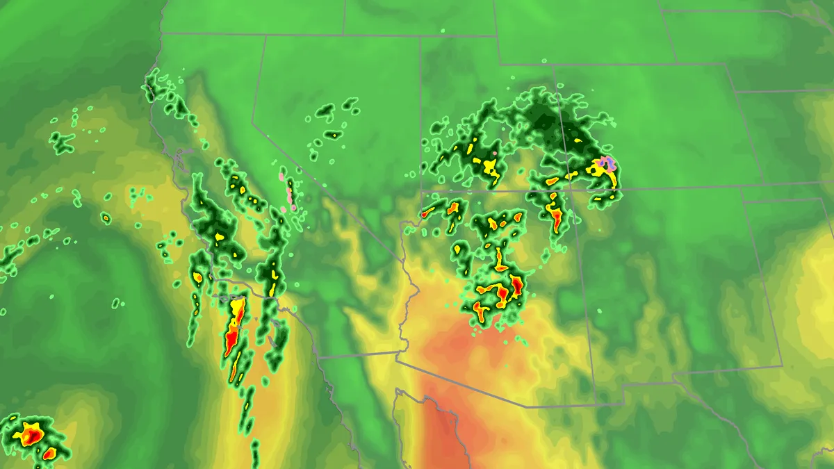
Large hail, tornadoes, flooding possible on Wednesday for SouthwestTropical moisture and favorable atmospheric conditions will fuel a multiday flood risk this week across seven states from California to Colorado. Severe storms are also likely, especially across Arizona. Millions are under a flood watch as days of rain will bring a threat of debris flows and landslides, especially across burn scars. Happening nowSevere storms and bands of heavy rainfall are hitting parts of California and the Four Corners region. Any ongoing tornado watches and warnings as well as any flash flood warnings are on the map below: Timing out this week’s rainfallWednesday overnight: The highest risk of flooding covers much of Arizona and New Mexico, and portions of Colorado and Utah, as well as Southern California. There will be an abundance of moisture available to support heavy downpours and training storms. This means storms will produce heavy rain over the same areas for long periods of time. The Weather Prediction Center is forecasting rainfall rates as high as 2 inches per hour. Get More of Our News on GoogleSet The Weather Company as a 'Preferred Source' to get quicker access to the news you value
Subtropical Storm Josephine churns up high waves, winds
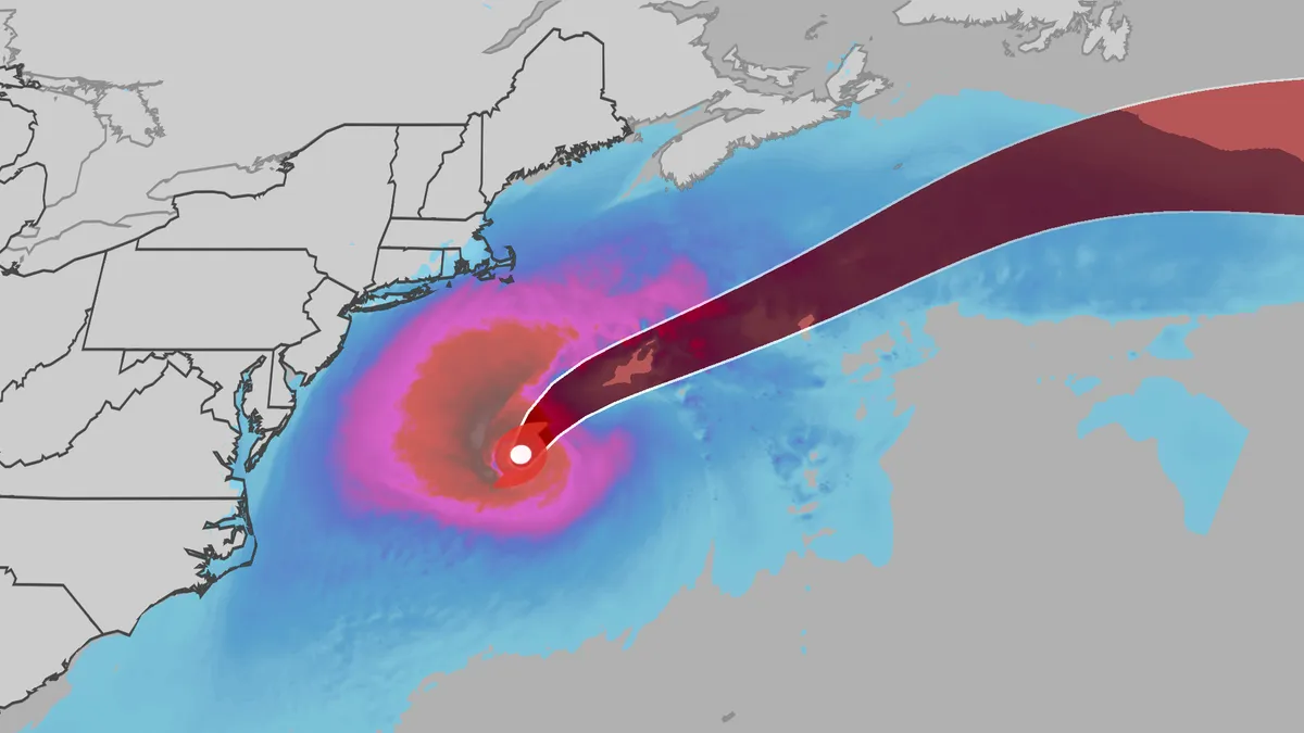
An October nor'easter is still hugging the Atlantic coast, and the National Hurricane Center just officially named the system Subtropical Storm Josephine. Even though the storm has been named Josephine, the impacts will be the same as if it were only a nor'easter. (MORE: What is a subtropical storm?|Josephine tracker)Here's the latestSubtropical Storm Josephine has winds of 65 mph and is located about 265 miles south of Nantucket, Massachusetts, moving north at 10 mph. Josephine is expected to stay well offshore and will turn to the east. It actually will strengthen slightly, potentially reaching sustained winds of 80 mph on Friday. The heaviest winds and rain will stay off shore, but rip currents could be life-threatening the rest of the week. (MORE: 'This job can kill you': Meet the people on the wildfire frontlines)ImpactsWhile we do not expect Josephine to be as impactful as the late September nor'easter, there will still be some. They are broken down below: Get More of Our News on GoogleSet The Weather Company as a 'Preferred Source' to get quicker access to the news you value.
Subtropical Storm Josephine maps tracker: radar and more
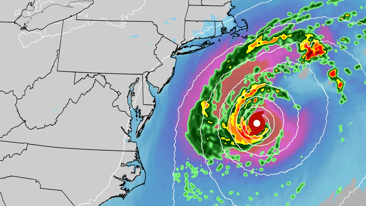
An October nor'easter received the name Subtropical Storm Josephine. The storm is swirling off the East Coast, bringing gusty winds, coastal flooding and rip currents to much of the region. Track the storm here with all the maps you need. (MORE: Subtropical Storm Josephine in the Atlantic)Current informationCurrent wind gustsCoastal flood alertsImpact forecastTrackGet More of Our News on GoogleSet The Weather Company as a 'Preferred Source' to get quicker access to the news you value. Wave heightsRiver gauge forecast
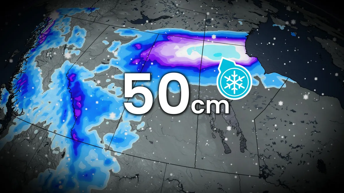
50 cm: Parts of the Prairies in line for a blast of wintry weather
Folks across portions of the Prairies may need to dig their Halloween decorations out of the snow this week as a round of widespread snow moves into the provinces late Thursday through Friday. A strong low-pressure system developing across the American Rockies will push across the Prairies this week, bringing wind and widespread snow to all three provinces in the region. Some areas on the northern Prairies could see up to 50 cm of snow. SEE ALSO: Canadian officials say high winds intensified tragic fire at CFB WainwrightSignificant impacts on morning commutes are likely as the roads become messy from snow and winds. People likely don't have winter tires on, yet, either, so use extra caution when driving in this weather. Consider postponing travel in the hardest-hit regions. Widespread snow into this weekendA potent, cold air mass from Northern Canada will envelope all of B. C., Alberta and parts of Saskatchewan on Friday and Saturday. It will collide with abundant moisture lifting onto the Prairies from the Pacific Ocean and Gulf of Mexico. The result is a large fall storm with wind, rain and impactful snow across the Prairies.
0 comments
No comments yet. Be the first to share your thoughts!