Subtropical Storm Josephine maps tracker: radar and more
This story deserves to be shared
Send it to someone who'd care, or post it on your networks.
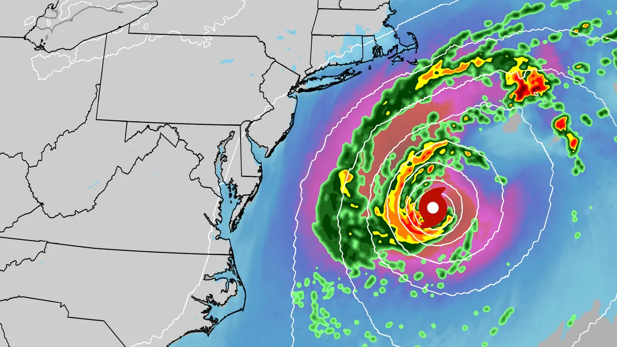
An October nor'easter received the name Subtropical Storm Josephine. The storm is swirling off the East Coast, bringing gusty winds, coastal flooding and rip currents to much of the region. Track the storm here with all the maps you need. (MORE: Subtropical Storm Josephine in the Atlantic)Current informationCurrent wind gustsCoastal flood alertsImpact forecastTrackGet More of Our News on GoogleSet The Weather Company as a 'Preferred Source' to get quicker access to the news you value. Wave heightsRiver gauge forecast
This article is an excerpt. To read the full content, visit the original source. The Weather Channel
Related articles

Bryan Norcross: The last day for Subtropical Storm Josephine before it morphs into a non-tropical system
Subtropical Storm Josephine to race away from East Coast, lashing New England with strong wind gusts Subtropical Storm Josephine is spinning less than 200 miles south of southern New England, lashing parts of the Massachusetts coast and eastern portions of New York's Long Island with strong wind gusts as it begins to accelerate away from the East Coast. Josephine blasted parts of the Carolina and Mid-Atlantic coasts earlier in the week with strong winds, coastal flooding and beach erosion as a strong nor'easter, before acquiring enough tropical characteristics in the warm waters off the Southeast to be named by the National Hurricane Center (NHC) on Wednesday. Last updated at 10 a.m. on Thursday, Oct. 22, 2026. The system that was the non-tropical nor'easter and yesterday morphed into Subtropical Storm Josephine is forecast to remorph into a non-tropical North Atlantic system late today or tonight. Except for southeastern New England, winds are letting up along the East Coast, but large waves will continue to pound the shoreline, so overwash in vulnerable areas is still possible.
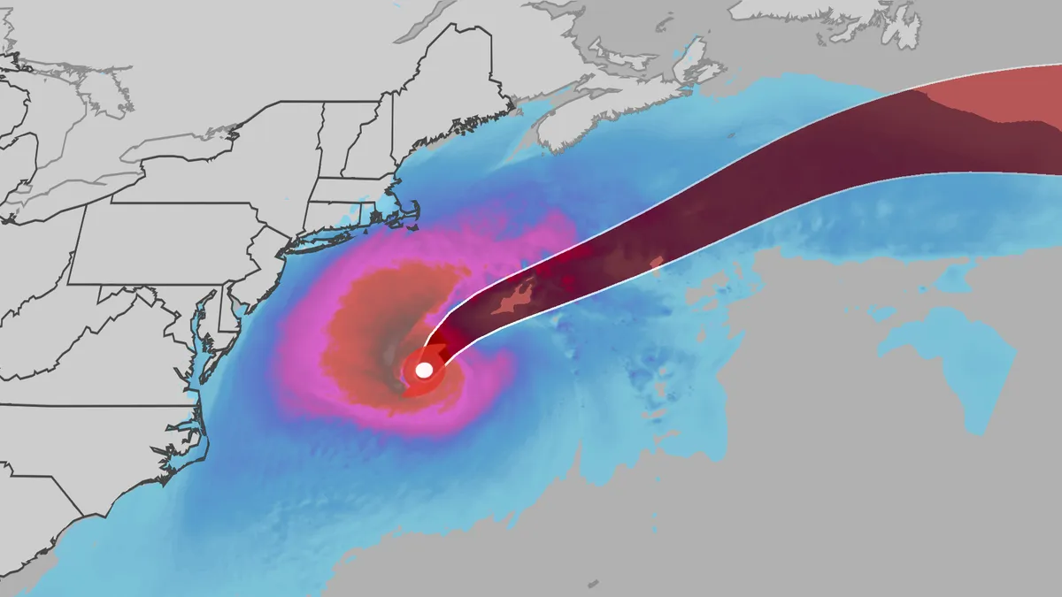
Subtropical Storm Josephine churns up high waves, winds
An October nor'easter is still hugging the Atlantic coast, and the National Hurricane Center just officially named the system Subtropical Storm Josephine. Even though the storm has been named Josephine, the impacts will be the same as if it were only a nor'easter. (MORE: What is a subtropical storm?|Josephine tracker)Here's the latestSubtropical Storm Josephine has winds of 65 mph and is located about 265 miles south of Nantucket, Massachusetts, moving north at 10 mph. Josephine is expected to stay well offshore and will turn to the east. It actually will strengthen slightly, potentially reaching sustained winds of 80 mph on Friday. The heaviest winds and rain will stay off shore, but rip currents could be life-threatening the rest of the week. (MORE: 'This job can kill you': Meet the people on the wildfire frontlines)ImpactsWhile we do not expect Josephine to be as impactful as the late September nor'easter, there will still be some. They are broken down below: Get More of Our News on GoogleSet The Weather Company as a 'Preferred Source' to get quicker access to the news you value.
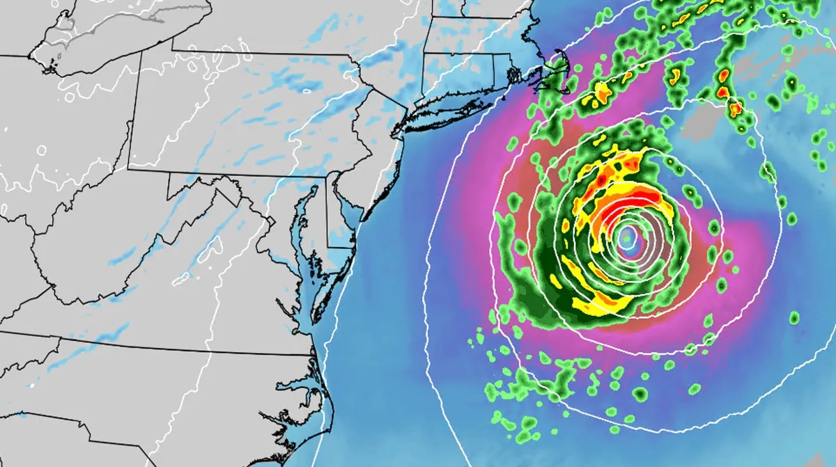
Subtropical Storm Josephine churns up high waves, winds
An October nor'easter is still hugging the Atlantic coast, and the National Hurricane Center just officially named the system Subtropical Storm Josephine. Even though the storm has been named Josephine, the impacts will be the same as if it were only a nor'easter. (MORE: What is a subtropical storm?|Josephine tracker)Where will it go? Josephine is expected to stay well offshore and will head to the northeast over the next few days. It actually will strengthen slightly, potentially reaching sustained winds of 80 mph on Friday. The heaviest winds and rain will stay off shore, but rip currents could be life-threatening the rest of the week. (MORE: 'This job can kill you': Meet the people on the wildfire frontlines)ImpactsWhile we do not expect this storm to be as strong as the late September nor'easter, there will still be some impacts. They are broken down below: Coastal floodingGet More of Our News on GoogleSet The Weather Company as a 'Preferred Source' to get quicker access to the news you value. The area most likely to be impacted the longest appears to stretch from the Delmarva Peninsula to eastern North Carolina.
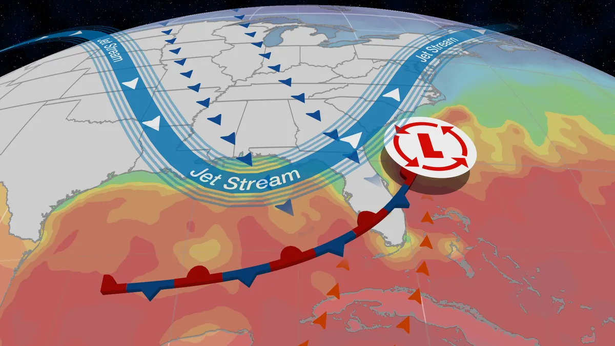
What is a subtropical storm, and why are they dangerous?
Nicole as a subtropical storm. (CIRA/NOAA)A subtropical storm is different from a tropical storm, hurricane and even a nor'easter - and it can mean a lot of rain, wind and rough sea conditions for those living along the coast. Subtropical storms in the Atlantic Basin can occur one or more times each hurricane season, and are a mix of two different, familiar storm types. We will break down these two more common storms and explain how subtropical storms fall between them. Type 1: Tropical LowsAlso called tropical cyclones, these are low-pressure systems fueled solely by heat energy released when water vapor that has evaporated off warm ocean water condenses into liquid. Due to all this heat, the core circulation of a tropical cyclone is warm, and its strongest winds are usually found near its center. With low wind shear and moist air, tropical storms can intensify into hurricanes. Most storms that impact a wide part of the Lower 48 are extratropical lows. Think of winter storms, lows that slam into the West Coast or storms off the coast of the East Coast. Get More of Our News on GoogleSet The Weather Company as a 'Preferred Source' to get quicker access to the news you value.
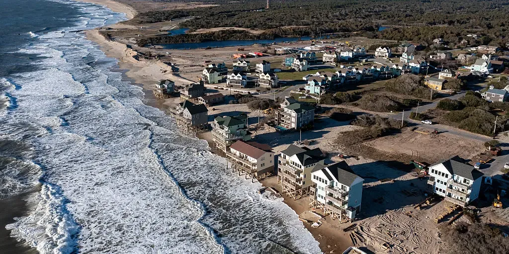
Brewing Fall nor'easter could become subtropical as storm threatens millions along East Coast
THE TAKEAWAYA nor’easter is expected to begin to form off the Carolina coast late Sunday. The system’s track and intensity remain highly uncertain but showers, gusty winds, high surf and coastal flooding could impact areas from Florida through the Carolinas to New Jersey. Mandatory evacuation issued for all visitors on Hatteras Island along the North Carolina Outer Banks. This storm could take on subtropical characteristics later next week. A nor’easter is expected to form off the Carolina coast late Sunday, bringing gusty winds and coastal flooding to millions from the Jersey Shore to the Outer Banks early next week. The National Hurricane Center said Saturday afternoon that this storm could take on some subtropical characteristics over the next seven days as it stalls off the Southeast coast. WHAT IS A NOR'EASTER? Nor'easter could take on subtropical characteristics this week. (FOX Weather / FOX Weather)"If the system were to meander near North Carolina or Virginia, where the ocean is unusually warm, there is a slight chance that the front could dissipate and the system could become somewhat tropical," FOX Weather Hurricane Specialist Bryan Norcross said.

Warnings persist as high winds, heavy snow hit the Prairies
Steady snowfall will continue for a wide swath of the Prairies as a blustery low-pressure system continues trekking across the region. Calgary picked up measurable snowfall early Friday. Additional accumulations are likely toward the east, with some areas on the northern Prairies picking up as much as 50 cm of snow. Warnings remain in effect for both high winds and winter storm conditions. PHOTOS: Burst of October snow falls over major Canadian citiesThe large low-pressure system responsible for the early dose of wintry weather will continue lifting north as we head into Saturday, bringing heavy snowfall to the north and blowing snow to southern regions. Wind gusts of 50-80+ km/h will persist through Saturday across Saskatchewan and Manitoba, easing into the overnight hours. Sudden reductions in visibility are expected late Friday into early Saturday across southern Saskatchewan as brief but intense snowfall accompanies the gusty winds in the region. Content continues belowRELATED: What’s the snowiest month in your corner of Canada? High snowfall rates will continue into the weekend across northern portions of Saskatchewan and Manitoba, including Cree Lake and Black Lake.
0 comments
No comments yet. Be the first to share your thoughts!