Good morning, Midland! Here's today's weather! - MidlandToday.ca
This story deserves to be shared
Send it to someone who'd care, or post it on your networks.
This article is an excerpt. To read the full content, visit the original source. MidlandToday.ca
Related articles

Nikon Small World 2026 winners announced: See the photos
This microscopic view of an inkjet printer depositing ink onto paper was selected as the winning photo of the 2026 Nikon Small World competition. (Ole Bielfeldt via Nikon Small World)Colossal tornadoes, hurricanes and winter storms get plenty of attention. It's time to honor the tiniest phenomena among us. The Nikon Small World Photomicrography Competition has just announced its winner for 2026 — it's the picture above. Taken by Ole Bielfeldt in Cologne, Germany, it shows a printer dropping ink onto paper like raindrops falling on the flat ground. The annual competition honors the best of the best in photography under the light microscope. Simply put, it's some of the most awe-inspiring and downright coolest photography you'll see all year. Below, you can see a few of our favorite finalists. For the full top 20 and to see previous winners, head to the competition's website.(MORE: Video winners take us into worlds the eyes can't see)Second place — John-Oliver DumExtreme macro close-up of a jumping spider's face with large black eyes, white scales and pollen grains.(John-Oliver Dum via Nikon Small World)Third place — Kaelin Wulf and Ms.

Hazardous chemical leak drives Toledo residents from their homes
TOLEDO, Ohio (AP) — Some Ohio residents have been ordered to evacuate because of the release of a chemical that can cause burning of the eyes, nose, mouth and skin, and other residents have been told to shelter in place, the city fire department said Wednesday. People within a 1-mile radius of the “hazardous materials release” were ordered to evacuate at about 10:50 p.m. Tuesday. The shelter-in-place order was issued for Toledo residents within a 3-mile radius beyond that area. Dense fog and haze hindered visibility in the city of about 265,000 people and local news stations reported smelling a plastic-like odor. The dense fog lingered this morning. The National Weather Service has issued a a dense fog advisory until 10 a.m. Once the fog clears out, it will make way for sunny skies through the rest of the day, but winds will remain light and variable. Winds will mostly be coming from the northeast, but low wind speeds will not help much in clearing out the chemicals in the air any time soon, The Weather Channel meteorologist Miriam Guthrie said.
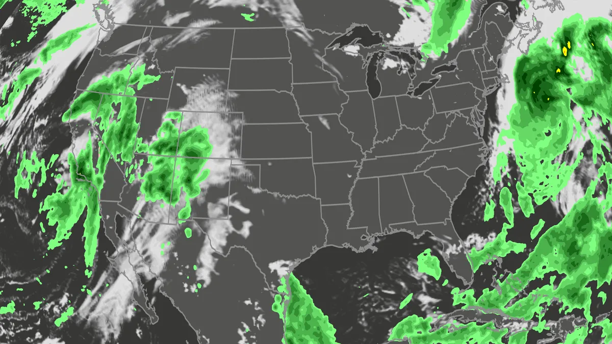
Orionid meteor shower 2026: cloud cover forecast by region
A meteor streaks across the sky over a desert in China during the Orionid meteor shower on Oct. 22, 2023.(VCG/VCG via Getty Images)The Orionid meteor shower is peaking this week, and it promises to be one of the most dazzling displays of the year. And while some of you will have clear skies, rain and clouds could impact the view for others. Here's what you need to know about the Orionids and your forecast:Fast factsPeak day: The meteor shower peaks Wednesday night, Oct. 21, into the early hours of Thursday morning, Oct. 22. Peak time: From midnight to dawn are the best hours to catch the meteors streaking through the sky, so plan on a late night or really early morning. What the Orionids are known for: The Orionid meteors are known for their brightness and their speed. As they streak across the sky at around 41 miles per second, the meteors leave behind a glowing "train" that can last several seconds to minutes. While you can make the perfect plan to catch the Orionids, the key to stellar viewing is still in Mother Nature's hands. The good news is that many of you should have good meteor shower-watching conditions. Much of the central and eastern U. S.
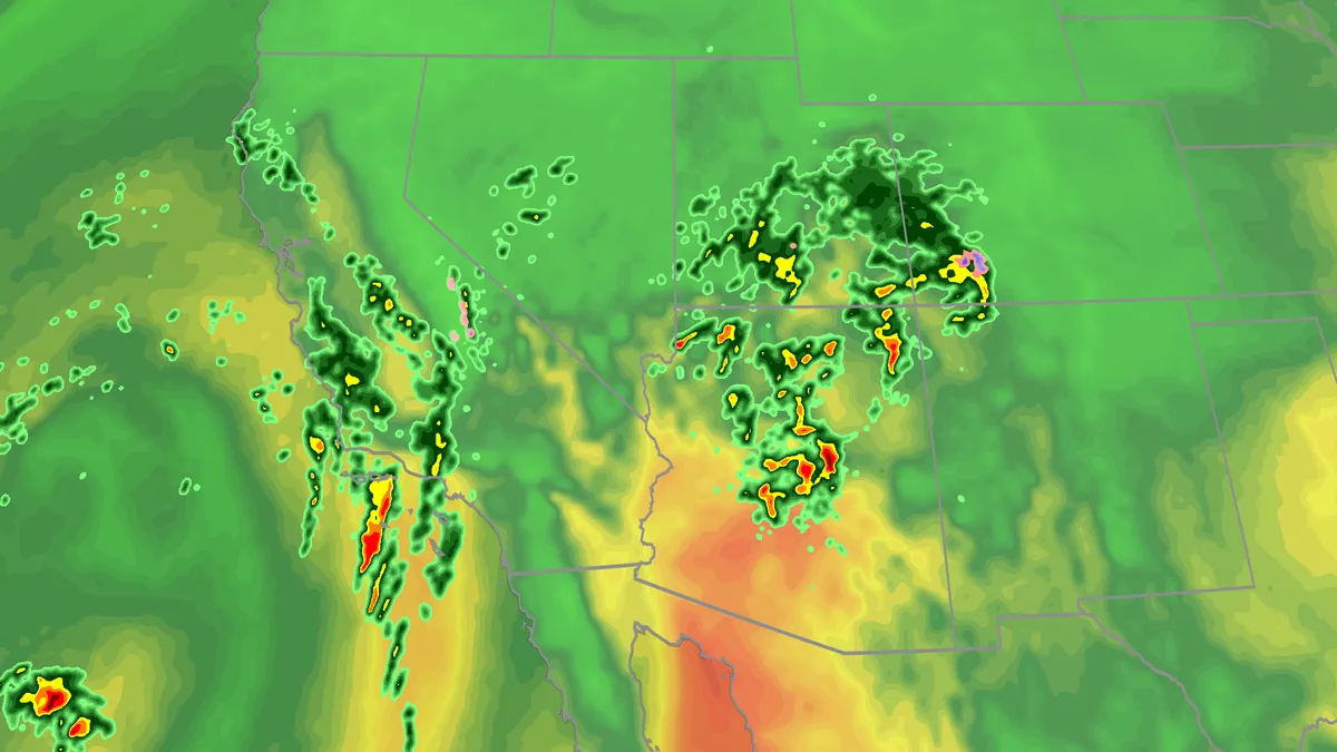
Flood risk, severe storms threat from California to Colorado
Hurricane Trudy will bring flood threat to the Southwest USTropical moisture and favorable atmospheric conditions will fuel a multiday flood risk this week across seven states from California to Colorado. Severe storms are also likely, especially across Arizona. Days of rain will bring a threat of debris flows and landslides, especially across burn scars. Timing out this week’s rainfallWednesday: The highest risk of flooding on Wednesday covers much of Arizona and New Mexico, and portions of Colorado and Utah, as well as Southern California. There will be an abundance of moisture available to support heavy downpours and training storms. This means storms will produce heavy rain over the same areas for long periods of time. The Weather Prediction Center is forecasting rainfall rates as high as 2 inches per hour. Some of the biggest concerns will be the possibility of mudslides over recent burn scar areas as well as slot canyons and arroyos. If you have plans to visit any of the national parks in the West this week, make sure you check the forecast daily and pay attention to any warnings or advisories issued.
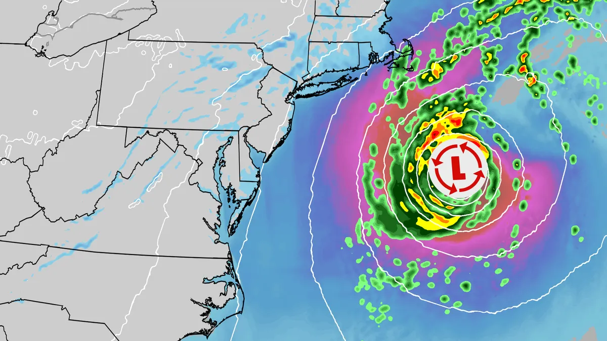
Nor'easter tracker: Radar, forecasts, current info and more
An October nor'easter is swirling off the East Coast, bringing gusty winds, coastal flooding and rip currents to much of the region. Track the storm here with all the maps you need. (MORE: Nor'easter lashes coast from Carolinas to Northeast)Current informationCurrent wind gustsCoastal flood alertsImpact forecastWave heightsGet More of Our News on GoogleSet The Weather Company as a 'Preferred Source' to get quicker access to the news you value. River gauge forecastCould it get a name? The National Hurricane Center is watching this nor'easter as well. Due to its unique properties, should it get a name, it will become Subtropical Storm Josephine.
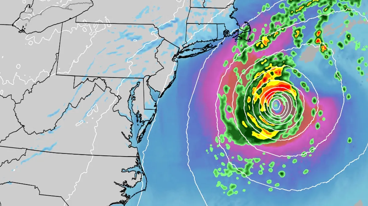
Nor'easter lashes coast from Carolinas to Northeast
An October nor'easter is still hugging the Atlantic coast, where it will bring high surf, rip currents, coastal flooding and winds to parts of the East Coast for several more days. The National Hurricane Center is continuing to monitor this area for possible subtropical development. If it gets a name, it will be Josephine. However, regardless of whether we call this system a nor'easter or Josephine, the impacts will be the same. (MORE: What is a nor'easter?|nor'easter tracker)ImpactsWhile we do not expect this storm to be as strong as the late September nor'easter, there will still be some impacts. They are broken down below: Coastal floodingGet More of Our News on GoogleSet The Weather Company as a 'Preferred Source' to get quicker access to the news you value. The area most likely to be impacted the longest appears to stretch from the Delmarva Peninsula to eastern North Carolina. Coastal flood alerts are in effect for parts of coastal North Carolina, where anywhere from 1 to 4 feet of inundation is possible. High surf advisories are also in place across the North Carolina coastline, with waves potentially reaching up to 14 feet.
0 comments
No comments yet. Be the first to share your thoughts!