Alberta drivers beware thick fog, slick roads into Saturday - The Weather Network
This story deserves to be shared
Send it to someone who'd care, or post it on your networks.
This article is an excerpt. To read the full content, visit the original source. The Weather Network
Related articles
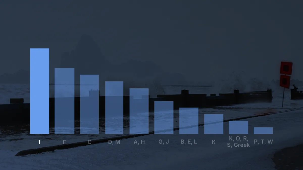
Beware the 'I' hurricanes, even during a super El Niño
Hurricane Isaias appears to be the most impactful storm of the 2026 Atlantic hurricane season dominated by a super El Niño. So far this century, storms beginning with "I" have often been the most damaging. (MORE: Latest forecast | tracking maps)Eleven "I" hurricanes retiredOver the past 25 years, 11 other "I" hurricanes have had their names retired by the World Meteorological Organization. By retired, we mean no future Atlantic Basin storm will use that name again. The name is retired when a particular tropical storm or hurricane is so deadly and/or damaging that future use might be considered insensitive or confusing. When that happens, a new name is chosen by a WMO committee that will be used every six years going forward. Isaias replaced Ike when that notorious 2008 hurricane name was retired. Get More of Our News on GoogleSet The Weather Company as a 'Preferred Source' to get quicker access to the news you value. Tracks and locations of retired hurricanes starting with the letter "I" from 2001 through 2025. (Data: NOAA/NHC)The notorious "I" listHere's the list of 11 retired "I" hurricanes, starting with the most recent.
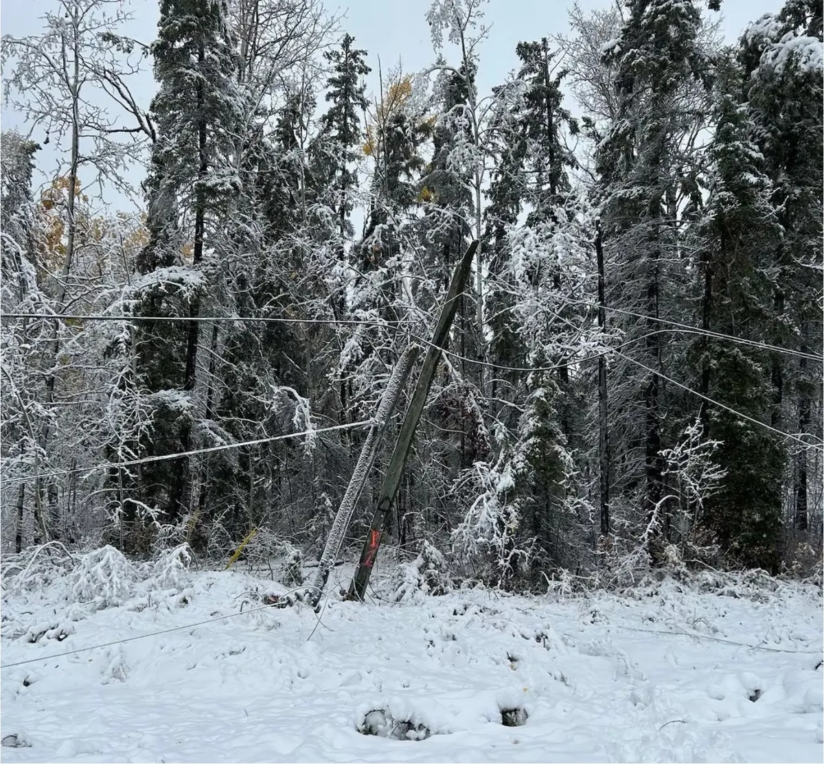
Beware the dangers of fall snowstorms across Canada
Snow is a defining part of everyday life for folks across Canada. But even a close relationship with frozen precipitation can turn into a dicey ordeal at times. Canadians should beware the dangers of autumn snowstorms. These early-season systems can prove more hazardous than meets the eye. DON’T MISS: How to prepare your vehicle for the cold weather aheadSnow can arrive pretty early from coast to coastWinter weather doesn’t wait for the seasons to change before flakes start flying across the country. Calgary saw 24.6 cm of snow on Sept. 29, 2019, an event that cancelled classes and knocked out power to communities across the region. Winnipeg saw the exact same amount of snow the day before Halloween in 1971. A coastal storm walloped Halifax with 38.6 cm of snow on Oct. 20, 1974, which still stands today as one of the city’s largest single-day snowfalls on record. First snow is dangerous as people acclimate to drivingThe first snow of the season is always a doozy on the roads as drivers get used to navigating slick conditions. Traffic accidents and long delays are a hazard during any storm, but especially during the first coating on the roads.
Montreal weather: Beware the vibes of March - Montreal Gazette
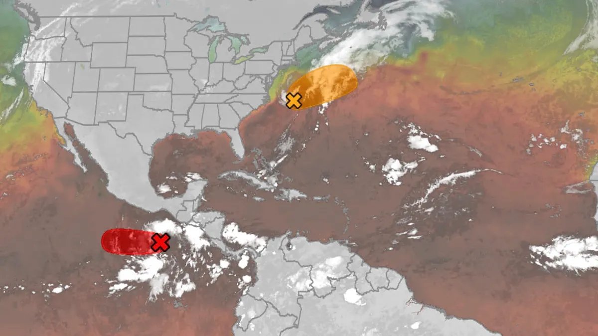
Hurricane season maps tracker: Latest forecasts and more
We have the maps you need to track all the systems ongoing in the Pacific and Atlantic below. Tracking the AtlanticTropical development areasSea surface temperatures Wind shear These are areas of strong wind shear, the difference in wind speed and direction with height, which are shown in purple. High wind shear is hostile to mature tropical cyclones and those trying to develop.(MORE: What is wind shear?)Get More of Our News on GoogleSet The Weather Company as a 'Preferred Source' to get quicker access to the news you value. Dry, dusty airAnother nemesis of tropical systems is dry air. In hurricane season, plumes of dust-laden air stream across the basin from Africa's Sahara Desert, as you can see in the map below. This sinking, dry air squelches thunderstorm development, the building blocks of tropical storms and hurricanes. So areas in the brown shading below are generally unfavorable for development. Atlantic tracks so far this seasonThese are the tracks of systems that were at least tropical or subtropical storms so far in the Atlantic Basin.
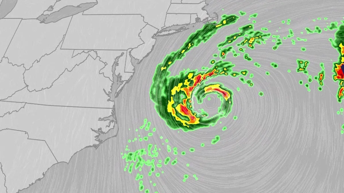
Nor'easter lashes coast from Carolinas to Northeast
An October nor'easter is meandering off the Atlantic coast, where it will bring high surf, rip currents, coastal flooding and winds to parts of the East Coast for several days this week. The National Hurricane Center has highlighted it as an area to watch this week for the potential development of Josephine. However, regardless of whether we call this system a nor'easter or Josephine, the impacts will be the same. The bottom line: This system will bring dangerous conditions to the East Coast for multiple days this week.(MORE: What is a nor'easter?)ImpactsWhile we do not expect this storm to be as strong as the late September nor'easter, there will still be some impacts. They are broken down below: Coastal floodingGet More of Our News on GoogleSet The Weather Company as a 'Preferred Source' to get quicker access to the news you value. The area most likely to be impacted the longest appears to stretch from the Delmarva Peninsula to eastern North Carolina. Coastal flood alerts are in effect for parts of coastal North Carolina, where anywhere from 1 to 4 feet of inundation is possible.
0 comments
No comments yet. Be the first to share your thoughts!