A Major Cold Intrusion Spreads Across Eastern Europe: First Seasonal Frost to Follow
This story deserves to be shared
Send it to someone who'd care, or post it on your networks.
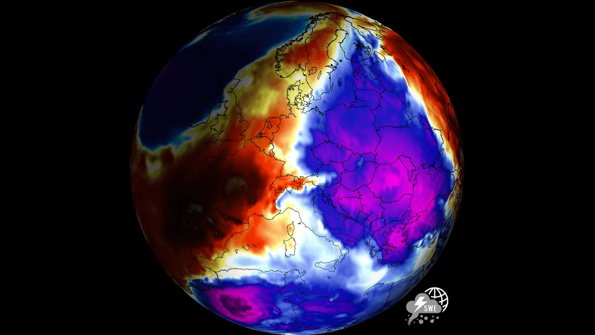
The main driver of this rapid thermal drop this week is a massive upper-level blocking ridge building over the North Atlantic and Scandinavia. This high-pressure area is forcing a direct atmospheric corridor for meridional flow from the north, allowing dense, polar-origin air to spill deep across Eastern Europe. As the cold front pushes south, daytime high temperatures across impacted regions will plunge by 10 to 15 °C compared to recent seasonal averages. As the polar air mass settles over the region, clear nocturnal skies and lighter winds will support first morning frost across low-lying valleys and agricultural basins from the Baltic countries down to the central Balkans, reaching Romania and Bulgaria. Across the higher elevations of the Carpathians and possibly the Northern Balkans, falling freezing levels will trigger the first notable high-altitude snowfalls of the autumn season. While the cold intrusion will last only through the mid-week days, it will be significant for the second half of September. The meteogram charts for Niš, Serbia (upper) and Istanbul, Turkey (bottom) both show a sharp temperature drop on Tuesday and Wednesday.
This article is an excerpt. To read the full content, visit the original source. Severe Weather Europe
Related articles
Nor' easter to bring coastal flooding, winds to East Coast
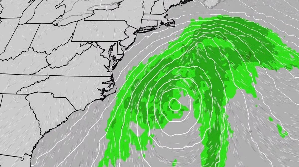
An October nor'easter is developing in the Atlantic, where it will bring high surf, rip currents, coastal flooding and winds to parts of the East Coast for several days this week. The National Hurricane Center has highlighted it as an area to watch this week for the potential development of Josephine. However, regardless of whether we call this system a nor'easter or Josephine, the impacts will be the same. The bottom line: This system will bring dangerous conditions to the East Coast for multiple days this week.(MORE: What is a nor'easter?)Fortunately, this nor'easter doesn't look to be as strong as the one in September. But the bad news? It could linger for much of the week, so impacts could have a longer duration. Coastal flood alerts are in effect for parts of coastal North Carolina and Virginia, where anywhere from 1 to 4 feet of inundation is possible. Get More of Our News on GoogleSet The Weather Company as a 'Preferred Source' to get quicker access to the news you value. Key takeawaysWe do not expect this storm to be as strong as the late September nor'easter.
Hurricane season maps tracker: Latest forecasts and more
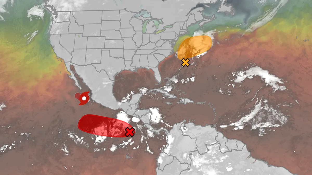
We have the maps you need to track all the systems ongoing in the Pacific and Atlantic below. Tracking the AtlanticTropical development areasSea surface temperatures Wind shear These are areas of strong wind shear, the difference in wind speed and direction with height, which are shown in purple. High wind shear is hostile to mature tropical cyclones and those trying to develop.(MORE: What is wind shear?)Get More of Our News on GoogleSet The Weather Company as a 'Preferred Source' to get quicker access to the news you value. Dry, dusty airAnother nemesis of tropical systems is dry air. In hurricane season, plumes of dust-laden air stream across the basin from Africa's Sahara Desert, as you can see in the map below. This sinking, dry air squelches thunderstorm development, the building blocks of tropical storms and hurricanes. So areas in the brown shading below are generally unfavorable for development. Atlantic tracks so far this seasonThese are the tracks of systems that were at least tropical or subtropical storms so far in the Atlantic Basin.

Winter storm checklist: What to do 72, 48, and 24 hours before it hits
Winter storm prep checklist: what to do 72, 48 and 24 hours outYou get the warning that a winter storm is coming: When you prepare matters as much as how you prepare. So I asked experts what you should do in the 72 hours, 48 hours and 24 hours before the storm arrives.(MORE: Your first freeze is coming — see average dates by region)Dan Stoneking spent a career in the U. S. Army and 15 years at FEMA. He’s now the founder and owner of Stoneking Strategic Communications. Remy Kennedy is a communications program manager with the American Red Cross. Both say you should create a checklist, and here’s what should be on it.72 hours before a storm: stock up and run errands“At 72 hours out, I like to tell people that’s basically the time you do all the things outside of your house,” Stoneking said. “One of the first things you want to do is evaluate your home situation,” Kennedy said. Who might need extra care in the cold? Kids, pets, older relatives, neighbors living alone. Then you need to make your errands list.
Brewing nor’easter threatens East Coast with days of coastal flooding, strong winds and pounding surf
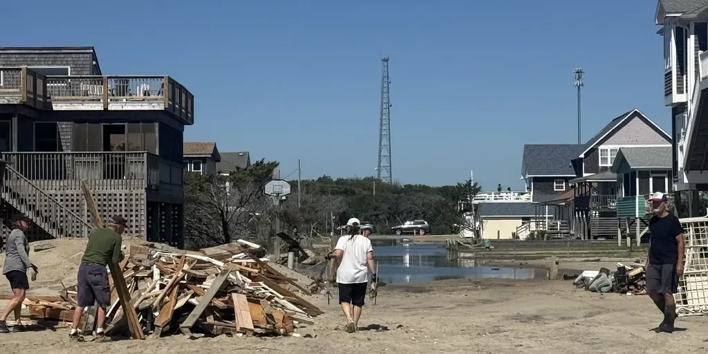
The next fall nor’easter is brewing off the North Carolina coast, setting the stage for extensive impacts throughout the week. The National Hurricane Center is now highlighting this area for potential tropical development, with a 30% chance over the next seven days. WHAT IS A NOR’EASTER? Regardless of tropical development, the Outer Banks are expected to see long-term impacts, including intense wind gusts from the approaching nor’easter, while the storm sits off the coast. The main concern for the Outer Banks region will be intense wind gusts as strong as 40 to 60 mph, fueling moderate coastal flooding and destructive waves. A mandatory evacuation for locals on Hatteras Island is in effect, as storm conditions are expected to worsen, with the potential for significant ocean overwash. This graphic shows the Wind Alerts for the upcoming Nor’easter.(FOX Weather) According to the FOX Forecast Center, the impacts will last through late Wednesday evening and into Thursday, totaling three days of nasty storms with ferocious wind gusts.
0 comments
No comments yet. Be the first to share your thoughts!