BBlogFlow
← Archives

Archives — August 2026

Browse all news sorted by date

Weather

A strong El Niño is in sight; what does that look like?

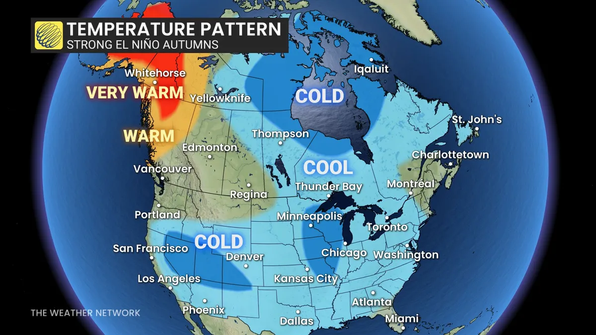
A historic El Niño may be right around the corner as we get closer to fall, with signs that it’s already here in some capacity. While strong El Niño events typically result in warmer winters across Canada, their influence on fall weather is different. The Pacific Ocean has been warming up along the equator, while the chance for the historic climate pattern to stick is building. Experts believe that a very strong El Niño will be present going into the fall and winter months, estimated at a 90 per cent likelihood. El Niño's impact on fall may be different than you expectSince 1950, we’ve seen seven separate years with a strong El Niño during the fall, or from September to November, with the last strong pattern from 2023. DON'T MISS: Latest El Niño forecast calls for historic heat by this autumnWarmer winter months are associated with a strong El Niño in Canada, but the effect is different in the fall months, depending on where you are in the country. A pronounced trough normally settles over Ontario, while a more dominant ridge covers the upper West Coast during these autumn months.
The Weather Network·
Weather

Weather Whiz: August 30

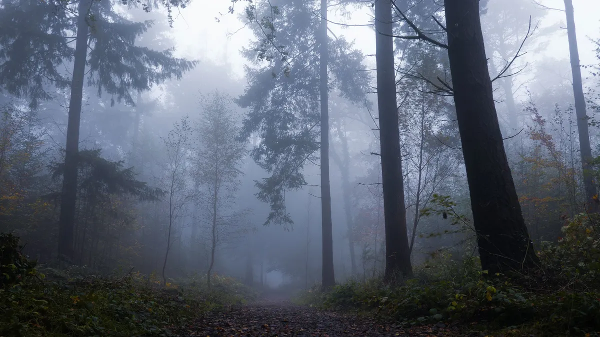
A foggy post-sunset scene in Dartmoor woods in England.(Simon Hodgkiss via Getty Images)How well have you been paying attention to the weather this week? Here are five questions that will test your knowledge of what's been going on. QUESTIONSThere’s something alive in fog — and it’s eating pollution. What is it? A storm formed in the Atlantic this week by the name of _______, coincidentally around the same time of the death of the American country, pop music icon's passing who shares its name. The _______ now ranks as the second largest wildfire in North Texas history. You’re about to have the chance to see a once-in-a-lifetime star explosion from a system known as the _______. What was the cause of flash floods on the Nepal‑China border that resulted in the death of hundreds of people?.... ANSWERSBacteriaDollyRoss Fire“Blaze Star"A glacier collapseHow did you do this week? Come back for more exciting weather questions next week, or risk showing up to trivia night unprepared! Get More of Our News on GoogleSet The Weather Company as a 'Preferred Source' to get quicker access to the news you value.

The Weather Channel·
Weather

Weather Of The World: August 30

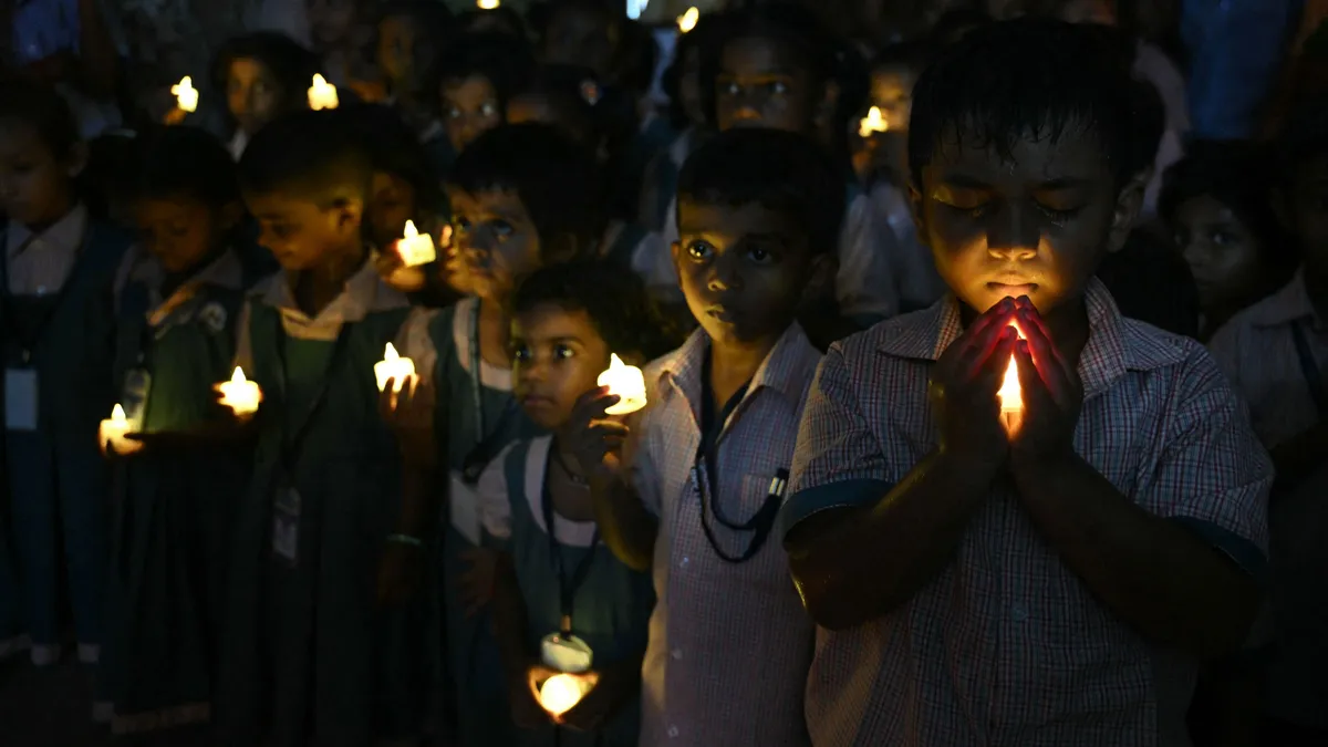
Wander the world one snapshot at a time. Explore striking moments of weather in motion in this week's slideshow. ByAda Wood•August 30, 2026Updated: August 30, 2026, 7:08 am EDTPublished: August 30, 2026, 7:00 am EDTSchool students hold LED candles as they gather to pay their homage to people who died in Nepal's flash flood, in Chennai on Thursday, Aug. 28, 2026.(R. Satish BABU/AFP via Getty Images)F​rom a vigil for the hundreds of lives lost in flash floods in Nepal to a rare and destructive tornado in France, it has been another busy week of weather around the world. Here are some of the most jaw-dropping and awe-inspiring weather photos we found this week. An aerial view shows houses lying deluged in sludge after flash floods at Devighat, Bidur Municipality in Nepal's Nuwakot district on Thursday, Aug. 27, 2026. Nepal's disaster agency said that 823 people remained out of contact on Aug. 27, more than 24 hours after a deadly flood tore through the border region with Tibet.(Prabin RANABHAT/AFP via Getty Images)People wade through a waterlogged street in front of a temple after heavy rain in Varanasi, India on Tuesday, Aug.

The Weather Channel·
Weather

Prairie storms risk damaging winds, large hail on Sunday

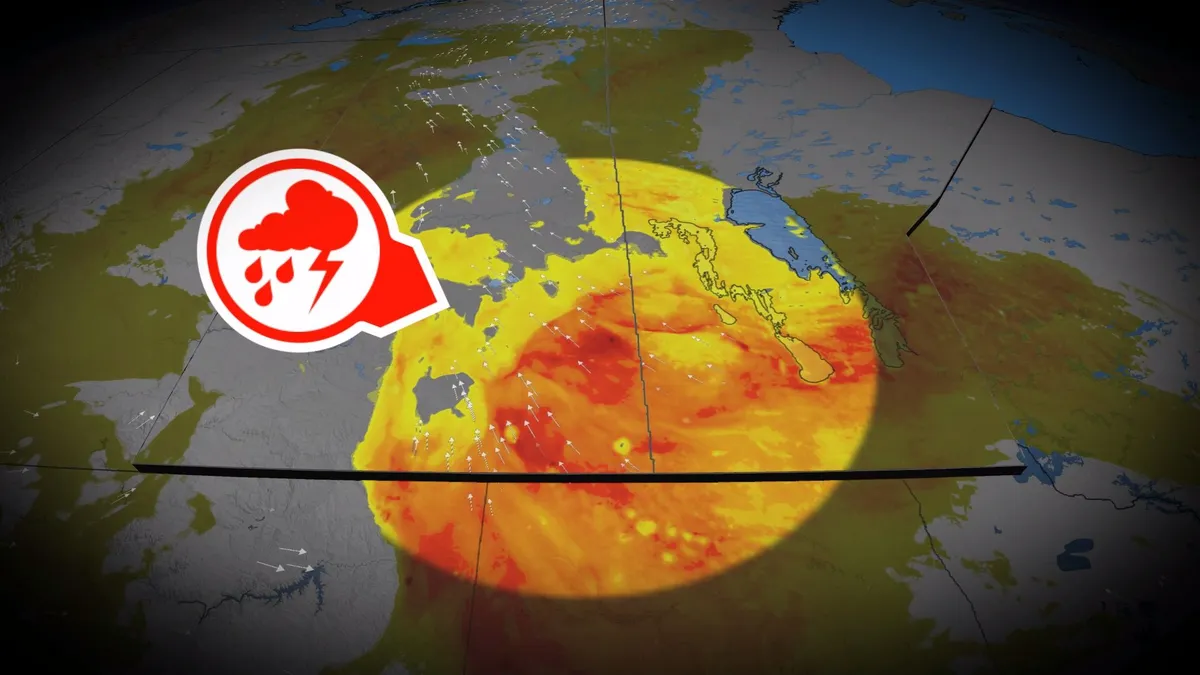
A stormy Saturday spawned very large hail and rotation across parts of the Prairies. We’ll see a renewed threat for severe storms develop throughout Sunday, with multiple rounds of hazardous weather expected. Be sure to monitor the radar if you’ve got plans through Sunday night, and stay aware of potential watches and warnings in your area. DON’T MISS: What is a mesoscale convective system? How an 'MCS' can spell dangerMoisture and instability streaming over the Prairies to end the weekend will bring a fresh threat for strong to severe thunderstorms across the region. The greatest concern will exist in southern Saskatchewan into southern Manitoba, including areas around Regina and Brandon. Sunday will start with morning thunderstorms across central Saskatchewan. These cells should remain non-severe, but downpours and small hail are possible. Content continues belowStorms will organize and tap into higher instability over eastern Saskatchewan by Sunday afternoon, quickly developing into one or more lines as a low-pressure system develops near the international border. This activity will increase the potential for damaging winds and large hail in southeastern Saskatchewan.

The Weather Network·
Weather

Tropical rains, fall cooldown makes its way to B.C.

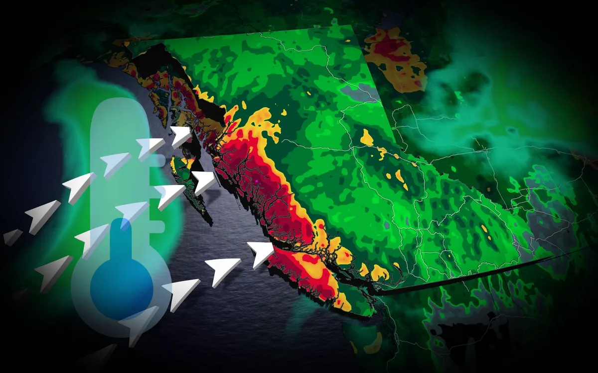
A typhoon set to make landfall in China will have impacts all the way in British Columbia. Typhoon Saudel has already pounded Japan's southwestern islands, dumping 230 mm of rain in 24 hours and cancelling over 150 flights at Okinawa Naha Airport. The storm made landfall in mainland China early Friday morning local time. TROPICAL STORMS: The Weather Network’s Hurricane and Tropical Storm HubSaudel’s moisture heads eastAlthough Saudel will weaken over China, its moisture will spread eastward across the Pacific. A low-pressure system over the Bering Sea will pull moisture into Alaska, while high pressure off the B. C. coast directs an atmospheric river toward the North Coast. The North Coast mountains could receive 50 to 75 mm of rain through Saturday, providing welcome relief after a drier-than-normal previous 30 days. Content continues belowREAD MORE: Krakatoa’s eruption created the loudest sound in human historyCooler weather aheadA cold front will drop temperatures below 20 C across the southern Interior. Kamloops could reach 17 C,, potentially making it the city's coldest day since May 15.

The Weather Network·