BBlogFlow

Categories

Weather

2750 articles

Weather

Rare and destructive tornado strikes Italian towns in Sicily

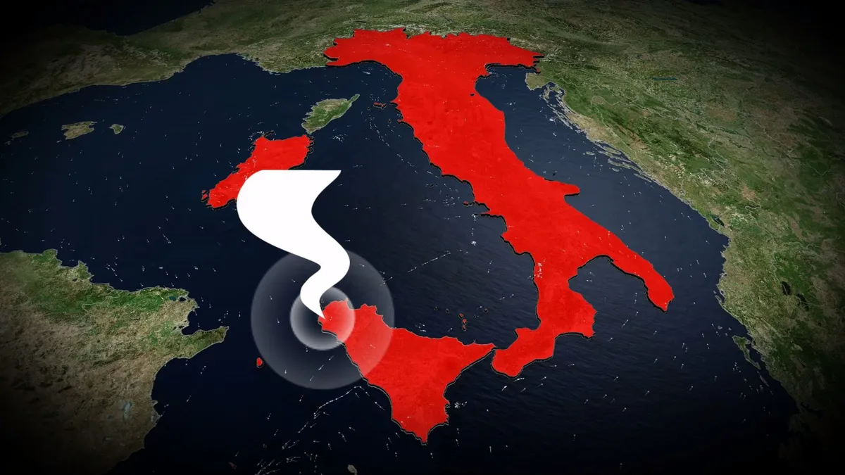
A rare tornado struck western Sicily on Friday, damaging homes and sending several people to the hospital. The storm reportedly began as a waterspout before coming ashore and tracking several kilometres inland, hitting the towns of Petrosino and Marsala, southwest of Palermo. DON’T MISS: Tornado, funnel cloud, waterspout, landspout, gustnado: what’s the difference? A video posted to Facebook appeared to show numerous vehicles overturned. Reuters reported on Friday that several people sustained injuries in the storm. Friday’s incident was an example of a tornadic waterspout, which is a full-fledged tornado that forms over water. These dangerous storms can track inland, as was the case in Sicily on Friday. Most of Italy’s organized tornado activity is centred within the Po Valley in the northern part of the country. Powerful supercell thunderstorms are known to hit cities between Milan and Venice with very large hail, destructive winds, and occasional tornadoes. Historical records hold several dozen reports of tornadoes in Sicily since the 19th century. A particularly damaging and deadly tornado struck the city of Catania on Oct. 7, 1884. WATCH: In a tornado warning?
The Weather Network·
Weather

Watches issued as rare tropical storm threatens California

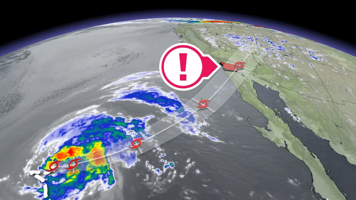
Tropical weather alerts are in effect for parts of California for only the second time in modern history as Tropical Storm Rachel quickly approaches the region. The U. S. National Hurricane Center (NHC) issued a tropical storm watch for San Diego County on Friday morning. Forecasters expect potentially dangerous winds to spread over the region overnight Saturday into Sunday morning. Farther south, Hurricane Simon is rapidly strengthening and will likely hit Mexico as a Category 4 storm this weekend. DON’T MISS: Climate change may boost California’s hurricane flood risk: studyTropical storm watch for San DiegoTropical Storm Rachel was located about 1,300 km southwest of San Diego on Friday as it picked up speed on a northeasterly track toward the region. The NHC issued a tropical storm watch for San Diego County for only the second time on record. Additional watches and warnings are in effect for portions of Mexico’s Baja Peninsula.

The Weather Network·
Weather

Powerful M7.7 earthquake strikes Panama on Friday

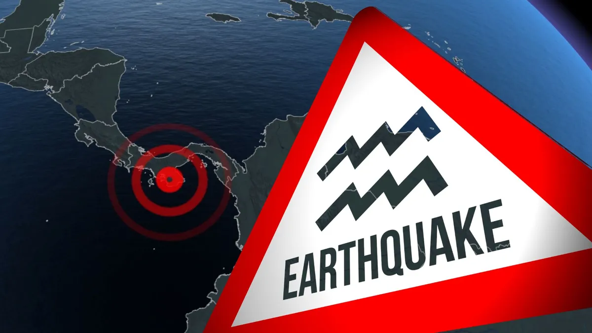
A powerful M7.7 earthquake struck southern Panama on Friday afternoon, according to the United States Geological Survey (USGS). RELATED: How to safely react when an earthquake strikesThe earthquake occurred just after 1:56 p.m. EDT on Friday. The epicentre was about 14 km southwest of Pitaloza Arriba, Panama, the USGS said, which is about 200 km southwest of Panama City. The earthquake reportedly occurred at a depth of about 33 km. Several strong aftershocks have struck the region since the main event on Friday afternoon. These aftershocks will likely continue for weeks. The U. S. National Tsunami Warning Center issued a statement saying that a tsunami threat existed along the Pacific coastline from Mexico to Peru. Tsunami waves of 1-3 metres above tide level were possible for parts of Panama, while tsunami waves up to 1 metre above tide level were possible in parts of Ecuador. There were no immediate reports of damage or casualties. Numerous significant earthquakes have struck this region of the world in the past few months, including a pair of M7.0+ quakes in Venezuela in June, followed by a M7.4 in Colombia in August. WATCH: How to safely react when an earthquake strikes

The Weather Network·
Weather

Hurricane Isaias Waffle House Index: Gulf Coast tracker

A Waffle House employee stands behind the counter.(James Manning/PA Images via Getty Images)Every hurricane that heads for the Gulf Coast brings the same side question: what are the Waffle Houses doing? When Hurricane Isaias took aim at the coast from Mobile to Panama City as a major hurricane, the answer became part of how people read the storm. That's because FEMA has long had an unofficial gauge that comes with hash browns: the Waffle House Index. The area under threat is big. A hurricane warning covers Ocean Springs, Mississippi, to the Bay/Gulf County line in Florida, including parts of southwest Alabama and the western Panhandle. A storm surge warning runs from the mouth of the Mississippi River to the Suwannee River. Rain could reach 15 inches locally, and winds of at least 40 mph could last through at least Saturday morning near the coast. (MORE: Hurricane Isaias forecast)One way to see how much of the coast is in the path is the Waffle House Tracker.

The Weather Channel·
Weather

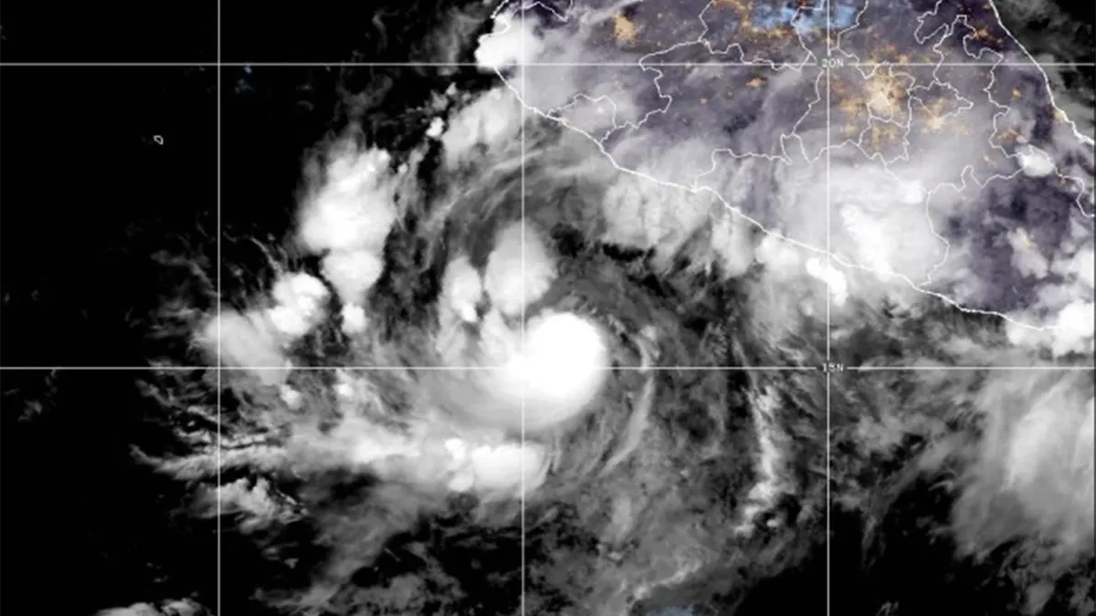
Hurricane Simon intensifies: Category 4 threat to Jalisco

(This satellite image provided by the National Oceanic and Atmospheric Administration, or NOAA shows Hurrican Simon in the Pacific on Friday, Oct. 9, 2026. (National Oceanic and Atmospheric Administration via AP))Hurricane Simon headed toward part of Mexico’s Pacific coast Friday and was forecast to get much stronger, threatening the coast of Jalisco and the popular tourist destination of Puerto Vallarta. U. S. forecasters issued a hurricane warning for parts of the central and southwest coast, where hurricane-force winds were expected within 36 hours. The Category 1 hurricane had maximum sustained winds of 150 kph (90 mph) early Friday and was moving northwest at 7 kph (5 mph), the U. S. National Hurricane Center in Miami said. It was forecast to turn to the north by early Saturday and approach the coast. Simon was expected to intensify rapidly and become a Category 4 storm before landfall.

The Weather Channel·
Weather

Delta was the 26th storm in this record-breaking hurricane season

This Day In Weather History is a daily podcast by Chris Mei from The Weather Network, featuring stories about people, communities and events and how weather impacted them.--Hurricane Delta formed from a tropical wave around the eastern Caribbean on Oct. 1, 2020. Delta was a part of the record-breaking Atlantic hurricane season. By the time Delta formed, it was the 26th tropical storm, 25th named storm, 10th hurricane, and third major hurricane. Atlantic storms are named according to the English alphabet, excluding the letters Q, U, X, Y and Z. So after 21 named storms, Atlantic naming convection heads to the Greek alphabet. On Oct. 5, the tropical wave was designated Tropical Depression 26, and then Tropical Storm Delta. "Tropical Storm Gamma (left) and Hurricane Delta (right) on Oct. 5. " Courtesy of WikipediaContent continues belowBy Oct. 6, Delta strengthened into a Category 4 hurricane, making it one of the fastest intensifications in the Atlantic Ocean. Delta first made landfall in Puerto Morelos, Mexico, as a Category 2 hurricane. The hurricane brought the town 165 km/h winds.

The Weather Network·
Weather

Tornado warning issued in Ontario amid popup supercell storm

11:42 a.m. ET - Environment and Climate Change Canada has ended the tornado warning in Ontario.11:12 a.m. ET - Severe thunderstorms prompted a tornado warning in Ontario on Friday. Environment and Climate Change Canada issued a tornado warning for the following areas in Ontario:Town Of Parry Sound - Rosseau - Killbear Park Huntsville - Baysville"This is a dangerous and potentially life-threatening situation. Take cover immediately, if threatening weather approaches," ECCC said in its warning. The agency added: "Go indoors to a room on the lowest floor, away from outside walls and windows, such as a basement, bathroom, stairwell or interior closet. Leave mobile homes, vehicles, tents, trailers and other temporary or free-standing shelter, and move to a strong building if you can. As a last resort, lie in a low spot and protect your head from flying debris.”Content continues belowDaytime heating and a lakeside boundary gave way to the development of isolated supercells off of Georgian Bay in northeastern Ontario on Friday.

The Weather Network·
Weather

Historic Tropical Storm Watch issued for San Diego as Rachel threatens rare West Coast landfall

Second-ever Tropical Storm Watch issued for Southern California A Tropical Storm Watch has been issued for San Diego for just the second time in its history as Tropical Storm Rachel threatens a rare landfall in Southern California. Rachel is weakening in the Eastern Pacific, but its moisture plume could trigger flooding rain, mountain snow and a rare late-season weather event across the West this weekend. THE TAKEAWAYA Tropical Storm Watch has been issued for San Diego for just the second time in its history as Tropical Storm Rachel threatens a rare landfall in Southern California. Tropical Storm Rachel is expected to impact parts of the West with flooding, strong winds and even a snowstorm. Rain will start on Saturday across portions of California and the Southwest, but the flood threat really starts to ramp up on Sunday. With Hurricane Isaias expected to make landfall along the northern Gulf Coast late Friday, two tropical systems could be affecting the Gulf and West coasts simultaneously by this weekend — something that has occurred only twice since 1963.

Fox Weather·
Weather

Tropical Storm Rachel threatens Southern California, Desert Southwest

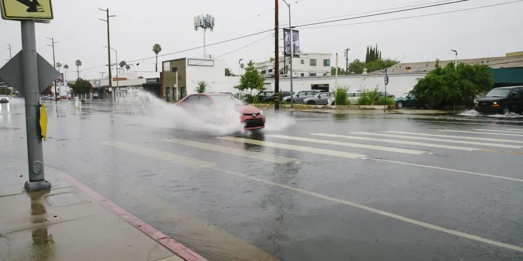
Here's a look at how prediction markets are analyzing rainfall in Los Angeles to the end of October. THE TAKEAWAYA Tropical Storm Watch has been issued for San Diego for just the second time in its history as Tropical Storm Rachel threatens a rare landfall in Southern California. A Level 2 out of 4 flash flood threat is possible Sunday, with up to 2 to 3 inches of rain forecast near Las Vegas and Phoenix. Rachel’s moisture could also fuel mountain snow across Montana, northern Wyoming and the Sierra Nevada. LOS ANGELES – A Tropical Storm Watch has been issued for San Diego for just the second time in its history as Tropical Storm Rachel threatens a rare landfall in Southern California. Rachel is weakening in the Eastern Pacific, but its moisture plume could trigger flooding rain, mountain snow and a rare late-season weather event across the West this weekend. Tropical Storm Rachel track. (FOX Weather)According to the FOX Forecast Center, Rachel weakened slightly Thursday after being downgraded from a hurricane. Although the storm will continue to weaken through the weekend, its expansive moisture field will not simply disappear. DO SANDBAGS ACTUALLY PREVENT FLOODING?

Fox Weather·
Weather

Bryan Norcross: Hurricane Isaias to make landfall this evening with widespread impacts across the Southeast

Last updated at 10 a.m. on Oct. 9, 2026Hurricane Isaias has intensified into a well-developed Category 3 hurricane and is making its move toward the Gulf Coast. Thankfully, the upper-level winds are somewhat hostile, or it would have gotten a lot stronger like Milton did two years ago. The peak winds will likely decrease a bit later today as the system approaches landfall, but it won't change the impacts significantly. LATEST FROM FOX WEATHER HURRICANE SPECIALIST BRYAN NORCROSS Satellite imagery of Hurricane Isaias (CIRA CSU)Damaging winds, storm surge, and rain heavy enough to cause flooding will affect the entire Florida Panhandle beginning late this afternoon, peaking this evening. Overnight, strong winds, which will likely knock out power, and torrential rain will spread into Alabama, Georgia, and eastern Mississippi. Tornadoes will also be a threat in the outer bands north and well east of Isaias's center, including Tallahassee, North Florida, and into Georgia.

Fox Weather·
Weather

Hurricane Isaias timing and location: Latest day-by-day forecast

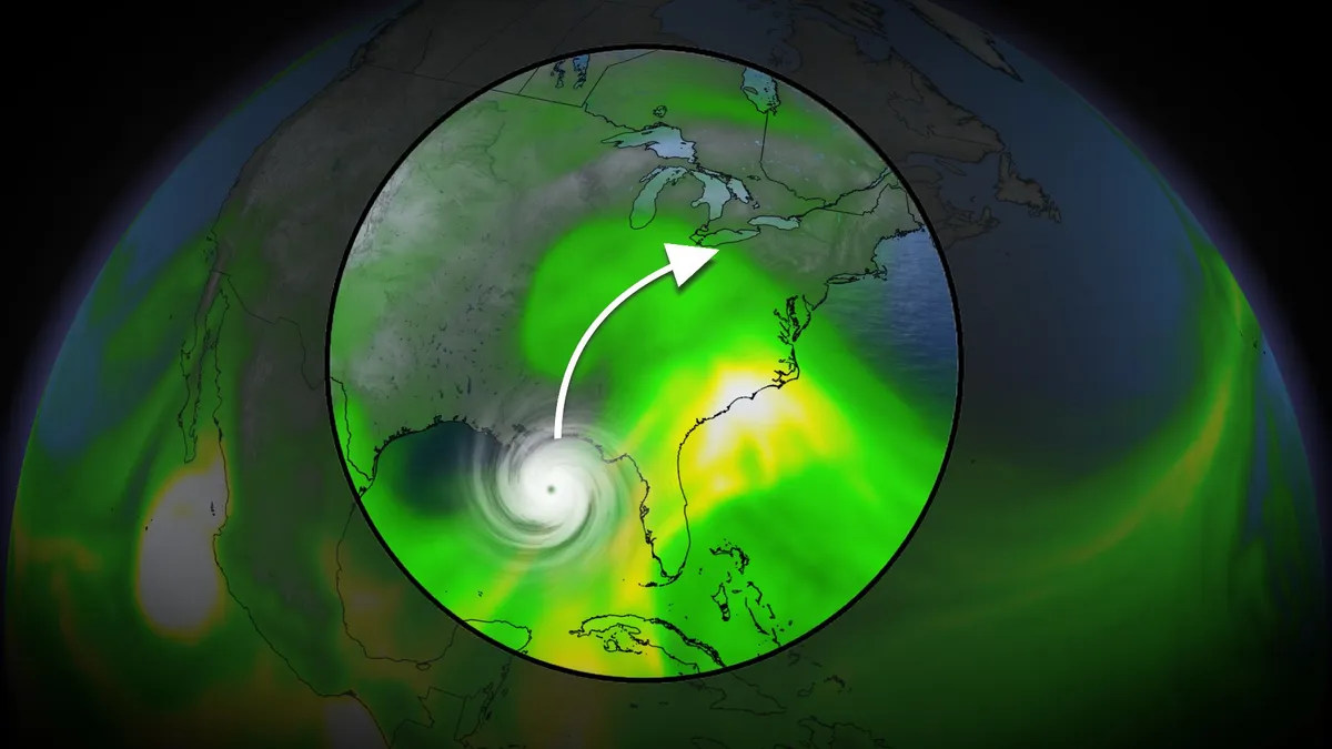
Hurricane Isaias is gaining strength in the Gulf and is expected to make landfall late Friday or early Saturday. But what exactly do we expect from this storm and how intense will it be? Here's a day-by-day breakdown of what you can expect:FridayConditions will deteriorate along the Gulf Coast. Anywhere from New Orleans to Tallahassee should see the worst of the rain and winds, but rainfall is also expected in central Florida and even into southeastern Georgia. SaturdayIsaias will move farther inland and weaken, but its impacts will be far from over. Heavy rain and powerful winds will spread inland across the Southeast. Cities like Jackson, Memphis, Nashville, Atlanta, Wilmington, Charleston, Tallahassee and Orlando could see the worst of the conditions. SundayWhat is left of Isaias will continue to move north, bringing rainfall to parts of the Great Lakes, mid-Atlantic and even the Northeast. Rainfall will still be ongoing as far south as Savannah and Nashville but will spread to Charlotte, Virginia Beach, Washington, New York City, Philadelphia and Baltimore. Rain could even fall for Cincinnati and Detroit.

The Weather Channel·
Weather

Active Kīlauea forces 'immediate' trail closures at Hawai'i Volcanoes National Park

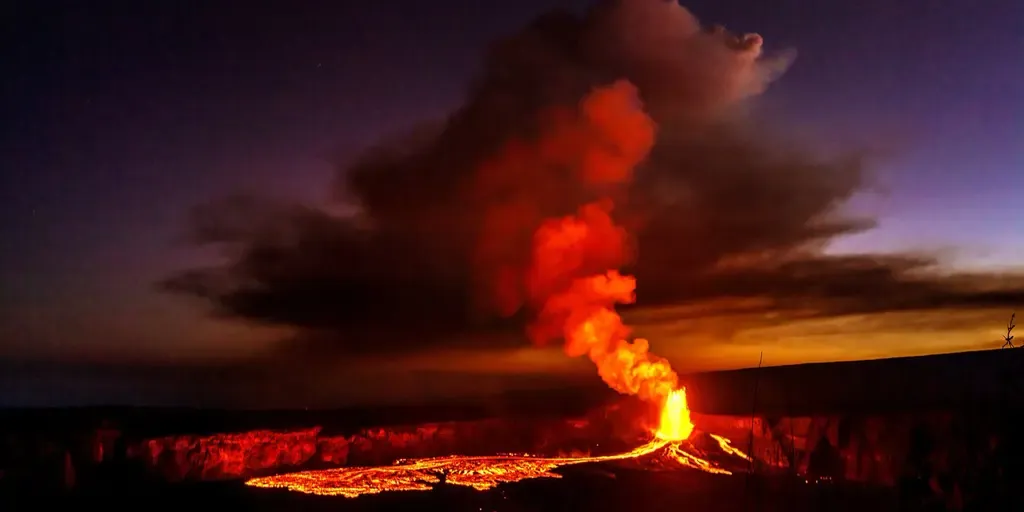
HAWAI'I VOLCANOES NATIONAL PARK, Hawaii  – Officials in Hawaii have closed hiking trails due to the Aloha State's active volcano. The National Park Service (NPS) announced on Wednesday that Halema'uma'u Trail and parts of Byron Ledge Trail are temporarily closed due to increased seismic activity at the summit of the Big Island's Kīlauea volcano. "The trail closure is a total of 1.3 miles," NPS said. "Viewing areas on the Keanakākoʻi side of the caldera closed for safety last week. "Safety closures in place: Halemaʻumaʻu Trail and part of Byron Ledge Trail are temporarily closed due to continued inflation and increased seismicity at the summit of Kīlauea volcano. The trail closure is a total of 1.3 miles. Viewing areas on the Keanakākoʻi side of the caldera closed for safety last week.

Fox Weather·
Weather

Snowy Thanksgiving weekend ahead for Western Canada

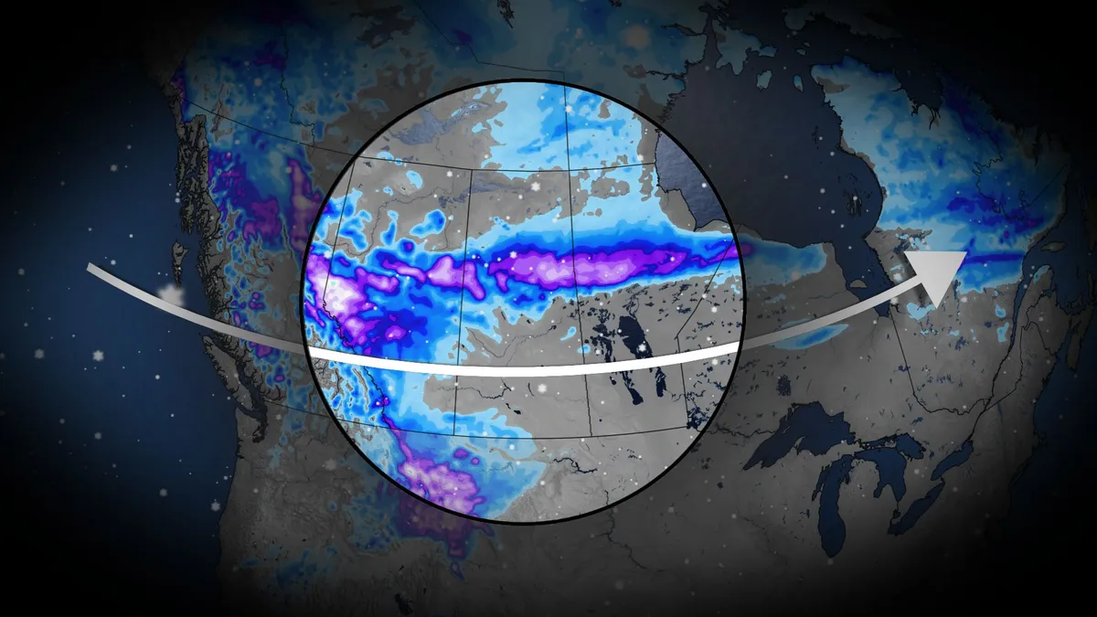
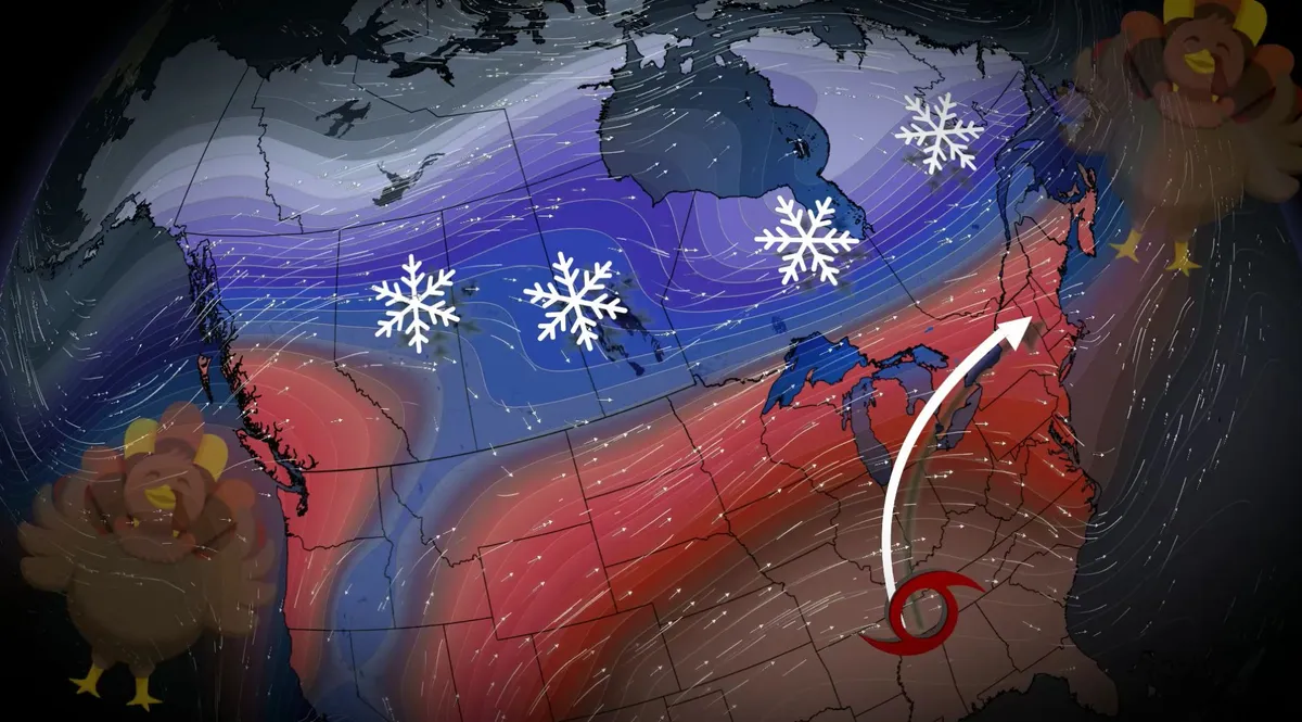
A shift to colder conditions this Thanksgiving weekend is set to bring snow across parts of Western Canada, beginning Friday and lasting through Sunday. DON’T MISS: Canada's Winter Sneak Peek: El Niño puts record warmth in playA trough of cold air from northern Canada will dig into the northwest United States, spilling over into British Columbia, Alberta, and Saskatchewan. Temperatures plunge across southern Alberta SaturdayTemperatures will drop near or below 0°C in parts of Alberta on Saturday and Sunday, with Saskatchewan sitting at the edge of the cold and southern Manitoba remaining milder. As the colder air interacts with warmer air to the south, an active storm system will develop. This will trigger rain, transitioning to snow from central Alberta into northern Saskatchewan. Snowfall will begin late Friday near Hinton, Grande Prairie, Edmonton, and Red Deer, with flurries spreading south to Calgary on Saturday. Accumulations between 2–5 cm are possible this weekend for areas between Edmonton and Calgary, with higher snowfall amounts expected in elevated regions near the foothills and significant accumulations in the Northern Rockies.

The Weather Network·
Weather

Millions of hectares burned on the day Chicago caught fire

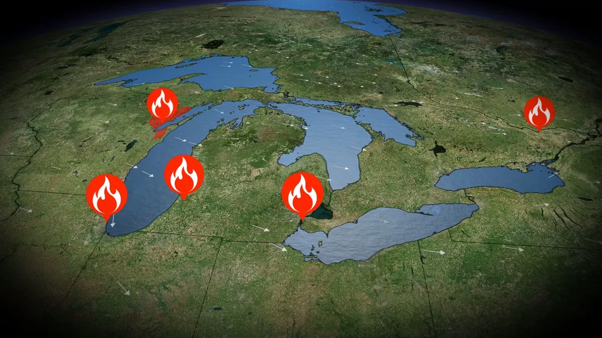
A small blaze broke out at 137 DeKoven Street in central Chicago on the evening of Oct. 8, 1871. Gusty winds spread the fire from a barn to neighbouring buildings, kickstarting a chain reaction that eventually ended in 300 fatalities and left more than one-quarter of the city’s residents homeless. But the Great Chicago Fire was relatively small compared to the mammoth firestorms that raged throughout the U. S. Midwest that week. RELATED: From flames to forecasts: How wildfire smoke affects your weatherA perfect storm of ingredients came together in October 1871 to make fertile ground for blazes from Chicago to Ottawa. Exceptionally dry conditions covered the U. S. Midwest through the end of summer and early autumn. Chicago recorded just 90 mm of rain between early July and early October, according to the U. S. National Weather Service, with only three days of measurable precipitation recorded in September. A strong low-pressure system east of the Rockies whipped up intense southwesterly winds on Oct. 8, ushering in unseasonably hot and dry conditions throughout the region. Wind gusts as high as 75 km/h fanned the flames across the city.

The Weather Network·
Weather

Winter snowfall across Canada may fall victim to El Niño

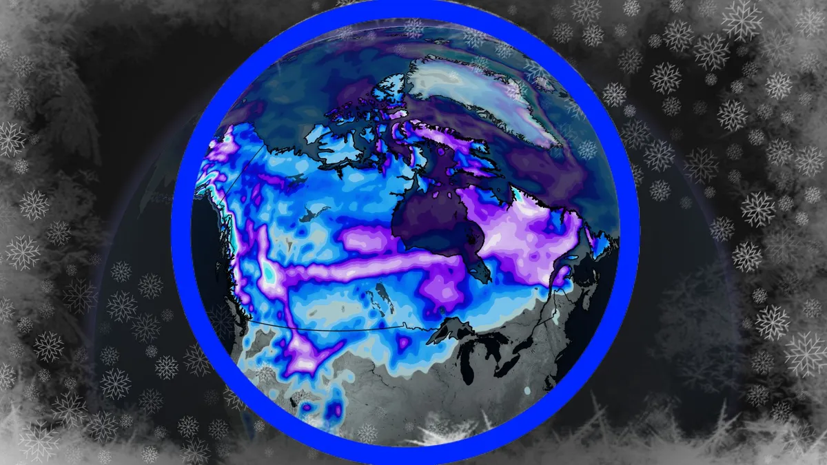
Snow lovers across Canada may not enjoy what El Niño has to offer the country this winter. The powerful Pacific pattern, which is likely headed toward historic heights in the next few months, could significantly affect how much snow falls across Canada this winter. WINTER SNEAK PEEK: El Niño puts record warmth in playEl Niño’s shadow looms over this winterWe can learn quite a bit from previous winters that featured a strong El Niño in the Pacific Ocean. These events typically favour patterns that sweep mild Pacific air across Canada, keeping wintertime temperatures warmer than normal. True to form, this winter will start on a warmer note and see above-seasonal conditions linger through the remainder of the season. A big question mark surrounds the end of the season regarding how quickly El Niño fades in early 2027. An active storm track is likely to set up farther to the south than we’d see during a usual winter, potentially keeping higher-impact systems stateside. This suppressed track, combined with warmer temperatures, should average out to below-average snowfall throughout Canada. This may be particularly tough for some ski regions.

The Weather Network·
Weather

Can October Snow Predict Your Winter? I Tested a Famous Forecast Signal Across 47 Winters

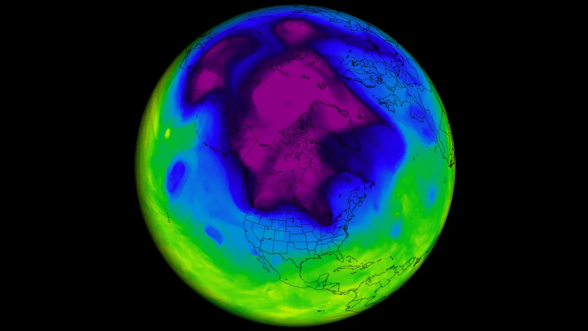
Every fall, the same question appears on weather forums and social media: Is snow spreading fast across Siberia? Many weather enthusiasts believe that a quick October snow advance there is an early warning sign of a cold, snowy winter for the United States, Canada, and Europe. This idea comes from a famous scientific study published in 2011, and it has been repeated every winter since. With a fast snow surge forecast again this October, I decided to test whether it still works in the modern era. I went through 47 winters of data, from 1979 to 2025, using four different snow datasets, including the satellite data used in the original study. The results were surprising, and they change how we should read this October’s snow. Below, I explain how October snow is supposed to disrupt the Polar Vortex, why the theory looked so convincing, what the data really shows, and what the latest forecasts indicate for Winter 2026/2027. In 2011, scientists Judah Cohen and Justin Jones found a remarkable winter signal. They measured how fast snow cover expanded across Eurasia during October and its potential impact on the following winter season.

Severe Weather Europe·
Weather

Hurricane Isaias forms in the Gulf: U.S. Coast at risk, impacts for Canada

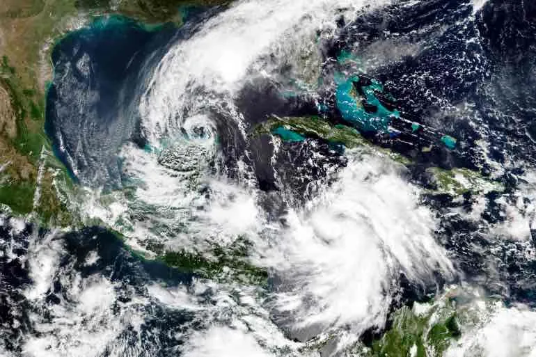
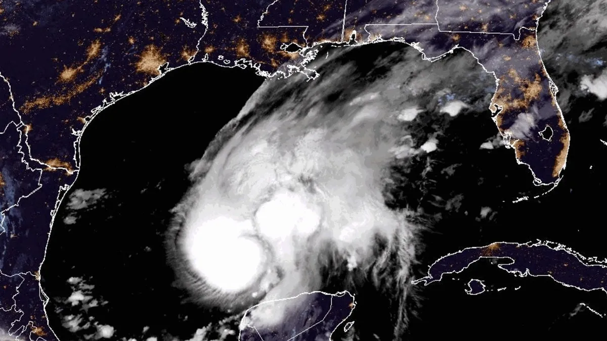
Hurricane Isaias, the first Atlantic hurricane of 2026, is currently spinning in the Gulf of Mexico and is expected to strengthen to a Category 2 storm. Its initial landfall is forecast to occur late Friday into early Saturday along the northern Gulf Coast near Mississippi and Florida’s Panhandle, bringing damaging winds, torrential rain, and dangerous storm surge. DON'T MISS: How hurricane categories forecast the scale of destruction"Additional strengthening is expected through early Friday, and Isaias should remain a strong hurricane as it approaches the northern Gulf Coast on Friday night," warns the U. S. National Hurricane Center (NHC). Hurricane warnings are in effect for impacted areas, with rainfall amounts projected to reach 75-150+ mm in parts of Louisiana and across the Florida Panhandle. Flash and urban flooding are possible, with a risk of isolated river flooding. States of emergency have been declared in parts of Alabama and Florida. Florida Gov. Ron DeSantis has urged residents to begin preparations immediately. Mandatory evacuation orders are in effect for two counties in the Florida Panhandle.

The Weather Network·
Weather

Classic Canadian fall weather for Thanksgiving weekend

As millions of Canadians prepare to spend time with loved ones during the Thanksgiving long weekend, most of them will experience a classic fall holiday alongside their hearty meal. That includes conditions that will feel more like both early winter and a brief hint of late summer for parts of Canada. Here’s a look at what you can expect across Canada for your long weekend. WINTER SNEAK PEEK: El Niño puts record warmth in playWeekend snow flies across Western CanadaA deep trough extending all the way to California will unfold across the western half of Canada through the long weekend. Northerly flow associated with a Pacific low will send temperatures dipping below-seasonal across Alberta and British Columbia, with southern portions of Manitoba and Saskatchewan tipping above seasonal. B. C. will see flurries at higher elevations as freezing levels fall down to 1500 metres on Saturday. Sunny skies and cool temperatures will prevail on Sunday and Monday. Content continues belowHeading east, cold air wrapping around the back side of the low-pressure system will bring the first flakes of the season into this weekend to parts of Alberta and Saskatchewan.

The Weather Network·