Why the world's tallest mountains are literally coming unglued
This story deserves to be shared
Send it to someone who'd care, or post it on your networks.
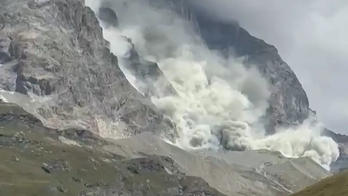
Why the Matterhorn and other peaks are literally falling apartThe mountains are coming unglued, and science can explain why. The Matterhorn, one of the most recognizable peaks in the world, is seeing more rock falls in recent years. Same for the Mont Blanc, the Himalayas and even Alaska. The aftermath of the August 26 flash flood along the Nepal-China Highway near the Bhote Koshi River at Syabrubesi in Nepal's Rasuwa district. (Getty Images)Recent examplesIn August, a towering cloud of dust rolled down the Matterhorn's south face as a chunk of rock broke loose. This was the latest in a run of rockfalls that forced Zermatt and Cervinia guides to repeatedly suspend climbs. But it isn’t just the Matterhorn. The Mont Blanc massif has seen numerous rockfalls this year. In the Himalayas, a large glacier gave way on the Langtang Lirung peak, creating an impact large enough to register on the USGS seismology scale. The debris fell into the Bhote Koshi River and temporarily clogged the river to form a lake.
This article is an excerpt. To read the full content, visit the original source. The Weather Channel
Related articles

Isaias' remnants flood NC mountains; 170K+ without power
Mother and daughter survive as Isaias rips off their roofMore than 170,000 people in Florida, Alabama, Georgia and the Carolinas were still without power early Monday after the remnants of Isaias pushed north, triggering floods in North Carolina on Sunday.(MORE: North Carolina flooding triggers landslides)The storm has been linked to at least four deaths, including two people killed by falling trees in Florida and Alabama. An apartment complex which had its roof ripped off is seen in the aftermath of Hurricane Isaias in Milton, Florida, on Saturday, Oct. 10, 2026.(AP Photo/Gerald Herbert)Landfall and damage in FloridaIsaias came ashore late Friday as a Category 2 hurricane near Destin, Florida. Despite storm surge warnings beforehand, several major coastal routes were open and clear of debris by Saturday morning.(MORE: Hurricane Isaias makes landfall near Destin, Florida, as a Category 2)Still, hurricane-force winds tore the roof off a Pensacola hotel, and the city's mayor said the airport also sustained damage. The storm destroyed a boathouse in Destin and tore away part of a high-rise's facade in Panama City Beach.
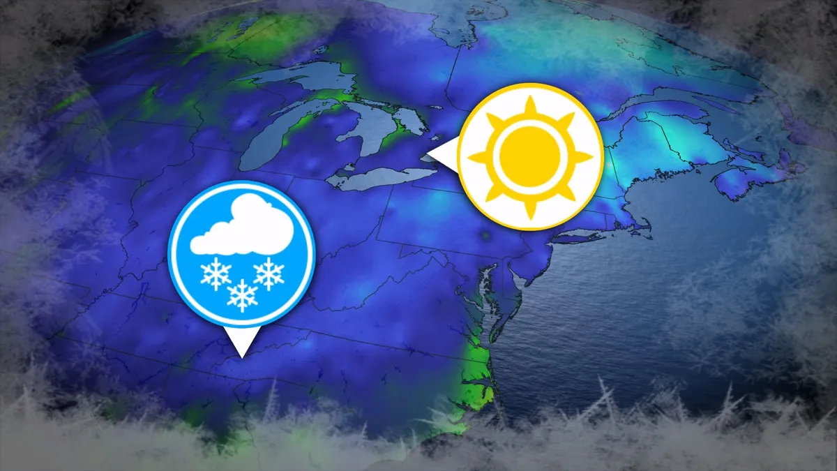
Where’s the frost? Southern U.S. hits freezing before Toronto, Montreal
Toronto and Montreal have remained above the freezing mark every day for almost six months. While frosts and even some snowflakes have intruded across parts of Ontario and Quebec in recent weeks, the two cities have yet to reach that magic number. What’s even more remarkable is that a handful of communities across the southern United States have already dipped to the freezing point--and some have even seen accumulating snowfall. DON’T MISS: Official: Canada records first -30°C reading of the seasonThe last time we saw a freezing temperature in either Toronto or Montreal was the second-to-last week of April. Toronto hit -1.3°C early on April 20, while Montreal dipped to -2.0°C the following morning. Our average first frost in both cities occurs right around the middle of October. But warmer-than-normal years can see this milestone slide several weeks past due. Montreal once had to wait 207 consecutive days for its first frost, with the city’s first subfreezing temperature in 2017 waiting until Nov. 7. The latest Toronto’s had to wait to hit the zero-degree mark was Nov. 13, 2022.
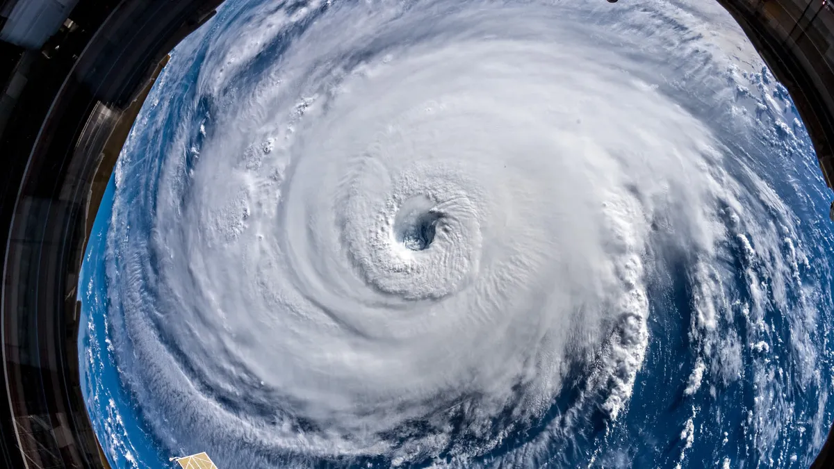
345 km/h: Meet the world’s strongest tropical cyclones
Tropical cyclones top the list of nature’s most powerful storms. Larger than tornadoes and more intense than any single thunderstorm, these systems can change the landscape when they swirl ashore. A handful of tropical cyclones take full advantage of their surroundings to achieve the apex of their potential, the strongest storms nature can produce. DON’T MISS: What’s the difference between hurricanes, typhoons, and cyclones? Tiny fraction of storms achieve upper limitsOnly about 4 per cent of all the world’s recorded tropical cyclones have reached the equivalent of Category 5 strength. Most tropical cyclones are relatively weak and short lived because it’s tough for all the necessary ingredients to align just right. But explosive development can result when all those factors come together in perfect harmony. Strongest Winds: Hurricane PatriciaAn exceptionally favourable setup off the western shores of Mexico in late-Oct. 2015 allowed Hurricane Patricia to grow into the world’s strongest hurricane since reliable observations began in 1966.
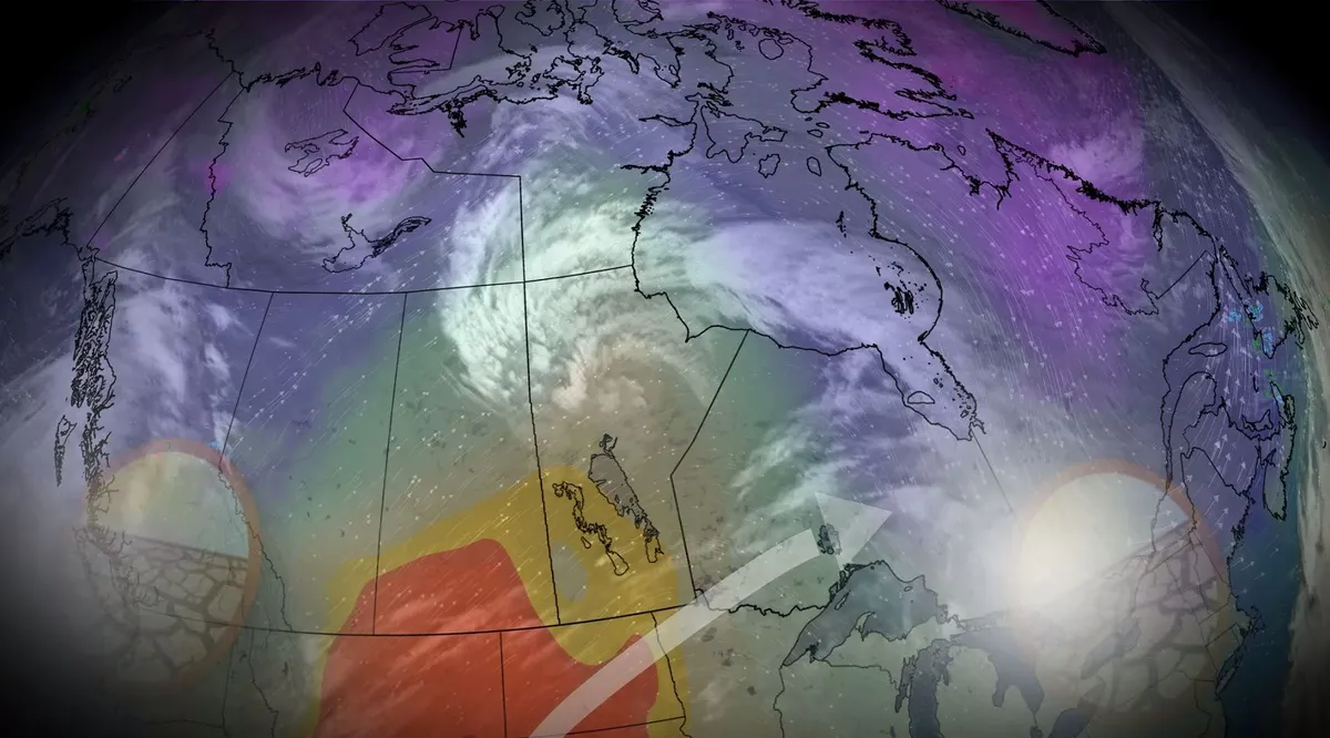
Canada, where did all the fall storms go?
While there have been some weather hiccups in October across Canada, one commonality is the lack of fall storms. The month has brought a very different flavour to parts of the country, compared to September's weather. October started with summer-like warmth in Ontario and Quebec, while the West endured some chilly temperatures. That pattern has since flipped. But there haven't been many of your typical fall storms this season, making for a super-dry pattern in many areas in Canada. Let’s dive into why the storms are absent so far. DON'T MISS: What does a classic fall storm look like in your part of Canada? What fuels fall storms? A split flow, in which the jet stream literally splits in two, will prove a prominent feature during the second half of October, promoting a less-consolidated jet stream that would otherwise impact the coast of British Columbia throughout autumn. Some of that energy is being redirected down toward California, a change that’s significantly affecting our weather patterns across Canada.
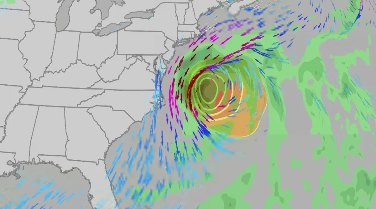
Nor' easter to bring coastal flooding, winds to East Coast
An October nor'easter is developing in the Atlantic, where it will bring high surf, rip currents, coastal flooding, winds and rain to parts of the East Coast for several days this week. The National Hurricane Center has it highlighted as an area to watch this week for potential subtropical development. However, regardless of development, this system will bring dangerous conditions to the East Coast this week. Fortunately, this system doesn't look to be as strong as the one in September. But the bad news? It could linger for much of the week, so impacts could have a longer duration than you would think. There are currently coastal flood alerts across parts of coastal North Carolina and Virginia, where anywhere from 1 to 4 feet of inundation is possible. Key takeawaysWe do not expect this storm to be as strong as the late September nor'easter. The area most likely impacted the longest appears to be from the Delmarva Peninsula to eastern North Carolina, with more models pointing to primarily eastern North Carolina.

Upgrade your pumpkin carving with these simple tricks
Fun fact: Pumpkin carving does not start from the top. It’s all about the bottom. Here’s how to really carve a pumpkin. Once the bottom is open, get your handheld mixer in there. Then, use an ice cream scoop. That is way more efficient. Next, map your design out with washable markers, not permanent. It's way easier to clean. Another tip: Power tools and cookie cutters are great! They can really elevate your design. (gadgemayur/Pixabay)Content continues belowAnd with some creativity, cut-out shapes can be used in your masterpiece. Fine lines and designs? Your cuticle cutter will do the trick. Slow down the drying and rotting process by sealing in moisture. Use petroleum jelly or vegetable oil on all of the cut edges and the inside. Glam up this year's pumpkin with a few trendy gems. The wind on Halloween night can often blow out candles. So, instead, use fairy lights. This year, I am spraying my pumpkin with lavender in the hopes of keeping some critters away.
0 comments
No comments yet. Be the first to share your thoughts!